Slovenia is a country in southern Central Europe. Borders with Italy, Austria, Croatia, and Hungary. Slovenia is the intersection of the main routes between north and south, east and west. Slovenia has 47 km of Adriatic coastline. Slovenia is one of the smallest countries in Europe, but has an exceptionally favorable geographical position, especially in terms of tourism development, because it is located between the majestic Alps and the Mediterranean Sea. The ski slopes are only a few hours away from the beaches. Slovenia is located in the Alpine-Danube region of Central Europe. There are 4 main geographical regions: in the north-west, there are the Alps (Julian, Kamensk-Savinsky, Karavanksky hr., Pohorje, occupying 42 % of the territory, in the north-east-the Pannonian (Middle Danube) lowland (28 %), in the south — the Dinaric Highlands (21%), including the karst plateau of Krasus, which gave the name to the relief of this type, in the west — the Mediterranean coast (the Adriatic Sea, 9%).
Area: 20,273 km sq. The highest point is the summit of Mount Triglav (2,864 m), the lowest-the Adriatic coast -0 m. Major rivers: Sava (221 km), Drava – right tributaries of the Danube. Mountain -glacial lakes (Bled, Bohinj) and karst lakes (Cerknica, drying up, the largest in the country, max. 26 km sq.). About 1,000 map caves (Postojna, Shkotsyanskaya). Many waterfalls, the most famous – Chedtsa (130 m).
The climate in Slovenia is temperate continental. There are slight differences in the climate of the highlands, the eastern part of the country, and the Adriatic coast. In the north-west, in a mountainous area in the summer, daytime temperatures are kept at +20..+22 degrees, at night there are 6..8 degrees of heat, winter is quite cold here: during the day, the air warms up to +2..+4 degrees. Most precipitation falls in the fall, in October – up to 250 mm, in general, up to 3000 mm of precipitation falls during the year. In ski resorts at altitudes of more than 1500 m in the season (from December to April), the air temperature reaches 0 degrees during the day, at night it can drop to -9 degrees.
In the central and eastern lowland regions in the summer, daytime temperatures are quite high – +25 degrees, at night-about 15 degrees Celsius. In winter, during the daytime, the air temperature does not fall below 0 degrees, at night, there are weakly negative temperatures from -3 to -1 degrees. The rains mainly occur in early summer and late autumn, this region is characterized by the lowest amount of precipitation within Slovenia, with up to 700 mm falling per year.
On the Adriatic coast, the climate is mild. In summer, during daytime hours, the air temperature rises to +24 degrees, in winter – to +6 degrees, monthly precipitation falls from 150 to 200 mm. In the summer months, the seawater warms up to +22..+24 degrees.
According to estimates for 2019, 2011.5 thousand people live in Slovenia. As of 2019, 14.3% of the population was under 15, 70.6% was between 15 and 65, and 15.1% was over 65. The population growth in 2019 was 0.01% , with a birth rate of 8.9 per 1,000, a death rate of 10.15 per 1,000, and an immigration rate of 2.11 per 1,000. Infant mortality was estimated at 4.5 per 1,000 newborns. Life expectancy is 75.93 years (for men-72.18 years, for women-79.92 years).
Of the successor countries to Yugoslavia, Slovenia is the most ethnically homogeneous: 88% of its population is Slovenian. Among the national minorities – Croats (3%), Serbs (2%), Bosnians (1%), Hungarians (0.4%), Italians, and others.
The majority of believers are Catholic Christians (80%), there are also Orthodox (3%), Muslim (1%), Protestant and Jewish communities.
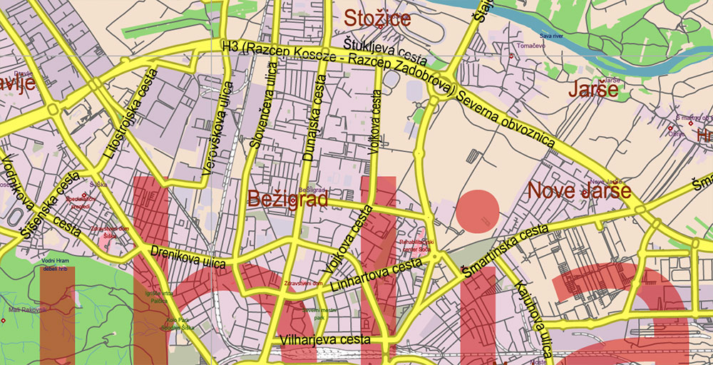
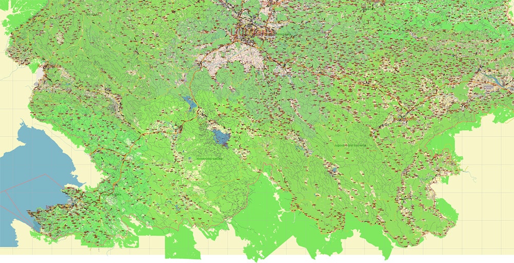
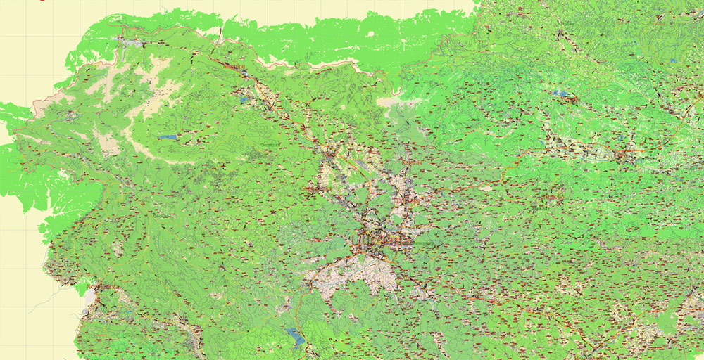
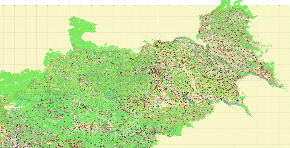
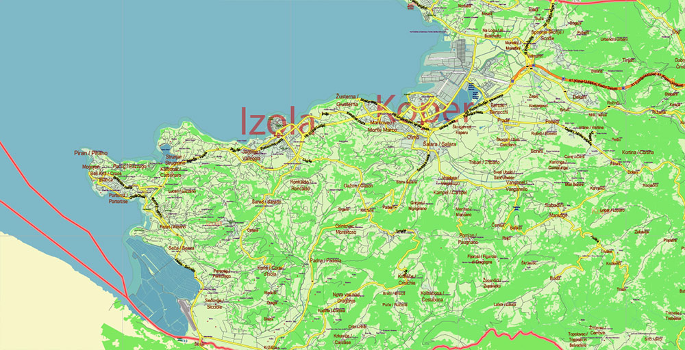
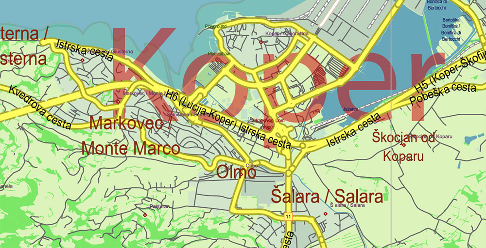
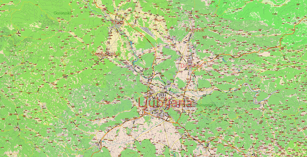
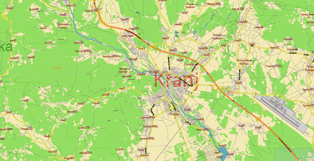
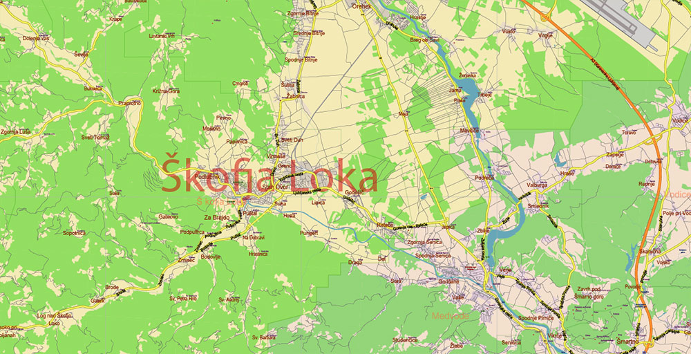
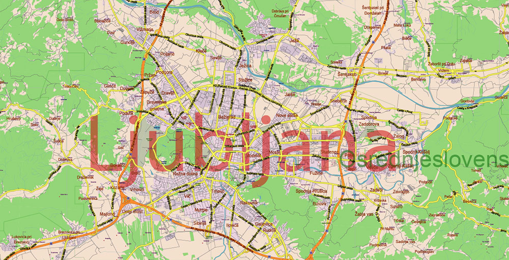
Printable Vector Map of Slovenia All Roads + Admin areas (provinces and counties) full editable Adobe Illustrator Map in layers, scalable, 147 MB ZIP
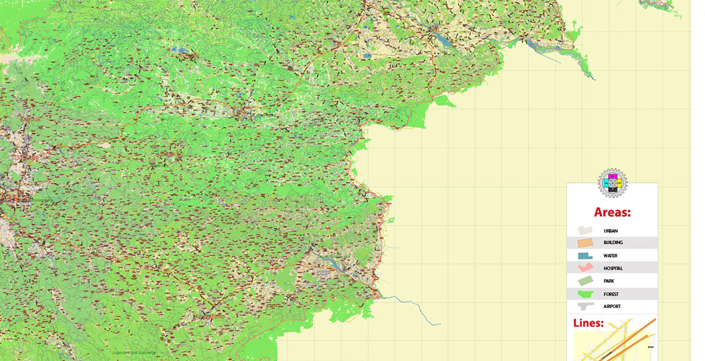
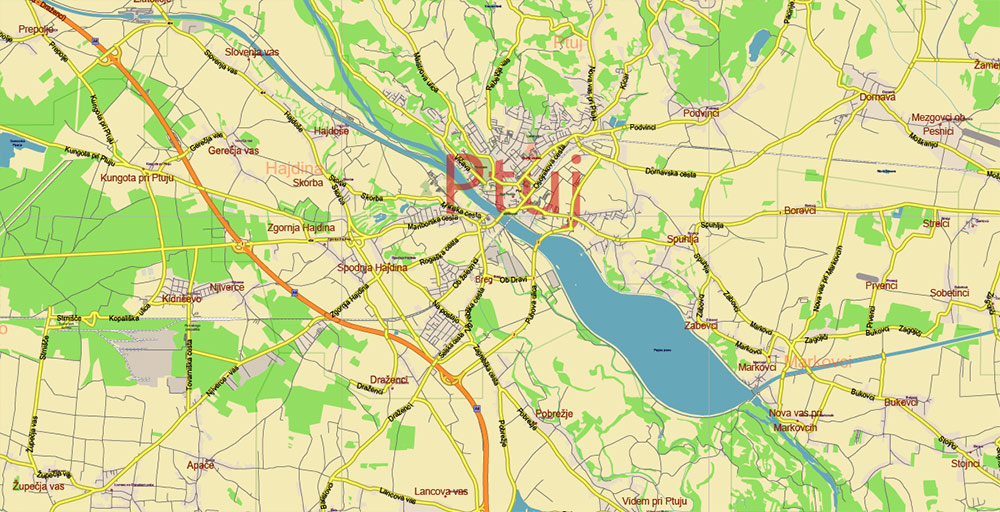
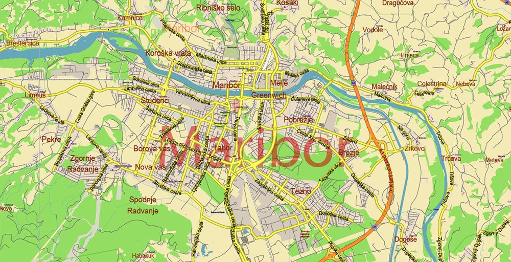
All streets and roads, Names of Principal streets, All Cities and Towns, Counties, Provinces. Map for design, printing, arts, projects, presentations, for architects, designers, and builders, business, logistics.
For Editing and High-Quality Printing, Royalty free
Need AutoCAD DWG / DXF or any other format? Please, contact us!
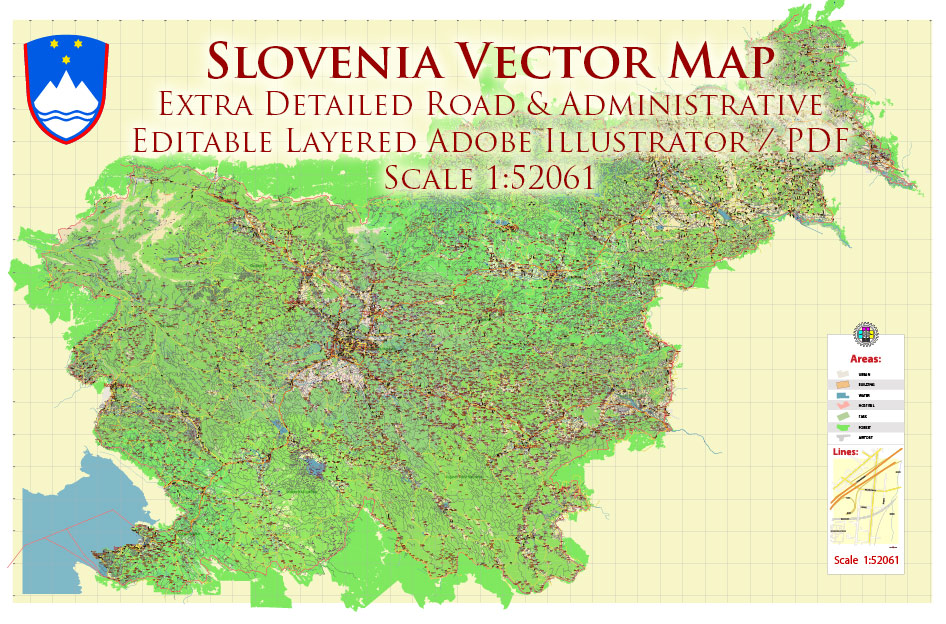
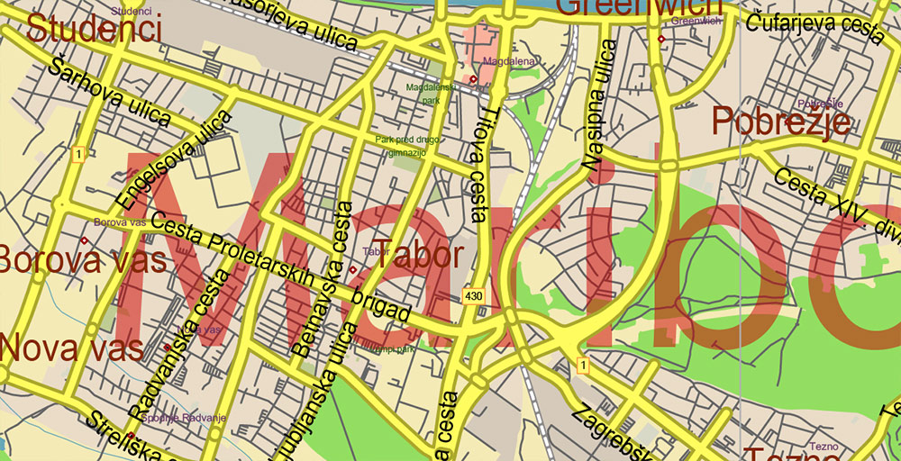
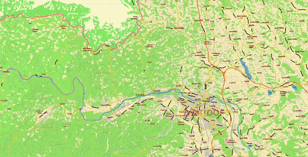
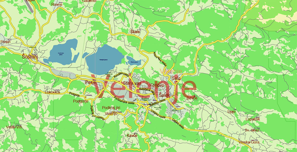
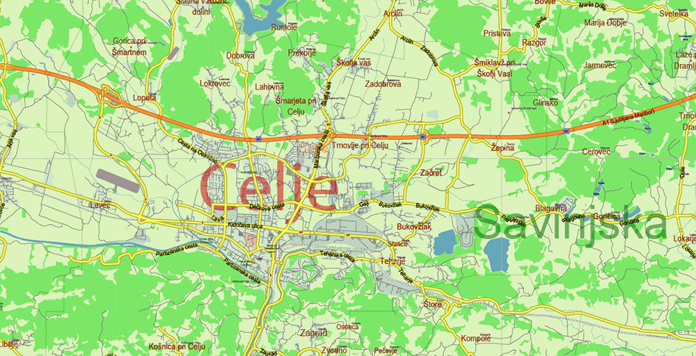
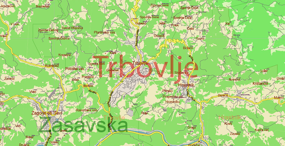
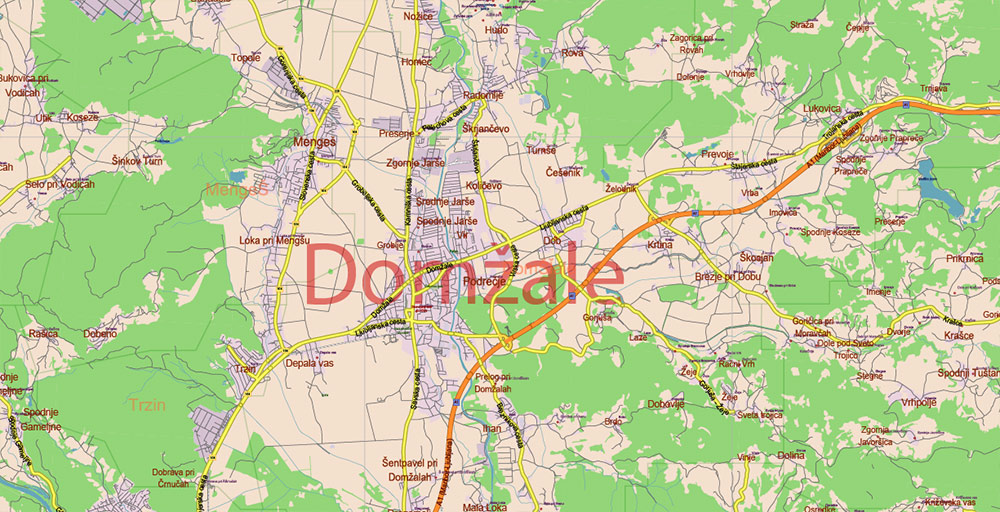
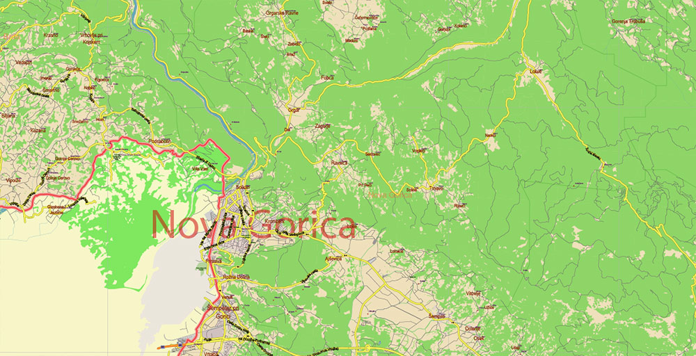
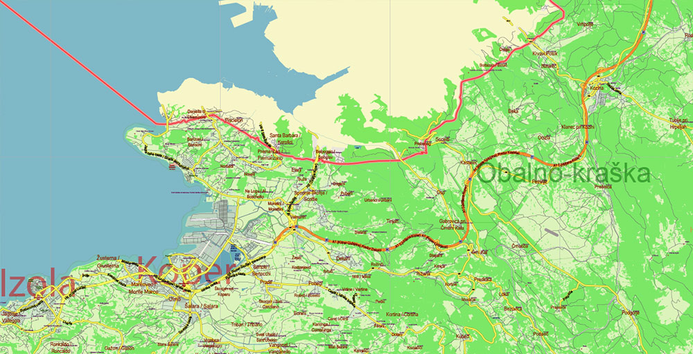
Slovenia Vector Map: Full Extra High Detailed 01 (all roads) + Admin Areas editable Adobe Illustrator in layers
Layers list:
- Names of Main Cities
- Names of middle towns
- Names of all Cities, towns, villages and hamlets
- Road labels
- Names of objects (water, park, hospital)
- Names of Provinces
- Names of Counties
- Points of the Cities, Towns and Villages
- Names of the Main Streets
- Major Roads and Streets – Highways
- Minor Roads and residencial streets
- Country Borders
- Railroads
- Water objects (rivers, lakes, ponds, swamps, reefs)
- Waterways
- Ground objects (urban areas, parks, hospitals, etc.
- Sea
- County Areas
- Provinces Areas
- Background
Slovenia Vector Map: Full Extra High Detailed 01 (all roads) + Admin Areas editable Adobe Illustrator in layers
Slovenia Vector Map: Full Extra High Detailed 01 (all roads) + Admin Areas editable Adobe Illustrator in layers
Slovenia Vector Map: Full Extra High Detailed 01 (all roads) + Admin Areas editable Adobe Illustrator in layers
Slovenia Vector Map: Full Extra High Detailed 01 (all roads) + Admin Areas editable Adobe Illustrator in layers
Slovenia Vector Map: Full Extra High Detailed 01 (all roads) + Admin Areas editable Adobe Illustrator in layers
Slovenia Vector Map: Full Extra High Detailed 01 (all roads) + Admin Areas editable Adobe Illustrator in layers
Slovenia Vector Map: Full Extra High Detailed 01 (all roads) + Admin Areas editable Adobe Illustrator in layers
Slovenia Vector Map: Full Extra High Detailed 01 (all roads) + Admin Areas editable Adobe Illustrator in layers
Slovenia Vector Map: Full Extra High Detailed 01 (all roads) + Admin Areas editable Adobe Illustrator in layers
Slovenia Vector Map: Full Extra High Detailed 01 (all roads) + Admin Areas editable Adobe Illustrator in layers
Slovenia Vector Map: Full Extra High Detailed 01 (all roads) + Admin Areas editable Adobe Illustrator in layers
Slovenia Vector Map: Full Extra High Detailed 01 (all roads) + Admin Areas editable Adobe Illustrator in layers

Slovenia Vector Map: Full Extra High Detailed 01 (all roads) + Admin Areas editable Adobe Illustrator in layers
Slovenia Vector Map: Full Extra High Detailed 01 (all roads) + Admin Areas editable Adobe Illustrator in layers
Slovenia Vector Map: Full Extra High Detailed 01 (all roads) + Admin Areas editable Adobe Illustrator in layers
Slovenia Vector Map: Full Extra High Detailed 01 (all roads) + Admin Areas editable Adobe Illustrator in layers
Slovenia Vector Map: Full Extra High Detailed 01 (all roads) + Admin Areas editable Adobe Illustrator in layers
Slovenia Vector Map: Full Extra High Detailed 01 (all roads) + Admin Areas editable Adobe Illustrator in layers
Slovenia Vector Map: Full Extra High Detailed 01 (all roads) + Admin Areas editable Adobe Illustrator in layers
Slovenia Vector Map: Full Extra High Detailed 01 (all roads) + Admin Areas editable Adobe Illustrator in layers
Slovenia Vector Map: Full Extra High Detailed 01 (all roads) + Admin Areas editable Adobe Illustrator in layers

 Author: Kirill Shrayber, Ph.D. FRGS
 + Admin Areas editable Adobe Illustrator in layers")