Extended Description of the Vector Map
Slovenia, or officially the Republic of Slovenia, is a country located in the south of Central Europe, on the Balkan Peninsula. Slovenia covers an area of 20,273 km2 with a population of 2,076,598 (as of 2018). The country has borders with Italy, Austria, Hungary, Croatia and is washed by the waters of the Adriatic Sea.
Slavic peoples on the territory of present-day Slovenia lived since the VI century. In 628-658, these lands belonged to the state of Samo, and then were part of the state of Carinthia. In the XI — XIII centuries, many small feudal principalities were formed on the territory of Slovenia (Carinthia, Styria, Kraina, etc.). In the XVI century, the area belonged to the Austrian Habsburgs. At the beginning of the XIX century, on the territory of Slovenia, which belonged to Napoleon, there was an administrative formation of the Illyrian Provinces. The national movement that began at the end of the XIX century, demanding cultural and administrative autonomy, in 1918 led to the annexation of the Slovak lands to the united kingdom of Serbs, Croats, and Slovenes, since 1929 called Yugoslavia. Some Slovak lands remained in the hands of Austria and Italy.
After the end of the Second World War, during which Yugoslavia was occupied by fascist troops, Slovenia became a republic within the Yugoslav Federation, and some Italian lands were returned to it (under the 1947 treaty). Slovenia’s independence was declared on 25 June 1991. On July 2, 1991, the Yugoslav army bombed the Slovenian capital, Ljubljana. The parties were saved from the escalation of the military conflict by the intervention of the EU countries. During the fighting in Slovenia, 18 people were killed.
In October 1991, Slovenia fully established its independence. Since 1992, the country has been a member of the UN.
Capital: Ljubljana
Area: 20,273 km2
Population: 2,076,598 (2018)
Language: Slovenian, Italian, Hungarian
Today’s Slovenia is a popular tourist destination. Guests of the country are attracted by many architectural and historical attractions, beach holidays on the Adriatic coast, as well as extensive opportunities for skiing and ecotourism.
The climate of Slovenia is temperate continental, the country is clearly divided into three climatic zones: Central European in the east (hot summers and cold winters), Alpine in the northwest (cold winters and warm summers) and Mediterranean on the Adriatic coast. The average air temperature in Slovenia in summer is from +23 to +25°C, in winter from -2°C to +6°C.
Printable PDF Vector Map of Slovenia All Roads + Admin areas (provinces and counties) full editable Adobe PDF Map in layers, scalable, 289 MB ZIP
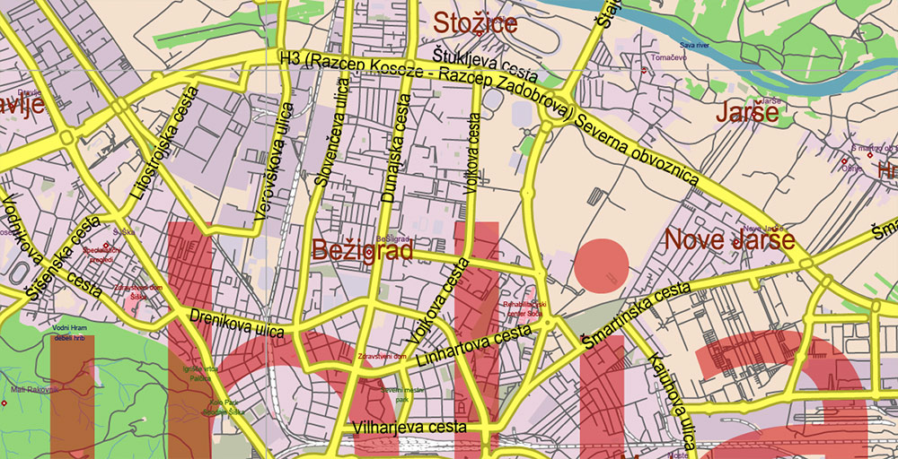
All streets and roads, Names of Principal streets, All Cities and Towns, Counties, Provinces. Map for design, printing, arts, projects, presentations, for architects, designers, and builders, business, logistics.
For Editing and High-Quality Printing, Royalty free
Need AutoCAD DWG / DXF or any other format? Please, contact us!
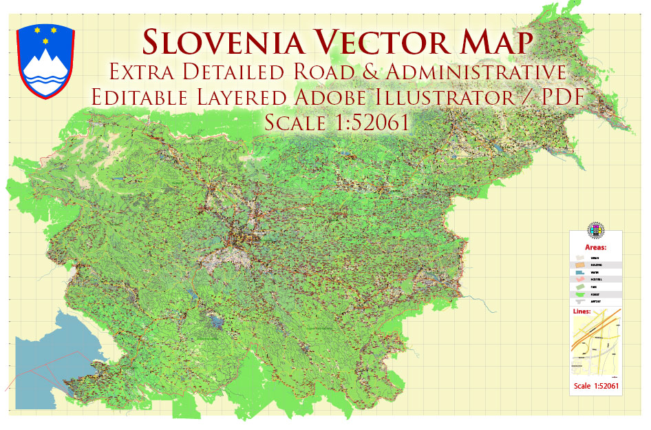
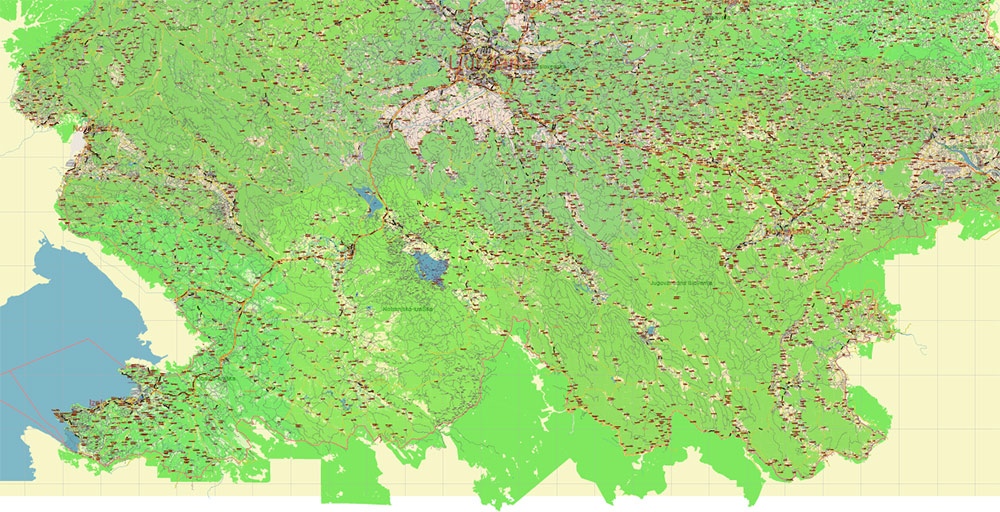
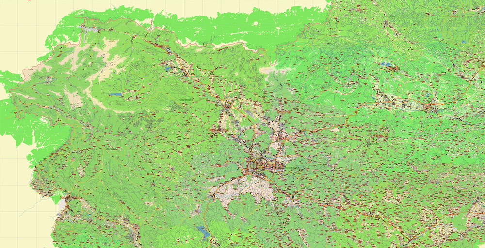
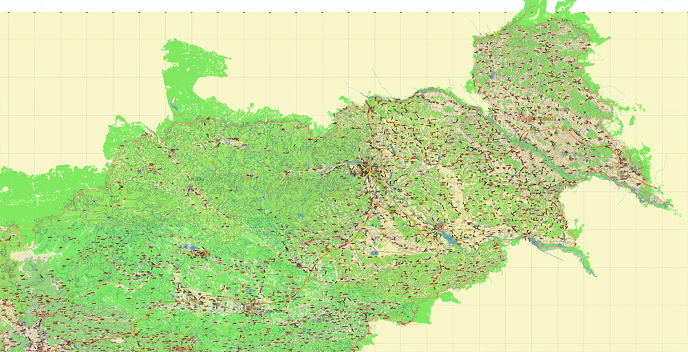
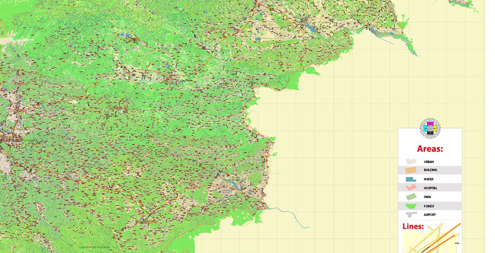
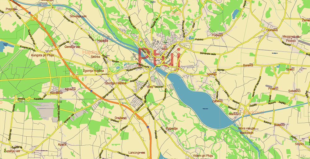
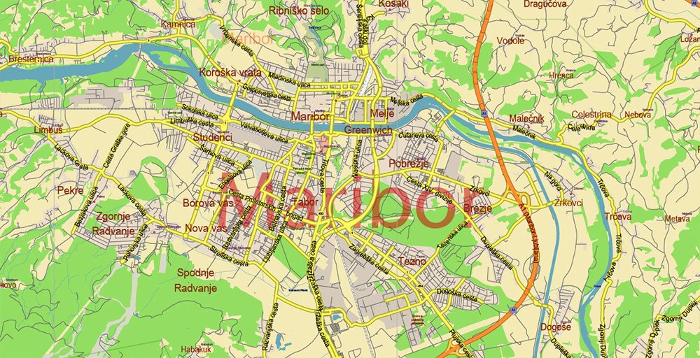
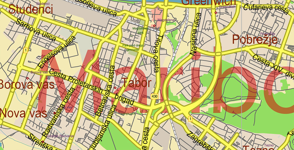
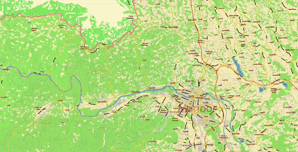
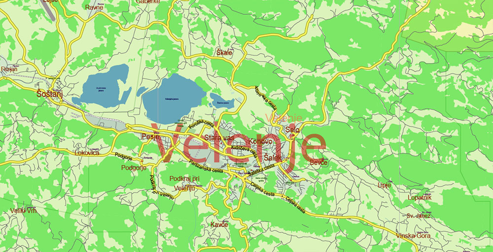
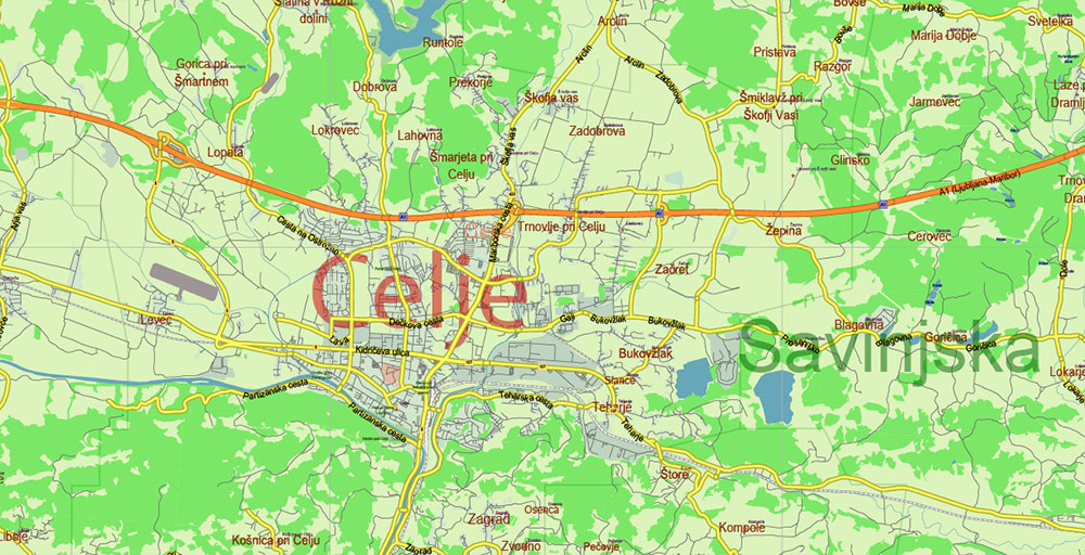
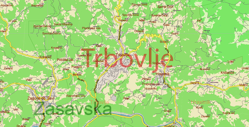
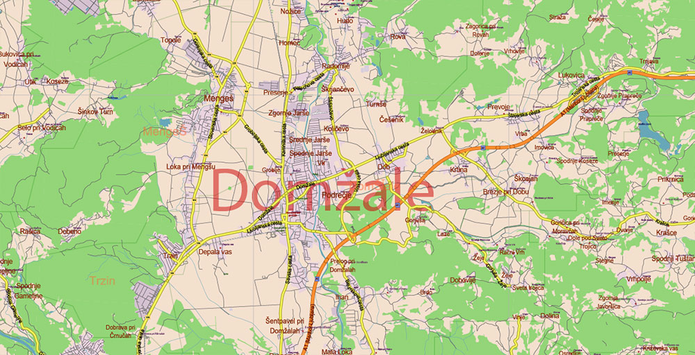
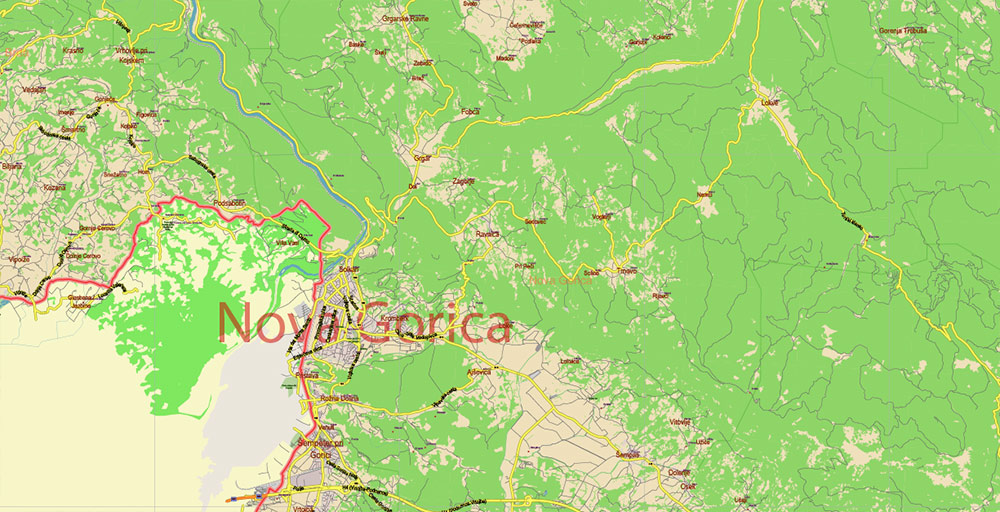
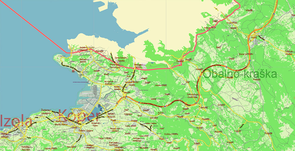
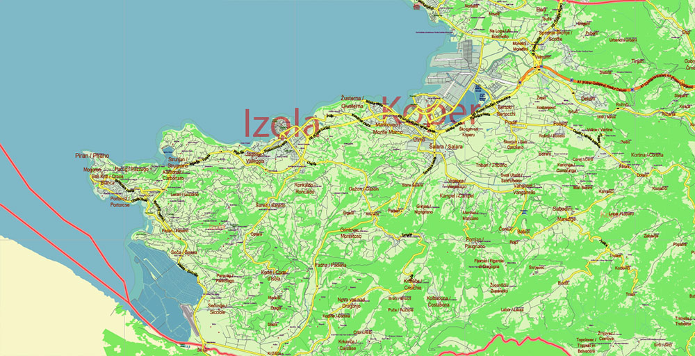
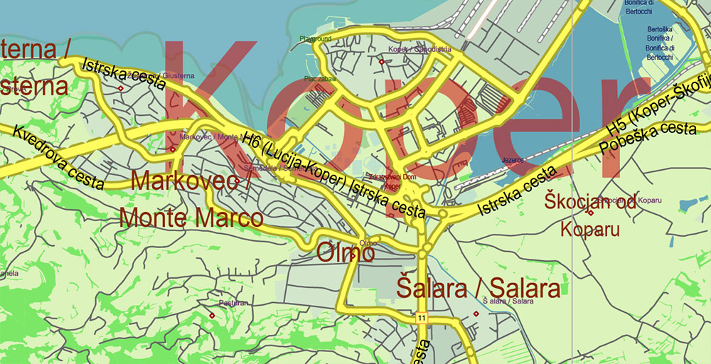
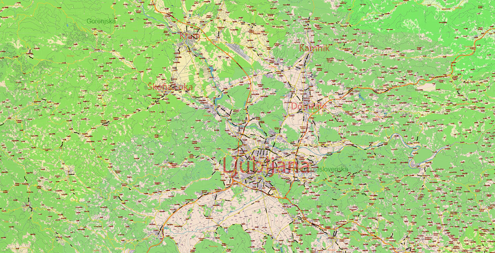
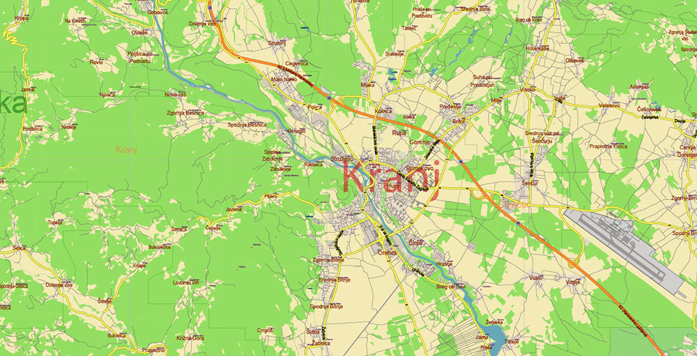
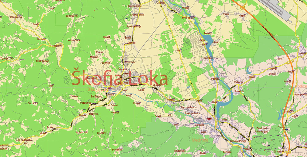
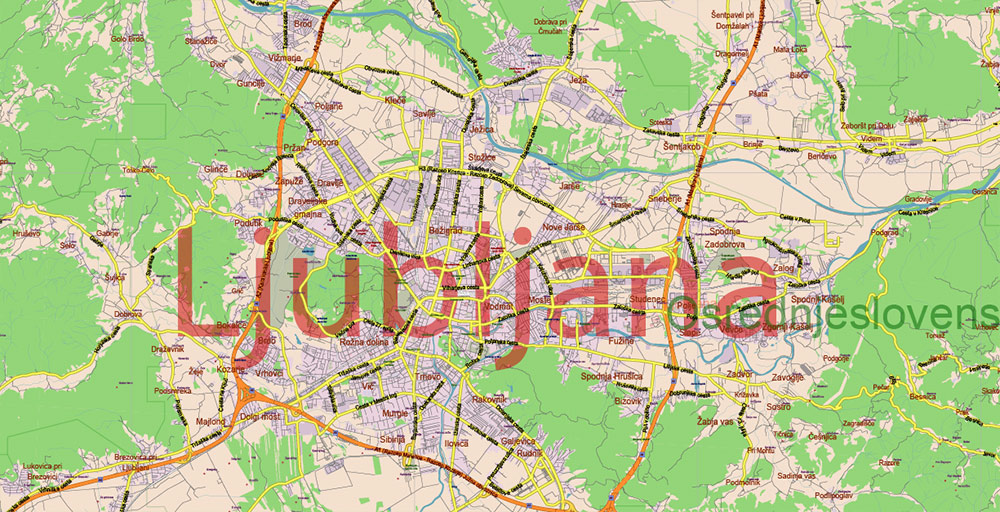
Slovenia PDF Vector Map: Full Extra High Detailed 01 (all roads) + Admin Areas editable Adobe PDF in layers
Layers list:
- Names of Main Cities
- Names of middle towns
- Names of all Cities, towns, villages and hamlets
- Road labels
- Names of objects (water, park, hospital)
- Names of Provinces
- Names of Counties
- Points of the Cities, Towns and Villages
- Names of the Main Streets
- Major Roads and Streets – Highways
- Minor Roads and residencial streets
- Country Borders
- Railroads
- Water objects (rivers, lakes, ponds, swamps, reefs)
- Waterways
- Ground objects (urban areas, parks, hospitals, etc.
- Sea
- County Areas
- Provinces Areas
- Background
Slovenia PDF Vector Map: Full Extra High Detailed 01 (all roads) + Admin Areas editable Adobe PDF in layers
Slovenia PDF Vector Map: Full Extra High Detailed 01 (all roads) + Admin Areas editable Adobe PDF in layers
Slovenia PDF Vector Map: Full Extra High Detailed 01 (all roads) + Admin Areas editable Adobe PDF in layers
Slovenia PDF Vector Map: Full Extra High Detailed 01 (all roads) + Admin Areas editable Adobe PDF in layers
Slovenia PDF Vector Map: Full Extra High Detailed 01 (all roads) + Admin Areas editable Adobe PDF in layers
Slovenia PDF Vector Map: Full Extra High Detailed 01 (all roads) + Admin Areas editable Adobe PDF in layers
Slovenia PDF Vector Map: Full Extra High Detailed 01 (all roads) + Admin Areas editable Adobe PDF in layers
Slovenia PDF Vector Map: Full Extra High Detailed 01 (all roads) + Admin Areas editable Adobe PDF in layers
Slovenia PDF Vector Map: Full Extra High Detailed 01 (all roads) + Admin Areas editable Adobe PDF in layers
Slovenia PDF Vector Map: Full Extra High Detailed 01 (all roads) + Admin Areas editable Adobe PDF in layers
Slovenia PDF Vector Map: Full Extra High Detailed 01 (all roads) + Admin Areas editable Adobe PDF in layers
Slovenia PDF Vector Map: Full Extra High Detailed 01 (all roads) + Admin Areas editable Adobe PDF in layers

Slovenia PDF Vector Map: Full Extra High Detailed 01 (all roads) + Admin Areas editable Adobe PDF in layers
Slovenia PDF Vector Map: Full Extra High Detailed 01 (all roads) + Admin Areas editable Adobe PDF in layers
Slovenia PDF Vector Map: Full Extra High Detailed 01 (all roads) + Admin Areas editable Adobe PDF in layers
Slovenia PDF Vector Map: Full Extra High Detailed 01 (all roads) + Admin Areas editable Adobe PDF in layers
Slovenia PDF Vector Map: Full Extra High Detailed 01 (all roads) + Admin Areas editable Adobe PDF in layers
Slovenia PDF Vector Map: Full Extra High Detailed 01 (all roads) + Admin Areas editable Adobe PDF in layers
Slovenia PDF Vector Map: Full Extra High Detailed 01 (all roads) + Admin Areas editable Adobe PDF in layers
Slovenia PDF Vector Map: Full Extra High Detailed 01 (all roads) + Admin Areas editable Adobe PDF in layers
Slovenia PDF Vector Map: Full Extra High Detailed 01 (all roads) + Admin Areas editable Adobe PDF in layers

 Author: Kirill Shrayber, Ph.D. FRGS
 + Admin Areas editable Adobe Illustrator in layers")