About ai Adobe Illustrator vector map of Roma, Italy, Atlas 25 parts
Archive size: 50 Mb .AI in ZIP
DPI: 300
License: Royalty Free
Also available in other vector formats: [DWG], [.PDF], [.EPS]; [.CDR], [.DXF]
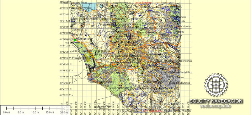
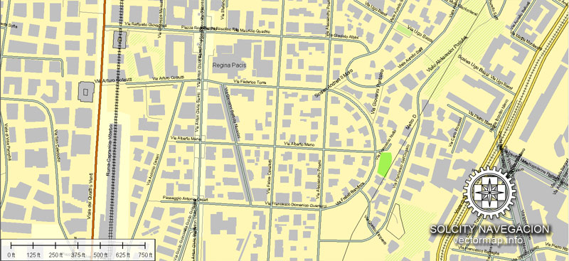
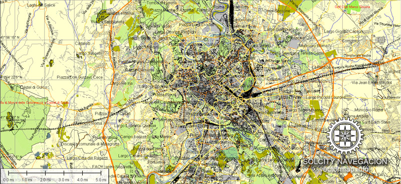
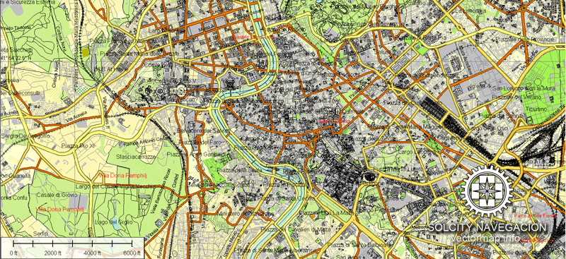
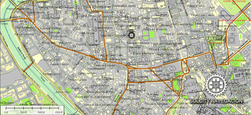
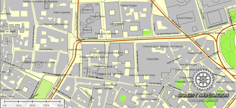
Roma vector map in Adobe Illustrator format (.AI) features (check the preview images):
Highways with names,
Major streets with names,
Major Roads,
Dam,
Pipeline,
National Park Borders,
Airports,
Houses,
Railway lines with stops,
Minor Roads,
Private Roads,
Parking,
Cemeteries,
Big and small Rivers, small streams also,
Lake, ponds and other water bodies,
Landmark fill,
Recreation zones,
County Borders with fill,
Sidewalk/Walkway/Pedestrian roads,
Power Lines,
Parks.
You can change fonts, colors of all objects mentioned above. Everything is editable. This layered vector map is scalable and can be adjusted to any size you need, no matter what big it is, with NO quality loss.
Rome, Italy.
This vector map of Rome is used as a basis for design, editing, and further printing.
This is the most detailed, exact map of Rome for high-quality printing and polygraphy. You can always clarify the map development date by contacting us.
For your convenience, all objects on Rome vector map are divided into layers. And the editing is very easy – colors, lines, etc.
You can easily add any objects needed (e.g. shops, salons, sale points, gas station or attraction) on any layer of Rome vector map.
Rome is the capital city of Italy and a special comune (named Comune di Roma Capitale). Rome also serves as the capital of the Lazio region. With 2,868,782 residents in 1,285 km2 (496.1 sq mi), it is also the country’s most populated comune. It is the fourth-most populous city in the European Union by population within city limits. It is the centre of the Metropolitan City of Rome, which has a population of 4.3 million residents. Rome is located in the central-western portion of the Italian Peninsula, within Lazio (Latium), along the shores of the Tiber. The Vatican City (the smallest country in the world) is an independent country inside the city boundaries of Rome, the only existing example of a country within a city: for this reason Rome has been often defined as capital of two states.
One of the advantages of Rome vector maps of our production is the relevance of cartographic data, we constantly update all our products.
This vector map of Rome is used by:
designers, layout designers, printers, advertisers and architects. Our product – vector maps – is designed for further editing and printing in large formats – from @Wall format (a few meters) to A-0 and A-1, A-2, A-3.
Rome map in vector format is used for design, urban planning, presentations and media visualizations.
Advertising and presentation map of Rome (usually the final designer marks the routes, and puts the client’s objects (shops, saloons, gas stations etc.)
The undoubted advantage is that people will NEVER throw out this advertising product – the map. In fact, as an advertising medium, a map is the most “long-playing” of the well-known polygraphic advertising media, with the longest lifespan, and the maximum number of interactions with the customer.
For travelers, maps are sold at the airports and gas stations around the world. Often the source is our vector maps.
Take a look, who purchases our vector maps of Rome in “Our Clients and Friends” page – these are large and small companies, from super-brands like Volvo and Starbucks, to small design studios and printing houses.
It’s very easy to work with vector maps of Rome, even for a not very experienced designer who can turn on and off the map layers, add new objects, change the colors of fill and lines according to customer requirements.
The undoubted advantage of Rome vector maps in printing is an excellent and detailed visualization, when customer can expand a large paper map and instantly define his location, find a landmark, an object or address on map, unlike using the popular electronic formats of Google and Yandex maps for example.
Printable vector maps of Rome are much more convenient and efficient than any electronic maps on your smartphone, because ALL DETAILS are displayed in the entire space of Rome map.
Useful tips on working with vector maps of cities and countries in Adobe Illustrator.
«V» – launches the Selection tool (cursor, black arrow), which makes active any vector line.
«А» – launches the Direct Selection tool (white cursor), allows you to select curve elements and drag them to the desired place.
«R» – activates the Rotate tool, which helps you rotating selected objects around the center point by 360 degrees.
«E» – gives you the opportunity to use the Eraser tool and erase unnecessary parts.
«X» – switches between Fill and Stroke in the Tools section. Try to get used to this hot key and
you will quickly understand that you can’t live and work without it.
Guides are not limited to vertical and horizontal in Adobe Illustrator. You can also create a diagonal guide for example. Moreover, you can turn any contours into guides. Select the outline and go to View > Guides > Make Guides (Create Guides), or simply press Cmd/Ctrl + 5. You can also turn the guides back into an editable object. Go to menu, View > Guides > Unlock Guides (Release Guides), select the guide you want to edit and select View > Guides > Release Guides (Reset Guides), or just press Cmd/Ctrl + Option / Alt + 5).
You will probably want to change the color scheme used on our Rome vector map.
To quickly and effectively play with colors.
Of course, you can do it manually, all objects in our Rome vector map are divided according to types and layers, and you can easily change the color gamma of vector objects in groups and layers.
But there is more effective way of working with the whole VECTOR MAP of Rome and all layers:
The overview dialog «Edit colors»/«Repaint Graphic Object» (this dialog box name can change depending on the context):
If you have selected a part or a layer of Rome vector map and open the dialog box by clicking the icon in the Control panel, on the Samples palette or the Color Catalog, or if you choose Edit > Edit Colors> Repaint Graphic Object, then the «Repaint Graphic Object» dialog box appears, and you get access to «Assign» and «Edit» tabs.
If a picture or a map fragment is not selected, and you open the dialog box by clicking the icon in the Control panel, on the Samples palette or in the Color Catalog, the «Edit Colors» dialog box appears and you can only access the «Edit» tab.
Regardless of the name at the top of the dialog box, the right-hand side always displays the color group of the current document, as well as two default color groups: Print Color and Grayscale. These color groups can be selected and used any time.
Create and edit color groups of Rome vector map, and also assign colors using the «Edit Colors»/ а «Repaint Graphic Object» dialog box.
A. Creating and editing of a color group on the «Edit» tab
B. Assigning colors on the «Assign» tab
C. Select a group of colors from the «Color groups» list
The option «Repaint a graphic object» in the lower part of the dialog box allows you to preview the colors on a selected layer of Vector map, or a group of elements, and specify whether its colors will be redefined when the dialog box is closed.
The main areas of the dialog box are:
«Edit»
The «Edit» tab is designed to create a new or edit the existing color groups.
The harmony rules Menu and the Color Wheel are used to conduct experiments with color harmonies. The color wheel shows how colors are related in color harmony, and the color bars allow you to view and manipulate an individual color values. In addition, you can adjust the brightness, add and remove colors, save color groups and view colors on the selected Vector Map of Rome or a separated layers.
«Assign»
The «Assign» tab is used to view and control on how the original colors are replaced with colors from the color group like your corporate colors in the Vector Map of Rome.
The assign color ability is provided only if the entire map, layer or fragment is selected in the document. You can specify which of new colors replace the current colors, whether the spot colors should be preserved and how colors are replaced (for example, you can replace colors completely or changing the color tone while maintaining the brightness). The «Assign» tab allows you to redefine colors in the Vector Map of Rome, or in separate layers and fragments using the current color group or reducing the number of colors in the current Vector Map.
Color groups
Is a list of all saved color groups for current document (the same groups appear in the «Samples» palette). You can edit and delete the existing color groups, as well as creating a new ones using the list of “Color Groups” in the dialog box. All changes appear in the «Samples» palette.
The highlighted color group shows, which color group is currently edited.
Any color group can be selected and edited, or used to redefine the colors in the selected vector map of Rome, its fragments or elements.
Saving a color group adds this group to the specified list.
Opening the «Edit Colors»/«Repaint Graphic Object» dialog box.
Open the «Edit Colors»/«Repaint Graphic Object» dialog box using one of the following methods:
«Edit»> «Edit Colors»> «Repaint Graphic object» or «Repaint With Style».
Use these commands if you need to edit the colors in the selected vector map of Rome.
«Repaint Graphic object» button on the «Control» panel.
Use this button if you need to adjust colors of Rome vector map using the а «Repaint graphic object» dialog box.
The specified button is available if the selected vector map or its fragment contains two or more colors.
Note. This color editing method is convenient for global color adjustment in a vector map, if global colors were not used when creating a Map of Rome.
The «Edit colors» button or «Edit or apply colors» on the «Color Catalog» palette
Click this button if you need to edit colors on the «Color Catalog» palette or edit and then apply them to the selected Vector Map of Rome or its fragment.
The «Edit color group» button or «Edit or apply color group» on the «Samples» palette.
Click this button if you need to edit the colors in the specific color group or edit and apply them to the selected Vector Map of Rome or a group of its elements, for example, the whole layer “Streets and lines”. You can also double-click the color group in the Samples panel to open the dialog box.
If the map file is too large and your computer freezes or even can’t open it quickly:
1. Try to reduce the color resolution of the video card (display) to 256 colors while working with a large map.
2. Using Windows Task Manager, select all the application you don’t need, while working with map, just turn them off.
3. Launch Adobe Illustrator. (DO NOT OPEN the vector map file)
4. Start the Windows Task Manager using administrator rights > Find the “Illustrator” process > set the «real time» priority,
5. Open the file. When you see the LEGACY FONT popup window – click “OK” (do not update). You can restore the TEXT later.
6. Can also be useful: When file is opened – Edit > Settings > Basic Settings > disable smoothing. /// It looks scary, but works quickly)))
We recommend saving the file in Adobe Illustrator 10 version. It’s much more stable when working with VERY BIG size files.
Rome’s history spans 28 centuries. While Roman mythology dates the founding of Rome at around 753 BC, the site has been inhabited for much longer, making it one of the oldest continuously occupied sites in Europe. The city’s early population originated from a mix of Latins, Etruscans, and Sabines. Eventually, the city successively became the capital of the Roman Kingdom, the Roman Republic and the Roman Empire, and is regarded as the birthplace of Western civilization and by some as the first ever metropolis. It was first called The Eternal City (Latin: Urbs Aeterna; Italian: La Città Eterna) by the Roman poet Tibullus in the 1st century BC, and the expression was also taken up by Ovid, Virgil, and Livy. Rome is also called the “Caput Mundi” (Capital of the World). After the fall of the Western Empire, which marked the beginning of the Middle Ages, Rome slowly fell under the political control of the Papacy, which had settled in the city since the 1st century AD, until in the 8th century it became the capital of the Papal States, which lasted until 1870. Beginning with the Renaissance, almost all the popes since Nicholas V (1447–1455) pursued over four hundred years a coherent architectural and urban programme aimed at making the city the artistic and cultural centre of the world. In this way, Rome became first one of the major centres of the Italian Renaissance, and then the birthplace of both the Baroque style and Neoclassicism. Famous artists, painters, sculptors and architects made Rome the centre of their activity, creating masterpieces throughout the city. In 1871, Rome became the capital of the Kingdom of Italy, which, in 1946, became the Italian Republic.
Rome has the status of a global city. In 2016, Rome ranked as the 14th-most-visited city in the world, 3rd most visited in the European Union, and the most popular tourist attraction in Italy. Its historic centre is listed by UNESCO as a World Heritage Site. Monuments and museums such as the Vatican Museums and the Colosseum are among the world’s most visited tourist destinations with both locations receiving millions of tourists a year, and the city hosted the 1960 Summer Olympics. Rome is the seat of several specialized agencies of the United Nations, such as the Food and Agriculture Organization (FAO), the World Food Programme (WFP) and the International Fund for Agricultural Development (IFAD). The city also hosts the Secretariat of the Parliamentary Assembly of the Union for the Mediterranean (UfM) as well as the headquarters of many international business companies such as Eni, Enel, TIM, Leonardo S.p.A., and national and international banks such as Unicredit and BNL. Its business district, called EUR, is the base of many companies involved in the oil industry, the pharmaceutical industry, and financial services. Rome is also an important fashion and design centre thanks to renowned international brands centered in the city. Rome’s Cinecittà Studios have been the set of many Academy Award–winning movies.
Cities and counties near Roma city vector map.
Tomba di Nerone, Municipio XIV, Tufello, Tor Sapienza, Osteria, Municipio XII, La Massimina Casal Lumbroso, Garbatella, Cinecitta, Vitinia, Ciampino, Marino, Frascati, Grottaferrata, Rocca di Papa, Tivoli, Guidonia.
Purchasing of AI vector map of Roma, Italy
This is a Royalty Free license. You don`t pay extra for copying or editing.
We accept credit cards and PayPal. After the payment you will be redirected to the download page.
Check our full base of detailed vector maps.
Ai proposito di Adobe Illustrator vettore la mappa di Roma, Italia
Dimensioni dell’archivio: 50 Mb .AI in ZIP
DPI: 300
Vector Map Dati: 2015
Licenza: Royalty Free
Disponibile anche in altri formati vettoriali: [DWG], [.PDF], [.EPS]; [.CDR], [.DXF]
Roma mappa vettoriale in formato Adobe Illustrator (.AI) presenta (controllare le immagini di anteprima):
Autostrade con nomi,
Le principali strade con nomi,
Strade principali,
Diga,
Pipeline,
Parco Nazionale Borders,
Aeroporti,
Case,
Le linee ferroviarie con fermate,
Minori Strade,
Strade private,
Parcheggio,
Cimiteri,
Grandi e piccoli fiumi, piccoli corsi d’acqua, anche
Lago, stagni e altri corpi idrici,
Riempimento punto di riferimento,
Zone ricreative,
Contea Bordi con riempimento,
Strade marciapiede / pedonale / pedonali,
Linee elettriche,
Parchi.
È possibile modificare font, colori di tutti gli oggetti di cui sopra. Tutto è modificabile. Questo vettore mappa stratificata è scalabile e può essere regolato a qualsiasi dimensione avete bisogno, non importa che cosa grande che è, senza perdita di qualità.
Città e contee vicino a Roma città mappa vettoriale.
Tomba di Nerone, Municipio XIV, Tufello, Tor Sapienza, Osteria, Municipio XII, La Massimina Casal Lumbroso, Garbatella, Cinecittà, Vitinia, Ciampino, Marino, Frascati, Grottaferrata, Rocca di Papa, Tivoli, Guidonia.
Acquisto di AI vettore la mappa di Roma, Italia
Questa è una licenza Royalty Free. Don `t pagare un extra per la copia o la modifica.
Si accettano carte di credito e PayPal. Dopo il pagamento sarete reindirizzati alla pagina di download.
Controlla la nostra completa base mappe vettoriali dettagliate.


 Author: Kirill Shrayber, Ph.D. FRGS
 Street Map editable Adobe Illustrator in layers")

