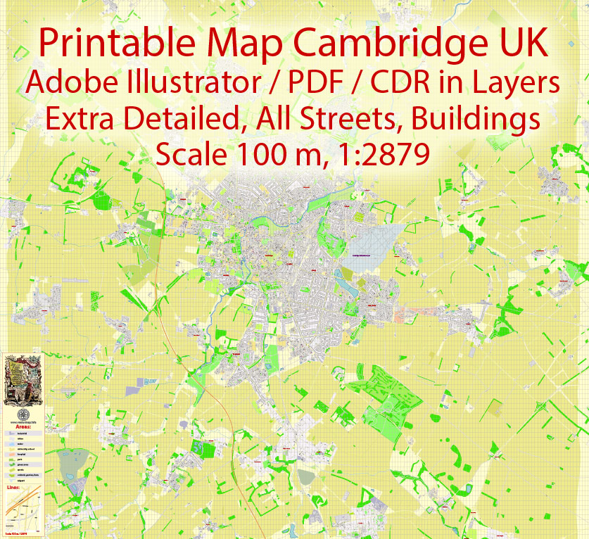
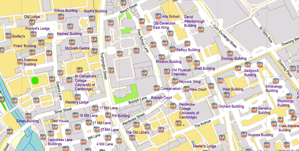
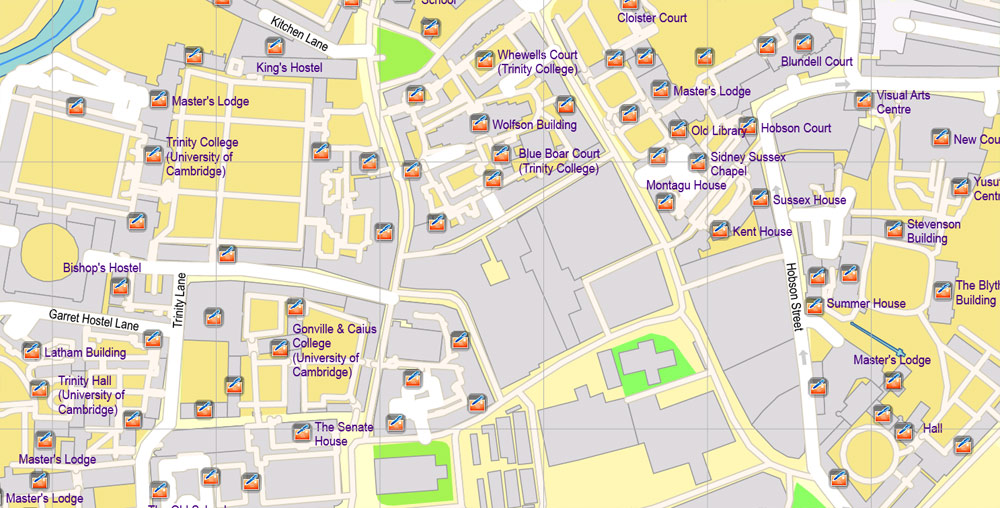
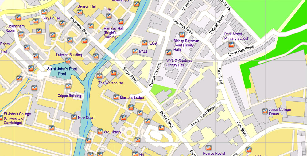
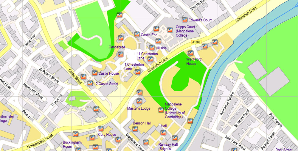
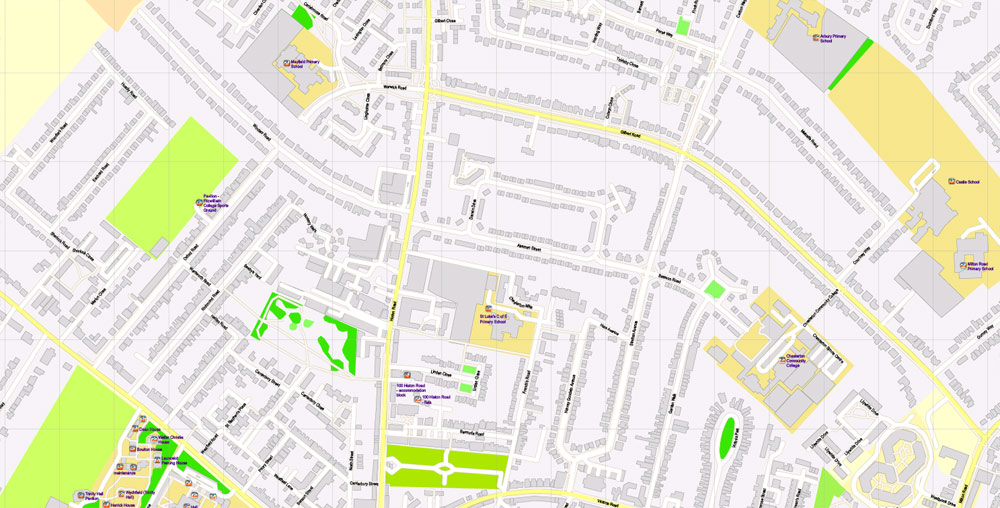
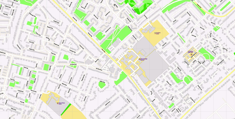
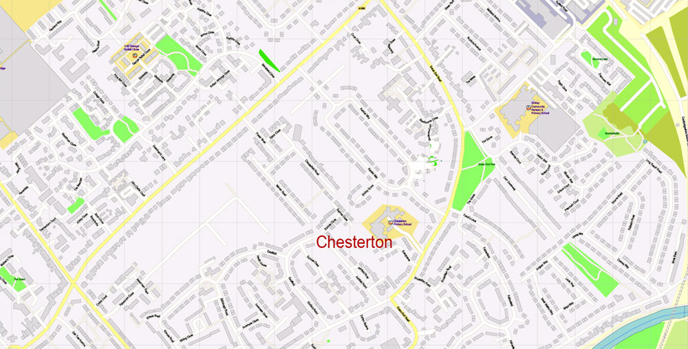
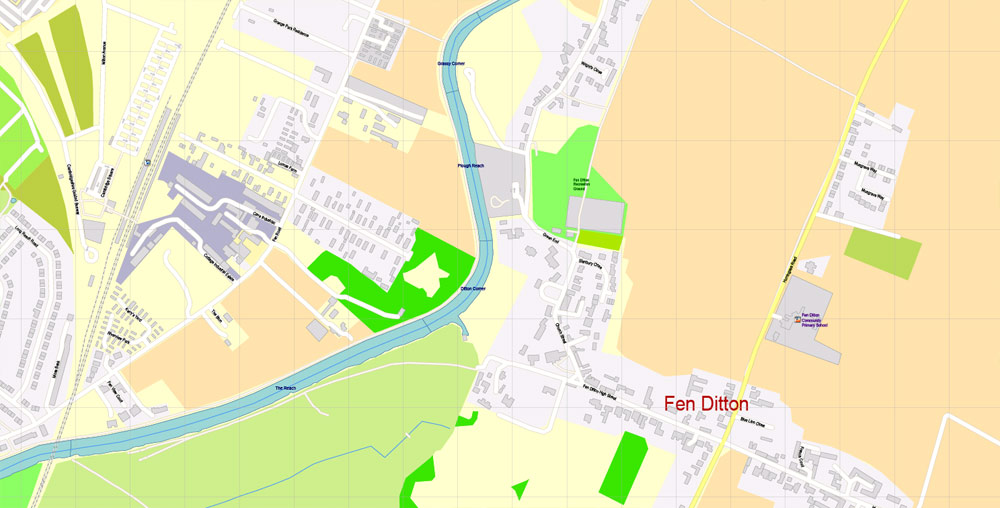
Printable Vector Map Cambridge UK, exact detailed City Plan all Buildings, Scale 1:2879, editable Layered Adobe Illustrator Street Map, 14 Mb ZIP.
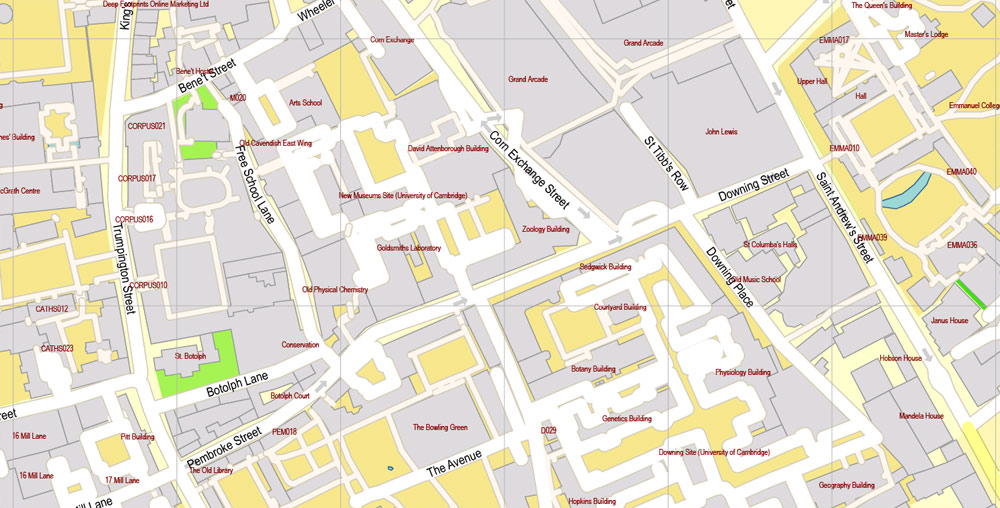
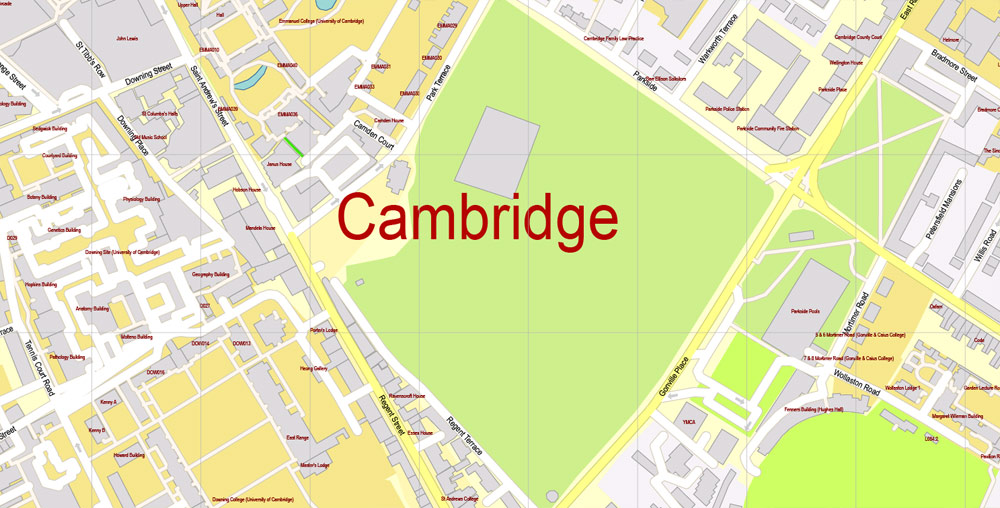
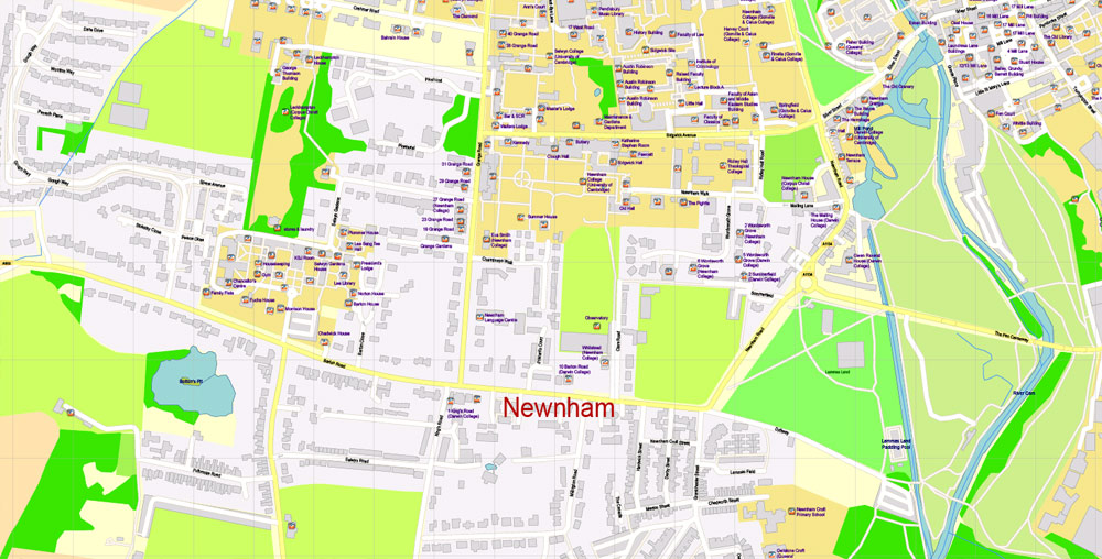
All streets named, main objects, all Building. Map for publishing, design, printing, publications, arts, projects, presentations, for architects, designers and builders, business, logistics. The most exact and detailed map of the city.
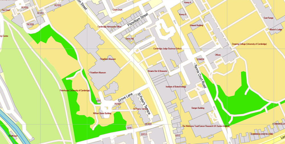
Layers: legend, grids, labels_roads, names_places, names_streets, buildings, names_objects, objects, arrows_streets, streets_roads, color_fills, etc.
Text format all names
DWG, DXF, CDR, ESRI Shapes, and other formats – by request, same price, please contact.
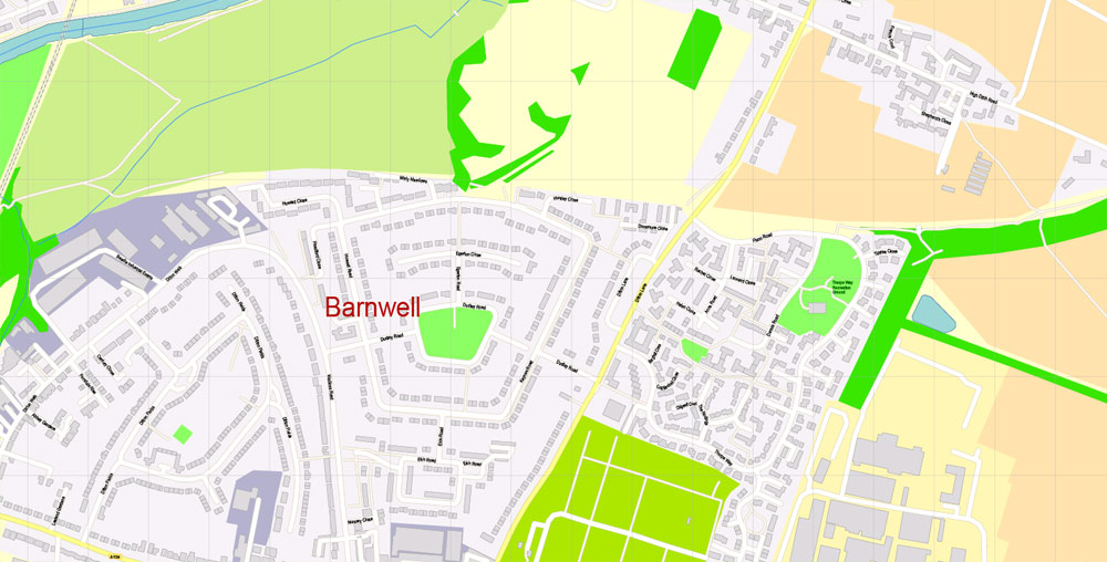
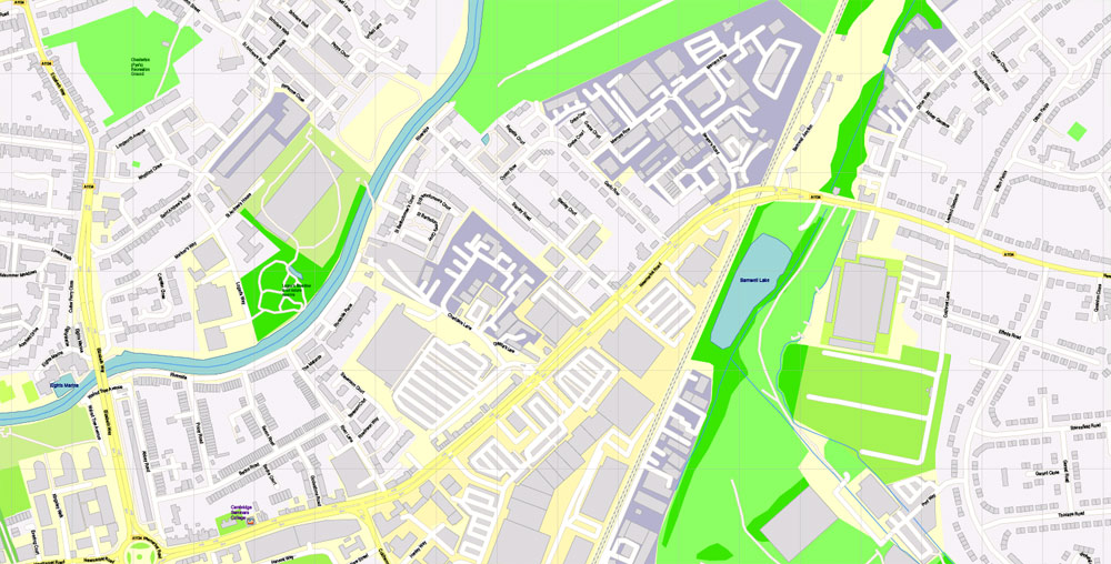
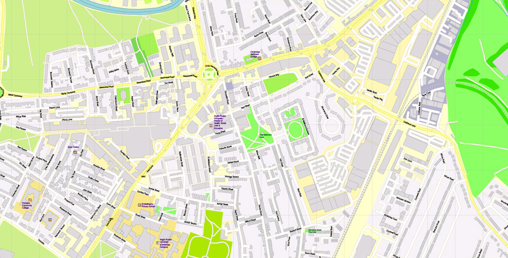
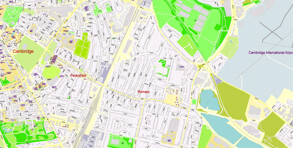
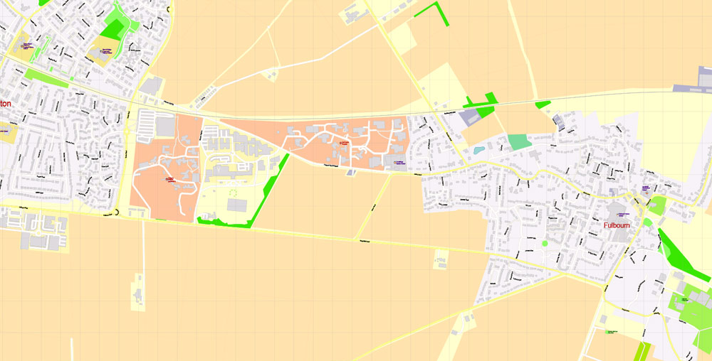
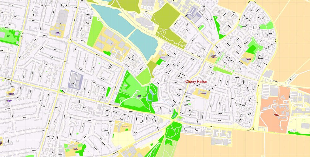
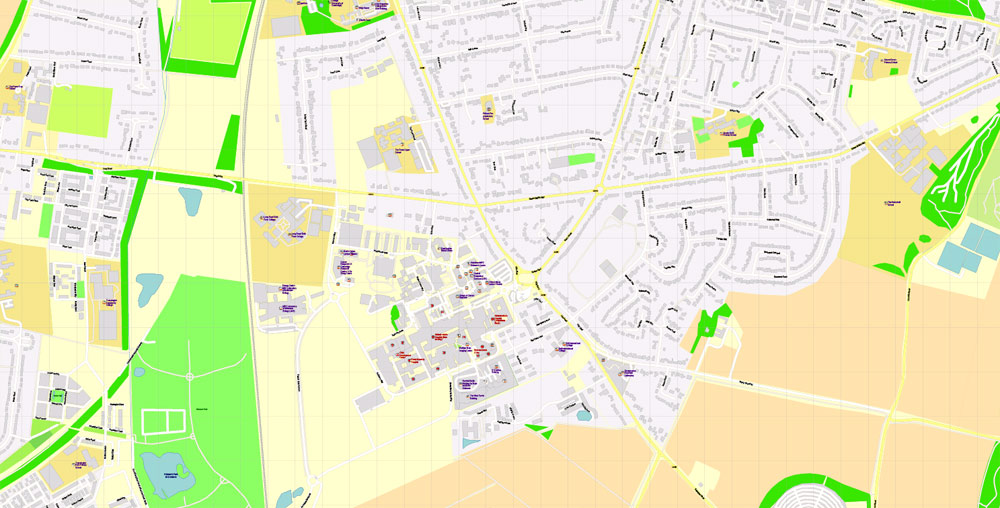
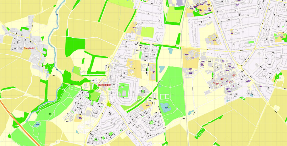
Cambridge, England.
This vector map of Cambridge city is used as a basis for design, editing, and further printing.
This is the most detailed, exact map of Cambridge city for high-quality printing and polygraphy. You can always clarify the map development date by contacting us.
For your convenience, all objects on Cambridge vector city map are divided into layers. And the editing is very easy – colors, lines, etc.
You can easily add any objects needed (e.g. shops, salons, sale points, gas station or attraction) on any layer of Cambridge vector map.
Cambridge is a university city and the county town of Cambridgeshire, England, on the River Cam approximately 50 miles (80 km) north of London. At the United Kingdom Census 2011, its population was 123,867 including 24,506 students. Cambridge became an important trading centre during the Roman and Viking ages, and there is archaeological evidence of settlement in the area as early as the Bronze Age. The first town charters were granted in the 12th century, although modern city status was not officially conferred until 1951.
One of the advantages of Cambridge city vector maps of our production is the relevance of cartographic data, we constantly update all our products.
This vector map of Cambridge city is used by:
designers, layout designers, printers, advertisers and architects. Our product – vector maps – is designed for further editing and printing in large formats – from @Wall format (a few meters) to A-0 and A-1, A-2, A-3.
The Cambridge city map in vector format is used for design, urban planning, presentations and media visualizations.
The advertising and presentation map of Cambridge city (usually the final designer marks the routes, and puts the client’s objects (shops, saloons, gas stations etc.)
The undoubted advantage is that people will NEVER throw out this advertising product – the map. In fact, as an advertising medium, a city map is the most “long-playing” of the well-known polygraphic advertising media, with the longest lifespan, and the maximum number of interactions with the customer.
The world-renowned University of Cambridge was founded in 1209. The buildings of the university include King’s College Chapel, Cavendish Laboratory, and the Cambridge University Library, one of the largest legal deposit libraries in the world. The city’s skyline is dominated by several college buildings, along with the spire of the Our Lady and the English Martyrs Church, the chimney of Addenbrooke’s Hospital and St John’s College Chapel tower. Anglia Ruskin University evolved from the Cambridge School of Art and the Cambridgeshire College of Arts and Technology. Its main campus is in the city.
For travelers, maps are sold at the airports and gas stations around the world. Often the source is our vector maps.
Take a look, who purchases our vector maps of Cambridge city in “Our Clients and Friends” page – these are large and small companies, from super-brands like Volvo and Starbucks, to small design studios and printing houses.
It’s very easy to work with vector maps of Cambridge city, even for a not very experienced designer who can turn on and off the map layers, add new objects, change the colors of fill and lines according to customer requirements.
The undoubted advantage of Cambridge city vector maps in printing is an excellent and detailed visualization, when customer can expand a large paper map and instantly define his location, find a landmark, an object or address on map, unlike using the popular electronic formats of Google and Yandex maps for example.
Printable vector maps of Cambridge city are much more convenient and efficient than any electronic maps on your smartphone, because ALL DETAILS are displayed in the entire space of Cambridge city map.
Cambridge is at the heart of the high-technology Silicon Fen with industries such as software and bioscience and many start-up companies born out of the university. More than 40% of the workforce have a higher education qualification, more than twice the national average. The Cambridge Biomedical Campus, one of the largest biomedical research clusters in the world, is soon to house premises of AstraZeneca, a hotel and the relocated Papworth Hospital.
Useful tips on working with vector maps of cities and countries in Adobe Illustrator.
«V» – launches the Selection tool (cursor, black arrow), which makes active any vector line.
«А» – launches the Direct Selection tool (white cursor), allows you to select curve elements and drag them to the desired place.
«R» – activates the Rotate tool, which helps you rotating selected objects around the center point by 360 degrees.
«E» – gives you the opportunity to use the Eraser tool and erase unnecessary parts.
«X» – switches between Fill and Stroke in the Tools section. Try to get used to this hot key and
you will quickly understand that you can’t live and work without it.
Guides are not limited to vertical and horizontal in Adobe Illustrator. You can also create a diagonal guide for example. Moreover, you can turn any contours into guides. Select the outline and go to View > Guides > Make Guides (Create Guides), or simply press Cmd/Ctrl + 5. You can also turn the guides back into an editable object. Go to menu, View > Guides > Unlock Guides (Release Guides), select the guide you want to edit and select View > Guides > Release Guides (Reset Guides), or just press Cmd/Ctrl + Option / Alt + 5).
You will probably want to change the color scheme used on our Cambridge vector city map.
Parker’s Piece hosted the first ever game of Association football. The Strawberry Fair music and arts festival and Midsummer Fairs are held on Midsummer Common, and the annual Cambridge Beer Festival takes place on Jesus Green. The city is adjacent to the M11 and A14 roads, and Cambridge station is less than an hour from London King’s Cross railway station.
To quickly and effectively play with colors.
Of course, you can do it manually, all objects in our Cambridge city vector map are divided according to types and layers, and you can easily change the color gamma of vector objects in groups and layers.
But there is more effective way of working with the whole VECTOR MAP of Cambridge city and all layers:
The overview dialog «Edit colors»/«Repaint Graphic Object» (this dialog box name can change depending on the context):
If you have selected a part or a layer of Cambridge city vector map and open the dialog box by clicking the icon in the Control panel, on the Samples palette or the Color Catalog, or if you choose Edit > Edit Colors> Repaint Graphic Object, then the «Repaint Graphic Object» dialog box appears, and you get access to «Assign» and «Edit» tabs.
If a picture or a map fragment is not selected, and you open the dialog box by clicking the icon in the Control panel, on the Samples palette or in the Color Catalog, the «Edit Colors» dialog box appears and you can only access the «Edit» tab.
Regardless of the name at the top of the dialog box, the right-hand side always displays the color group of the current document, as well as two default color groups: Print Color and Grayscale. These color groups can be selected and used any time.
Create and edit color groups of Cambridge city vector map, and also assign colors using the «Edit Colors»/ а «Repaint Graphic Object» dialog box.
A. Creating and editing of a color group on the «Edit» tab
B. Assigning colors on the «Assign» tab
C. Select a group of colors from the «Color groups» list
The option «Repaint a graphic object» in the lower part of the dialog box allows you to preview the colors on a selected layer of Vector map, or a group of elements, and specify whether its colors will be redefined when the dialog box is closed.
Geography and environment
Cambridge is situated about 50 miles (80 km) north-by-east of London. The city is located in an area of level and relatively low-lying terrain just south of the Fens, which varies between 6 and 24 metres (20 and 79 ft) above sea level. The town was thus historically surrounded by low lying wetlands that have been drained as the town has expanded.
The main areas of the dialog box are:
«Edit»
The «Edit» tab is designed to create a new or edit the existing color groups.
The harmony rules Menu and the Color Wheel are used to conduct experiments with color harmonies. The color wheel shows how colors are related in color harmony, and the color bars allow you to view and manipulate an individual color values. In addition, you can adjust the brightness, add and remove colors, save color groups and view colors on the selected Vector Map of Cambridge city or a separated layers.
«Assign»
The «Assign» tab is used to view and control on how the original colors are replaced with colors from the color group like your corporate colors in the Vector Map of Cambridge city.
The assign color ability is provided only if the entire map, layer or fragment is selected in the document. You can specify which of new colors replace the current colors, whether the spot colors should be preserved and how colors are replaced (for example, you can replace colors completely or changing the color tone while maintaining the brightness). The «Assign» tab allows you to redefine colors in the Vector Map of Cambridge city, or in separate layers and fragments using the current color group or reducing the number of colors in the current Vector Map.
The underlying geology of Cambridge consists of gault clay and Chalk Marl, known locally as Cambridge Greensand, partly overlaid by terrace gravel. A layer of phosphatic nodules (coprolites) under the marl were mined in the 19th century for fertiliser. It became a major industry in the county, and its profits yielded buildings such as the Corn Exchange, Fulbourn Hospital and St. John’s Chapel until the Quarries Act 1894 and competition from America ended production. The River Cam flows through the city from the village of Grantchester, to the southwest.
Color groups
Is a list of all saved color groups for current document (the same groups appear in the «Samples» palette). You can edit and delete the existing color groups, as well as creating a new ones using the list of “Color Groups” in the dialog box. All changes appear in the «Samples» palette.
The highlighted color group shows, which color group is currently edited.
Any color group can be selected and edited, or used to redefine the colors in the selected vector map of Cambridge city, its fragments or elements.
Saving a color group adds this group to the specified list.
Opening the «Edit Colors»/«Repaint Graphic Object» dialog box.
Open the «Edit Colors»/«Repaint Graphic Object» dialog box using one of the following methods:
«Edit»> «Edit Colors»> «Repaint Graphic object» or «Repaint With Style».
Use these commands if you need to edit the colors in the selected vector map of Cambridge city.
«Repaint Graphic object» button on the «Control» panel.
Use this button if you need to adjust colors of Cambridge city vector map using the а «Repaint graphic object» dialog box.
The specified button is available if the selected vector map or its fragment contains two or more colors.
Note. This color editing method is convenient for global color adjustment in a vector map, if global colors were not used when creating a City Map of Cambridge.
The «Edit colors» button or «Edit or apply colors» on the «Color Catalog» palette
Click this button if you need to edit colors on the «Color Catalog» palette or edit and then apply them to the selected Vector Map of Cambridge city or its fragment.
The «Edit color group» button or «Edit or apply color group» on the «Samples» palette.
It is bordered by water meadows within the city such as Sheep’s Green as well as residential development. Like most cities, modern-day Cambridge has many suburbs and areas of high-density housing. The city centre of Cambridge is mostly commercial, historic buildings, and large green areas such as Jesus Green, Parker’s Piece and Midsummer Common.
Click this button if you need to edit the colors in the specific color group or edit and apply them to the selected Vector Map of Cambridge city or a group of its elements, for example, the whole layer “Streets and lines”. You can also double-click the color group in the Samples panel to open the dialog box.
If the map file is too large and your computer freezes or even can’t open it quickly:
1. Try to reduce the color resolution of the video card (display) to 256 colors while working with a large map.
2. Using Windows Task Manager, select all the application you don’t need, while working with map, just turn them off.
3. Launch Adobe Illustrator. (DO NOT OPEN the vector map file)
4. Start the Windows Task Manager using administrator rights > Find the “Illustrator” process > set the «real time» priority,
5. Open the file. When you see the LEGACY FONT popup window – click “OK” (do not update). You can restore the TEXT later.
6. Can also be useful: When file is opened – Edit > Settings > Basic Settings > disable smoothing. /// It looks scary, but works quickly)))
We recommend saving the file in Adobe Illustrator 10 version. It’s much more stable when working with VERY BIG size files.
Many of the roads in the centre are pedestrianised. Population growth has seen new housing developments in the 21st century, with estates such as the CB1 and Accordia schemes near the station, and developments such as Great Kneighton, formally known as Clay Farm, and Trumpington Meadows currently under construction in the south of the city. Other major developments currently being constructed in the city are Darwin Green (formerly NIAB), and University-led developments at West Cambridge and North West Cambridge, (Eddington).
The entire city centre, as well as parts of Chesterton, Petersfield, West Cambridge, Newnham, and Abbey, are covered by an Air Quality Management Area, implemented to counter high levels of nitrogen dioxide in the atmosphere.
Cambridge
City in England
Cambridge is a city on the River Cam in eastern England, home to the prestigious University of Cambridge, dating to 1209. University colleges include King’s, famed for its choir and towering Gothic chapel, as well as Trinity, founded by Henry VIII, and St John’s, with its 16th-century Great Gate. University museums have exhibits on archaeology and anthropology, polar exploration, the history of science and zoology.
Free vector maps:

Free download printable map Europe vector Adobe Illustrator >>>
Free download printable PDF map Europe vector Adobe PDF >>>


 Author: Kirill Shrayber, Ph.D. FRGS


