Winnipeg, Canada, Printable City Plan V.3.09 Adobe Illustrator, full vector, Map V3.09, scalable, editable, separated text layer street names, 12 mb ZIP
All streets, some more buildings. Map for publishing, design, printing, arts, projects, presentations.
CDR, DWG, DXF and other formats – on demand, same price, please, contact
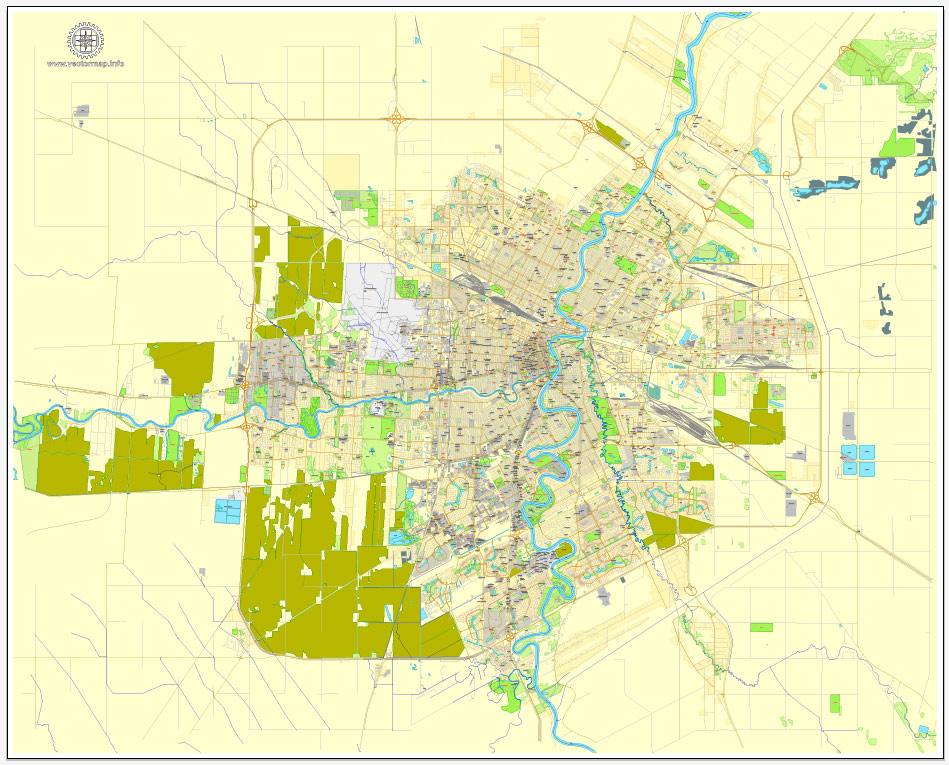
Winnipeg, Canada.
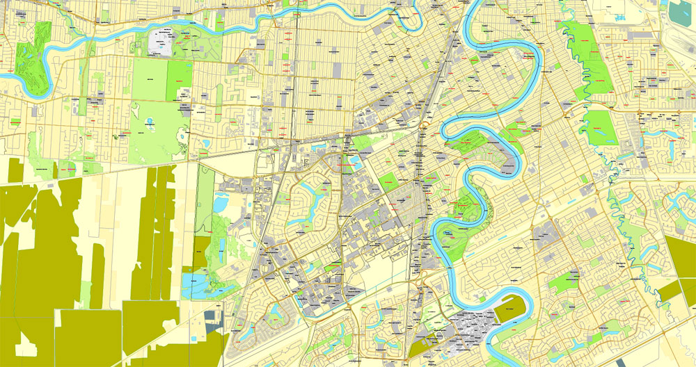
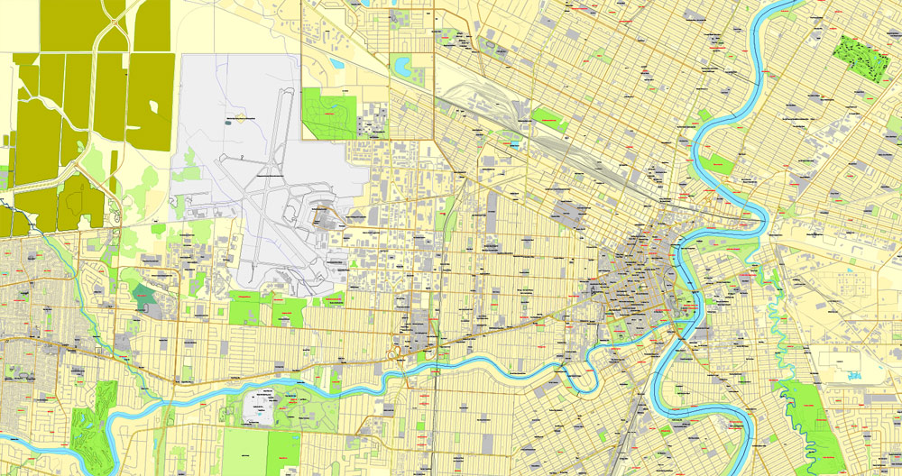
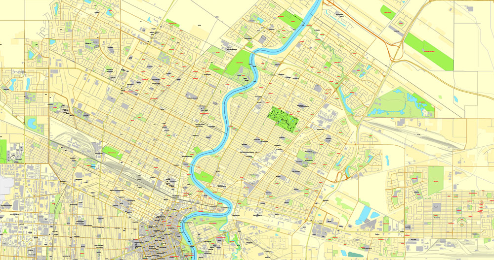
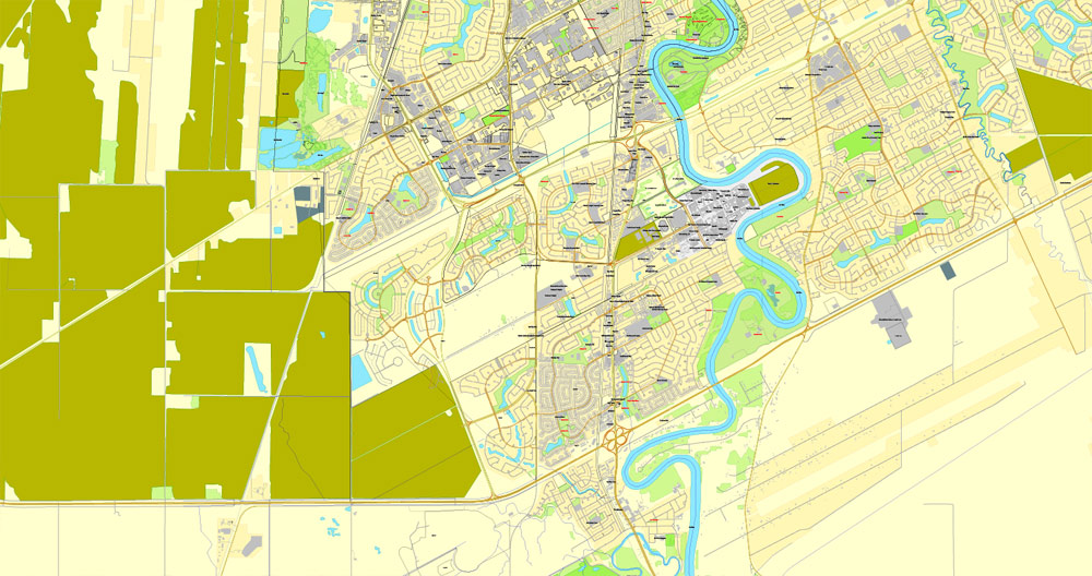
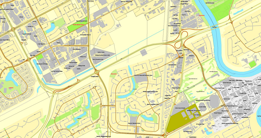
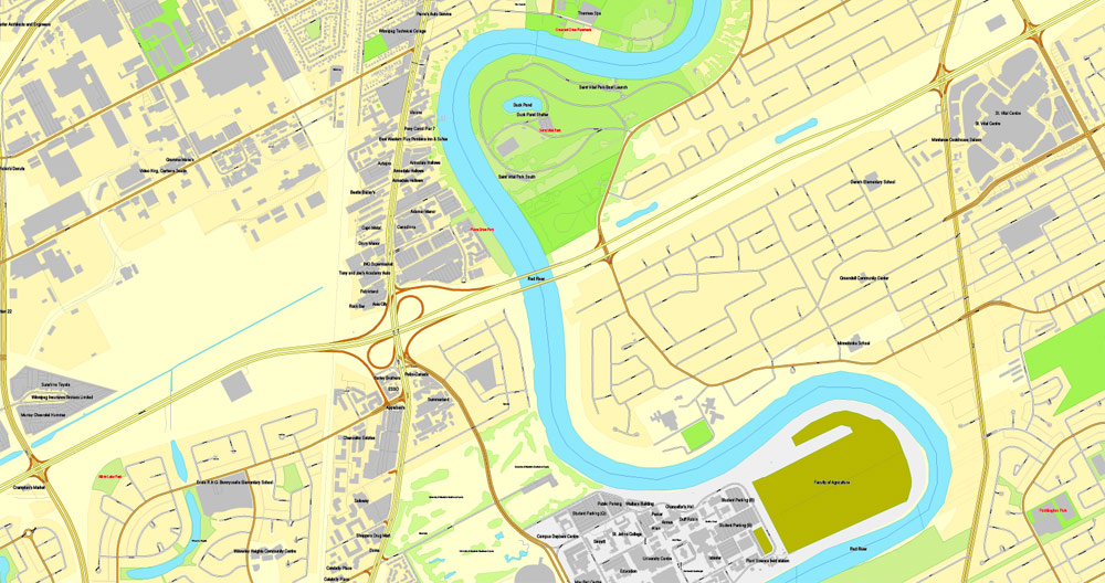
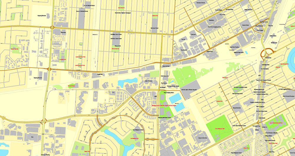
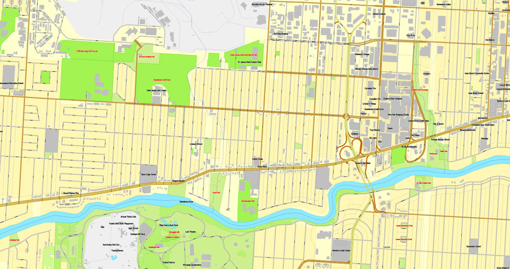
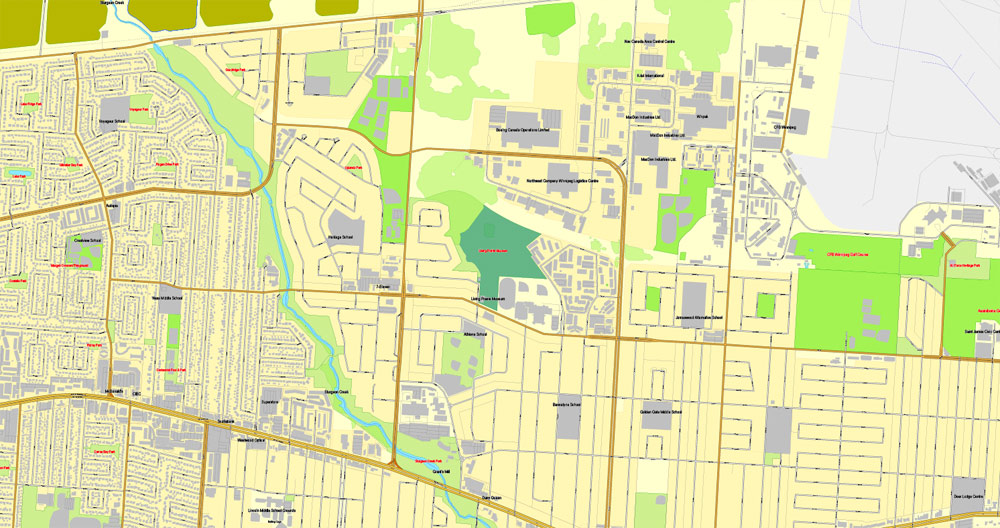
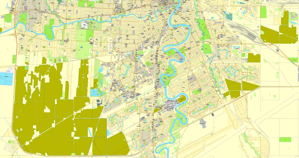
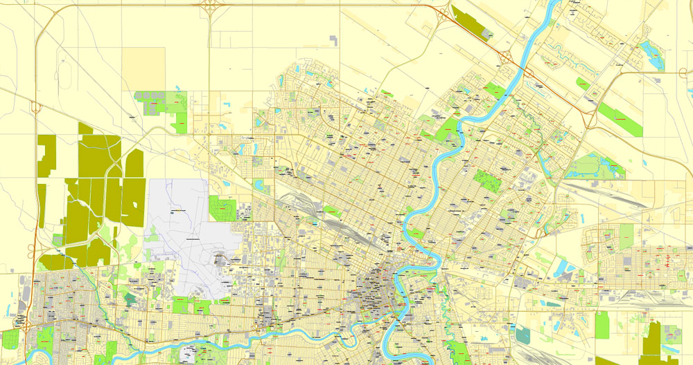
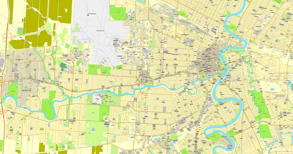
This vector map of Winnipeg is used as a basis for design, editing, and further printing.
This is the most detailed, exact map of Winnipeg for high-quality printing and polygraphy. You can always clarify the map development date by contacting us.
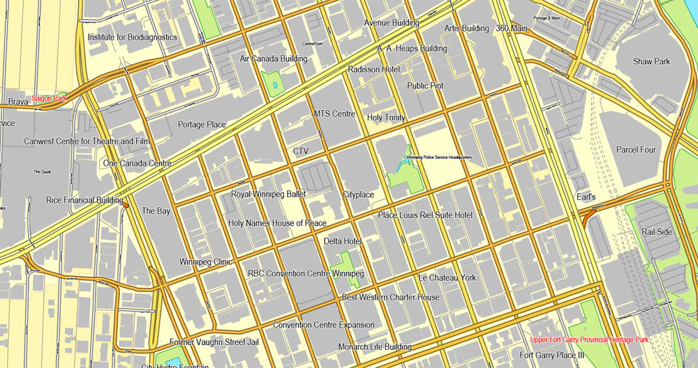
For your convenience, all objects on Winnipeg vector map are divided into layers. And the editing is very easy – colors, lines, etc.
You can easily add any objects needed (e.g. shops, salons, sale points, gas station or attraction) on any layer of Winnipeg vector map.
Winnipeg is the capital and largest city of the province of Manitoba in Canada. Centred on the confluence of the Red and Assiniboine rivers, it is near the longitudinal centre of North America, approximately 110 kilometres (70 mi) north of the Canada–United States border.
One of the advantages of Winnipeg vector maps of our production is the relevance of cartographic data, we constantly update all our products.
This vector map of Winnipeg is used by:
designers, layout designers, printers, advertisers and architects. Our product – vector maps – is designed for further editing and printing in large formats – from @Wall format (a few meters) to A-0 and A-1, A-2, A-3.
Winnipeg map in vector format is used for design, urban planning, presentations and media visualizations.
Advertising and presentation map of Winnipeg (usually the final designer marks the routes, and puts the client’s objects (shops, saloons, gas stations etc.)
The undoubted advantage is that people will NEVER throw out this advertising product – the map. In fact, as an advertising medium, a map is the most “long-playing” of the well-known polygraphic advertising media, with the longest lifespan, and the maximum number of interactions with the customer.
For travelers, maps are sold at the airports and gas stations around the world. Often the source is our vector maps.
The city is named after the nearby Lake Winnipeg; the name comes from the Western Cree words for muddy water. The region was a trading centre for aboriginal peoples long before the arrival of Europeans. French traders built the first fort on the site in 1738. A settlement was later founded by the Selkirk settlers of the Red River Colony in 1812, the nucleus of which was incorporated as the City of Winnipeg in 1873. As of 2011, Winnipeg is the seventh most populated municipality in Canada. Being far inland, the local climate is extremely seasonal even by Canadian standards with average January lows of around −21 °C (−6 °F) and average July highs of 26 °C (79 °F).
Take a look, who purchases our vector maps of Winnipeg in “Our Clients and Friends” page – these are large and small companies, from super-brands like Volvo and Starbucks, to small design studios and printing houses.
It’s very easy to work with vector maps of Winnipeg, even for a not very experienced designer who can turn on and off the map layers, add new objects, change the colors of fill and lines according to customer requirements.
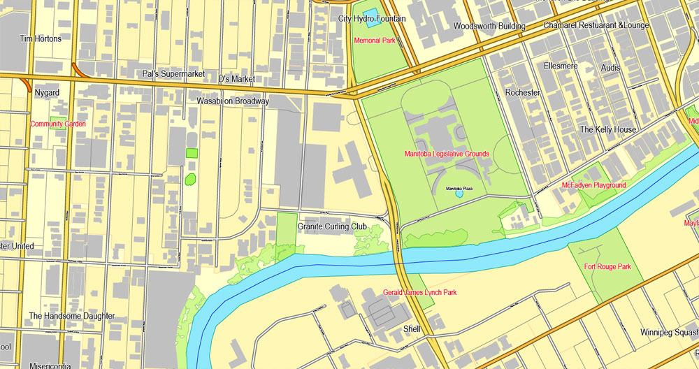
The undoubted advantage of Winnipeg vector maps in printing is an excellent and detailed visualization, when customer can expand a large paper map and instantly define his location, find a landmark, an object or address on map, unlike using the popular electronic formats of Google and Yandex maps for example.
Printable vector maps of Winnipeg are much more convenient and efficient than any electronic maps on your smartphone, because ALL DETAILS are displayed in the entire space of Winnipeg map.
Known as the “Gateway to the West”, Winnipeg is a railway and transportation hub with a diversified economy. This multicultural city hosts numerous annual festivals, including the Festival du Voyageur, the Winnipeg Folk Festival, the Jazz Winnipeg Festival, the Winnipeg Fringe Theatre Festival, and Folklorama. Winnipeg was the first Canadian host of the Pan American Games. It is home to several professional sports franchises, including the Winnipeg Blue Bombers (Canadian football), the Winnipeg Jets (ice hockey), Manitoba Moose (ice hockey) and the Winnipeg Goldeyes (baseball).
Useful tips on working with vector maps of cities and countries in Adobe Illustrator.
«V» – launches the Selection tool (cursor, black arrow), which makes active any vector line.
«А» – launches the Direct Selection tool (white cursor), allows you to select curve elements and drag them to the desired place.
«R» – activates the Rotate tool, which helps you rotating selected objects around the center point by 360 degrees.
«E» – gives you the opportunity to use the Eraser tool and erase unnecessary parts.
«X» – switches between Fill and Stroke in the Tools section. Try to get used to this hot key and
you will quickly understand that you can’t live and work without it.
Guides are not limited to vertical and horizontal in Adobe Illustrator. You can also create a diagonal guide for example. Moreover, you can turn any contours into guides. Select the outline and go to View > Guides > Make Guides (Create Guides), or simply press Cmd/Ctrl + 5. You can also turn the guides back into an editable object. Go to menu, View > Guides > Unlock Guides (Release Guides), select the guide you want to edit and select View > Guides > Release Guides (Reset Guides), or just press Cmd/Ctrl + Option / Alt + 5).
You will probably want to change the color scheme used on our Winnipeg vector map.
To quickly and effectively play with colors.
Of course, you can do it manually, all objects in our Winnipeg vector map are divided according to types and layers, and you can easily change the color gamma of vector objects in groups and layers.
But there is more effective way of working with the whole VECTOR MAP of Winnipeg and all layers:
The overview dialog «Edit colors»/«Repaint Graphic Object» (this dialog box name can change depending on the context):
If you have selected a part or a layer of Winnipeg vector map and open the dialog box by clicking the icon in the Control panel, on the Samples palette or the Color Catalog, or if you choose Edit > Edit Colors> Repaint Graphic Object, then the «Repaint Graphic Object» dialog box appears, and you get access to «Assign» and «Edit» tabs.
If a picture or a map fragment is not selected, and you open the dialog box by clicking the icon in the Control panel, on the Samples palette or in the Color Catalog, the «Edit Colors» dialog box appears and you can only access the «Edit» tab.
Regardless of the name at the top of the dialog box, the right-hand side always displays the color group of the current document, as well as two default color groups: Print Color and Grayscale. These color groups can be selected and used any time.
Create and edit color groups of Winnipeg vector map, and also assign colors using the «Edit Colors»/ а «Repaint Graphic Object» dialog box.
A. Creating and editing of a color group on the «Edit» tab
B. Assigning colors on the «Assign» tab
C. Select a group of colors from the «Color groups» list
The option «Repaint a graphic object» in the lower part of the dialog box allows you to preview the colors on a selected layer of Vector map, or a group of elements, and specify whether its colors will be redefined when the dialog box is closed.
The main areas of the dialog box are:
«Edit»
The «Edit» tab is designed to create a new or edit the existing color groups.
The harmony rules Menu and the Color Wheel are used to conduct experiments with color harmonies. The color wheel shows how colors are related in color harmony, and the color bars allow you to view and manipulate an individual color values. In addition, you can adjust the brightness, add and remove colors, save color groups and view colors on the selected Vector Map of Winnipeg or a separated layers.
«Assign»
The «Assign» tab is used to view and control on how the original colors are replaced with colors from the color group like your corporate colors in the Vector Map of Winnipeg.
The assign color ability is provided only if the entire map, layer or fragment is selected in the document. You can specify which of new colors replace the current colors, whether the spot colors should be preserved and how colors are replaced (for example, you can replace colors completely or changing the color tone while maintaining the brightness). The «Assign» tab allows you to redefine colors in the Vector Map of Winnipeg, or in separate layers and fragments using the current color group or reducing the number of colors in the current Vector Map.
Color groups
Is a list of all saved color groups for current document (the same groups appear in the «Samples» palette). You can edit and delete the existing color groups, as well as creating a new ones using the list of “Color Groups” in the dialog box. All changes appear in the «Samples» palette.
The highlighted color group shows, which color group is currently edited.
Any color group can be selected and edited, or used to redefine the colors in the selected vector map of Winnipeg , its fragments or elements.
Saving a color group adds this group to the specified list.
Opening the «Edit Colors»/«Repaint Graphic Object» dialog box.
Open the «Edit Colors»/«Repaint Graphic Object» dialog box using one of the following methods:
«Edit»> «Edit Colors»> «Repaint Graphic object» or «Repaint With Style».
Use these commands if you need to edit the colors in the selected vector map of Winnipeg.
«Repaint Graphic object» button on the «Control» panel.
Use this button if you need to adjust colors of Winnipeg vector map using the а «Repaint graphic object» dialog box.
The specified button is available if the selected vector map or its fragment contains two or more colors.
Geography
Winnipeg lies at the bottom of the Red River Valley, a flood plain with an extremely flat topography. It is on the eastern edge of the Canadian Prairies in Western Canada and is known as the “Gateway to the West”. Winnipeg is bordered by tallgrass prairie to the west and south and the aspen parkland to the northeast, although most of the native prairie grasses have been removed for agriculture and urbanization. It is relatively close to many large Canadian Shield lakes and parks, as well as Lake Winnipeg (the Earth’s 11th largest freshwater lake). Winnipeg has North America’s largest extant mature urban elm forest. The city has an area of 464.08 km2 (179.18 sq mi).
Note. This color editing method is convenient for global color adjustment in a vector map, if global colors were not used when creating a Map of Winnipeg.
The «Edit colors» button or «Edit or apply colors» on the «Color Catalog» palette
Click this button if you need to edit colors on the «Color Catalog» palette or edit and then apply them to the selected Vector Map of Winnipeg or its fragment.
The «Edit color group» button or «Edit or apply color group» on the «Samples» palette.
Click this button if you need to edit the colors in the specific color group or edit and apply them to the selected Vector Map of Winnipeg or a group of its elements, for example, the whole layer “Streets and lines”. You can also double-click the color group in the Samples panel to open the dialog box.
If the map file is too large and your computer freezes or even can’t open it quickly:
1. Try to reduce the color resolution of the video card (display) to 256 colors while working with a large map.
2. Using Windows Task Manager, select all the application you don’t need, while working with map, just turn them off.
3. Launch Adobe Illustrator. (DO NOT OPEN the vector map file)
4. Start the Windows Task Manager using administrator rights > Find the “Illustrator” process > set the «real time» priority,
5. Open the file. When you see the LEGACY FONT popup window – click “OK” (do not update). You can restore the TEXT later.
6. Can also be useful: When file is opened – Edit > Settings > Basic Settings > disable smoothing. /// It looks scary, but works quickly)))
We recommend saving the file in Adobe Illustrator 10 version. It’s much more stable when working with VERY BIG size files.
Winnipeg has four major rivers: the Red, Assiniboine, La Salle and Seine. The city was subject to severe flooding in the past. The Red River reached its greatest flood height in 1826. Another large flood in 1950 caused millions of dollars in damage and mass evacuations. This flood prompted Duff Roblin’s provincial government to build the Red River Floodway to protect the city; the project began in 1962 and was completed in 1968. In the 1997 flood, flood control dikes were reinforced and raised using sandbags; Winnipeg suffered limited damage compared to the flood’s impact on cities without such structures, such as Grand Forks, North Dakota. The generally flat terrain and the poor drainage of the Red River Valley’s clay-based soil also results in many mosquitoes during wetter years.
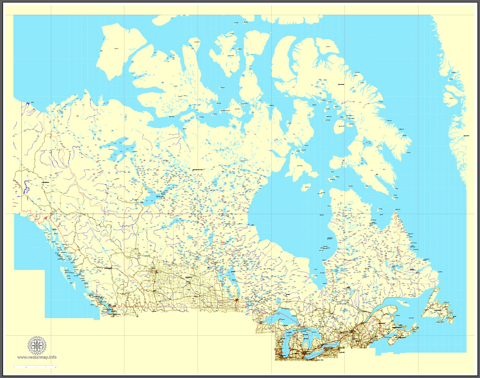
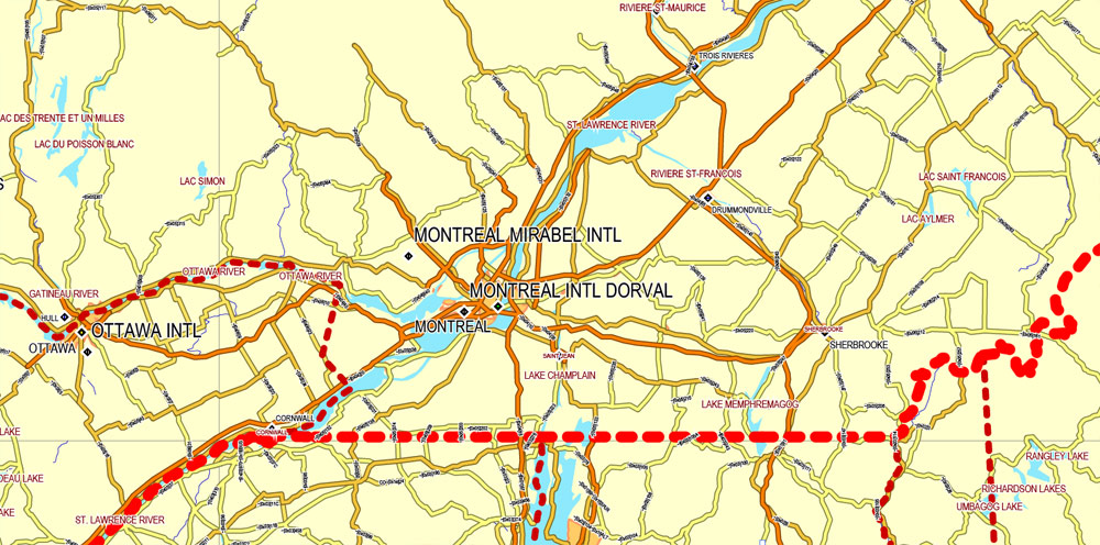
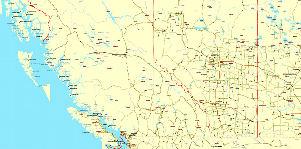
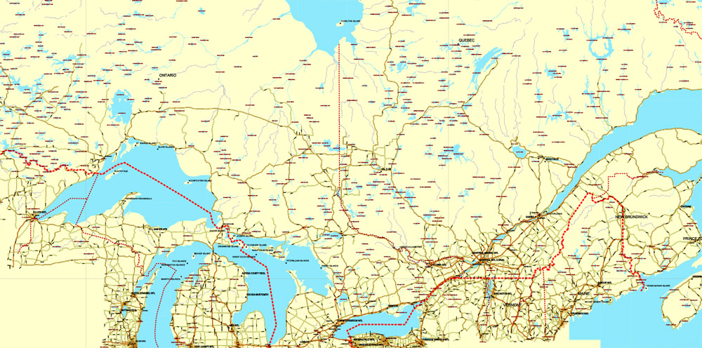
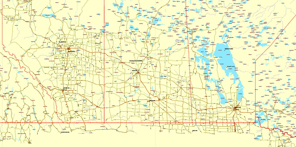
Download Free vector Map Canada, mainroads, cities, borders, province borders, Adobe Illustrator Text format street names, full editable, Layers: grownd, nombres, borders, symbols, halo
vector_map_canada_mainroads_mercator_projection_ai-ai
Download Free PDF Map Canada, mainroads, cities, borders, province borders, Adobe PDF Text format street names, full editable, Layers: grownd, nombres, borders, symbols, halo
vector_map_canada_mainroads_mercator_projection_pdf-pdf

 Author: Kirill Shrayber, Ph.D. FRGS

