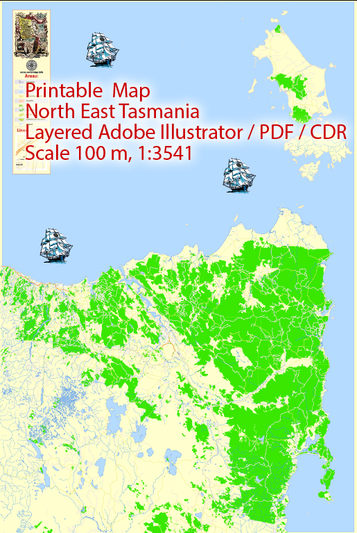
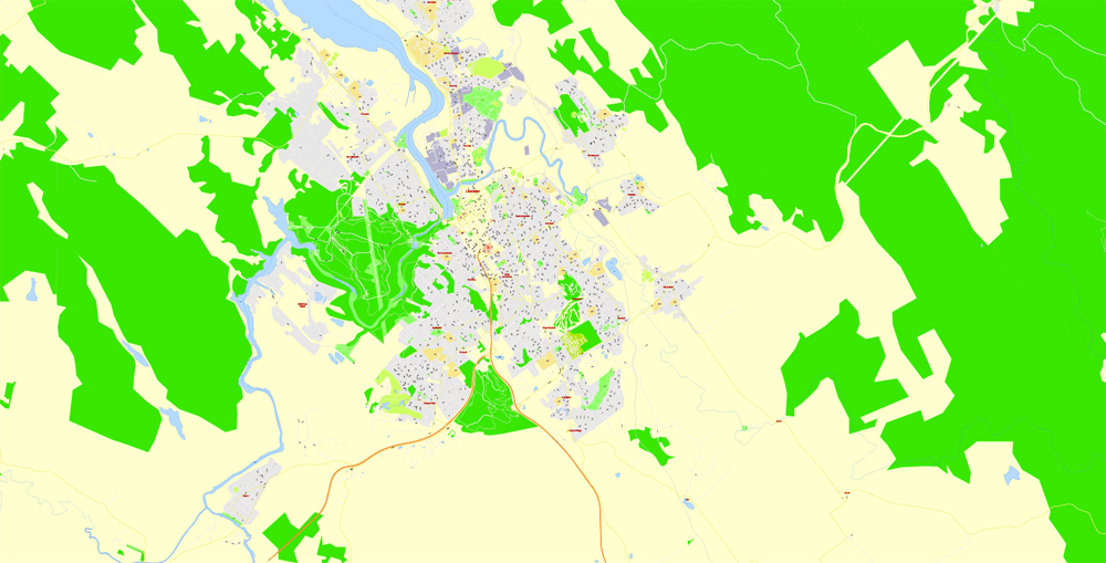
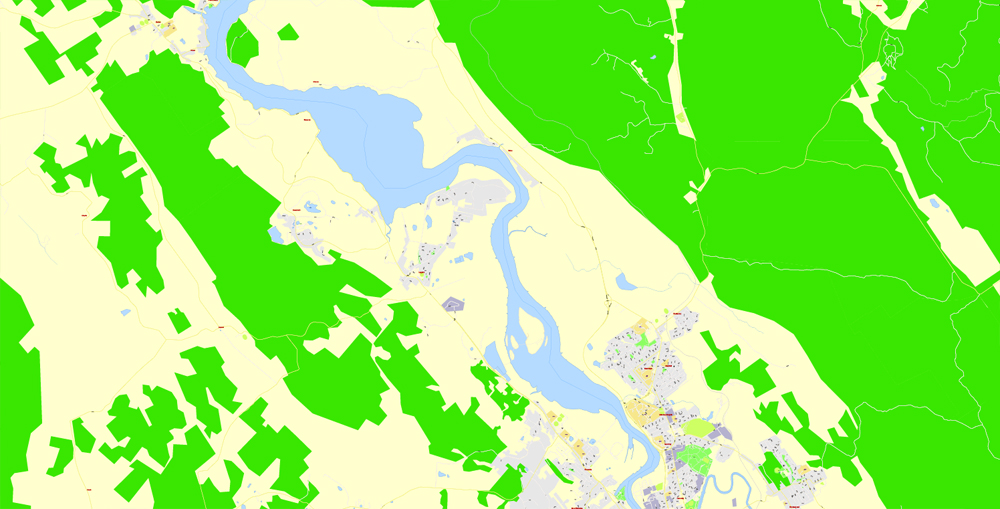
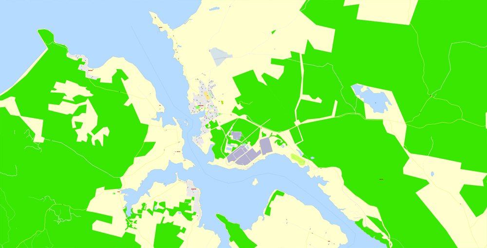
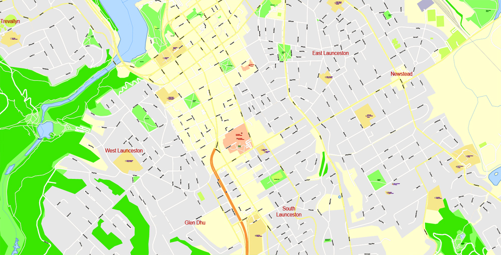
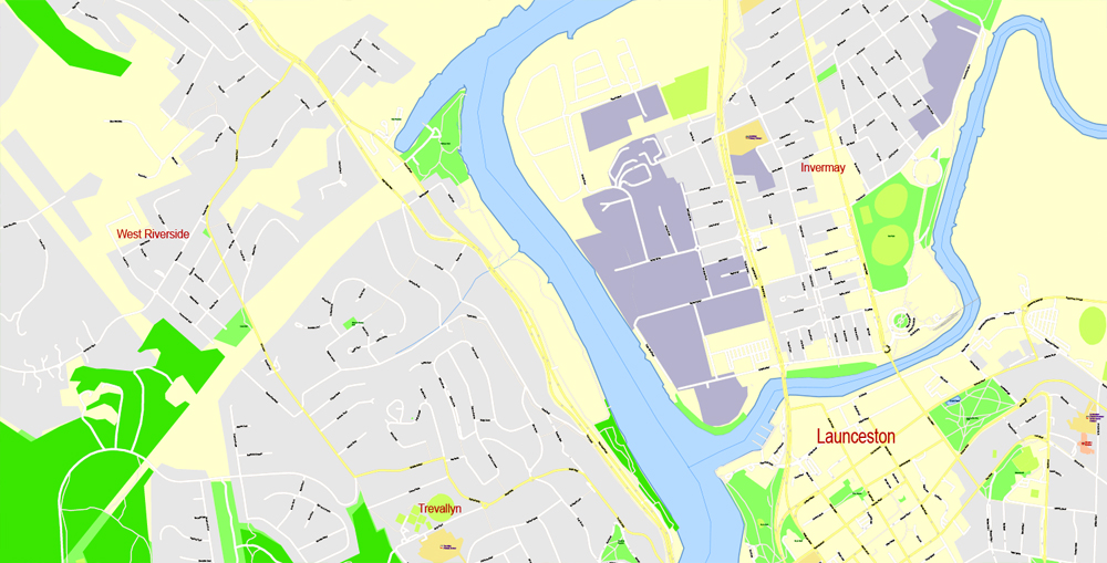
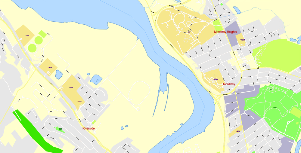
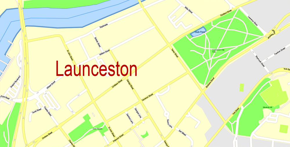
Printable Map North East Tasmania, exact vector City Plan Map street G-View Level 17 (100 meters scale 1:3541) full editable, Adobe Illustrator, full vector, scalable, editable text format street names, 24 mb ZIP
All streets named, Main Objects, no buildings. Map for design, printing, arts, projects, presentations, for architects, designers and builders, business, logistics.
Layers: color fills, streets_roads, arrows_streets, labels_roads, objects, names_objects, names_streets civll, names main streets, names_places, grids, legend.
The most exact and detailed map of the city.
For print LARGE (WALL) format.
DWG, DXF and other formats – on request, same price, please, contact
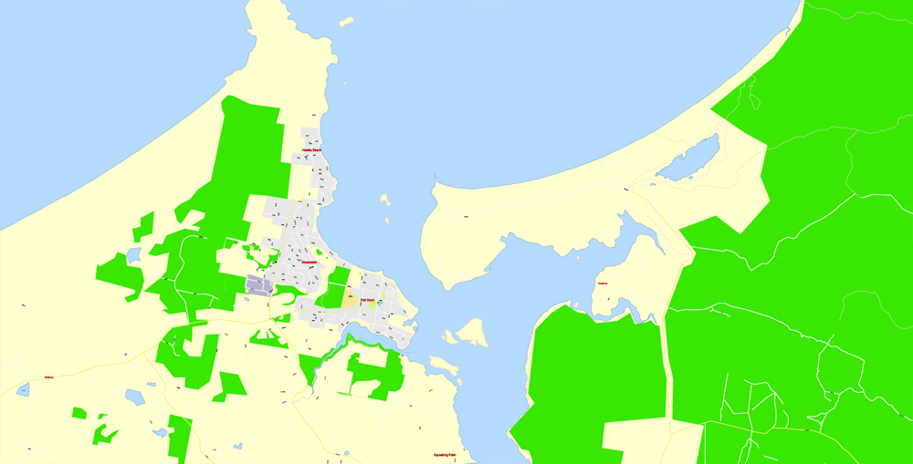
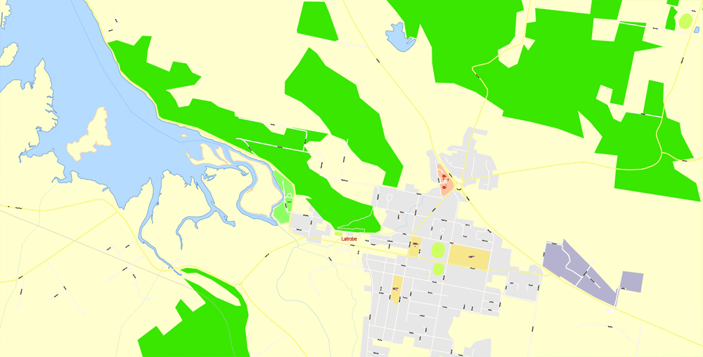
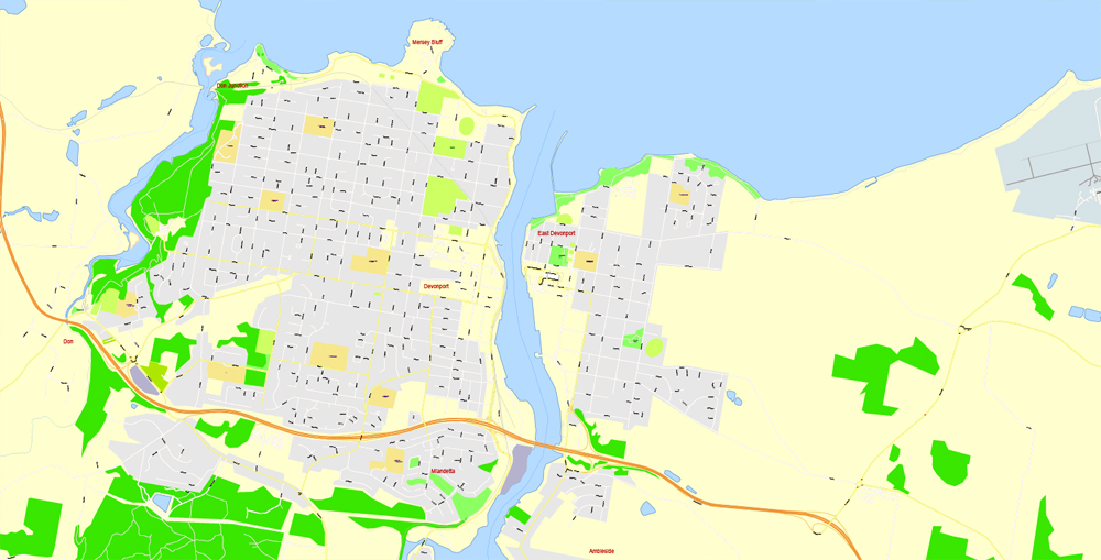
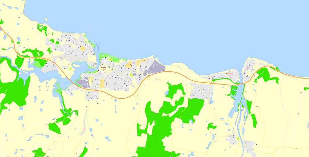
Tasmania, Australia.
This vector map of Tasmania is used as a basis for design, editing, and further printing.
This is the most detailed, exact map of Tasmania for high-quality printing and polygraphy. You can always clarify the map development date by contacting us.
For your convenience, all objects on Tasmania vector map are divided into layers. And the editing is very easy – colors, lines, etc.
You can easily add any objects needed (e.g. shops, salons, sale points, gas station or attraction) on any layer of Tasmania vector map.
Tasmania is an island state of Australia. It is located 240 km (150 mi) to the south of the Australian mainland, separated by the Bass Strait. The state encompasses the main island of Tasmania, the 26th-largest island in the world, and the surrounding 334 islands. The state has a population of around 526,700 as of March 2018. Just over forty percent of the population resides in the Greater Hobart precinct, which forms the metropolitan area of the state capital and largest city, Hobart.
One of the advantages of Tasmania vector maps of our production is the relevance of cartographic data, we constantly update all our products.
This vector map of Tasmania is used by:
designers, layout designers, printers, advertisers and architects. Our product – vector maps – is designed for further editing and printing in large formats – from @Wall format (a few meters) to A-0 and A-1, A-2, A-3.
Tasmania’s area is 68,401 km2 (26,410 sq mi), of which the main island covers 64,519 km2 (24,911 sq mi). It is promoted as a natural state, and protected areas of Tasmania cover about 42% of its land area, which includes national parks and World Heritage Sites. Tasmania was the founding place of the first environmental party in the world.
The Tasmania map in vector format is used for design, urban planning, presentations and media visualizations.
The advertising and presentation map of Tasmania (usually the final designer marks the routes, and puts the client’s objects (shops, saloons, gas stations etc.)
The undoubted advantage is that people will NEVER throw out this advertising product – the map. In fact, as an advertising medium, a map is the most “long-playing” of the well-known polygraphic advertising media, with the longest lifespan, and the maximum number of interactions with the customer.
For travelers, maps are sold at the airports and gas stations around the world. Often the source is our vector maps.
Take a look, who purchases our vector maps of Tasmania in “Our Clients and Friends” page – these are large and small companies, from super-brands like Volvo and Starbucks, to small design studios and printing houses.
It’s very easy to work with vector maps of Tasmania city, even for a not very experienced designer who can turn on and off the map layers, add new objects, change the colors of fill and lines according to customer requirements.
The undoubted advantage of Tasmania vector maps in printing is an excellent and detailed visualization, when customer can expand a large paper map and instantly define his location, find a landmark, an object or address on map, unlike using the popular electronic formats of Google and Yandex maps for example.
Printable vector maps of Tasmania are much more convenient and efficient than any electronic maps on your smartphone, because ALL DETAILS are displayed in the entire space of Tasmania map.
Due to an administrative quirk caused by an early mapping error, the state of Tasmania shares a tiny land border with the state of Victoria. This 85 metres (279 ft) line bisects Boundary Islet, a nature reserve in the Bass Strait, separating the northernmost land governed by Tasmania from the southernmost land governed by Victoria.
Useful tips on working with vector maps of cities and countries in Adobe Illustrator.
«V» – launches the Selection tool (cursor, black arrow), which makes active any vector line.
«А» – launches the Direct Selection tool (white cursor), allows you to select curve elements and drag them to the desired place.
«R» – activates the Rotate tool, which helps you rotating selected objects around the center point by 360 degrees.
«E» – gives you the opportunity to use the Eraser tool and erase unnecessary parts.
«X» – switches between Fill and Stroke in the Tools section. Try to get used to this hot key and
you will quickly understand that you can’t live and work without it.
The Bishop and Clerk Islets, about 37 km south of Macquarie Island, are the southernmost terrestrial point of the state of Tasmania, and the southernmost internationally recognised land in Australia. About 2,500 kilometres (1,600 mi) south of Tasmania island lies Antarctica, which is nearer than areas in the northern Australian mainland.
Guides are not limited to vertical and horizontal in Adobe Illustrator. You can also create a diagonal guide for example. Moreover, you can turn any contours into guides. Select the outline and go to View > Guides > Make Guides (Create Guides), or simply press Cmd/Ctrl + 5. You can also turn the guides back into an editable object. Go to menu, View > Guides > Unlock Guides (Release Guides), select the guide you want to edit and select View > Guides > Release Guides (Reset Guides), or just press Cmd/Ctrl + Option / Alt + 5).
The island is believed to have been occupied by indigenous peoples for 30,000 years before British colonisation. It is thought Aboriginal Tasmanians were separated from the mainland Aboriginal groups about 10,000 years ago when the sea rose to form the Bass Strait. The Aboriginal population was estimated to have been between 3,000 and 7,000 at the time of colonisation, but was almost wiped out within 30 years by a combination of violent guerrilla conflict with settlers known as the “Black War”, intertribal conflict, and from the late 1820s, the spread of infectious diseases to which they had no immunity.
You will probably want to change the color scheme used on our Tasmania vector map.
To quickly and effectively play with colors.
Of course, you can do it manually, all objects in our Tasmania vector map are divided according to types and layers, and you can easily change the color gamma of vector objects in groups and layers.
The conflict, which peaked between 1825 and 1831 and led to more than three years of martial law, cost the lives of almost 1100 Aboriginals and settlers. The near-destruction of Tasmania’s Aboriginal population has been described by some historians as an act of genocide by the British.
The island was permanently settled by Europeans in 1803 as a penal settlement of the British Empire to prevent claims to the land by the First French Empire during the Napoleonic Wars; around 75,000 convicts were sent to Van Diemen’s Land before transportation ceased in 1853.
But there is more effective way of working with the whole VECTOR MAP of Tasmania and all layers:
The overview dialog «Edit colors»/«Repaint Graphic Object» (this dialog box name can change depending on the context):
If you have selected a part or a layer of Tasmania vector map and open the dialog box by clicking the icon in the Control panel, on the Samples palette or the Color Catalog, or if you choose Edit > Edit Colors> Repaint Graphic Object, then the «Repaint Graphic Object» dialog box appears, and you get access to «Assign» and «Edit» tabs.
The island was initially part of the Colony of New South Wales but became a separate, self-governing colony under the name Van Diemen’s Land (named after Anthony van Diemen) in 1825. In 1854 the present Constitution of Tasmania was passed and the following year the colony received permission to change its name to Tasmania. In 1901 it became a state through the process of the Federation of Australia.
If a picture or a map fragment is not selected, and you open the dialog box by clicking the icon in the Control panel, on the Samples palette or in the Color Catalog, the «Edit Colors» dialog box appears and you can only access the «Edit» tab.
Regardless of the name at the top of the dialog box, the right-hand side always displays the color group of the current document, as well as two default color groups: Print Color and Grayscale. These color groups can be selected and used any time.
Geography
Topography of Tasmania
Tasmania’s landmass of 68,401 km2 (26,410 sq mi) is located directly in the pathway of the notorious “Roaring Forties” wind that encircles the globe. To its north, it is separated from mainland Australia by Bass Strait. Tasmania is the only Australian state that is not located on the Australian mainland. Depending on which borders of the oceans are used, the island can be said to be either surrounded by the Southern Ocean, or to have the Pacific on its east and the Indian to its west. Still other definitions of the ocean boundaries would have Tasmania with the Great Australian Bight to the west, and the Tasman Sea to the east. It lies at similar latitudes to the South Island of New Zealand, and parts of Patagonia in South America.
Create and edit color groups of Tasmania vector map, and also assign colors using the «Edit Colors»/ а «Repaint Graphic Object» dialog box.
A. Creating and editing of a color group on the «Edit» tab
B. Assigning colors on the «Assign» tab
C. Select a group of colors from the «Color groups» list
The option «Repaint a graphic object» in the lower part of the dialog box allows you to preview the colors on a selected layer of Vector map, or a group of elements, and specify whether its colors will be redefined when the dialog box is closed.
Tasmania has been volcanically inactive in recent geological times but has many jagged peaks resulting from recent glaciation. Tasmania is the most mountainous state in Australia. The most mountainous region is the Central Highlands area, which covers most of the central western parts of the state. The Midlands located in the central east, is fairly flat, and is predominantly used for agriculture, although farming activity is scattered throughout the state.
The main areas of the dialog box are:
«Edit»
The «Edit» tab is designed to create a new or edit the existing color groups.
The harmony rules Menu and the Color Wheel are used to conduct experiments with color harmonies. The color wheel shows how colors are related in color harmony, and the color bars allow you to view and manipulate an individual color values. In addition, you can adjust the brightness, add and remove colors, save color groups and view colors on the selected Vector Map of Tasmania or a separated layers.
Tasmania’s tallest mountain is Mount Ossa at 1,617 m (5,305 ft). The mountain lies in the heart of the world-famous Cradle Mountain-Lake St Clair National Park. Much of Tasmania is still densely forested, with the Southwest National Park and neighbouring areas holding some of the last temperate rain forests in the Southern Hemisphere.
«Assign»
The «Assign» tab is used to view and control on how the original colors are replaced with colors from the color group like your corporate colors in the Vector Map of Tasmania city.
The assign color ability is provided only if the entire map, layer or fragment is selected in the document. You can specify which of new colors replace the current colors, whether the spot colors should be preserved and how colors are replaced (for example, you can replace colors completely or changing the color tone while maintaining the brightness). The «Assign» tab allows you to redefine colors in the Vector Map of Tasmania city, or in separate layers and fragments using the current color group or reducing the number of colors in the current Vector Map.
The Tarkine, containing Savage River National Park located in the island’s far north west, is the largest temperate rainforest area in Australia covering about 3,800 square kilometres (1,500 sq mi). With its rugged topography, Tasmania has a great number of rivers. Several of Tasmania’s largest rivers have been dammed at some point to provide hydroelectricity. Many rivers begin in the Central Highlands and flow out to the coast. Tasmania’s major population centres are mainly situated around estuaries (some of which are named rivers).
Color groups
Is a list of all saved color groups for current document (the same groups appear in the «Samples» palette). You can edit and delete the existing color groups, as well as creating a new ones using the list of “Color Groups” in the dialog box. All changes appear in the «Samples» palette.
The highlighted color group shows, which color group is currently edited.
Any color group can be selected and edited, or used to redefine the colors in the selected vector map of Tasmania city, its fragments or elements.
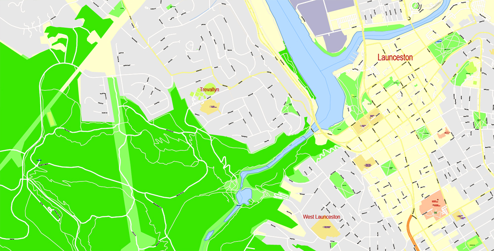
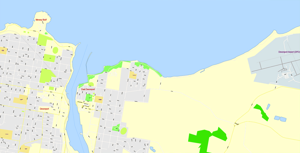
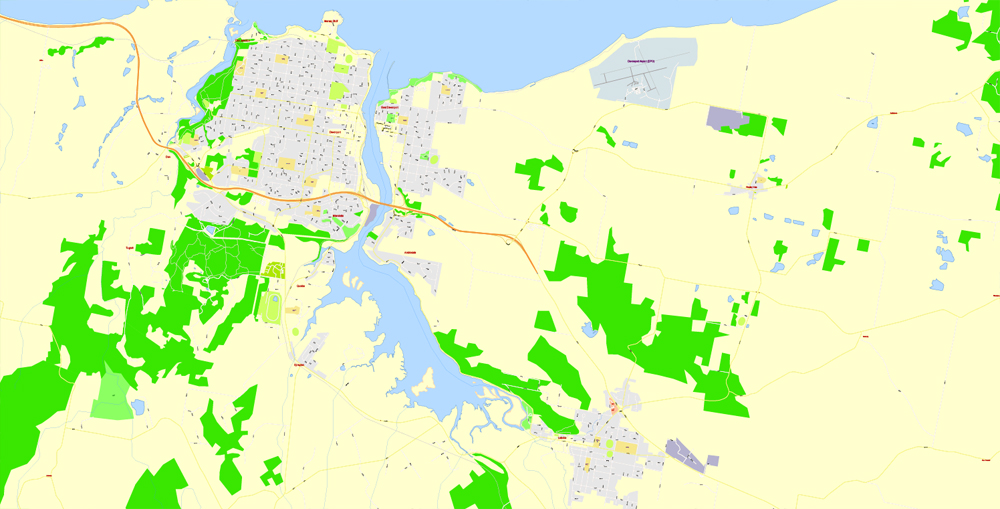
The Derwent River flows south east and reaches the coast at Hobart; the Tamar River flows north from Launceston; the Mersey River also flows north to the North West Coast at Devonport; the Franklin and Gordon Rivers flow west and meet the coast at Strahan. The South Esk River is the longest river in Tasmania. It starts in the mountains at Fingal and flows through Avoca, Evandale, Longford, Hadspen and finally Launceston. The river is dammed at Launceston’s Trevallyn Dam and used for the city’s hydroelectricity. Although most of the water is dammed at Lake Trevallyn, some flows on into the Cataract Gorge, where it becomes a tributary to the Tamar Estuary, and the outflow from the power station also joins the Tamar River downstream of Launceston.
Saving a color group adds this group to the specified list.
Opening the «Edit Colors»/«Repaint Graphic Object» dialog box.
Open the «Edit Colors»/«Repaint Graphic Object» dialog box using one of the following methods:
«Edit»> «Edit Colors»> «Repaint Graphic object» or «Repaint With Style».
Use these commands if you need to edit the colors in the selected vector map of Tasmania city.
«Repaint Graphic object» button on the «Control» panel.
Use this button if you need to adjust colors of Tasmania vector map using the а «Repaint graphic object» dialog box.
The state of Tasmania shares a land border with Victoria at its northernmost terrestrial point, Boundary Islet, a nature reserve in Bass Strait. Tasmania (the state) also includes Macquarie Island, situated 1,500 km south of the state, and approximately halfway between New Zealand and the Antarctic mainland, along with neighbouring island groups Judge and Clerk Islets 11 km north and Bishop and Clerk Islets about 37 km south of Macquarie Island. The latter include the southernmost terrestrial point of the state of Tasmania, and the southernmost internationally recognised land in Australia.
The specified button is available if the selected vector map or its fragment contains two or more colors.
Note. This color editing method is convenient for global color adjustment in a vector map, if global colors were not used when creating a Map of Tasmania.
The «Edit colors» button or «Edit or apply colors» on the «Color Catalog» palette
Click this button if you need to edit colors on the «Color Catalog» palette or edit and then apply them to the selected Vector Map of Tasmania or its fragment.
The «Edit color group» button or «Edit or apply color group» on the «Samples» palette.
Click this button if you need to edit the colors in the specific color group or edit and apply them to the selected Vector Map of Tasmania or a group of its elements, for example, the whole layer “Streets and lines”. You can also double-click the color group in the Samples panel to open the dialog box.
If the map file is too large and your computer freezes or even can’t open it quickly:
1. Try to reduce the color resolution of the video card (display) to 256 colors while working with a large map.
2. Using Windows Task Manager, select all the application you don’t need, while working with map, just turn them off.
3. Launch Adobe Illustrator. (DO NOT OPEN the vector map file)
4. Start the Windows Task Manager using administrator rights > Find the “Illustrator” process > set the «real time» priority,
5. Open the file. When you see the LEGACY FONT popup window – click “OK” (do not update). You can restore the TEXT later.
6. Can also be useful: When file is opened – Edit > Settings > Basic Settings > disable smoothing. /// It looks scary, but works quickly)))
We recommend saving the file in Adobe Illustrator 10 version. It’s much more stable when working with VERY BIG size files.
Tasmania
Australian State
Tasmania, an isolated island state off Australia’s south coast, is known for its vast, rugged wilderness areas, largely protected within parks and reserves. On the Tasman Peninsula, the 19th-century Port Arthur penal settlement is now an open-air museum. In Hobart, the port capital, Salamanca Place’s Georgian warehouses now house galleries and boutiques. Its Museum of Old and New Art has a contemporary edge.
Area
• Total 68,401 km² (7th)
26,410 sq mi
• Land 67,031 km²
25,881 sq mi
• Water 1,370.42 km² (2%)
529 sq mi
Population
• Population 519,100 (6th)
• Density 7.74/km² (4th)
20 /sq mi
Elevation
• Highest point Mount Ossa
1,617 m (5,305 ft)
Free vector map World, Adobe Illustrator, download now maps vector clipart
Map for design, projects, presentation free to use as you like.
See also: TERMS & CONDITIONS: SOFTWARE LICENSE AGREEMENT FOR DIGITAL CARTOGRAPHIC DATA.
Need more USA Vector Maps, printable and editable?

 Author: Kirill Shrayber, Ph.D. FRGS