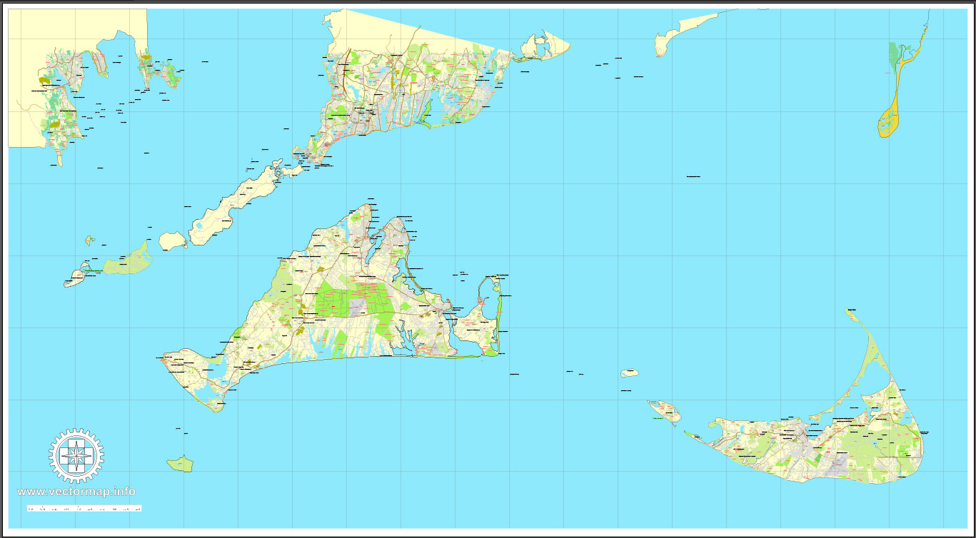
Nantucket and Martha’s Vineyard Islands, Massachusetts, US, printable vector map street City Plan V.3.09 full editable, Adobe Illustrator, full vector, scalable, editable text format street names, 14 mb ZIP
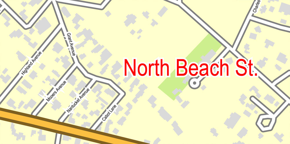
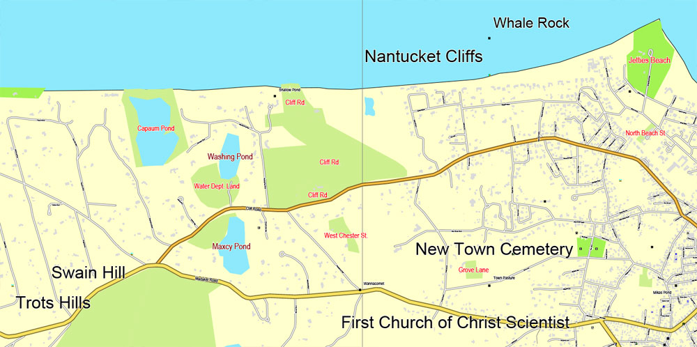
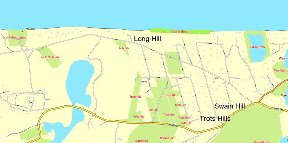
All streets, some more buildings, objects POI.
Separated layers – Names, POI, Grownd.
Map for publishing, design, printing, arts, projects, presentations, for architects, designers and builders, business, logistics.
The most accurate and detailed map.
Different font colors of the street names (black); object names by type (brown, red).
DWG, DXF, CDR and other formats – on request, same price, please, contact
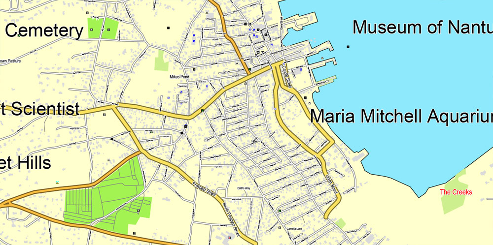
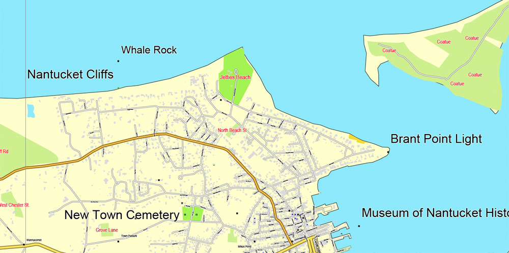
Nantucket + Martha’s Vineyard Islands, Massachusetts, USA.
This vector map of Nantucket is used as a basis for design, editing, and further printing.
This is the most detailed, exact map of Nantucket for high-quality printing and polygraphy. You can always clarify the map development date by contacting us.
For your convenience, all objects on Nantucket vector map are divided into layers. And the editing is very easy – colors, lines, etc.
You can easily add any objects needed (e.g. shops, salons, sale points, gas station or attraction) on any layer of Nantucket vector map.
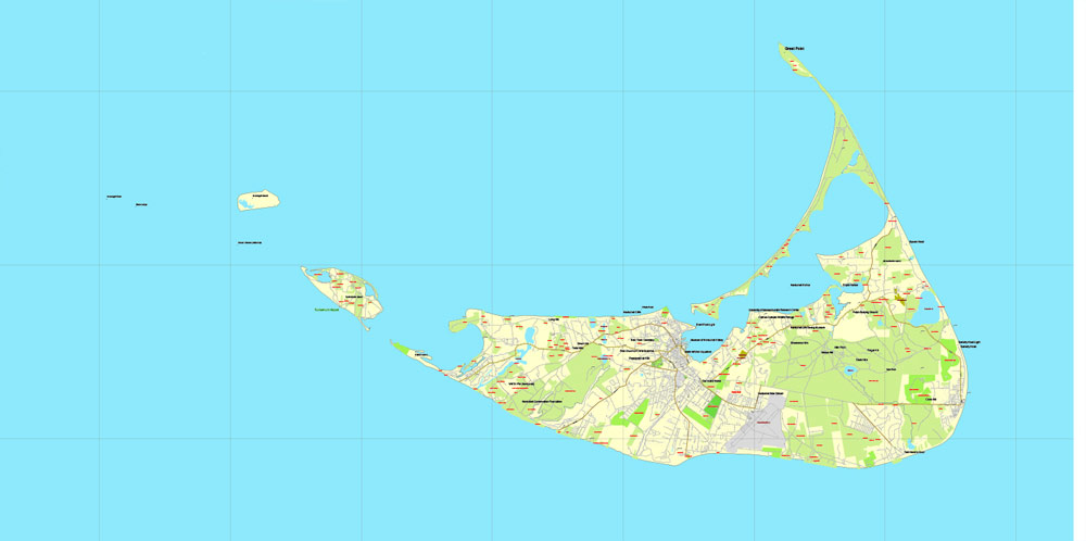
Nantucket is an island about 30 miles (50 km) by ferry south from Cape Cod, in the U.S. state of Massachusetts. Together with the small islands of Tuckernuck and Muskeget, it constitutes the Town of Nantucket, and the conterminous Nantucket County. As of the 2010 census, the population was 10,172. Part of the town is designated the Nantucket CDP, or census-designated place. The region of Surfside on Nantucket is the southernmost settlement in Massachusetts.
One of the advantages of Nantucket vector maps of our production is the relevance of cartographic data, we constantly update all our products.
This vector map of Nantucket is used by:
designers, layout designers, printers, advertisers and architects. Our product – vector maps – is designed for further editing and printing in large formats – from @Wall format (a few meters) to A-0 and A-1, A-2, A-3.
Nantucket map in vector format is used for design, urban planning, presentations and media visualizations.
Advertising and presentation map of Nantucket (usually the final designer marks the routes, and puts the client’s objects (shops, saloons, gas stations etc.)
The undoubted advantage is that people will NEVER throw out this advertising product – the map. In fact, as an advertising medium, a map is the most “long-playing” of the well-known polygraphic advertising media, with the longest lifespan, and the maximum number of interactions with the customer.
For travelers, maps are sold at the airports and gas stations around the world. Often the source is our vector maps.
Take a look, who purchases our vector maps of Nantucket in “Our Clients and Friends” page – these are large and small companies, from super-brands like Volvo and Starbucks, to small design studios and printing houses.
It’s very easy to work with vector maps of Nantucket, even for a not very experienced designer who can turn on and off the map layers, add new objects, change the colors of fill and lines according to customer requirements.
The undoubted advantage of Nantucket vector maps in printing is an excellent and detailed visualization, when customer can expand a large paper map and instantly define his location, find a landmark, an object or address on map, unlike using the popular electronic formats of Google and Yandex maps for example.
Printable vector maps of Nantucket are much more convenient and efficient than any electronic maps on your smartphone, because ALL DETAILS are displayed in the entire space of Nantucket map.
Useful tips on working with vector maps of cities and countries in Adobe Illustrator.
«V» – launches the Selection tool (cursor, black arrow), which makes active any vector line.
«А» – launches the Direct Selection tool (white cursor), allows you to select curve elements and drag them to the desired place.
«R» – activates the Rotate tool, which helps you rotating selected objects around the center point by 360 degrees.
«E» – gives you the opportunity to use the Eraser tool and erase unnecessary parts.
«X» – switches between Fill and Stroke in the Tools section. Try to get used to this hot key and
you will quickly understand that you can’t live and work without it.
Guides are not limited to vertical and horizontal in Adobe Illustrator. You can also create a diagonal guide for example. Moreover, you can turn any contours into guides. Select the outline and go to View > Guides > Make Guides (Create Guides), or simply press Cmd/Ctrl + 5. You can also turn the guides back into an editable object. Go to menu, View > Guides > Unlock Guides (Release Guides), select the guide you want to edit and select View > Guides > Release Guides (Reset Guides), or just press Cmd/Ctrl + Option / Alt + 5).
The name “Nantucket” is adapted from similar Algonquian names for the island, perhaps meaning “faraway land or island” or “sandy, sterile soil tempting no one.”
Nantucket is a tourist destination and summer colony. Due to tourists and seasonal residents, the population of the island increases to at least 50,000 during the summer months. The average sale price for a single-family home was $2.3 million in the first quarter of 2018.
You will probably want to change the color scheme used on our Nantucket vector map.
To quickly and effectively play with colors.
Of course, you can do it manually, all objects in our Nantucket vector map are divided according to types and layers, and you can easily change the color gamma of vector objects in groups and layers.
But there is more effective way of working with the whole VECTOR MAP of Nantucket and all layers:
The overview dialog «Edit colors»/«Repaint Graphic Object» (this dialog box name can change depending on the context):
If you have selected a part or a layer of Nantucket vector map and open the dialog box by clicking the icon in the Control panel, on the Samples palette or the Color Catalog, or if you choose Edit > Edit Colors> Repaint Graphic Object, then the «Repaint Graphic Object» dialog box appears, and you get access to «Assign» and «Edit» tabs.
If a picture or a map fragment is not selected, and you open the dialog box by clicking the icon in the Control panel, on the Samples palette or in the Color Catalog, the «Edit Colors» dialog box appears and you can only access the «Edit» tab.
Regardless of the name at the top of the dialog box, the right-hand side always displays the color group of the current document, as well as two default color groups: Print Color and Grayscale. These color groups can be selected and used any time.
Create and edit color groups of Nantucket vector map, and also assign colors using the «Edit Colors»/ а «Repaint Graphic Object» dialog box.
A. Creating and editing of a color group on the «Edit» tab
B. Assigning colors on the «Assign» tab
C. Select a group of colors from the «Color groups» list
The option «Repaint a graphic object» in the lower part of the dialog box allows you to preview the colors on a selected layer of Vector map, or a group of elements, and specify whether its colors will be redefined when the dialog box is closed.
The main areas of the dialog box are:
«Edit»
The «Edit» tab is designed to create a new or edit the existing color groups.
The harmony rules Menu and the Color Wheel are used to conduct experiments with color harmonies. The color wheel shows how colors are related in color harmony, and the color bars allow you to view and manipulate an individual color values. In addition, you can adjust the brightness, add and remove colors, save color groups and view colors on the selected Vector Map of Nantucket or a separated layers.
«Assign»
The «Assign» tab is used to view and control on how the original colors are replaced with colors from the color group like your corporate colors in the Vector Map of Nantucket.
The assign color ability is provided only if the entire map, layer or fragment is selected in the document. You can specify which of new colors replace the current colors, whether the spot colors should be preserved and how colors are replaced (for example, you can replace colors completely or changing the color tone while maintaining the brightness). The «Assign» tab allows you to redefine colors in the Vector Map of Nantucket, or in separate layers and fragments using the current color group or reducing the number of colors in the current Vector Map.
Color groups
Is a list of all saved color groups for current document (the same groups appear in the «Samples» palette). You can edit and delete the existing color groups, as well as creating a new ones using the list of “Color Groups” in the dialog box. All changes appear in the «Samples» palette.
The highlighted color group shows, which color group is currently edited.
The National Park Service cites Nantucket, designated a National Historic Landmark District in 1966, as being the “finest surviving architectural and environmental example of a late 18th- and early 19th-century New England seaport town.”
Geology and geography
According to the U.S. Census Bureau, the county has a total area of 304 square miles (790 km2), of which 45 square miles (120 km2) is land and 259 square miles (670 km2) (85%) is water. It is the smallest county in Massachusetts by land area and second-smallest by total area. The area of Nantucket Island proper is 47.8 square miles (124 km2). The triangular region of ocean between Nantucket, Martha’s Vineyard, and Cape Cod is Nantucket Sound. The highest point on the island is Sankaty Head, which stands 111 feet (34 m) above sea level.
Any color group can be selected and edited, or used to redefine the colors in the selected vector map of Nantucket , its fragments or elements.
Saving a color group adds this group to the specified list.
Opening the «Edit Colors»/«Repaint Graphic Object» dialog box.
Open the «Edit Colors»/«Repaint Graphic Object» dialog box using one of the following methods:
«Edit»> «Edit Colors»> «Repaint Graphic object» or «Repaint With Style».
Use these commands if you need to edit the colors in the selected vector map of Nantucket.
«Repaint Graphic object» button on the «Control» panel.
Use this button if you need to adjust colors of Nantucket vector map using the а «Repaint graphic object» dialog box.
The specified button is available if the selected vector map or its fragment contains two or more colors.
Note. This color editing method is convenient for global color adjustment in a vector map, if global colors were not used when creating a Map of Nantucket.
The «Edit colors» button or «Edit or apply colors» on the «Color Catalog» palette
Click this button if you need to edit colors on the «Color Catalog» palette or edit and then apply them to the selected Vector Map of Nantucket or its fragment.
The «Edit color group» button or «Edit or apply color group» on the «Samples» palette.
Click this button if you need to edit the colors in the specific color group or edit and apply them to the selected Vector Map of Nantucket or a group of its elements, for example, the whole layer “Streets and lines”. You can also double-click the color group in the Samples panel to open the dialog box.
If the map file is too large and your computer freezes or even can’t open it quickly:
1. Try to reduce the color resolution of the video card (display) to 256 colors while working with a large map.
2. Using Windows Task Manager, select all the application you don’t need, while working with map, just turn them off.
3. Launch Adobe Illustrator. (DO NOT OPEN the vector map file)
4. Start the Windows Task Manager using administrator rights > Find the “Illustrator” process > set the «real time» priority,
5. Open the file. When you see the LEGACY FONT popup window – click “OK” (do not update). You can restore the TEXT later.
6. Can also be useful: When file is opened – Edit > Settings > Basic Settings > disable smoothing. /// It looks scary, but works quickly)))
We recommend saving the file in Adobe Illustrator 10 version. It’s much more stable when working with VERY BIG size files.
Nantucket was formed by the outermost reach of the Laurentide Ice Sheet during the recent Wisconsin Glaciation, shaped by the subsequent rise in sea level. The low ridge across the northern section of the island was deposited as glacial moraine during a period of glacial standstill, a period during which till continued to arrive and was deposited as the glacier melted at a stationary front. The southern part of the island is an outwash plain, sloping away from the arc of the moraine and shaped at its margins by the sorting actions and transport of longshore drift. Nantucket became an island when rising sea levels covered the connection with the mainland, about 5,000–6,000 years ago.
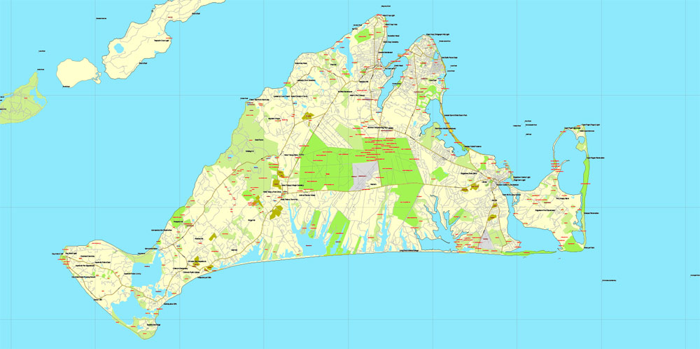
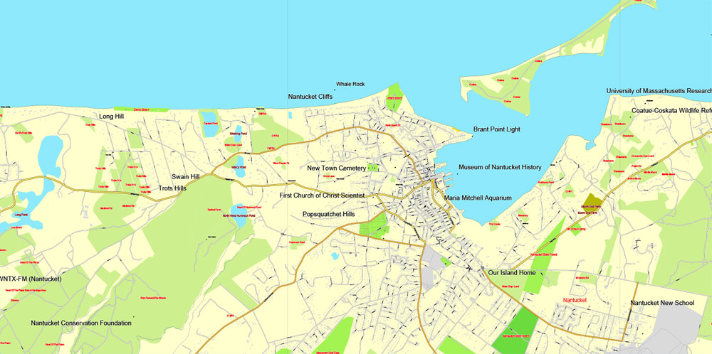
The entire island, as well as the adjoining islands of Tuckernuck and Muskeget, comprise both the Town of Nantucket and the County of Nantucket, which are consolidated. The main settlement, also called Nantucket, is located at the western end of Nantucket Harbor, where it opens into Nantucket Sound. Key localities on the island include Madaket, Surfside, Polpis, Wauwinet, Miacomet, and Siasconset (generally shortened to “‘Sconset”).
Martha’s Vineyard (Wampanoag: Noepe; often simply called The Vineyard) is an island located south of Cape Cod in Massachusetts that is known for being an affluent summer colony. Martha’s Vineyard includes the smaller Chappaquiddick Island, which is usually connected to the Vineyard, though storms and hurricanes have separated them, as in 2007. It is the 58th largest island in the United States, with a land area of 100 square miles (260 km2), and the third-largest on the East Coast of the United States, after Long Island and Mount Desert Island. Martha’s Vineyard constitutes the bulk of Dukes County, Massachusetts, which also includes the Elizabeth Islands and the island of Nomans Land.
The Vineyard was home to one of the earliest known deaf communities in the United States; consequently, a special sign language, Martha’s Vineyard Sign Language, was developed on the island. The 2010 census reported a year-round population of 16,535 residents, although the summer population can swell to more than 100,000 people. About 56 percent of the Vineyard’s 14,621 homes are seasonally occupied.
Martha’s Vineyard is primarily known as a summer colony, and it is only accessible by boat and air. However, its year-round population has considerably increased since the 1960s. The island’s year-round population increased about a third each decade from 1970 to 2000, for a total of 145 percent or about 3 percent to 4 percent per year (46 percent, 30 percent, and 29 percent in each respective decade). The population of the Vineyard was 14,901 in the 2000 Census and was estimated at 15,582 in 2004. (Dukes County was 14,987 in 2000 and 15,669 in 2004). Dukes County includes the six towns on Martha’s Vineyard and Gosnold; it increased by more than 10 percent between 2000 and 2010, according to Census data released in 2011, gaining nearly 1,548 residents. The Island’s population increased from 14,987 to 16,535.
A study by the Martha’s Vineyard Commission found that the cost of living on the island is 60 percent higher than the national average, and housing prices are 96 percent higher. A study of housing needs by the Commission found that the average weekly wage on Martha’s Vineyard was “71 percent of the state average, the median home price was 54 percent above the state’s and the median rent exceeded the state’s by 17 percent”.

Free download Vector Map US Interstate roads, Adobe PDF, V.2 Free_Map_US_Interstates_Roads_2.pdf
Free download Vector Map US Interstate roads, Adobe Illustrator, V.2 Free_Map_US_Interstates_Roads_2.ai

Free Download Vector Map US County and State Adobe Illustrator
Free_Vector_Map_US_States_County_Map.ai
Free Download Vector Map US County and State Adobe PDF
Free_Vector_Map_US_States_County_Map.pdf

Free Vector Map US Census Data Top US Ancestries by County Adobe Illustrator
Free_Vector_Map_US_Census-Data-Top-US-Ancestries-by-County.ai
Free Vector Map US Census Data Top US Ancestries by County Adobe PDF
Free_Vector_Map_US_Census-Data-Top-US-Ancestries-by-County.pdf

 Author: Kirill Shrayber, Ph.D. FRGS

