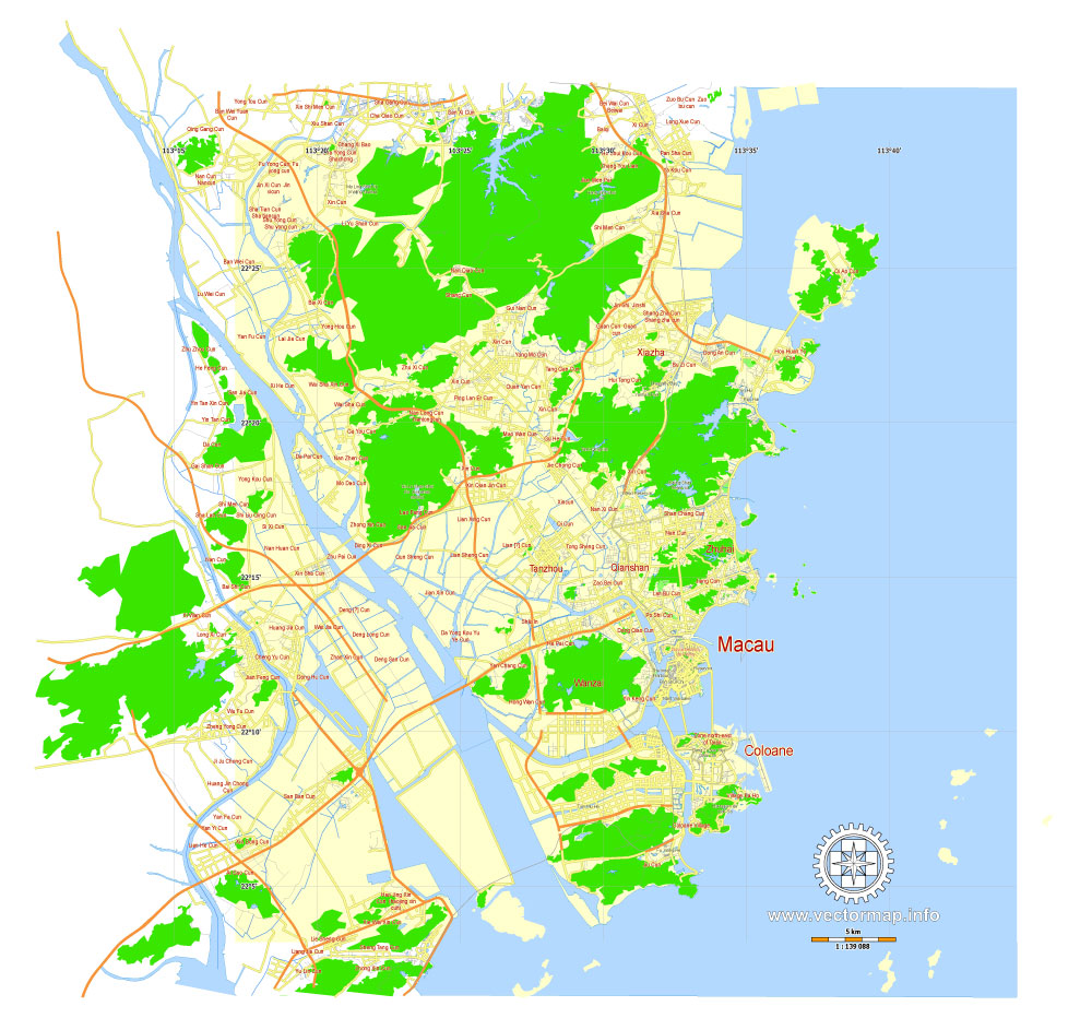
Macau, China, printable vector street G-view Level 12 (5 km scale) map, full editable in ENGLISH, Adobe illustrator, full vector, scalable, editable, text format names, 2 mb ZIP
Principal streets, No Buildings. English names, Map for publishing, design, print, arts, projects, presentations, for architects, designers and builders. Royalty Free.
Good for publishing in small formats (Letter, A5, A4, A3)
Separated layers.
DXF, DWG, CDR and other formats – on request, same price, please, contact.
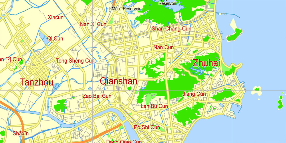
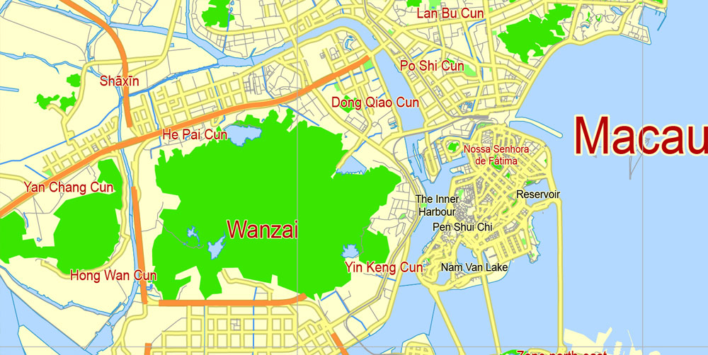
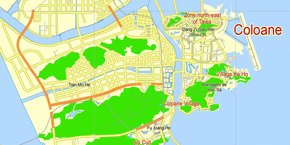
Macau, China.
This vector map of Macau is used as a basis for design, editing, and further printing.
This is the most detailed, exact map of Macau for high-quality printing and polygraphy. You can always clarify the map development date by contacting us.
For your convenience, all objects on Macau vector map are divided into layers. And the editing is very easy – colors, lines, etc.
You can easily add any objects needed (e.g. shops, salons, sale points, gas station or attraction) on any layer of Macau vector map.
Macau or officially the Macao Special Administrative Region of the People’s Republic of China, is an autonomous territory on the western side of the Pearl River estuary in East Asia. Along with Hong Kong, Guangzhou, Shenzhen, Zhuhai, and several other major cities in Guangdong, the territory forms a core part of the Pearl River Delta metropolitan region. With a population of 650,900 in an area of 30.5 km2 (11.8 sq mi), it is the most densely populated region in the world.
One of the advantages of Macau vector maps of our production is the relevance of cartographic data, we constantly update all our products.
This vector map of Macau is used by:
designers, layout designers, printers, advertisers and architects. Our product – vector maps – is designed for further editing and printing in large formats – from @Wall format (a few meters) to A-0 and A-1, A-2, A-3.
Macau map in vector format is used for design, urban planning, presentations and media visualizations.
Advertising and presentation map of Macau (usually the final designer marks the routes, and puts the client’s objects (shops, saloons, gas stations etc.)
The undoubted advantage is that people will NEVER throw out this advertising product – the map. In fact, as an advertising medium, a map is the most “long-playing” of the well-known polygraphic advertising media, with the longest lifespan, and the maximum number of interactions with the customer.
For travelers, maps are sold at the airports and gas stations around the world. Often the source is our vector maps.
Take a look, who purchases our vector maps of Macau in “Our Clients and Friends” page – these are large and small companies, from super-brands like Volvo and Starbucks, to small design studios and printing houses.
Macau was formerly a colony of the Portuguese Empire, after Ming China leased the territory as a trading post in 1557. Originally governing under Chinese authority and sovereignty, Portugal was given perpetual occupation rights for Macau in 1887. Macau remained under Portuguese control until 1999, when it was returned to China. As a special administrative region, Macau maintains a separate political and economic system apart from mainland China. The People’s Republic of China’s obligation to run Macau as a special administrative region, per the Joint Declaration on the Question of Macau, expires on 20 December 2049.
It’s very easy to work with vector maps of Macau, even for a not very experienced designer who can turn on and off the map layers, add new objects, change the colors of fill and lines according to customer requirements.
The undoubted advantage of Macau vector maps in printing is an excellent and detailed visualization, when customer can expand a large paper map and instantly define his location, find a landmark, an object or address on map, unlike using the popular electronic formats of Google and Yandex maps for example.
Printable vector maps of Macau are much more convenient and efficient than any electronic maps on your smartphone, because ALL DETAILS are displayed in the entire space of Macau map.
Useful tips on working with vector maps of cities and countries in Adobe Illustrator.
«V» – launches the Selection tool (cursor, black arrow), which makes active any vector line.
«А» – launches the Direct Selection tool (white cursor), allows you to select curve elements and drag them to the desired place.
«R» – activates the Rotate tool, which helps you rotating selected objects around the center point by 360 degrees.
«E» – gives you the opportunity to use the Eraser tool and erase unnecessary parts.
«X» – switches between Fill and Stroke in the Tools section. Try to get used to this hot key and
you will quickly understand that you can’t live and work without it.
Guides are not limited to vertical and horizontal in Adobe Illustrator. You can also create a diagonal guide for example. Moreover, you can turn any contours into guides. Select the outline and go to View > Guides > Make Guides (Create Guides), or simply press Cmd/Ctrl + 5. You can also turn the guides back into an editable object. Go to menu, View > Guides > Unlock Guides (Release Guides), select the guide you want to edit and select View > Guides > Release Guides (Reset Guides), or just press Cmd/Ctrl + Option / Alt + 5).
You will probably want to change the color scheme used on our Macau vector map.
To quickly and effectively play with colors.
Of course, you can do it manually, all objects in our Macau vector map are divided according to types and layers, and you can easily change the color gamma of vector objects in groups and layers.
But there is more effective way of working with the whole VECTOR MAP of Macau and all layers:
The overview dialog «Edit colors»/«Repaint Graphic Object» (this dialog box name can change depending on the context):
If you have selected a part or a layer of Macau vector map and open the dialog box by clicking the icon in the Control panel, on the Samples palette or the Color Catalog, or if you choose Edit > Edit Colors> Repaint Graphic Object, then the «Repaint Graphic Object» dialog box appears, and you get access to «Assign» and «Edit» tabs.
If a picture or a map fragment is not selected, and you open the dialog box by clicking the icon in the Control panel, on the Samples palette or in the Color Catalog, the «Edit Colors» dialog box appears and you can only access the «Edit» tab.
Regardless of the name at the top of the dialog box, the right-hand side always displays the color group of the current document, as well as two default color groups: Print Color and Grayscale. These color groups can be selected and used any time.

Create and edit color groups of Macau vector map, and also assign colors using the «Edit Colors»/ а «Repaint Graphic Object» dialog box.
A. Creating and editing of a color group on the «Edit» tab
B. Assigning colors on the «Assign» tab
C. Select a group of colors from the «Color groups» list
The option «Repaint a graphic object» in the lower part of the dialog box allows you to preview the colors on a selected layer of Vector map, or a group of elements, and specify whether its colors will be redefined when the dialog box is closed.
The main areas of the dialog box are:
«Edit»
The «Edit» tab is designed to create a new or edit the existing color groups.
The harmony rules Menu and the Color Wheel are used to conduct experiments with color harmonies. The color wheel shows how colors are related in color harmony, and the color bars allow you to view and manipulate an individual color values. In addition, you can adjust the brightness, add and remove colors, save color groups and view colors on the selected Vector Map of Macau or a separated layers.
«Assign»
The «Assign» tab is used to view and control on how the original colors are replaced with colors from the color group like your corporate colors in the Vector Map of Macau.
The assign color ability is provided only if the entire map, layer or fragment is selected in the document. You can specify which of new colors replace the current colors, whether the spot colors should be preserved and how colors are replaced (for example, you can replace colors completely or changing the color tone while maintaining the brightness). The «Assign» tab allows you to redefine colors in the Vector Map of Macau, or in separate layers and fragments using the current color group or reducing the number of colors in the current Vector Map.
Color groups
Is a list of all saved color groups for current document (the same groups appear in the «Samples» palette). You can edit and delete the existing color groups, as well as creating a new ones using the list of “Color Groups” in the dialog box. All changes appear in the «Samples» palette.
The highlighted color group shows, which color group is currently edited.
Any color group can be selected and edited, or used to redefine the colors in the selected vector map of Macau , its fragments or elements.
Saving a color group adds this group to the specified list.
Opening the «Edit Colors»/«Repaint Graphic Object» dialog box.
Open the «Edit Colors»/«Repaint Graphic Object» dialog box using one of the following methods:
«Edit»> «Edit Colors»> «Repaint Graphic object» or «Repaint With Style».
Macau is the gambling capital of the world. Its economy is heavily dependent on gambling and tourism, and in 2006 it surpassed Las Vegas as the world’s largest gambling center by revenue. It has a very high Human Development Index and the fourth-highest life expectancy in the world. Macau is among the world’s richest regions and its GDP per capita by purchasing power parity was higher than that of any country in the world. In 2015, Macau was ranked as the fastest growing metropolitan area in the world by the Brookings Institution.
Use these commands if you need to edit the colors in the selected vector map of Macau city.
«Repaint Graphic object» button on the «Control» panel.
Use this button if you need to adjust colors of Macau vector map using the а «Repaint graphic object» dialog box.
The specified button is available if the selected vector map or its fragment contains two or more colors.
Note. This color editing method is convenient for global color adjustment in a vector map, if global colors were not used when creating a Map of Macau.
The «Edit colors» button or «Edit or apply colors» on the «Color Catalog» palette
Click this button if you need to edit colors on the «Color Catalog» palette or edit and then apply them to the selected Vector Map of Macau or its fragment.
The «Edit color group» button or «Edit or apply color group» on the «Samples» palette.
Click this button if you need to edit the colors in the specific color group or edit and apply them to the selected Vector Map of Macau or a group of its elements, for example, the whole layer “Streets and lines”. You can also double-click the color group in the Samples panel to open the dialog box.
If the map file is too large and your computer freezes or even can’t open it quickly:
1. Try to reduce the color resolution of the video card (display) to 256 colors while working with a large map.
2. Using Windows Task Manager, select all the application you don’t need, while working with map, just turn them off.
3. Launch Adobe Illustrator. (DO NOT OPEN the vector map file)
4. Start the Windows Task Manager using administrator rights > Find the “Illustrator” process > set the «real time» priority,
5. Open the file. When you see the LEGACY FONT popup window – click “OK” (do not update). You can restore the TEXT later.
6. Can also be useful: When file is opened – Edit > Settings > Basic Settings > disable smoothing. /// It looks scary, but works quickly)))
We recommend saving the file in Adobe Illustrator 10 version. It’s much more stable when working with VERY BIG size files.
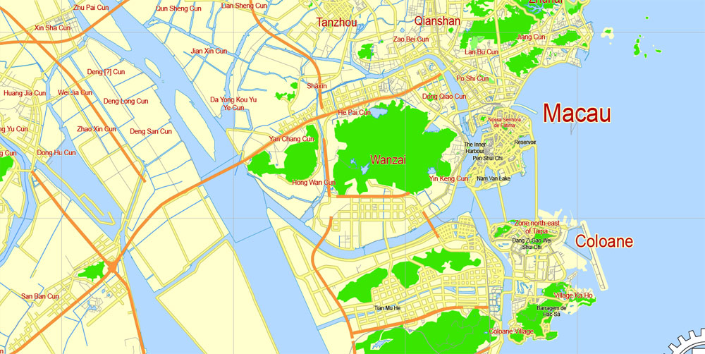
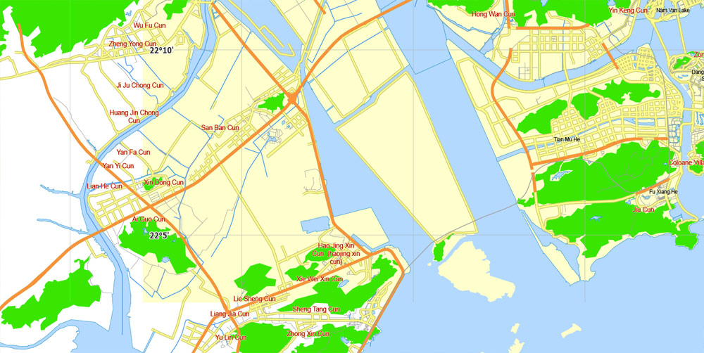
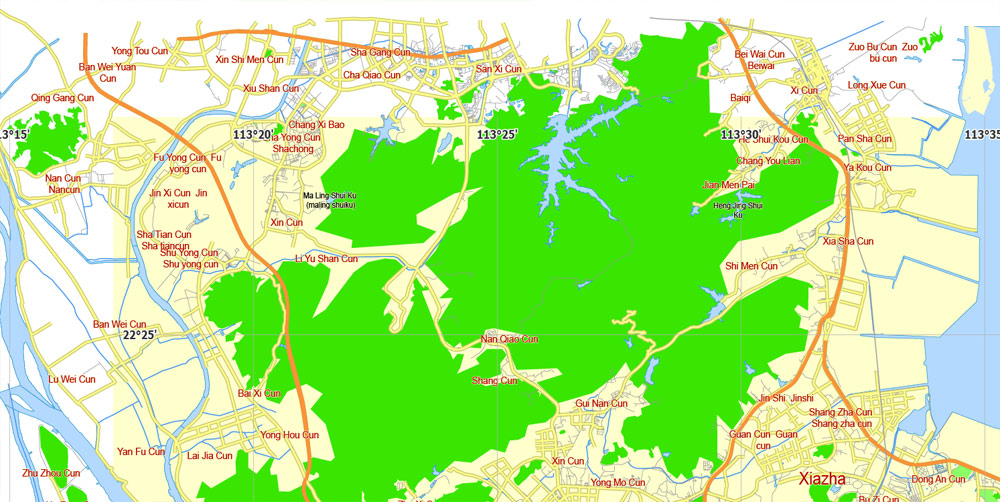
Macau is a Special Administrative Region on the southern coast of China. It is located at the south of Guangdong Province, on the tip of the peninsula formed by the Zhujiang (Pearl River) estuary on the east and the Xijiang (West River) on the west. Macau is situated 60 km west of Hong Kong and 145 km southwest of Guangzhou, the capital of Guangdong Province. It situates immediately east and south of Zhuhai.
The region comprises the Macau Peninsula and the islands of Taipa and Coloane. Macau was once an island but gradually a connecting sandbar turned into a narrow isthmus. Land reclamation in the 17th century made Macau into a peninsula, and a barrier gate was built to mark the separation between the peninsula and the mainland. Pre-colonial records show that Macau totalled only 2.78 km2 (1.07 sq mi) but began to increase as a result of Portuguese settlement. Land growth has accelerated since the last quarter of the 20th century, from 15 km2 (5.8 sq mi) in 1972 to 16.1 km2 (6.22 sq mi) in 1983 to 21.3 km2 (8.22 sq mi) in 1994. Macau’s size has gradually increased as result of continued land reclamation, especially on Taipa and Coloane. In 2014, the total land area was approximately 30.3 km2 (11.7 sq mi).
There is a 0.34 km (0.21 mi) long border between Macau and mainland China and a forty-kilometer-long coastline. The main border crossing between Macau and China is the Portas do Cerco (Barrier Gate) Frontier Checkpoint on the Macau side, and the Gongbei checkpoint on the Chinese side.
Macau has generally flat terrain resulting from extensive land reclamation, but numerous steep hills mark the original natural land mass. The modern high-rise skyline of Macau obscures much of the hilly landscape. The Macau skyline both defines and obscures its topography.
The Macau Peninsula is narrow in shape but varies in terrain.
Small guide: How to work with the vector map?
You can: Mass select objects by type and color – for example, the objects type “building” (they are usually dark gray) – and remove them from the map, if you do not need them in your print or design project. You can also easily change the thickness of lines (streets), just bulk selection the road by the line color.
The streets are separated by type, for example, type “residential road” are usually white with a gray stroke. Highway usually orange with a brown or dark gray stroke.
It is easy to change the font of inscriptions, all or each individually. Also, just can be make and any other manipulation of objects on the vector map in Adobe illustrator format.
Important: All the proportions on the map are true, that is, the relative sizes of the objects are true, because Map is based on an accurate GPS projection, and It transated into the (usual for all) the Mercator projection.
You can easily change the color, stroke and fill of any object on the map, zoom without loss of quality Image Verification.

 Author: Kirill Shrayber, Ph.D. FRGS
 map, full editable in ENGLISH, Adobe illustrator")