Extended Description of the Vector Map
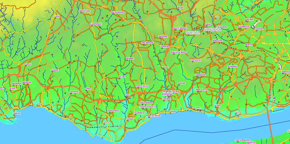
Printable PDF Vector Map Portugal, – Roads, Relief and Admin High Detailed Map in Mercator Projection fully editable, Adobe PDF in layers, full vector, scalable, curves/text format names, 325 mb ZIP
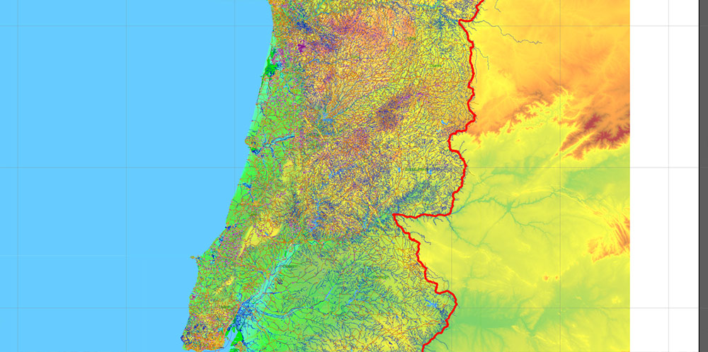
Main and secondary roads, railroads, Colored Relief Raster. Map for design, printing, arts, projects, presentations, for architects, designers and builders, business, logistics, education.
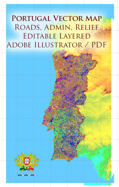
Portugal PDF Vector Map – Main Roads, Relief and Admin High Detailed Map, printable vector map Adobe PDF editable Layered
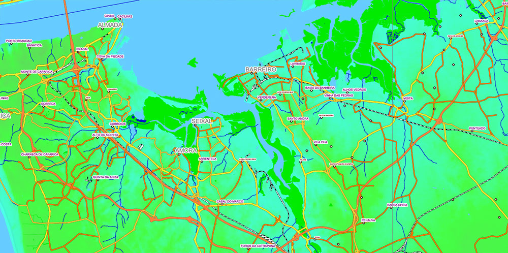
Layers:
- Legend
- Grids 3 degrees
- Cities points
- Names Admin Areas
- Cities names by population
Sorted by font size
- Admin Areas names (provinces level)
- Principal roads 1, 2, 3 class
- Railroads
- Waterways
- Water / wetland objects (areas)
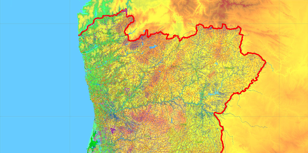
- Country boundaries
- Admin areas (colored areas) (transparent 20%)
- Relief Colored Topo (transparent 50%)
- Background
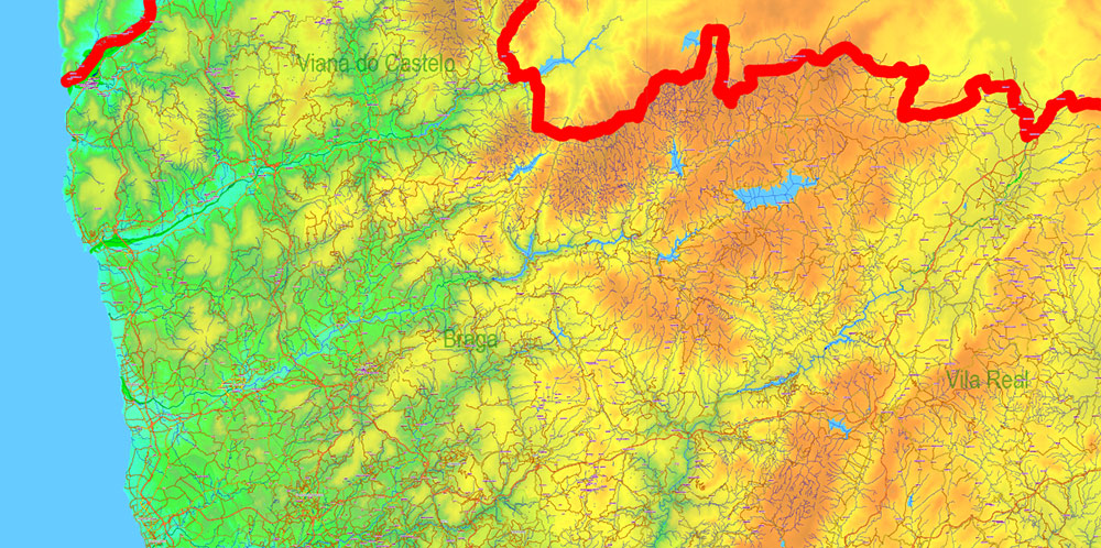
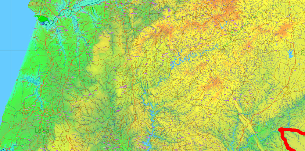
Portugal PDF Vector Map – Main Roads, Relief and Admin High Detailed Map, printable vector map Adobe PDF editable Layered

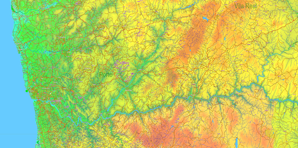
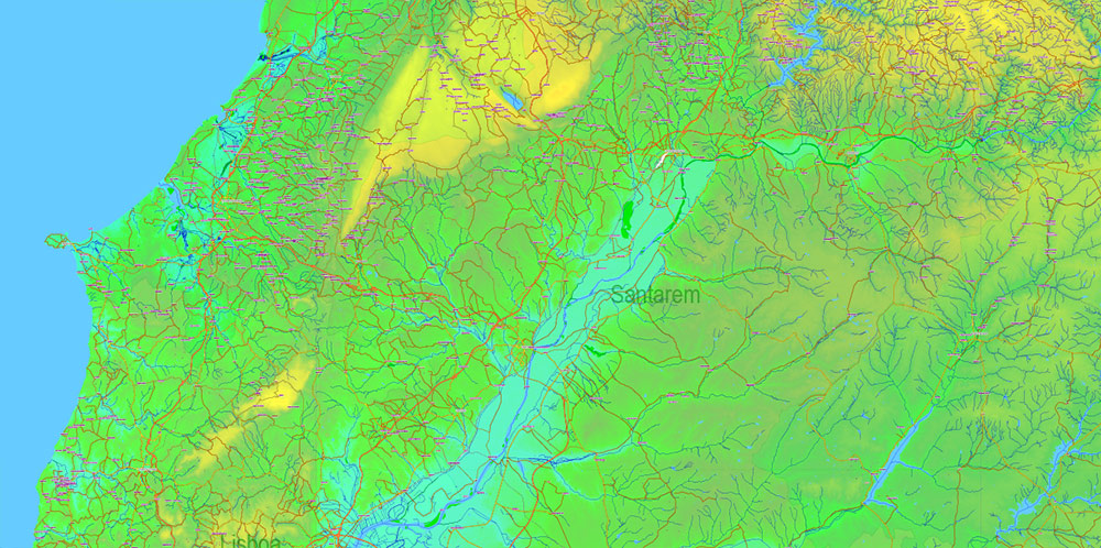
Portugal PDF Vector Map – Main Roads, Relief and Admin High Detailed Map, printable vector map Adobe PDF editable Layered
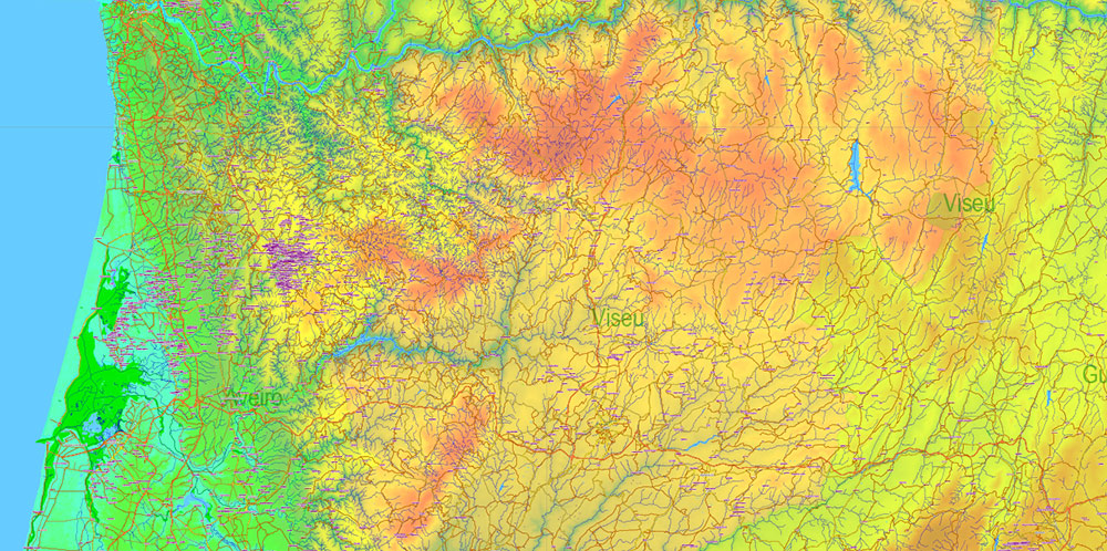
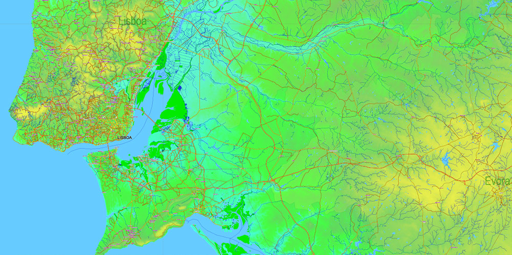
Portugal PDF Vector Map – Main Roads, Relief and Admin High Detailed Map, printable vector map Adobe PDF editable Layered
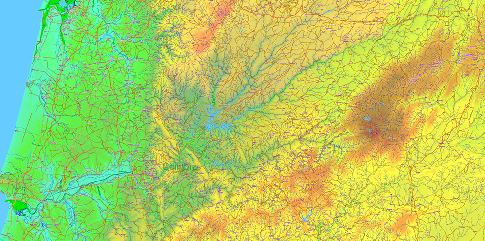
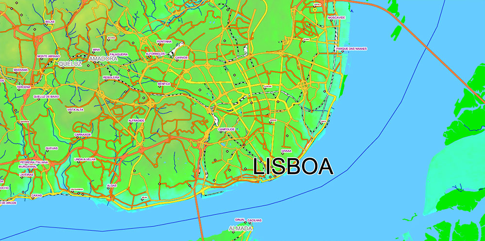
Portugal PDF Vector Map – Main Roads, Relief and Admin High Detailed Map, printable vector map Adobe PDF editable Layered
Portugal PDF Vector Map – Main Roads, Relief and Admin High Detailed Map, printable vector map Adobe PDF editable Layered
Portugal PDF Vector Map – Main Roads, Relief and Admin High Detailed Map, printable vector map Adobe PDF editable Layered
Portugal PDF Vector Map – Main Roads, Relief and Admin High Detailed Map, printable vector map Adobe PDF editable Layered
Portugal PDF Vector Map – Main Roads, Relief and Admin High Detailed Map, printable vector map Adobe PDF editable Layered
Portugal PDF Vector Map – Main Roads, Relief and Admin High Detailed Map, printable vector map Adobe PDF editable Layered
Portugal PDF Vector Map – Main Roads, Relief and Admin High Detailed Map, printable vector map Adobe PDF editable Layered
Portugal PDF Vector Map – Main Roads, Relief and Admin High Detailed Map, printable vector map Adobe PDF editable Layered
Portugal PDF Vector Map – Main Roads, Relief and Admin High Detailed Map, printable vector map Adobe PDF editable Layered
Portugal PDF Vector Map – Main Roads, Relief and Admin High Detailed Map, printable vector map Adobe PDF editable Layered

 Author: Kirill Shrayber, Ph.D. FRGS
