Extended Description of the Vector Map
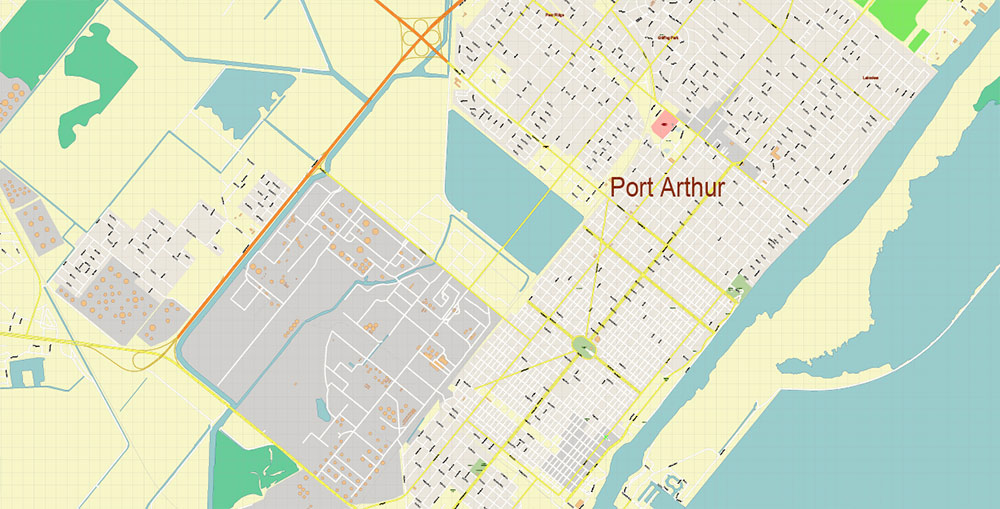
Port Arthur is a city in Jefferson County, Texas. At the 2020 census, the city had a population of 63,942.
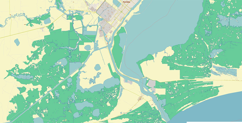
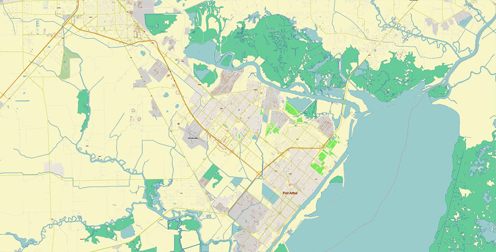
Port Arthur is located on the western shore of Sabine Lake. The Neches River Bridge connects Port Arthur and Bridge City. Port Arthur was founded by Arthur Stilwell in the late 19th century and was once the center of the world’s largest oil network.
The 1940s saw an influx of middle-class African Americans, most of whom came to Port Arthur from nearby cities. This led to an exodus of whites, with many whites moving to nearby towns. In the late 1950s, the city was divided, and its black residents were forced to move to the western part of the city. There, the municipality built the Carver Terrace complex for low-income African Americans. In the 1970s, blacks were able to purchase homes on the other side of the railroad, and many African-American families moved to other parts of the city. According to the 2020 census, 60% of the city’s population is African American.
Not far from the city is located Pleasure Island – an artificial island that was created from the ground in the period from 1899 to 1908.
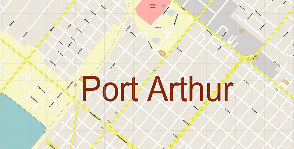
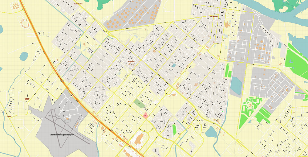
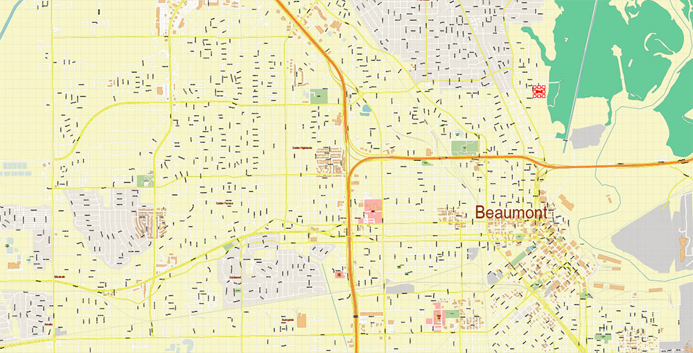
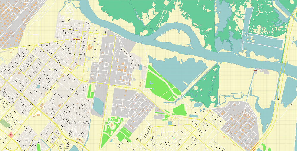
Printable PDF Vector Map of Port Arthur Texas US detailed City Plan (with the neighborhood) scale 1:4072 full editable Adobe PDF Street Map in layers, scalable, text format all names, 52 MB ZIP
All street names, Main Objects, Buildings. Map for design, printing, arts, projects, presentations, for architects, designers, and builders, business, logistics.
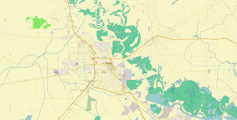
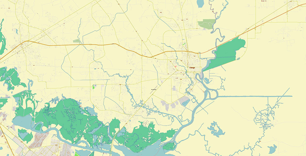
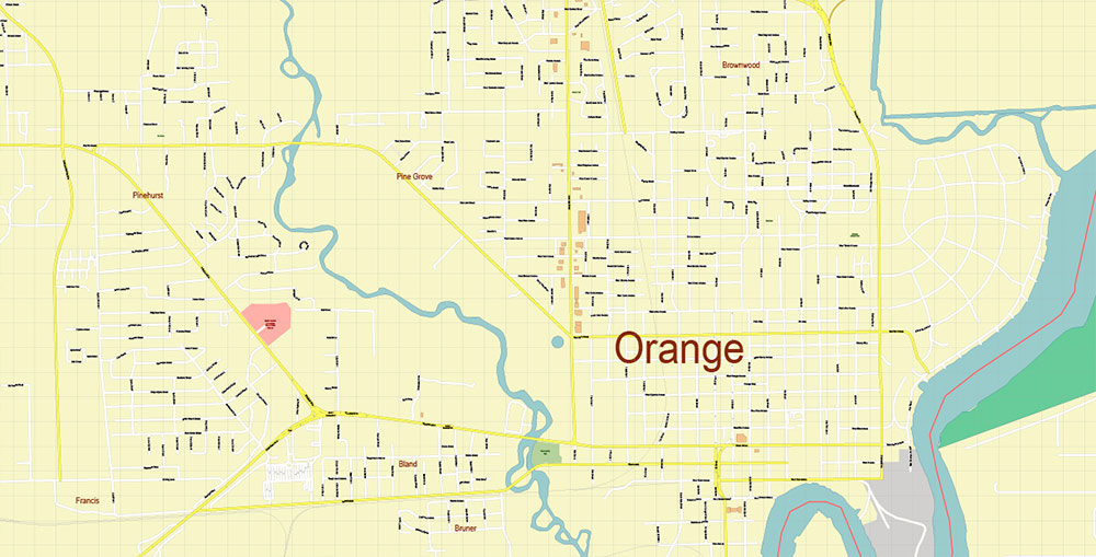
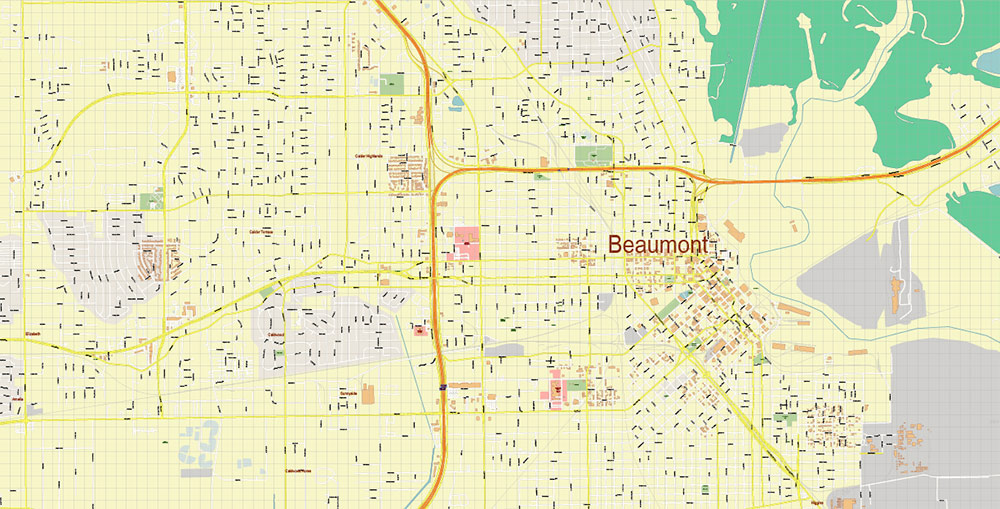
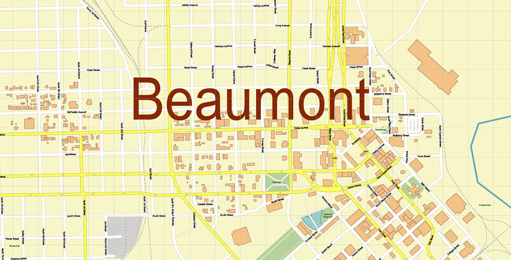
Included: Beaumont and Orange.
Included: Simple vector map of Texas.
Also: We can add the ZIP (postal) codes areas with numbers (additional layer for this map), and other objects for you. It’s free for our customers.
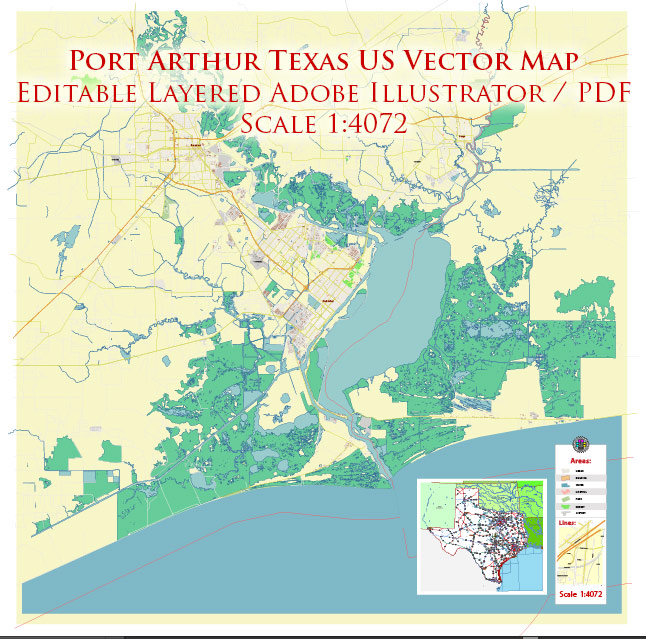
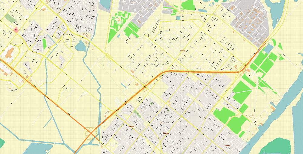
Port Arthur Texas US PDF Vector Map Exact City Plan High Detailed Street Map editable Adobe PDF in layers
Layers list:
- Legend
- Grids
- Labels of roads
- Names of places (city, hamlet, etc.)
- Names of objects (hospitals, parks, water)
- Names of main streets
- Names of civil streets
- Main Streets, roads
- Civil streets
- Railroads
- Buildings
- Airports and heliports
- Water objects (rivers, lakes, ponds)
- Waterways
- Color fills (parks, hospital areas, land use, etc.)
- Background + Sea
Port Arthur Texas US PDF Vector Map Exact City Plan High Detailed Street Map editable Adobe PDF in layers
Port Arthur Texas US PDF Vector Map Exact City Plan High Detailed Street Map editable Adobe PDF in layers
Port Arthur Texas US PDF Vector Map Exact City Plan High Detailed Street Map editable Adobe PDF in layers
Port Arthur Texas US PDF Vector Map Exact City Plan High Detailed Street Map editable Adobe PDF in layers
Port Arthur Texas US PDF Vector Map Exact City Plan High Detailed Street Map editable Adobe PDF in layers
Port Arthur Texas US PDF Vector Map Exact City Plan High Detailed Street Map editable Adobe PDF in layers
Port Arthur Texas US PDF Vector Map Exact City Plan High Detailed Street Map editable Adobe PDF in layers
Port Arthur Texas US PDF Vector Map Exact City Plan High Detailed Street Map editable Adobe PDF in layers
Port Arthur Texas US PDF Vector Map Exact City Plan High Detailed Street Map editable Adobe PDF in layers
Port Arthur Texas US PDF Vector Map Exact City Plan High Detailed Street Map editable Adobe PDF in layers
Port Arthur Texas US PDF Vector Map Exact City Plan High Detailed Street Map editable Adobe PDF in layers
Port Arthur Texas US PDF Vector Map Exact City Plan High Detailed Street Map editable Adobe PDF in layers

Port Arthur Texas US PDF Vector Map Exact City Plan High Detailed Street Map editable Adobe PDF in layers
Port Arthur Texas US PDF Vector Map Exact City Plan High Detailed Street Map editable Adobe PDF in layers

 Author: Kirill Shrayber, Ph.D. FRGS

