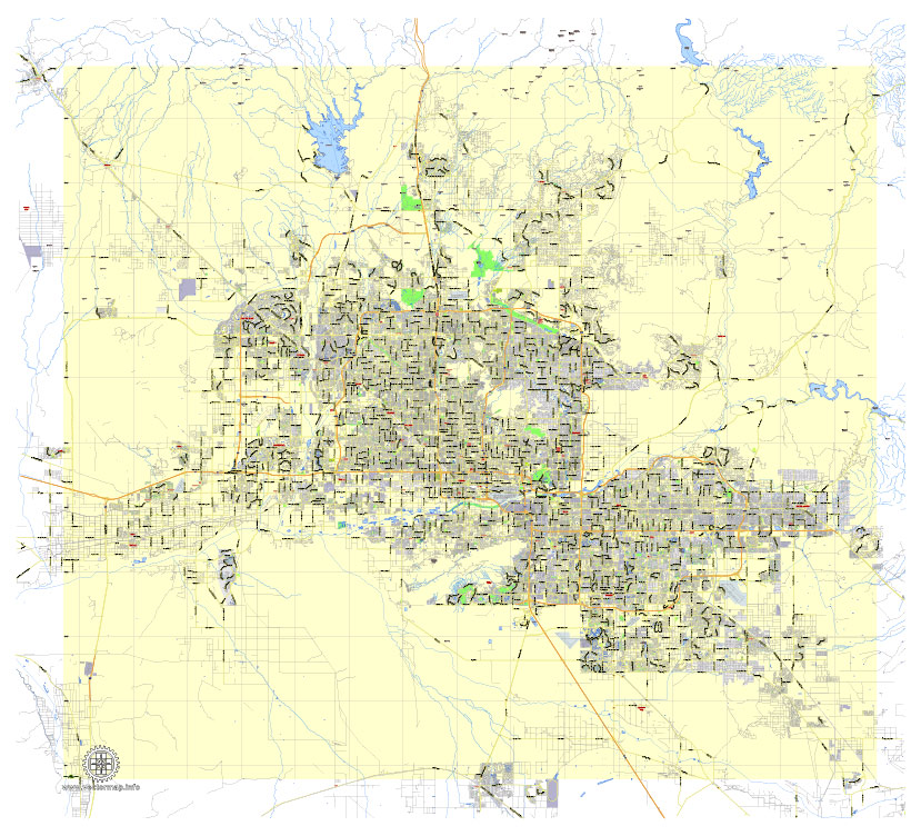
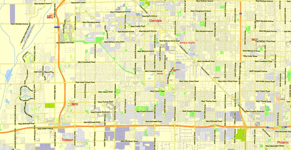
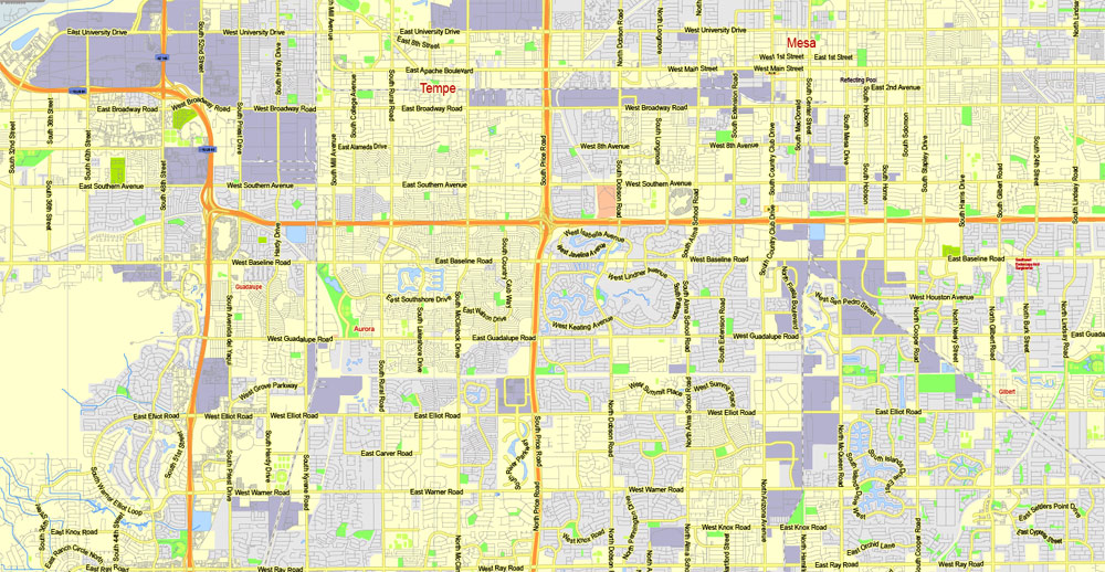
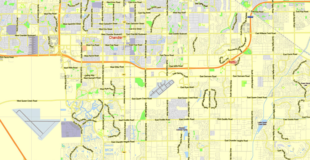
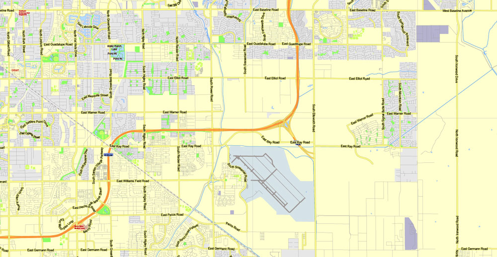
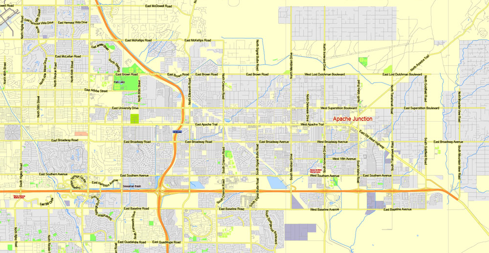
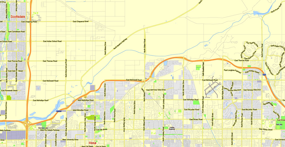
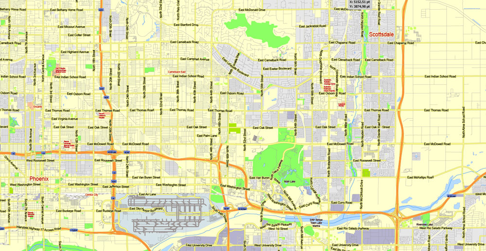
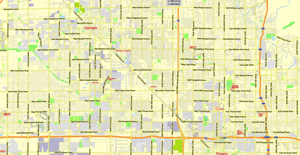
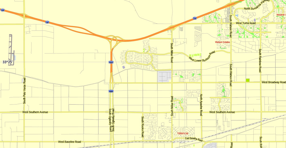
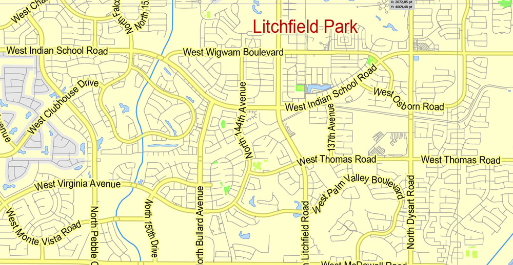
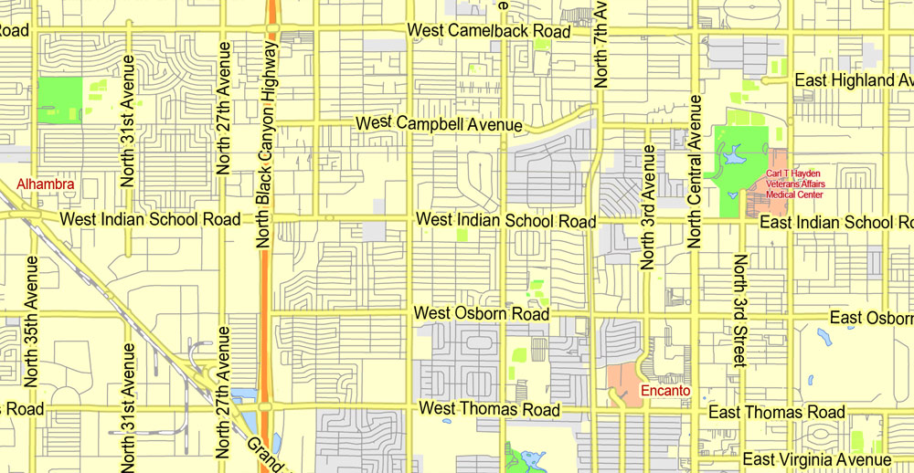
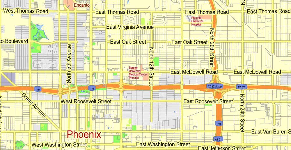
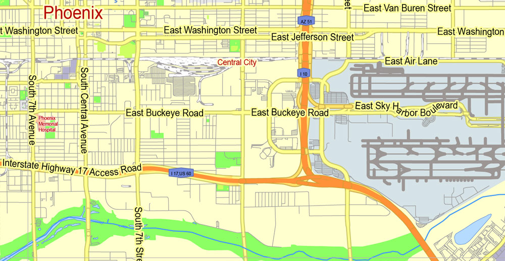
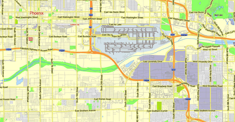
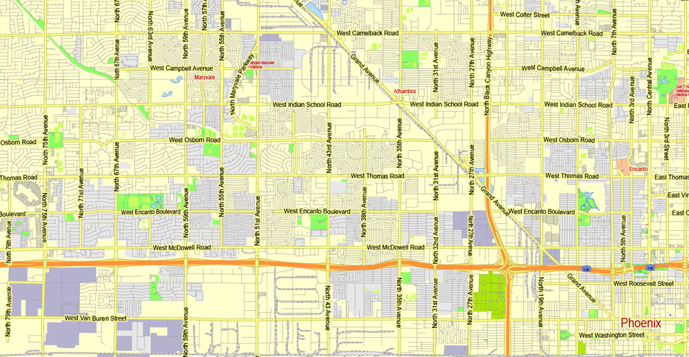
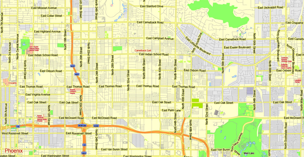
PDF Map Phoenix metro area, Arizona, exact vector street G-View Level 13 (2000 meters scale) map, V.12.12. fully editable, Adobe PDF, full vector, scalable, editable text format of street names, 36 Mb ZIP.
Named Principal streets, main objects, no buildings. Map for publishing, design, printing, publications, arts, projects, presentations, for architects, designers and builders, business, logistics. The most exact and detailed map of the city.
For printing middle, small format
Separated layers: streets and roads, color fills, road labels, names 1,2,3, scales.
You can edit this file by Adobe Illustrator, Adobe Acrobat, Corel Draw.
DWG, DXF, CDR, ESRI Shapes, and other formats – by request, same price, please contact.
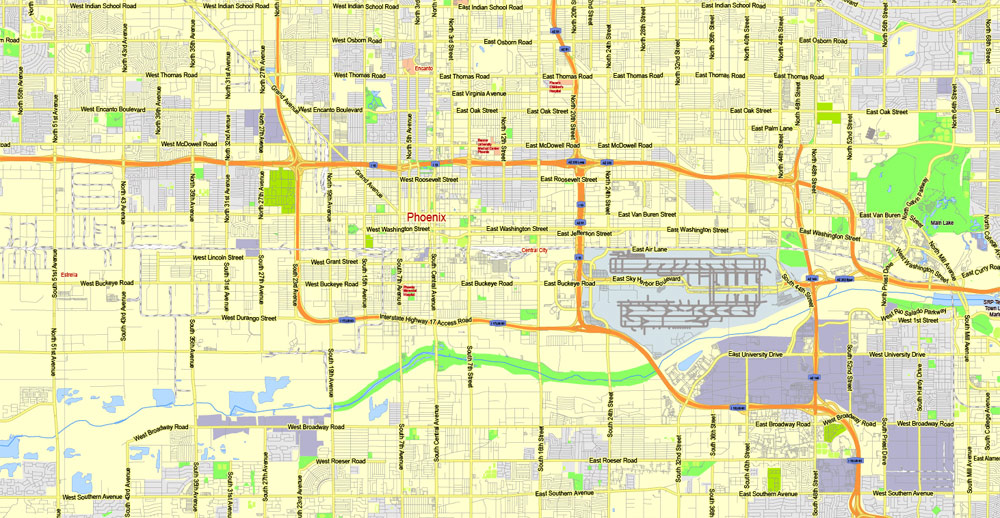
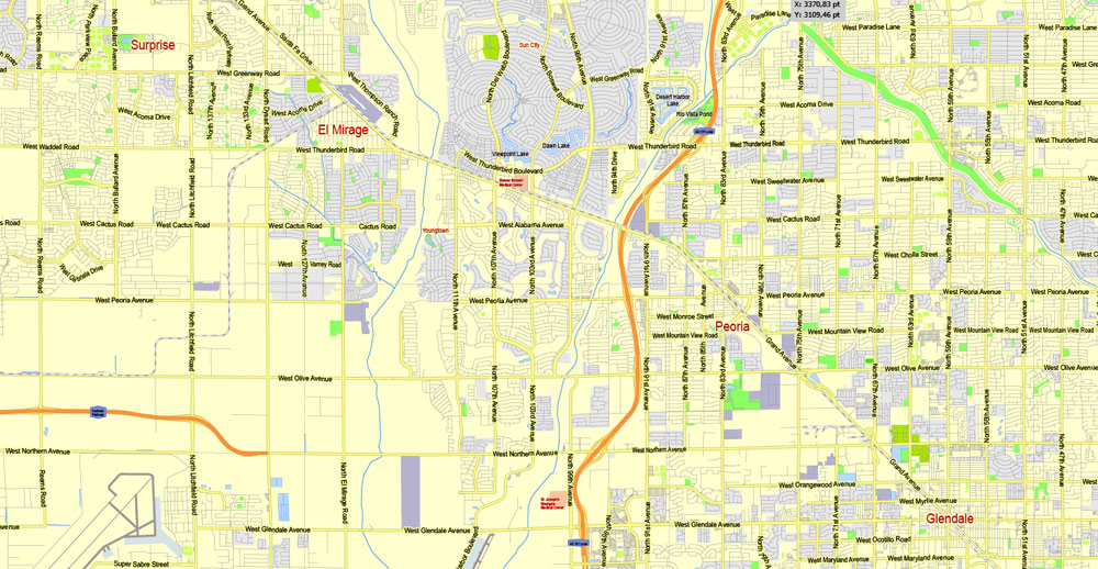
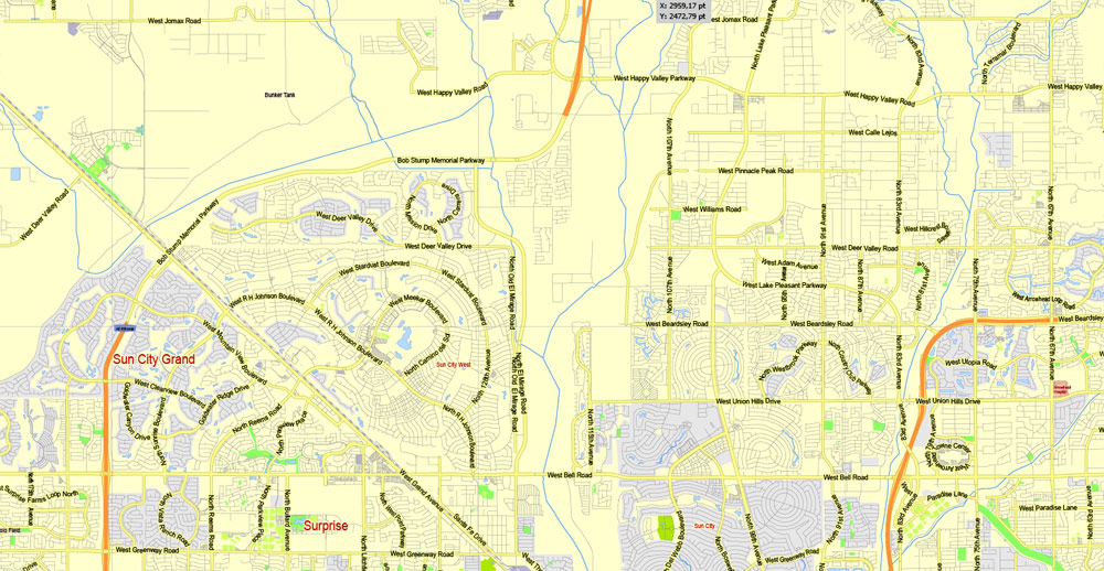
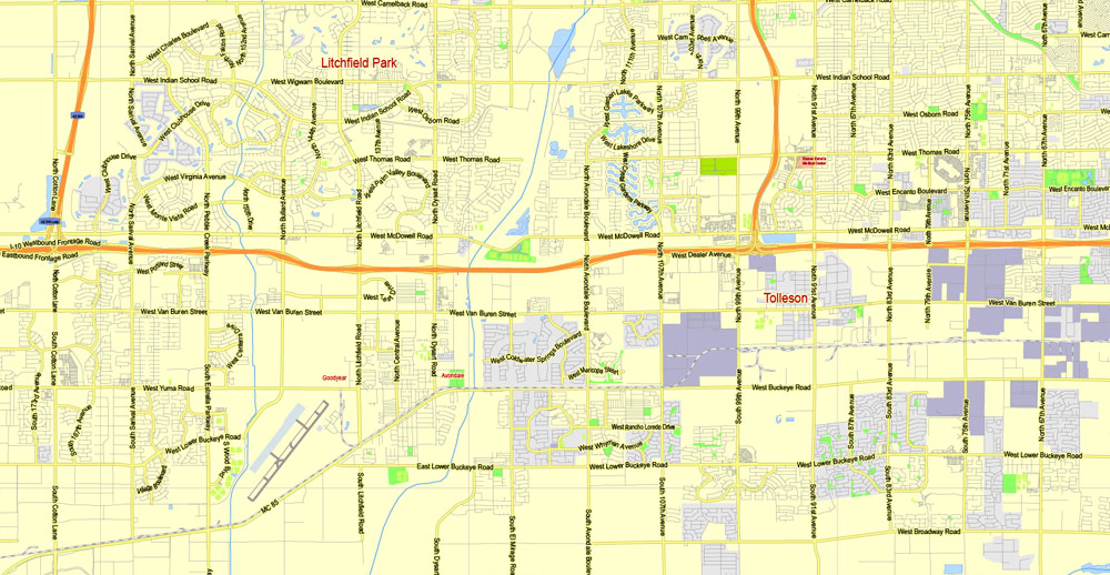
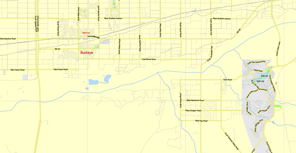
Phoenix, Arizona, USA.
This vector map of Phoenix is used as a basis for design, editing, and further printing.
This is the most detailed, exact map of Phoenix for high-quality printing and polygraphy. You can always clarify the map development date by contacting us.
For your convenience, all objects on Phoenix vector map are divided into layers. And the editing is very easy – colors, lines, etc.
You can easily add any objects needed (e.g. shops, salons, sale points, gas station or attraction) on any layer of Phoenix vector map.
Phoenix is the capital and most populous city of the U.S. state of Arizona. With 1,626,078 people (as of 2017), Phoenix is the fifth most populous city nationwide, the most populous state capital in the United States, and the only state capital with a population of more than one million residents.
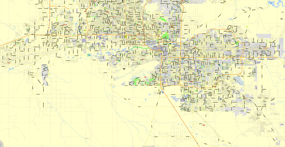
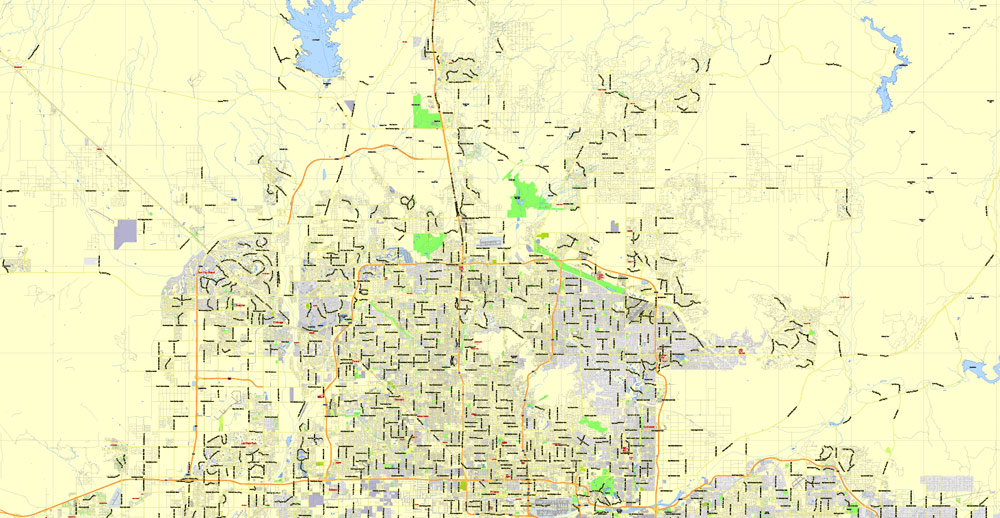
Phoenix is the anchor of the Phoenix metropolitan area, also known as the Valley of the Sun, which in turn is a part of the Salt River Valley. The metropolitan area is the 11th largest by population in the United States, with approximately 4.73 million people as of 2017. In addition, Phoenix is the seat of Maricopa County, and at 517.9 square miles (1,341 km2), it is the largest city in the state, more than twice the size of Tucson and one of the largest cities in the United States.
One of the advantages of Phoenix vector maps of our production is the relevance of cartographic data, we constantly update all our products.
This vector map of Phoenix is used by:
designers, layout designers, printers, advertisers and architects. Our product – vector maps – is designed for further editing and printing in large formats – from @Wall format (a few meters) to A-0 and A-1, A-2, A-3.
Phoenix map in vector format is used for design, urban planning, presentations and media visualizations.
Advertising and presentation map of Phoenix (usually the final designer marks the routes, and puts the client’s objects (shops, saloons, gas stations etc.)
The undoubted advantage is that people will NEVER throw out this advertising product – the map. In fact, as an advertising medium, a map is the most “long-playing” of the well-known polygraphic advertising media, with the longest lifespan, and the maximum number of interactions with the customer.
For travelers, maps are sold at the airports and gas stations around the world. Often the source is our vector maps.
Settled in 1867 as an agricultural community near the confluence of the Salt and Gila Rivers, Phoenix incorporated as a city in 1881. It became the capital of Arizona Territory in 1889. Located in the northeastern reaches of the Sonoran Desert, Phoenix has a hot desert climate. Despite this, its canal system led to a thriving farming community with many of the original crops, such as alfalfa, cotton, citrus, and hay, remaining important parts of the Phoenix economy for decades. Cotton, cattle, citrus, climate, and copper were known locally as the “Five C’s” of Phoenix’s economy. These industries remained the driving forces of the city until after World War II, when high-tech companies began to move into the valley and air conditioning made Phoenix’s hot summers more bearable.
Take a look, who purchases our vector maps of Phoenix in “Our Clients and Friends” page – these are large and small companies, from super-brands like Volvo and Starbucks, to small design studios and printing houses.
It’s very easy to work with vector maps of Phoenix, even for a not very experienced designer who can turn on and off the map layers, add new objects, change the colors of fill and lines according to customer requirements.
The undoubted advantage of Phoenix vector maps in printing is an excellent and detailed visualization, when customer can expand a large paper map and instantly define his location, find a landmark, an object or address on map, unlike using the popular electronic formats of Google and Yandex maps for example.
Printable vector maps of Phoenix are much more convenient and efficient than any electronic maps on your smartphone, because ALL DETAILS are displayed in the entire space of Phoenix map.
Useful tips on working with vector maps of cities and countries in Adobe Illustrator.
«V» – launches the Selection tool (cursor, black arrow), which makes active any vector line.
«А» – launches the Direct Selection tool (white cursor), allows you to select curve elements and drag them to the desired place.
«R» – activates the Rotate tool, which helps you rotating selected objects around the center point by 360 degrees.
«E» – gives you the opportunity to use the Eraser tool and erase unnecessary parts.
«X» – switches between Fill and Stroke in the Tools section. Try to get used to this hot key and
you will quickly understand that you can’t live and work without it.
The city averaged a four percent annual population growth rate over a 40-year period from the mid-1960s to the mid-2000s. This growth rate slowed during the Great Recession of 2007–09, and has rebounded slowly. Phoenix is the cultural center of the Valley of the Sun, as well as the entire state.
Phoenix is in the southwestern United States, in the south-central portion of Arizona; about halfway between Tucson to the southeast and Flagstaff to the north. By car, the city is approximately 150 miles (240 kilometers) north of the US-Mexico border at Sonoyta and 180 mi (290 km) north of the border at Nogales. The metropolitan area is known as the “Valley of the Sun”, due to its location in the Salt River Valley. It lies at a mean elevation of 1,086 feet (331 m), in the northern reaches of the Sonoran Desert.
Guides are not limited to vertical and horizontal in Adobe Illustrator. You can also create a diagonal guide for example. Moreover, you can turn any contours into guides. Select the outline and go to View > Guides > Make Guides (Create Guides), or simply press Cmd/Ctrl + 5. You can also turn the guides back into an editable object. Go to menu, View > Guides > Unlock Guides (Release Guides), select the guide you want to edit and select View > Guides > Release Guides (Reset Guides), or just press Cmd/Ctrl + Option / Alt + 5).
You will probably want to change the color scheme used on our Phoenix vector map.
To quickly and effectively play with colors.
Of course, you can do it manually, all objects in our Phoenix vector map are divided according to types and layers, and you can easily change the color gamma of vector objects in groups and layers.
But there is more effective way of working with the whole VECTOR MAP of Phoenix and all layers:
The overview dialog «Edit colors»/«Repaint Graphic Object» (this dialog box name can change depending on the context):
If you have selected a part or a layer of Phoenix vector map and open the dialog box by clicking the icon in the Control panel, on the Samples palette or the Color Catalog, or if you choose Edit > Edit Colors> Repaint Graphic Object, then the «Repaint Graphic Object» dialog box appears, and you get access to «Assign» and «Edit» tabs.
If a picture or a map fragment is not selected, and you open the dialog box by clicking the icon in the Control panel, on the Samples palette or in the Color Catalog, the «Edit Colors» dialog box appears and you can only access the «Edit» tab.
Regardless of the name at the top of the dialog box, the right-hand side always displays the color group of the current document, as well as two default color groups: Print Color and Grayscale. These color groups can be selected and used any time.
Create and edit color groups of Phoenix vector map, and also assign colors using the «Edit Colors»/ а «Repaint Graphic Object» dialog box.
A. Creating and editing of a color group on the «Edit» tab
B. Assigning colors on the «Assign» tab
C. Select a group of colors from the «Color groups» list
The option «Repaint a graphic object» in the lower part of the dialog box allows you to preview the colors on a selected layer of Vector map, or a group of elements, and specify whether its colors will be redefined when the dialog box is closed.
The main areas of the dialog box are:
«Edit»
The «Edit» tab is designed to create a new or edit the existing color groups.
The harmony rules Menu and the Color Wheel are used to conduct experiments with color harmonies. The color wheel shows how colors are related in color harmony, and the color bars allow you to view and manipulate an individual color values. In addition, you can adjust the brightness, add and remove colors, save color groups and view colors on the selected Vector Map of Phoenix or a separated layers.
«Assign»
The «Assign» tab is used to view and control on how the original colors are replaced with colors from the color group like your corporate colors in the Vector Map of Phoenix.
The assign color ability is provided only if the entire map, layer or fragment is selected in the document. You can specify which of new colors replace the current colors, whether the spot colors should be preserved and how colors are replaced (for example, you can replace colors completely or changing the color tone while maintaining the brightness). The «Assign» tab allows you to redefine colors in the Vector Map of Phoenix, or in separate layers and fragments using the current color group or reducing the number of colors in the current Vector Map.
Color groups
Is a list of all saved color groups for current document (the same groups appear in the «Samples» palette). You can edit and delete the existing color groups, as well as creating a new ones using the list of “Color Groups” in the dialog box. All changes appear in the «Samples» palette.
The highlighted color group shows, which color group is currently edited.
Any color group can be selected and edited, or used to redefine the colors in the selected vector map of Phoenix, its fragments or elements.
Saving a color group adds this group to the specified list.
Opening the «Edit Colors»/«Repaint Graphic Object» dialog box.
Open the «Edit Colors»/«Repaint Graphic Object» dialog box using one of the following methods:
«Edit»> «Edit Colors»> «Repaint Graphic object» or «Repaint With Style».
Use these commands if you need to edit the colors in the selected vector map of Phoenix.
«Repaint Graphic object» button on the «Control» panel.
Use this button if you need to adjust colors of Phoenix vector map using the а «Repaint graphic object» dialog box.
The specified button is available if the selected vector map or its fragment contains two or more colors.
Note. This color editing method is convenient for global color adjustment in a vector map, if global colors were not used when creating a Map of Phoenix.
The «Edit colors» button or «Edit or apply colors» on the «Color Catalog» palette
Click this button if you need to edit colors on the «Color Catalog» palette or edit and then apply them to the selected Vector Map of Phoenix or its fragment.
The «Edit color group» button or «Edit or apply color group» on the «Samples» palette.
Click this button if you need to edit the colors in the specific color group or edit and apply them to the selected Vector Map of Phoenix or a group of its elements, for example, the whole layer “Streets and lines”. You can also double-click the color group in the Samples panel to open the dialog box.
If the map file is too large and your computer freezes or even can’t open it quickly:
1. Try to reduce the color resolution of the video card (display) to 256 colors while working with a large map.
2. Using Windows Task Manager, select all the application you don’t need, while working with map, just turn them off.
3. Launch Adobe Illustrator. (DO NOT OPEN the vector map file)
4. Start the Windows Task Manager using administrator rights > Find the “Illustrator” process > set the «real time» priority,
5. Open the file. When you see the LEGACY FONT popup window – click “OK” (do not update). You can restore the TEXT later.
6. Can also be useful: When file is opened – Edit > Settings > Basic Settings > disable smoothing. /// It looks scary, but works quickly)))
We recommend saving the file in Adobe Illustrator 10 version. It’s much more stable when working with VERY BIG size files.
Other than the mountains in and around the city, the topography of Phoenix is generally flat, allowing the city’s main streets to run on a precise grid with wide, open-spaced roadways. Scattered, low mountain ranges surround the valley: McDowell Mountains to the northeast, the White Tank Mountains to the west, the Superstition Mountains far to the east, and both South Mountain and the Sierra Estrella to the south/southwest. Camelback Mountain, North Mountain, Sunnyslope Mountain, and Piestewa Peak are located within the heart of the valley. On the outskirts of Phoenix are large fields of irrigated cropland and Native American reservation lands. The Salt River runs westward through the city of Phoenix, but the riverbed is often dry or contains little water due to large irrigation diversions. The community of Ahwatukee is separated from the rest of the city by South Mountain.
According to the United States Census Bureau, the city has a total area of 517.9 square miles (1,341 km2). 516.7 square miles (1,338 km2) of it is land, and 1.2 square miles (0.6 km2, or 0.2%) of it is water. Even though it is the fifth most populated city, the large area gives it a low density rate of approximately 2,797 people per square mile. In comparison, Philadelphia, the sixth most populous city, has a density of over 11,000.
As with most of Arizona, Phoenix does not observe daylight saving time. In 1973, Governor Jack Williams argued to the U.S. Congress that due to air conditioning units not being used as often in the morning on standard time, energy use would increase in the evening should the state observe daylight saving time. He went on to say that energy use would also rise early in the day “because there would be more lights on in the early morning.” Additionally, he said that daylight saving time would cause children to go to school in the dark.
Sunrise occurs at around 7:29am on December 21 and 5:19am on June 21. Sunset occurs at around 5:25pm on December 21 and 7:41pm on June 21.

Phoenix
City in Arizona
Phoenix is the capital of the southwestern U.S. state of Arizona. Known for its year-round sun and warm temperatures, it anchors a sprawling, multicity metropolitan area known as the Valley of the Sun. It’s known for high-end spa resorts, Jack Nicklaus–designed golf courses and vibrant nightclubs. Other highlights include the Desert Botanical Garden, displaying cacti and numerous native plants.
Area
• City 517.948 sq mi (1,341.48 km2)
• Land 516.704 sq mi (1,338.26 km2)
• Water 1.244 sq mi (3.22 km2)
• Metro 14,565.76 sq mi (37,725.1 km2)
Elevation 1,086 ft (331 m)
Population
• City 1,445,632
• Estimate 1,563,025
Free vector maps:

Free download Vector Map US Interstate roads, Adobe PDF, V.2 Free_Map_US_Interstates_Roads_2.pdf
Free download Vector Map US Interstate roads, Adobe Illustrator, V.2 Free_Map_US_Interstates_Roads_2.ai

Free Download Vector Map US County and State Adobe Illustrator
Free_Vector_Map_US_States_County_Map.ai
Free Download Vector Map US County and State Adobe PDF
Free_Vector_Map_US_States_County_Map.pdf

Free Vector Map US Census Data Top US Ancestries by County Adobe Illustrator
Free_Vector_Map_US_Census-Data-Top-US-Ancestries-by-County.ai
Free Vector Map US Census Data Top US Ancestries by County Adobe PDF
Free_Vector_Map_US_Census-Data-Top-US-Ancestries-by-County.pdf
Free US Maps from WIKIPEDIA
Small guide: How to work with the vector map?
You can: Mass select objects by type and color – for example, the objects type “building” (they are usually dark gray) – and remove them from the map, if you do not need them in your print or design project. You can also easily change the thickness of lines (streets), just bulk selection the road by the line color.
The streets are separated by type, for example, type “residential road” are usually white with a gray stroke. Highway usually orange with a brown or dark gray stroke.
It is easy to change the font of inscriptions, all or each individually. Also, just can be make and any other manipulation of objects on the vector map in Adobe illustrator format.
Important: All the proportions on the map are true, that is, the relative sizes of the objects are true, because Map is based on an accurate GPS projection, and It transated into the (usual for all) the Mercator projection.
You can easily change the color, stroke and fill of any object on the map, zoom without loss of quality Image Verification.
Select object

Bulk selection the same objects on the vector map

See the bulk selected objects on the vector map

Bulk delete buildungs from the vector map

Select residencial road (small street) on the vector map

Bulk selection the same lines (streets, roads) on the full map

Create fat lines of the streets on the vector maps (bulk action) 1

Create fat lines of the streets on the vector maps (bulk action) 2

Create fat lines of the streets on the vector maps (bulk action) 3

You can easily change the color, stroke and fill of any object on the map, zoom without loss of quality Image Verification.

 Author: Kirill Shrayber, Ph.D. FRGS

