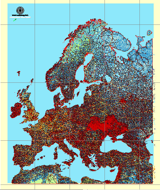
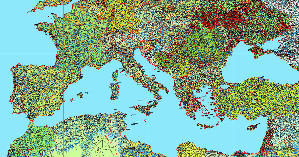
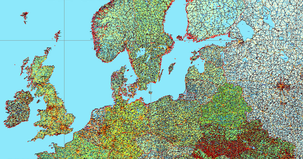
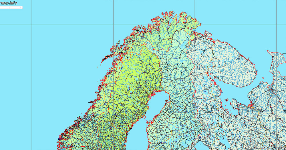
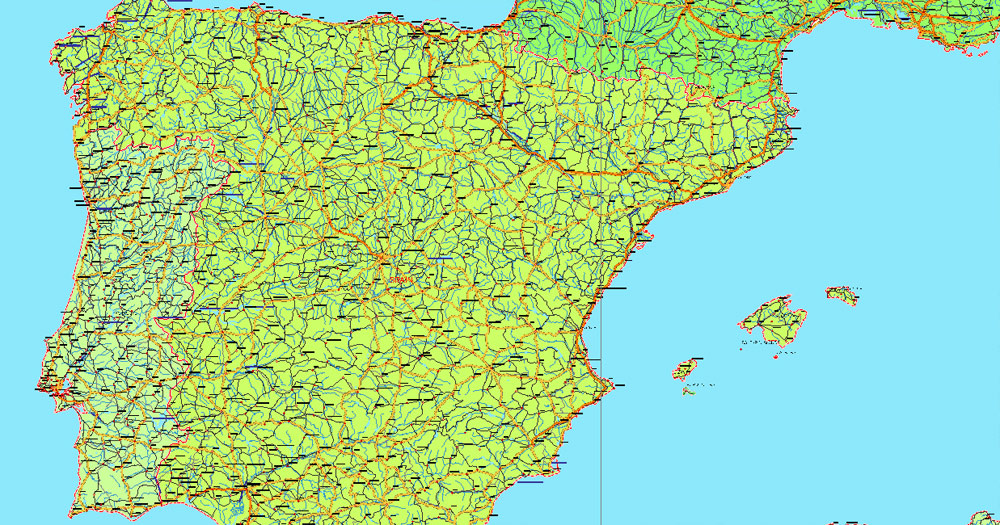
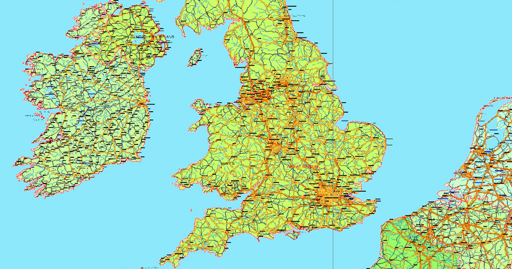
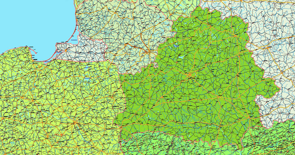
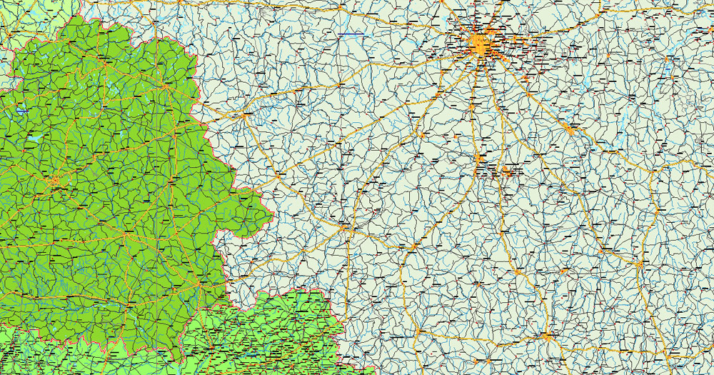
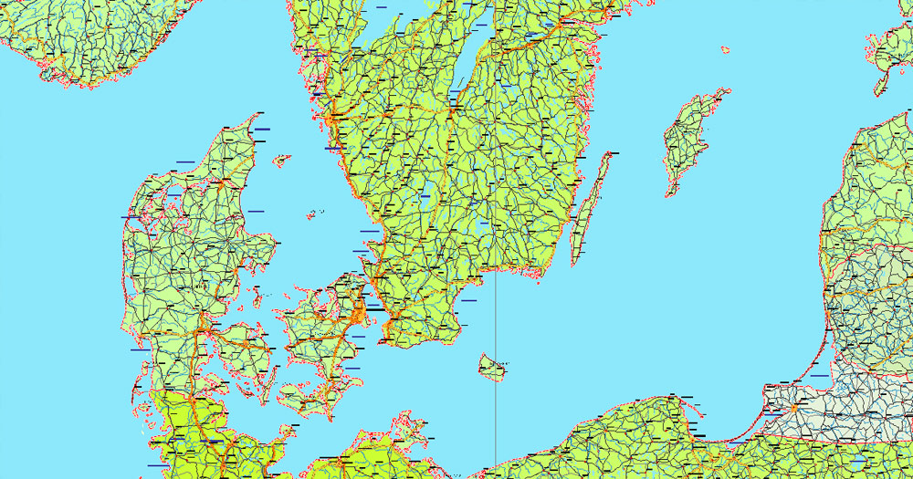
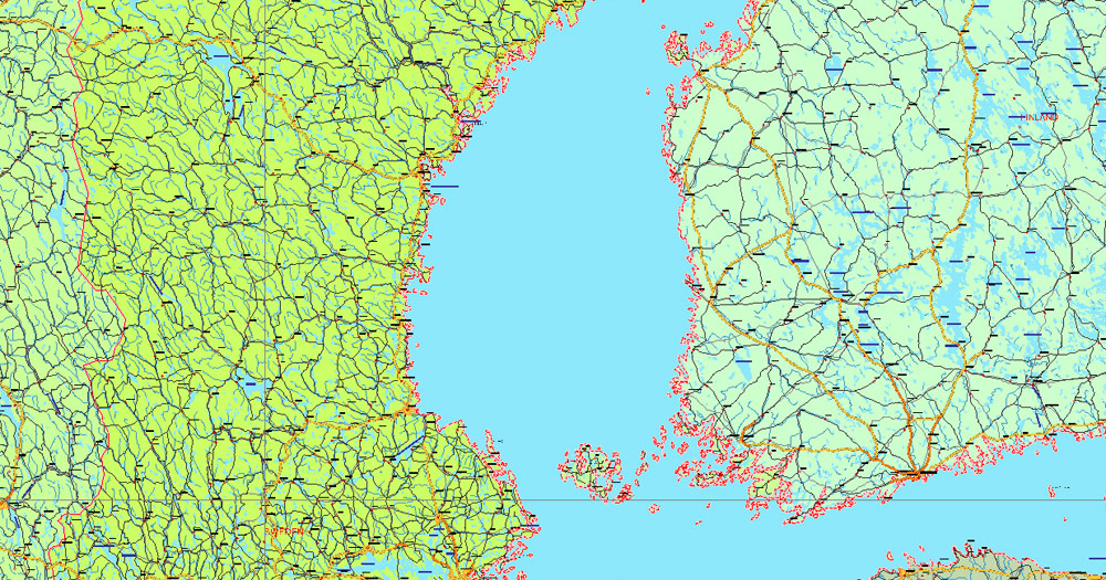
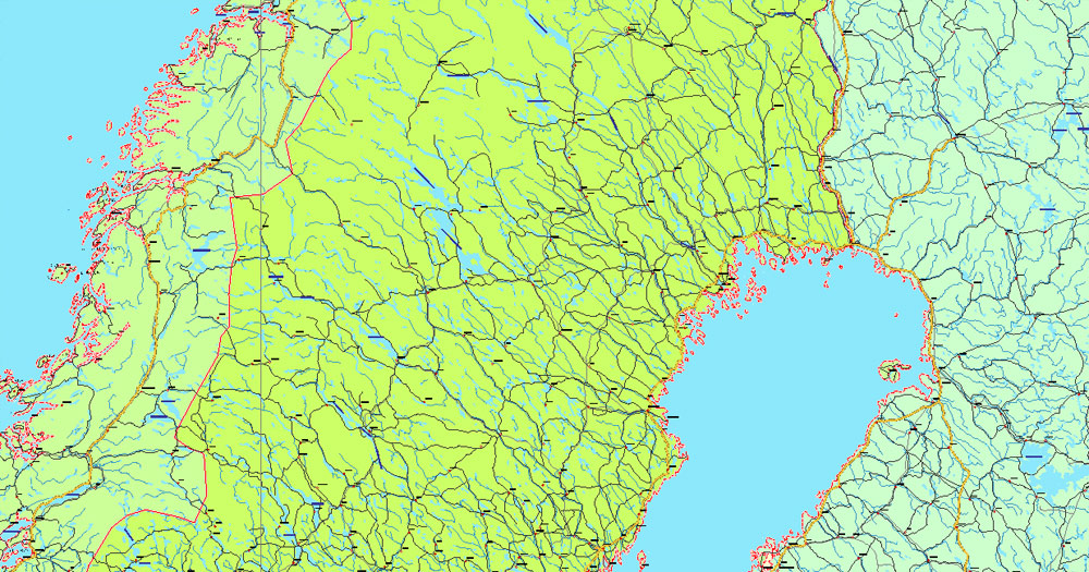
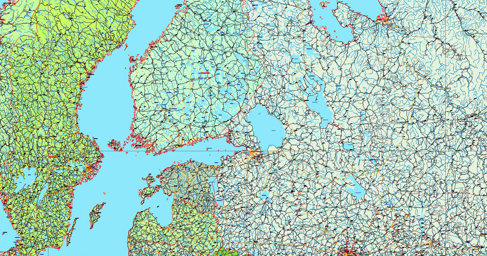
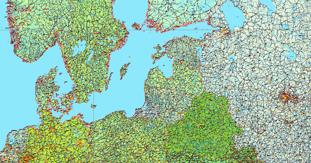
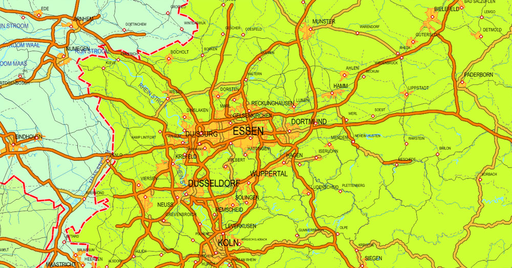
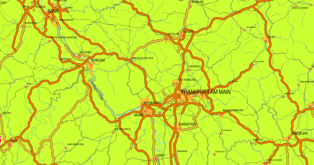
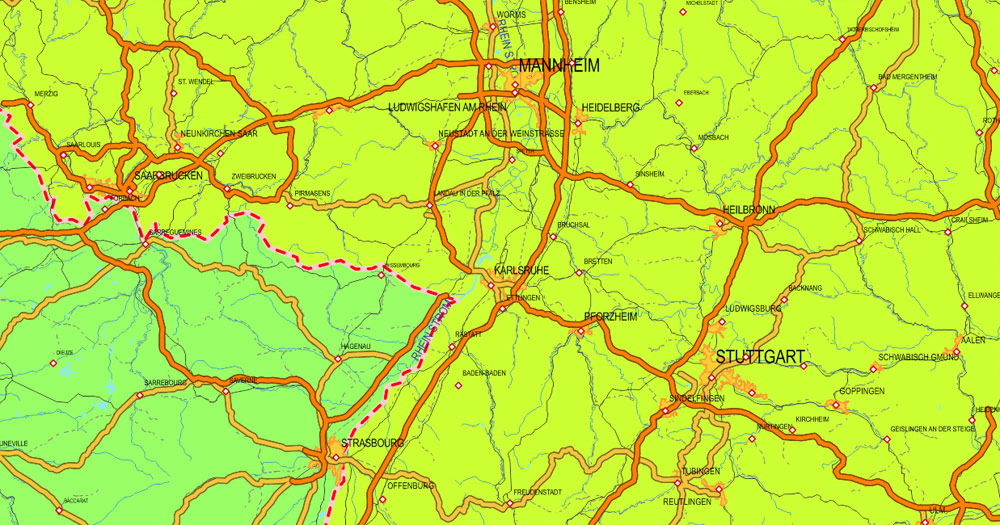
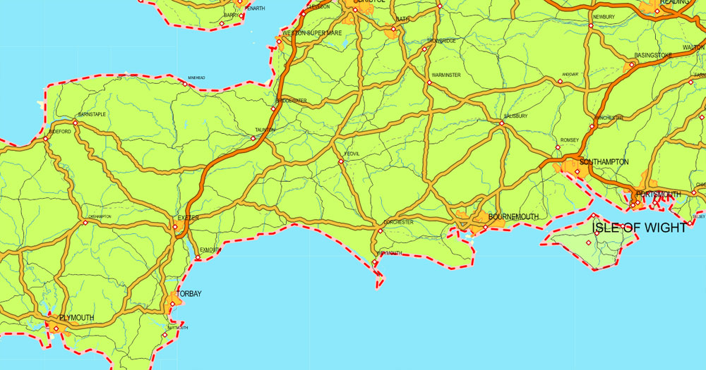
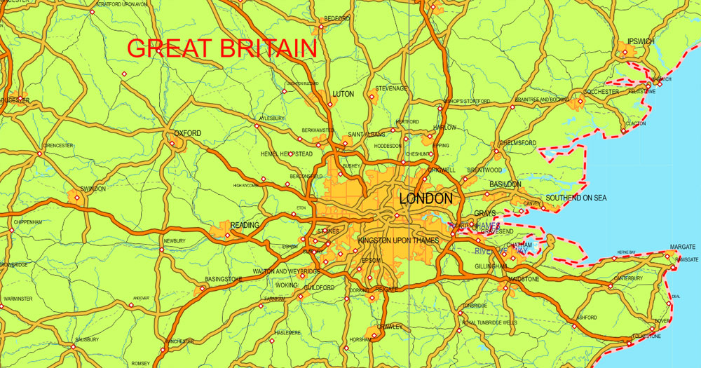
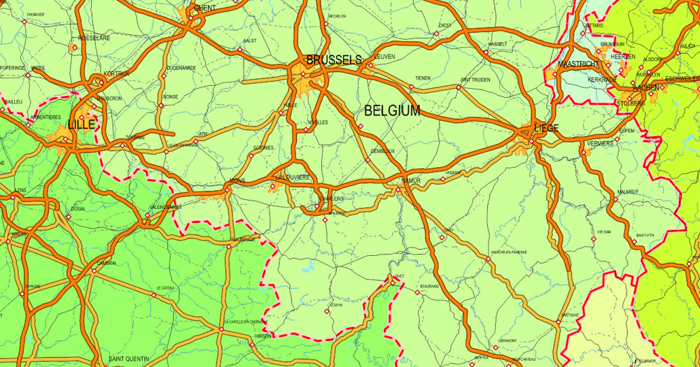
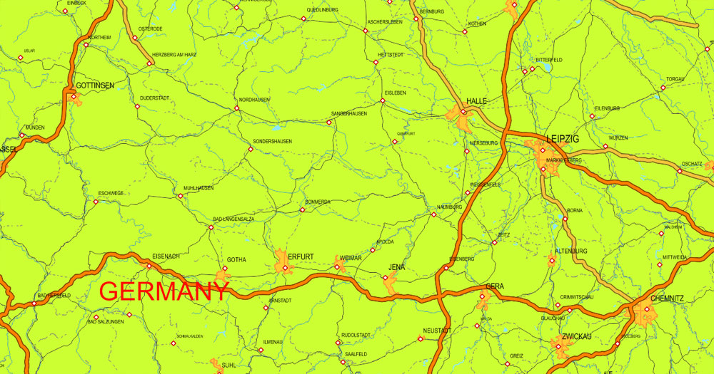
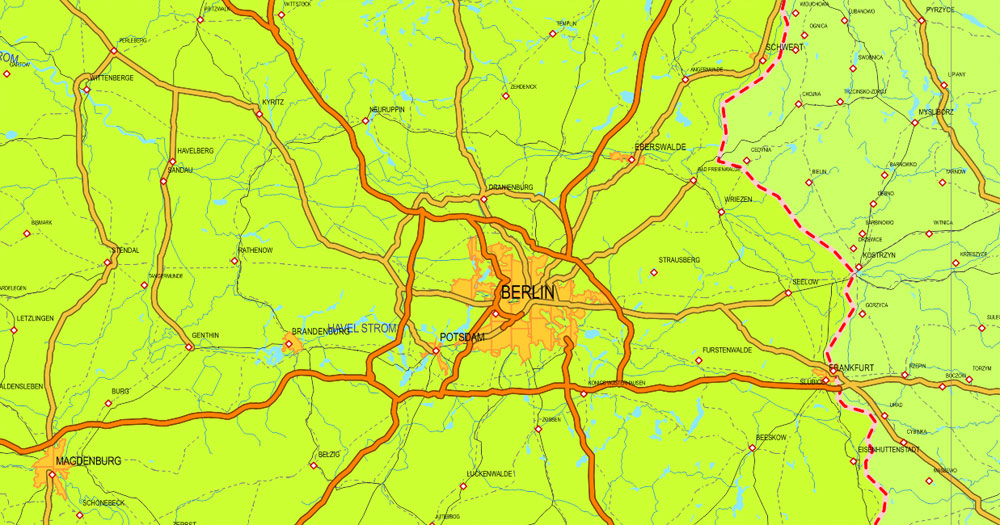
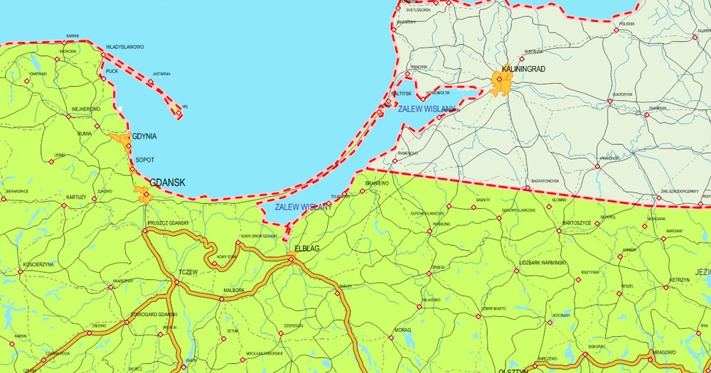
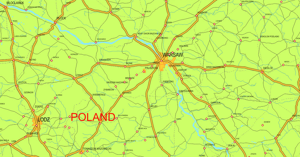
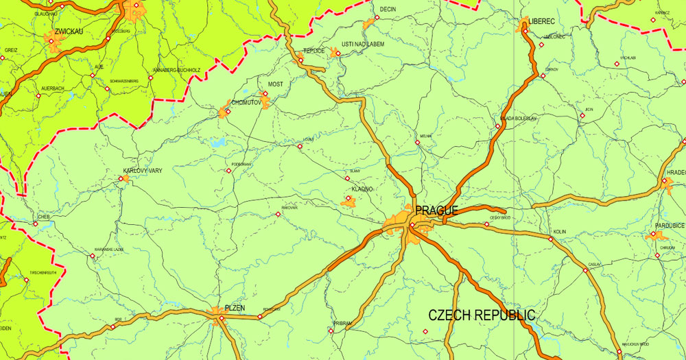
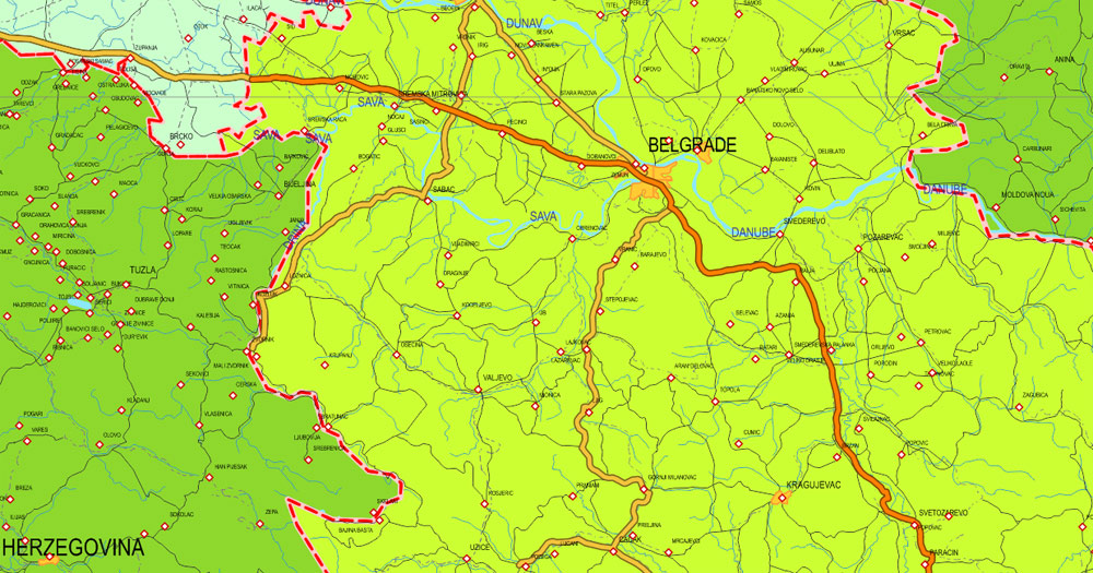
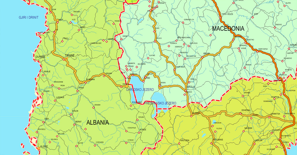
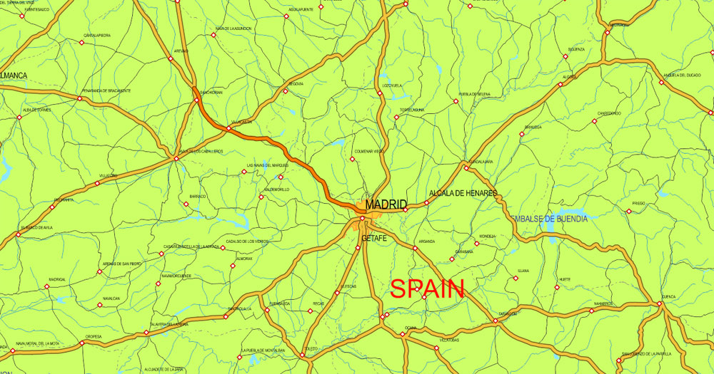
Printable Europe full Extra Detailed Map, exact vector map Adobe PDF editable, scalable, curves format names, 154 mb ZIP
Include ALL roads + principal roads colored, All cities and small towns, All names, railroads, All water objects – rivers, lakes, country borders, urban areas, scales etc. Included corrected shorelines/coastlines. HiRes Map for publishing, design, printing, arts, projects, presentations, for architects, designers and builders. Royalty Free.
You can edit this file by Adobe Illustrator, Adobe Acrobat, Corel Draw.
DWG, DXF and other formats – on demand, same price, please, contact.
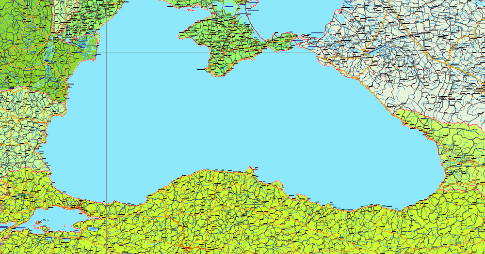
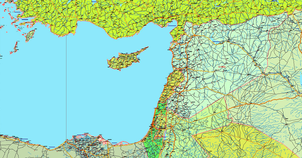
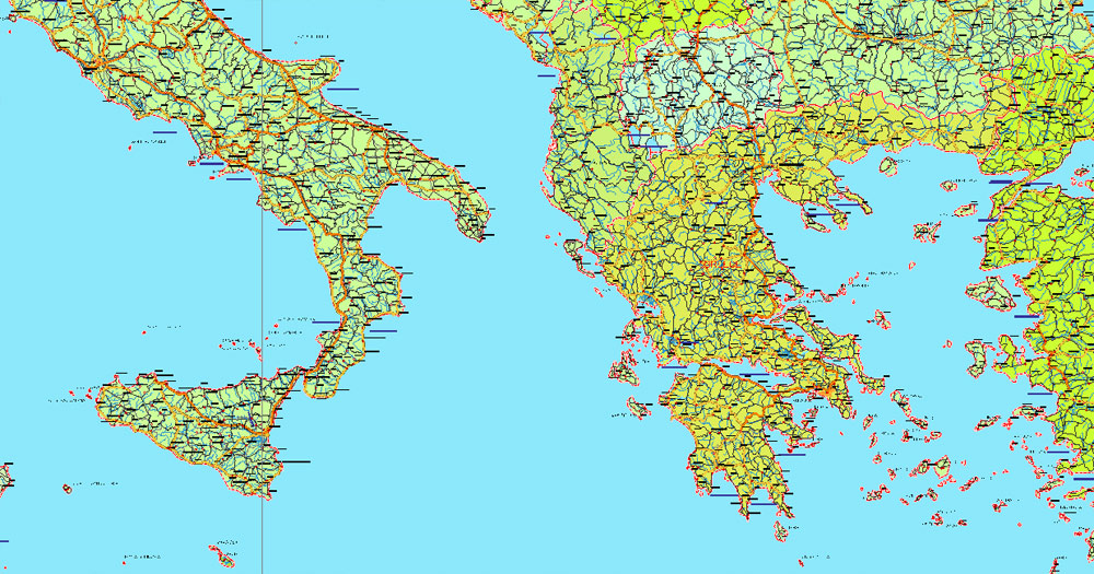
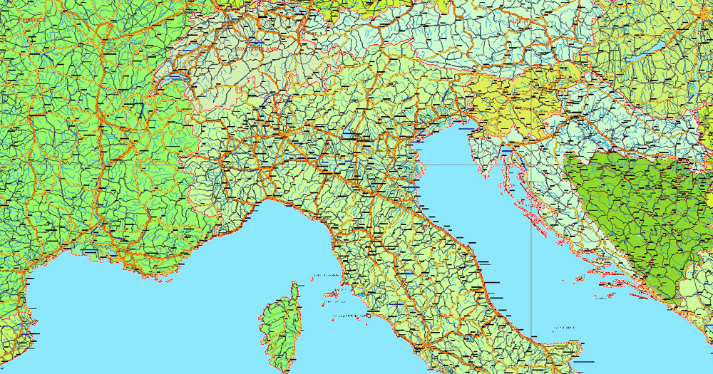
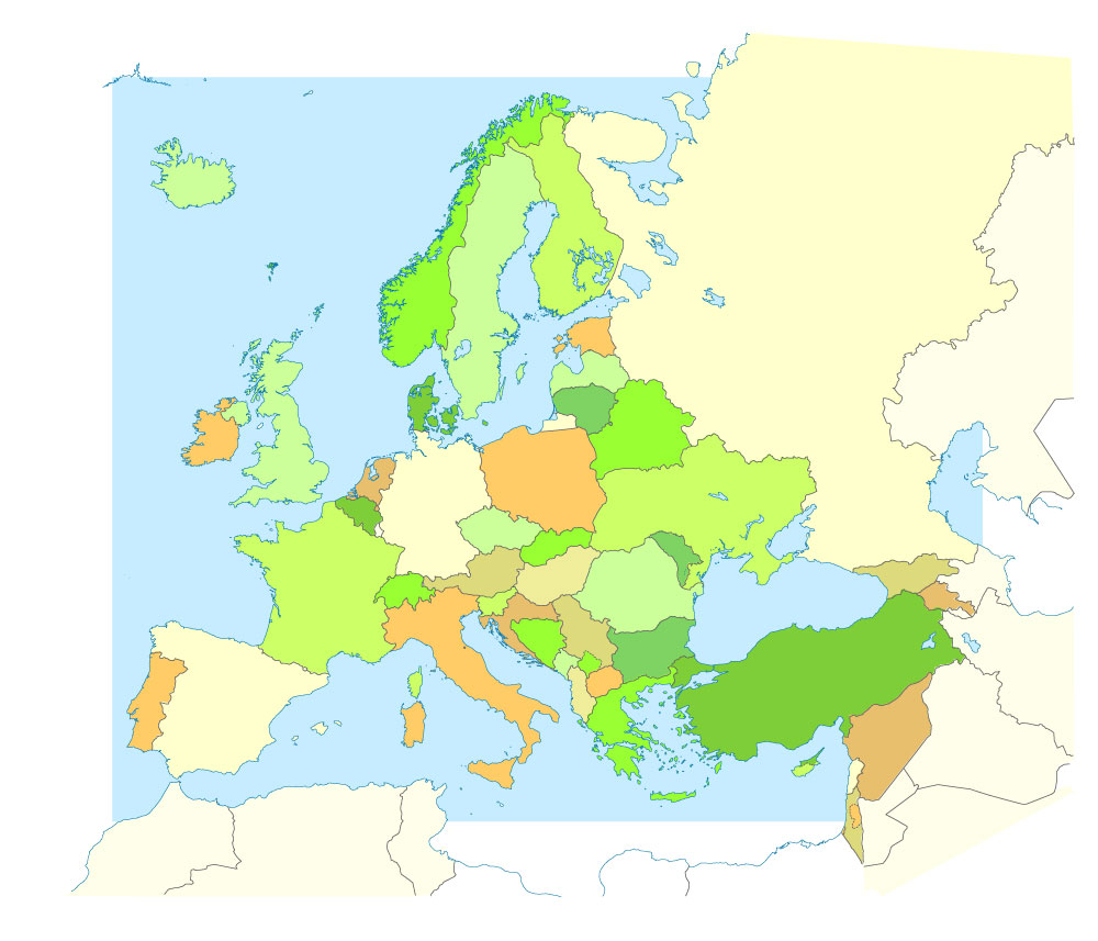
Europe.
This vector map of Europe is used as a basis for design, editing, and further printing.
This is the most detailed, exact map of Europe for high-quality printing and polygraphy. You can always clarify the map development date by contacting us.
For your convenience, all objects on Europe vector map are divided into layers. And the editing is very easy – colors, lines, etc.
You can easily add any objects needed (e.g. shops, salons, sale points, gas station or attraction) on any layer of Europe vector map.
Europe is a continent located entirely in the Northern Hemisphere and mostly in the Eastern Hemisphere. It is bordered by the Arctic Ocean to the north, the Atlantic Ocean to the west and the Mediterranean Sea to the south. It comprises the westernmost part of Eurasia.
Since around 1850, Europe is most commonly considered to be separated from Asia by the watershed divides of the Ural and Caucasus Mountains, the Ural River, the Caspian and Black Seas and the waterways of the Turkish Straits. Although the term “continent” implies physical geography, the land border is somewhat arbitrary and has been redefined several times since its first conception in classical antiquity. The division of Eurasia into two continents reflects East-West cultural, linguistic and ethnic differences which vary on a spectrum rather than with a sharp dividing line. The geographic border also does not follow political boundaries, with Turkey, Russia and Kazakhstan being transcontinental countries. A strict application of the Caucasus Mountains boundary also places two comparatively small countries, Azerbaijan and Georgia, in both continents.
One of the advantages of Europe vector maps of our production is the relevance of cartographic data, we constantly update all our products.
This vector map of Europe is used by:
designers, layout designers, printers, advertisers and architects. Our product – vector maps – is designed for further editing and printing in large formats – from @Wall format (a few meters) to A-0 and A-1, A-2, A-3.
Europe map in vector format is used for design, urban planning, presentations and media visualizations.
Advertising and presentation map of Europe (usually the final designer marks the routes, and puts the client’s objects (shops, saloons, gas stations etc.)
The undoubted advantage is that people will NEVER throw out this advertising product – the map. In fact, as an advertising medium, a map is the most “long-playing” of the well-known polygraphic advertising media, with the longest lifespan, and the maximum number of interactions with the customer.
For travelers, maps are sold at the airports and gas stations around the world. Often the source is our vector maps.
Take a look, who purchases our vector maps of Europe in “Our Clients and Friends” page – these are large and small companies, from super-brands like Volvo and Starbucks, to small design studios and printing houses.
It’s very easy to work with vector maps of Europe, even for a not very experienced designer who can turn on and off the map layers, add new objects, change the colors of fill and lines according to customer requirements.
The undoubted advantage of Europe vector maps in printing is an excellent and detailed visualization, when customer can expand a large paper map and instantly define his location, find a landmark, an object or address on map, unlike using the popular electronic formats of Google and Yandex maps for example.
Printable vector maps of Europe are much more convenient and efficient than any electronic maps on your smartphone, because ALL DETAILS are displayed in the entire space of Europe map.
Useful tips on working with vector maps of cities and countries in Adobe Illustrator.
«V» – launches the Selection tool (cursor, black arrow), which makes active any vector line.
«А» – launches the Direct Selection tool (white cursor), allows you to select curve elements and drag them to the desired place.
«R» – activates the Rotate tool, which helps you rotating selected objects around the center point by 360 degrees.
«E» – gives you the opportunity to use the Eraser tool and erase unnecessary parts.
«X» – switches between Fill and Stroke in the Tools section. Try to get used to this hot key and
you will quickly understand that you can’t live and work without it.
Guides are not limited to vertical and horizontal in Adobe Illustrator. You can also create a diagonal guide for example. Moreover, you can turn any contours into guides. Select the outline and go to View > Guides > Make Guides (Create Guides), or simply press Cmd/Ctrl + 5. You can also turn the guides back into an editable object. Go to menu, View > Guides > Unlock Guides (Release Guides), select the guide you want to edit and select View > Guides > Release Guides (Reset Guides), or just press Cmd/Ctrl + Option / Alt + 5).
You will probably want to change the color scheme used on our Europe vector map.
To quickly and effectively play with colors.
Of course, you can do it manually, all objects in our Europe vector map are divided according to types and layers, and you can easily change the color gamma of vector objects in groups and layers.
But there is more effective way of working with the whole VECTOR MAP of Europe and all layers:
The overview dialog «Edit colors»/«Repaint Graphic Object» (this dialog box name can change depending on the context):
If you have selected a part or a layer of Europe vector map and open the dialog box by clicking the icon in the Control panel, on the Samples palette or the Color Catalog, or if you choose Edit > Edit Colors> Repaint Graphic Object, then the «Repaint Graphic Object» dialog box appears, and you get access to «Assign» and «Edit» tabs.
If a picture or a map fragment is not selected, and you open the dialog box by clicking the icon in the Control panel, on the Samples palette or in the Color Catalog, the «Edit Colors» dialog box appears and you can only access the «Edit» tab.
Regardless of the name at the top of the dialog box, the right-hand side always displays the color group of the current document, as well as two default color groups: Print Color and Grayscale. These color groups can be selected and used any time.
Create and edit color groups of Europe vector map, and also assign colors using the «Edit Colors»/ а «Repaint Graphic Object» dialog box.
A. Creating and editing of a color group on the «Edit» tab
B. Assigning colors on the «Assign» tab
C. Select a group of colors from the «Color groups» list
The option «Repaint a graphic object» in the lower part of the dialog box allows you to preview the colors on a selected layer of Vector map, or a group of elements, and specify whether its colors will be redefined when the dialog box is closed.
The main areas of the dialog box are:
«Edit»
The «Edit» tab is designed to create a new or edit the existing color groups.
The harmony rules Menu and the Color Wheel are used to conduct experiments with color harmonies. The color wheel shows how colors are related in color harmony, and the color bars allow you to view and manipulate an individual color values. In addition, you can adjust the brightness, add and remove colors, save color groups and view colors on the selected Vector Map of Europe or a separated layers.
«Assign»
The «Assign» tab is used to view and control on how the original colors are replaced with colors from the color group like your corporate colors in the Vector Map of Europe.
The assign color ability is provided only if the entire map, layer or fragment is selected in the document. You can specify which of new colors replace the current colors, whether the spot colors should be preserved and how colors are replaced (for example, you can replace colors completely or changing the color tone while maintaining the brightness). The «Assign» tab allows you to redefine colors in the Vector Map of Europe, or in separate layers and fragments using the current color group or reducing the number of colors in the current Vector Map.
Color groups
Is a list of all saved color groups for current document (the same groups appear in the «Samples» palette). You can edit and delete the existing color groups, as well as creating a new ones using the list of “Color Groups” in the dialog box. All changes appear in the «Samples» palette.
The highlighted color group shows, which color group is currently edited.

Any color group can be selected and edited, or used to redefine the colors in the selected vector map of Europe , its fragments or elements.
Saving a color group adds this group to the specified list.
Opening the «Edit Colors»/«Repaint Graphic Object» dialog box.
Open the «Edit Colors»/«Repaint Graphic Object» dialog box using one of the following methods:
«Edit»> «Edit Colors»> «Repaint Graphic object» or «Repaint With Style».
Use these commands if you need to edit the colors in the selected vector map of Europe city.
«Repaint Graphic object» button on the «Control» panel.
Use this button if you need to adjust colors of Europe vector map using the а «Repaint graphic object» dialog box.
The specified button is available if the selected vector map or its fragment contains two or more colors.
Note. This color editing method is convenient for global color adjustment in a vector map, if global colors were not used when creating a Map of Europe.
The «Edit colors» button or «Edit or apply colors» on the «Color Catalog» palette
Click this button if you need to edit colors on the «Color Catalog» palette or edit and then apply them to the selected Vector Map of Europe or its fragment.
The «Edit color group» button or «Edit or apply color group» on the «Samples» palette.
Click this button if you need to edit the colors in the specific color group or edit and apply them to the selected Vector Map of Europe or a group of its elements, for example, the whole layer “Streets and lines”. You can also double-click the color group in the Samples panel to open the dialog box.
If the map file is too large and your computer freezes or even can’t open it quickly:
1. Try to reduce the color resolution of the video card (display) to 256 colors while working with a large map.
2. Using Windows Task Manager, select all the application you don’t need, while working with map, just turn them off.
3. Launch Adobe Illustrator. (DO NOT OPEN the vector map file)
4. Start the Windows Task Manager using administrator rights > Find the “Illustrator” process > set the «real time» priority,
5. Open the file. When you see the LEGACY FONT popup window – click “OK” (do not update). You can restore the TEXT later.
6. Can also be useful: When file is opened – Edit > Settings > Basic Settings > disable smoothing. /// It looks scary, but works quickly)))
We recommend saving the file in Adobe Illustrator 10 version. It’s much more stable when working with VERY BIG size files.
Europe covers about 10,180,000 square kilometres (3,930,000 sq mi), or 2% of the Earth’s surface (6.8% of land area). Politically, Europe is divided into about fifty sovereign states of which the Russian Federation is the largest and most populous, spanning 39% of the continent and comprising 15% of its population. Europe had a total population of about 741 million (about 11% of the world population) as of 2016. The European climate is largely affected by warm Atlantic currents that temper winters and summers on much of the continent, even at latitudes along which the climate in Asia and North America is severe. Further from the sea, seasonal differences are more noticeable than close to the coast.
Europe, in particular ancient Greece, was the birthplace of Western civilization. The fall of the Western Roman Empire in 476 AD and the subsequent Migration Period marked the end of ancient history and the beginning of the Middle Ages. Renaissance humanism, exploration, art and science led to the modern era. Since the Age of Discovery started by Portugal and Spain, Europe played a predominant role in global affairs. Between the 16th and 20th centuries, European powers controlled at various times the Americas, almost all of Africa and Oceania and the majority of Asia.
The Age of Enlightenment, the subsequent French Revolution and the Napoleonic Wars shaped the continent culturally, politically and economically from the end of the 17th century until the first half of the 19th century. The Industrial Revolution, which began in Great Britain at the end of the 18th century, gave rise to radical economic, cultural and social change in Western Europe and eventually the wider world. Both world wars took place for the most part in Europe, contributing to a decline in Western European dominance in world affairs by the mid-20th century as the Soviet Union and the United States took prominence. During the Cold War, Europe was divided along the Iron Curtain between NATO in the West and the Warsaw Pact in the East, until the revolutions of 1989 and fall of the Berlin Wall.
In 1949 the Council of Europe was founded, following a speech by Sir Winston Churchill, with the idea of unifying Europe to achieve common goals. It includes all European states except for Belarus, Kazakhstan and Vatican City. Further European integration by some states led to the formation of the European Union (EU), a separate political entity that lies between a confederation and a federation. The EU originated in Western Europe but has been expanding eastward since the fall of the Soviet Union in 1991. The currency of most countries of the European Union, the euro, is the most commonly used among Europeans; and the EU’s Schengen Area abolishes border and immigration controls among most of its member states. The European Anthem is “Ode to Joy”, and states celebrate peace and unity on Europe Day.
Europe is traditionally defined as one of seven continents. Physiographically, it is the northwestern peninsula of the larger landmass known as Eurasia (or the larger Afro-Eurasia); Asia occupies the eastern bulk of this continuous landmass and all share a common continental shelf. Europe’s eastern frontier is delineated by the Ural Mountains in Russia. The southeast boundary with Asia is not universally defined, but the modern definition is generally the Ural River or, less commonly, the Emba River. The boundary continues to the Caspian Sea, the crest of the Caucasus Mountains (or, less commonly, the river Kura in the Caucasus), and on to the Black Sea. The Bosporus, the Sea of Marmara, and the Dardanelles conclude the Asian boundary. The Mediterranean Sea to the south separates Europe from Africa. The western boundary is the Atlantic Ocean. Iceland, though on the Mid-Atlantic Ridge and nearer to Greenland (North America) than mainland Europe, is generally included in Europe for cultural reasons and because it is over twice as close to mainland Europe than to mainland North America. There is ongoing debate on where the geographical centre of Europe falls.
Some geographical texts refer to a Eurasian continent given that Europe is not surrounded by sea and its southeastern border has always been variously defined for centuries.
In terms of shape, Europe is a collection of connected peninsulas and nearby islands. The two largest peninsulas are mainland Europe and Scandinavia to the north, divided from each other by the Baltic Sea. Three smaller peninsulas—Iberia, Italy and the Balkans—emerge from the southern margin of the mainland. The Balkan peninsula is separated from Asia by the Black and Aegean Seas. Italy is separated from the Balkans by the Adriatic Sea, and from Iberia by the Mediterranean Sea, which also separates Europe from Africa. Eastward, mainland Europe widens much like the mouth of a funnel, until the boundary with Asia is reached at the Ural Mountains and Ural River, the Caspian Sea and Caucasus Mountains.
Land relief in Europe shows great variation within relatively small areas. The southern regions are mountainous, while moving north the terrain descends from the high Alps, Pyrenees and Carpathians, through hilly uplands, into broad, low northern plains, which are vast in the east. An arc of uplands also exists along the northwestern seaboard, beginning in southwestern Ireland, continuing across through western and northern Great Britain, and up along the mountainous, fjord-cut spine of Norway.
This description is simplified. Sub-regions such as Iberia and Italy contain their own complex features, as does mainland Europe itself, where the relief contains many plateaus, river valleys and basins that complicate the general trend. Iceland and the British Isles are special cases. The former is of North Atlantic volcanic formation, while the latter consist of upland areas once joined to the mainland until cut off by rising sea levels.


Free download simple map Europe vector:
europe_blank_laea_location_map_all-ai
europe_blank_laea_location_map_all-pdf
Small guide: How to work with the vector map?
You can: Mass select objects by type and color – for example, the objects type “building” (they are usually dark gray) – and remove them from the map, if you do not need them in your print or design project. You can also easily change the thickness of lines (streets), just bulk selection the road by the line color.
The streets are separated by type, for example, type “residential road” are usually white with a gray stroke. Highway usually orange with a brown or dark gray stroke.
All objects are divided by types: different types of roads and streets, polygons of buildings, landfills, urban areas, parks and more other.
It is easy to change the font of inscriptions, all or each individually. Also, just can be make and any other manipulation of objects on the vector map in Adobe illustrator format.
Important: All the proportions on the map are true, that is, the relative sizes of the objects are true, because Map is based on an accurate GPS projection, and It transated into the (usual for all) the Mercator projection.
You can easily change the color, stroke and fill of any object on the map, zoom without loss of quality Image Verification.
Select object

Bulk selection the same objects on the vector map

See the bulk selected objects on the vector map

Bulk delete buildungs from the vector map

Select residencial road (small street) on the vector map

Bulk selection the same lines (streets, roads) on the full map

Create fat lines of the streets on the vector maps (bulk action) 1

Create fat lines of the streets on the vector maps (bulk action) 2

Create fat lines of the streets on the vector maps (bulk action) 3

You can easily change the color, stroke and fill of any object on the map, zoom without loss of quality Image Verification.

 Author: Kirill Shrayber, Ph.D. FRGS

