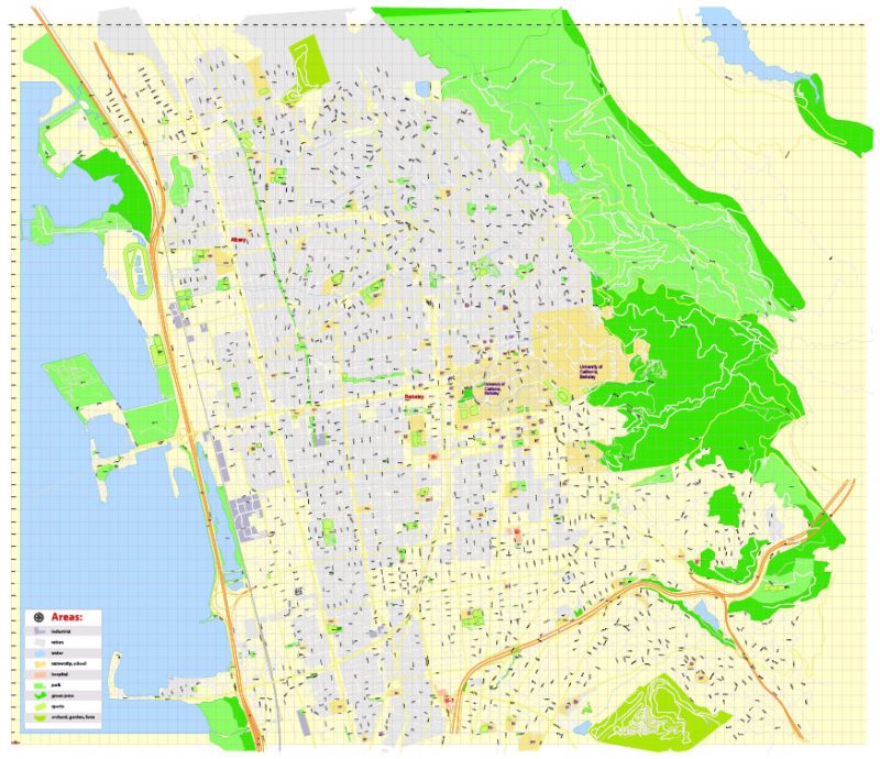
PDF Map University of California Berkeley, Berkeley CA, US, exact vector street G-View Level 17 (100 meters scale) map, V.21.12. fully editable, Adobe PDF, full vector, scalable, editable text format of street names, 6 Mb ZIP.
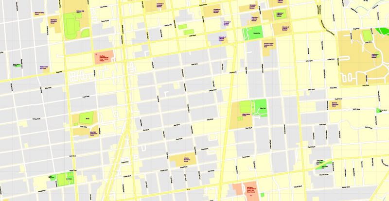
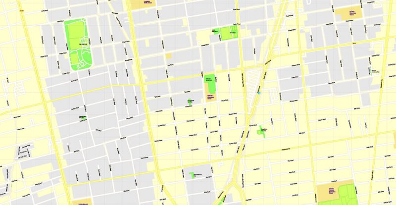
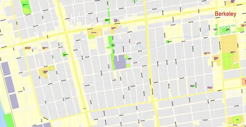
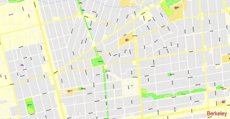
All streets named, main objects, no buildings. Map for publishing, design, printing, publications, arts, projects, presentations, for architects, designers and builders, business, logistics. The most exact and detailed map.
Separated layers: streets and roads, color fills, road labels, names 1,2,3, street arrows, objects, scales, legend, grid.
For large format (wall) printing.
You can edit this file by Adobe Illustrator, Adobe Acrobat, Corel Draw.
DWG, DXF, CDR, ESRI Shapes, and other formats – by request, same price, please contact.
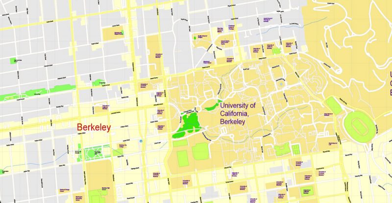
University of California, Berkeley
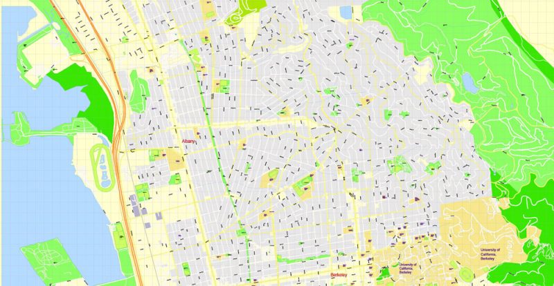
This vector map of Berkeley is used as a basis for design, editing, and further printing.
This is the most detailed, exact map of Berkeley for high-quality printing and polygraphy. You can always clarify the map development date by contacting us.
For your convenience, all objects on Berkeley vector map are divided into layers. And the editing is very easy – colors, lines, etc.
You can easily add any objects needed (e.g. shops, salons, sale points, gas station or attraction) on any layer of Berkeley vector map.
One of the advantages of Berkeley vector maps of our production is the relevance of cartographic data, we constantly update all our products.
The University of California, Berkeley (UC Berkeley, Berkeley, Cal, or California) is a public research university in the United States. Located in the city of Berkeley, it was founded in 1868, and serves as the flagship institution of the ten research universities affiliated with the University of California system. Berkeley has since grown to instruct over 40,000 students in approximately 350 undergraduate and graduate degree programs covering numerous disciplines.
This vector map of Berkeley is used by:
designers, layout designers, printers, advertisers and architects. Our product – vector maps – is designed for further editing and printing in large formats – from @Wall format (a few meters) to A-0 and A-1, A-2, A-3.
Berkeley map in vector format is used for design, urban planning, presentations and media visualizations.
Advertising and presentation map of Berkeley (usually the final designer marks the routes, and puts the client’s objects (shops, saloons, gas stations etc.)
The undoubted advantage is that people will NEVER throw out this advertising product – the map. In fact, as an advertising medium, a map is the most “long-playing” of the well-known polygraphic advertising media, with the longest lifespan, and the maximum number of interactions with the customer.
For travelers, maps are sold at the airports and gas stations around the world. Often the source is our vector maps.
Take a look, who purchases our vector maps of Berkeley in “Our Clients and Friends” page – these are large and small companies, from super-brands like Volvo and Starbucks, to small design studios and printing houses.
It’s very easy to work with vector maps of Berkeley, even for a not very experienced designer who can turn on and off the map layers, add new objects, change the colors of fill and lines according to customer requirements.
The undoubted advantage of Berkeley vector maps in printing is an excellent and detailed visualization, when customer can expand a large paper map and instantly define his location, find a landmark, an object or address on map, unlike using the popular electronic formats of Google and Yandex maps for example.
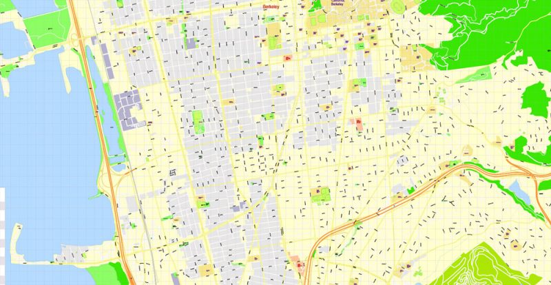
Printable vector maps of Berkeley are much more convenient and efficient than any electronic maps on your smartphone, because ALL DETAILS are displayed in the entire space of Berkeley map.
Useful tips on working with vector maps of cities and countries in Adobe Illustrator.
«V» – launches the Selection tool (cursor, black arrow), which makes active any vector line.
«А» – launches the Direct Selection tool (white cursor), allows you to select curve elements and drag them to the desired place.
«R» – activates the Rotate tool, which helps you rotating selected objects around the center point by 360 degrees.
«E» – gives you the opportunity to use the Eraser tool and erase unnecessary parts.
«X» – switches between Fill and Stroke in the Tools section. Try to get used to this hot key and
you will quickly understand that you can’t live and work without it.
Guides are not limited to vertical and horizontal in Adobe Illustrator. You can also create a diagonal guide for example. Moreover, you can turn any contours into guides. Select the outline and go to View > Guides > Make Guides (Create Guides), or simply press Cmd/Ctrl + 5. You can also turn the guides back into an editable object. Go to menu, View > Guides > Unlock Guides (Release Guides), select the guide you want to edit and select View > Guides > Release Guides (Reset Guides), or just press Cmd/Ctrl + Option / Alt + 5).
You will probably want to change the color scheme used on our Berkeley vector map.
To quickly and effectively play with colors.
Of course, you can do it manually, all objects in our Berkeley vector map are divided according to types and layers, and you can easily change the color gamma of vector objects in groups and layers.
But there is more effective way of working with the whole VECTOR MAP of Berkeley and all layers:
The overview dialog «Edit colors»/«Repaint Graphic Object» (this dialog box name can change depending on the context):
If you have selected a part or a layer of Berkeley vector map and open the dialog box by clicking the icon in the Control panel, on the Samples palette or the Color Catalog, or if you choose Edit > Edit Colors> Repaint Graphic Object, then the «Repaint Graphic Object» dialog box appears, and you get access to «Assign» and «Edit» tabs.
If a picture or a map fragment is not selected, and you open the dialog box by clicking the icon in the Control panel, on the Samples palette or in the Color Catalog, the «Edit Colors» dialog box appears and you can only access the «Edit» tab.
Regardless of the name at the top of the dialog box, the right-hand side always displays the color group of the current document, as well as two default color groups: Print Color and Grayscale. These color groups can be selected and used any time.
Create and edit color groups of Berkeley vector map, and also assign colors using the «Edit Colors»/ а «Repaint Graphic Object» dialog box.
A. Creating and editing of a color group on the «Edit» tab
B. Assigning colors on the «Assign» tab
C. Select a group of colors from the «Color groups» list
The option «Repaint a graphic object» in the lower part of the dialog box allows you to preview the colors on a selected layer of Vector map, or a group of elements, and specify whether its colors will be redefined when the dialog box is closed.
The main areas of the dialog box are:
«Edit»
The «Edit» tab is designed to create a new or edit the existing color groups.
The harmony rules Menu and the Color Wheel are used to conduct experiments with color harmonies. The color wheel shows how colors are related in color harmony, and the color bars allow you to view and manipulate an individual color values. In addition, you can adjust the brightness, add and remove colors, save color groups and view colors on the selected Vector Map of Berkeley or a separated layers.
«Assign»
The «Assign» tab is used to view and control on how the original colors are replaced with colors from the color group like your corporate colors in the Vector Map of Berkeley.
The assign color ability is provided only if the entire map, layer or fragment is selected in the document. You can specify which of new colors replace the current colors, whether the spot colors should be preserved and how colors are replaced (for example, you can replace colors completely or changing the color tone while maintaining the brightness). The «Assign» tab allows you to redefine colors in the Vector Map of Berkeley, or in separate layers and fragments using the current color group or reducing the number of colors in the current Vector Map.
Color groups
Is a list of all saved color groups for current document (the same groups appear in the «Samples» palette). You can edit and delete the existing color groups, as well as creating a new ones using the list of “Color Groups” in the dialog box. All changes appear in the «Samples» palette.
The highlighted color group shows, which color group is currently edited.
Any color group can be selected and edited, or used to redefine the colors in the selected vector map of Berkeley, its fragments or elements.
Saving a color group adds this group to the specified list.
Opening the «Edit Colors»/«Repaint Graphic Object» dialog box.
Open the «Edit Colors»/«Repaint Graphic Object» dialog box using one of the following methods:
«Edit»> «Edit Colors»> «Repaint Graphic object» or «Repaint With Style».
Use these commands if you need to edit the colors in the selected vector map of Berkeley.
«Repaint Graphic object» button on the «Control» panel.
Use this button if you need to adjust colors of Berkeley vector map using the а «Repaint graphic object» dialog box.
The specified button is available if the selected vector map or its fragment contains two or more colors.
Note. This color editing method is convenient for global color adjustment in a vector map, if global colors were not used when creating a Map of Berkeley.
The «Edit colors» button or «Edit or apply colors» on the «Color Catalog» palette
Click this button if you need to edit colors on the «Color Catalog» palette or edit and then apply them to the selected Vector Map of Berkeley or its fragment.
The «Edit color group» button or «Edit or apply color group» on the «Samples» palette.
Click this button if you need to edit the colors in the specific color group or edit and apply them to the selected Vector Map of Berkeley or a group of its elements, for example, the whole layer “Streets and lines”. You can also double-click the color group in the Samples panel to open the dialog box.
If the map file is too large and your computer freezes or even can’t open it quickly:
1. Try to reduce the color resolution of the video card (display) to 256 colors while working with a large map.
2. Using Windows Task Manager, select all the application you don’t need, while working with map, just turn them off.
3. Launch Adobe Illustrator. (DO NOT OPEN the vector map file)
4. Start the Windows Task Manager using administrator rights > Find the “Illustrator” process > set the «real time» priority,
5. Open the file. When you see the LEGACY FONT popup window – click “OK” (do not update). You can restore the TEXT later.
6. Can also be useful: When file is opened – Edit > Settings > Basic Settings > disable smoothing. /// It looks scary, but works quickly)))
We recommend saving the file in Adobe Illustrator 10 version. It’s much more stable when working with VERY BIG size files.
Berkeley is one of the 14 founding members of the Association of American Universities, with $789 million in R&D expenditures in the fiscal year ending June 30, 2015. Today, Berkeley maintains close relationships with three United States Department of Energy National Laboratories—Lawrence Berkeley National Laboratory, Lawrence Livermore National Laboratory and Los Alamos National Laboratory—and is home to many institutes, including the Mathematical Sciences Research Institute and the Space Sciences Laboratory. Through its partner institution University of California, San Francisco (UCSF), Berkeley also offers a joint medical program at the UCSF Medical Center.
As of October 2018, Berkeley alumni, faculty members and researchers include 107 Nobel laureates, 25 Turing Awards winners, and 14 Fields Medalists. They have also won 9 Wolf Prizes, 45 MacArthur Fellowships, 20 Academy Awards, 14 Pulitzer Prizes and 207 Olympic medals (117 gold, 51 silver and 39 bronze). In 1930, Ernest Lawrence invented the cyclotron at Berkeley, based on which UC Berkeley researchers along with Berkeley Lab have discovered or co-discovered 16 chemical elements of the periodic table – more than any other university in the world. During the 1940s, Berkeley physicist J. R. Oppenheimer, the “Father of the Atomic Bomb”, led the Manhattan project to create the first atomic bomb. In the 1960s, Berkeley was particularly noted for the Free Speech Movement as well as the Anti-Vietnam War Movement led by its students. In the 21st century, Berkeley has become one of the leading universities in producing entrepreneurs and its alumni have founded a large number of companies worldwide.
Berkeley is often ranked as a top-ten university in the world and as the top public university in the United States. For 2017–18, the Academic Ranking of World Universities (ARWU) ranked Berkeley 5th in the world. Berkeley also ranks 6th internationally in the CWUR World University Rankings. It is additionally ranked 4th in the world by U.S. News & World Report. Berkeley is ranked 15th internationally in the Times Higher Education World University Rankings, and as the 6th most reputed university in the world by the Times Higher Education World Reputation Rankings.
The Berkeley campus encompasses approximately 1,232 acres (499 ha), though the “central campus” occupies only the low-lying western 178 acres (72 ha) of this area. Of the remaining acres, approximately 200 acres (81 ha) are occupied by the Lawrence Berkeley National Laboratory; other facilities above the main campus include the Lawrence Hall of Science and several research units, notably the Space Sciences Laboratory, the Mathematical Sciences Research Institute, an undeveloped 800-acre (320 ha) ecological preserve, the University of California Botanical Garden and a recreation center in Strawberry Canyon. Portions of the mostly undeveloped, eastern area of the campus are actually within the City of Oakland; these portions extend from the Claremont Resort north through the Panoramic Hill neighborhood to Tilden Park.
View looking west from Wurster Hall
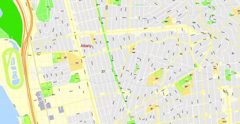
To the west of the central campus is the downtown business district of Berkeley; to the northwest is the neighborhood of North Berkeley, including the so-called Gourmet Ghetto, a commercial district known for high quality dining due to the presence of such world-renowned restaurants as Chez Panisse. Immediately to the north is a quiet residential neighborhood known as Northside with a large graduate student population; situated north of that are the upscale residential neighborhoods of the Berkeley Hills. Immediately southeast of campus lies fraternity row, and beyond that the Clark Kerr Campus and an upscale residential area named Claremont. The area south of the university includes student housing and Telegraph Avenue, one of Berkeley’s main shopping districts with stores, street vendors and restaurants catering to college students and tourists. In addition, the University also owns land to the northwest of the main campus, a 90-acre (36 ha) married student housing complex in the nearby town of Albany (“Albany Village” and the “Gill Tract”), and a field research station several miles to the north in Richmond, California.
The campus is home to several museums including the University of California Museum of Paleontology, the UC Berkeley Art Museum and Pacific Film Archive, and the Lawrence Hall of Science. The Museum of Paleontology, found in the lobby of the Valley Life Sciences Building, showcases a variety of dinosaur fossils including a complete cast of a Tyrannosaurus Rex.
Outside of the Bay Area, the University owns various research laboratories and research forests in both northern and southern Sierra Nevada.
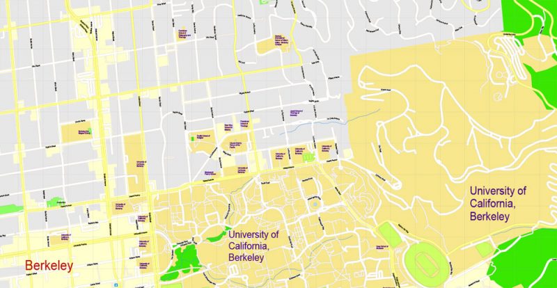
University of California, Berkeley
The University of California, Berkeley, is a public research university located in Berkeley, California.
Address: Berkeley, CA 94720
Acceptance rate: 17.5% (2016)
Undergraduate tuition and fees: In-state tuition: 13,510 USD (2016)
Mascot: Oski
Total enrollment: 38,204 (2015)
Colors: Berkeley Blue, California Gold
Berkeley
City in California
Berkeley is a city in Northern California on the east side of San Francisco Bay. It’s home to the University of California, Berkeley, birthplace of the 1960s Free Speech Movement. The 1914 Sather Tower, known as the Campanile, has views of the campus and the bay. The open-air Hearst Greek Theatre stages major concerts. Clustered on and near Telegraph Avenue, south of the university, are cafes, shops and music stores.
Population: 116,768
Area:
• Total 17.696 sq mi (45.833 km2)
• Land 10.470 sq mi (27.118 km2)
• Water 7.226 sq mi (18.716 km2)
Free vector maps:

Free download Vector Map US Interstate roads, Adobe PDF, V.2 Free_Map_US_Interstates_Roads_2.pdf
Free download Vector Map US Interstate roads, Adobe Illustrator, V.2 Free_Map_US_Interstates_Roads_2.ai

Free Download Vector Map US County and State Adobe Illustrator
Free_Vector_Map_US_States_County_Map.ai
Free Download Vector Map US County and State Adobe PDF
Free_Vector_Map_US_States_County_Map.pdf

Free Vector Map US Census Data Top US Ancestries by County Adobe Illustrator
Free_Vector_Map_US_Census-Data-Top-US-Ancestries-by-County.ai
Free Vector Map US Census Data Top US Ancestries by County Adobe PDF
Free_Vector_Map_US_Census-Data-Top-US-Ancestries-by-County.pdf
Free US Maps from WIKIPEDIA
Small guide: How to work with the vector map?
You can: Mass select objects by type and color – for example, the objects type “building” (they are usually dark gray) – and remove them from the map, if you do not need them in your print or design project. You can also easily change the thickness of lines (streets), just bulk selection the road by the line color.
The streets are separated by type, for example, type “residential road” are usually white with a gray stroke. Highway usually orange with a brown or dark gray stroke.
It is easy to change the font of inscriptions, all or each individually. Also, just can be make and any other manipulation of objects on the vector map in Adobe illustrator format.
Important: All the proportions on the map are true, that is, the relative sizes of the objects are true, because Map is based on an accurate GPS projection, and It transated into the (usual for all) the Mercator projection.
You can easily change the color, stroke and fill of any object on the map, zoom without loss of quality Image Verification.
Select object

Bulk selection the same objects on the vector map

See the bulk selected objects on the vector map

Bulk delete buildungs from the vector map

Select residencial road (small street) on the vector map

Bulk selection the same lines (streets, roads) on the full map

Create fat lines of the streets on the vector maps (bulk action) 1

Create fat lines of the streets on the vector maps (bulk action) 2

Create fat lines of the streets on the vector maps (bulk action) 3

You can easily change the color, stroke and fill of any object on the map, zoom without loss of quality Image Verification.

 Author: Kirill Shrayber, Ph.D. FRGS

