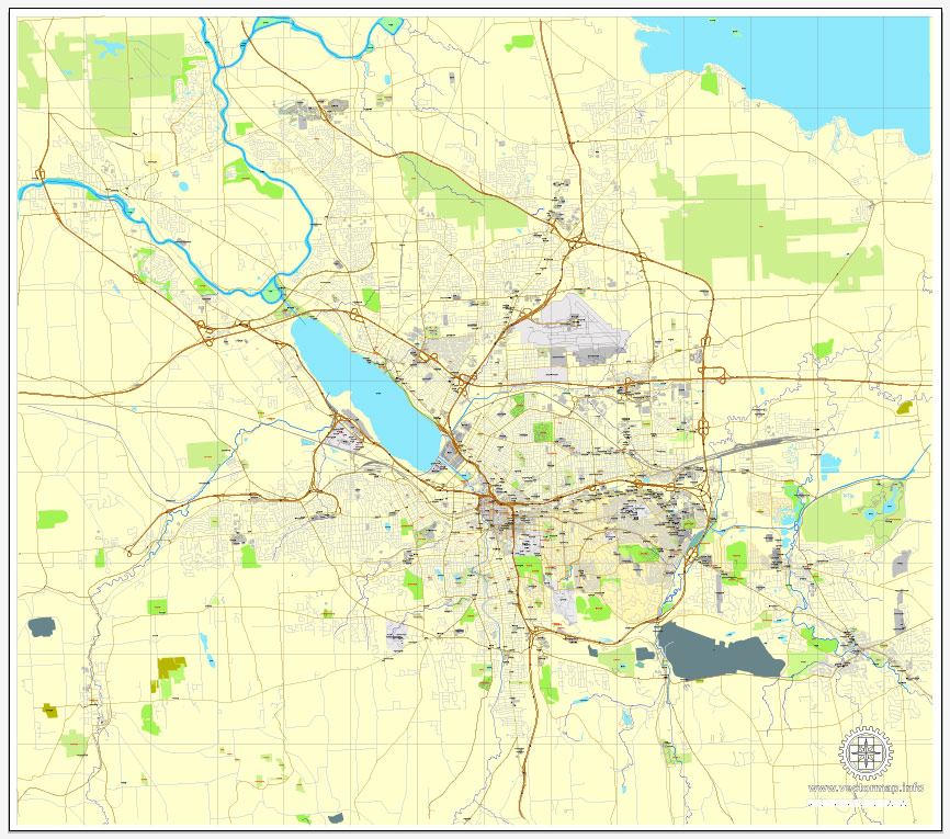
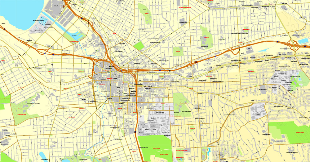
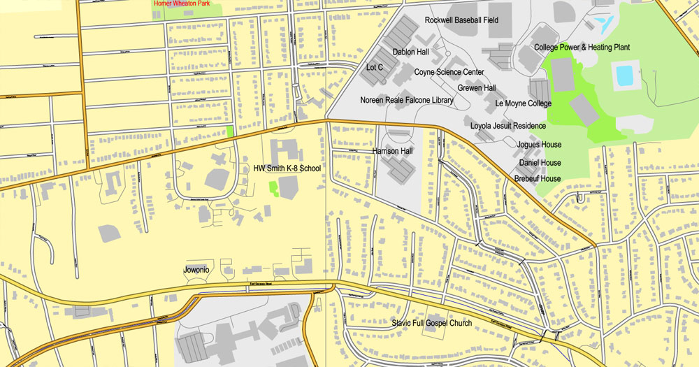
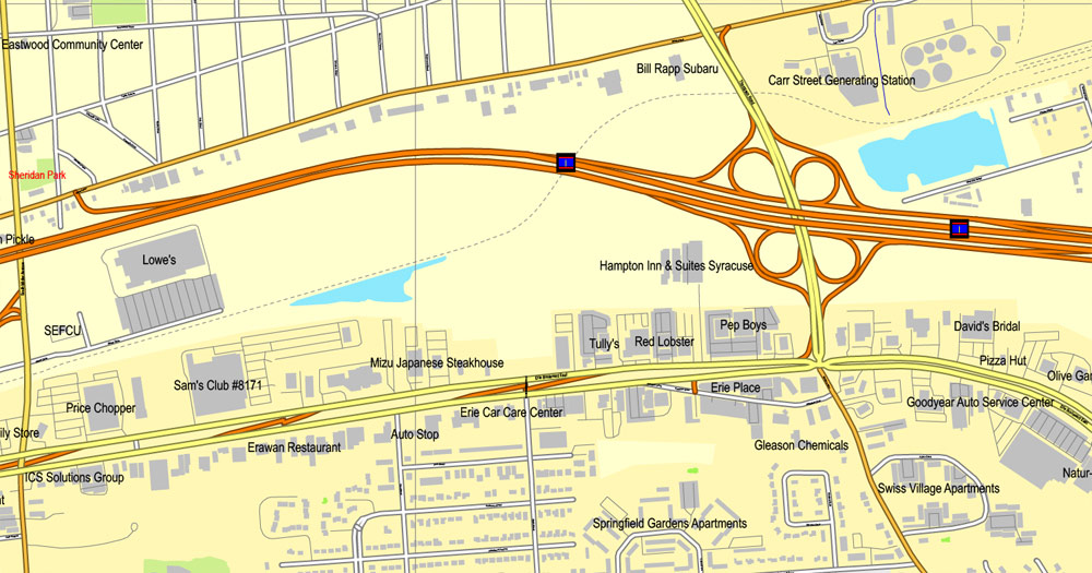
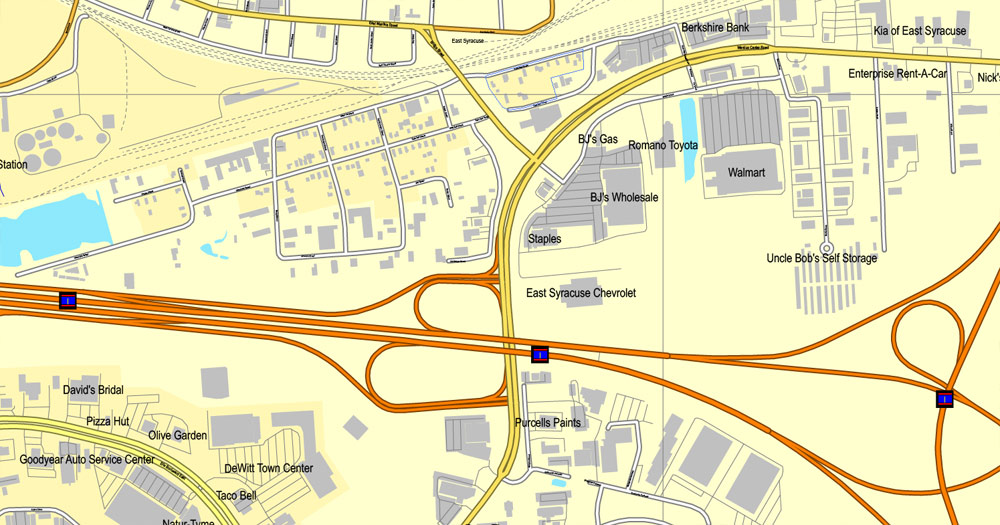
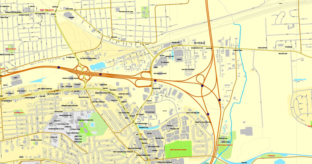
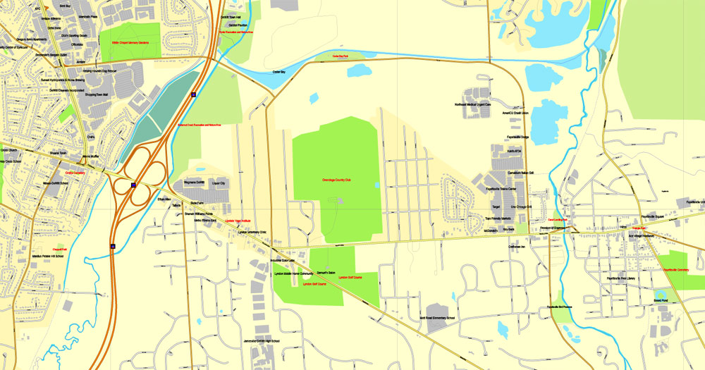
Syracuse, New York, US, exact vector street City Plan map V2.09, full editable, Adobe PDF, full vector, scalable, editable text format street names, 13 mb ZIP
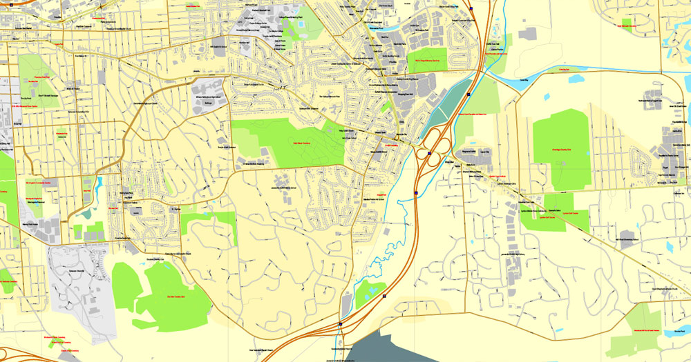
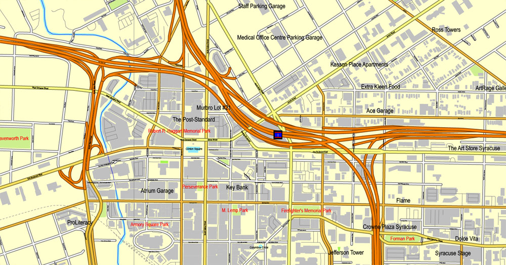
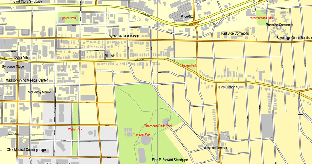
All streets, Some more buildings. Map for publishing, design, printing, publications, arts, projects, presentations, for architects, designers and builders, business, logistics. The most exact and detailed map of the city.
You can edit this file by Adobe Illustrator, Adobe Acrobat, Corel Draw.
DXF, DWG, CDR and other formats – on request, same price, please, contact
Syracuse, New York, USA.
This vector map of Syracuse is used as a basis for design, editing, and further printing.
This is the most detailed, exact map of Syracuse for high-quality printing and polygraphy. You can always clarify the map development date by contacting us.
For your convenience, all objects on Syracuse vector map are divided into layers. And the editing is very easy – colors, lines, etc.
You can easily add any objects needed (e.g. shops, salons, sale points, gas station or attraction) on any layer of Syracuse vector map.
Syracuse is a city in and the county seat of Onondaga County, New York, in the United States. It is the fifth-most populous city in the state of New York following New York City, Buffalo, Rochester, and Yonkers.
One of the advantages of Syracuse vector maps of our production is the relevance of cartographic data, we constantly update all our products.
This vector map of Syracuse is used by:
designers, layout designers, printers, advertisers and architects. Our product – vector maps – is designed for further editing and printing in large formats – from @Wall format (a few meters) to A-0 and A-1, A-2, A-3.
Syracuse map in vector format is used for design, urban planning, presentations and media visualizations.
Advertising and presentation map of Syracuse (usually the final designer marks the routes, and puts the client’s objects (shops, saloons, gas stations etc.)
The undoubted advantage is that people will NEVER throw out this advertising product – the map. In fact, as an advertising medium, a map is the most “long-playing” of the well-known polygraphic advertising media, with the longest lifespan, and the maximum number of interactions with the customer.
For travelers, maps are sold at the airports and gas stations around the world. Often the source is our vector maps.
Take a look, who purchases our vector maps of Syracuse in “Our Clients and Friends” page – these are large and small companies, from super-brands like Volvo and Starbucks, to small design studios and printing houses.
It’s very easy to work with vector maps of Syracuse, even for a not very experienced designer who can turn on and off the map layers, add new objects, change the colors of fill and lines according to customer requirements.
The undoubted advantage of Syracuse vector maps in printing is an excellent and detailed visualization, when customer can expand a large paper map and instantly define his location, find a landmark, an object or address on map, unlike using the popular electronic formats of Google and Yandex maps for example.
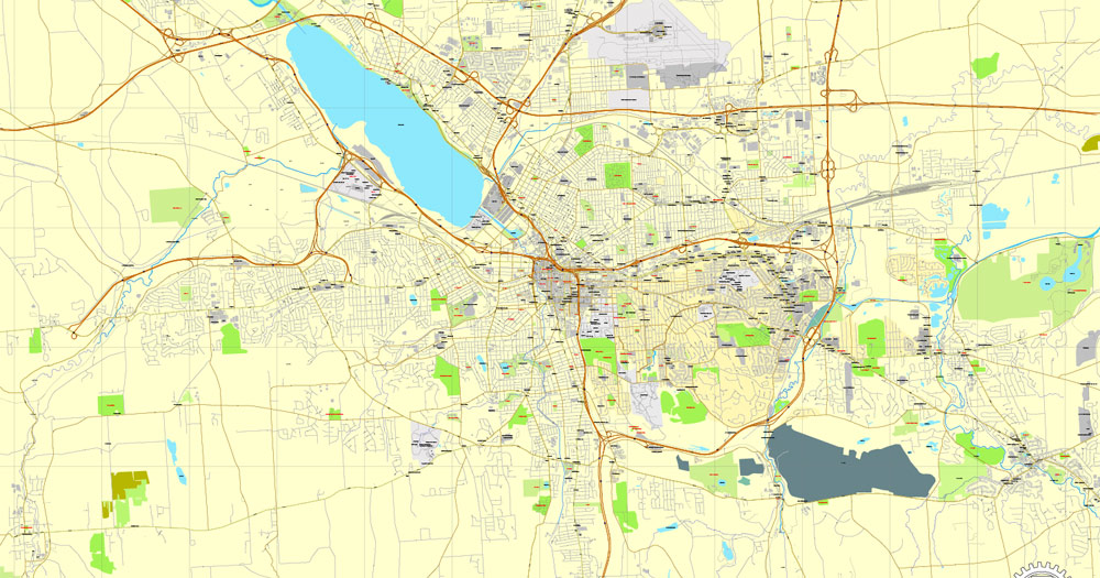
Printable vector maps of Syracuse are much more convenient and efficient than any electronic maps on your smartphone, because ALL DETAILS are displayed in the entire space of Syracuse map.
Useful tips on working with vector maps of cities and countries in Adobe Illustrator.
«V» – launches the Selection tool (cursor, black arrow), which makes active any vector line.
«А» – launches the Direct Selection tool (white cursor), allows you to select curve elements and drag them to the desired place.
«R» – activates the Rotate tool, which helps you rotating selected objects around the center point by 360 degrees.
«E» – gives you the opportunity to use the Eraser tool and erase unnecessary parts.
«X» – switches between Fill and Stroke in the Tools section. Try to get used to this hot key and
you will quickly understand that you can’t live and work without it.
Guides are not limited to vertical and horizontal in Adobe Illustrator. You can also create a diagonal guide for example. Moreover, you can turn any contours into guides. Select the outline and go to View > Guides > Make Guides (Create Guides), or simply press Cmd/Ctrl + 5. You can also turn the guides back into an editable object. Go to menu, View > Guides > Unlock Guides (Release Guides), select the guide you want to edit and select View > Guides > Release Guides (Reset Guides), or just press Cmd/Ctrl + Option / Alt + 5).
You will probably want to change the color scheme used on our Syracuse vector map.
To quickly and effectively play with colors.
Of course, you can do it manually, all objects in our Syracuse vector map are divided according to types and layers, and you can easily change the color gamma of vector objects in groups and layers.
But there is more effective way of working with the whole VECTOR MAP of Syracuse and all layers:
The overview dialog «Edit colors»/«Repaint Graphic Object» (this dialog box name can change depending on the context):
If you have selected a part or a layer of Syracuse vector map and open the dialog box by clicking the icon in the Control panel, on the Samples palette or the Color Catalog, or if you choose Edit > Edit Colors> Repaint Graphic Object, then the «Repaint Graphic Object» dialog box appears, and you get access to «Assign» and «Edit» tabs.
If a picture or a map fragment is not selected, and you open the dialog box by clicking the icon in the Control panel, on the Samples palette or in the Color Catalog, the «Edit Colors» dialog box appears and you can only access the «Edit» tab.
Regardless of the name at the top of the dialog box, the right-hand side always displays the color group of the current document, as well as two default color groups: Print Color and Grayscale. These color groups can be selected and used any time.
Create and edit color groups of Syracuse vector map, and also assign colors using the «Edit Colors»/ а «Repaint Graphic Object» dialog box.
A. Creating and editing of a color group on the «Edit» tab
B. Assigning colors on the «Assign» tab
C. Select a group of colors from the «Color groups» list
The option «Repaint a graphic object» in the lower part of the dialog box allows you to preview the colors on a selected layer of Vector map, or a group of elements, and specify whether its colors will be redefined when the dialog box is closed.
The main areas of the dialog box are:
«Edit»
The «Edit» tab is designed to create a new or edit the existing color groups.
The harmony rules Menu and the Color Wheel are used to conduct experiments with color harmonies. The color wheel shows how colors are related in color harmony, and the color bars allow you to view and manipulate an individual color values. In addition, you can adjust the brightness, add and remove colors, save color groups and view colors on the selected Vector Map of Syracuse or a separated layers.
«Assign»
The «Assign» tab is used to view and control on how the original colors are replaced with colors from the color group like your corporate colors in the Vector Map of Syracuse.
The assign color ability is provided only if the entire map, layer or fragment is selected in the document. You can specify which of new colors replace the current colors, whether the spot colors should be preserved and how colors are replaced (for example, you can replace colors completely or changing the color tone while maintaining the brightness). The «Assign» tab allows you to redefine colors in the Vector Map of Syracuse, or in separate layers and fragments using the current color group or reducing the number of colors in the current Vector Map.
Color groups
Is a list of all saved color groups for current document (the same groups appear in the «Samples» palette). You can edit and delete the existing color groups, as well as creating a new ones using the list of “Color Groups” in the dialog box. All changes appear in the «Samples» palette.
The highlighted color group shows, which color group is currently edited.
At the 2010 census, the city population was 145,252, and its metropolitan area had a population of 662,577. It is the economic and educational hub of Central New York, a region with over one million inhabitants. Syracuse is also well-provided with convention sites, with a downtown convention complex. Syracuse was named after the classical Greek city Syracuse (Siracusa in Italian), a city on the eastern coast of the Italian island of Sicily.
Any color group can be selected and edited, or used to redefine the colors in the selected vector map of Syracuse , its fragments or elements.
Saving a color group adds this group to the specified list.
Opening the «Edit Colors»/«Repaint Graphic Object» dialog box.
Open the «Edit Colors»/«Repaint Graphic Object» dialog box using one of the following methods:
«Edit»> «Edit Colors»> «Repaint Graphic object» or «Repaint With Style».
Use these commands if you need to edit the colors in the selected vector map of Syracuse.
«Repaint Graphic object» button on the «Control» panel.
Use this button if you need to adjust colors of Syracuse vector map using the а «Repaint graphic object» dialog box.
The specified button is available if the selected vector map or its fragment contains two or more colors.
Note. This color editing method is convenient for global color adjustment in a vector map, if global colors were not used when creating a Map of Syracuse.
The «Edit colors» button or «Edit or apply colors» on the «Color Catalog» palette
Click this button if you need to edit colors on the «Color Catalog» palette or edit and then apply them to the selected Vector Map of Syracuse or its fragment.
The «Edit color group» button or «Edit or apply color group» on the «Samples» palette.
Click this button if you need to edit the colors in the specific color group or edit and apply them to the selected Vector Map of Syracuse or a group of its elements, for example, the whole layer “Streets and lines”. You can also double-click the color group in the Samples panel to open the dialog box.
If the map file is too large and your computer freezes or even can’t open it quickly:
1. Try to reduce the color resolution of the video card (display) to 256 colors while working with a large map.
2. Using Windows Task Manager, select all the application you don’t need, while working with map, just turn them off.
3. Launch Adobe Illustrator. (DO NOT OPEN the vector map file)
4. Start the Windows Task Manager using administrator rights > Find the “Illustrator” process > set the «real time» priority,
5. Open the file. When you see the LEGACY FONT popup window – click “OK” (do not update). You can restore the TEXT later.
6. Can also be useful: When file is opened – Edit > Settings > Basic Settings > disable smoothing. /// It looks scary, but works quickly)))
We recommend saving the file in Adobe Illustrator 10 version. It’s much more stable when working with VERY BIG size files.
The city has functioned as a major crossroads over the last two centuries, first between the Erie Canal and its branch canals, then of the railway network. Today, Syracuse is at the intersection of Interstates 81 and 90. Its airport is the largest in the region. Syracuse is home to Syracuse University, a major research university, as well as Le Moyne College, a nationally recognized liberal arts college. In 2010, Forbes rated Syracuse fourth among the top 10 places in the U.S. to raise a family.
Geography
Syracuse is located at 43°2′49″N 76°8′40″W (43.046899, -76.144423).
According to the United States Census Bureau, the city has a total area of 25.6 square miles (66 square kilometres), of which 25.1 square miles (65 square kilometres) is land and 0.6 square miles (1.6 square kilometres) (2.15%) water.
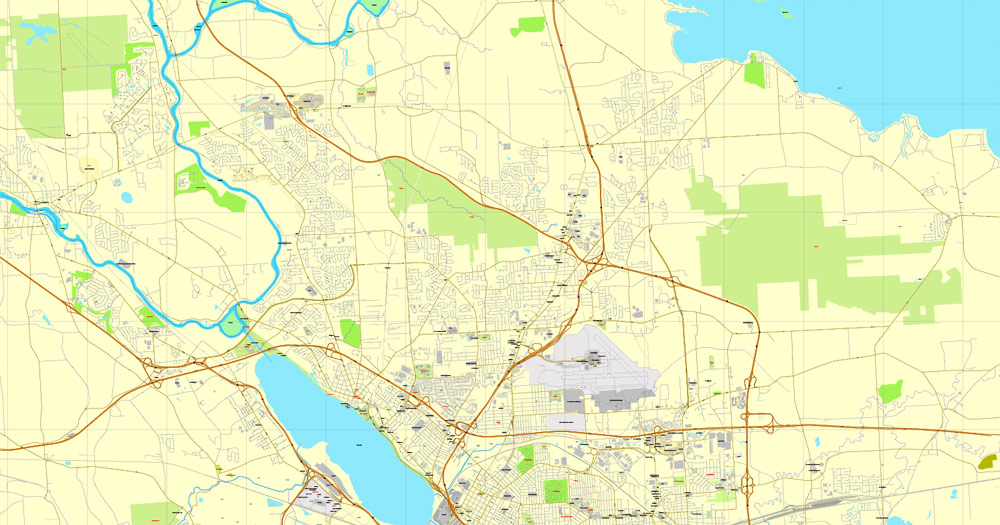
The city developed at the northeast corner of the Finger Lakes region. The city has many neighborhoods that were originally independent villages, which joined the city over the years. Although the central part of Syracuse is flat, many of its neighborhoods are on small hills such as University Hill and Tipperary Hill. Land to the north of Syracuse is generally flat, while land to the south is hilly.
About 27 percent of Syracuse’s land area is covered by 890,000 trees — a higher percentage than in Albany, Rochester or Buffalo. The Labor Day Storm of 1998 was a derecho that destroyed approximately 30,000 trees. The sugar maple accounts for 14.2 percent of Syracuse’s trees, followed by the Northern white cedar (9.8 percent) and the European buckthorn (6.8 percent). The most common street tree is the Norway maple (24.3 percent), followed by the honey locust (9.3 percent).
The densest tree cover in Syracuse is in the two Valley neighborhoods, where 46.6 percent of the land is covered by trees. The lowest tree cover percentage is found in the densely developed downtown, which has only 4.6 percent trees.
Syracuse’s main water source is Skaneateles Lake, one of the country’s cleanest lakes, located 15 miles (24 kilometres) southwest of the city. Water from nearby Onondaga Lake is not drinkable due to the industrial dumping that spanned many decades, leaving the lake heavily polluted. Incoming water is left unfiltered, and chlorine is added to prevent bacterial growth. Most of the environmental work to achieve lake cleanup is scheduled to be completed by 2016; the county is scheduled to finish its work by 2018. For periods of drought, there is also a backup line which uses water from Lake Ontario.
Onondaga Creek, a waterway that runs through downtown, flows northward through the city. A creek walk borders it and the city has plans to connect it to the Lakefront and Inner Harbor, as well as to Franklin Square, Armory Square, The Valley, and ultimately the Onondaga Nation. The creek is navigable but it can be a challenge. Its channelized nature speeds up its flow, particularly in the spring, when it may be dangerous. After some youngsters drowned in the creek, some residential areas fenced off the creek in their neighborhoods.
Free vector maps:

Free download Vector Map US Interstate roads, Adobe PDF, V.2 Free_Map_US_Interstates_Roads_2.pdf
Free download Vector Map US Interstate roads, Adobe Illustrator, V.2 Free_Map_US_Interstates_Roads_2.ai

Free Download Vector Map US County and State Adobe Illustrator
Free_Vector_Map_US_States_County_Map.ai
Free Download Vector Map US County and State Adobe PDF
Free_Vector_Map_US_States_County_Map.pdf

Free Vector Map US Census Data Top US Ancestries by County Adobe Illustrator
Free_Vector_Map_US_Census-Data-Top-US-Ancestries-by-County.ai
Free Vector Map US Census Data Top US Ancestries by County Adobe PDF
Free_Vector_Map_US_Census-Data-Top-US-Ancestries-by-County.pdf

 Author: Kirill Shrayber, Ph.D. FRGS


