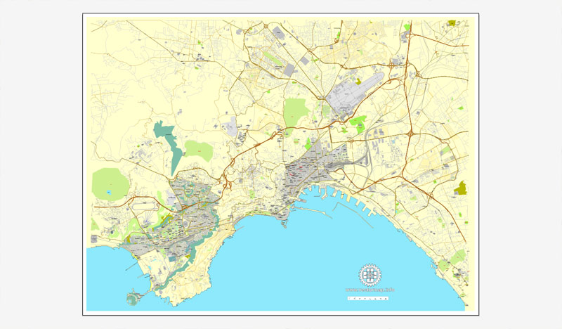
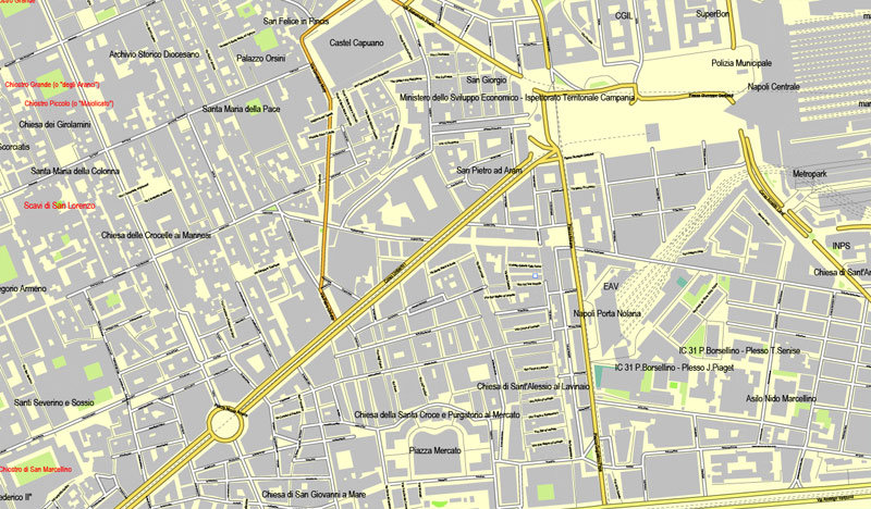
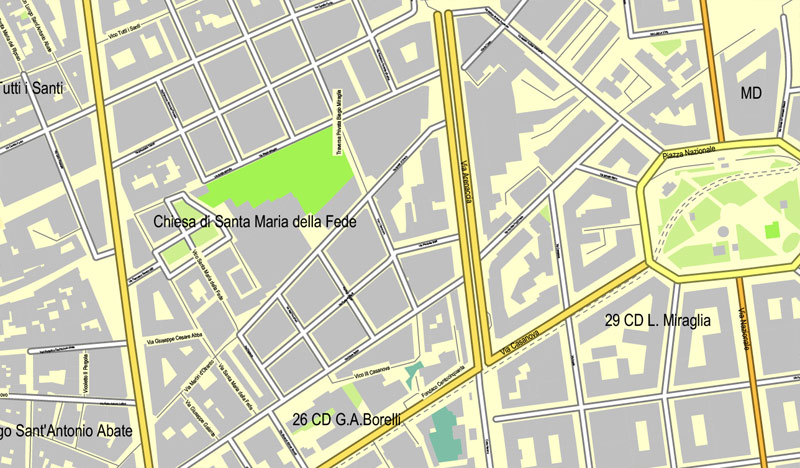
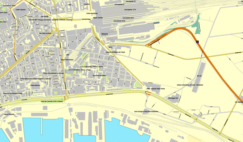
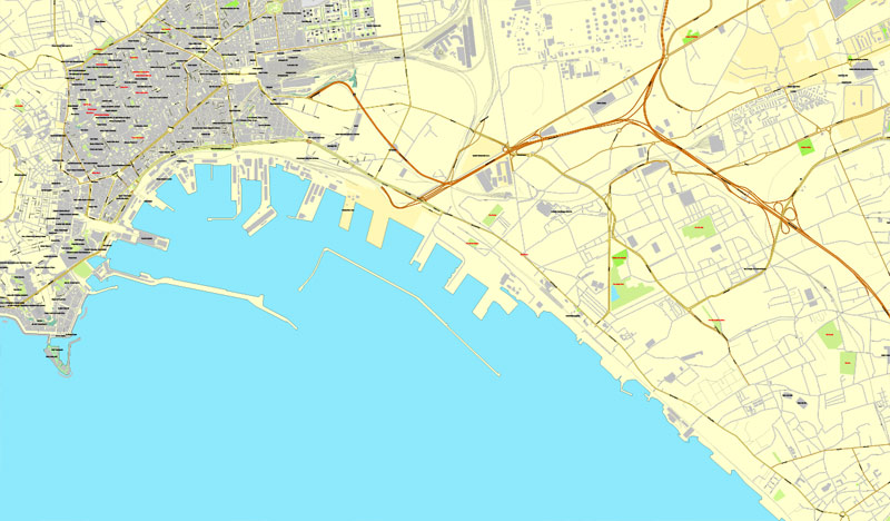
Naples / Napoli, Italy, printable vector street map City Plan, full editable, Adobe PDF, Royalty free, full vector, scalable, editable, text format street names, 9 Mb ZIP.
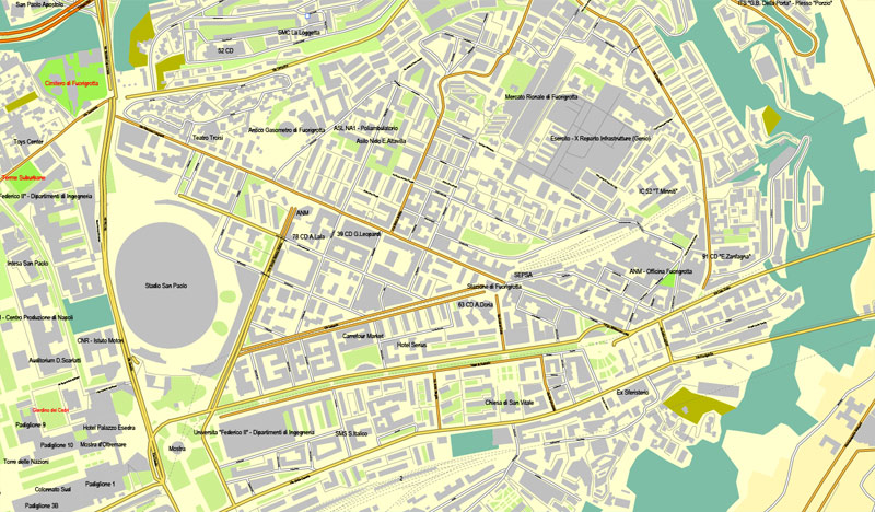
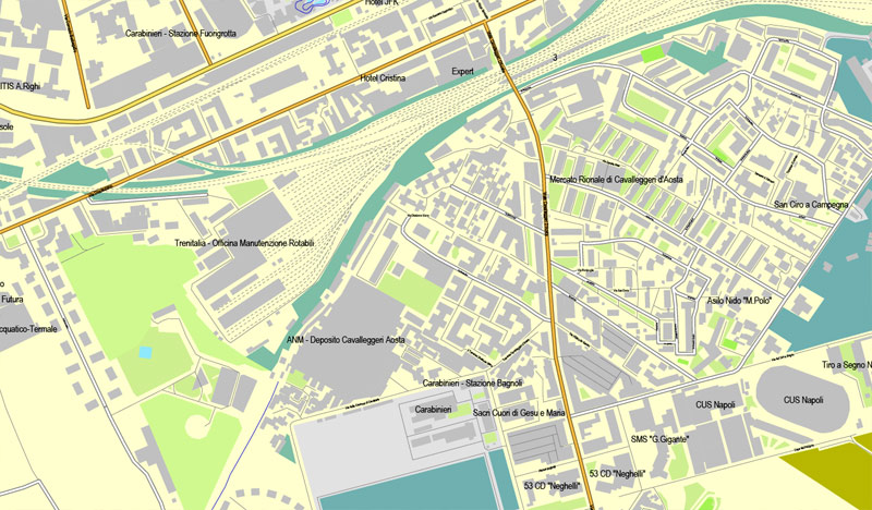
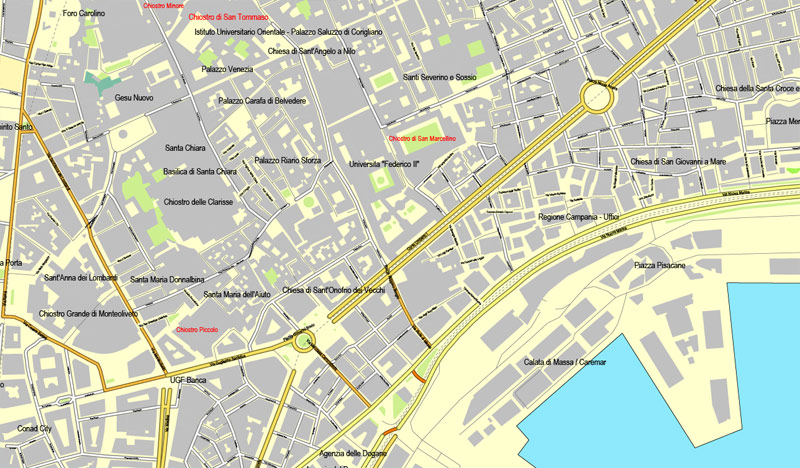
All streets, All buildings.
Map for design, print, arts, projects, presentations, for architects, designers and builders.
You can edit this file by Adobe Illustrator, Adobe Acrobat, Corel Draw.
The most accurate and detailed map of the city.
DXF, DWG, CDR and other formats – on request, same price, please contact us.
Naples / Napoli, Italia, stampabile mappa vettore via Piano Città, piena modificabile, Adobe PDF, Diritti, vettore completo, i nomi delle strade in formato testo modificabile scalabili, 9 MB zip
Tutte le strade, tutti gli edifici.
Mappa per la progettazione, la stampa, le arti, i progetti, le presentazioni, per architetti, progettisti e costruttori.
DXF, DWG, CDR e altri formati – a richiesta, lo stesso prezzo, si prega di contattare
Naples, Italy.
This vector map of Naples is used as a basis for design, editing, and further printing.
This is the most detailed, exact map of Naples for high-quality printing and polygraphy. You can always clarify the map development date by contacting us.
For your convenience, all objects on Naples vector map are divided into layers. And the editing is very easy – colors, lines, etc.
You can easily add any objects needed (e.g. shops, salons, sale points, gas station or attraction) on any layer of Naples vector map.
Naples is the regional capital of Campania and the third-largest municipality in Italy after Rome and Milan. In 2017, around 967,069 people lived within the city’s administrative limits while its province-level municipality has a population of 3,115,320 residents. Its continuously built-up metropolitan area (that stretches beyond the boundaries of the Metropolitan City of Naples) is the second or third largest metropolitan area in Italy.
One of the advantages of Naples vector maps of our production is the relevance of cartographic data, we constantly update all our products.
This vector map of Naples is used by:
designers, layout designers, printers, advertisers and architects. Our product – vector maps – is designed for further editing and printing in large formats – from @Wall format (a few meters) to A-0 and A-1, A-2, A-3.
Naples map in vector format is used for design, urban planning, presentations and media visualizations.
Advertising and presentation map of Naples (usually the final designer marks the routes, and puts the client’s objects (shops, saloons, gas stations etc.)
The undoubted advantage is that people will NEVER throw out this advertising product – the map. In fact, as an advertising medium, a map is the most “long-playing” of the well-known polygraphic advertising media, with the longest lifespan, and the maximum number of interactions with the customer.

For travelers, maps are sold at the airports and gas stations around the world. Often the source is our vector maps.
Take a look, who purchases our vector maps of Naples in “Our Clients and Friends” page – these are large and small companies, from super-brands like Volvo and Starbucks, to small design studios and printing houses.
It’s very easy to work with vector maps of Naples, even for a not very experienced designer who can turn on and off the map layers, add new objects, change the colors of fill and lines according to customer requirements.
The undoubted advantage of Naples vector maps in printing is an excellent and detailed visualization, when customer can expand a large paper map and instantly define his location, find a landmark, an object or address on map, unlike using the popular electronic formats of Google and Yandex maps for example.
Printable vector maps of Naples are much more convenient and efficient than any electronic maps on your smartphone, because ALL DETAILS are displayed in the entire space of Naples map.
Useful tips on working with vector maps of cities and countries in Adobe Illustrator.
«V» – launches the Selection tool (cursor, black arrow), which makes active any vector line.
«А» – launches the Direct Selection tool (white cursor), allows you to select curve elements and drag them to the desired place.
«R» – activates the Rotate tool, which helps you rotating selected objects around the center point by 360 degrees.
«E» – gives you the opportunity to use the Eraser tool and erase unnecessary parts.
«X» – switches between Fill and Stroke in the Tools section. Try to get used to this hot key and
you will quickly understand that you can’t live and work without it.
Guides are not limited to vertical and horizontal in Adobe Illustrator. You can also create a diagonal guide for example. Moreover, you can turn any contours into guides. Select the outline and go to View > Guides > Make Guides (Create Guides), or simply press Cmd/Ctrl + 5. You can also turn the guides back into an editable object. Go to menu, View > Guides > Unlock Guides (Release Guides), select the guide you want to edit and select View > Guides > Release Guides (Reset Guides), or just press Cmd/Ctrl + Option / Alt + 5).
You will probably want to change the color scheme used on our Naples vector map.
To quickly and effectively play with colors.
Of course, you can do it manually, all objects in our Naples vector map are divided according to types and layers, and you can easily change the color gamma of vector objects in groups and layers.
But there is more effective way of working with the whole VECTOR MAP of Naples and all layers:
The overview dialog «Edit colors»/«Repaint Graphic Object» (this dialog box name can change depending on the context):
If you have selected a part or a layer of Naples vector map and open the dialog box by clicking the icon in the Control panel, on the Samples palette or the Color Catalog, or if you choose Edit > Edit Colors> Repaint Graphic Object, then the «Repaint Graphic Object» dialog box appears, and you get access to «Assign» and «Edit» tabs.
If a picture or a map fragment is not selected, and you open the dialog box by clicking the icon in the Control panel, on the Samples palette or in the Color Catalog, the «Edit Colors» dialog box appears and you can only access the «Edit» tab.
First settled by Greeks in the second millennium BC, Naples is one of the oldest continuously inhabited urban areas in the world. In the ninth century BC, a colony known as Parthenope or Παρθενόπη was established on the Island of Megaride, later refounded as Neápolis in the sixth century BC. The city was an important part of Magna Graecia, played a major role in the merging of Greek and Roman society and a significant cultural centre under the Romans. It served as the capital of the Duchy of Naples (661–1139), then of the Kingdom of Naples (1282–1816) and finally of the Two Sicilies until the unification of Italy in 1861.
Regardless of the name at the top of the dialog box, the right-hand side always displays the color group of the current document, as well as two default color groups: Print Color and Grayscale. These color groups can be selected and used any time.
Create and edit color groups of Naples vector map, and also assign colors using the «Edit Colors»/ а «Repaint Graphic Object» dialog box.
A. Creating and editing of a color group on the «Edit» tab
B. Assigning colors on the «Assign» tab
C. Select a group of colors from the «Color groups» list
The option «Repaint a graphic object» in the lower part of the dialog box allows you to preview the colors on a selected layer of Vector map, or a group of elements, and specify whether its colors will be redefined when the dialog box is closed.
The main areas of the dialog box are:
«Edit»
The «Edit» tab is designed to create a new or edit the existing color groups.
The harmony rules Menu and the Color Wheel are used to conduct experiments with color harmonies. The color wheel shows how colors are related in color harmony, and the color bars allow you to view and manipulate an individual color values. In addition, you can adjust the brightness, add and remove colors, save color groups and view colors on the selected Vector Map of Naples or a separated layers.
«Assign»
The «Assign» tab is used to view and control on how the original colors are replaced with colors from the color group like your corporate colors in the Vector Map of Naples.
The assign color ability is provided only if the entire map, layer or fragment is selected in the document. You can specify which of new colors replace the current colors, whether the spot colors should be preserved and how colors are replaced (for example, you can replace colors completely or changing the color tone while maintaining the brightness). The «Assign» tab allows you to redefine colors in the Vector Map of Naples, or in separate layers and fragments using the current color group or reducing the number of colors in the current Vector Map.

Color groups
Is a list of all saved color groups for current document (the same groups appear in the «Samples» palette). You can edit and delete the existing color groups, as well as creating a new ones using the list of “Color Groups” in the dialog box. All changes appear in the «Samples» palette.
The highlighted color group shows, which color group is currently edited.
Any color group can be selected and edited, or used to redefine the colors in the selected vector map of Naples, its fragments or elements.
Saving a color group adds this group to the specified list.
Opening the «Edit Colors»/«Repaint Graphic Object» dialog box.
Open the «Edit Colors»/«Repaint Graphic Object» dialog box using one of the following methods:
«Edit»> «Edit Colors»> «Repaint Graphic object» or «Repaint With Style».
Use these commands if you need to edit the colors in the selected vector map of Naples.
«Repaint Graphic object» button on the «Control» panel.
Use this button if you need to adjust colors of Naples vector map using the а «Repaint graphic object» dialog box.
The specified button is available if the selected vector map or its fragment contains two or more colors.
Note. This color editing method is convenient for global color adjustment in a vector map, if global colors were not used when creating a Map of Naples.
The «Edit colors» button or «Edit or apply colors» on the «Color Catalog» palette
Click this button if you need to edit colors on the «Color Catalog» palette or edit and then apply them to the selected Vector Map of Naples or its fragment.
The «Edit color group» button or «Edit or apply color group» on the «Samples» palette.
Click this button if you need to edit the colors in the specific color group or edit and apply them to the selected Vector Map of Naples or a group of its elements, for example, the whole layer “Streets and lines”. You can also double-click the color group in the Samples panel to open the dialog box.
If the map file is too large and your computer freezes or even can’t open it quickly:
1. Try to reduce the color resolution of the video card (display) to 256 colors while working with a large map.
2. Using Windows Task Manager, select all the application you don’t need, while working with map, just turn them off.
3. Launch Adobe Illustrator. (DO NOT OPEN the vector map file)
4. Start the Windows Task Manager using administrator rights > Find the “Illustrator” process > set the «real time» priority,
5. Open the file. When you see the LEGACY FONT popup window – click “OK” (do not update). You can restore the TEXT later.
6. Can also be useful: When file is opened – Edit > Settings > Basic Settings > disable smoothing. /// It looks scary, but works quickly)))
We recommend saving the file in Adobe Illustrator 10 version. It’s much more stable when working with VERY BIG size files.
Between 1925 and 1936, Naples was expanded and upgraded by Benito Mussolini’s government but subsequently sustained severe damage from Allied bombing during World War II, which led to extensive post-1945 reconstruction work. Naples has experienced significant economic growth in recent decades, helped by the construction of the Centro Direzionale business district and an advanced transportation network, which includes the Alta Velocità high-speed rail link to Rome and Salerno and an expanded subway network. Naples is the third-largest urban economy in Italy, after Milan and Rome. The Port of Naples is one of the most important in Europe and home of the Allied Joint Force Command Naples, the NATO body that oversees North Africa, the Sahel and Middle East.
Naples’ historic city centre is the largest in Europe and a UNESCO World Heritage Site, with a wide range of culturally and historically significant sites nearby, including the Palace of Caserta and the Roman ruins of Pompeii and Herculaneum. Naples is also known for its natural beauties such as Posillipo, Phlegraean Fields, Nisida, and Vesuvius.
Neapolitan cuisine is synonymous with pizza – which originated in the city – but it also includes many lesser-known dishes; Naples has the greatest number of accredited stars from the Michelin Guide of any Italian city.
The best-known sports team in Naples is the Serie A club S.S.C. Napoli, two-time Italian champions who play at the San Paolo Stadium in the southwest of the city.
See more Italian cities vector maps for printing, editable
For example: Printable City plan map of Rome Italy
Napoli/Naples vector map, Italy
Vector map of Bologna (Italy, Europe) Atlas 25 parts
Florentia / Florence / Firenze vector map, Italy
Detailed vector map of Milano (Italy) Atlas 49 parts
Naples,Italian: Napoli, Neapolitan: Napule or; Latin: Neapolis; Ancient Greek: Νεάπολις, meaning “new city” is the capital of the Italian region Campania and the third-largest municipality in Italy, after Rome and Milan. In 2015, around 975,260 people lived within the city’s administrative limits. The Metropolitan City of Naples had a population of 3,115,320. Naples is the 9th-most populous urban area in the European Union with a population of between 3 million and 3.7 million. About 4.4 million people live in the Naples metropolitan area, one of the largest metropolises on the Mediterranean Sea.
Naples is one of the oldest continuously inhabited cities in the world. Bronze Age Greek settlements were established in the Naples area in the second millennium BC. A larger colony – initially known as Parthenope, Παρθενόπη – developed on the Island of Megaride around the ninth century BC, at the end of the Greek Dark Ages. The city was refounded[by whom?] as Neápolis in the sixth century BC and became a lynchpin of Magna Graecia, playing a key role in the merging of Greek culture into Roman society and eventually becoming a cultural centre of the Roman Republic. Naples remained influential after the fall of the Western Roman Empire, serving as the capital city of the Kingdom of Naples between 1282 and 1816. Thereafter, in union with Sicily, it became the capital of the Two Sicilies until the unification of Italy in 1861.
Naples was the most-bombed Italian city during World War II. Much of the city’s 20th-century periphery was constructed under Benito Mussolini’s fascist government, and during reconstruction efforts after World War II. In recent decades, Naples has constructed a large business district, the Centro Direzionale, and has developed an advanced transport infrastructure, including an Alta Velocità high-speed rail link to Rome and Salerno, and an expanded subway network, which is planned to eventually cover half of the region. The city has experienced significant economic growth in recent decades, and unemployment levels in the city and surrounding Campania have decreased since 1999. However, Naples still suffers from political and economic corruption, and unemployment levels remain high.
Naples has the fourth-largest urban economy in Italy, after Milan, Rome and Turin. It is the world’s 103rd-richest city by purchasing power, with an estimated 2011 GDP of US$83.6 billion. The port of Naples is one of the most important in Europe, and has the world’s second-highest level of passenger flow, after the port of Hong Kong. Numerous major Italian companies, such as MSC Cruises Italy S.p.A, are headquartered in Naples street map. The city also hosts NATO’s Allied Joint Force Command Naples, the SRM Institution for Economic Research and the OPE Company and Study Centre. Naples is a full member of the Eurocities network of European cities. The city was selected to become the headquarters of the European institution ACP/UE and was named a City of Literature by UNESCO’s Creative Cities Network. The Villa Rosebery, one of the three official residences of the President of Italy, is located in the city’s Posillipo district.
Naples‘ historic city centre is the largest in Europe, covering 1,700 hectares (4,200 acres) and enclosing 27 centuries of history, and is listed by UNESCO as a World Heritage Site. Naples has long been a major cultural centre with a global sphere of influence, particularly during the Renaissance and Enlightenment eras. In the immediate vicinity of Naples are numerous culturally and historically significant sites, including the Palace of Caserta and the Roman ruins of Pompeii and Herculaneum. Culinarily, Naples street plan is synonymous with pizza, which originated in the city. Neapolitan music has furthermore been highly influential, credited with the invention of the romantic guitar and the mandolin, as well as notable contributions to opera and folk standards. Popular characters and historical figures who have come to symbolise the city include Januarius, the patron saint of Naples, the comic figure Pulcinella, and the Sirens from the Greek epic poem the Odyssey. According to CNN, the metro stop “Toledo” is the most beautiful in Europe and it won also the LEAF Award ‘2013 as “Public building of the year”. Naples is the Italian city with the highest number of accredited stars from the Michelin Guide.
Naples’ sports scene is dominated by football and Serie A club S.S.C. Napoli, two-time Italian champions and winner of European trophies, who play at the San Paolo Stadium in the south-west of the city.
Geography of Naples
The city is situated on the Gulf of Naples, on the western coast of Southern Italy; it rises from sea level to an elevation of 450 metres (1,480 ft). The small rivers which formerly crossed the centre of the city have since been covered over by construction. It lies between two notable volcanic regions, Mount Vesuvius and the Campi Flegrei (en: Phlegraean Fields). The islands of Procida, Capri and Ischia can all be reached from Naples map in vector by hydrofoils and ferries. Sorrento and the Amalfi Coast are situated south of the city, while the Roman ruins of Pompeii, Herculaneum, Oplontis and Stabiae, which were destroyed in the eruption of Vesuvius in 79 AD, are also visible nearby. The port towns of Pozzuoli and Baia, which were part of the Roman naval facility of Portus Julius, lie to the north of the city.
Quarters Naples
The quarters of Naples.
The thirty quarters (quartieri) of Naples are listed below. For administrative purposes, these thirty neighbourhoods are grouped together into ten governmental community boards.
1. Pianura
2. Bagnoli
3. Posillipo
4. Fuorigrotta
5. Soccavo
6. Chiaiano
7. Arenella
8. Vomero
9. Chiaia
10. San Ferdinando
11. Montecalvario
12. San Giuseppe
13. Avvocata
14. Porto
15. Pendino
16. San Lorenzo
17. Mercato
18. Vicaria
19. Stella
20. San Carlo all’Arena
21. Piscinola-Marianella
22. Scampìa
23. Miano
24. Secondigliano
25. S.Pietro a Patierno
26. Poggioreale
27. Zona Industriale
28. San Giovanni a Teduccio
29. Barra
30. Ponticelli
Source
Napoli, Nàpule in lingua napoletana, pronuncia [ˈnɑːpulə] o [ˈnɑːpələ]) è un comune italiano di 971 849 abitanti, terzo in Italia per popolazione, capoluogo della omonima città metropolitana e della regione Campania, centro di una delle aree urbane più popolose e densamente abitate dell’Unione europea.
Fondata dai Cumani nell’VIII secolo a.C., fu tra le città egemoni della Magna Græcia, grazie al rapporto privilegiato con Atene, ed esercitò una notevole influenza commerciale, culturale e religiosa sulle popolazioni italiche circostanti tanto da diventare il centro della filosofia epicurea in Italia. Dopo il crollo dell’Impero romano, nell’VIII secolo la città formò un ducato autonomo indipendente dall’Impero bizantino; in seguito, dal XIII secolo e per circa seicento anni, fu capitale del regno di Napoli. Divenuta capitale del Regno delle Due Sicilie sotto i Borbone, ebbe un periodo di sviluppo socioeconomico culminato in una serie di primati civili e tecnologici tra cui la costruzione della prima ferrovia in Italia. Dopo l’annessione al Regno d’Italia soffrì di un sensibile declino esteso anche a tutto il sud Italia. Per motivi storici, artistici, politici ed ambientali è stata, dal IX secolo fino ad oggi, tra i principali centri di riferimento culturale d’Europa.
Sede della Federico II, la più antica università statale d’Europa, ospita altresì l’Orientale, la più antica università di studi sinologici ed orientalistici del continente e la Nunziatella, una delle più antiche accademie militari al mondo, eletta patrimonio storico e culturale dei Paesi del Mediterraneo da parte dell’Assemblea parlamentare del Mediterraneo. Luogo d’origine della lingua napoletana, ha esercitato ed esercita un forte ruolo in numerosi campi del sapere, della cultura e dell’immaginario collettivo a livello nazionale ed internazionale.
Punto focale dell’Umanesimo attraverso l’Accademia Pontaniana, centro della filosofia naturalistica del rinascimento, culla dell’illuminismo in Italia, è stata lungamente un punto di riferimento globale per la musica classica e l’opera attraverso la scuola musicale napoletana, dando tra l’altro origine all’opera buffa. Città dall’imponente tradizione nel campo delle arti figurative, che affonda le proprie radici nell’età classica, ha dato luogo a movimenti architettonici e pittorici originali, quali il rinascimento e il barocco napoletano, il caravaggismo, la scuola di Posillipo ed il Liberty napoletano, nonché ad arti minori ma di rilevanza internazionale, quali la porcellana di Capodimonte ed il presepe napoletano. È all’origine di una forma distintiva di teatro, di una canzone di fama mondiale e di una peculiare tradizione culinaria che comprende alimenti che assumono il ruolo di icone globali, come la pizza napoletana.
Nel 1995 il centro storico di Napoli mappa vettoriale, il più vasto d’Europa, è stato riconosciuto dall’UNESCO come patrimonio mondiale dell’umanità. Nel 1997 l’apparato vulcanico Somma-Vesuvio è stato eletto dalla stessa agenzia internazionale (con il vicino Miglio d’Oro, in cui ricadono anche i quartieri napoletani di San Giovanni a Teduccio, Barra e Ponticelli) tra le riserve mondiali della biosfera.
Territorio Napoli
Napoli sorge quasi al centro dell’omonimo golfo, dominato dal massiccio vulcanico Vesuvio e delimitato ad est dalla penisola sorrentina con Punta Campanella, ad ovest dai Campi Flegrei con Monte di Procida, a nord ovest-est dal versante meridionale della piana campana che si estende dal lago Patria al nolano.
La città storica è andata sviluppandosi prevalentemente sulla costa. Il territorio di Napoli è composto prevalentemente da colline (molti di questi rilievi superano i 150 metri d’altezza per giungere fino ai 452 m della collina dei Camaldoli), ma anche da isole, insenature e penisole a strapiombo sul Mar Tirreno.
Il territorio urbano, limitato a occidente dal complesso vulcanico a crateri multipli dei Campi Flegrei, ed a oriente dal Somma-Vesuvio, ha una storia geologicamente complessa. Il substrato su cui poggia la città ha origine eminentemente vulcanica, ed è il prodotto di una serie di eruzioni dei due complessi. Per quanto riguarda il gruppo dei Campi Flegrei, avvenute nel tardo Pliocene o inizio Quaternario. I diversi autori distinguono tre periodi di attività, denominati Archiflegreo, ciclo antico (che portò alla formazione del caratteristico tufo giallo napoletano) e ciclo recente dei Campi Flegrei.
I materiali vulcanici costituiscono l’unica fonte litogenetica dell’area, dato che anche i depositi alluvionali, o quelli provenienti da ambiente di spiaggia, non sono altro che il risultato del rimaneggiamento delle rocce eruttive. Da un punto di vista strettamente petrografico, i materiali possono essere classificati nei tre macrogruppi: lave, materiali piroclastici lapidei e materiali piroclastici sciolti. Le lave possono essere grossolanamente suddivise in lave di origine flegrea e lave di origine vesuviana; i piroclasti lapidei comprendono tufo grigio campano, piperno, tufo giallo stratificato e tufo giallo caotico; i piroclasti sciolti comprendono invece una serie di elementi di varia origine, che al di là delle distinzioni litogenetiche possono essere classificati in rimaneggiati e non rimaneggiati.
Secondo la classificazione sismica nazionale, Napoli è ubicata in zona 2 (sismicità medio-alta), così come esposto nell’Ordinanza PCM n. 3274 del 20 gennaio 2003.
Source
Small guide: How to work with the vector map?
You can: Mass select objects by type and color – for example, the objects type “building” (they are usually dark gray) – and remove them from the map, if you do not need them in your print or design project. You can also easily change the thickness of lines (streets), just bulk selection the road by the line color.
The streets are separated by type, for example, type “residential road” are usually white with a gray stroke. Highway usually orange with a brown or dark gray stroke.
All objects are divided by types: different types of roads and streets, polygons of buildings, landfills, urban areas, parks and more other.
It is easy to change the font of inscriptions, all or each individually. Also, just can be make and any other manipulation of objects on the vector map in Adobe illustrator format.
Important: All the proportions on the map are true, that is, the relative sizes of the objects are true, because Map is based on an accurate GPS projection, and It transated into the (usual for all) the Mercator projection.
You can easily change the color, stroke and fill of any object on the map, zoom without loss of quality Image Verification.
Select object

Bulk selection the same objects on the vector map

See the bulk selected objects on the vector map

Bulk delete buildungs from the vector map

Select residencial road (small street) on the vector map

Bulk selection the same lines (streets, roads) on the full map

Create fat lines of the streets on the vector maps (bulk action) 1

Create fat lines of the streets on the vector maps (bulk action) 2

Create fat lines of the streets on the vector maps (bulk action) 3

You can easily change the color, stroke and fill of any object on the map, zoom without loss of quality Image Verification.

 Author: Kirill Shrayber, Ph.D. FRGS

