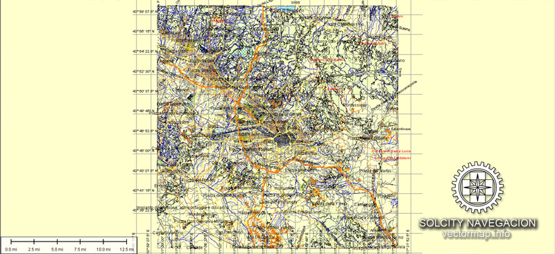
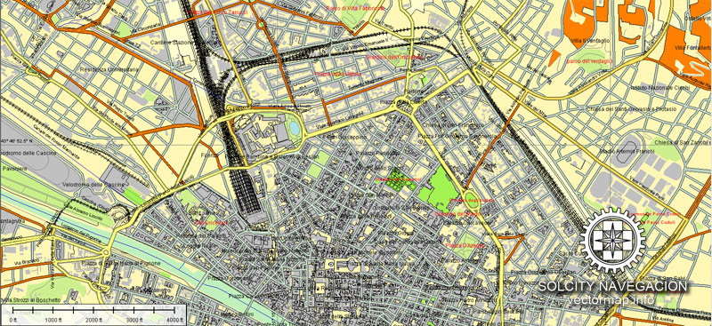
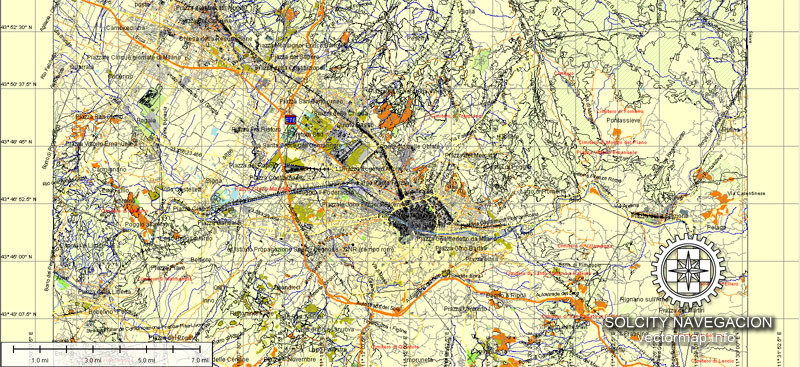
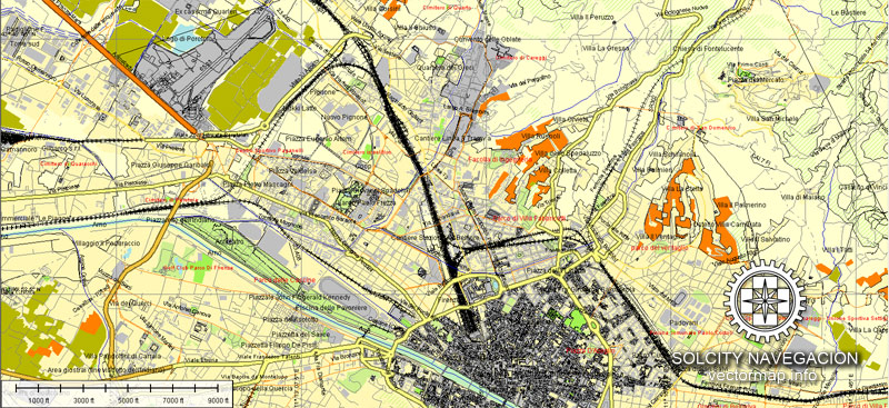
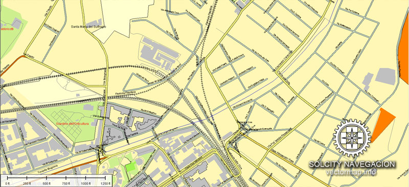
About scalable and editable vector city map of Florence (Florentia / Firenze), Italy, Europe
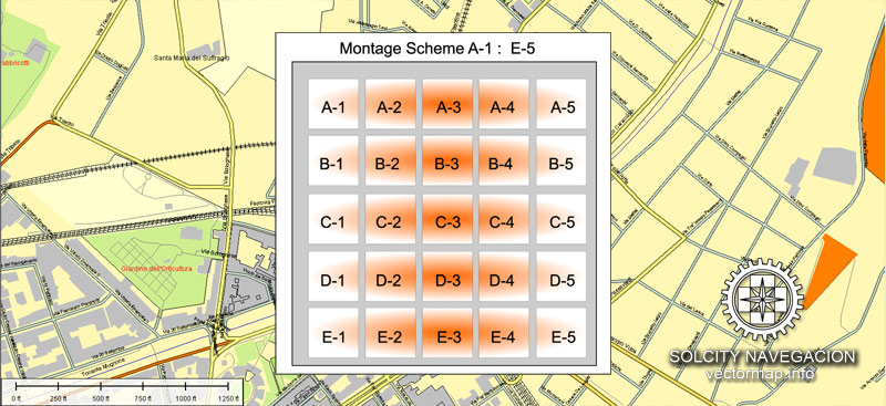
Atlas 25 parts
Archive size: 25 Mb, AI zipped
DPI: 300
License: Royalty Free
You can edit all map data using different vector graphics editors like Adobe Illustrator, Freehand or CorelDraw, cropping, changing colors, fonts or borders, also adding your company logo or necessary objects. And also is a fully scalable map, no matter what size you need.
Florence vector map features (check the preview images):
Highways with names,
Major streets with names,
Major Roads,
Airports,
Houses,
Railway,
Minor Roads,
Cemeteries,
Big and small Rivers, small streams also,
Lake, ponds and other water bodies,
Landmark fill,
County Borders with fill,
Parks.
Probably you need more data on map? Please feel free to contact us, and we add it with no problem.
Florence (Firenze), Italy.
This vector map of Florence is used as a basis for design, editing, and further printing.
This is the most detailed, exact map of Florence for high-quality printing and polygraphy. You can always clarify the map development date by contacting us.
For your convenience, all objects on Florence vector map are divided into layers. And the editing is very easy – colors, lines, etc.
You can easily add any objects needed (e.g. shops, salons, sale points, gas station or attraction) on any layer of Florence vector map.
Florence is the capital city of the Italian region of Tuscany. It is the most populous city in Tuscany, with 383,084 inhabitants in 2013, and over 1,520,000 in its metropolitan area.
One of the advantages of Florence vector maps of our production is the relevance of cartographic data, we constantly update all our products.
This vector map of Florence is used by:
designers, layout designers, printers, advertisers and architects. Our product – vector maps – is designed for further editing and printing in large formats – from @Wall format (a few meters) to A-0 and A-1, A-2, A-3.
Florence map in vector format is used for design, urban planning, presentations and media visualizations.
Advertising and presentation map of Florence (usually the final designer marks the routes, and puts the client’s objects (shops, saloons, gas stations etc.)
The undoubted advantage is that people will NEVER throw out this advertising product – the map. In fact, as an advertising medium, a map is the most “long-playing” of the well-known polygraphic advertising media, with the longest lifespan, and the maximum number of interactions with the customer.

For travelers, maps are sold at the airports and gas stations around the world. Often the source is our vector maps.
Take a look, who purchases our vector maps of Florence in “Our Clients and Friends” page – these are large and small companies, from super-brands like Volvo and Starbucks, to small design studios and printing houses.
It’s very easy to work with vector maps of Florence, even for a not very experienced designer who can turn on and off the map layers, add new objects, change the colors of fill and lines according to customer requirements.
The undoubted advantage of Florence vector maps in printing is an excellent and detailed visualization, when customer can expand a large paper map and instantly define his location, find a landmark, an object or address on map, unlike using the popular electronic formats of Google and Yandex maps for example.
Printable vector maps of Florence are much more convenient and efficient than any electronic maps on your smartphone, because ALL DETAILS are displayed in the entire space of Florence map.
Useful tips on working with vector maps of cities and countries in Adobe Illustrator.
«V» – launches the Selection tool (cursor, black arrow), which makes active any vector line.
«А» – launches the Direct Selection tool (white cursor), allows you to select curve elements and drag them to the desired place.
«R» – activates the Rotate tool, which helps you rotating selected objects around the center point by 360 degrees.
«E» – gives you the opportunity to use the Eraser tool and erase unnecessary parts.
«X» – switches between Fill and Stroke in the Tools section. Try to get used to this hot key and
you will quickly understand that you can’t live and work without it.
Guides are not limited to vertical and horizontal in Adobe Illustrator. You can also create a diagonal guide for example. Moreover, you can turn any contours into guides. Select the outline and go to View > Guides > Make Guides (Create Guides), or simply press Cmd/Ctrl + 5. You can also turn the guides back into an editable object. Go to menu, View > Guides > Unlock Guides (Release Guides), select the guide you want to edit and select View > Guides > Release Guides (Reset Guides), or just press Cmd/Ctrl + Option / Alt + 5).
You will probably want to change the color scheme used on our Florence vector map.
To quickly and effectively play with colors.
Of course, you can do it manually, all objects in our Florence vector map are divided according to types and layers, and you can easily change the color gamma of vector objects in groups and layers.
But there is more effective way of working with the whole VECTOR MAP of Florence and all layers:
The overview dialog «Edit colors»/«Repaint Graphic Object» (this dialog box name can change depending on the context):
If you have selected a part or a layer of Florence vector map and open the dialog box by clicking the icon in the Control panel, on the Samples palette or the Color Catalog, or if you choose Edit > Edit Colors> Repaint Graphic Object, then the «Repaint Graphic Object» dialog box appears, and you get access to «Assign» and «Edit» tabs.
If a picture or a map fragment is not selected, and you open the dialog box by clicking the icon in the Control panel, on the Samples palette or in the Color Catalog, the «Edit Colors» dialog box appears and you can only access the «Edit» tab.
Regardless of the name at the top of the dialog box, the right-hand side always displays the color group of the current document, as well as two default color groups: Print Color and Grayscale. These color groups can be selected and used any time.

Create and edit color groups of Florence vector map, and also assign colors using the «Edit Colors»/ а «Repaint Graphic Object» dialog box.
A. Creating and editing of a color group on the «Edit» tab
B. Assigning colors on the «Assign» tab
C. Select a group of colors from the «Color groups» list
The option «Repaint a graphic object» in the lower part of the dialog box allows you to preview the colors on a selected layer of Vector map, or a group of elements, and specify whether its colors will be redefined when the dialog box is closed.
The main areas of the dialog box are:
«Edit»
The «Edit» tab is designed to create a new or edit the existing color groups.
The harmony rules Menu and the Color Wheel are used to conduct experiments with color harmonies. The color wheel shows how colors are related in color harmony, and the color bars allow you to view and manipulate an individual color values. In addition, you can adjust the brightness, add and remove colors, save color groups and view colors on the selected Vector Map of Florence or a separated layers.
«Assign»
The «Assign» tab is used to view and control on how the original colors are replaced with colors from the color group like your corporate colors in the Vector Map of Florence.
The assign color ability is provided only if the entire map, layer or fragment is selected in the document. You can specify which of new colors replace the current colors, whether the spot colors should be preserved and how colors are replaced (for example, you can replace colors completely or changing the color tone while maintaining the brightness). The «Assign» tab allows you to redefine colors in the Vector Map of Florence, or in separate layers and fragments using the current color group or reducing the number of colors in the current Vector Map.
Color groups
Is a list of all saved color groups for current document (the same groups appear in the «Samples» palette). You can edit and delete the existing color groups, as well as creating a new ones using the list of “Color Groups” in the dialog box. All changes appear in the «Samples» palette.
The highlighted color group shows, which color group is currently edited.
Any color group can be selected and edited, or used to redefine the colors in the selected vector map of Florence, its fragments or elements.
Saving a color group adds this group to the specified list.
Opening the «Edit Colors»/«Repaint Graphic Object» dialog box.
Open the «Edit Colors»/«Repaint Graphic Object» dialog box using one of the following methods:
«Edit»> «Edit Colors»> «Repaint Graphic object» or «Repaint With Style».
Use these commands if you need to edit the colors in the selected vector map of Florence.
«Repaint Graphic object» button on the «Control» panel.
Use this button if you need to adjust colors of Florence vector map using the а «Repaint graphic object» dialog box.
The specified button is available if the selected vector map or its fragment contains two or more colors.
Note. This color editing method is convenient for global color adjustment in a vector map, if global colors were not used when creating a Map of Florence.
The «Edit colors» button or «Edit or apply colors» on the «Color Catalog» palette
Click this button if you need to edit colors on the «Color Catalog» palette or edit and then apply them to the selected Vector Map of Florence or its fragment.
The «Edit color group» button or «Edit or apply color group» on the «Samples» palette.
Click this button if you need to edit the colors in the specific color group or edit and apply them to the selected Vector Map of Florence or a group of its elements, for example, the whole layer “Streets and lines”. You can also double-click the color group in the Samples panel to open the dialog box.
If the map file is too large and your computer freezes or even can’t open it quickly:
1. Try to reduce the color resolution of the video card (display) to 256 colors while working with a large map.
2. Using Windows Task Manager, select all the application you don’t need, while working with map, just turn them off.
3. Launch Adobe Illustrator. (DO NOT OPEN the vector map file)
4. Start the Windows Task Manager using administrator rights > Find the “Illustrator” process > set the «real time» priority,
5. Open the file. When you see the LEGACY FONT popup window – click “OK” (do not update). You can restore the TEXT later.
6. Can also be useful: When file is opened – Edit > Settings > Basic Settings > disable smoothing. /// It looks scary, but works quickly)))
We recommend saving the file in Adobe Illustrator 10 version. It’s much more stable when working with VERY BIG size files.
Florence was a centre of medieval European trade and finance and one of the wealthiest cities of that era. It is considered the birthplace of the Renaissance, and has been called “the Athens of the Middle Ages”. A turbulent political history includes periods of rule by the powerful Medici family and numerous religious and republican revolutions. From 1865 to 1871 the city was the capital of the recently established Kingdom of Italy. The Florentine dialect forms the base of Standard Italian and it became the language of culture throughout Italy due to the prestige of the masterpieces by Dante Alighieri, Petrarch, Giovanni Boccaccio, Niccolò Machiavelli and Francesco Guicciardini.
The city attracts millions of tourists each year, and the Historic Centre of Florence was declared a World Heritage Site by UNESCO in 1982. The city is noted for its culture, Renaissance art and architecture and monuments. The city also contains numerous museums and art galleries, such as the Uffizi Gallery and the Palazzo Pitti, and still exerts an influence in the fields of art, culture and politics. Due to Florence’s artistic and architectural heritage, it has been ranked by Forbes as one of the most beautiful cities in the world.
Florence is an important city in Italian fashion, being ranked in the top 15 fashion capitals of the world; furthermore, it is a major national economic centre, as well as a tourist and industrial hub. In 2008, the city had the 17th highest average income in Italy.
Geography
Florence lies in a basin formed by the hills of Careggi, Fiesole, Settignano, Arcetri, Poggio Imperiale and Bellosguardo (Florence). The Arno river, three other minor rivers (Mugnone, Ema and Greve) and some streams flow through it.

Cities and counties near Florence city (Firenze, Italie) vector map.
Fiesole, Polo Scientifico, Poggio Gherardo, Parco delle Cascine, Arcetri, Coverciano, San Niccolo, Bellosguardo, Porta Romana, Settignano, Vincigliata, Maiano, Ontignano, Montebeni, Candeli, Rimaggio, Bagno A Ripolo, Santa Teresa, Santa Chiara, Callai, Piazza Calda, San Michele A Monteripaldi, Paterno, Scandicci, Urgano Mantignano, Badia a Settimo, San Donnino, Romania, San Martino Alla Palma, Vacciano, Pozzolatico, Sesto Fiorentino, Il Casale, Segalari, Osmannoro.
Purchasing of AI vector map of Florence (Florentia / Firenze), Italy
This is a Royalty Free license. You don`t pay extra for copying or editing.
We accept credit cards and PayPal. After the payment you will be redirected to the download page.
We always have: unbeatable prices and quality.
Mappa Chi scalabile e vettoriale modificabile città di Firenze (Florentia / Firenze), Italia, Europa
Dimensioni dell’archivio: 25 Mb, AI zip
DPI: 300
Licenza: Royalty Free
È possibile modificare tutti i dati della mappa con diversi editor di grafica vettoriale come Adobe Illustrator, Freehand o CorelDraw, il ritaglio, la modifica colori, caratteri o confini, anche aggiungendo il vostro logo aziendale o oggetti necessari. Ed è anche una mappa completamente scalabile, non importa quale formato avete bisogno.
Firenze vettore cartografici (controllare le immagini di anteprima):
Autostrade con nomi,
Le principali strade con nomi,
Strade principali,
Aeroporti,
Case,
Ferrovia,
Minori Strade,
Cimiteri,
Grandi e piccoli fiumi, piccoli corsi d’acqua, anche
Lago, stagni e altri corpi idrici,
Riempimento punto di riferimento,
Contea Bordi con riempimento,
Parchi.
Probabilmente avete bisogno di più dati sulla carta? Non esitate a contattarci, e aggiungiamo con nessun problema.
Città e contee vicino a città di Firenze (Firenze, Italia) mappa vettoriale.
Fiesole, Polo Scientifico, Poggio Gherardo, Parco delle Cascine, Arcetri, Coverciano, San Niccolo, Bellosguardo, Porta Romana, Settignano, Vincigliata, Maiano, Ontignano, Montebeni, Candeli, Rimaggio, Bagno A Ripolo, Santa Teresa, Santa Chiara, Callai, Piazza Calda, San Michele a Monteripaldi, Paterno, Scandicci, Urgano Mantignano, Badia a Settimo, San Donnino, Romania, San Martino alla Palma, Vacciano, Pozzolatico, Sesto Fiorentino, Il Casale, Segalari, Osmannoro.
Acquisto di AI vettore mappa di Firenze (Florentia / Firenze), Italia
Questa è una licenza Royalty Free. Don `t pagare un extra per la copia o la modifica.
Si accettano carte di credito e PayPal. Dopo il pagamento sarete reindirizzati alla pagina di download.
Abbiamo sempre: prezzi imbattibili e qualità.
See more Italian cities vector maps for printing, editable
For example: Printable City plan map of Rome Italy
Napoli/Naples vector map in PDF, Italy
Vector map of Bologna (Italy, Europe) Atlas 25 parts
Detailed vector map of Milano (Italy) Atlas 49 parts
Small guide: How to work with the vector map?
You can: Mass select objects by type and color – for example, the objects type “building” (they are usually dark gray) – and remove them from the map, if you do not need them in your print or design project. You can also easily change the thickness of lines (streets), just bulk selection the road by the line color.
The streets are separated by type, for example, type “residential road” are usually white with a gray stroke. Highway usually orange with a brown or dark gray stroke.
All objects are divided by types: different types of roads and streets, polygons of buildings, landfills, urban areas, parks and more other.
It is easy to change the font of inscriptions, all or each individually. Also, just can be make and any other manipulation of objects on the vector map in Adobe illustrator format.
Important: All the proportions on the map are true, that is, the relative sizes of the objects are true, because Map is based on an accurate GPS projection, and It transated into the (usual for all) the Mercator projection.
You can easily change the color, stroke and fill of any object on the map, zoom without loss of quality Image Verification.


 Author: Kirill Shrayber, Ph.D. FRGS

 map, V.16.12. fully editable, Adobe Illustrator")