Essen, Germany printable vector map, full editable, Adobe PDF, Printable City Plan, full vector, scalable, editable, text format street names, 9 mb ZIP
All streets, no buildings.
You can edit this file by Adobe Illustrator, Adobe Acrobat, Corel Draw.
The most accurate and detailed map of the city.
DWG, CDR, DXF and other formats – on demand, same price, please, contact
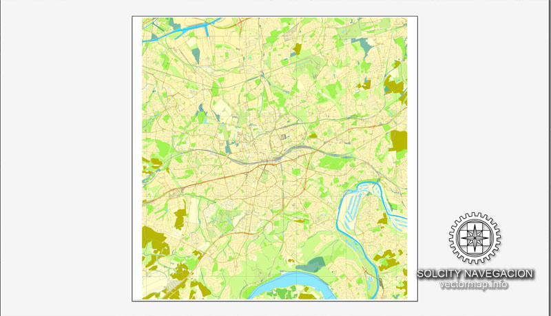
Essen, Germany.
This vector map of Essen city is used as a basis for design, editing, and further printing.
This is the most detailed, exact map of Essen city for high-quality printing and polygraphy. You can always clarify the map development date by contacting us.
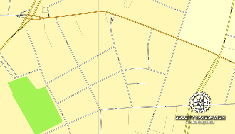
For your convenience, all objects on Essen vector city map are divided into layers. And the editing is very easy – colors, lines, etc.
Essen is the fourth largest city of Germany’s most populous federal state of North Rhine-Westphalia, and its population of approximately 589,000 (as of 31 March 2016) also makes it the ninth largest city of Germany, as well as the third largest city of the Rhineland after Cologne and Düsseldorf. On the Ruhr and Emscher rivers (tributaries of the Rhine), it lies at the centre of the Ruhr, Germany’s largest urban area, of which it is the second largest city after Dortmund.
One of the advantages of Essen city vector maps of our production is the relevance of cartographic data, we constantly update all our products.
This vector map of Essen city is used by:
designers, layout designers, printers, advertisers and architects. Our product – vector maps – is designed for further editing and printing in large formats – from @Wall format (a few meters) to A-0 and A-1, A-2, A-3.
The Essen city map in vector format is used for design, urban planning, presentations and media visualizations.
The advertising and presentation map of Essen city (usually the final designer marks the routes, and puts the client’s objects (shops, saloons, gas stations etc.)
The undoubted advantage is that people will NEVER throw out this advertising product – the map. In fact, as an advertising medium, a city map is the most “long-playing” of the well-known polygraphic advertising media, with the longest lifespan, and the maximum number of interactions with the customer.
The Ruhr is itself part of the larger Rhine-Ruhr Metropolitan Region, the most highly populated area in Europe with a population of 13,400,000. Essen lies in the Low German (Westphalian) and Low Franconian (East Bergish) dialect areas.
For travelers, maps are sold at the airports and gas stations around the world. Often the source is our vector maps.
Take a look, who purchases our vector maps of Essen city in “Our Clients and Friends” page – these are large and small companies, from super-brands like Volvo and Starbucks, to small design studios and printing houses.
It’s very easy to work with vector maps of Essen city, even for a not very experienced designer who can turn on and off the map layers, add new objects, change the colors of fill and lines according to customer requirements.
The undoubted advantage of Essen city vector maps in printing is an excellent and detailed visualization, when customer can expand a large paper map and instantly define his location, find a landmark, an object or address on map, unlike using the popular electronic formats of Google and Yandex maps for example.
Essen is seat to several of the region’s authorities, and to eight of the 100 largest German corporations regarding turnover, including three DAX corporations, placing the city second only to Munich and on par with Frankfurt am Main in number of corporate headquarters. It is often considered to be the energy capital of Germany with E.ON and RWE, Germany’s largest energy providers, both headquartered in Essen. Essen is also known for its Red Dot industrial product design award and its impact on the arts through the highly respected Folkwang University of the Arts and its Zollverein School of Management and Design.
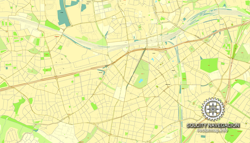
Printable vector maps of Essen city are much more convenient and efficient than any electronic maps on your smartphone, because ALL DETAILS are displayed in the entire space of Essen city map.
Useful tips on working with vector maps of cities and countries in Adobe Illustrator.
«V» – launches the Selection tool (cursor, black arrow), which makes active any vector line.
«А» – launches the Direct Selection tool (white cursor), allows you to select curve elements and drag them to the desired place.
«R» – activates the Rotate tool, which helps you rotating selected objects around the center point by 360 degrees.
«E» – gives you the opportunity to use the Eraser tool and erase unnecessary parts.
«X» – switches between Fill and Stroke in the Tools section. Try to get used to this hot key and
you will quickly understand that you can’t live and work without it.
Guides are not limited to vertical and horizontal in Adobe Illustrator. You can also create a diagonal guide for example. Moreover, you can turn any contours into guides. Select the outline and go to View > Guides > Make Guides (Create Guides), or simply press Cmd/Ctrl + 5. You can also turn the guides back into an editable object. Go to menu, View > Guides > Unlock Guides (Release Guides), select the guide you want to edit and select View > Guides > Release Guides (Reset Guides), or just press Cmd/Ctrl + Option / Alt + 5).
In early 2003, the universities of Essen and the nearby city of Duisburg (both established in 1972) were merged into the University of Duisburg-Essen with campuses in both cities and a university hospital in Essen. In 1958, Essen was chosen to serve as the seat to a Roman Catholic diocese (often referred to as Ruhrbistum or diocese of the Ruhr).
You will probably want to change the color scheme used on our Essen vector city map.
To quickly and effectively play with colors.
Of course, you can do it manually, all objects in our Essen city vector map are divided according to types and layers, and you can easily change the color gamma of vector objects in groups and layers.
But there is more effective way of working with the whole VECTOR MAP of Essen city and all layers:
The overview dialog «Edit colors»/«Repaint Graphic Object» (this dialog box name can change depending on the context):
If you have selected a part or a layer of Essen city vector map and open the dialog box by clicking the icon in the Control panel, on the Samples palette or the Color Catalog, or if you choose Edit > Edit Colors> Repaint Graphic Object, then the «Repaint Graphic Object» dialog box appears, and you get access to «Assign» and «Edit» tabs.
Founded around 845, Essen remained a small town within the sphere of influence of an important ecclesiastical principality (Essen Abbey) until the onset of industrialization. The city then — especially through the Krupp family iron works — became one of Germany’s most important coal and steel centers. Essen, until the 1970s, attracted workers from all over the country; it was the 5th-largest city in Germany between 1929 and 1988, peaking at over 730,000 inhabitants in 1962. Following the region-wide decline of heavy industries in the last decades of the 20th century, the city has seen the development of a strong tertiary sector of the economy.
If a picture or a map fragment is not selected, and you open the dialog box by clicking the icon in the Control panel, on the Samples palette or in the Color Catalog, the «Edit Colors» dialog box appears and you can only access the «Edit» tab.
Regardless of the name at the top of the dialog box, the right-hand side always displays the color group of the current document, as well as two default color groups: Print Color and Grayscale. These color groups can be selected and used any time.
Create and edit color groups of Essen city vector map, and also assign colors using the «Edit Colors»/ а «Repaint Graphic Object» dialog box.
Notable accomplishments in recent years include the title of European Capital of Culture on behalf of the whole Ruhr area in 2010 and the selection as the European Green Capital for 2017.
Geography
Essen is located in the centre of the Ruhr area, one of the largest urban areas in Europe (see also: megalopolis), comprising eleven independent cities and four districts with some 5.3 million inhabitants. The city limits of Essen itself are 87 km (54 mi) long and border ten cities, five independent and five kreisangehörig (i.e., belonging to a district), with a total population of approximately 1.4 million.
A. Creating and editing of a color group on the «Edit» tab
B. Assigning colors on the «Assign» tab
C. Select a group of colors from the «Color groups» list
The option «Repaint a graphic object» in the lower part of the dialog box allows you to preview the colors on a selected layer of Vector map, or a group of elements, and specify whether its colors will be redefined when the dialog box is closed.
The city extends over 21 km (13 mi) from north to south and 17 km (11 mi) from west to east, mainly north of the River Ruhr.
The Ruhr forms the Lake Baldeney reservoir in the boroughs of Fischlaken, Kupferdreh, Heisingen and Werden. The lake, a popular recreational area, dates from 1931 to 1933, when some thousands of unemployed coal miners dredged it with primitive tools.
«Edit»
The «Edit» tab is designed to create a new or edit the existing color groups.
The harmony rules Menu and the Color Wheel are used to conduct experiments with color harmonies. The color wheel shows how colors are related in color harmony, and the color bars allow you to view and manipulate an individual color values. In addition, you can adjust the brightness, add and remove colors, save color groups and view colors on the selected Vector Map of Essen city or a separated layers.
«Assign»
The «Assign» tab is used to view and control on how the original colors are replaced with colors from the color group like your corporate colors in the Vector Map of Essen city.
The assign color ability is provided only if the entire map, layer or fragment is selected in the document. You can specify which of new colors replace the current colors, whether the spot colors should be preserved and how colors are replaced (for example, you can replace colors completely or changing the color tone while maintaining the brightness). The «Assign» tab allows you to redefine colors in the Vector Map of Essen city, or in separate layers and fragments using the current color group or reducing the number of colors in the current Vector Map.
Generally, large areas south of the River Ruhr (including the suburbs of Schuir and Kettwig) are quite green and are often quoted as examples of rural structures in the otherwise relatively densely populated central Ruhr area. According to the Federal Statistical Office of Germany, Essen with 9.2% of its area covered by recreational green is the greenest city in North Rhine-Westphalia and the third-greenest city in Germany. The city has been shortlisted for the title of European Green Capital two consecutive times, for 2016 and 2017, winning for 2017.
Color groups
Is a list of all saved color groups for current document (the same groups appear in the «Samples» palette). You can edit and delete the existing color groups, as well as creating a new ones using the list of “Color Groups” in the dialog box. All changes appear in the «Samples» palette.
The highlighted color group shows, which color group is currently edited.
Any color group can be selected and edited, or used to redefine the colors in the selected vector map of Essen city, its fragments or elements.
Saving a color group adds this group to the specified list.
Opening the «Edit Colors»/«Repaint Graphic Object» dialog box.
Open the «Edit Colors»/«Repaint Graphic Object» dialog box using one of the following methods:
«Edit»> «Edit Colors»> «Repaint Graphic object» or «Repaint With Style».
Use these commands if you need to edit the colors in the selected vector map of Essen city.
«Repaint Graphic object» button on the «Control» panel.
Use this button if you need to adjust colors of Essen city vector map using the а «Repaint graphic object» dialog box.
The city was singled out for its exemplary practices in protecting and enhancing nature and biodiversity and efforts to reduce water consumption. Essen participates in a variety of networks and initiatives to reduce greenhouse gas emissions and to improve the city’s resilience in the face of climate change.
The lowest point can be found in the northern borough of Karnap at 26.5 m (86.9 ft), the highest point in the borough of Heidhausen at 202.5 m (664 ft). The average elevation is 116 m (381 ft).
The specified button is available if the selected vector map or its fragment contains two or more colors.
Note. This color editing method is convenient for global color adjustment in a vector map, if global colors were not used when creating a City Map of Essen.
The «Edit colors» button or «Edit or apply colors» on the «Color Catalog» palette
Click this button if you need to edit colors on the «Color Catalog» palette or edit and then apply them to the selected Vector Map of Essen city or its fragment.
The «Edit color group» button or «Edit or apply color group» on the «Samples» palette.
Click this button if you need to edit the colors in the specific color group or edit and apply them to the selected Vector Map of Essen city or a group of its elements, for example, the whole layer “Streets and lines”. You can also double-click the color group in the Samples panel to open the dialog box.
If the map file is too large and your computer freezes or even can’t open it quickly:
1. Try to reduce the color resolution of the video card (display) to 256 colors while working with a large map.
2. Using Windows Task Manager, select all the application you don’t need, while working with map, just turn them off.
3. Launch Adobe Illustrator. (DO NOT OPEN the vector map file)
4. Start the Windows Task Manager using administrator rights > Find the “Illustrator” process > set the «real time» priority,
5. Open the file. When you see the LEGACY FONT popup window – click “OK” (do not update). You can restore the TEXT later.
6. Can also be useful: When file is opened – Edit > Settings > Basic Settings > disable smoothing. /// It looks scary, but works quickly)))
We recommend saving the file in Adobe Illustrator 10 version. It’s much more stable when working with VERY BIG size files.
City districts
Essen comprises fifty boroughs which in turn are grouped into nine suburban districts (called Stadtbezirke) often named after the most important boroughs. Each Stadtbezirk is assigned a Roman numeral and has a local body of nineteen members with limited authority. Most of the boroughs were originally independent municipalities but were gradually annexed from 1901 to 1975. This long-lasting process of annexation has led to a strong identification of the population with “their” boroughs or districts and to a rare peculiarity: The borough of Kettwig, located south of the Ruhr River, and which was not annexed until 1975, has its own area code. Additionally (allegedly due to relatively high church tax incomes), the Archbishop of Cologne managed to keep Kettwig directly subject to the Archdiocese of Cologne, whereas all other boroughs of Essen and some neighboring cities constitute the Diocese of Essen.
Small guide: How to work with the vector map?
You can: Mass select objects by type and color – for example, the objects type “building” (they are usually dark gray) – and remove them from the map, if you do not need them in your print or design project. You can also easily change the thickness of lines (streets), just bulk selection the road by the line color.
The streets are separated by type, for example, type “residential road” are usually white with a gray stroke. Highway usually orange with a brown or dark gray stroke.
All objects are divided by types: different types of roads and streets, polygons of buildings, landfills, urban areas, parks and more other.
It is easy to change the font of inscriptions, all or each individually. Also, just can be make and any other manipulation of objects on the vector map in Adobe illustrator format.
Important: All the proportions on the map are true, that is, the relative sizes of the objects are true, because Map is based on an accurate GPS projection, and It transated into the (usual for all) the Mercator projection.
You can easily change the color, stroke and fill of any object on the map, zoom without loss of quality Image Verification.
Select object

Bulk selection the same objects on the vector map

See the bulk selected objects on the vector map

Bulk delete buildungs from the vector map

Select residencial road (small street) on the vector map

Bulk selection the same lines (streets, roads) on the full map

Create fat lines of the streets on the vector maps (bulk action) 1

Create fat lines of the streets on the vector maps (bulk action) 2

Create fat lines of the streets on the vector maps (bulk action) 3

You can easily change the color, stroke and fill of any object on the map, zoom without loss of quality Image Verification.

 Author: Kirill Shrayber, Ph.D. FRGS


