Extended Description of the Vector Map
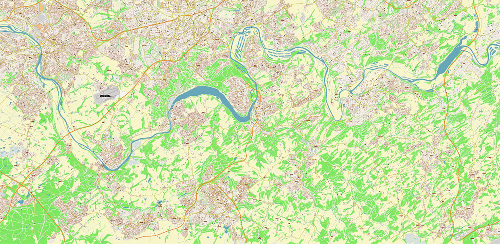
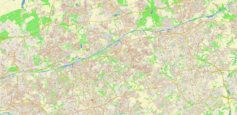
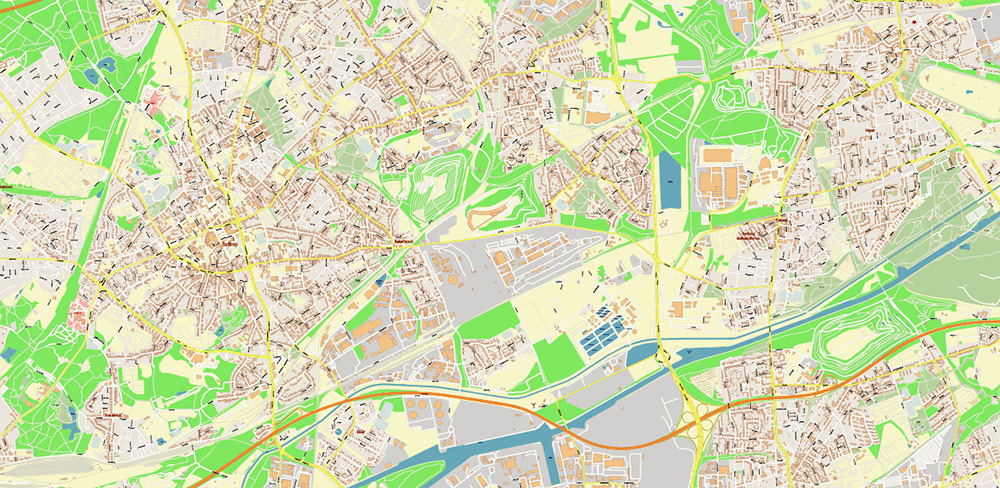
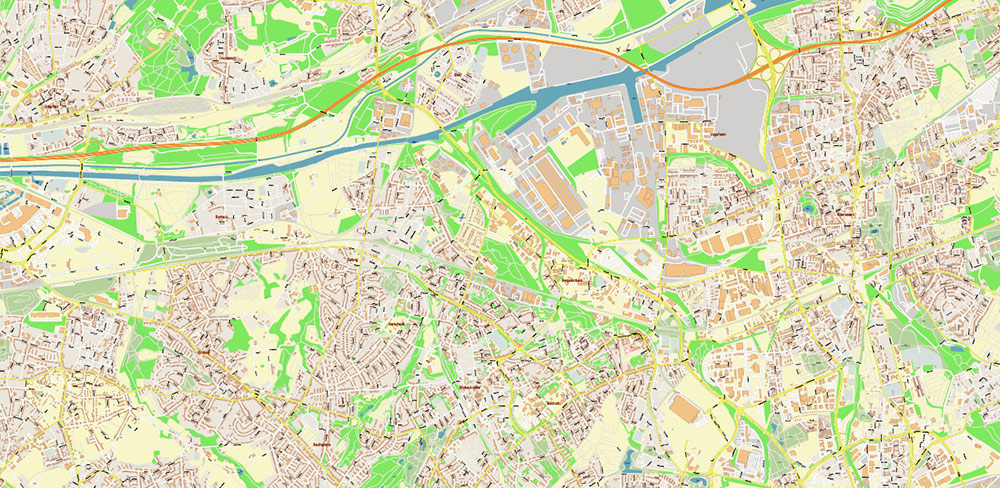
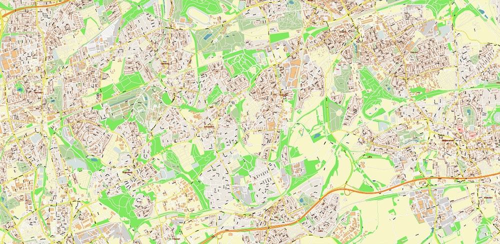
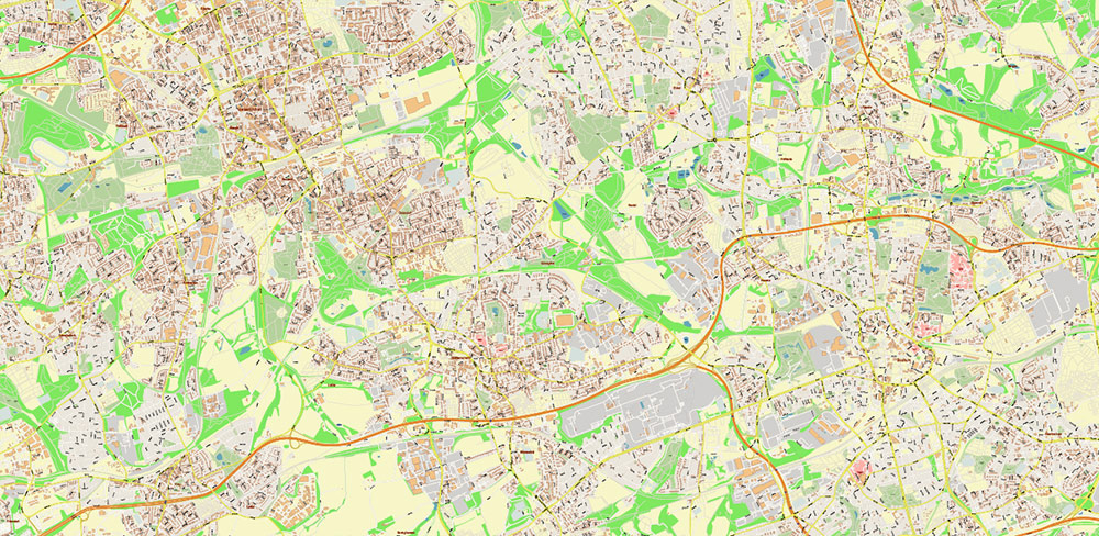
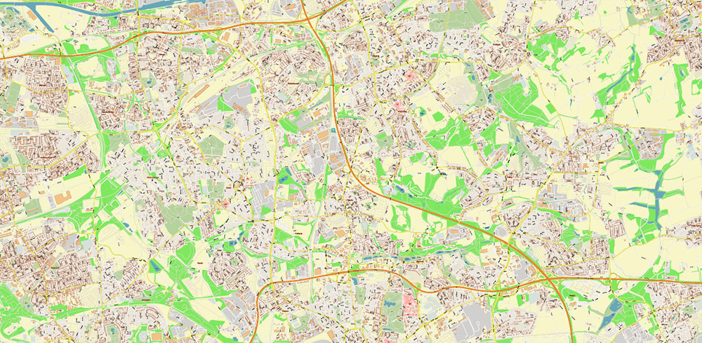
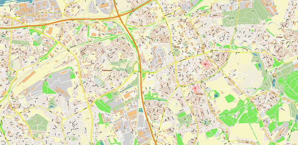
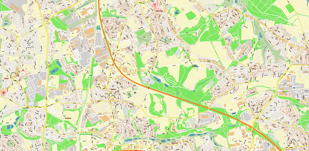
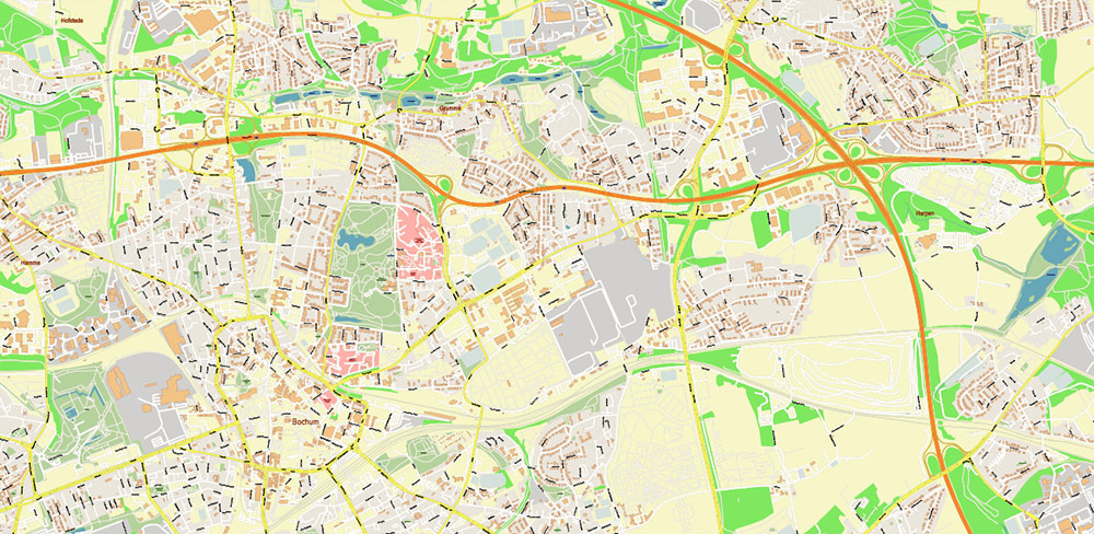
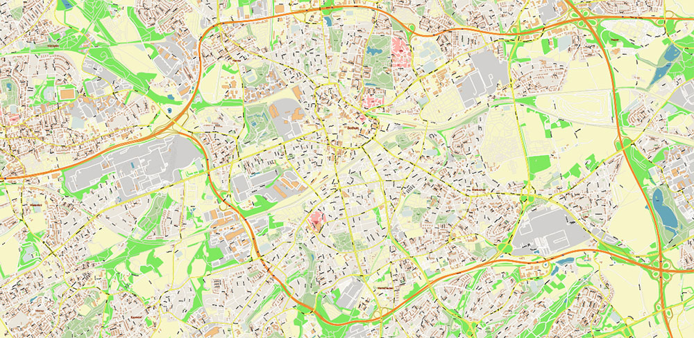
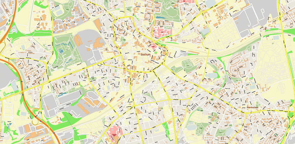
Printable Vector Map of Essen + Bochum Germany High Detailed City Plan scale 1:2927 full editable Adobe Illustrator Street Map in layers, scalable, text/curves format all names, 64 MB ZIP
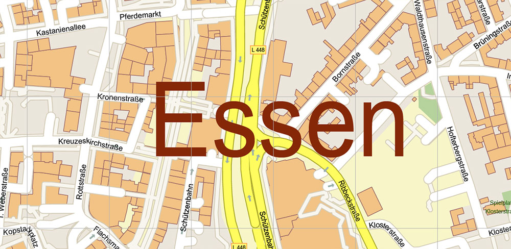
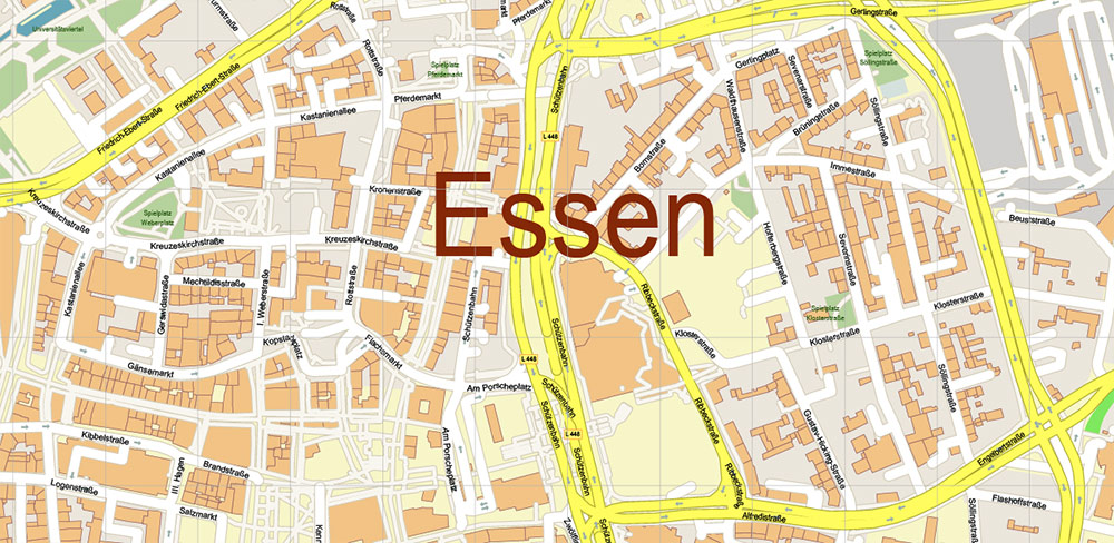
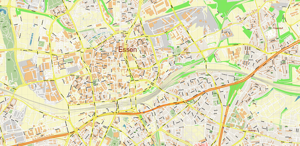
All street names, Main Objects, Buildings. Map for design, printing, arts, projects, presentations, for architects, designers, and builders, business, logistics.
Also: We can add (additional layer for this map), any other objects for you. It’s free for our customers.
Also: We can add the RELIEF (Topo Isolines or shaded relief)
If you need any OTHER format – DWG, DXF, Corel, or something else – please, email us
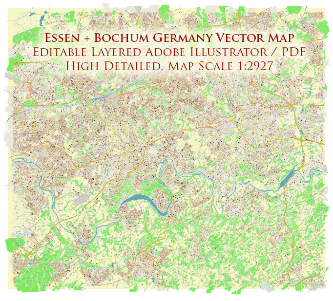
Essen + Bochum Germany Map Vector City Plan High Detailed Street Map editable Adobe Illustrator in layers
Druckbare Vektorkarte von Essen + Bochum Deutschland Hochdetaillierter Stadtplan Maßstab 1:2927 voll editierbarer Adobe Illustrator Straßenkarte in Ebenen, skalierbar, Text-/Kurvenformat alle Namen, 64 MB ZIP
Alle Straßennamen, Hauptobjekte, Gebäude. Karte für Design, Druck, Kunst, Projekte, Präsentationen, für Architekten, Designer und Bauherren, Wirtschaft, Logistik.
Außerdem: Wir können (zusätzliche Ebene für diese Karte) beliebige andere Objekte für Sie hinzufügen. Für unsere Kunden ist es kostenlos.
Außerdem: Wir können das RELIEF hinzufügen (Topo Isolines oder schattiertes Relief)
Essen + Bochum Germany Map Vector City Plan High Detailed Street Map editable Adobe Illustrator in layers
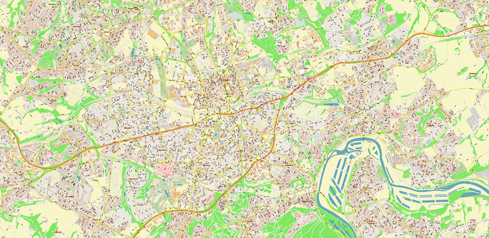
Essen is a city in the western part of Germany. Essen is home to the Zollverein coal mine, a former industrial complex with a rich history. Now the mine is closed, and several museums operate on its territory, where you can get acquainted with the history of coal mining and steel production. Where the coal preparation plant used to be, the Ruhr Regional Museum is now located. The building of the former boiler house houses the Red Dot Design Museum. It presents works of contemporary art created from everyday items.
Area: 210.3 km²
Height above sea level: 116 m
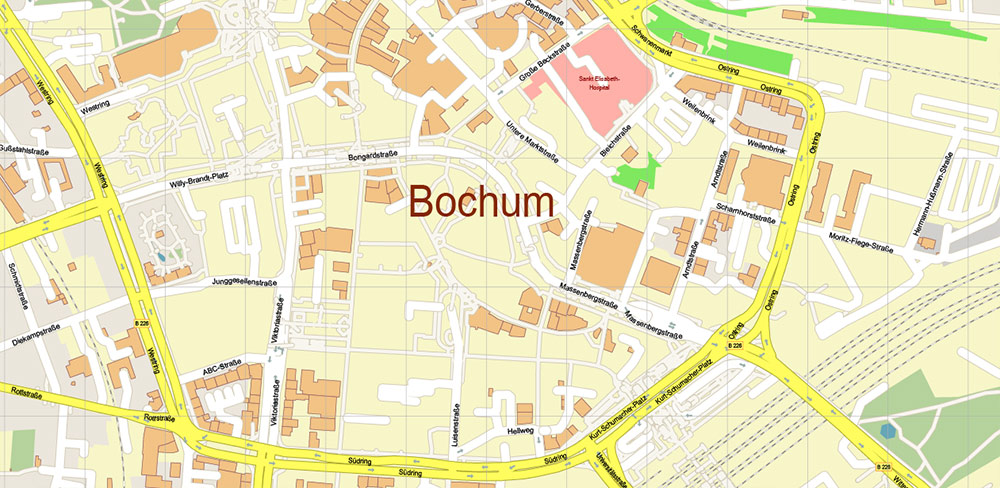
Bochum – according to one version from Büchum, a city in Germany, one of the four centers of the Ruhr region in North Rhine-Westphalia. The center of the Middle Ruhr region, together with the cities of Hattingen, Herne and Witten. The population of the city is 375.2 thousand inhabitants. The population of the Middle Ruhr is 750,000.
Area: 145.4 km²
Height above sea level: 100 m
Essen + Bochum Germany Map Vector City Plan High Detailed Street Map editable Adobe Illustrator in layers
Layers list:
- Legend
- Grids
- Labels of roads
- Names of places (city, hamlet, etc.)
- Names of objects (hospitals, parks, water)
- Names of main streets
- Names of residential streets
- Arrows of street directions
- Main Streets, roads
- Residential streets
- Railroads
- Buildings
- Waterways
- Water objects (rivers, lakes, ponds, marshes)
- Airports and Heliports
- Color fills (parks, hospital areas, land use, etc.)
- Background
Essen + Bochum Germany Map Vector City Plan High Detailed Street Map editable Adobe Illustrator in layers
Essen + Bochum Germany Map Vector City Plan High Detailed Street Map editable Adobe Illustrator in layers
Essen + Bochum Germany Map Vector City Plan High Detailed Street Map editable Adobe Illustrator in layers
Essen + Bochum Germany Map Vector City Plan High Detailed Street Map editable Adobe Illustrator in layers
Essen + Bochum Germany Map Vector City Plan High Detailed Street Map editable Adobe Illustrator in layers
Essen + Bochum Germany Map Vector City Plan High Detailed Street Map editable Adobe Illustrator in layers
Essen + Bochum Germany Map Vector City Plan High Detailed Street Map editable Adobe Illustrator in layers
Essen + Bochum Germany Map Vector City Plan High Detailed Street Map editable Adobe Illustrator in layers

Essen + Bochum Germany Map Vector City Plan High Detailed Street Map editable Adobe Illustrator in layers
Essen + Bochum Germany Map Vector City Plan High Detailed Street Map editable Adobe Illustrator in layers
Essen + Bochum Germany Map Vector City Plan High Detailed Street Map editable Adobe Illustrator in layers
Essen + Bochum Germany Map Vector City Plan High Detailed Street Map editable Adobe Illustrator in layers
Essen + Bochum Germany Map Vector City Plan High Detailed Street Map editable Adobe Illustrator in layers
Essen + Bochum Germany Map Vector City Plan High Detailed Street Map editable Adobe Illustrator in layers
Essen + Bochum Germany Map Vector City Plan High Detailed Street Map editable Adobe Illustrator in layers
Essen + Bochum Germany Map Vector City Plan High Detailed Street Map editable Adobe Illustrator in layers
Essen + Bochum Germany Map Vector City Plan High Detailed Street Map editable Adobe Illustrator in layers

 Author: Kirill Shrayber, Ph.D. FRGS


