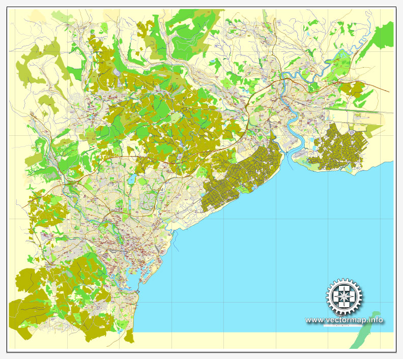
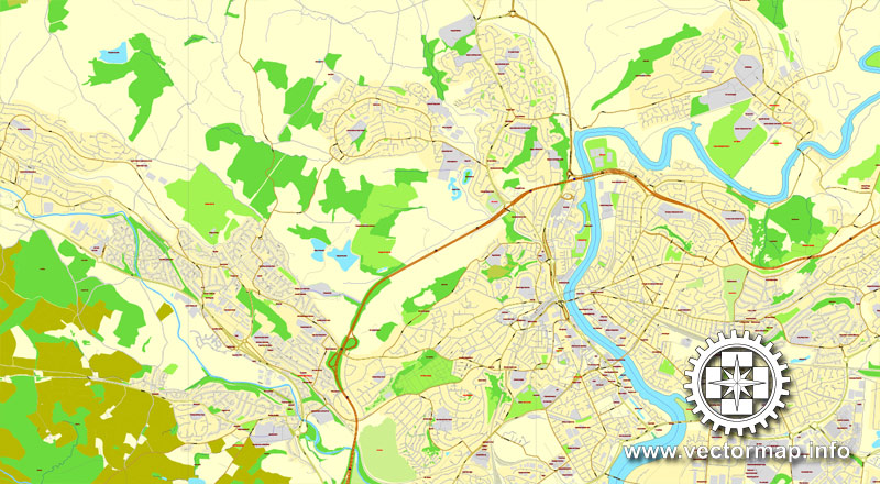
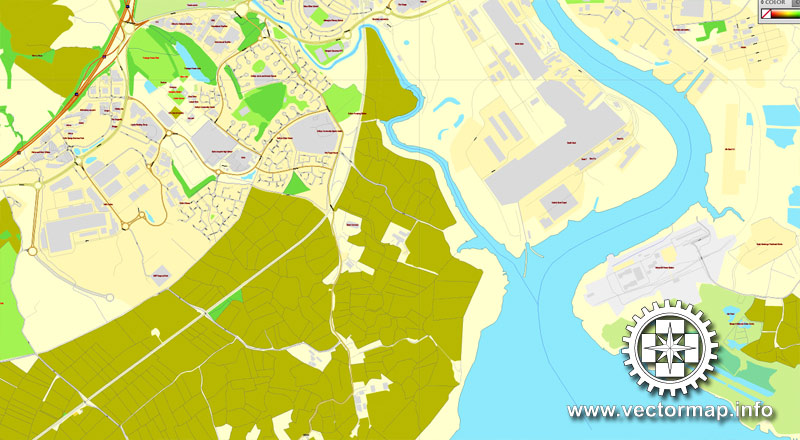
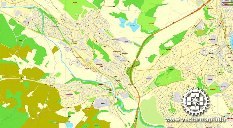
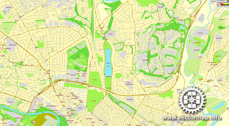
Cardiff + Newport, Wales, UK, printable vector City Plan map, full editable, Adobe PDF, full vector, scalable, editable, text format street names, 23 mb ZIP
All streets, All buildings. Map for design, print, arts, projects, presentations.
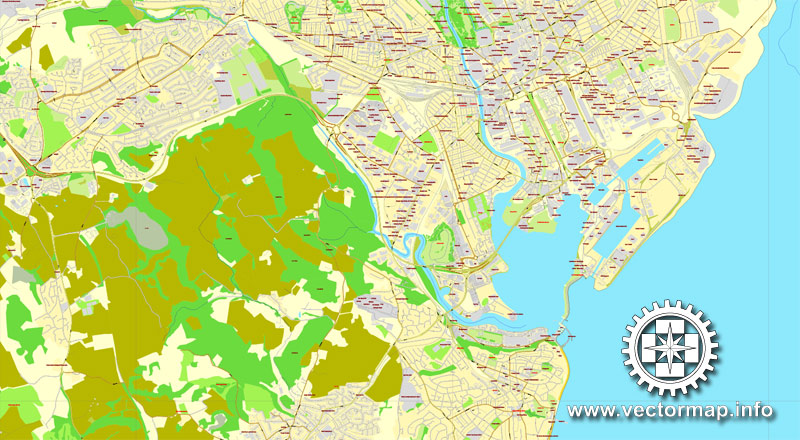
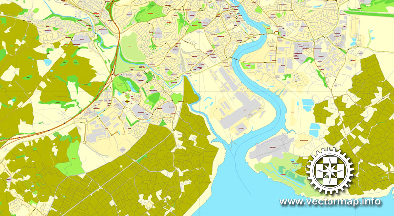
The most accurate and detailed map of the city.
Different font colors of the street names (black); object names by type (brown, red).
You can edit this file by Adobe Illustrator, Adobe Acrobat, Corel Draw.
DXF, DWG, CDR and other formats – on request, same price, please, contact
Cardiff and Newport, Wales United Kingdom.
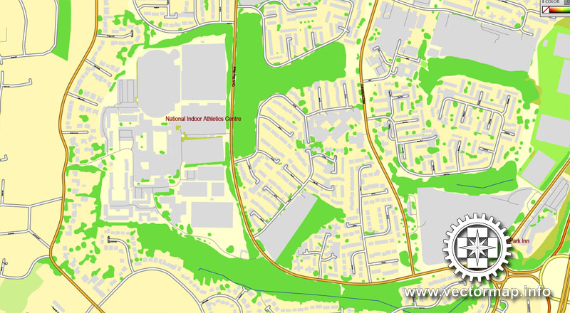
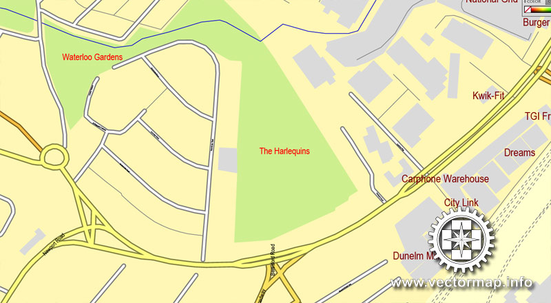
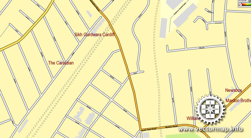
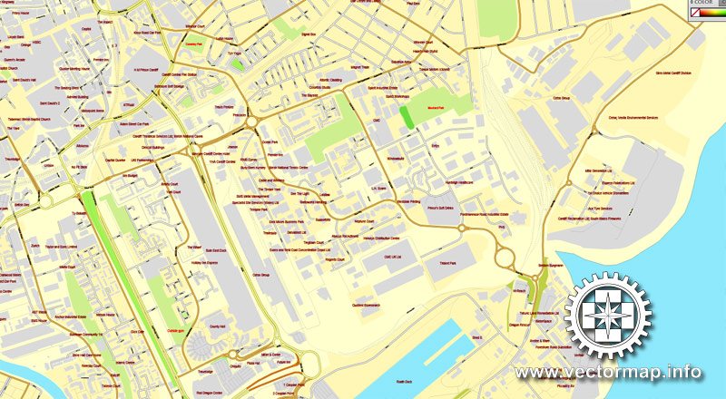
This vector map of Cardiff city is used as a basis for design, editing, and further printing.
This is the most detailed, exact map of Cardiff city for high-quality printing and polygraphy. You can always clarify the map development date by contacting us.
For your convenience, all objects on Cardiff vector city map are divided into layers. And the editing is very easy – colors, lines, etc.
You can easily add any objects needed (e.g. shops, salons, sale points, gas station or attraction) on any layer of Cardiff vector map.
Cardiff is the capital of Wales, and its largest city. The eleventh-largest city in the United Kingdom, it is Wales’s chief commercial centre, the base for most national cultural institutions and Welsh media, and the seat of the National Assembly for Wales. The unitary authority area’s 2017 population was estimated to be 362,756. Cardiff is a significant tourist centre and the most popular visitor destination in Wales with 21.3 million visitors in 2017. In 2011, Cardiff was ranked sixth in the world in National Geographic’s alternative tourist destinations.
One of the advantages of Cardiff city vector maps of our production is the relevance of cartographic data, we constantly update all our products.
This vector map of Cardiff city is used by:
designers, layout designers, printers, advertisers and architects. Our product – vector maps – is designed for further editing and printing in large formats – from @Wall format (a few meters) to A-0 and A-1, A-2, A-3.
The Cardiff city map in vector format is used for design, urban planning, presentations and media visualizations.
The advertising and presentation map of Cardiff city (usually the final designer marks the routes, and puts the client’s objects (shops, saloons, gas stations etc.)
The undoubted advantage is that people will NEVER throw out this advertising product – the map. In fact, as an advertising medium, a city map is the most “long-playing” of the well-known polygraphic advertising media, with the longest lifespan, and the maximum number of interactions with the customer.
Cardiff is the county town of the historic county of Glamorgan (and later South Glamorgan). Cardiff is part of the Eurocities network of the largest European cities. A small town until the early 19th century, its prominence as a major port for the transport of coal following the arrival of industry in the region contributed to its rise as a major city. The Cardiff Built-up Area covers a slightly larger area outside the county boundary and includes the towns of Dinas Powys and Penarth. In 1905, Cardiff was made a city and proclaimed the capital of Wales in 1955.
For travelers, maps are sold at the airports and gas stations around the world. Often the source is our vector maps.
Take a look, who purchases our vector maps of Cardiff city in “Our Clients and Friends” page – these are large and small companies, from super-brands like Volvo and Starbucks, to small design studios and printing houses.
It’s very easy to work with vector maps of Cardiff city, even for a not very experienced designer who can turn on and off the map layers, add new objects, change the colors of fill and lines according to customer requirements.
The undoubted advantage of Cardiff city vector maps in printing is an excellent and detailed visualization, when customer can expand a large paper map and instantly define his location, find a landmark, an object or address on map, unlike using the popular electronic formats of Google and Yandex maps for example.
Since the 1980s, Cardiff has seen significant development. A new waterfront area at Cardiff Bay contains the Senedd building, home to the Welsh Assembly and the Wales Millennium Centre arts complex. Current developments include the continuation of the redevelopment of the Cardiff Bay and city centre areas with projects such as the Cardiff International Sports Village, a BBC drama village, and a new business district in the city centre.
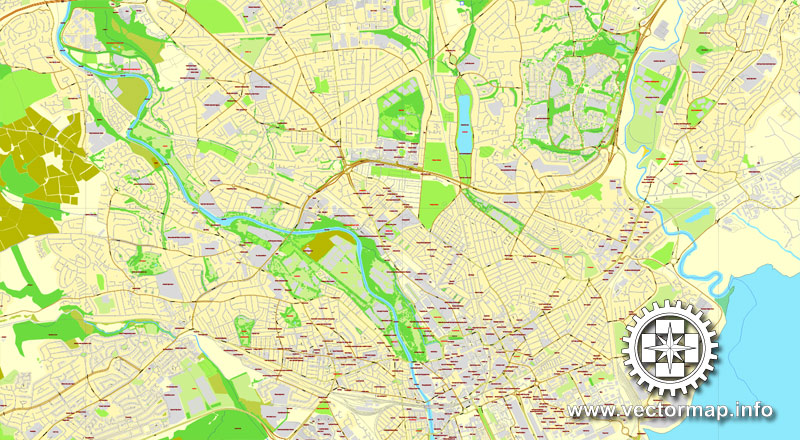
Printable vector maps of Cardiff city are much more convenient and efficient than any electronic maps on your smartphone, because ALL DETAILS are displayed in the entire space of Cardiff city map.
Useful tips on working with vector maps of cities and countries in Adobe Illustrator.
«V» – launches the Selection tool (cursor, black arrow), which makes active any vector line.
«А» – launches the Direct Selection tool (white cursor), allows you to select curve elements and drag them to the desired place.
«R» – activates the Rotate tool, which helps you rotating selected objects around the center point by 360 degrees.
«E» – gives you the opportunity to use the Eraser tool and erase unnecessary parts.
«X» – switches between Fill and Stroke in the Tools section. Try to get used to this hot key and
you will quickly understand that you can’t live and work without it.
Guides are not limited to vertical and horizontal in Adobe Illustrator. You can also create a diagonal guide for example. Moreover, you can turn any contours into guides. Select the outline and go to View > Guides > Make Guides (Create Guides), or simply press Cmd/Ctrl + 5. You can also turn the guides back into an editable object. Go to menu, View > Guides > Unlock Guides (Release Guides), select the guide you want to edit and select View > Guides > Release Guides (Reset Guides), or just press Cmd/Ctrl + Option / Alt + 5).
Sporting venues in the city include the Principality Stadium—the national stadium and the home of the Wales national rugby union team—Sophia Gardens (the home of Glamorgan County Cricket Club), Cardiff City Stadium (the home of Cardiff City football team and the Wales football team), Cardiff International Sports Stadium (the home of Cardiff Amateur Athletic Club), Cardiff Arms Park (the home of Cardiff Blues and Cardiff RFC rugby union teams) and Ice Arena Wales (the home of Cardiff Devils ice hockey team). The city hosted the 1958 British Empire and Commonwealth Games. The city was awarded the title of European City of Sport twice, due to its role in hosting major international sporting events: first in 2009 and again in 2014. The Principality Stadium hosted 11 football matches as part of the 2012 Summer Olympics, including the games’ opening event and the men’s bronze medal match.
You will probably want to change the color scheme used on our Cardiff vector city map.
To quickly and effectively play with colors.
Of course, you can do it manually, all objects in our Cardiff city vector map are divided according to types and layers, and you can easily change the color gamma of vector objects in groups and layers.
But there is more effective way of working with the whole VECTOR MAP of Cardiff city and all layers:
The overview dialog «Edit colors»/«Repaint Graphic Object» (this dialog box name can change depending on the context):
If you have selected a part or a layer of Cardiff city vector map and open the dialog box by clicking the icon in the Control panel, on the Samples palette or the Color Catalog, or if you choose Edit > Edit Colors> Repaint Graphic Object, then the «Repaint Graphic Object» dialog box appears, and you get access to «Assign» and «Edit» tabs.
If a picture or a map fragment is not selected, and you open the dialog box by clicking the icon in the Control panel, on the Samples palette or in the Color Catalog, the «Edit Colors» dialog box appears and you can only access the «Edit» tab.
Geography
The centre of Cardiff is relatively flat and is bounded by hills on the outskirts to the east, north and west. Its geographic features were influential in its development as the world’s largest coal port, most notably its proximity and easy access to the coal fields of the south Wales valleys. The highest point in the authority is Garth Hill 307 metres (1,007 feet) above sea level.
Regardless of the name at the top of the dialog box, the right-hand side always displays the color group of the current document, as well as two default color groups: Print Color and Grayscale. These color groups can be selected and used any time.
Create and edit color groups of Cardiff city vector map, and also assign colors using the «Edit Colors»/ а «Repaint Graphic Object» dialog box.
A. Creating and editing of a color group on the «Edit» tab
B. Assigning colors on the «Assign» tab
C. Select a group of colors from the «Color groups» list
The option «Repaint a graphic object» in the lower part of the dialog box allows you to preview the colors on a selected layer of Vector map, or a group of elements, and specify whether its colors will be redefined when the dialog box is closed.
Cardiff is built on reclaimed marshland on a bed of Triassic stones; this reclaimed marshland stretches from Chepstow to the Ely Estuary, which is the natural boundary of Cardiff and the Vale of Glamorgan. Triassic landscapes of this part of the world are usually shallow and low-lying which accounts and explains the flatness of the centre of Cardiff.
The main areas of the dialog box are:
«Edit»
The «Edit» tab is designed to create a new or edit the existing color groups.
The harmony rules Menu and the Color Wheel are used to conduct experiments with color harmonies. The color wheel shows how colors are related in color harmony, and the color bars allow you to view and manipulate an individual color values. In addition, you can adjust the brightness, add and remove colors, save color groups and view colors on the selected Vector Map of Cardiff city or a separated layers.
«Assign»
The «Assign» tab is used to view and control on how the original colors are replaced with colors from the color group like your corporate colors in the Vector Map of Cardiff city.
The assign color ability is provided only if the entire map, layer or fragment is selected in the document. You can specify which of new colors replace the current colors, whether the spot colors should be preserved and how colors are replaced (for example, you can replace colors completely or changing the color tone while maintaining the brightness). The «Assign» tab allows you to redefine colors in the Vector Map of Cardiff city, or in separate layers and fragments using the current color group or reducing the number of colors in the current Vector Map.
The classic Triassic marl, sand and conglomerate rocks are used predominantly throughout Cardiff as building materials. Many of these Triassic rocks have a purple complexion, especially the coastal marl found near Penarth. One of the Triassic rocks used in Cardiff is “Radyr Stone”, a freestone which as its name suggests is quarried in the Radyr district. Cardiff has also imported some materials for buildings: Devonian sandstones (the Old Red Sandstone) from the Brecon Beacons has been used. Most famously, the buildings of Cathays Park, the civic centre in the centre of the city, are built of Portland stone which was imported from Dorset. A widely used building stone in Cardiff is the yellow-grey Liassic limestone rock of the Vale of Glamorgan, including the very rare “Sutton Stone”, a conglomerate of lias limestone and carboniferous limestone.
Color groups
Is a list of all saved color groups for current document (the same groups appear in the «Samples» palette). You can edit and delete the existing color groups, as well as creating a new ones using the list of “Color Groups” in the dialog box. All changes appear in the «Samples» palette.
The highlighted color group shows, which color group is currently edited.
Any color group can be selected and edited, or used to redefine the colors in the selected vector map of Cardiff city, its fragments or elements.
Saving a color group adds this group to the specified list.
Opening the «Edit Colors»/«Repaint Graphic Object» dialog box.
Open the «Edit Colors»/«Repaint Graphic Object» dialog box using one of the following methods:
«Edit»> «Edit Colors»> «Repaint Graphic object» or «Repaint With Style».
Use these commands if you need to edit the colors in the selected vector map of Cardiff city.
«Repaint Graphic object» button on the «Control» panel.
Use this button if you need to adjust colors of Cardiff city vector map using the а «Repaint graphic object» dialog box.
The specified button is available if the selected vector map or its fragment contains two or more colors.
Note. This color editing method is convenient for global color adjustment in a vector map, if global colors were not used when creating a City Map of Cardiff.
The «Edit colors» button or «Edit or apply colors» on the «Color Catalog» palette
Click this button if you need to edit colors on the «Color Catalog» palette or edit and then apply them to the selected Vector Map of Cardiff city or its fragment.
The «Edit color group» button or «Edit or apply color group» on the «Samples» palette.
Click this button if you need to edit the colors in the specific color group or edit and apply them to the selected Vector Map of Cardiff city or a group of its elements, for example, the whole layer “Streets and lines”. You can also double-click the color group in the Samples panel to open the dialog box.
If the map file is too large and your computer freezes or even can’t open it quickly:
1. Try to reduce the color resolution of the video card (display) to 256 colors while working with a large map.
2. Using Windows Task Manager, select all the application you don’t need, while working with map, just turn them off.
3. Launch Adobe Illustrator. (DO NOT OPEN the vector map file)
4. Start the Windows Task Manager using administrator rights > Find the “Illustrator” process > set the «real time» priority,
5. Open the file. When you see the LEGACY FONT popup window – click “OK” (do not update). You can restore the TEXT later.
6. Can also be useful: When file is opened – Edit > Settings > Basic Settings > disable smoothing. /// It looks scary, but works quickly)))
We recommend saving the file in Adobe Illustrator 10 version. It’s much more stable when working with VERY BIG size files.
Cardiff is bordered to the west by the rural district of the Vale of Glamorgan – also known as The Garden of Cardiff – to the east by the city of Newport, to the north by the South Wales Valleys and to the south by the Severn Estuary and Bristol Channel. The River Taff winds through the centre of the city and together with the River Ely flows into the freshwater lake of Cardiff Bay. A third river, the Rhymney flows through the east of the city entering directly into the Severn Estuary.
Cardiff is situated near the Glamorgan Heritage Coast, stretching westward from Penarth and Barry – commuter towns of Cardiff – with striped yellow-blue Jurassic limestone cliffs. The Glamorgan coast is the only part of the Celtic Sea that has exposed Jurassic (blue lias) geology. This stretch of coast, which has reefs, sandbanks and serrated cliffs, was a ship graveyard; ships sailing up to Cardiff during the industrial era often never made it as far as Cardiff as many were wrecked around this hostile coastline during west/south-westerly gales. Consequently, smuggling, deliberate shipwrecking and attacks on ships were common.
Geography
The centre of Cardiff is relatively flat and is bounded by hills on the outskirts to the east, north and west. Its geographic features were influential in its development as the world’s largest coal port, most notably its proximity and easy access to the coal fields of the south Wales valleys.
Cardiff is built on reclaimed marshland on a bed of Triassic stones; this reclaimed marshland stretches from Chepstow to the Ely Estuary, which is the natural boundary of Cardiff and the Vale of Glamorgan. Triassic landscapes of this part of the world are usually shallow and low-lying which accounts and explains the flatness of the centre of Cardiff. The classic Triassic marl, sand and conglomerate rocks are used predominantly throughout Cardiff as building materials. Many of these Triassic rocks have a purple complexion, especially the coastal marl found near Penarth. One of the Triassic rocks used in Cardiff is “Radyr Stone”, a freestone which as its name suggests is quarried in the Radyr district. Cardiff has also imported some materials for buildings: Devonian sandstones (the Old Red Sandstone) from the Brecon Beacons has been used. Most famously, the buildings of Cathays Park, the civic centre in the centre of the city, are built of Portland stone which was imported from Dorset. A widely used building stone in Cardiff is the yellow-grey Liassic limestone rock of the Vale of Glamorgan, including the very rare “Sutton Stone”, a conglomerate of lias limestone and carboniferous limestone.
Cardiff is bordered to the west by the rural district of the Vale of Glamorgan—also known as The Garden of Cardiff to the east by the city of Newport, to the north by the South Wales Valleys and to the south by the Severn Estuary and Bristol Channel. The River Taff winds through the centre of the city and together with the River Ely flows into the freshwater lake of Cardiff Bay. A third river, the Rhymney flows through the east of the city entering directly into the Severn Estuary.
The stretch of coast west of Cardiff, which has reefs, sandbanks and serrated cliffs, was a ship graveyard; ships sailing up to Cardiff during the industrial era often never made it as far as Cardiff as many were wrecked around this hostile coastline during west/south-westerly gales. Consequently, smuggling, deliberate shipwrecking and attacks on ships were common.
“Inner Cardiff” consists of the following wards: Penylan, Plasnewydd, Gabalfa, Roath, Cathays, Adamsdown and Splott ward on the north and east of the city centre, and Butetown, Grangetown, Riverside and Canton to the south and west. The inner-city areas to the south of the A4161 road (known as the “Southern Arc”) are, with the exception of Cardiff Bay, some of the poorest districts of Wales with low levels of economic activity. On the other hand, Gabalfa, Plasnewydd and Cathays north of the ‘arc’ have very large student populations, and Pontcanna (situated north of Riverside and alongside Canton) is a favourite for students and young professionals. Penylan, which lies to the north east side of Roath Park, is an affluent area popular with those with older children and the retired.
“Suburban Cardiff” can be broken down into three distinct areas. To the west lie Ely, Caerau and Fairwater which contain some of the largest housing estates in the United Kingdom. With the exception of some of the outlying privately built estates at Michaelston Super Ely and 1930s developments near Waun-Gron Road, this is an economically disadvantaged area with high numbers of unemployed households. Culverhouse Cross is a more affluent western area of the city. Radyr, Llandaff, Llandaff North, Whitchurch & Tongwynlais, Rhiwbina, Heath, Llanishen, Thornhill, Lisvane and Cyncoed which lie in an arc from the north west to the north east of the centre can be considered the main middle class suburbs of the city. In particular, Cyncoed, Radyr and Lisvane contain some of the most expensive housing in Wales. Further to the east lie the wards of Pontprennau & Old St Mellons, Rumney, Pentwyn, Llanrumney and Trowbridge. The latter three are again largely of public housing stock, although new private housing is being built in Trowbridge in considerable number. Pontprennau is the newest ‘suburb’ of Cardiff, whilst Old St Mellons has a history going back to the Norman Conquest in the 11th century.
To the north west of the city lies a region that may be called “Rural Cardiff” containing the villages of St. Fagans, Creigiau, Pentyrch, Tongwynlais and Gwaelod-y-garth. St. Fagans, home to the Museum of Welsh Life, is protected from further development.
Since 2000, there has been a significant change of scale and building height in Cardiff, with the development of the city centre’s first purpose-built high-rise apartments. Tall buildings have been built in the city centre and Cardiff Bay, and more are planned. A luxury hotel, Bayscape, has been granted planning permission at the Cardiff International Sports Village and it will be the tallest building in Wales upon completion.
Newport is a cathedral and university city and unitary authority area in south east Wales. It is located on the River Usk close to its confluence with the Severn Estuary, approximately 12 miles (19 km) northeast of Cardiff. At the 2011 census it was the third largest city in Wales, with a city population of 145,700 and an urban population of 306,844. The city forms part of the Cardiff-Newport metropolitan area with a population of 1,097,000.
Newport has been a port since medieval times, when the first Newport Castle was built by the Normans. The town outgrew the earlier Roman town of Caerleon, immediately upstream, and gained its first charter in 1314. It grew significantly in the 19th century, when its port became the focus of coal exports from the eastern valleys of South Wales. Until the rise of Cardiff from the 1850s, Newport was Wales’ largest coal-exporting port. Newport was the site of the last large-scale armed insurrection in Britain, the Newport Rising of 1839 led by the Chartists.
During the 20th century, when the docks declined in importance, Newport remained an important manufacturing and engineering centre. It was granted city status in 2002. Newport hosted the Ryder Cup in 2010 and was the venue for the 2014 NATO summit.
It is the largest urban area within the historic county boundaries of Monmouthshire and the preserved county of Gwent. The City of Newport, which includes some surrounding rural areas as well as the built up area, is governed by Newport City Council.
Geography
Newport is located 138 miles (222 km) west of London and 12 miles (19 km) east of Cardiff. It is the largest urban area within the historic county boundaries of Monmouthshire and the preserved county of Gwent. The City of Newport, which includes rural areas as well as the built up area, is the seventh most populous unitary authority in Wales.
The city is largely low-lying, but with a few hilly areas. (Wentwood reaches 310 metres above sea level). Areas in the south and east of the city tend to be flat and fertile with some housing estates and industrial areas reclaimed from marshland. Areas near the banks of the River Usk, such as Caerleon, are also low-lying. The eastern outskirts of the city are characterised by the gently rolling hills of the Vale of Usk and Christchurch has panoramic views of the Vale of Usk and the Bristol Channel. Ridgeway at Allt-yr-yn also has good views of the surrounding areas and Bristol Channel. Brynglas has views over the city centre and Twmbarlwm to the west. The suburbs of the city have grown outwards from the inner-city, mostly near the main roads, giving the suburban sprawl of the city an irregular shape. The urban area is continuing to expand rapidly with new housing estates continuing to be built.
The city boundaries include a number of villages in the Newport Built-up area.
Cardiff is the capital and largest city in Wales and the tenth largest city in the United Kingdom. The city is the country’s chief commercial centre, the base for most national cultural and sporting institutions, the Welsh national media, and the seat of the National Assembly for Wales. The unitary authority area’s mid-2011 population was estimated to be 346,100, while the population of the Larger Urban Zone was estimated at 861,400 in 2009. The Cardiff metropolitan area makes up over a third of the total population of Wales, with a mid-2011 population estimate of about 1,100,000 people. Cardiff is a significant tourist centre and the most popular visitor destination in Wales with 18.3 million visitors in 2010. In 2011, Cardiff was ranked sixth in the world in National Geographic’s alternative tourist destinations.
The city of Cardiff is the county town of the historic county of Glamorgan (and later South Glamorgan). Cardiff is part of the Eurocities network of the largest European cities. The Cardiff Urban Area covers a slightly larger area outside the county boundary, and includes the towns of Dinas Powys and Penarth. A small town until the early 19th century, its prominence as a major port for the transport of coal following the arrival of industry in the region contributed to its rise as a major city.
Cardiff was made a city in 1905, and proclaimed the capital of Wales in 1955. Since the 1980s, Cardiff has seen significant development. A new waterfront area at Cardiff Bay contains the Senedd building, home to the Welsh Assembly and the Wales Millennium Centre arts complex. Current developments include the continuation of the redevelopment of the Cardiff Bay and city centre areas with projects such as the Cardiff International Sports Village, a BBC drama village, and a new business district in the city centre.
Sporting venues in the city include the Millennium Stadium (the national stadium for the Wales national rugby union team), SWALEC Stadium (the home of Glamorgan County Cricket Club), Cardiff City Stadium (the home of Cardiff City football team), Cardiff International Sports Stadium (the home of Cardiff Amateur Athletic Club) and Cardiff Arms Park (the home of Cardiff Blues and Cardiff RFC rugby union teams). The city was awarded the title of European City of Sport twice, due to its role in hosting major international sporting events: first in 2009 and again in 2014. The Millennium Stadium hosted 11 football matches as part of the 2012 Summer Olympics, including the games’ opening event and the men’s bronze medal match.
Newport is a cathedral and university city and unitary authority area in south east Wales. It is located on the River Usk close to its confluence with the Severn estuary, approximately 12 miles (19 km) northeast of Cardiff. At the 2011 census it is the third largest city in Wales, with a city population of 145,700 and an urban population of 306,844. The city forms part of the Cardiff-Newport metropolitan area with a population of 1,097,000.
Newport has been a port since medieval times, when Newport Castle was built by the Normans. The town outgrew the earlier Roman town of Caerleon, immediately upstream, and gained its first charter in 1314. It grew significantly in the 19th century, when its port became the focus of coal exports from the eastern valleys of South Wales. Until the rise of Cardiff from the 1850s, Newport was Wales’ largest coal-exporting port. It was the site of the last large-scale armed insurrection in Britain, the Newport Rising of 1839 led by the Chartists.
During the 20th century, when the docks declined in importance, Newport remained an important manufacturing and engineering centre. It was granted city status in 2002. Newport hosted the Ryder Cup in 2010. The city was the venue of the 2014 NATO summit.
It is the largest urban area within the historic county boundaries of Monmouthshire and the preserved county of Gwent. The City of Newport, which includes some surrounding rural areas as well as the built up area, is governed by Newport City Council.
Small guide: How to work with the vector map?
You can: Mass select objects by type and color – for example, the objects type “building” (they are usually dark gray) – and remove them from the map, if you do not need them in your print or design project. You can also easily change the thickness of lines (streets), just bulk selection the road by the line color.
The streets are separated by type, for example, type “residential road” are usually white with a gray stroke. Highway usually orange with a brown or dark gray stroke.
It is easy to change the font of inscriptions, all or each individually. Also, just can be make and any other manipulation of objects on the vector map in Adobe illustrator format.
Important: All the proportions on the map are true, that is, the relative sizes of the objects are true, because Map is based on an accurate GPS projection, and It transated into the (usual for all) the Mercator projection.
You can easily change the color, stroke and fill of any object on the map, zoom without loss of quality Image Verification.
Select object

Bulk selection the same objects on the vector map

See the bulk selected objects on the vector map

Bulk delete buildungs from the vector map

Select residencial road (small street) on the vector map

Bulk selection the same lines (streets, roads) on the full map

Create fat lines of the streets on the vector maps (bulk action) 1

Create fat lines of the streets on the vector maps (bulk action) 2

Create fat lines of the streets on the vector maps (bulk action) 3

You can easily change the color, stroke and fill of any object on the map, zoom without loss of quality Image Verification.

 Author: Kirill Shrayber, Ph.D. FRGS


