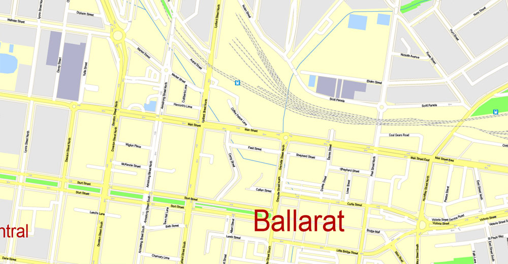
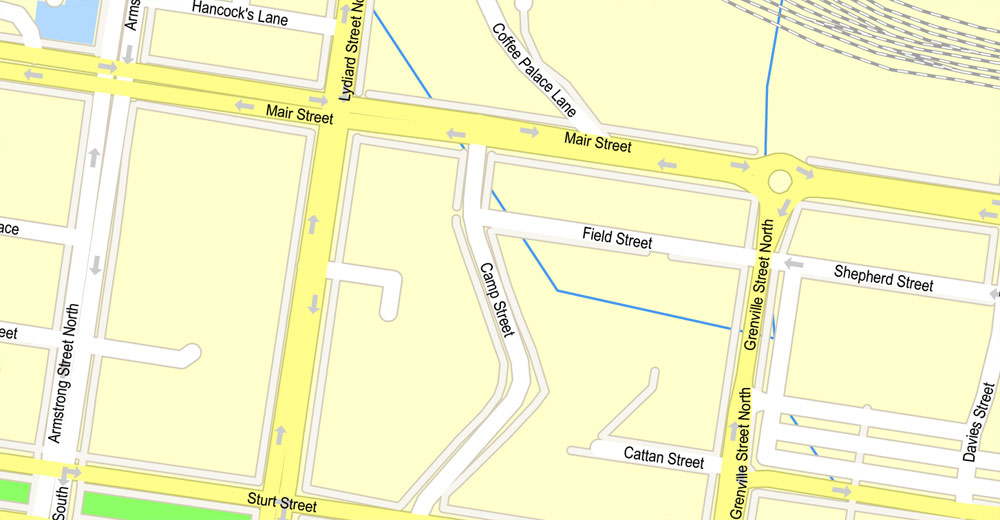
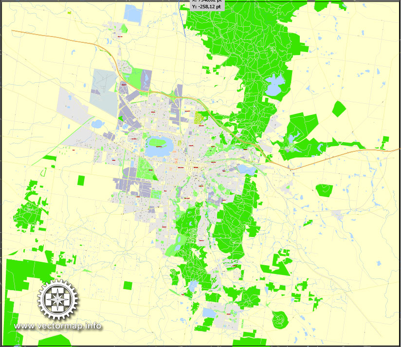
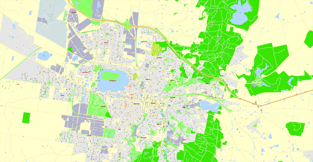
PDF Map Ballarat, Australia, exact printable vector street map, V11.11, fully editable, Adobe PDF, G-View Level 17 (100 meters scale), full vector, scalable, editable, text format of street names, 7 Mb ZIP.
All streets named, NO buildings, main objects. Map for publishing, design, printing, publications, arts, projects, presentations, for architects, designers and builders, business, logistics. The most exact and detailed map of the city.
Separated layers: streets and roads, color fills, road labels, street arrows, objects, names 1,2,3, scales. Royalty Free.
You can edit this file by Adobe Illustrator, Adobe Acrobat, Corel Draw.
DWG, DXF, CDR and other formats – by request, same price, please contact.
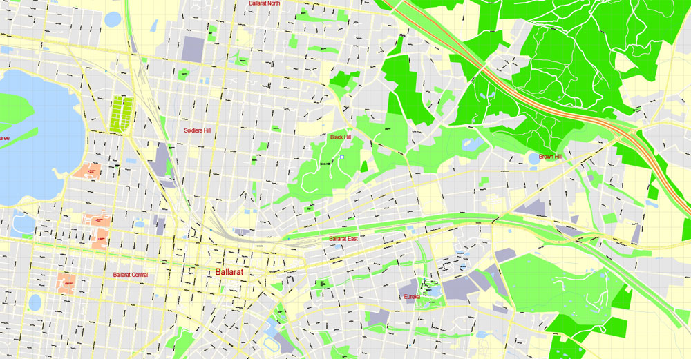
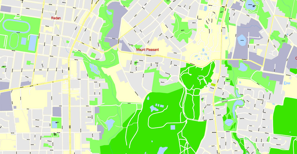
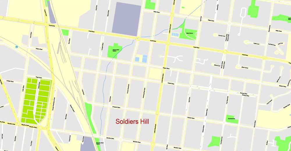
Urban plan Ballarat Australia High Detailed Cartography
Ballarat is a fairly large Australian city with a population of about 85 thousand people, located 110 km from Melbourne. Mechanical engineering, food, and textile industries are developed here, construction materials are produced, but the main revenue part of the city budget is tourism. Just a century and a half ago, the most important historical events took place here – the richest gold deposits were discovered, mines began to work, and the city “fell ill” with a Gold Rush.
In the immediate vicinity of Ballarat is Sovereign Hill. This is an old town that has turned into an open-air museum. At the beginning of the XX century, all the mines were closed, and the settlement became the largest open-air museum on the continent. The atmosphere of the XIX century, when life in the city was in full swing, is completely preserved here. Today, more than three hundred people live and work in this unusual museum. It’s like a time machine takes the park’s guests to the past, to the 50s of the XIX century. Fluffy skirts, shoes, hairstyles, and hats of that time, a stylized bank, post office, school, theater, saloons, no cars, only horse-drawn carts, and a complete lack of electricity – all this helps to create an appropriate atmosphere and mood.
One of the main adventures for tourists is a visit to an abandoned mine and the opportunity to independently wash gold sand or find ingots, but everything should be real, so you need to purchase a license in advance for a nominal fee. If you find gold, it’s yours! There are many artisans working in Sovereign Hill. The blacksmith accepts orders for the manufacture of personalized horseshoes, and in souvenir shops, you can buy candles, dishes, pans and pots, furniture made by local craftsmen. Children definitely need to attend a performance in a candy store, where a pastry chef will prepare sweets according to old recipes right in front of the amazed children. He cooks sugar syrup, then pours it on the table and kneads it like dough. After that, dyes are added to the sweet mass and passed through a special machine. Just a few minutes and the delicious lollipops are ready.
Do not forget to look into the local printing house, where they manually type the texts of advertisements and theater posters. In the photo salon, you can order your own portrait made in the style of that era. The museum exposition of Sovereign Hill deserves special attention. The entire “golden” history of Ballarat is presented here: a lot of bullion, coins, and jewelry, and the accompanying guide will tell you about how life went on in this amazing place at that time.
Theatrical performances and all kinds of historical productions are shown here for free, and musicians play in the shade of canopies. You only need a little imagination, and you will feel like participants in those events – an Australian living in the XIX century. Unsurprisingly, in 2005-2006, Sovereign Hill broke attendance records among all tourist centers in Australia.
Strolling through the streets of Ballarat, visitors to the city pay attention to the local architecture. Many buildings built in the luxurious Victorian-style have been preserved since the “golden era”. One of the main attractions of the city is the Krayal Castle. Be sure to see the city hall, the post office, the art gallery, the theater, the Reids Coffee Palace – all of them were built in the middle of the XIX century, perfectly preserved, and continue to work.
You can get to Ballarat by plane, there is an airport 8 km from the city, by rail or by car, just do not forget to book a hotel room in advance, this will save time and enjoy the beauty of the old town longer.
Related Images “Urban plan Ballarat Australia 17”:
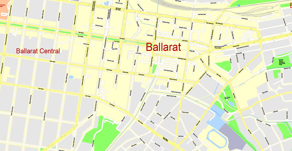
Ballarat, Victoria, Australia.
This vector map of Ballarat is used as a basis for design, editing, and further printing.
This is the most detailed, exact map of Ballarat for high-quality printing and polygraphy. You can always clarify the map development date by contacting us.
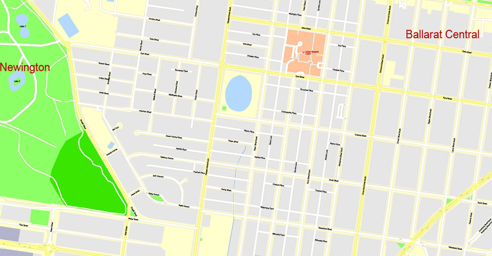
For your convenience, all objects on Ballarat vector map are divided into layers. And the editing is very easy – colors, lines, etc.
You can easily add any objects needed (e.g. shops, salons, sale points, gas station or attraction) on any layer of Ballarat vector map.
Ballarat is a city located on the Yarrowee River in the Central Highlands of Victoria, Australia. The city has a population of 101,588.
In terms of population Ballarat is the third largest inland city in Australia. Just months after Victoria was granted separation from the state of New South Wales, the Victorian gold rush transformed Ballarat from a small sheep station to a major settlement. Gold was discovered on 18 August 1851, and news quickly spread of rich alluvial fields where gold could easily be extracted. Unlike many other gold boom towns, the Ballarat fields experienced sustained high gold yields for many decades, which can be evidenced to this day in the city’s rich architecture.
One of the advantages of Ballarat vector maps of our production is the relevance of cartographic data, we constantly update all our products.
This vector map of Ballarat is used by:
designers, layout designers, printers, advertisers and architects. Our product – vector maps – is designed for further editing and printing in large formats – from @Wall format (a few meters) to A-0 and A-1, A-2, A-3.
Ballarat map in vector format is used for design, urban planning, presentations and media visualizations.
Advertising and presentation map of Ballarat (usually the final designer marks the routes, and puts the client’s objects (shops, saloons, gas stations etc.)
The undoubted advantage is that people will NEVER throw out this advertising product – the map. In fact, as an advertising medium, a map is the most “long-playing” of the well-known polygraphic advertising media, with the longest lifespan, and the maximum number of interactions with the customer.
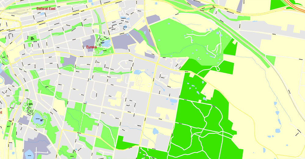
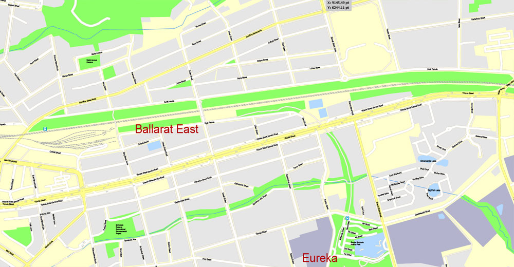
The city is famous in Australia for the Eureka Rebellion, the only armed rebellion in Australian history. In response to this event the first male suffrage in Australia was instituted and as such Eureka is interpreted by some as the origin of democracy in Australia. The rebellion’s symbol, the Eureka Flag, has become a national symbol and is held at the Museum of Australian Democracy at Eureka in Ballarat.
For travelers, maps are sold at the airports and gas stations around the world. Often the source is our vector maps.
Take a look, who purchases our vector maps of Ballarat in “Our Clients and Friends” page – these are large and small companies, from super-brands like Volvo and Starbucks, to small design studios and printing houses.
It’s very easy to work with vector maps of Ballarat, even for a not very experienced designer who can turn on and off the map layers, add new objects, change the colors of fill and lines according to customer requirements.
The undoubted advantage of Ballarat vector maps in printing is an excellent and detailed visualization, when customer can expand a large paper map and instantly define his location, find a landmark, an object or address on map, unlike using the popular electronic formats of Google and Yandex maps for example.
Printable vector maps of Ballarat are much more convenient and efficient than any electronic maps on your smartphone, because ALL DETAILS are displayed in the entire space of Ballarat map.
Useful tips on working with vector maps of cities and countries in Adobe Illustrator.
«V» – launches the Selection tool (cursor, black arrow), which makes active any vector line.
«А» – launches the Direct Selection tool (white cursor), allows you to select curve elements and drag them to the desired place.
«R» – activates the Rotate tool, which helps you rotating selected objects around the center point by 360 degrees.
«E» – gives you the opportunity to use the Eraser tool and erase unnecessary parts.
«X» – switches between Fill and Stroke in the Tools section. Try to get used to this hot key and
you will quickly understand that you can’t live and work without it.
Guides are not limited to vertical and horizontal in Adobe Illustrator. You can also create a diagonal guide for example. Moreover, you can turn any contours into guides. Select the outline and go to View > Guides > Make Guides (Create Guides), or simply press Cmd/Ctrl + 5. You can also turn the guides back into an editable object. Go to menu, View > Guides > Unlock Guides (Release Guides), select the guide you want to edit and select View > Guides > Release Guides (Reset Guides), or just press Cmd/Ctrl + Option / Alt + 5).
You will probably want to change the color scheme used on our Ballarat vector map.
To quickly and effectively play with colors.
Of course, you can do it manually, all objects in our Ballarat vector map are divided according to types and layers, and you can easily change the color gamma of vector objects in groups and layers.
But there is more effective way of working with the whole VECTOR MAP of Ballarat and all layers:
The overview dialog «Edit colors»/«Repaint Graphic Object» (this dialog box name can change depending on the context):
If you have selected a part or a layer of Ballarat vector map and open the dialog box by clicking the icon in the Control panel, on the Samples palette or the Color Catalog, or if you choose Edit > Edit Colors> Repaint Graphic Object, then the «Repaint Graphic Object» dialog box appears, and you get access to «Assign» and «Edit» tabs.
If a picture or a map fragment is not selected, and you open the dialog box by clicking the icon in the Control panel, on the Samples palette or in the Color Catalog, the «Edit Colors» dialog box appears and you can only access the «Edit» tab.
Regardless of the name at the top of the dialog box, the right-hand side always displays the color group of the current document, as well as two default color groups: Print Color and Grayscale. These color groups can be selected and used any time.
Create and edit color groups of Ballarat vector map, and also assign colors using the «Edit Colors»/ а «Repaint Graphic Object» dialog box.
A. Creating and editing of a color group on the «Edit» tab
B. Assigning colors on the «Assign» tab
C. Select a group of colors from the «Color groups» list
The option «Repaint a graphic object» in the lower part of the dialog box allows you to preview the colors on a selected layer of Vector map, or a group of elements, and specify whether its colors will be redefined when the dialog box is closed.
The main areas of the dialog box are:
«Edit»
The «Edit» tab is designed to create a new or edit the existing color groups.
The harmony rules Menu and the Color Wheel are used to conduct experiments with color harmonies. The color wheel shows how colors are related in color harmony, and the color bars allow you to view and manipulate an individual color values. In addition, you can adjust the brightness, add and remove colors, save color groups and view colors on the selected Vector Map of Ballarat or a separated layers.
«Assign»
The «Assign» tab is used to view and control on how the original colors are replaced with colors from the color group like your corporate colors in the Vector Map of Ballarat.
The assign color ability is provided only if the entire map, layer or fragment is selected in the document. You can specify which of new colors replace the current colors, whether the spot colors should be preserved and how colors are replaced (for example, you can replace colors completely or changing the color tone while maintaining the brightness). The «Assign» tab allows you to redefine colors in the Vector Map of Ballarat, or in separate layers and fragments using the current color group or reducing the number of colors in the current Vector Map.
Color groups
Is a list of all saved color groups for current document (the same groups appear in the «Samples» palette). You can edit and delete the existing color groups, as well as creating a new ones using the list of “Color Groups” in the dialog box. All changes appear in the «Samples» palette.
The highlighted color group shows, which color group is currently edited.
Any color group can be selected and edited, or used to redefine the colors in the selected vector map of Ballarat , its fragments or elements.
Saving a color group adds this group to the specified list.
Opening the «Edit Colors»/«Repaint Graphic Object» dialog box.
Open the «Edit Colors»/«Repaint Graphic Object» dialog box using one of the following methods:
«Edit»> «Edit Colors»> «Repaint Graphic object» or «Repaint With Style».
Use these commands if you need to edit the colors in the selected vector map of Ballarat city.
«Repaint Graphic object» button on the «Control» panel.
Use this button if you need to adjust colors of Ballarat vector map using the а «Repaint graphic object» dialog box.
The specified button is available if the selected vector map or its fragment contains two or more colors.
Note. This color editing method is convenient for global color adjustment in a vector map, if global colors were not used when creating a Map of Ballarat.
The «Edit colors» button or «Edit or apply colors» on the «Color Catalog» palette
Click this button if you need to edit colors on the «Color Catalog» palette or edit and then apply them to the selected Vector Map of Ballarat or its fragment.
The «Edit color group» button or «Edit or apply color group» on the «Samples» palette.
Click this button if you need to edit the colors in the specific color group or edit and apply them to the selected Vector Map of Ballarat or a group of its elements, for example, the whole layer “Streets and lines”. You can also double-click the color group in the Samples panel to open the dialog box.
If the map file is too large and your computer freezes or even can’t open it quickly:
1. Try to reduce the color resolution of the video card (display) to 256 colors while working with a large map.
2. Using Windows Task Manager, select all the application you don’t need, while working with map, just turn them off.
3. Launch Adobe Illustrator. (DO NOT OPEN the vector map file)
4. Start the Windows Task Manager using administrator rights > Find the “Illustrator” process > set the «real time» priority,
5. Open the file. When you see the LEGACY FONT popup window – click “OK” (do not update). You can restore the TEXT later.
6. Can also be useful: When file is opened – Edit > Settings > Basic Settings > disable smoothing. /// It looks scary, but works quickly)))
We recommend saving the file in Adobe Illustrator 10 version. It’s much more stable when working with VERY BIG size files.
Proclaimed a city in 1871, its prosperity continued until late in the 19th century, after which its importance relative to both Melbourne and Geelong rapidly faded with the slowing of gold extraction. It has endured as a major regional centre hosting the rowing and kayaking events from the 1956 Summer Olympics. It is the commercial capital of the Central Highlands and its largest city, as well a significant tourist destination. Ballarat is known for its history, culture and its well-preserved Victorian era heritage, with much of the city subject to heritage overlays. After a narrow popular vote the city merged with the town of Ballarat East in 1921, ending a long-standing rivalry.
Geography
Ballarat lies at the foothills of the Great Dividing Range in Central Western Victoria. Also known as the Central Highlands, it is named so because of its gentle hills and lack of any significant mountains that are more common in the eastern sections of the Great Dividing Range. The city lies within a mostly gently undulating section of the midland plains which stretch from Creswick in the north, to Rokewood in the south, and from Lal Lal in the south-east to Pittong in the west.
Geologically, the area consists of alluvial sediment and volcanic flows originating from now-extinct volcanoes such as nearby Buninyong and Warrenheip, which are the area’s tallest peaks. As a result, the basin contains large areas of fertile agricultural soil. Ballarat itself is situated on an alluvial basin of the Yarrowee catchment and its tributary creeks, penetrated by sub-ranges of schists composed of granites and quartz. Along with the visible river and creeks, the catchment basin has numerous active and inactive aquifers and natural wetlands, which are used for urban water supply, agriculture and recreation.
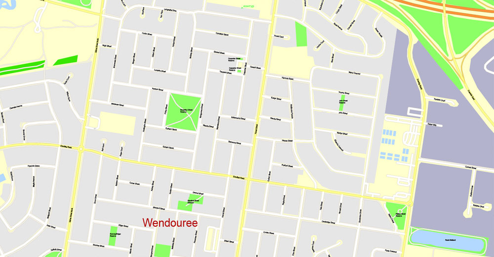
There are numerous densely forested areas around Ballarat; however due to historic wood milling and land clearing there remain no old-growth forests. The major natural bodies of water are in the west and include the former shallow swamps of Lake Wendouree which is central to the city’s western suburbs and beyond Winter’s Swamp and the large Lake Burrumbeet wetland complex. Almost all of the other numerous bodies of water have been created artificially and include several reservoirs, the largest being the White Swan Reservoir and smaller suburban lakes such as Lake Esmond.
The contiguous urban area of Ballarat covers approximately 90 km2 (35 sq mi) of the local government area’s 740 km2 (286 sq mi). Approximately 90% of the urban area’s land use is residential and suburban. From the city centre this area extends approximately 6 kilometres (4 miles) north to the hills around Invermay, approximately 7.5 km (4.7 mi) east to Leigh Creek in the foothills of Mount Warrenheip, approximately 7 km (4 mi) west along the plains to Lucas and approximately 8.5 km (5.3 mi) south along the Yarrowee River and Canadian Creek valley to the fringe of Buninyong. The central city is situated low in the valley of the Yarrowee River and surrounded by hills such that the city skyline is visible only from the hills and the lower lying inner eastern suburbs. The reach of the Yarrowee River toward Ballarat Central becomes a stormwater drain and is completely covered over as it flows under the CBD.
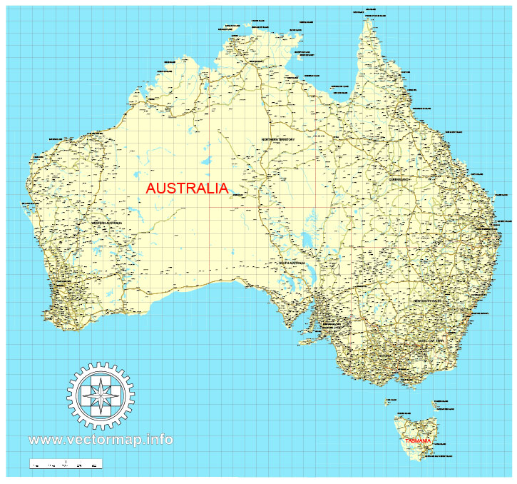
Free download vector map Australia, Adobe Illustrator, download now Free maps vector clipart >>>>>
Map for design, projects, presentation free to use as you like.
Share it!
Small guide: How to work with the vector map?
You can: Mass select objects by type and color – for example, the objects type “building” (they are usually dark gray) – and remove them from the map, if you do not need them in your print or design project. You can also easily change the thickness of lines (streets), just bulk selection the road by the line color.
The streets are separated by type, for example, type “residential road” are usually white with a gray stroke. Highway usually orange with a brown or dark gray stroke.
It is easy to change the font of inscriptions, all or each individually. Also, just can be make and any other manipulation of objects on the vector map in Adobe illustrator format.
Important: All the proportions on the map are true, that is, the relative sizes of the objects are true, because Map is based on an accurate GPS projection, and It transated into the (usual for all) the Mercator projection.
You can easily change the color, stroke and fill of any object on the map, zoom without loss of quality Image Verification.
Select object

Bulk selection the same objects on the vector map

See the bulk selected objects on the vector map

Bulk delete buildungs from the vector map

Select residencial road (small street) on the vector map

Bulk selection the same lines (streets, roads) on the full map

Create fat lines of the streets on the vector maps (bulk action) 1

Create fat lines of the streets on the vector maps (bulk action) 2

Create fat lines of the streets on the vector maps (bulk action) 3

You can easily change the color, stroke and fill of any object on the map, zoom without loss of quality Image Verification.

 Author: Kirill Shrayber, Ph.D. FRGS