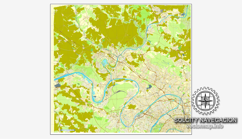
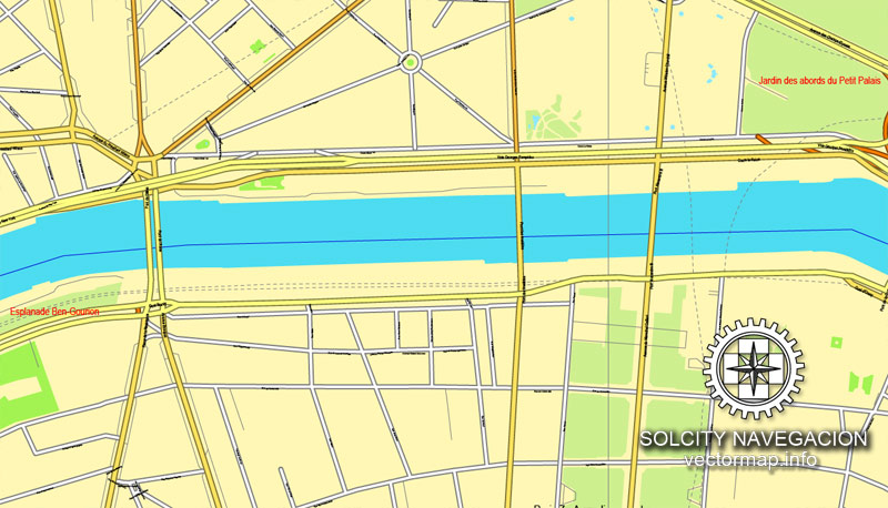
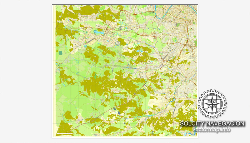
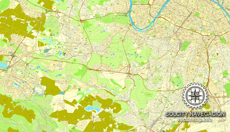
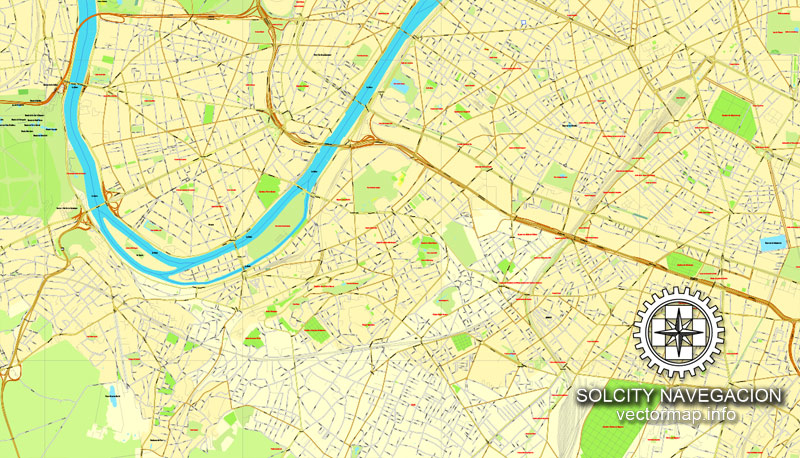
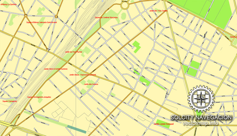
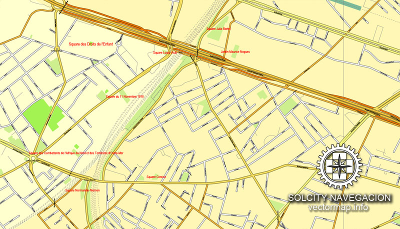
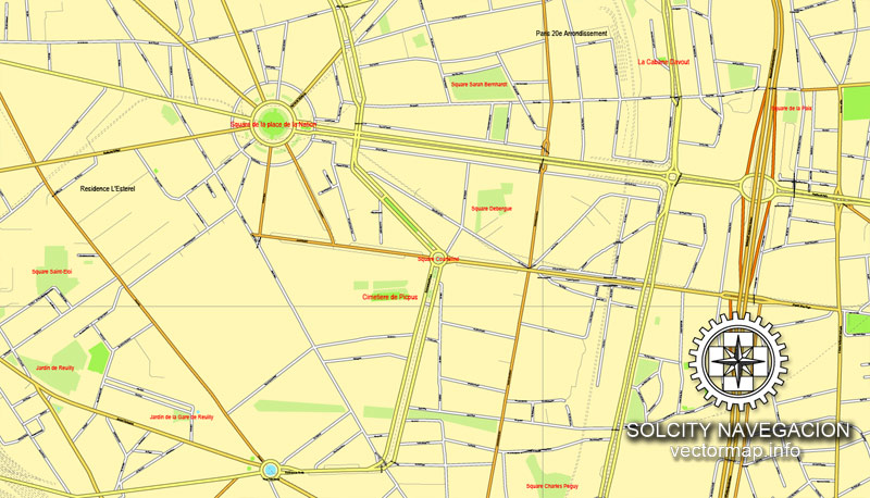
Paris Full Grande, France printable vector street City Plan 4 parts map, full editable, Adobe Illustrator, full vector, scalable, editable, text format street names, 40,7 mb ZIP
All streets, NO buildings. Map for design, print, arts, projects, presentations,
for architects, designers and builders.
PDF, DXF, DWG, CDR and other formats – on request, same price, please, contact
Paris Plein Grande, France rue vecteur imprimable Plan Plan de ville 4 pièces, complètement modifiable, Adobe Illustrator, vectoriel complet,,, noms évolutives rue format texte modifiable, 40,7 mb ZIP
Toutes les rues, pas de bâtiments. Carte de conception, d’impression, des arts, des projets, des présentations, pour les architectes, les concepteurs et les constructeurs.
PDF, DXF, DWG, CDR et d’autres formats – sur demande, même prix, s’il vous plaît, contactez
Paris, France.
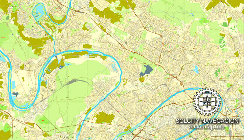
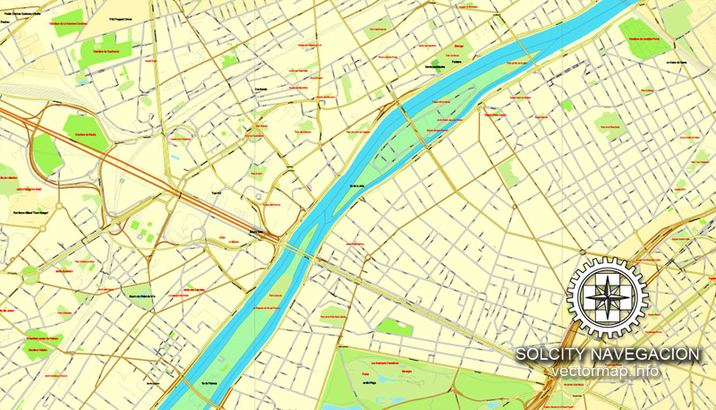
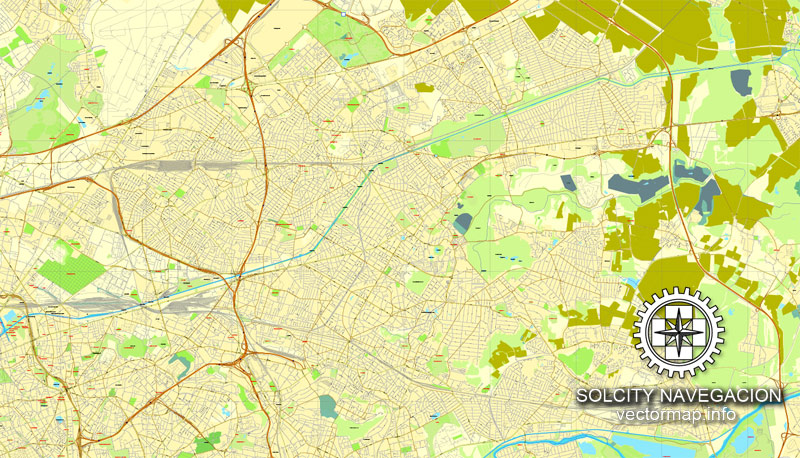
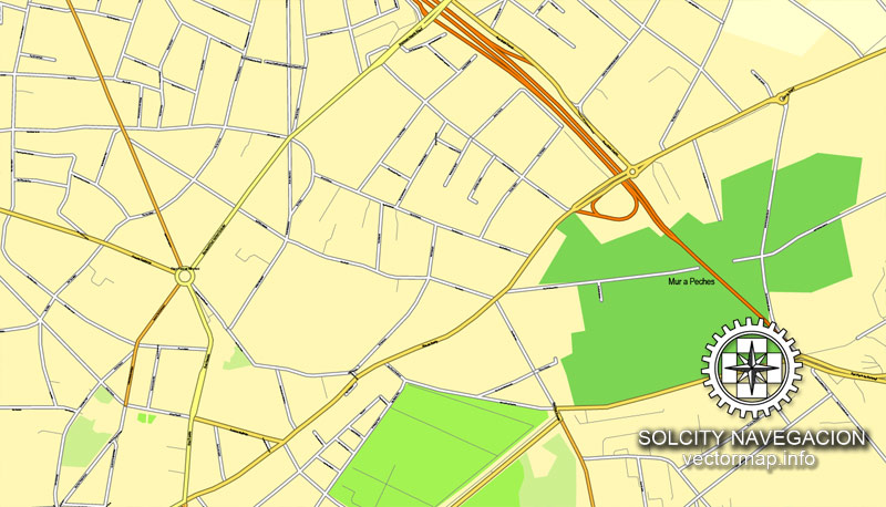
This vector map of Paris is used as a basis for design, editing, and further printing.
This is the most detailed, exact map of Paris for high-quality printing and polygraphy. You can always clarify the map development date by contacting us.
For your convenience, all objects on Paris vector map are divided into layers. And the editing is very easy – colors, lines, etc.
You can easily add any objects needed (e.g. shops, salons, sale points, gas station or attraction) on any layer of Paris vector map.
Paris is the capital and most populous city of France, with an area of 105 square kilometres (41 square miles) and a population of 2,206,488. Since the 17th century, Paris has been one of Europe’s major centres of finance, commerce, fashion, science, and the arts.

One of the advantages of Paris vector maps of our production is the relevance of cartographic data, we constantly update all our products.
This vector map of Paris is used by:
designers, layout designers, printers, advertisers and architects. Our product – vector maps – is designed for further editing and printing in large formats – from @Wall format (a few meters) to A-0 and A-1, A-2, A-3.
Paris map in vector format is used for design, urban planning, presentations and media visualizations.
Advertising and presentation map of Paris (usually the final designer marks the routes, and puts the client’s objects (shops, saloons, gas stations etc.)
The undoubted advantage is that people will NEVER throw out this advertising product – the map. In fact, as an advertising medium, a map is the most “long-playing” of the well-known polygraphic advertising media, with the longest lifespan, and the maximum number of interactions with the customer.
For travelers, maps are sold at the airports and gas stations around the world. Often the source is our vector maps.
Take a look, who purchases our vector maps of Paris in “Our Clients and Friends” page – these are large and small companies, from super-brands like Volvo and Starbucks, to small design studios and printing houses.
It’s very easy to work with vector maps of Paris, even for a not very experienced designer who can turn on and off the map layers, add new objects, change the colors of fill and lines according to customer requirements.
The undoubted advantage of Paris vector maps in printing is an excellent and detailed visualization, when customer can expand a large paper map and instantly define his location, find a landmark, an object or address on map, unlike using the popular electronic formats of Google and Yandex maps for example.
Printable vector maps of Paris are much more convenient and efficient than any electronic maps on your smartphone, because ALL DETAILS are displayed in the entire space of Paris map.
Useful tips on working with vector maps of cities and countries in Adobe Illustrator.
«V» – launches the Selection tool (cursor, black arrow), which makes active any vector line.
«А» – launches the Direct Selection tool (white cursor), allows you to select curve elements and drag them to the desired place.
«R» – activates the Rotate tool, which helps you rotating selected objects around the center point by 360 degrees.
«E» – gives you the opportunity to use the Eraser tool and erase unnecessary parts.
«X» – switches between Fill and Stroke in the Tools section. Try to get used to this hot key and
you will quickly understand that you can’t live and work without it.
Guides are not limited to vertical and horizontal in Adobe Illustrator. You can also create a diagonal guide for example. Moreover, you can turn any contours into guides. Select the outline and go to View > Guides > Make Guides (Create Guides), or simply press Cmd/Ctrl + 5. You can also turn the guides back into an editable object. Go to menu, View > Guides > Unlock Guides (Release Guides), select the guide you want to edit and select View > Guides > Release Guides (Reset Guides), or just press Cmd/Ctrl + Option / Alt + 5).
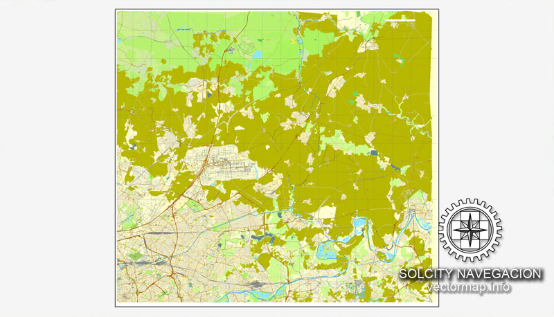
The City of Paris is the centre and seat of government of the Île-de-France, or Paris Region, which has an estimated official 2018 population of 12,246,234, or 18.2 percent of the population of France. Besides this,the Paris metropolitan area had a population of 12,532,901 in 2015. The Paris Region had a GDP of €681 billion (US$850 billion) in 2016, accounting for 31 percent of the GDP of France. According to the Economist Intelligence Unit Worldwide Cost of Living Survey in 2018, Paris was the second-most expensive city in the world, behind Singapore and ahead of Zurich, Hong Kong, Oslo and Geneva.
You will probably want to change the color scheme used on our Paris vector map.
To quickly and effectively play with colors.
Of course, you can do it manually, all objects in our Paris vector map are divided according to types and layers, and you can easily change the color gamma of vector objects in groups and layers.
But there is more effective way of working with the whole VECTOR MAP of Paris and all layers:
The overview dialog «Edit colors»/«Repaint Graphic Object» (this dialog box name can change depending on the context):
If you have selected a part or a layer of Paris vector map and open the dialog box by clicking the icon in the Control panel, on the Samples palette or the Color Catalog, or if you choose Edit > Edit Colors> Repaint Graphic Object, then the «Repaint Graphic Object» dialog box appears, and you get access to «Assign» and «Edit» tabs.
If a picture or a map fragment is not selected, and you open the dialog box by clicking the icon in the Control panel, on the Samples palette or in the Color Catalog, the «Edit Colors» dialog box appears and you can only access the «Edit» tab.
Regardless of the name at the top of the dialog box, the right-hand side always displays the color group of the current document, as well as two default color groups: Print Color and Grayscale. These color groups can be selected and used any time.
Create and edit color groups of Paris vector map, and also assign colors using the «Edit Colors»/ а «Repaint Graphic Object» dialog box.
A. Creating and editing of a color group on the «Edit» tab
B. Assigning colors on the «Assign» tab
C. Select a group of colors from the «Color groups» list
The option «Repaint a graphic object» in the lower part of the dialog box allows you to preview the colors on a selected layer of Vector map, or a group of elements, and specify whether its colors will be redefined when the dialog box is closed.
The main areas of the dialog box are:
«Edit»
The «Edit» tab is designed to create a new or edit the existing color groups.
The harmony rules Menu and the Color Wheel are used to conduct experiments with color harmonies. The color wheel shows how colors are related in color harmony, and the color bars allow you to view and manipulate an individual color values. In addition, you can adjust the brightness, add and remove colors, save color groups and view colors on the selected Vector Map of Paris or a separated layers.
«Assign»
The «Assign» tab is used to view and control on how the original colors are replaced with colors from the color group like your corporate colors in the Vector Map of Paris.
The assign color ability is provided only if the entire map, layer or fragment is selected in the document. You can specify which of new colors replace the current colors, whether the spot colors should be preserved and how colors are replaced (for example, you can replace colors completely or changing the color tone while maintaining the brightness). The «Assign» tab allows you to redefine colors in the Vector Map of Paris, or in separate layers and fragments using the current color group or reducing the number of colors in the current Vector Map.
Color groups
Is a list of all saved color groups for current document (the same groups appear in the «Samples» palette). You can edit and delete the existing color groups, as well as creating a new ones using the list of “Color Groups” in the dialog box. All changes appear in the «Samples» palette.
The highlighted color group shows, which color group is currently edited.
Any color group can be selected and edited, or used to redefine the colors in the selected vector map of Paris , its fragments or elements.
Saving a color group adds this group to the specified list.
Opening the «Edit Colors»/«Repaint Graphic Object» dialog box.
Open the «Edit Colors»/«Repaint Graphic Object» dialog box using one of the following methods:
«Edit»> «Edit Colors»> «Repaint Graphic object» or «Repaint With Style».
Use these commands if you need to edit the colors in the selected vector map of Paris.
«Repaint Graphic object» button on the «Control» panel.
Use this button if you need to adjust colors of Paris vector map using the а «Repaint graphic object» dialog box.
The specified button is available if the selected vector map or its fragment contains two or more colors.
The city is a major rail, highway, and air-transport hub served by two international airports: Paris-Charles de Gaulle (the second busiest airport in Europe after London Heathrow Airport with 69.5 million passengers in 2017) and Paris-Orly. Opened in 1900, the city’s subway system, the Paris Métro, serves 5.23 million passengers daily, and is the second busiest metro system in Europe after Moscow Metro. Gare du Nord is the 24th busiest railway station in the world, with 262 million passengers in 2015.
Note. This color editing method is convenient for global color adjustment in a vector map, if global colors were not used when creating a Map of Paris.
The «Edit colors» button or «Edit or apply colors» on the «Color Catalog» palette
Click this button if you need to edit colors on the «Color Catalog» palette or edit and then apply them to the selected Vector Map of Paris or its fragment.
The «Edit color group» button or «Edit or apply color group» on the «Samples» palette.
Click this button if you need to edit the colors in the specific color group or edit and apply them to the selected Vector Map of Paris or a group of its elements, for example, the whole layer “Streets and lines”. You can also double-click the color group in the Samples panel to open the dialog box.
If the map file is too large and your computer freezes or even can’t open it quickly:
1. Try to reduce the color resolution of the video card (display) to 256 colors while working with a large map.
2. Using Windows Task Manager, select all the application you don’t need, while working with map, just turn them off.
3. Launch Adobe Illustrator. (DO NOT OPEN the vector map file)
4. Start the Windows Task Manager using administrator rights > Find the “Illustrator” process > set the «real time» priority,
5. Open the file. When you see the LEGACY FONT popup window – click “OK” (do not update). You can restore the TEXT later.
6. Can also be useful: When file is opened – Edit > Settings > Basic Settings > disable smoothing. /// It looks scary, but works quickly)))
We recommend saving the file in Adobe Illustrator 10 version. It’s much more stable when working with VERY BIG size files.
Paris is especially known for its museums and architectural landmarks: the Louvre was the most visited art museum in the world in 2017, with 8.1 million visitors. The Musée d’Orsay and Musée de l’Orangerie are noted for their collections of French Impressionist art, and the Pompidou Centre Musée National d’Art Moderne has the largest collection of modern and contemporary art in Europe. The historical district along the Seine in the city centre is classified as a UNESCO Heritage Site. Popular landmarks in the centre of the city include the Cathedral of Notre Dame de Paris and the Gothic royal chapel of Sainte-Chapelle, both on the Île de la Cité; the Eiffel Tower, constructed for the Paris Universal Exposition of 1889; the Grand Palais and Petit Palais, built for the Paris Universal Exposition of 1900; the Arc de Triomphe on the Champs-Élysées, and the Basilica of Sacré-Coeur on the hill of Montmartre. Paris received 23 million visitors in 2017, measured by hotel stays, with the largest numbers of foreign visitors coming from the United States, the UK, Germany and China. It was ranked as the third most visited travel destination in the world in 2017, after Bangkok and London.

The football club Paris Saint-Germain and the rugby union club Stade Français are based in Paris. The 80,000-seat Stade de France, built for the 1998 FIFA World Cup, is located just north of Paris in the neighbouring commune of Saint-Denis. Paris hosts the annual French Open Grand Slam tennis tournament on the red clay of Roland Garros. Paris hosted the Olympic Games in 1900, 1924 and will host the 2024 Summer Olympics. The 1938 and 1998 FIFA World Cups, the 2007 Rugby World Cup, and the 1960, 1984, and 2016 UEFA European Championships were also held in the city and, every July, the Tour de France bicycle race finishes there.
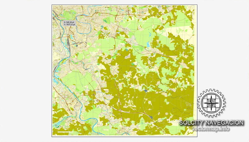
The geography of Paris is characterized by the urbanization of the area it lies within, and its position in the Petite Couronne, Grande Couronne, and Île-de-France.
Location
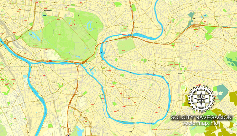
Paris is located in northern central France. By road, it is 450 kilometres (280 mi) southeast of London, 287 kilometres (178 mi) south of Calais, 305 kilometres (190 mi) southwest of Brussels, 774 kilometres (481 mi) north of Marseille, 385 kilometres (239 mi) northeast of Nantes, and 135 kilometres (84 mi) southeast of Rouen. Paris is located in the north-bending arc of the river Seine and includes two islands, the Île Saint-Louis and the larger Île de la Cité, which form the oldest part of the city. The river’s mouth on the English Channel (La Manche) is about 233 mi (375 km) downstream from the city. The city is spread widely on both banks of the river.
Area
Excluding the outlying parks of Bois de Boulogne and Bois de Vincennes, Paris covers an oval measuring about 87 km2 (34 sq mi) in area, enclosed by the 35 km (22 mi) ring road, the Boulevard Périphérique. The city’s last major annexation of outlying territories in 1860 not only gave it its modern form but also created the 20 clockwise-spiralling arrondissements (municipal boroughs). From the 1860 area of 78 km2 (30 sq mi), the city limits were expanded marginally to 86.9 km2 (33.6 sq mi) in the 1920s. In 1929, the Bois de Boulogne and Bois de Vincennes forest parks were officially annexed to the city, bringing its area to about 105 km2 (41 sq mi). The metropolitan area of the city is 2,300 km2 (890 sq mi).

Small guide: How to work with the vector map?
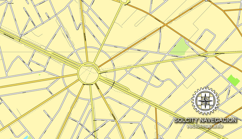
You can: Mass select objects by type and color – for example, the objects type “building” (they are usually dark gray) – and remove them from the map, if you do not need them in your print or design project. You can also easily change the thickness of lines (streets), just bulk selection the road by the line color.
The streets are separated by type, for example, type “residential road” are usually white with a gray stroke. Highway usually orange with a brown or dark gray stroke.
It is easy to change the font of inscriptions, all or each individually. Also, just can be make and any other manipulation of objects on the vector map in Adobe illustrator format.
Important: All the proportions on the map are true, that is, the relative sizes of the objects are true, because Map is based on an accurate GPS projection, and It transated into the (usual for all) the Mercator projection.
You can easily change the color, stroke and fill of any object on the map, zoom without loss of quality Image Verification.
Select object

Bulk selection the same objects on the vector map

See the bulk selected objects on the vector map

Bulk delete buildungs from the vector map

Select residencial road (small street) on the vector map

Bulk selection the same lines (streets, roads) on the full map

Create fat lines of the streets on the vector maps (bulk action) 1

Create fat lines of the streets on the vector maps (bulk action) 2

Create fat lines of the streets on the vector maps (bulk action) 3

You can easily change the color, stroke and fill of any object on the map, zoom without loss of quality Image Verification.

 Author: Kirill Shrayber, Ph.D. FRGS
 Street Map editable Adobe Illustrator in layers")
 editable Adobe Illustrator in layers")

