Extended Description of the Vector Map
Printable Vector Map of Oregon State – US Extra High detailed State Plan scale 1:53930 full editable Adobe Illustrator Road + Admin (counties) + ZipCodes Map in layers, scalable, text format all names, 81 MB ZIP
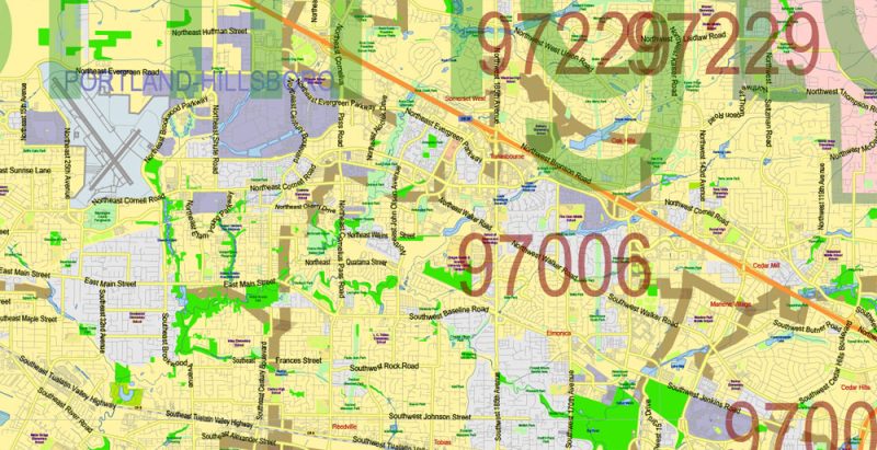
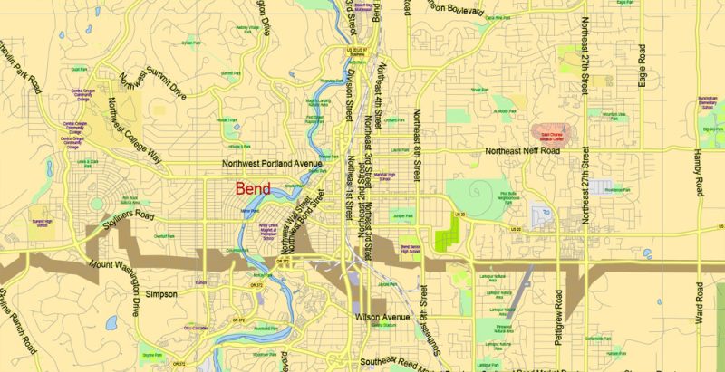
Principal street names, ALL STREETS AND ROADS, Main Objects, Counties, Zipcodes. Map for design, printing, arts, projects, presentations, for architects, designers, and builders, business, logistics.
Included: Simple map of Oregon state.
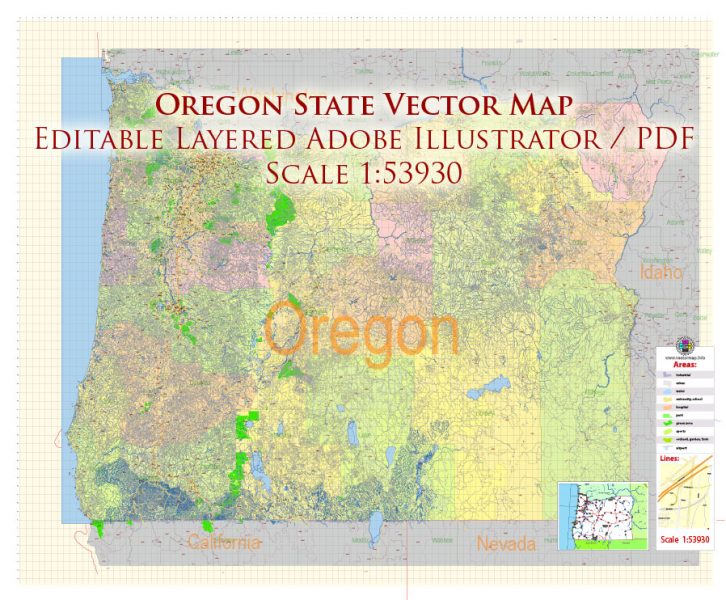
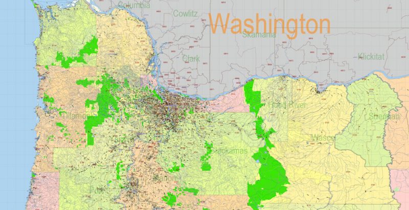
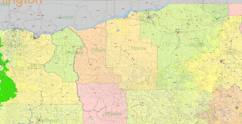
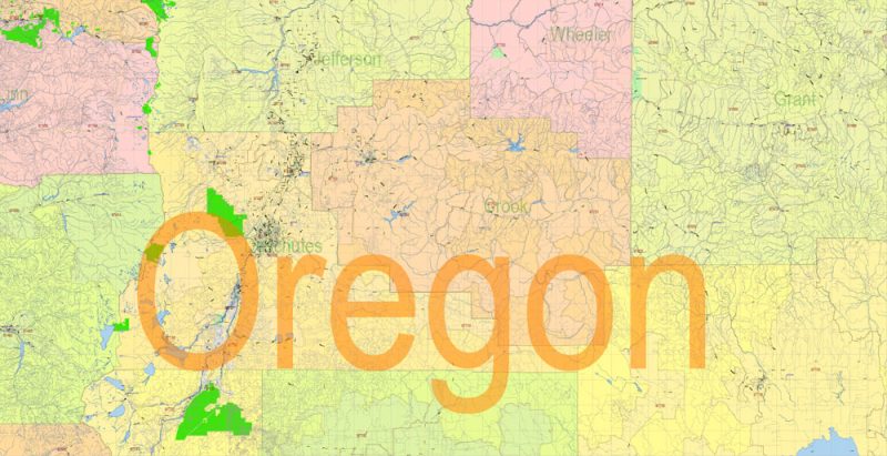
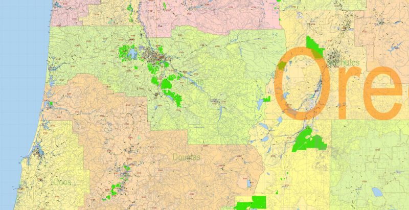
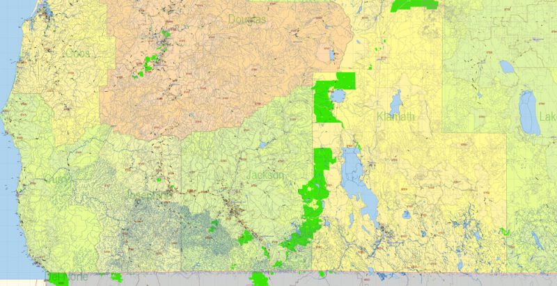
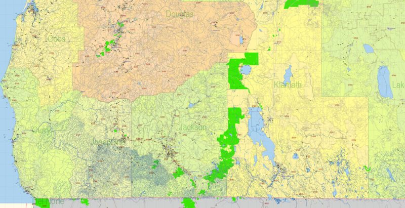
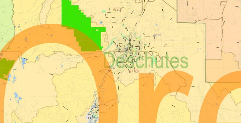
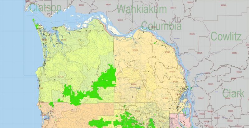
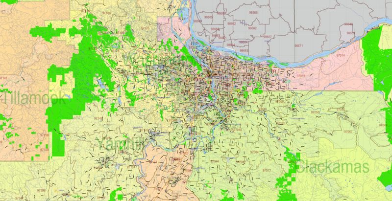
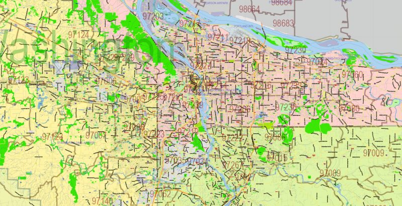
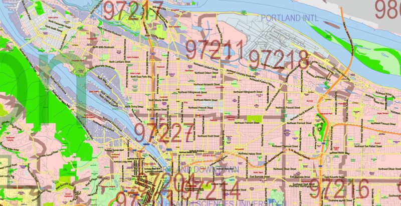
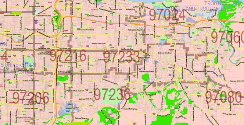
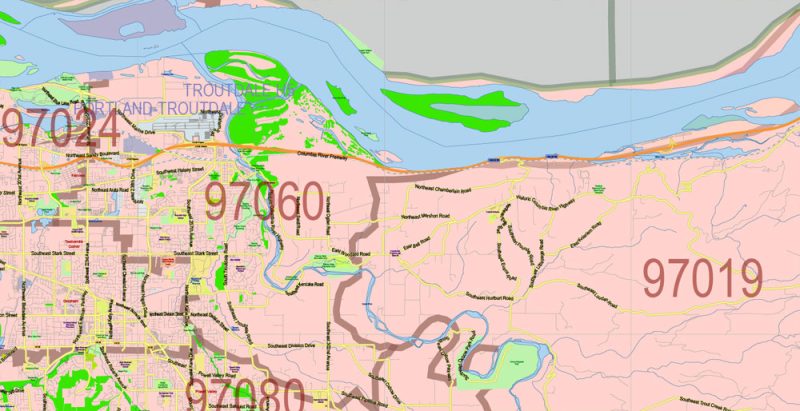
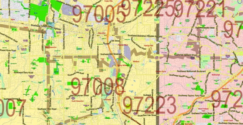
Oregon State US Map Vector Exact City Plan High Detailed Street Map + admin + Zipcodes editable Adobe Illustrator in layers
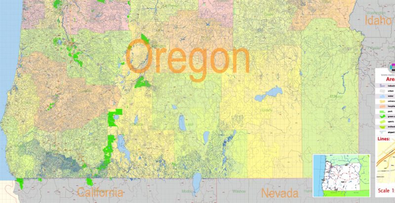
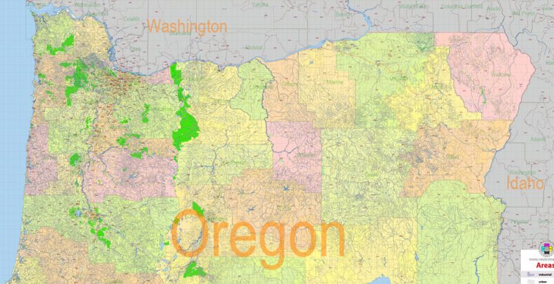
Layers list Oregon State Roads Admin map:
- Legend
- Grids
- Labels of roads
- Points of airports
- Names of airports
- Names of places (city, hamlet, etc.)
- Names of cities, towns, hamlets 2
- Names of objects (hospitals, schools, parks, water)
- Points of cities, towns, hamlets
- Names of Main streets
- Main Streets, roads, railroads, lines
- Civil streets
- Railroads
- Waterways (lines)
- Water objects (rivers, lakes, ponds) areas
- Names of Counties
- Names of States
- Zipcodes areas
- Zipcodes numbers
- Counties areas
- States areas
- Color fills (parks, hospital areas, school areas, etc.)
- Back
The most exact and detailed map of the State of Oregon in scale.
ALSO: DWG, DXF, CDR and other formats: free convert for our customers.
For Editing and High-Quality Printing
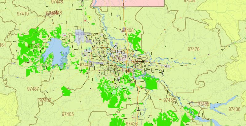
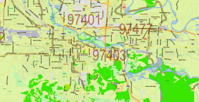
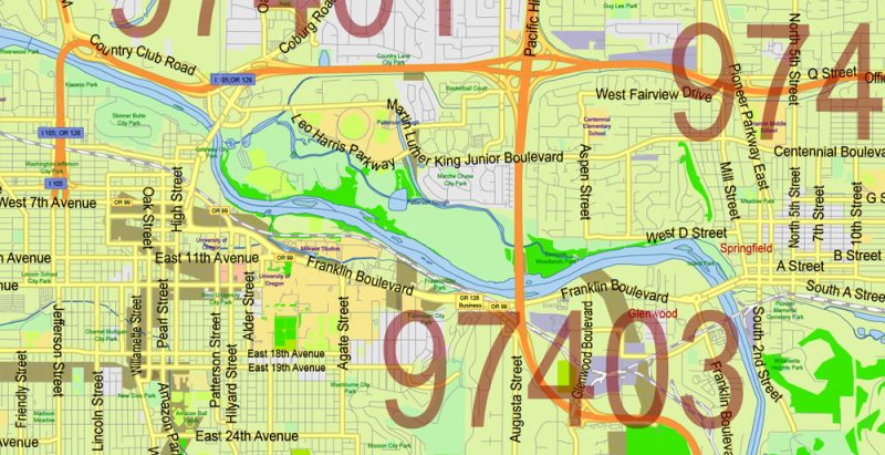
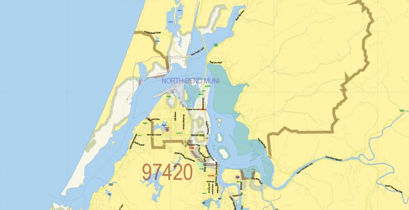
Oregon State US Map Vector Exact City Plan High Detailed Street Map + admin + Zipcodes editable Adobe Illustrator in layers
Oregon State US Map Vector Exact City Plan High Detailed Street Map + admin + Zipcodes editable Adobe Illustrator in layers
Oregon State US Map Vector Exact City Plan High Detailed Street Map + admin + Zipcodes editable Adobe Illustrator in layers
Oregon State US Map Vector Exact City Plan High Detailed Street Map + admin + Zipcodes editable Adobe Illustrator in layers
Oregon State US Map Vector Exact City Plan High Detailed Street Map + admin + Zipcodes editable Adobe Illustrator in layers
Oregon State US Map Vector Exact City Plan High Detailed Street Map + admin + Zipcodes editable Adobe Illustrator in layers
Oregon State US Map Vector Exact City Plan High Detailed Street Map + admin + Zipcodes editable Adobe Illustrator in layers
Oregon State US Map Vector Exact City Plan High Detailed Street Map + admin + Zipcodes editable Adobe Illustrator in layers
Oregon State US Map Vector Exact City Plan High Detailed Street Map + admin + Zipcodes editable Adobe Illustrator in layers
Oregon State US Map Vector Exact City Plan High Detailed Street Map + admin + Zipcodes editable Adobe Illustrator in layers
Oregon State US Map Vector Exact City Plan High Detailed Street Map + admin + Zipcodes editable Adobe Illustrator in layers
Oregon State US Map Vector Exact City Plan High Detailed Street Map + admin + Zipcodes editable Adobe Illustrator in layers
Oregon State US Map Vector Exact City Plan High Detailed Street Map + admin + Zipcodes editable Adobe Illustrator in layers
Oregon State US Map Vector Exact City Plan High Detailed Street Map + admin + Zipcodes editable Adobe Illustrator in layers
Oregon State US Map Vector Exact City Plan High Detailed Street Map + admin + Zipcodes editable Adobe Illustrator in layers
Oregon State US Map Vector Exact City Plan High Detailed Street Map + admin + Zipcodes editable Adobe Illustrator in layers
Oregon State US Map Vector Exact City Plan High Detailed Street Map + admin + Zipcodes editable Adobe Illustrator in layers
Oregon State US Map Vector Exact City Plan High Detailed Street Map + admin + Zipcodes editable Adobe Illustrator in layers
Oregon State US Map Vector Exact City Plan High Detailed Street Map + admin + Zipcodes editable Adobe Illustrator in layers
Oregon State US Map Vector Exact City Plan High Detailed Street Map + admin + Zipcodes editable Adobe Illustrator in layers
Oregon State US Map Vector Exact City Plan High Detailed Street Map + admin + Zipcodes editable Adobe Illustrator in layers
Oregon State US Map Vector Exact City Plan High Detailed Street Map + admin + Zipcodes editable Adobe Illustrator in layers


 Author: Kirill Shrayber, Ph.D. FRGS
