Extended Description of the Vector Map
Printable PDF Map Vector Ohio State State (Full Area), US detailed fully editable Adobe PDF Road Map in layers, scalable, text/curves format all names, 287 MB ZIP
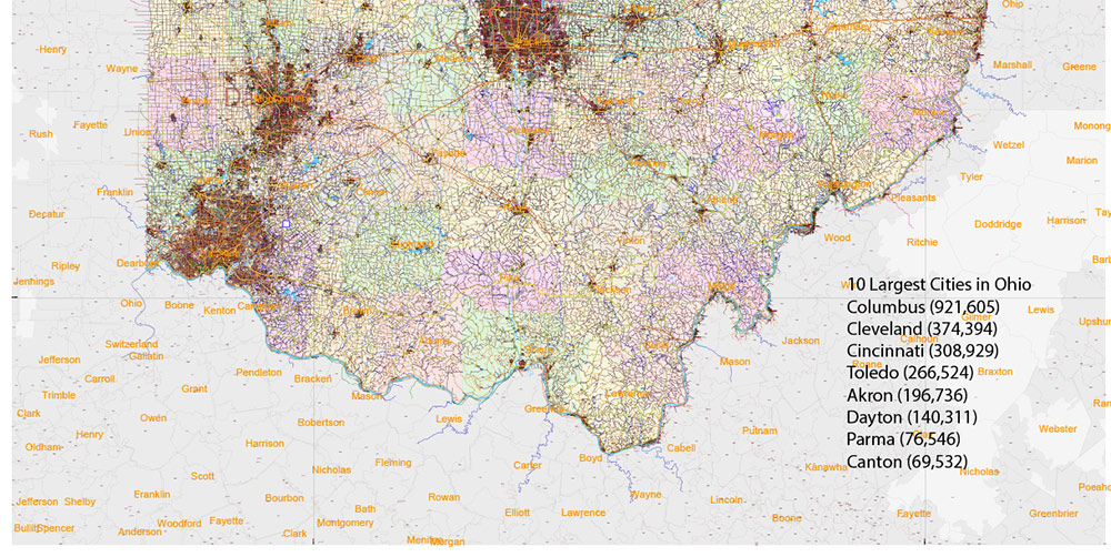
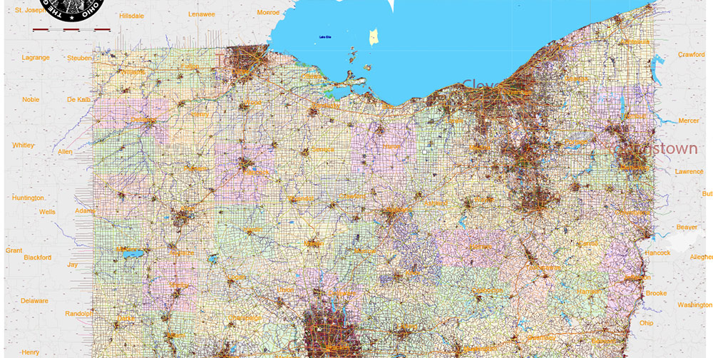
All streets and roads, Names Main streets and roads, Cities and Towns, Water Objects, Railroads, Airports, Zipcodes, Counties. Map for design, printing, arts, projects, presentations, for architects, designers, and builders, business, logistics.
Also: We can add (additional layer for this map), any other objects for you. It’s free for our customers.
If you need any OTHER format – DWG, DXF, Corel, or something else – please, email us
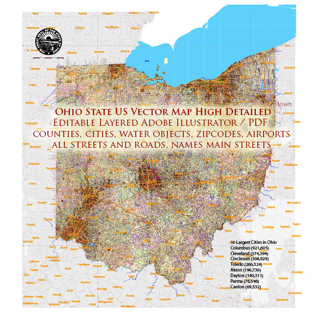
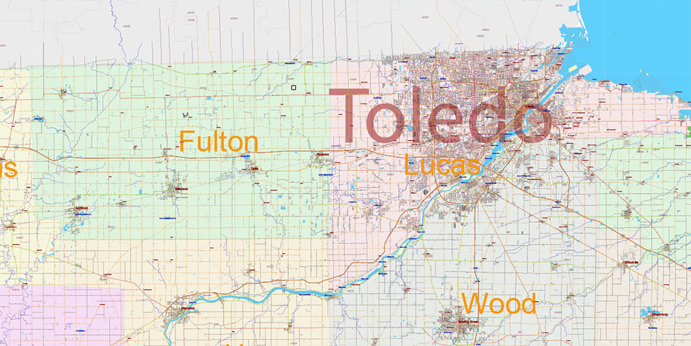
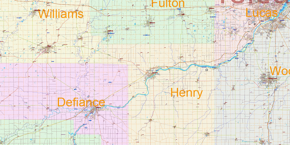
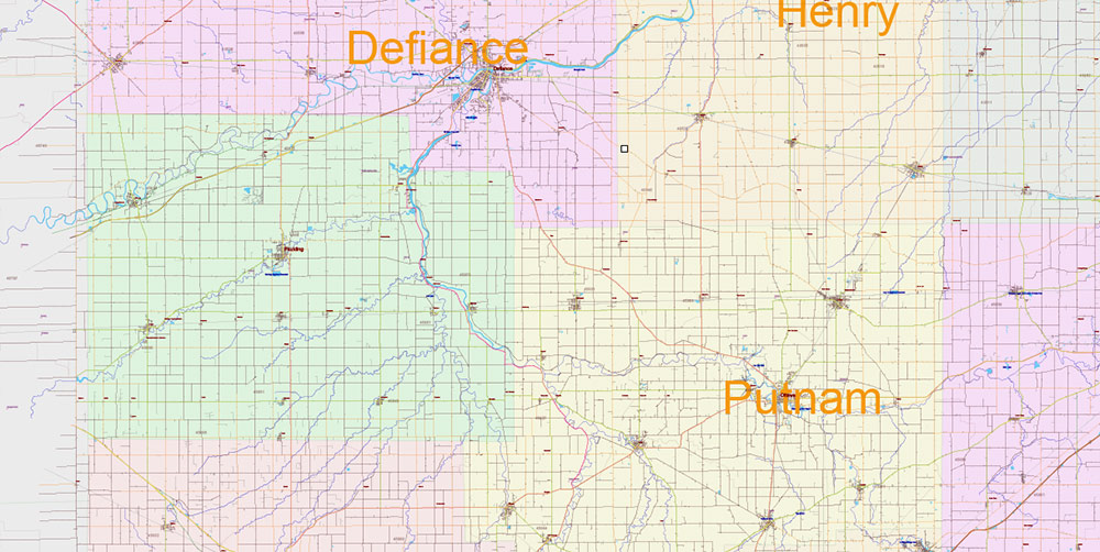
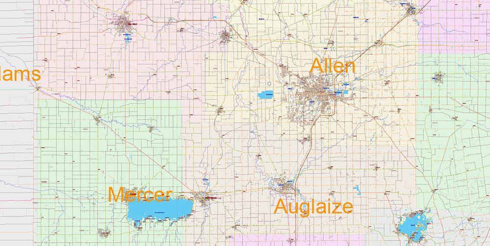
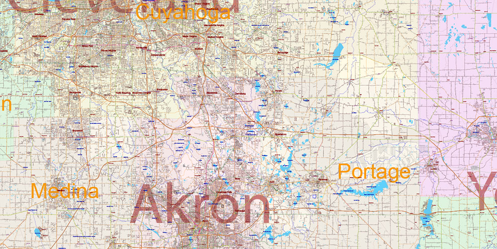
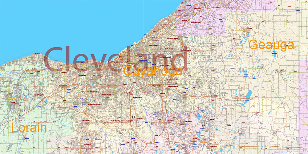
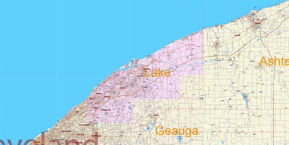
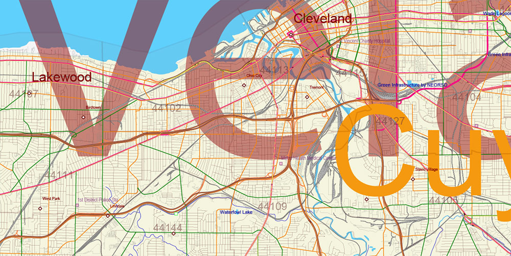
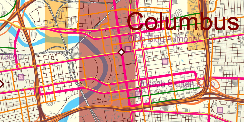
Ohio State US PDF Vector Map: Exact Roads Plan High Detailed Street Map + Counties + Zipcodes editable Adobe PDF in layers
Layers list:
- Legend
- Grids
- Names of Airports
- Points of Airports
- Names of places (city, hamlet, etc.) 1,2
- Names of Main Cities
- Points of places 1,2
- Names of water objects (rivers, lakes, ponds)
- Numbers of Zipcodes
- Names of Counties
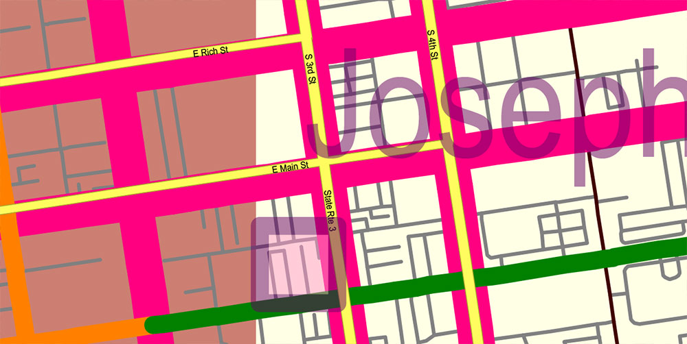
- Names of Main Streets and Roads
- Main streets and roads
- Residential streets and roads
- Railroads
- Water objects (areas)
- Waterways
- Airport runways
- Zipcodes areas
- Counties areas
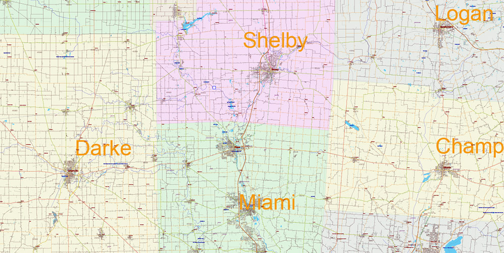
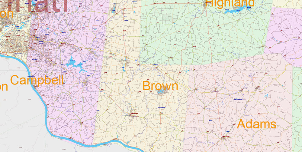
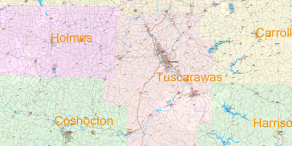
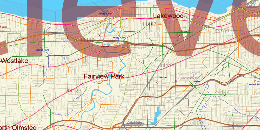
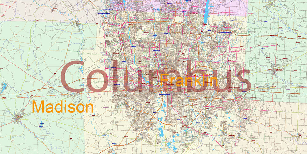
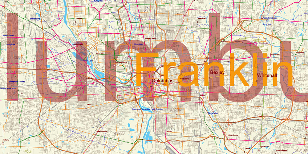
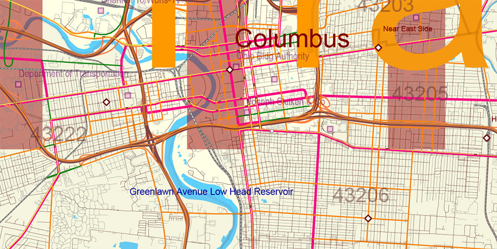
Ohio State US PDF Vector Map: Exact Roads Plan High Detailed Street Map + Counties + Zipcodes editable Adobe PDF in layers
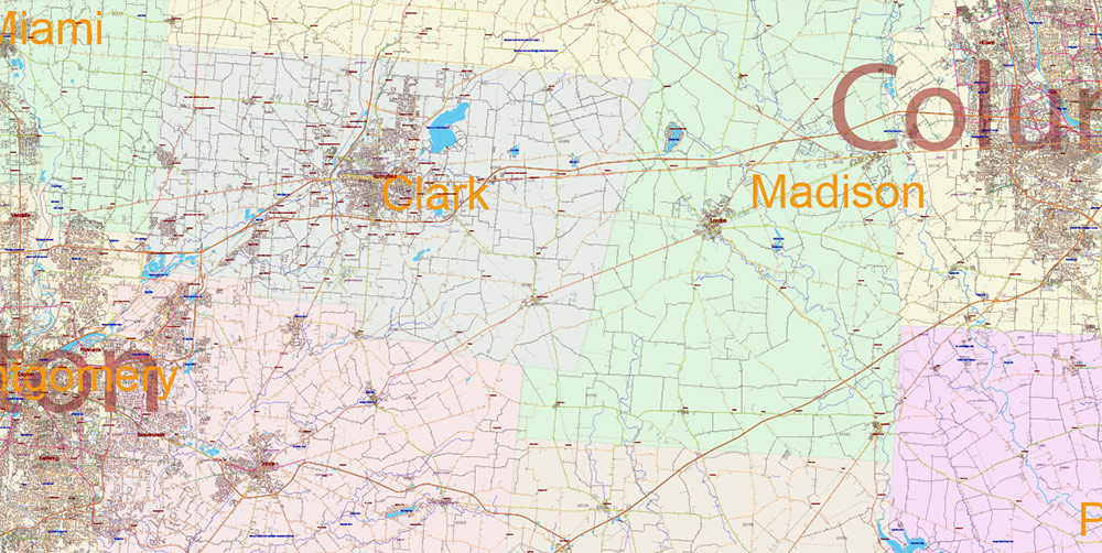
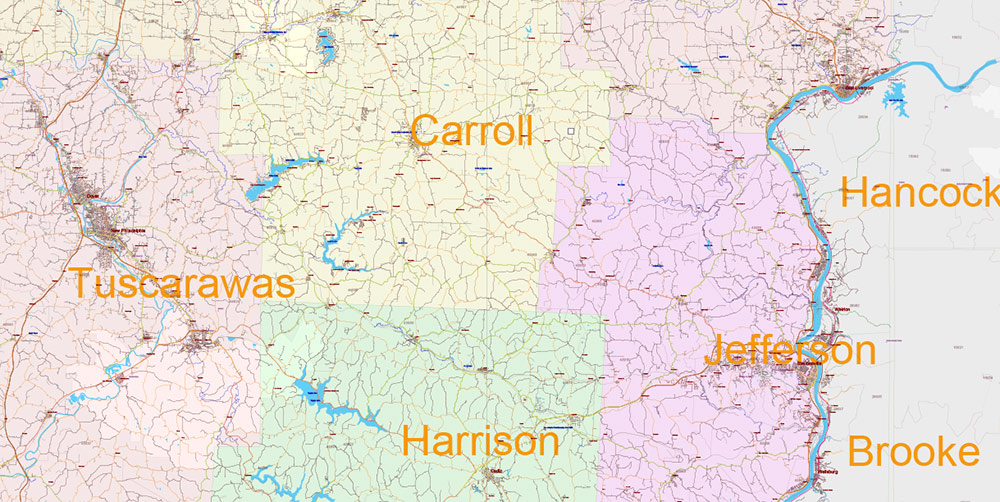
Ohio State US PDF Vector Map: Exact Roads Plan High Detailed Street Map + Counties + Zipcodes editable Adobe PDF in layers
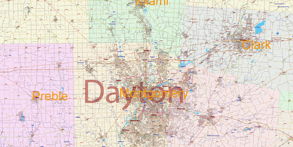
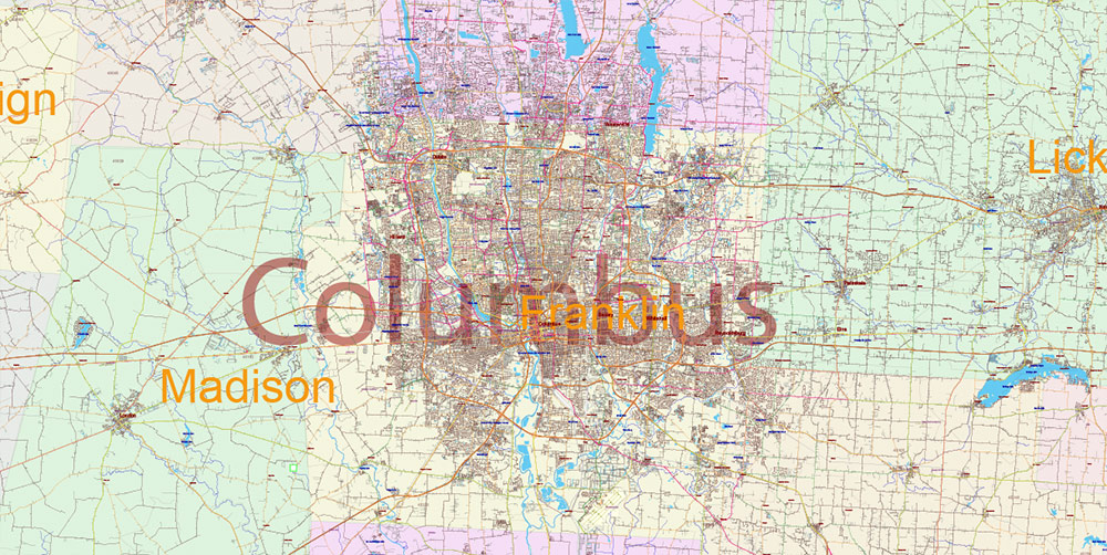
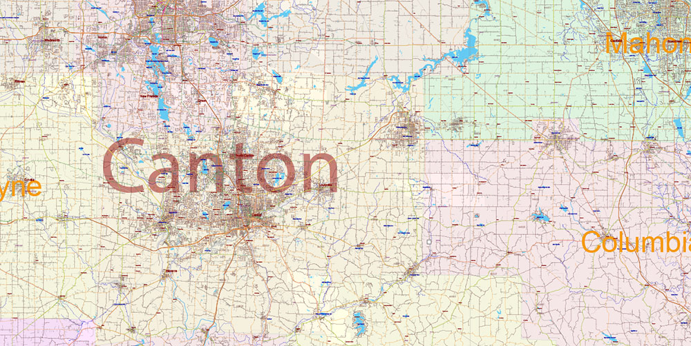
Ohio State US PDF Vector Map: Exact Roads Plan High Detailed Street Map + Counties + Zipcodes editable Adobe PDF in layers
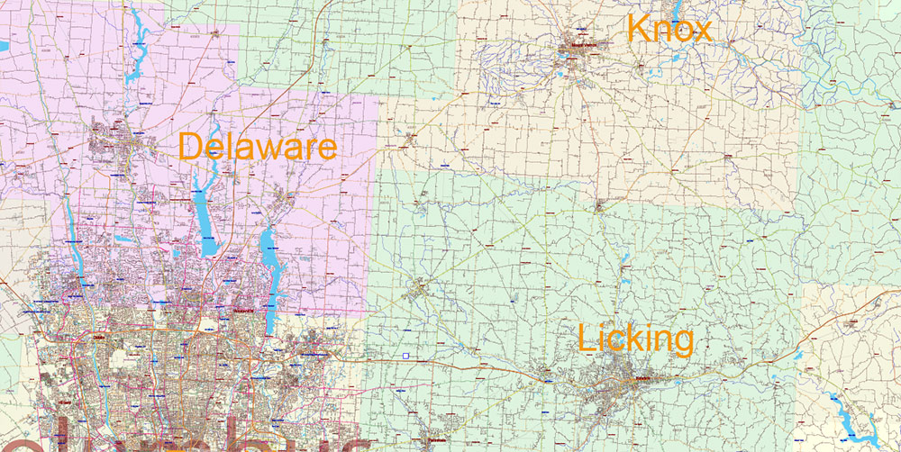
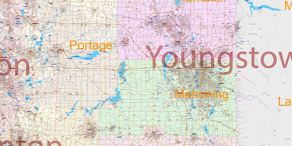
Ohio State US PDF Vector Map: Exact Roads Plan High Detailed Street Map + Counties + Zipcodes editable Adobe PDF in layers
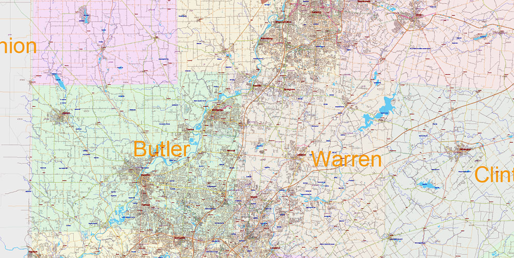
Ohio State US PDF Vector Map: Exact Roads Plan High Detailed Street Map + Counties + Zipcodes editable Adobe PDF in layers
Ohio State US PDF Vector Map: Exact Roads Plan High Detailed Street Map + Counties + Zipcodes editable Adobe PDF in layers
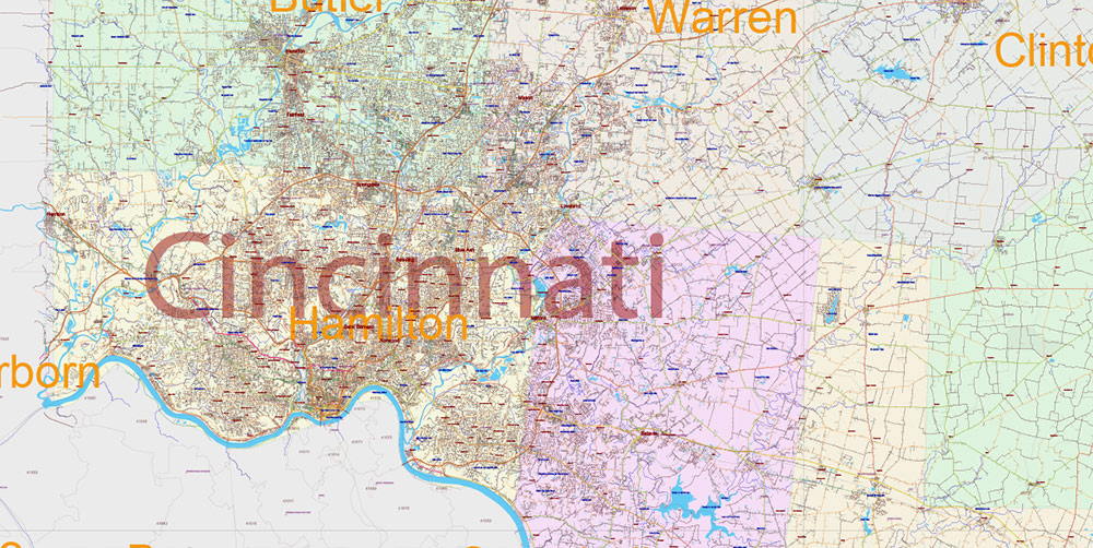
Ohio State US PDF Vector Map: Exact Roads Plan High Detailed Street Map + Counties + Zipcodes editable Adobe PDF in layers
Ohio State US PDF Vector Map: Exact Roads Plan High Detailed Street Map + Counties + Zipcodes editable Adobe PDF in layers
Ohio State US PDF Vector Map: Exact Roads Plan High Detailed Street Map + Counties + Zipcodes editable Adobe PDF in layers
Ohio State US PDF Vector Map: Exact Roads Plan High Detailed Street Map + Counties + Zipcodes editable Adobe PDF in layers
Ohio State US PDF Vector Map: Exact Roads Plan High Detailed Street Map + Counties + Zipcodes editable Adobe PDF in layers
Ohio State US PDF Vector Map: Exact Roads Plan High Detailed Street Map + Counties + Zipcodes editable Adobe PDF in layers
Ohio State US PDF Vector Map: Exact Roads Plan High Detailed Street Map + Counties + Zipcodes editable Adobe PDF in layers
Ohio State US PDF Vector Map: Exact Roads Plan High Detailed Street Map + Counties + Zipcodes editable Adobe PDF in layers
Ohio State US PDF Vector Map: Exact Roads Plan High Detailed Street Map + Counties + Zipcodes editable Adobe PDF in layers
Ohio State US PDF Vector Map: Exact Roads Plan High Detailed Street Map + Counties + Zipcodes editable Adobe PDF in layers
Ohio State US PDF Vector Map: Exact Roads Plan High Detailed Street Map + Counties + Zipcodes editable Adobe PDF in layers
Ohio State US PDF Vector Map: Exact Roads Plan High Detailed Street Map + Counties + Zipcodes editable Adobe PDF in layers
Ohio State US PDF Vector Map: Exact Roads Plan High Detailed Street Map + Counties + Zipcodes editable Adobe PDF in layers
Ohio State US PDF Vector Map: Exact Roads Plan High Detailed Street Map + Counties + Zipcodes editable Adobe PDF in layers
Ohio State US PDF Vector Map: Exact Roads Plan High Detailed Street Map + Counties + Zipcodes editable Adobe PDF in layers
Ohio State US PDF Vector Map: Exact Roads Plan High Detailed Street Map + Counties + Zipcodes editable Adobe PDF in layers
Ohio State US PDF Vector Map: Exact Roads Plan High Detailed Street Map + Counties + Zipcodes editable Adobe PDF in layers
Ohio State US PDF Vector Map: Exact Roads Plan High Detailed Street Map + Counties + Zipcodes editable Adobe PDF in layers
Ohio State US PDF Vector Map: Exact Roads Plan High Detailed Street Map + Counties + Zipcodes editable Adobe PDF in layers
Ohio State US PDF Vector Map: Exact Roads Plan High Detailed Street Map + Counties + Zipcodes editable Adobe PDF in layers
Ohio State US PDF Vector Map: Exact Roads Plan High Detailed Street Map + Counties + Zipcodes editable Adobe PDF in layers
Ohio State US PDF Vector Map: Exact Roads Plan High Detailed Street Map + Counties + Zipcodes editable Adobe PDF in layers

 Author: Kirill Shrayber, Ph.D. FRGS


