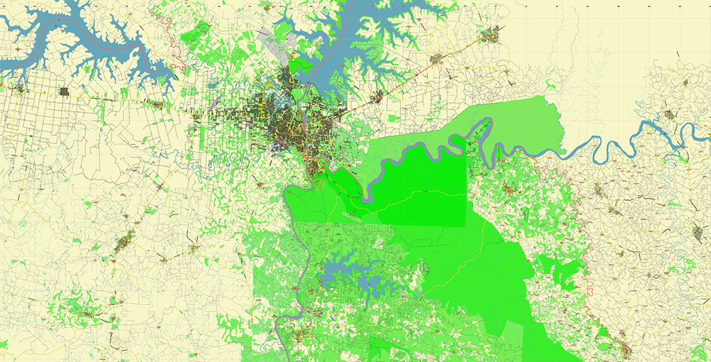
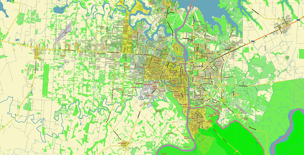
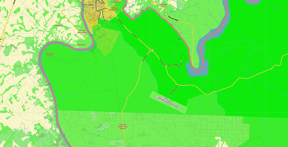
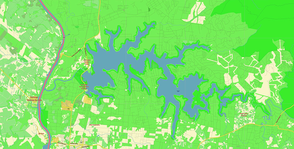
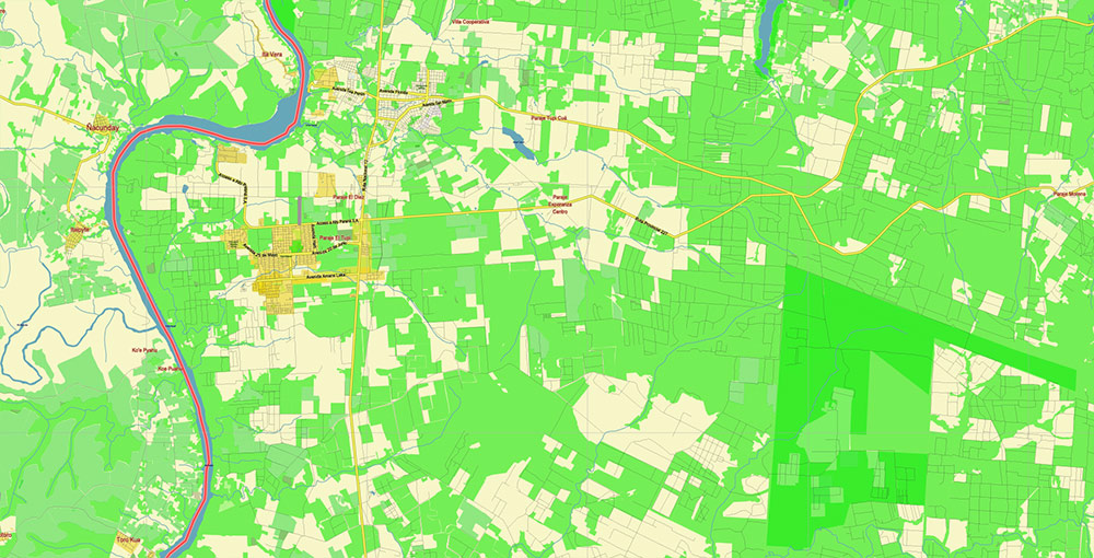
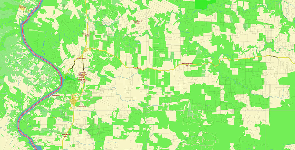
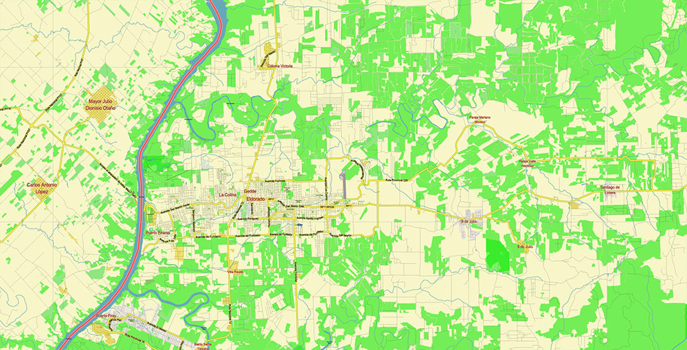
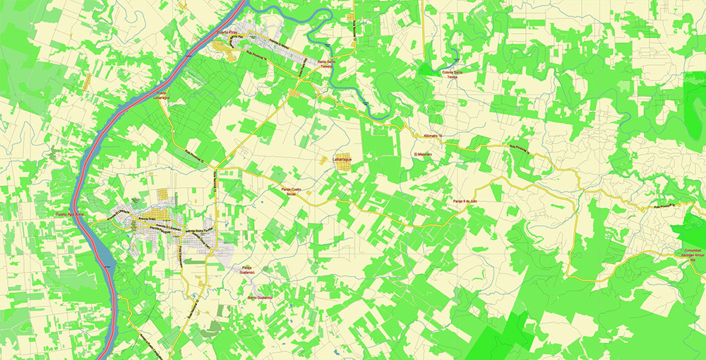
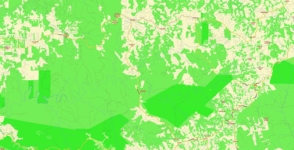
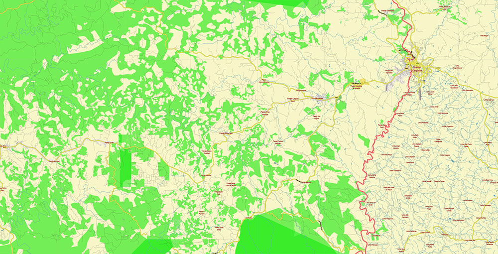
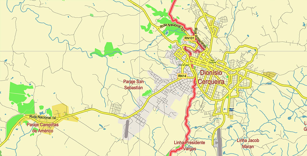
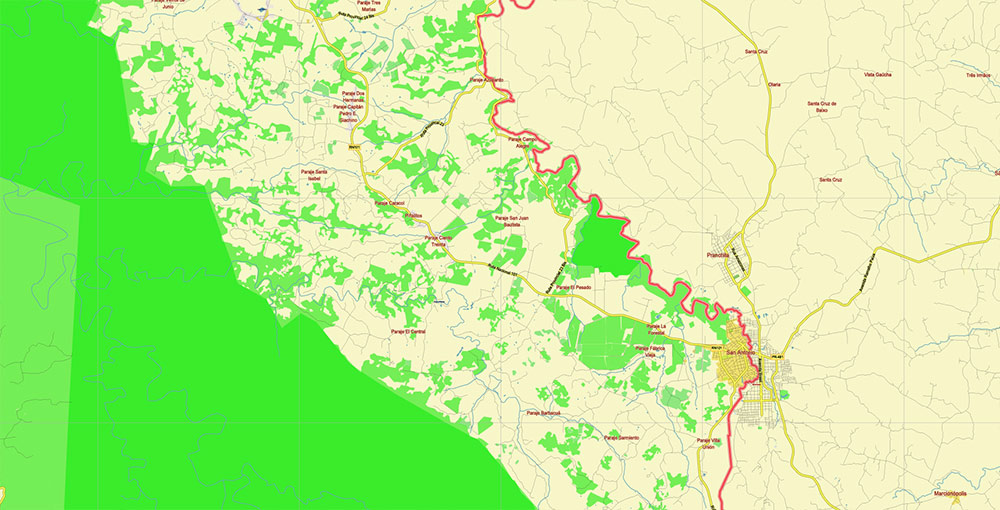
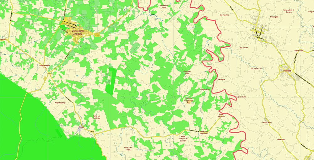
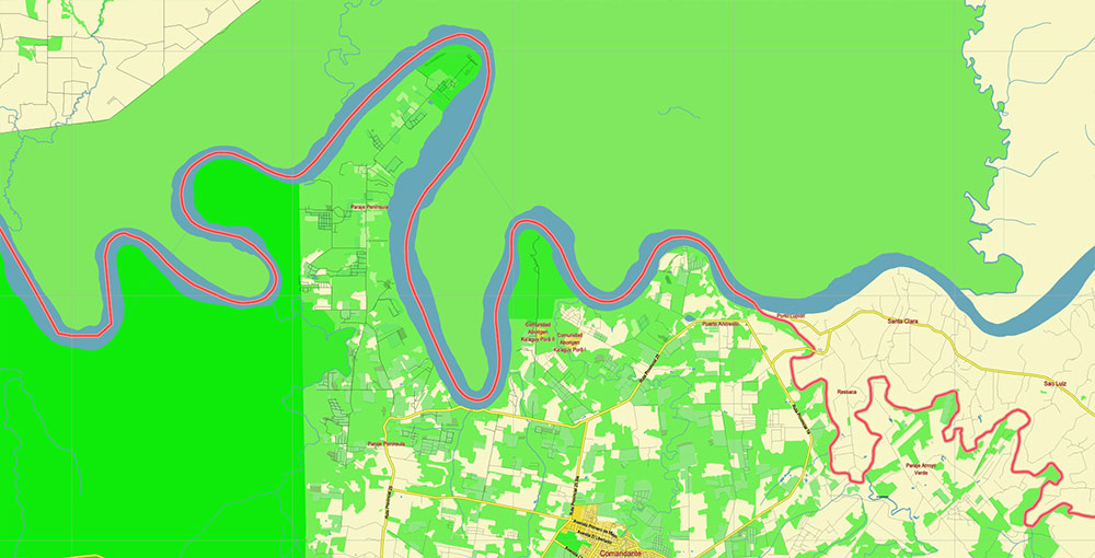
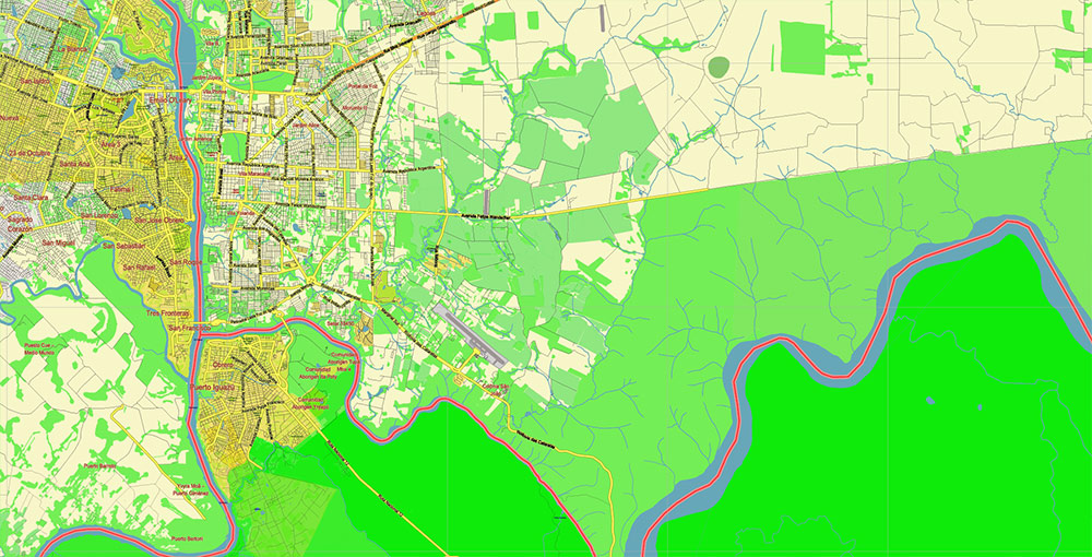
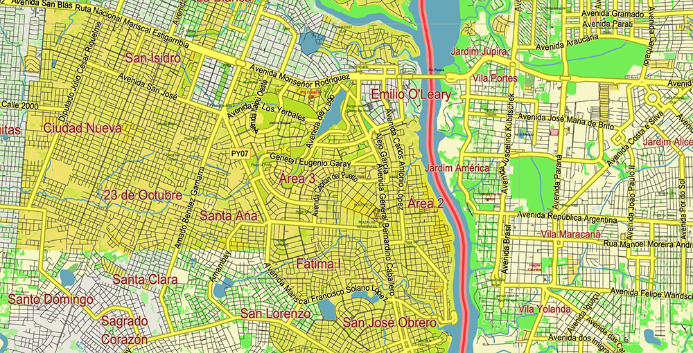
Printable PDF Vector Map of Northern region of Misiones Argentina detailed street map scale 1:67408 fully editable Adobe PDF scalable, text/curves all names, 170 MB ZIP
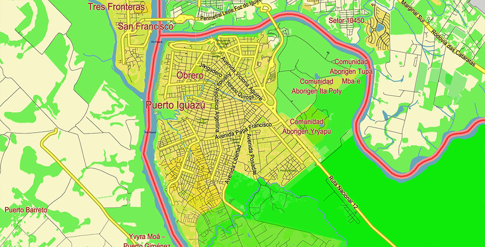
Principal street names, Main Objects. Map for design, printing, arts, projects, presentations, for architects, designers, and builders, business, logistics.
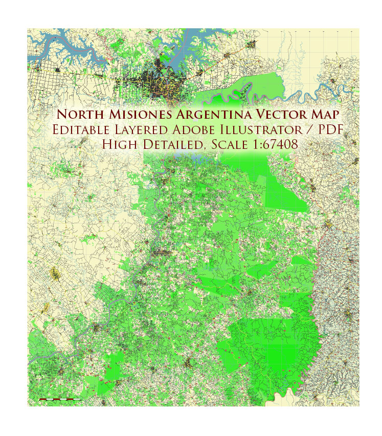
Northern region of Misiones Argentina PDF Map Vector Exact High Detailed Road Map editable Adobe PDF in layers
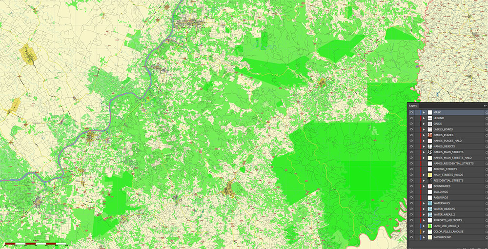
Layers list:
- Legend
- Grids
- Labels of roads
- Names of places (city, hamlet, etc.)
- Names of objects (parks, water, Hospitals)
- Names of main streets
- Main Streets, roads
- Residential streets
- Buildings
- Airports and Heliports
- Water objects (rivers, lakes, ponds)
- Waterways
- Color fills (parks, hospital areas, forest, land use, etc.) 1, 2
- Background
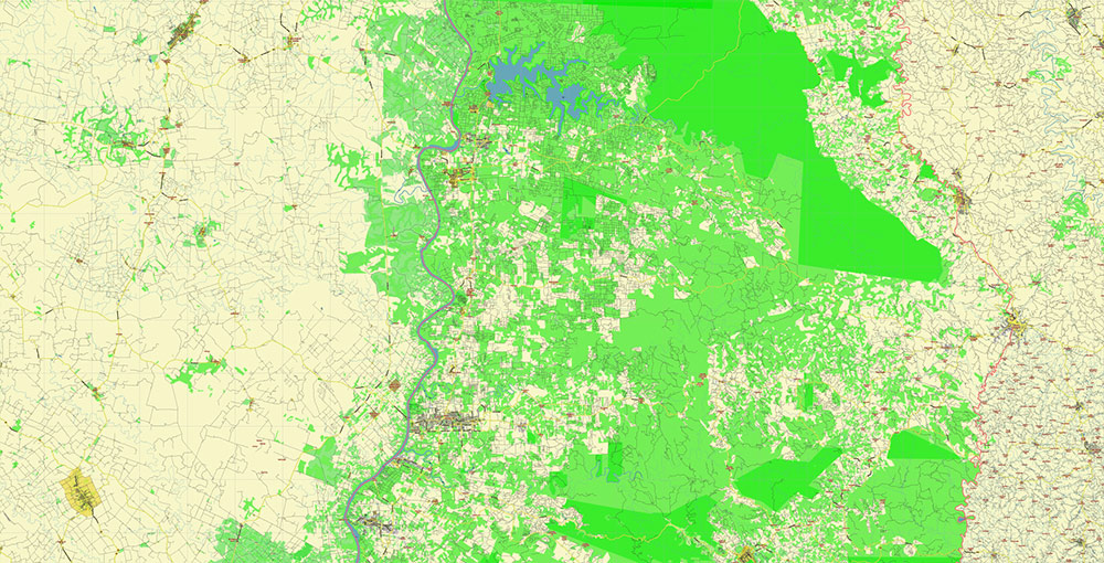
The most exact and detailed map of the region in scale.
For Editing and High-Quality Printing
Northern region of Misiones Argentina PDF Map Vector Exact High Detailed Road Map editable Adobe PDF in layers
AO ENVIRONMENTAL BRIEF — Northern Misiones, Argentina
(Cartographic / terrain intelligence format)
Overview
Northern Misiones is one of the most biologically rich regions in Argentina, forming the southern extension of the Atlantic Forest (Mata Atlântica) biome — one of South America’s most endangered and species-dense ecosystems.
Operational character:
- dense subtropical rainforest
- major river barriers
- extremely high biodiversity
- fragmented but still substantial protected forest blocks
- numerous streams, ravines, and wet microhabitats
- terrain often more restrictive than maps initially suggest
This is forest-country, not pampas country.
Hydrography / Water Resources
Major Rivers
Paraná River
western boundary of northern Misiones
Characteristics:
- one of South America’s major river systems
- broad navigable river in sectors
- major natural political boundary with Paraguay
- steep banks in places
- extensive floodplain influence locally
Functions:
- hydrological spine
- barrier to ground movement
- water supply
- fisheries
- historical transport corridor
Iguazú River
northern boundary sector
Characteristics:
- forms major border with Brazil
- fast-flowing, heavily dissected channel
- deeply entrenched in places
- broken by rapids and cataracts
Strategic significance:
- severe terrain barrier
- controls northern access corridors
San Antonio River
northeast boundary sectors toward Brazil
Characteristics:
- smaller than Paraná/Iguazú
- border-forming watercourse
- forested riparian corridors
Secondary River Systems
Extremely dense drainage network.
Important tributary systems include:
- Urugua-í
- Piray
- Pepirí Guazú
- Yabotí-associated waters
- dozens of smaller jungle streams (“arroyos”)
Characteristics:
- steep-gradient streams
- narrow ravines
- flash runoff
- frequent crossings required
- bridges operationally critical
Terrain impact:
movement often constrained less by elevation than by water fragmentation.
Wetlands / Reservoirs
Urugua-í Reservoir
major artificial water body
Functions:
- hydroelectric infrastructure
- water management
- regional ecological significance
Effects:
- altered drainage patterns
- aquatic habitat creation
- shoreline fragmentation
Jungle Wet Microhabitats
Not giant Pantanal-style wetlands, but widespread:
- marsh pockets
- swamp forest
- streamside saturated soils
- seasonal standing water
Operational effect:
off-road mobility often deceptively poor.
Forests / Vegetation
Atlantic Forest (Selva Paranaense)
Primary ecological identity of northern Misiones.
Characteristics:
- dense evergreen subtropical rainforest
- multilayer canopy
- lianas
- bamboo thickets
- heavy understory
- rapid regrowth after disturbance
Visibility:
often extremely limited.
Canopy:
15–35 m common, locally higher.
Ground conditions:
- roots
- red clay
- slick slopes
- insect pressure
- rapid vegetation encroachment
Araucaria Influence
Higher/eastern sectors may show:
Paraná pine (Araucaria angustifolia) remnants.
Characteristics:
- historically important
- heavily reduced from original extent
- ecologically significant relic stands
Commercial Forestry
Managed plantation areas exist.
Species commonly planted:
Visual distinction:
more geometric/artificial than native forest.
Protected Areas / Natural Parks
Iguazú National Park
Premier protected area.
Characteristics:
- globally famous protected rainforest complex
- contains Iguazú Falls
- UNESCO-grade significance
- dense forest
- river canyon systems
Terrain:
- ravines
- cliffs
- humid jungle
- high wildlife density
Operational note:
movement highly constrained.
Urugua-í Provincial Park
Major protected forest block.
Importance:
- critical biodiversity refuge
- significant intact forest
- watershed protection
Yabotí Biosphere Reserve
Eastern / southeastern broader protected landscape influence.
Characteristics:
- massive forest conservation zone
- river-cut terrain
- biodiversity hotspot
Smaller Protected Areas
Network includes:
- provincial reserves
- ecological corridors
- private conservation lands
Important because:
fragment connectivity matters enormously for wildlife.
Botany
Dominant flora:
- laurels
- cedars
- palms
- tree ferns
- lapacho
- guatambú
- Paraná pine remnants
- bamboo
- epiphytes
- orchids
- bromeliads
- moss-rich humid understory
Botanical character:
lush, layered, high-biomass ecosystem.
Special notes:
- rapid vegetative regeneration
- vine entanglement
- strong edge effects where forest fragmented
Zoology
Mammals
Potential flagship fauna:
- jaguar (extremely rare but ecologically important)
- puma
- ocelot
- jaguarundi
- tapir
- peccaries
- capuchin monkeys
- howler monkeys
- coatis
- giant anteater (limited distribution)
- armadillos
- agoutis
Reality:
large predators rare, elusive, habitat-sensitive.
Birds
Exceptionally rich avifauna.
Representative species:
- toucans
- parrots
- macaws (historically stronger presence)
- trogons
- woodpeckers
- hawks
- hummingbirds
- forest passerines
Bird diversity is internationally significant.
Reptiles
Likely fauna:
- caimans (localized)
- boas
- coral snakes
- pit vipers
- lizards
- freshwater turtles
Amphibians
Very strong amphibian presence:
- frogs
- tree frogs
- moisture-dependent specialists
Indicators of healthy humid ecosystem.
Invertebrates
Major ecological presence:
- butterflies
- ants
- termites
- beetles
- mosquitoes
- wasps
Operational significance:
constant insect burden.
Ecological Constraints
Key environmental realities:
- dense canopy reduces aerial visibility
- watercourses fragment terrain
- clay soils degrade rapidly in rain
- humidity damages equipment
- vegetation reclaims disturbed ground quickly
- wildlife corridors depend on forest continuity
Cartographic Takeaways
- Hydrology is denser than standard road maps imply.
- Forest cover is operationally dominant terrain.
- Protected areas occupy strategically significant blocks.
- Paraná + Iguazú are major hard geographic barriers.
- Off-road movement is substantially worse than topographic profiles alone suggest.
Northern region of Misiones Argentina PDF Map Vector Exact High Detailed Road Map editable Adobe PDF in layers
Northern region of Misiones Argentina PDF Map Vector Exact High Detailed Road Map editable Adobe PDF in layers
Northern region of Misiones Argentina PDF Map Vector Exact High Detailed Road Map editable Adobe PDF in layers
Northern region of Misiones Argentina PDF Map Vector Exact High Detailed Road Map editable Adobe PDF in layers
Northern region of Misiones Argentina PDF Map Vector Exact High Detailed Road Map editable Adobe PDF in layers
Northern region of Misiones Argentina PDF Map Vector Exact High Detailed Road Map editable Adobe PDF in layers
Northern region of Misiones Argentina PDF Map Vector Exact High Detailed Road Map editable Adobe PDF in layers
Northern region of Misiones Argentina PDF Map Vector Exact High Detailed Road Map editable Adobe PDF in layers
Northern region of Misiones Argentina PDF Map Vector Exact High Detailed Road Map editable Adobe PDF in layers
Northern region of Misiones Argentina PDF Map Vector Exact High Detailed Road Map editable Adobe PDF in layers
Northern region of Misiones Argentina PDF Map Vector Exact High Detailed Road Map editable Adobe PDF in layers
Northern region of Misiones Argentina PDF Map Vector Exact High Detailed Road Map editable Adobe PDF in layers
Northern region of Misiones Argentina PDF Map Vector Exact High Detailed Road Map editable Adobe PDF in layers
Northern region of Misiones Argentina PDF Map Vector Exact High Detailed Road Map editable Adobe PDF in layers
Northern region of Misiones Argentina PDF Map Vector Exact High Detailed Road Map editable Adobe PDF in layers
NNorthern region of Misiones Argentina PDF Map Vector Exact High Detailed Road Map editable Adobe PDF in layers
Northern region of Misiones Argentina PDF Map Vector Exact High Detailed Road Map editable Adobe PDF in layers
Northern region of Misiones Argentina PDF Map Vector Exact High Detailed Road Map editable Adobe PDF in layers

 Author: Kirill Shrayber, Ph.D. FRGS