Extended Description of the Vector Map
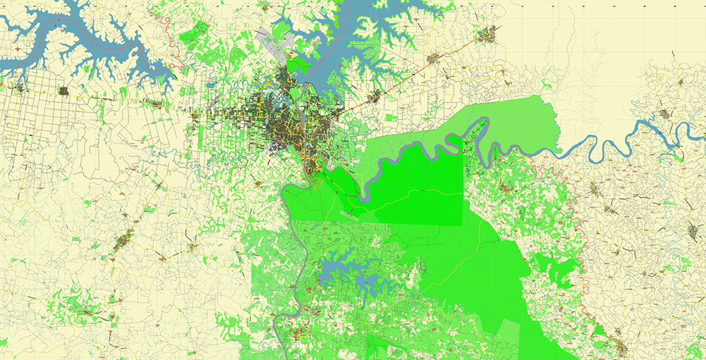
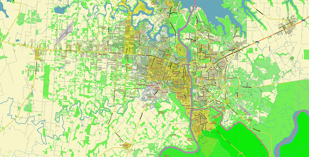
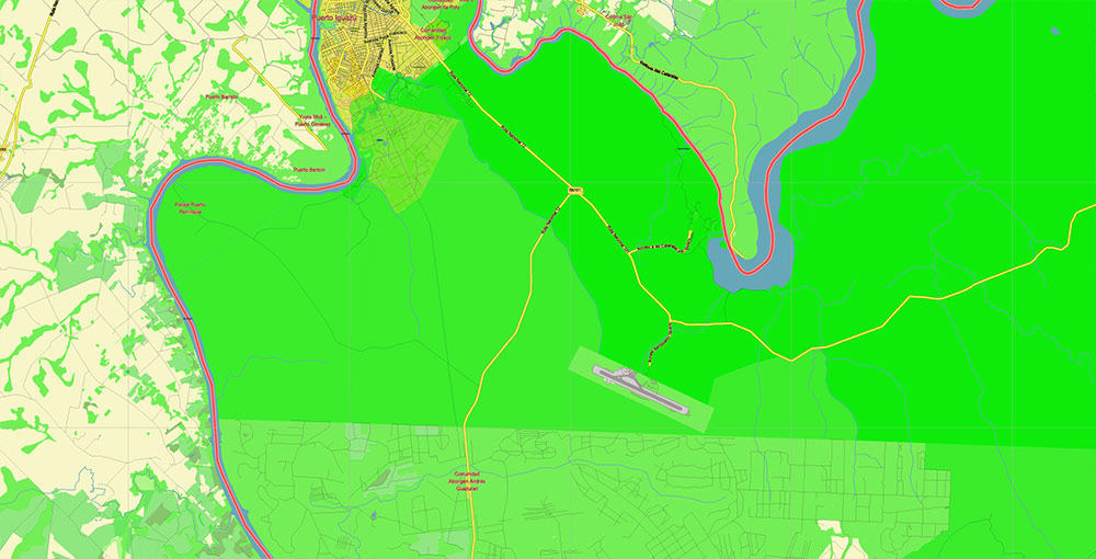
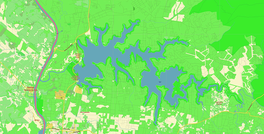
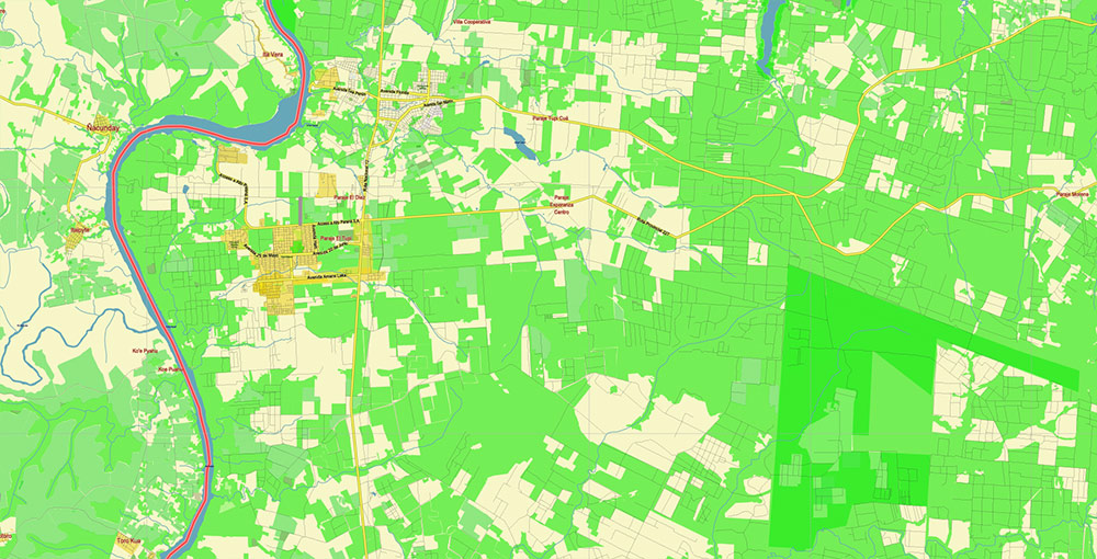
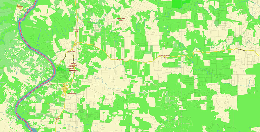
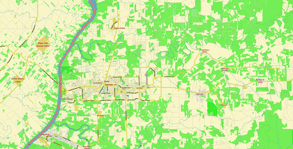
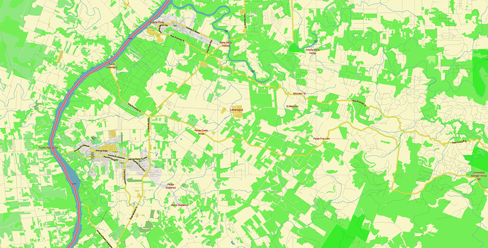
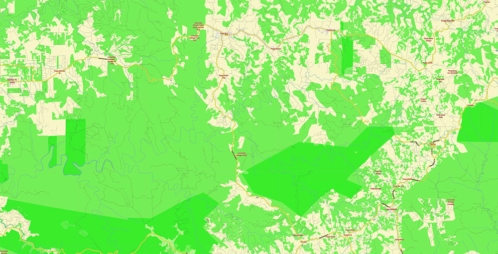
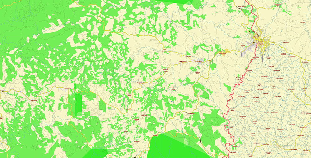
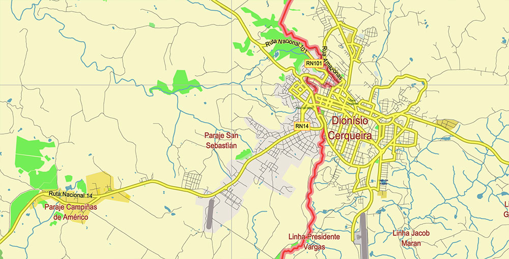
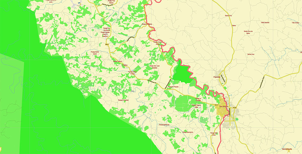
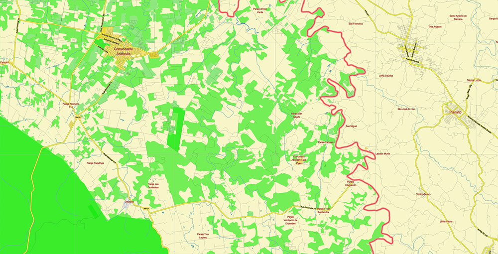
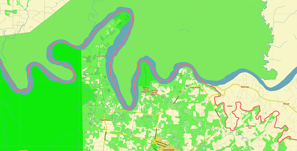
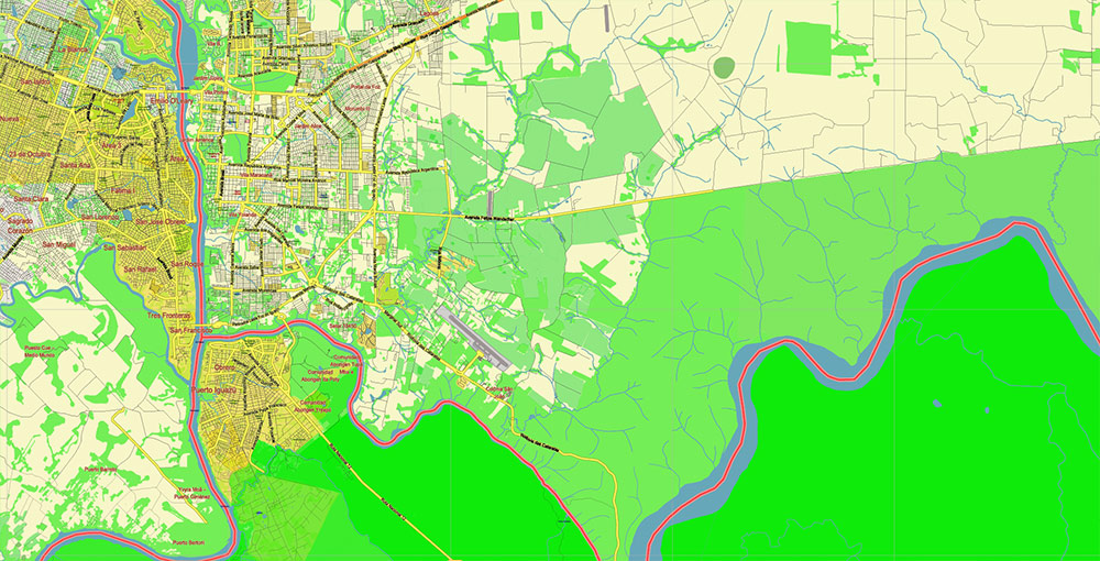
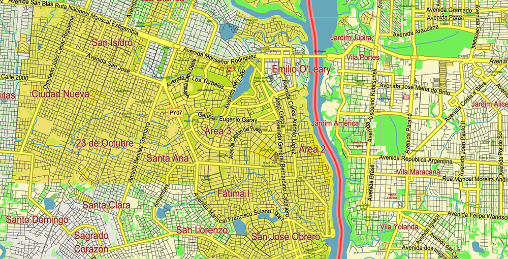
Printable Vector Map of Northern region of Misiones Argentina detailed street map scale 1:67408 fully editable Adobe Illustrator scalable, text/curves all names, 92 MB ZIP
Principal street names, Main Objects. Map for design, printing, arts, projects, presentations, for architects, designers, and builders, business, logistics.
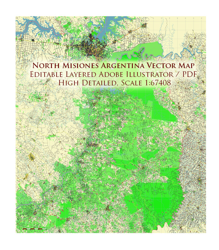
Northern region of Misiones Argentina Map Vector Exact High Detailed Road Map editable Adobe Illustrator in layers
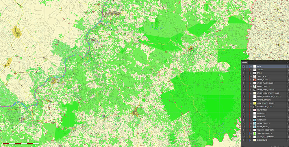
Layers list:
- Legend
- Grids
- Labels of roads
- Names of places (city, hamlet, etc.)
- Names of objects (parks, water, Hospitals)
- Names of main streets
- Main Streets, roads
- Residential streets
- Buildings
- Airports and Heliports
- Water objects (rivers, lakes, ponds)
- Waterways
- Color fills (parks, hospital areas, forest, land use, etc.) 1, 2
- Background
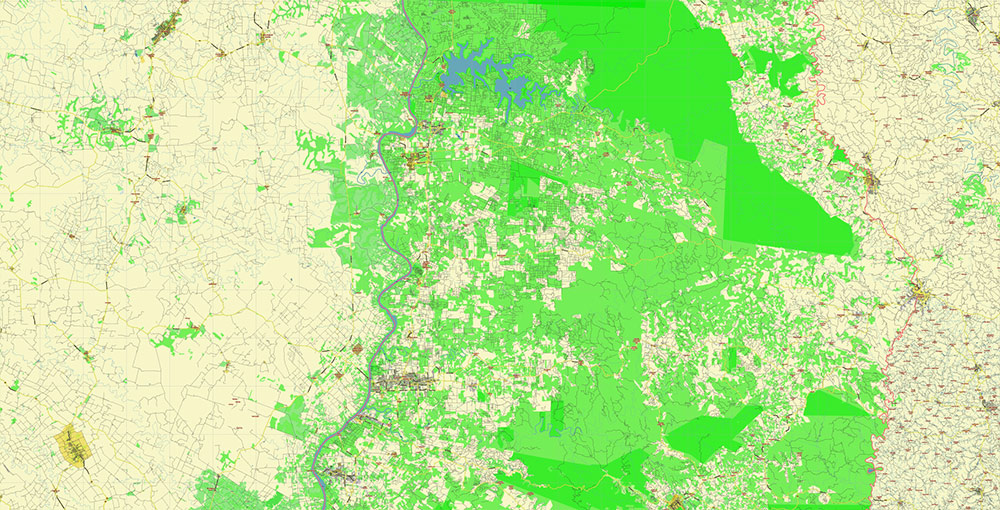
The most exact and detailed map of the region in scale.
For Editing and High-Quality Printing
Northern region of Misiones Argentina Map Vector Exact High Detailed Road Map editable Adobe Illustrator in layers
AO BRIEF — Northern Misiones, Argentina
(Operational/cartographic format)
Overview
- Northern Misiones = Argentina’s far northeastern salient, wedged between Paraguay (west) and Brazil (north/east).
- Strategic tri-border jungle corridor with heavy cross-border movement, tourism, timber/agriculture logistics, and customs traffic.
- Region dominated by subtropical forest, river barriers, rolling plateau terrain, and limited east-west connectivity.
- Principal operational axis runs south–north along RN-12 toward Iguazú.
Primary Urban Nodes
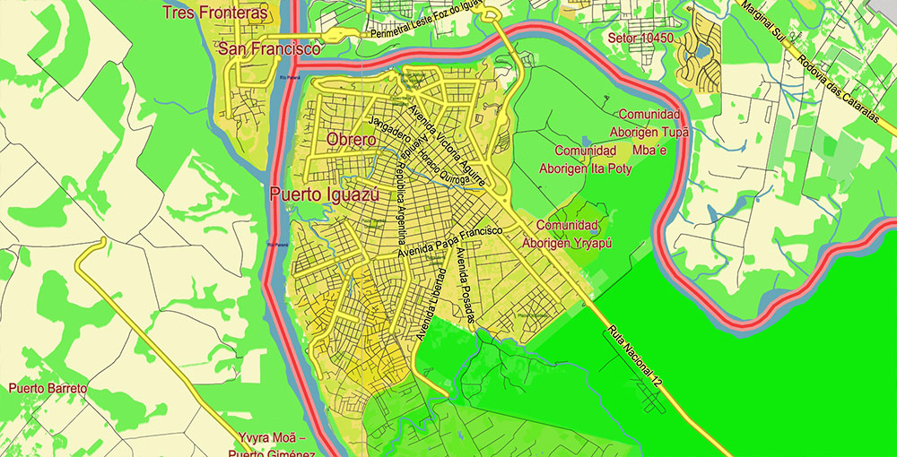
Puerto Iguazú
- primary strategic city
- tri-border node (Argentina / Brazil / Paraguay)
- tourism capital (Iguazú Falls)
- customs / freight / passenger concentration
- international airport
Eldorado
- principal industrial/logistics city in central-northern Misiones
- timber processing, agro-industry, warehousing
- Paraná river corridor location
Puerto Esperanza
- secondary industrial node
- forestry / wood products
- positioned between Eldorado and Iguazú axis
Wanda
- smaller but regionally relevant
- tourism support / gemstone activity
- roadside logistics stop
Bernardo de Irigoyen
- eastern border town with Brazil
- customs / trucking / cross-border trade
- important but geographically isolated from main Paraná axis
Comandante Andresito
- frontier agricultural settlement
- yerba mate / forestry / cattle interface
- northern agricultural edge
Lines of Communication (Road Network)
RN-12 (Main Strategic Artery)
Posadas → Eldorado → Puerto Esperanza → Wanda → Puerto Iguazú
- dominant north-south highway
- backbone of freight, tourism, fuel, supplies
- follows Paraná side / western corridor
- most critical road in region
RN-101
RN-12 → Andresito / Iguazú National Park interior
- secondary operational route
- forest penetration road
- narrower, less redundant
RN-14 (Eastern Axis)
runs farther east through Misiones
connects:
- San Pedro
- Bernardo de Irigoyen
- southern provincial network
- Brazil border corridor
Function:
- timber transport
- agriculture haulage
- regional trucking
Provincial Roads
mixed paved / secondary roads
connect:
- agricultural colonies
- timber zones
- plantations
- border settlements
Limitations:
- jungle terrain
- drainage issues
- slower speeds
- fewer redundant alternatives
Air Transport
Cataratas del Iguazú International Airport (IGR)
- principal aviation node
- domestic + international tourism gateway
- handles business / customs / tourism traffic
Eldorado Airport
- minor regional aviation role
- not major strategic hub
Nearest heavy aviation outside AO:
Rail
- effectively negligible for strategic freight relevance
- historic networks largely non-operational
- road transport dominates overwhelmingly
Water Transport
Paraná River
major western natural transport barrier/corridor
Functions:
- local river activity
- historical freight role
- border geography influence
Limitations:
- modern freight dependence is overwhelmingly road-based
Industry / Economic Base
Forestry / Timber
dominant industrial sector
products:
- lumber
- plywood
- processed wood
- pulp-related activity
Yerba Mate
major agricultural cash crop
processing facilities distributed regionally
Tea Production
commercial plantations in wider Misiones belt
Citrus / Specialty Agriculture
oranges
grapefruit
smaller-scale mixed agriculture
Tourism
major concentration around Iguazú:
- hotels
- transport
- retail
- hospitality
- excursion infrastructure
Cross-Border Commerce
formal + informal trade significant near:
- Puerto Iguazú
- Bernardo de Irigoyen
Geography / Terrain
- part of Argentine Mesopotamia region
- elevated basaltic plateau
- dissected by dense stream networks
- rolling relief rather than flat plains
Terrain character:
- jungle-covered ridges
- steep drainage cuts
- lateritic red soils
- constrained visibility
Major hydro barriers:
Paraná River (west)
Iguazú River (north)
multiple tributary streams
Terrain effect:
- roads funnel into predictable corridors
- maneuver off-road difficult
- bridge points operationally important
Climate
Humid subtropical / rainforest-influenced
characteristics:
- hot summers
- warm winters
- high annual rainfall
- humidity persistent year-round
Operational effects:
- vegetation overgrowth
- drainage/flood issues
- reduced visibility
- road degradation on secondary routes
- insect/vector burden
Demography / Human Terrain
Population composition:
- Argentine majority
- strong immigrant-descended communities:
- German
- Polish
- Ukrainian
- Paraguayan influence
- Brazilian influence
Settlement pattern:
- linear roadside urbanization
- dispersed agricultural colonies
- frontier settlements
Languages commonly encountered:
- Spanish
- Portuguese influence near border
- Guaraní presence in cultural sphere
Population density:
- moderate in corridor zones
- sparse in forest interiors
Operational Constraints / Hazards
- jungle canopy limits observation
- few redundant transport corridors
- border smuggling environment
- heavy tourist congestion near Iguazú
- flash drainage issues
- environmental restrictions in protected zones
- customs choke points
Command Takeaways
- RN-12 is the critical strategic spine.
- Puerto Iguazú is the decisive urban/logistics node.
- Terrain strongly canalizes movement.
- Forestry + tourism dominate economic geography.
- Tri-border dynamics make the AO unusually porous and commercially active.
Northern region of Misiones Argentina Map Vector Exact High Detailed Road Map editable Adobe Illustrator in layers
Northern region of Misiones Argentina Map Vector Exact High Detailed Road Map editable Adobe Illustrator in layers
Northern region of Misiones Argentina Map Vector Exact High Detailed Road Map editable Adobe Illustrator in layers
Northern region of Misiones Argentina Map Vector Exact High Detailed Road Map editable Adobe Illustrator in layers
Northern region of Misiones Argentina Map Vector Exact High Detailed Road Map editable Adobe Illustrator in layers
Northern region of Misiones Argentina Map Vector Exact High Detailed Road Map editable Adobe Illustrator in layers
Northern region of Misiones Argentina Map Vector Exact High Detailed Road Map editable Adobe Illustrator in layers
Northern region of Misiones Argentina Map Vector Exact High Detailed Road Map editable Adobe Illustrator in layers
Northern region of Misiones Argentina Map Vector Exact High Detailed Road Map editable Adobe Illustrator in layers
Northern region of Misiones Argentina Map Vector Exact High Detailed Road Map editable Adobe Illustrator in layers
Northern region of Misiones Argentina Map Vector Exact High Detailed Road Map editable Adobe Illustrator in layers
Northern region of Misiones Argentina Map Vector Exact High Detailed Road Map editable Adobe Illustrator in layers
Northern region of Misiones Argentina Map Vector Exact High Detailed Road Map editable Adobe Illustrator in layers
Northern region of Misiones Argentina Map Vector Exact High Detailed Road Map editable Adobe Illustrator in layers
Northern region of Misiones Argentina Map Vector Exact High Detailed Road Map editable Adobe Illustrator in layers
Northern region of Misiones Argentina Map Vector Exact High Detailed Road Map editable Adobe Illustrator in layers
Northern region of Misiones Argentina Map Vector Exact High Detailed Road Map editable Adobe Illustrator in layers
Northern region of Misiones Argentina Map Vector Exact High Detailed Road Map editable Adobe Illustrator in layers

 Author: Kirill Shrayber, Ph.D. FRGS