Extended Description of the Vector Map
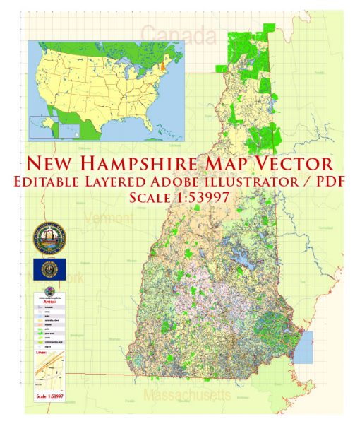
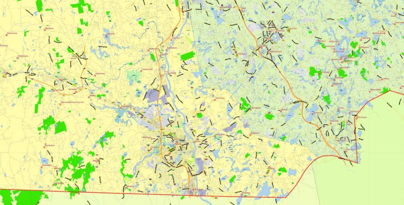
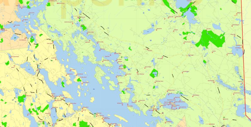
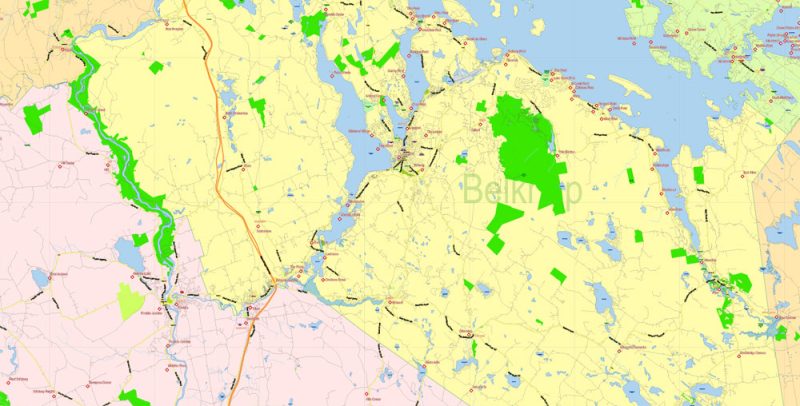
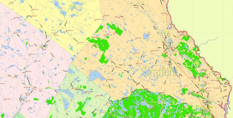
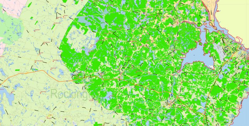
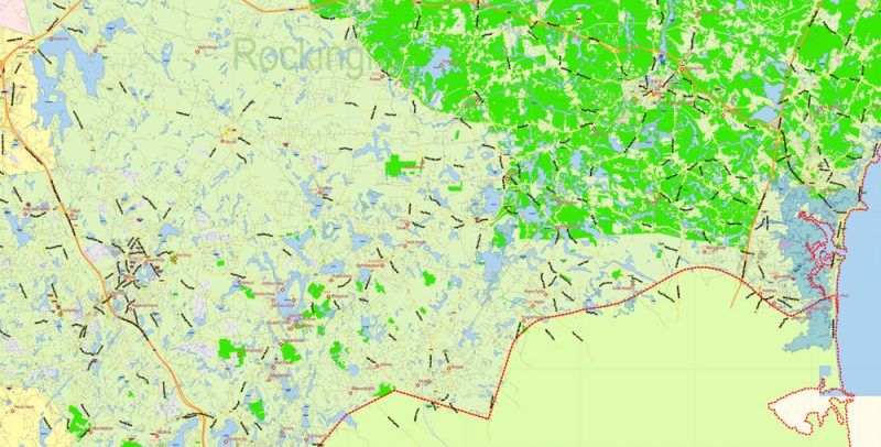
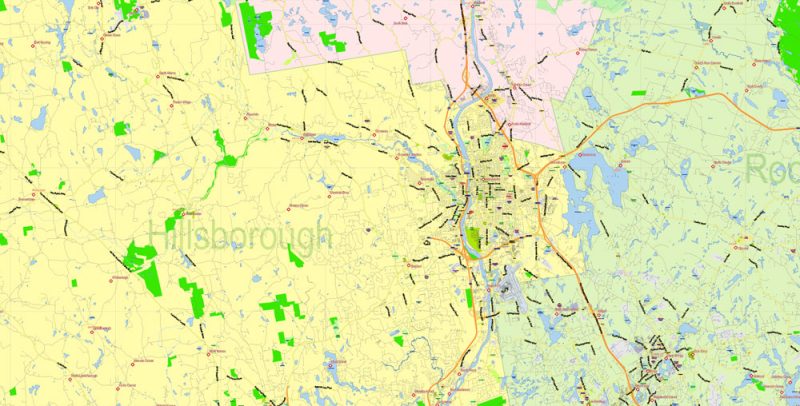
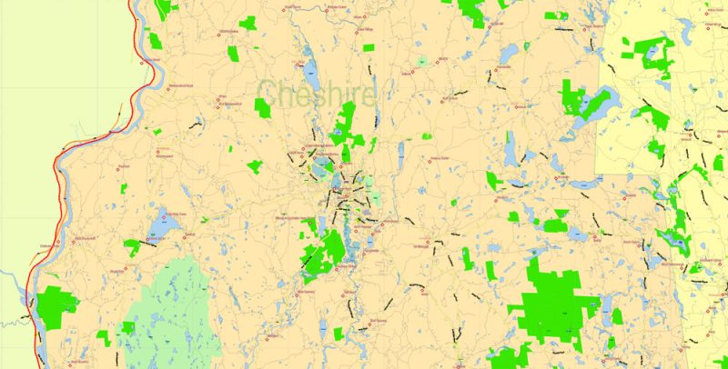
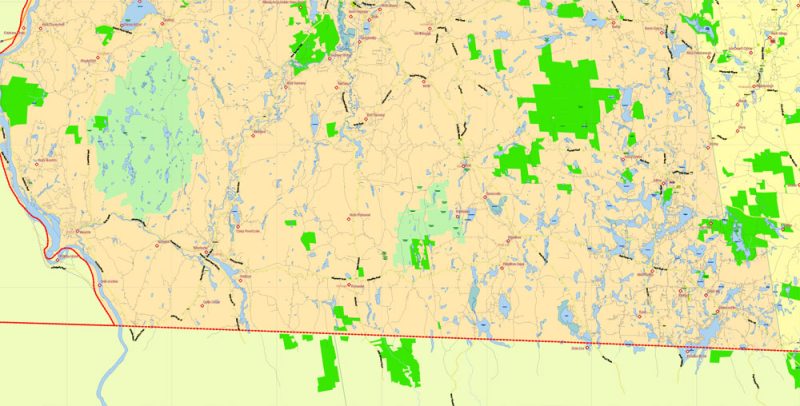
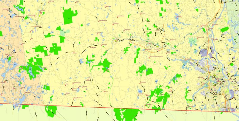
Printable Vector Map of New Hampshire State US High Detailed Plan scale 1:53997 full editable Adobe Illustrator Road Admin Map in layers, scalable, text format all names, 26 MB ZIP
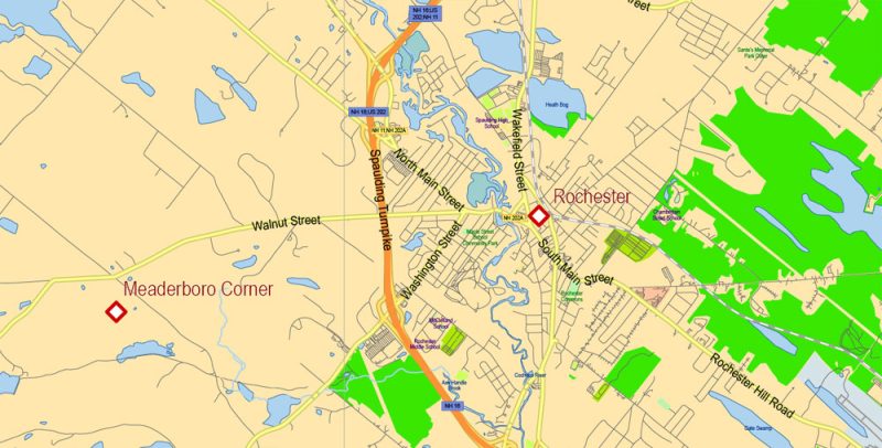
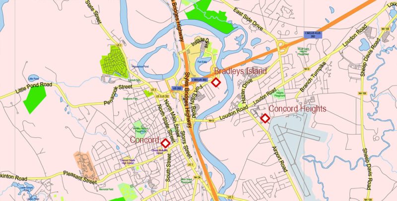
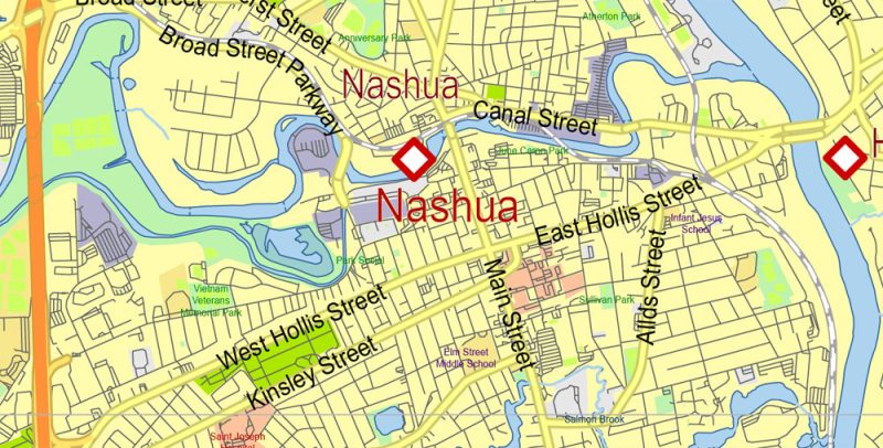
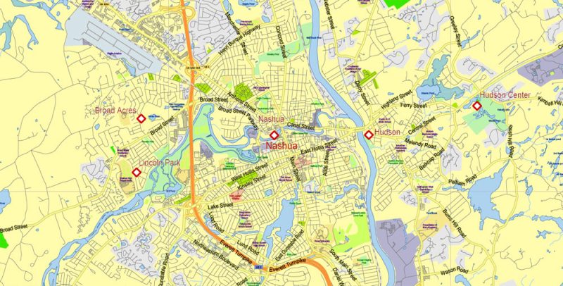
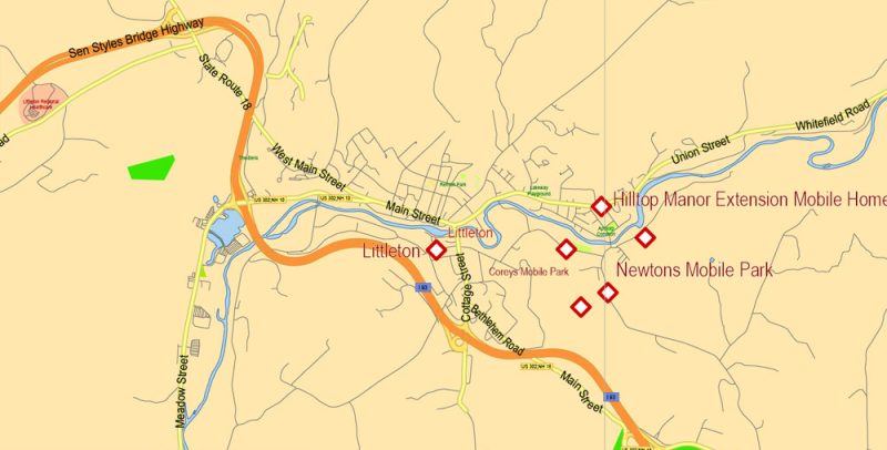
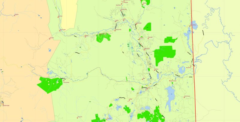
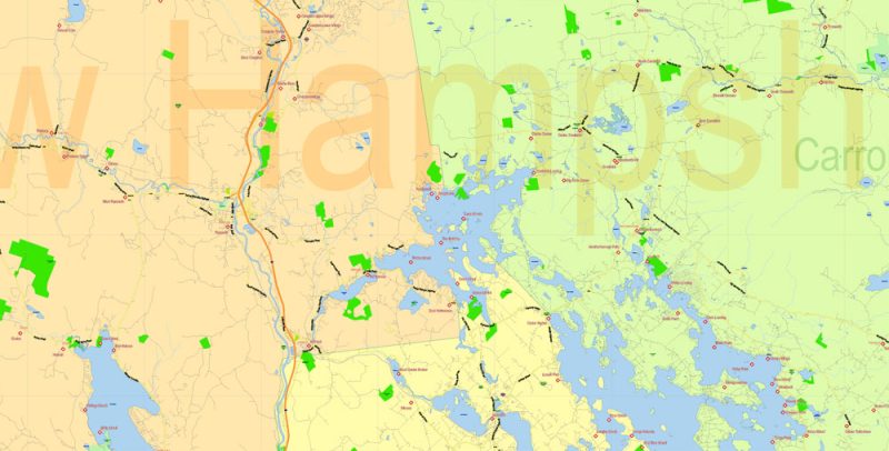
All streets and roads, Principal street names, All Cities and Towns, Main Objects, Counties. Map for design, printing, arts, projects, presentations, for architects, designers, and builders, business, logistics.
Layers: color_fills, water, main_streets_roads, civil_streets, labels_roads, counties_areas, state_areas, names_objects, names_streets, names_places, grids, legend, etc.
If you need: we can add postal codes layer (zip codes areas with numbers) to the map as a separated layer.
The most exact and detailed map of the state in scale.
For Editing and High-Quality Printing
TERMS AND CONDITIONS
New Hampshire US Map Vector Exact State Plan High Detailed Street Road Admin Map editable Adobe Illustrator in layers
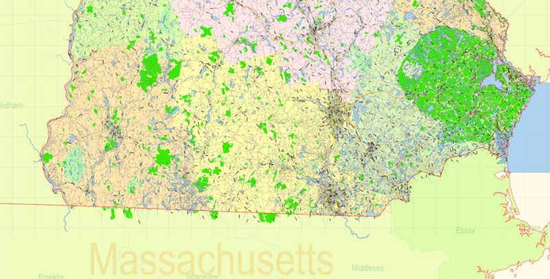
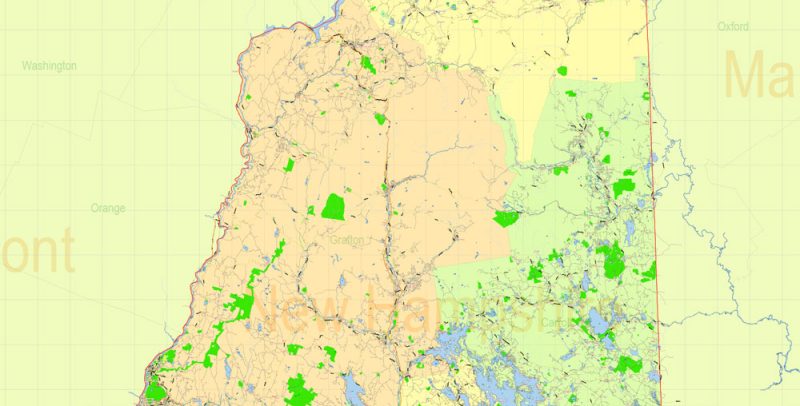
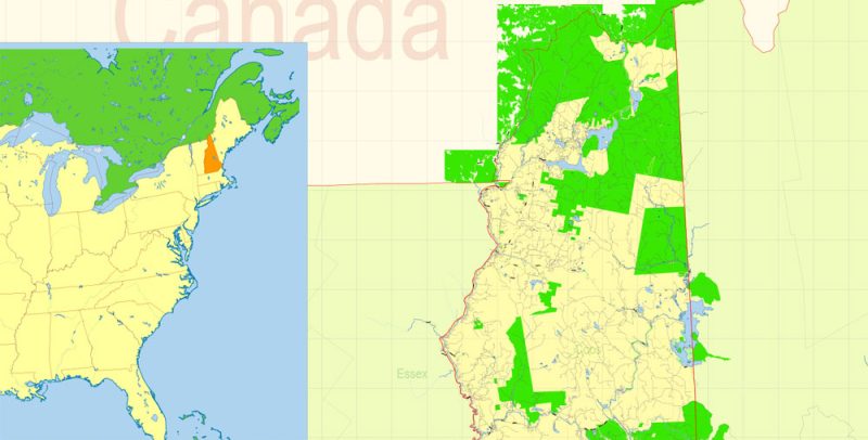
New Hampshire is one of the States of the New England region in the North-Eastern United States. In the North and East, the “neighbors” of the state are the Canadian province of Quebec and the Atlantic Ocean, on other sides, it is surrounded by the States of Maine, Massachusetts, and Vermont.
New Hampshire US Map Vector Exact State Plan High Detailed Street Road Admin Map editable Adobe Illustrator in layers
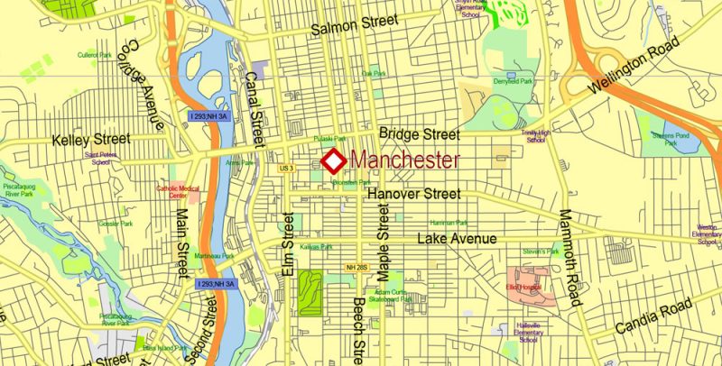
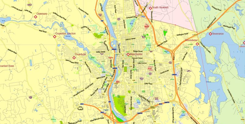
New Hampshire – one of the small States: it is home to 1.3 million people, in other American cities the population is many times more. The area of the state is included in the last ten. One of the largest cities in the state is Manchester, and the functions of the administrative center belong to the city of Concord.
New Hampshire US Map Vector Exact State Plan High Detailed Street Road Admin Map editable Adobe Illustrator in layers
Rest in New Hampshire on the fan: the summer is short and not hot, and the winter is harsh and windy. Nevertheless, the state has gained popularity in the tourist area located near the big cities, for example, New York.
New Hampshire US Map Vector Exact State Plan High Detailed Street Road Admin Map editable Adobe Illustrator in layers
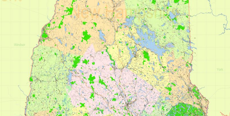
Forests, mountains, and lakes call travelers here. Especially popular are the White Mountains in the Northern and Central parts of the state. The main peak of the white mountains is Mount Washington with a height of more than 1900 meters. This mountain is one of the peaks of the Presidential ridge, which were named after the American presidents. The white mountains reserve was established in the Northern part of the state.
New Hampshire US Map Vector Exact State Plan High Detailed Street Road Admin Map editable Adobe Illustrator in layers
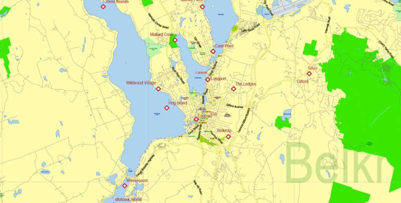
To the south of the White Mountains is the “lake district” with many lakes. Winnipesaukee is the largest, smaller – Annisquam, Squam and Newfound.
New Hampshire US Map Vector Exact State Plan High Detailed Street Road Admin Map editable Adobe Illustrator in layers
On the rocky Atlantic coast of New Hampshire still found a sandy area on which the resort was created HAMPTON beach, where you can enjoy water sports. In the mountains of New Hampshire ski resorts – for example, on mount Sunapee, on the same lake there is a beach. Spring and autumn are dominated by activities such as Hiking, fishing.
New Hampshire US Map Vector Exact State Plan High Detailed Street Road Admin Map editable Adobe Illustrator in layers
In Concord, founded in the first half of the XVIII century, preserved several buildings of the period, they are on the street main street. The state Capitol was built in 1819, but its appearance was changed in the second half of the XIX-th and early XX century. The building is closed in the 60-ies of the hotel Eagle is remarkable as a stopping place for several American presidents. One of the buildings on the main street is the Phoenix Hall, where Abraham Lincoln and Theodore Roosevelt performed. However, this is a restored building, not the original.
New Hampshire US Map Vector Exact State Plan High Detailed Street Road Admin Map editable Adobe Illustrator in layers
Manchester, named after the British city, stands on the banks of the river Merrimack. Despite the status of the largest, it is home to only about a hundred thousand people. In this industrial city saved many buildings of the XIX century.
New Hampshire US Map Vector Exact State Plan High Detailed Street Road Admin Map editable Adobe Illustrator in layers
New Hampshire US Map Vector Exact State Plan High Detailed Street Road Admin Map editable Adobe Illustrator in layers
New Hampshire US Map Vector Exact State Plan High Detailed Street Road Admin Map editable Adobe Illustrator in layers
New Hampshire US Map Vector Exact State Plan High Detailed Street Road Admin Map editable Adobe Illustrator in layers
New Hampshire US Map Vector Exact State Plan High Detailed Street Road Admin Map editable Adobe Illustrator in layers
New Hampshire US Map Vector Exact State Plan High Detailed Street Road Admin Map editable Adobe Illustrator in layers
New Hampshire US Map Vector Exact State Plan High Detailed Street Road Admin Map editable Adobe Illustrator in layers
New Hampshire US Map Vector Exact State Plan High Detailed Street Road Admin Map editable Adobe Illustrator in layers
New Hampshire US Map Vector Exact State Plan High Detailed Street Road Admin Map editable Adobe Illustrator in layers
New Hampshire US Map Vector Exact State Plan High Detailed Street Road Admin Map editable Adobe Illustrator in layers
New Hampshire US Map Vector Exact State Plan High Detailed Street Road Admin Map editable Adobe Illustrator in layers
New Hampshire US Map Vector Exact State Plan High Detailed Street Road Admin Map editable Adobe Illustrator in layers
New Hampshire US Map Vector Exact State Plan High Detailed Street Road Admin Map editable Adobe Illustrator in layers
New Hampshire US Map Vector Exact State Plan High Detailed Street Road Admin Map editable Adobe Illustrator in layers
New Hampshire US Map Vector Exact State Plan High Detailed Street Road Admin Map editable Adobe Illustrator in layers
New Hampshire US Map Vector Exact State Plan High Detailed Street Road Admin Map editable Adobe Illustrator in layers


 Author: Kirill Shrayber, Ph.D. FRGS

