Extended Description of the Vector Map
Printable PDF Vector Map New England United States (+ Zipcodes areas + numbers), all Cities and towns, States, Counties with names, Main Roads and Railroads, fully editable in layers, Adobe PDF, scalable, curves format of all names, 97 Mb ZIP.
Layered exact editable map, included states: New York, Vermont, Connecticut, Maine, Massachusetts, New Hampshire, Rhode island, New Jersey, Pennsylvania.. Map for publishing, design, printing, publications, arts, projects, presentations, for architects, designers, and builders, business, logistics. The most exact and detailed map. GPS correct Mercator Projection.
For printing any format.
Please note: in the preview, SOME LAYERS are disabled and not visible. Of course, you can easily turn on the layers and the map will become much more info.
This is done to make it easier to print in different formats, so as not to scale each object – for example, if you plan to print in A4-A3 format – you can simply turn off all the small inscriptions with names, and turn on only the layers with large inscriptions.
DWG, DXF, CDR, ESRI Shapes, and other formats – by request, the same price, please contact.
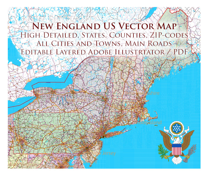
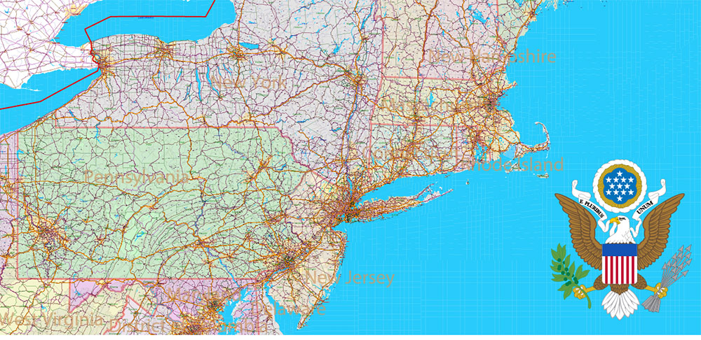
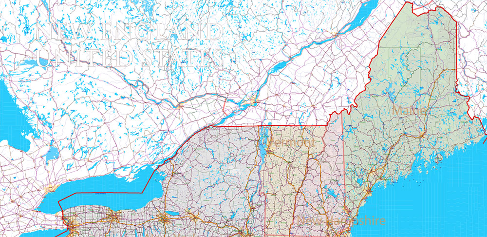
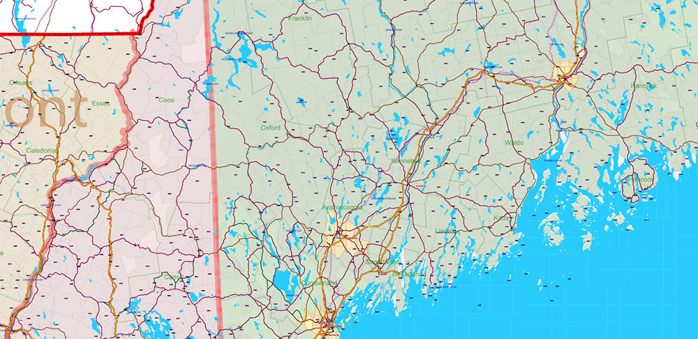
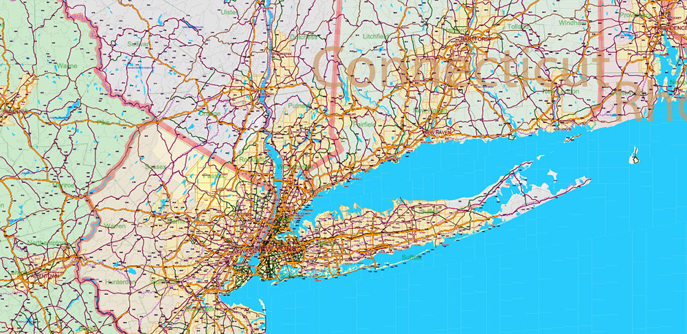
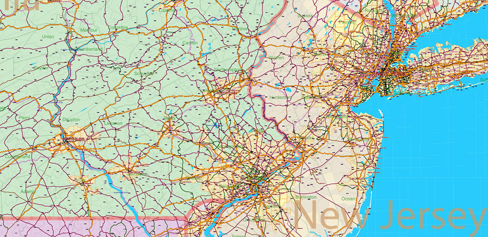
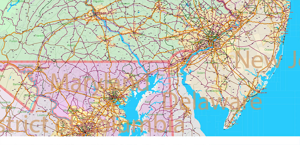
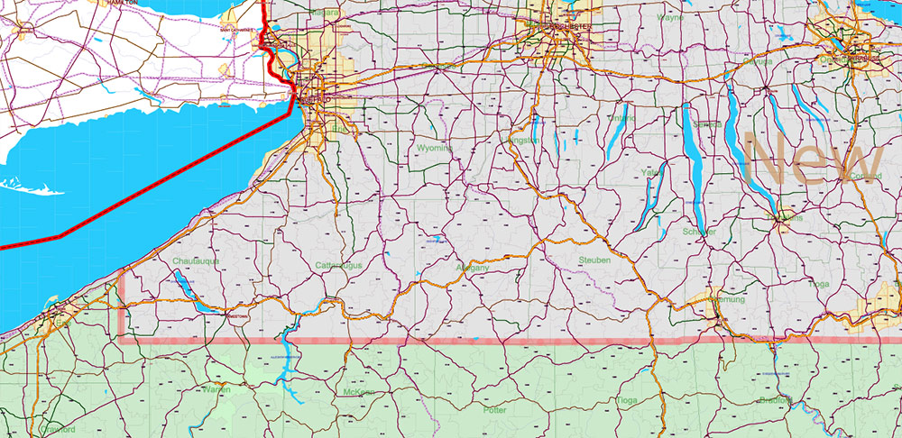
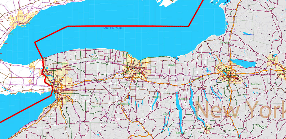
New England States US PDF Vector Map: Exact High Detailed Road Map + Counties + zip-codes areas editable Adobe PDF in layers
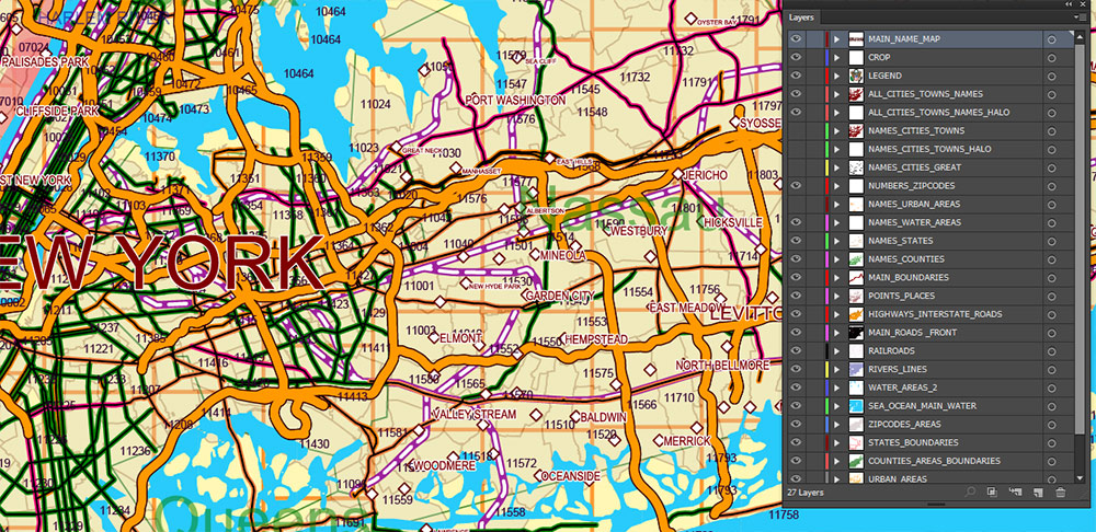
Separated layers:
- Legend
- Numbers Zipcodes
- Names Counties
- Names Water objects (areas)
- Names States
- Names Cities ant Towms
- Names Urban Areas
- Names All Cities and Towns (small)
- Points Places (cities, towns)
- Highways, Interstate (lines)
- Main Roads and streets (lines)
- Railroads
- Urban areas
- Water areas 1
- Water areas 2
- Waterways
- Zipcodes areas
- Counties areas (polygons)
- States areas (polygons)

New England States US PDF Vector Map: Exact High Detailed Road Map + Counties + zip-codes areas editable Adobe PDF in layers
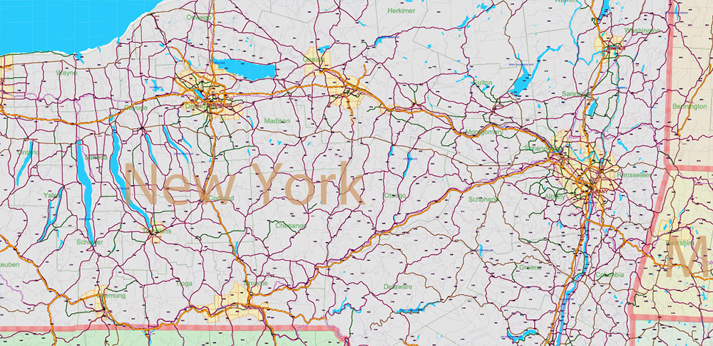
New England States US PDF Vector Map: Exact High Detailed Road Map + Counties + zip-codes areas editable Adobe PDF in layers
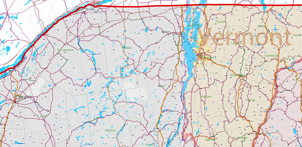
New England States US PDF Vector Map: Exact High Detailed Road Map + Counties + zip-codes areas editable Adobe PDF in layers
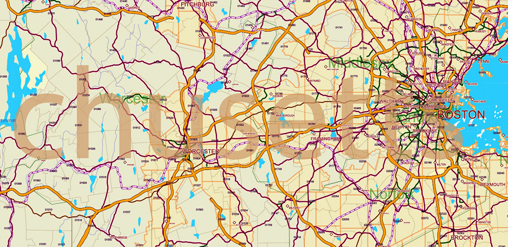
New England States US PDF Vector Map: Exact High Detailed Road Map + Counties + zip-codes areas editable Adobe PDF in layers

New England States US PDF Vector Map: Exact High Detailed Road Map + Counties + zip-codes areas editable Adobe PDF in layers

New England States US PDF Vector Map: Exact High Detailed Road Map + Counties + zip-codes areas editable Adobe PDF in layers
New England States US PDF Vector Map: Exact High Detailed Road Map + Counties + zip-codes areas editable Adobe PDF in layers
New England States US PDF Vector Map: Exact High Detailed Road Map + Counties + zip-codes areas editable Adobe PDF in layers
New England States US PDF Vector Map: Exact High Detailed Road Map + Counties + zip-codes areas editable Adobe PDF in layers

New England States US PDF Vector Map: Exact High Detailed Road Map + Counties + zip-codes areas editable Adobe PDF in layers
New England States US PDF Vector Map: Exact High Detailed Road Map + Counties + zip-codes areas editable Adobe PDF in layers
New England States US PDF Vector Map: Exact High Detailed Road Map + Counties + zip-codes areas editable Adobe PDF in layers
New England States US PDF Vector Map: Exact High Detailed Road Map + Counties + zip-codes areas editable Adobe PDF in layers
New England States US PDF Vector Map: Exact High Detailed Road Map + Counties + zip-codes areas editable Adobe PDF in layers
New England States US PDF Vector Map: Exact High Detailed Road Map + Counties + zip-codes areas editable Adobe PDF in layers
New England States US PDF Vector Map: Exact High Detailed Road Map + Counties + zip-codes areas editable Adobe PDF in layers

 Author: Kirill Shrayber, Ph.D. FRGS
