Extended Description of the Vector Map
Printable PDF Vector Map of Mount Hope Fayette County West Virginia USA High detailed street map scale 1:3706 fully editable Layered Adobe PDF scalable, text format all names, 2 MB ZIP
All street names, Main Objects, Buildings. Map for design, printing, arts, projects, presentations, for architects, designers, and builders, business, logistics.
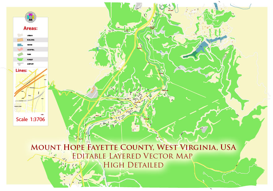
Mount Hope Fayette County West Virginia USA PDF Map Vector Exact Plan High Detailed Street Map editable Adobe PDF in layers
Layers list:
- Legend
- Names of places (city, hamlet, etc.)
- Names of objects (parks, water)
- Names of main streets
- Names of residential streets
- Arrows of streets
- Main Streets, roads
- Residential streets
- Buildings
- Railroads
- Water objects (rivers, lakes, ponds)
- Waterways
- Color fills (parks, land use, etc.)
- Background
The most exact and detailed map of the Mount Hope Fayette County West Virginia USA in scale.
For Editing and High-Quality Printing
Overview
Key Roads / Lines of Communication
-
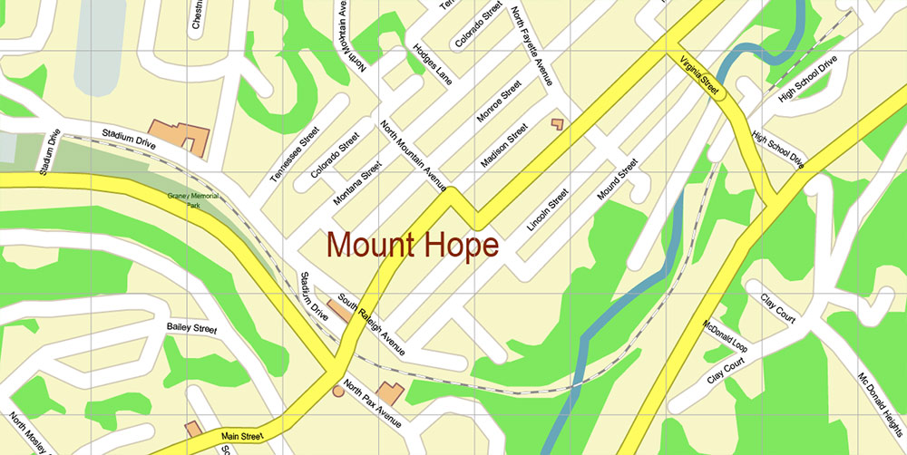
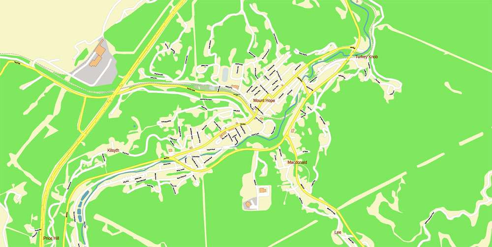
WV-211 (Main Street): short in-town spine through the historic center.
-
WV-16 & WV-61: converge at the town’s edges; primary north–south access toward Oak Hill/Fayetteville and Beckley.
-
US-19 corridor: regional fast-mover to I-79 (north) and I-64/I-77 (south).
-
Local grid: short numbered streets feeding Main; low speed, on-street parking; truck turns tight in core.
Terrain & Geography
-
Ridge-and-hollow topography ~1,700–1,900 ft ASL; rolling divides with narrow bottoms.
-
Mixed residential blocks on gentle slopes; wooded ravines at periphery; small creeks with culverts under the grid.
-
Proximity to the New River Gorge plateau—scenic overlooks and trail access within short drives.
Climate / Seasonality
-
Temperate four-season mountain climate.
-
Winters cold with periodic snow/ice; shoulder seasons variable and breezy; summers warm, humid, with frequent convective showers.
-
Fog and wet pavement common at dawn/dusk; leaf-off improves sightlines in late fall–winter.
Demography / Human Terrain
-
Small-town scale (≈1–1.5k residents).
-
Housing stock: older single-family homes and small multifamily; owner-renter mix typical for legacy coal communities.
-
Workforce and services tied to nearby Beckley–Oak Hill–Fayetteville nodes (retail, healthcare, education, light industry, outdoor recreation).
Points of Interest / Tourism
-
Historic downtown streetscape reflecting coalfield boom years (early 1900s–1950s).
-
Community walking routes and local heritage stops; quick access to New River Gorge area recreation (hiking, biking, climbing, rafting).
-
Small parks, civic buildings, and school-centric facilities; local events on/near Main Street.
Hazards / Constraints
-
Winter driving: snow/ice on grades; black ice on shaded curves.
-
Heavy rain: localized ponding at low spots; storm-drain capacity can be tested.
-
Narrow rights-of-way, low clearances on side streets; occasional freight movements on nearby corridors.
-
Wildfire risk generally low but leaf-litter and dry spells can elevate brush-fire potential at edges.
Logistics / Sustainment
-
Nearest full-service retail/medical hubs: Beckley and Oak Hill (short drive).
-
Fuel, groceries, and basic services available in-area or adjacent towns.
-
Regional access via US-19 to interstates; day-trip range to Charleston and Lewisburg airports via I-64/I-77 links.
Command Takeaways
-
Treat WV-211 (Main Street) as the civic and navigational anchor; WV-16/61 for through-movement.
-
Expect small-town speeds, tight geometry, and seasonal weather impacts.
-
For visitors, position Mount Hope as a quiet historic gateway to New River Gorge recreation, with services concentrated along nearby regional corridors.
Mount Hope Fayette County West Virginia USA PDF Map Vector Exact Plan High Detailed Street Map editable Adobe PDF in layers
Mount Hope Fayette County West Virginia USA PDF Map Vector Exact Plan High Detailed Street Map editable Adobe PDF in layers

 Author: Kirill Shrayber, Ph.D. FRGS


