Extended Description of the Vector Map
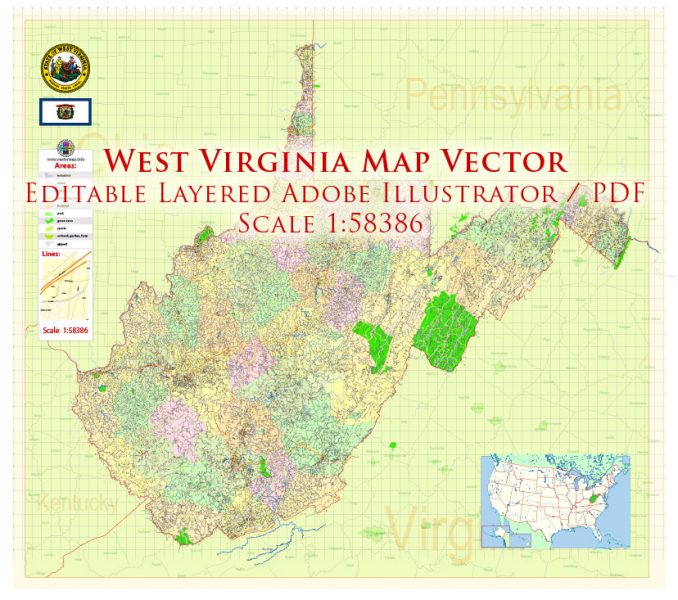
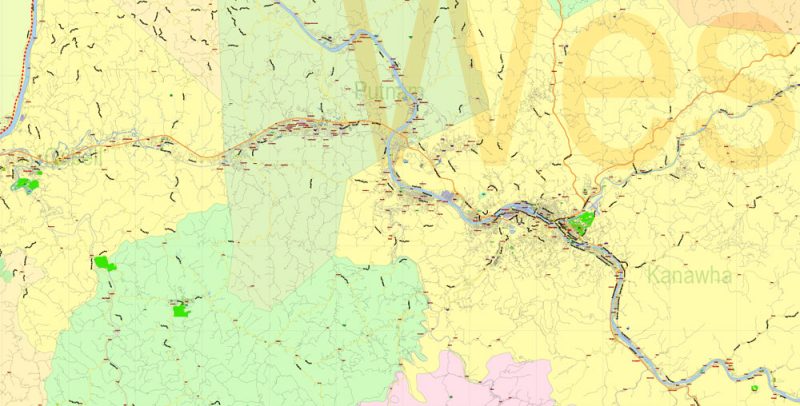
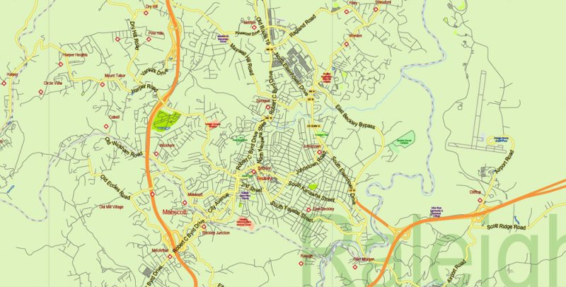
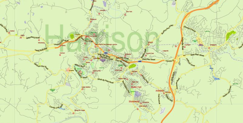
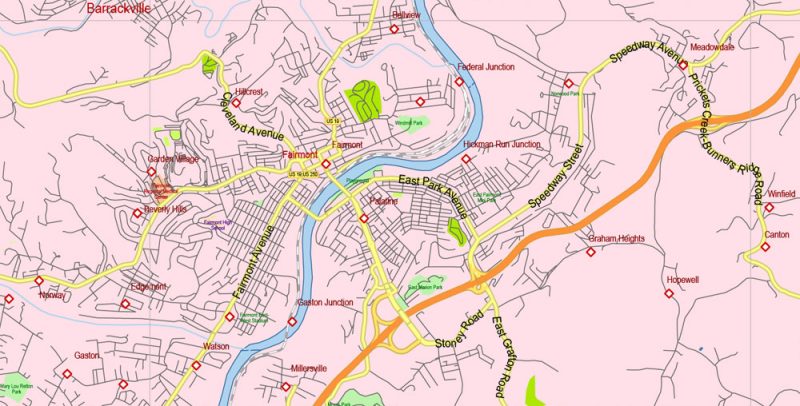
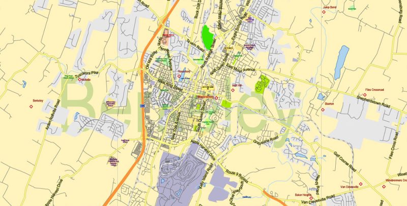
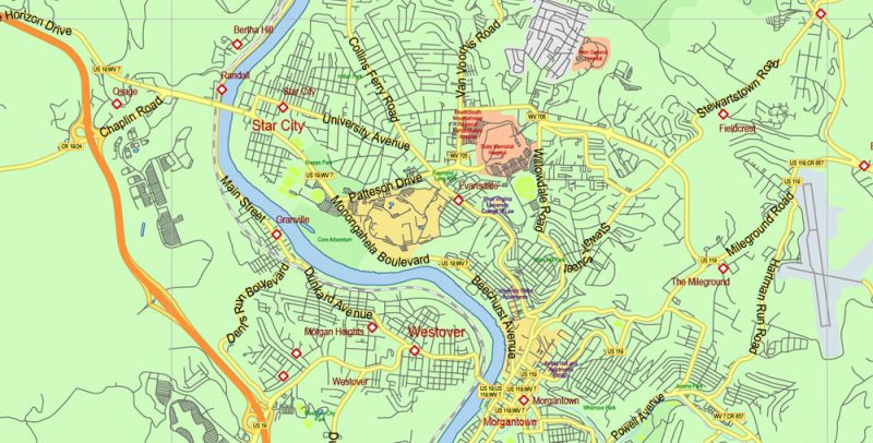
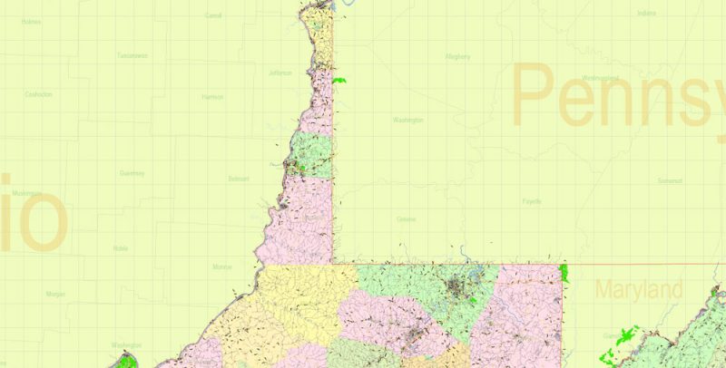
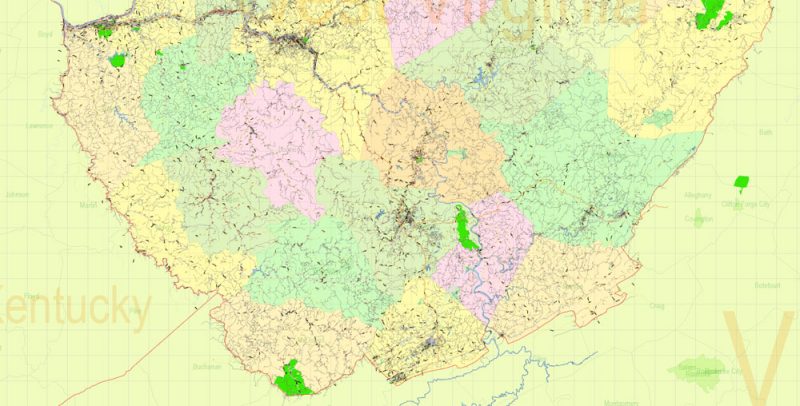
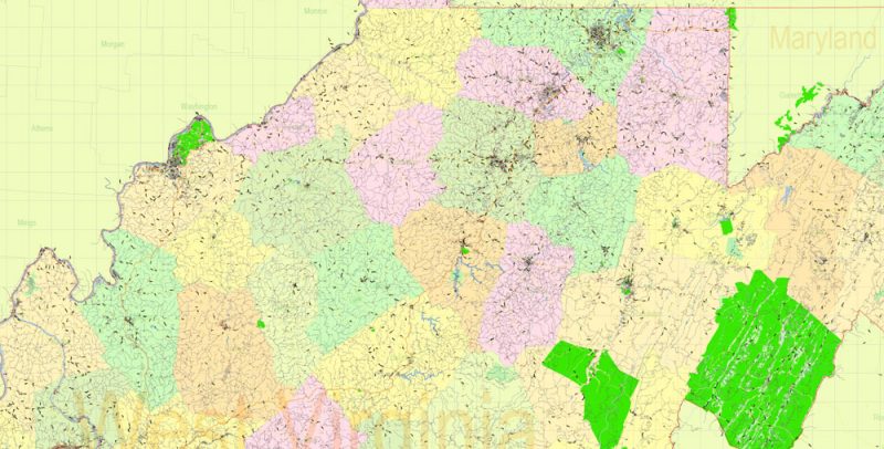
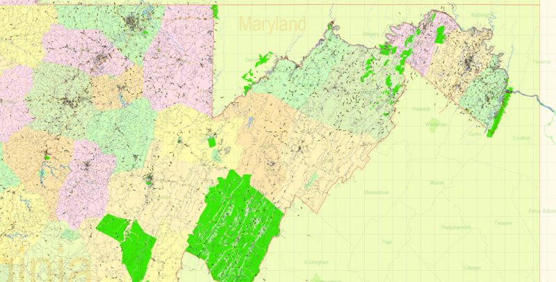
Printable Vector Map of West Virginia State US High Detailed Plan scale 1:58386 full editable Adobe Illustrator Road Admin Map in layers, scalable, text format all names, 31 MB ZIP
All streets and roads, Principal street names, All Cities and Towns, Main Objects, Counties. Map for design, printing, arts, projects, presentations, for architects, designers, and builders, business, logistics.
Layers: color_fills, water, main_streets_roads, civil_streets, labels_roads, counties_areas, state_areas, names_objects, names_streets, names_places, grids, legend, etc.
If you need: we can add postal codes layer (zip codes areas with numbers) to the map as a separated layer.
The most exact and detailed map of the state in scale.
For Editing and High-Quality Printing, Royalty free
TERMS AND CONDITIONS
West Virginia US Map Vector Exact State Plan High Detailed Street Road Admin Map editable Adobe Illustrator in layers
West Virginia US Map Vector Exact State Plan High Detailed Street Road Admin Map editable Adobe Illustrator in layers
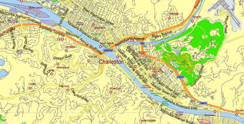
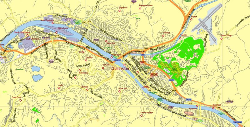
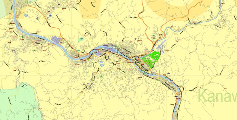
West Virginia – this state, though part of the group “South Atlantic States”, but has no access to the ocean. West Virginia is home to less than two million people. The administrative center of the state and at the same time the largest settlement is Charleston.
West Virginia US Map Vector Exact State Plan High Detailed Street Road Admin Map editable Adobe Illustrator in layers
Among other States, West Virginia in the fourth ten – 38th place in population and 41st in area. Due to the terrain features, West Virginia was called the “Mountain State” – more than half of the territory is occupied by the Appalachian plateau. The state could also be called “Forest”, as 4/5 of the territory of West Virginia is covered with forests.
West Virginia US Map Vector Exact State Plan High Detailed Street Road Admin Map editable Adobe Illustrator in layers
In 1776, residents of the Western part of Virginia decided to separate because they supported the northerners, and the people who lived in the Eastern part of the state – the southerners. However, the Constitution of West Virginia was adopted only almost a hundred years later – in the 60s of the XIX century.
West Virginia US Map Vector Exact State Plan High Detailed Street Road Admin Map editable Adobe Illustrator in layers
The predominance of mountains and forests played a role in the development of the state’s tourism infrastructure. West Virginia has a number of natural parks with recreational areas where travelers can go Hiking, mountaineering, caving, fishing, and river rafting. In winter, snowboarders and skiers come here. Popular places – the mountains of blue ridge, with rivers Shenandoah and Potomac, and the Monongahela, reserve.
West Virginia US Map Vector Exact State Plan High Detailed Street Road Admin Map editable Adobe Illustrator in layers
In the Northern part of West Virginia preserved barrows, composed of representatives of one of the Indian cultures many centuries ago. One of the first settlements founded by Europeans in the XVIII century was the city of new Mecklenburg. It’s called Shepherdstown now.
West Virginia US Map Vector Exact State Plan High Detailed Street Road Admin Map editable Adobe Illustrator in layers
In Charleston preserved many buildings belonging to the period of Foundation of the city – the end of XVII – early XIX century. These buildings are included in the national register of historic places. Even more clearly, the history of the United States is represented in the harper’s ferry national Park. It is a small town, in fact, an open-air Museum, in which many museums, preserved and restored historic buildings, festivals are often held.
West Virginia US Map Vector Exact State Plan High Detailed Street Road Admin Map editable Adobe Illustrator in layers
Another historic town is Lewisburg. In addition to the beautiful historic center, it is also famous for the chocolate festival, which is held in April.
West Virginia US Map Vector Exact State Plan High Detailed Street Road Admin Map editable Adobe Illustrator in layers
The city of willing was the first capital of the state, now it is one of the five largest cities in West Virginia and is the center of industry and сommerce.
West Virginia US Map Vector Exact State Plan High Detailed Street Road Admin Map editable Adobe Illustrator in layers
West Virginia US Map Vector Exact State Plan High Detailed Street Road Admin Map editable Adobe Illustrator in layers
West Virginia US Map Vector Exact State Plan High Detailed Street Road Admin Map editable Adobe Illustrator in layers
West Virginia US Map Vector Exact State Plan High Detailed Street Road Admin Map editable Adobe Illustrator in layers
West Virginia US Map Vector Exact State Plan High Detailed Street Road Admin Map editable Adobe Illustrator in layers


 Author: Kirill Shrayber, Ph.D. FRGS

