Extended Description of the Vector Map
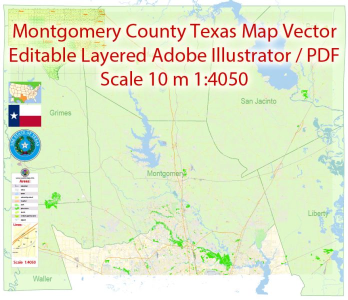
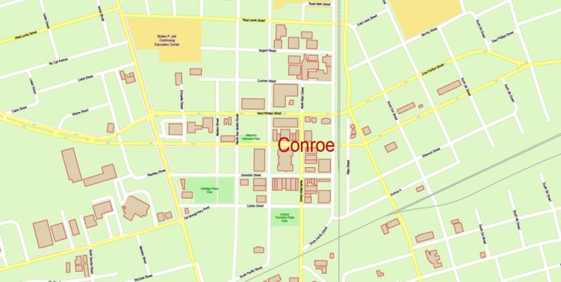
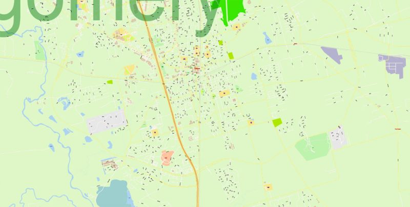
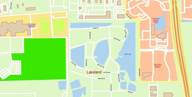
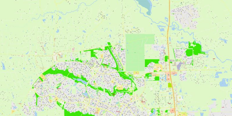
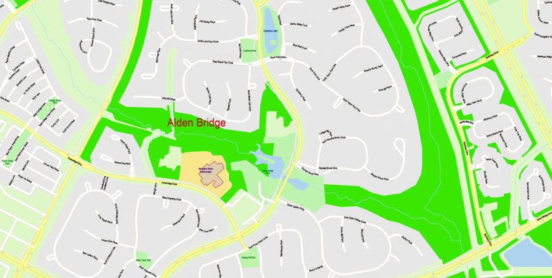
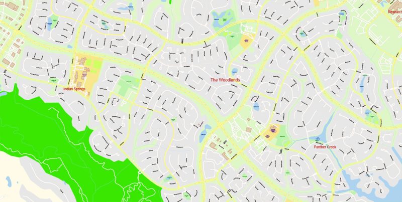
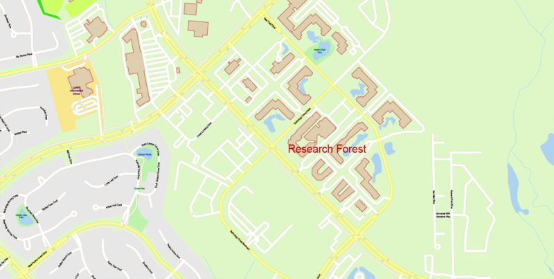
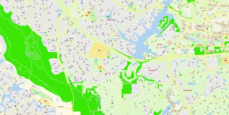
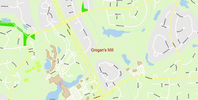
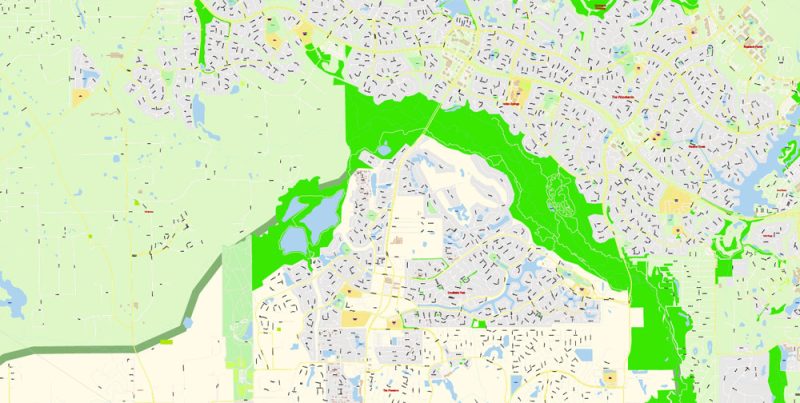
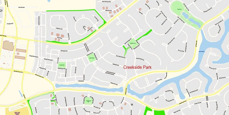
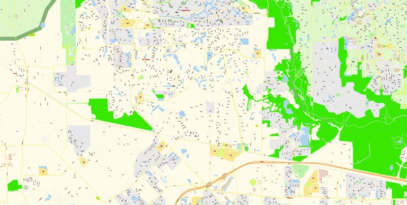
Printable PDF Vector Map of Montgomery County Texas and nearest counties detailed City Plan scale 1:4050 full editable Adobe PDF Street Map in layers, scalable, text format all names, 140 MB ZIP
All street names, Main Objects, Buildings. Map for design, printing, arts, projects, presentations, for architects, designers, and builders, business, logistics.
Included: Coat of Arms, Flag, Map of Texas Counties and the nearest states.
Layers: color_fills, water, streets_roads, labels_roads, names_objects, names_streets, names_places, arrows_streets, buildings, grids, legend, etc.
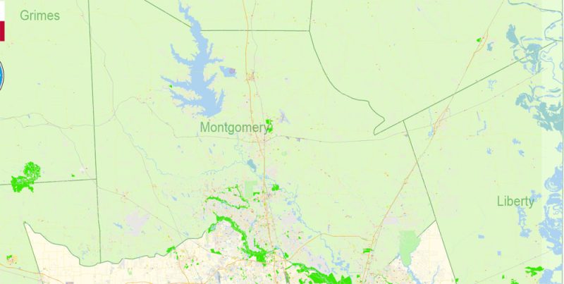
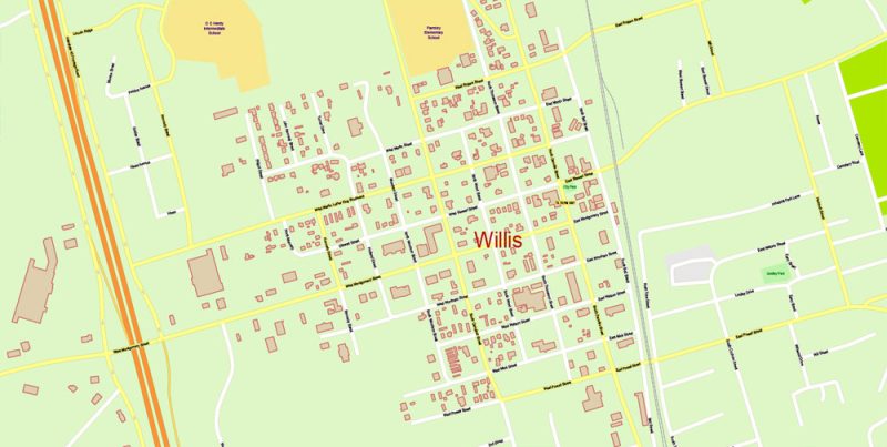
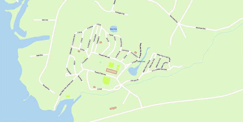
The most exact and detailed map of the city in scale.
For Editing and High-Quality Printing
Montgomery County, Texas
Montgomery County is a county in the U.S. state of Texas. As of the 2010 census, its population was 455,746. A 2016 estimate places the population at 556,203. The county seat is Conroe. Wikipedia
Area: 2,789 km²
Population: 570,934
County seat: Conroe
Colleges and Universities: Lone Star College – Montgomery,
Map covered area
Printable PDF Vector Map of Montgomery County Texas and nearest counties detailed City Plan scale 1:4050 full editable Adobe PDF Street Map in layers
Printable PDF Vector Map of Montgomery County Texas and nearest counties detailed City Plan scale 1:4050 full editable Adobe PDF Street Map in layers
Printable PDF Vector Map of Montgomery County Texas and nearest counties detailed City Plan scale 1:4050 full editable Adobe PDF Street Map in layers
Printable PDF Vector Map of Montgomery County Texas and nearest counties detailed City Plan scale 1:4050 full editable Adobe PDF Street Map in layers
Printable PDF Vector Map of Montgomery County Texas and nearest counties detailed City Plan scale 1:4050 full editable Adobe PDF Street Map in layers
Printable PDF Vector Map of Montgomery County Texas and nearest counties detailed City Plan scale 1:4050 full editable Adobe PDF Street Map in layers
Printable PDF Vector Map of Montgomery County Texas and nearest counties detailed City Plan scale 1:4050 full editable Adobe PDF Street Map in layers
Printable PDF Vector Map of Montgomery County Texas and nearest counties detailed City Plan scale 1:4050 full editable Adobe PDF Street Map in layers
Printable PDF Vector Map of Montgomery County Texas and nearest counties detailed City Plan scale 1:4050 full editable Adobe PDF Street Map in layers
Printable PDF Vector Map of Montgomery County Texas and nearest counties detailed City Plan scale 1:4050 full editable Adobe PDF Street Map in layers
Printable PDF Vector Map of Montgomery County Texas and nearest counties detailed City Plan scale 1:4050 full editable Adobe PDF Street Map in layers
Printable PDF Vector Map of Montgomery County Texas and nearest counties detailed City Plan scale 1:4050 full editable Adobe PDF Street Map in layers
Printable PDF Vector Map of Montgomery County Texas and nearest counties detailed City Plan scale 1:4050 full editable Adobe PDF Street Map in layers
Printable PDF Vector Map of Montgomery County Texas and nearest counties detailed City Plan scale 1:4050 full editable Adobe PDF Street Map in layers
Printable PDF Vector Map of Montgomery County Texas and nearest counties detailed City Plan scale 1:4050 full editable Adobe PDF Street Map in layers
Printable PDF Vector Map of Montgomery County Texas and nearest counties detailed City Plan scale 1:4050 full editable Adobe PDF Street Map in layers
Printable PDF Vector Map of Montgomery County Texas and nearest counties detailed City Plan scale 1:4050 full editable Adobe PDF Street Map in layers
Printable PDF Vector Map of Montgomery County Texas and nearest counties detailed City Plan scale 1:4050 full editable Adobe PDF Street Map in layers


 Author: Kirill Shrayber, Ph.D. FRGS

