Extended Description of the Vector Map
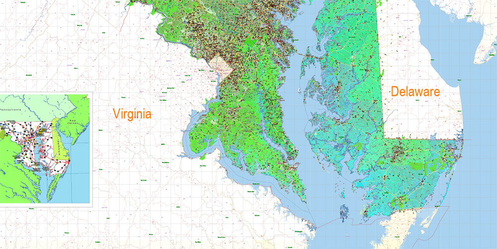
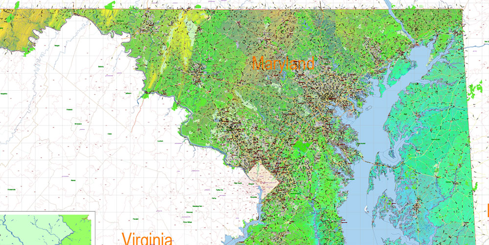
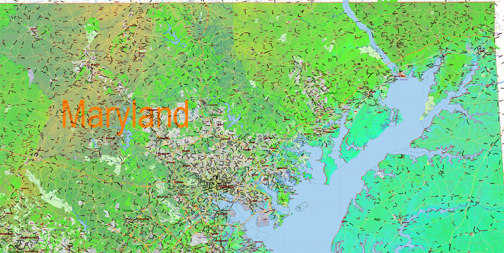
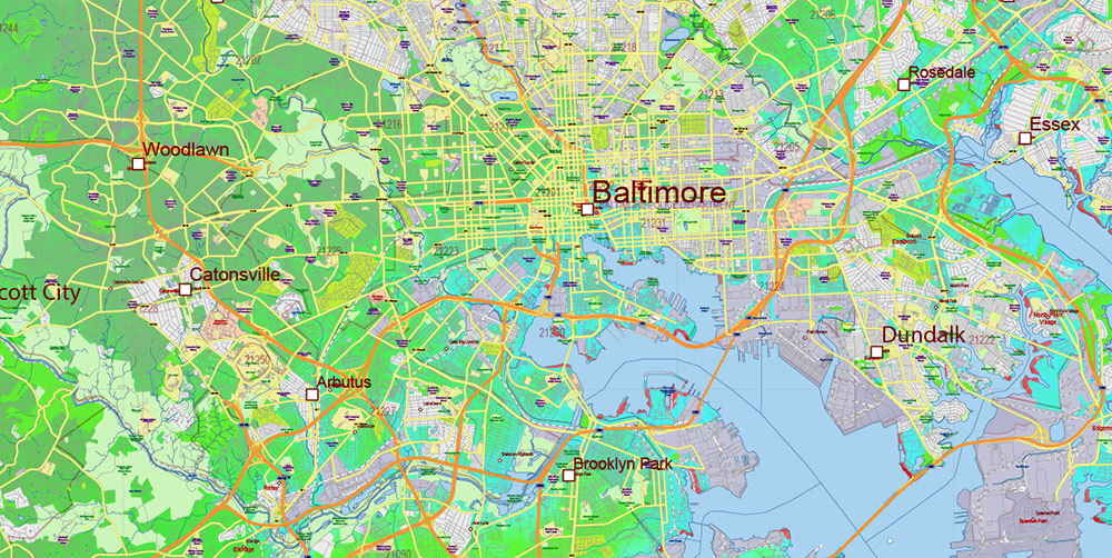
Printable PDF Colored Relief Vector Map of Maryland State Extended Version – US Extra High detailed State Plan scale 1:58526 full editable Adobe PDF Road + Counties + ZipCodes Colored Relief Map in layers, scalable, text format all names, 311 MB ZIP
Principal street names, ALL STREETS AND ROADS, Main Objects, Counties, Zipcodes, addon layers – Cities / towns by population categories by layers, Colored Relief JPG. Map for design, printing, arts, projects, presentations, for architects, designers, and builders, business, logistics.
Included: Simple map of Maryland state.
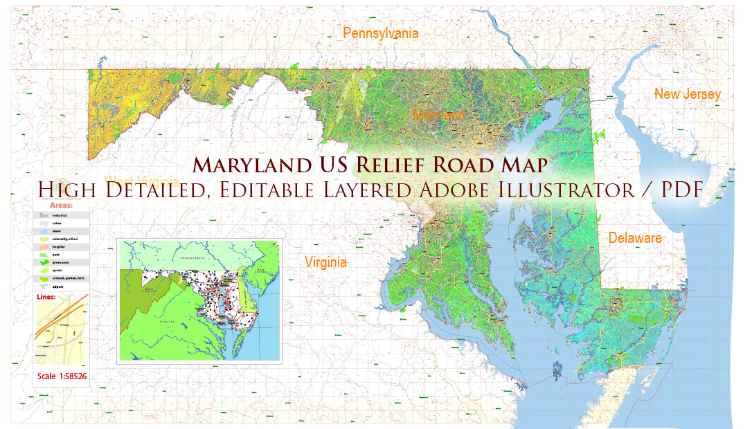
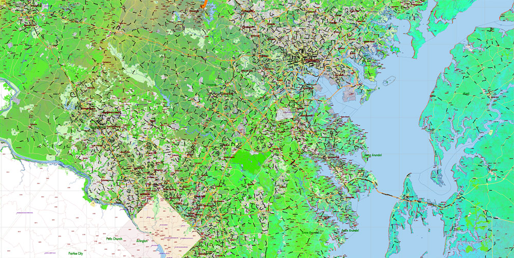
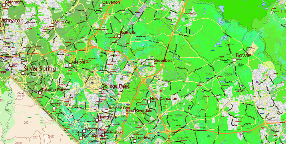
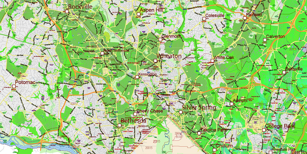
Maryland State US PDF Map Vector Colored Relief Extended Exact High Detailed Street Road Map + Counties + Zipcodes editable Adobe PDF in layers
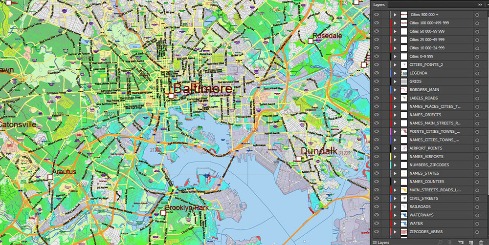
Layers list Maryland State Roads Admin map:
- Legend
- Grids
- Labels of roads
- Addon layers – Cities by population categories + addon points
- Points of airports
- Names of airports
- Names of places (city, hamlet, etc.)
- Names of cities, towns, hamlets 2
- Names of objects (hospitals, schools, parks, water)
- Points of cities, towns, hamlets
- Names of Main streets
- Main Streets, roads.
- Civil streets
- Railroads
- Waterways (lines)
- Water objects (rivers, lakes, ponds) areas
- Names of Counties
- Names of States
- Zipcodes areas
- Zipcodes numbers
- Counties areas
- States areas
- Color fills (parks, hospital areas, school areas, etc.)
- Colored Relief Raster JPG
- Background and sea
The most exact and detailed map of the State of Maryland in scale.
ALSO: DWG, DXF, CDR and other formats: free convert for our customers.
For Editing and High-Quality Printing
AO BRIEF — MARYLAND (STATEWIDE)
Colored Relief • No Shading • Print & Design Focus
Operational Overview
Extended color relief vector map of Maryland using elevation-based color bands without terrain shading. Designed for clean, high-density cartography where clarity, neutrality, and visual balance are critical. Suitable for unlimited print sizes and refined graphic applications.
Relief Representation
-
Elevation expressed through calibrated color relief only
-
No shadows or directional lighting — neutral, timeless appearance
-
Clear distinction between uplands, plateaus, coastal plains, and lowlands
-
Terrain structure remains readable without visual noise
Visual Hierarchy & Clarity
-
Color relief supports dense road and administrative data without competition
-
Designed to handle extremely high object density (all streets, ZIPs, counties)
-
Clean background for labels, boundaries, and thematic layers
Human & Administrative Geography
-
Cities and towns structured by population categories in separate layers
-
Counties and ZIP Codes clearly readable for analytical and design tasks
-
Effective for planning, real estate, business, and educational graphics
Transport Framework
-
Complete street and road network integrated as a core visual element
-
Principal streets emphasized without overpowering composition
-
Suitable for logistics, accessibility, and network visualization
Hydrography & Regional Identity
-
Chesapeake Bay and river systems act as dominant spatial anchors
-
Water features remain visually clean against color relief
-
Supports regional identity in both technical and decorative outputs
Print & Design Engineering
-
Fully editable layered vector PDF
-
All names in text format, scalable and print-safe
-
No resolution or format limitations for large prints or wall installations
-
Suitable for posters, wall maps, reports, and high-end design projects
Aesthetic Intent
-
Cartographically accurate, visually restrained, and composition-focused
-
Designed for environments where readability and aesthetics must coexist
-
Works equally as a technical base map and refined wall art
Command Takeaways
-
Color relief without shading for maximum clarity
-
High-density data handled cleanly
-
Unlimited print scalability
-
Ideal for design studios, offices, and analytical presentations
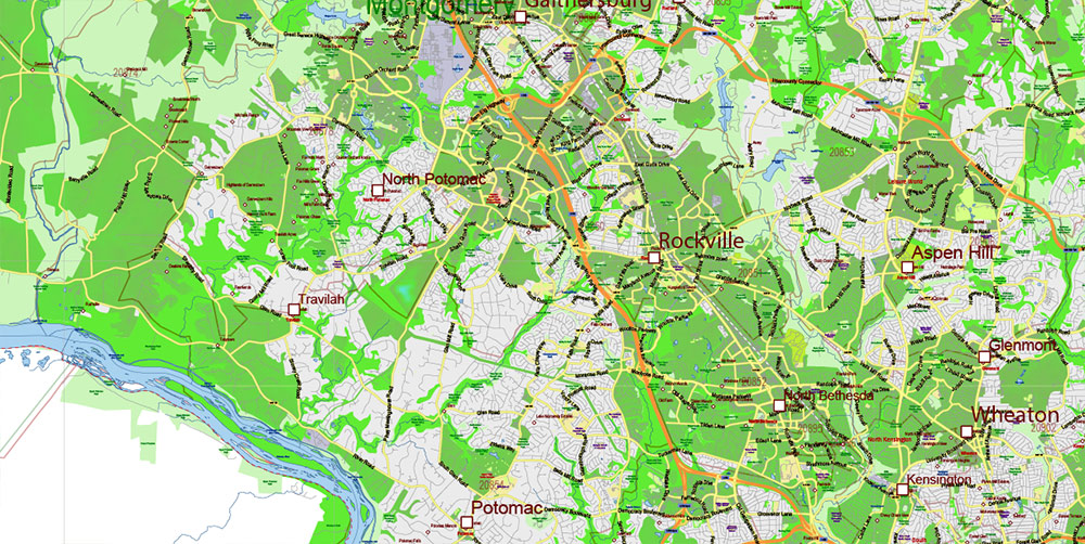
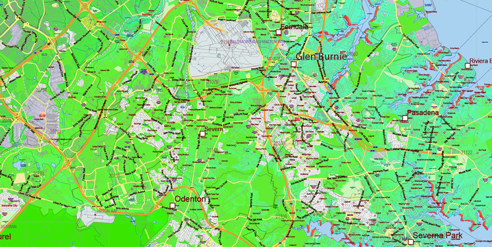
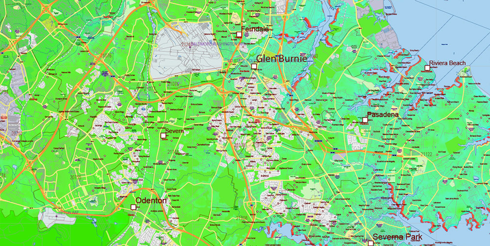
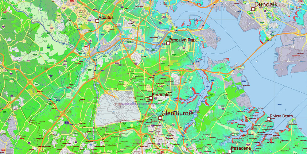
Maryland State US PDF Map Vector Colored Relief Extended Exact High Detailed Street Road Map + Counties + Zipcodes editable Adobe PDF in layers
Maryland State US PDF Map Vector Colored Relief Extended Exact High Detailed Street Road Map + Counties + Zipcodes editable Adobe PDF in layers

Maryland State US PDF Map Vector Colored Relief Extended Exact High Detailed Street Road Map + Counties + Zipcodes editable Adobe PDF in layers
Maryland State US PDF Map Vector Colored Relief Extended Exact High Detailed Street Road Map + Counties + Zipcodes editable Adobe PDF in layers
Maryland State US PDF Map Vector Colored Relief Extended Exact High Detailed Street Road Map + Counties + Zipcodes editable Adobe PDF in layers
Maryland State US PDF Map Vector Colored Relief Extended Exact High Detailed Street Road Map + Counties + Zipcodes editable Adobe PDF in layers
Maryland State US PDF Map Vector Colored Relief Extended Exact High Detailed Street Road Map + Counties + Zipcodes editable Adobe PDF in layers
Maryland State US PDF Map Vector Colored Relief Extended Exact High Detailed Street Road Map + Counties + Zipcodes editable Adobe PDF in layers
Maryland State US PDF Map Vector Colored Relief Extended Exact High Detailed Street Road Map + Counties + Zipcodes editable Adobe PDF in layers
Maryland State US PDF Map Vector Colored Relief Extended Exact High Detailed Street Road Map + Counties + Zipcodes editable Adobe PDF in layers
Maryland State US PDF Map Vector Colored Relief Extended Exact High Detailed Street Road Map + Counties + Zipcodes editable Adobe PDF in layers
Maryland State US PDF Map Vector Colored Relief Extended Exact High Detailed Street Road Map + Counties + Zipcodes editable Adobe PDF in layers
Maryland State US PDF Map Vector Colored Relief Extended Exact High Detailed Street Road Map + Counties + Zipcodes editable Adobe PDF in layers
Maryland State US PDF Map Vector Colored Relief Extended Exact High Detailed Street Road Map + Counties + Zipcodes editable Adobe PDF in layers

 Author: Kirill Shrayber, Ph.D. FRGS


 Street Map editable Adobe Illustrator in layers")