Extended Description of the Vector Map
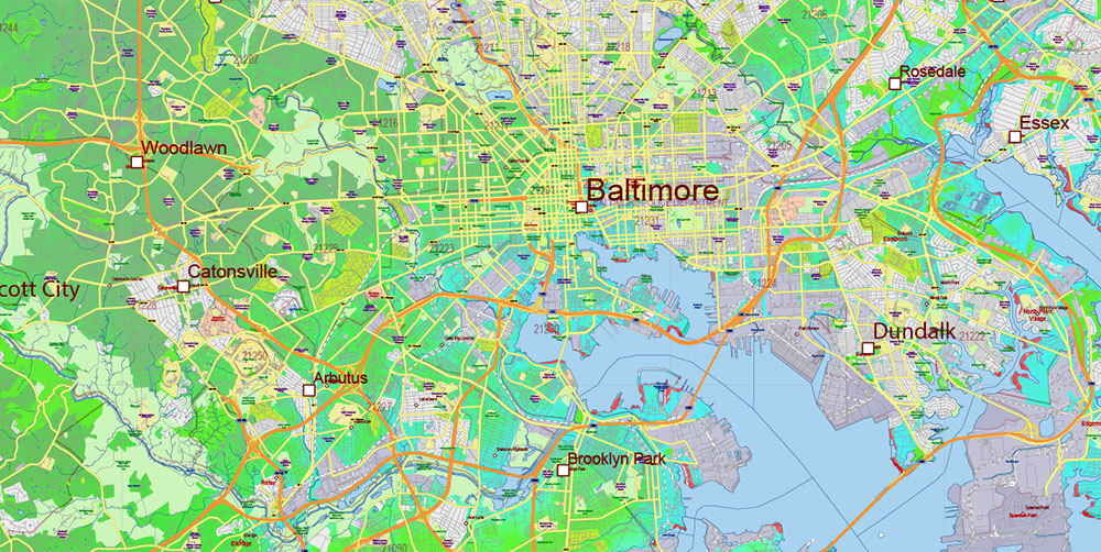
Printable Colored Relief Vector Map of Maryland State Extended Version – US Extra High detailed State Plan scale 1:58526 full editable Adobe Illustrator Road + Counties + ZipCodes Colored Relief Map in layers, scalable, text format all names, 125 MB ZIP
Principal street names, ALL STREETS AND ROADS, Main Objects, Counties, Zipcodes, addon layers – Cities / towns by population categories by layers, Colored Relief JPG. Map for design, printing, arts, projects, presentations, for architects, designers, and builders, business, logistics.
Included: Simple map of Maryland state.
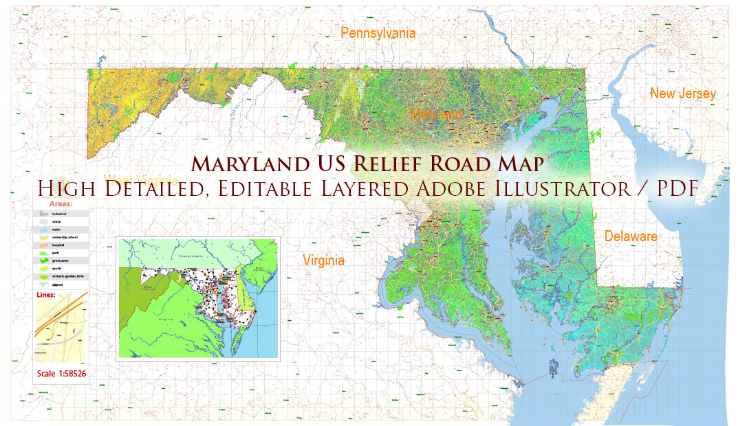
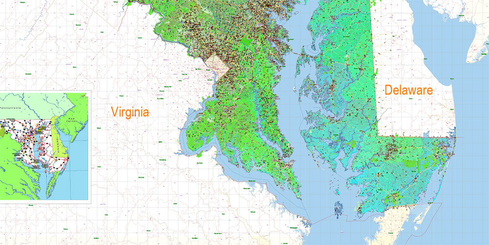
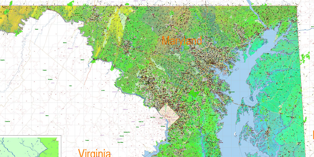
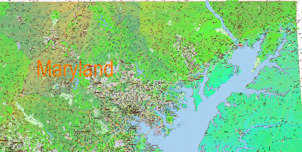
Maryland State US Map Vector Colored Relief Extended Exact High Detailed Street Road Map + Counties + Zipcodes editable Adobe Illustrator in layers
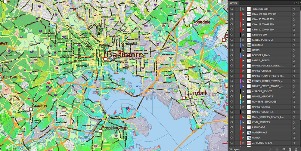
Layers list Maryland State Roads Admin map:
- Legend
- Grids
- Labels of roads
- Addon layers – Cities by population categories + addon points
- Points of airports
- Names of airports
- Names of places (city, hamlet, etc.)
- Names of cities, towns, hamlets 2
- Names of objects (hospitals, schools, parks, water)
- Points of cities, towns, hamlets
- Names of Main streets
- Main Streets, roads.
- Civil streets
- Railroads
- Waterways (lines)
- Water objects (rivers, lakes, ponds) areas
- Names of Counties
- Names of States
- Zipcodes areas
- Zipcodes numbers
- Counties areas
- States areas
- Color fills (parks, hospital areas, school areas, etc.)
- Colored Relief Raster JPG
- Background and sea
The most exact and detailed map of the State of Maryland in scale.
ALSO: DWG, DXF, CDR and other formats: free convert for our customers.
For Editing and High-Quality Printing
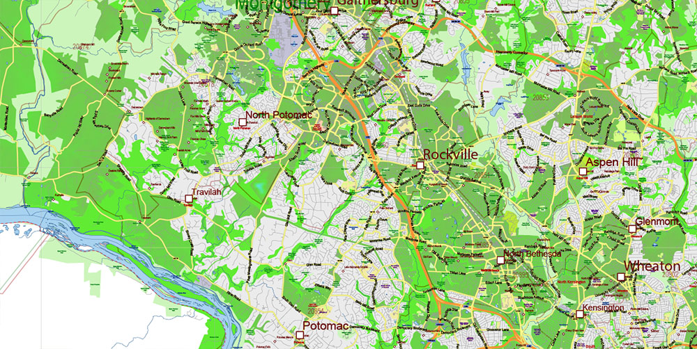
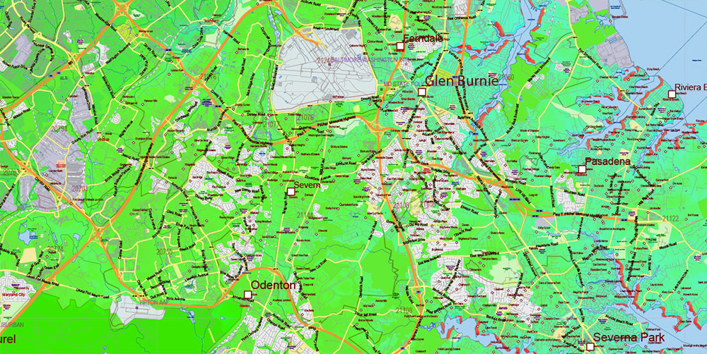
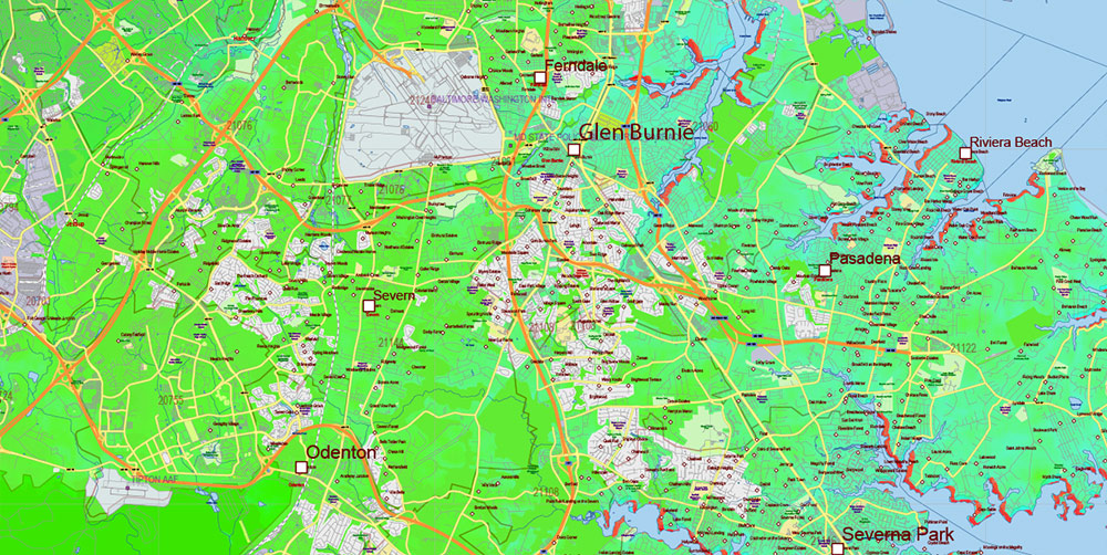
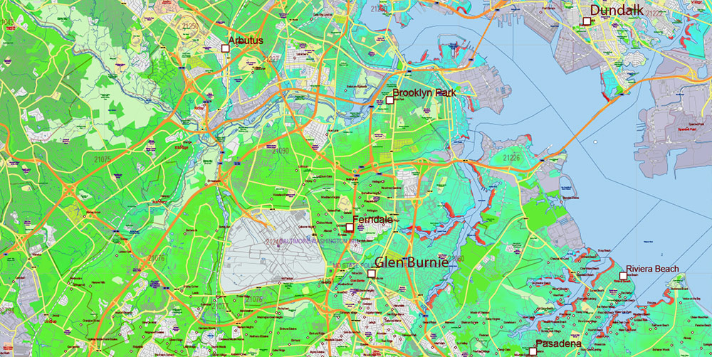
Maryland State US Map Vector Colored Relief Extended Exact High Detailed Street Road Map + Counties + Zipcodes editable Adobe Illustrator in layers
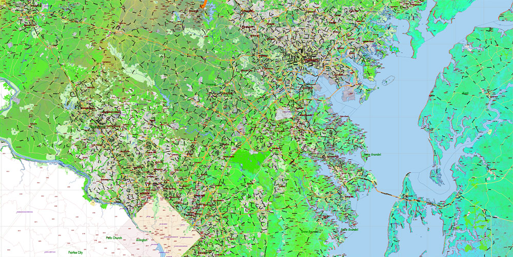
Maryland State US Map Vector Colored Relief Extended Exact High Detailed Street Road Map + Counties + Zipcodes editable Adobe Illustrator in layers

Maryland State US Map Vector Colored Relief Extended Exact High Detailed Street Road Map + Counties + Zipcodes editable Adobe Illustrator in layers
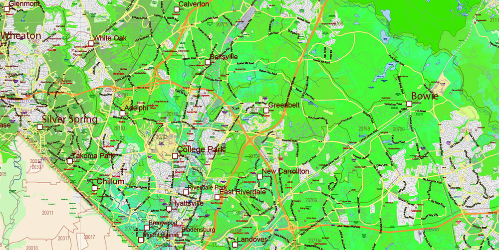
Maryland State US Map Vector Colored Relief Extended Exact High Detailed Street Road Map + Counties + Zipcodes editable Adobe Illustrator in layers
Maryland State US Map Vector Colored Relief Extended Exact High Detailed Street Road Map + Counties + Zipcodes editable Adobe Illustrator in layers
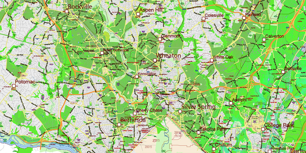
Maryland State US Map Vector Colored Relief Extended Exact High Detailed Street Road Map + Counties + Zipcodes editable Adobe Illustrator in layers
Maryland State US Map Vector Colored Relief Extended Exact High Detailed Street Road Map + Counties + Zipcodes editable Adobe Illustrator in layers
Maryland State US Map Vector Colored Relief Extended Exact High Detailed Street Road Map + Counties + Zipcodes editable Adobe Illustrator in layers
Maryland State US Map Vector Colored Relief Extended Exact High Detailed Street Road Map + Counties + Zipcodes editable Adobe Illustrator in layers
Maryland State US Map Vector Colored Relief Extended Exact High Detailed Street Road Map + Counties + Zipcodes editable Adobe Illustrator in layers
Maryland State US Map Vector Colored Relief Extended Exact High Detailed Street Road Map + Counties + Zipcodes editable Adobe Illustrator in layers
Maryland State US Map Vector Colored Relief Extended Exact High Detailed Street Road Map + Counties + Zipcodes editable Adobe Illustrator in layers
Maryland State US Map Vector Colored Relief Extended Exact High Detailed Street Road Map + Counties + Zipcodes editable Adobe Illustrator in layers
Maryland State US Map Vector Colored Relief Extended Exact High Detailed Street Road Map + Counties + Zipcodes editable Adobe Illustrator in layers

 Author: Kirill Shrayber, Ph.D. FRGS


 Street Map editable Adobe Illustrator in layers")