About editable vector map of Newcastle, England
Archive size: 31 Mb, AI zipped
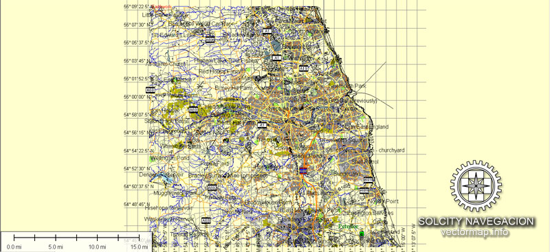
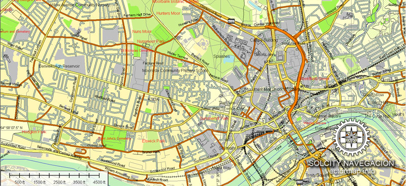
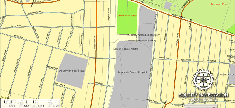
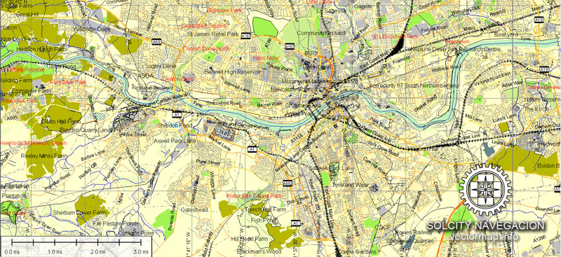
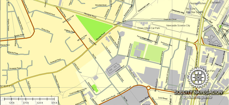
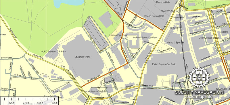
Download a free example of Newcastle map in vector.
DPI: 300
License: Royalty Free
You can edit all map data using different vector graphics editors like Adobe Illustrator, Freehand or CorelDraw, cropping, changing colors, fonts or borders, also adding your company logo or necessary objects. And also is a fully scalable map, no matter what size you need.
Newcastle vector map features (check the preview images):
Highways with names,
Major streets with names,
Major Roads,
Airports,
Houses,
Railway,
Minor Roads,
Cemeteries,
Big and small Rivers, small streams also,
Lake, ponds and other water bodies,
Landmark fill,
County Borders with fill,
Parks.
Probably you need more data on map? Please feel free to contact us, and we add it with no problem.
Newcastle, England.
This vector map of Newcastle is used as a basis for design, editing, and further printing.
This is the most detailed, exact map of Newcastle for high-quality printing and polygraphy. You can always clarify the map development date by contacting us.
For your convenience, all objects on Newcastle vector map are divided into layers. And the editing is very easy – colors, lines, etc.
You can easily add any objects needed (e.g. shops, salons, sale points, gas station or attraction) on any layer of Newcastle vector map.
Newcastle upon Tyne is a city in Tyne and Wear, North East England, 103 miles (166 km) south of Edinburgh and 277 miles (446 km) north of London on the northern bank of the River Tyne, 8.5 mi (13.7 km) from the North Sea. Newcastle is the most populous city in the North East, and forms the core of the Tyneside conurbation, the eighth most populous urban area in the United Kingdom. Newcastle is a member of the English Core Cities Group and is a member of the Eurocities network of European cities.
One of the advantages of Newcastle vector maps of our production is the relevance of cartographic data, we constantly update all our products.
This vector map of Newcastle is used by:
designers, layout designers, printers, advertisers and architects. Our product – vector maps – is designed for further editing and printing in large formats – from @Wall format (a few meters) to A-0 and A-1, A-2, A-3.
Newcastle map in vector format is used for design, urban planning, presentations and media visualizations.
Advertising and presentation map of Newcastle (usually the final designer marks the routes, and puts the client’s objects (shops, saloons, gas stations etc.)
The undoubted advantage is that people will NEVER throw out this advertising product – the map. In fact, as an advertising medium, a map is the most “long-playing” of the well-known polygraphic advertising media, with the longest lifespan, and the maximum number of interactions with the customer.
For travelers, maps are sold at the airports and gas stations around the world. Often the source is our vector maps.
Take a look, who purchases our vector maps of Newcastle in “Our Clients and Friends” page – these are large and small companies, from super-brands like Volvo and Starbucks, to small design studios and printing houses.
It’s very easy to work with vector maps of Newcastle, even for a not very experienced designer who can turn on and off the map layers, add new objects, change the colors of fill and lines according to customer requirements.
The undoubted advantage of Newcastle vector maps in printing is an excellent and detailed visualization, when customer can expand a large paper map and instantly define his location, find a landmark, an object or address on map, unlike using the popular electronic formats of Google and Yandex maps for example.
Printable vector maps of Newcastle are much more convenient and efficient than any electronic maps on your smartphone, because ALL DETAILS are displayed in the entire space of Newcastle map.
Useful tips on working with vector maps of cities and countries in Adobe Illustrator.
«V» – launches the Selection tool (cursor, black arrow), which makes active any vector line.
«А» – launches the Direct Selection tool (white cursor), allows you to select curve elements and drag them to the desired place.
«R» – activates the Rotate tool, which helps you rotating selected objects around the center point by 360 degrees.
«E» – gives you the opportunity to use the Eraser tool and erase unnecessary parts.
«X» – switches between Fill and Stroke in the Tools section. Try to get used to this hot key and
you will quickly understand that you can’t live and work without it.
Guides are not limited to vertical and horizontal in Adobe Illustrator. You can also create a diagonal guide for example. Moreover, you can turn any contours into guides. Select the outline and go to View > Guides > Make Guides (Create Guides), or simply press Cmd/Ctrl + 5. You can also turn the guides back into an editable object. Go to menu, View > Guides > Unlock Guides (Release Guides), select the guide you want to edit and select View > Guides > Release Guides (Reset Guides), or just press Cmd/Ctrl + Option / Alt + 5).
You will probably want to change the color scheme used on our Newcastle vector map.
To quickly and effectively play with colors.
Of course, you can do it manually, all objects in our Newcastle vector map are divided according to types and layers, and you can easily change the color gamma of vector objects in groups and layers.
But there is more effective way of working with the whole VECTOR MAP of Newcastle and all layers:
The overview dialog «Edit colors»/«Repaint Graphic Object» (this dialog box name can change depending on the context):
If you have selected a part or a layer of Newcastle vector map and open the dialog box by clicking the icon in the Control panel, on the Samples palette or the Color Catalog, or if you choose Edit > Edit Colors> Repaint Graphic Object, then the «Repaint Graphic Object» dialog box appears, and you get access to «Assign» and «Edit» tabs.
If a picture or a map fragment is not selected, and you open the dialog box by clicking the icon in the Control panel, on the Samples palette or in the Color Catalog, the «Edit Colors» dialog box appears and you can only access the «Edit» tab.
Regardless of the name at the top of the dialog box, the right-hand side always displays the color group of the current document, as well as two default color groups: Print Color and Grayscale. These color groups can be selected and used any time.
Newcastle was part of the county of Northumberland until 1400, when it became a county of itself, a status it retained until becoming part of Tyne and Wear in 1974. The regional nickname and dialect for people from Newcastle and the surrounding area is Geordie. Newcastle also houses Newcastle University, a member of the Russell Group, as well as Northumbria University.
Create and edit color groups of Newcastle vector map, and also assign colors using the «Edit Colors»/ а «Repaint Graphic Object» dialog box.
A. Creating and editing of a color group on the «Edit» tab
B. Assigning colors on the «Assign» tab
C. Select a group of colors from the «Color groups» list
The option «Repaint a graphic object» in the lower part of the dialog box allows you to preview the colors on a selected layer of Vector map, or a group of elements, and specify whether its colors will be redefined when the dialog box is closed.
The main areas of the dialog box are:
«Edit»
The «Edit» tab is designed to create a new or edit the existing color groups.
The harmony rules Menu and the Color Wheel are used to conduct experiments with color harmonies. The color wheel shows how colors are related in color harmony, and the color bars allow you to view and manipulate an individual color values. In addition, you can adjust the brightness, add and remove colors, save color groups and view colors on the selected Vector Map of Newcastle or a separated layers.
«Assign»
The «Assign» tab is used to view and control on how the original colors are replaced with colors from the color group like your corporate colors in the Vector Map of Newcastle.
The assign color ability is provided only if the entire map, layer or fragment is selected in the document. You can specify which of new colors replace the current colors, whether the spot colors should be preserved and how colors are replaced (for example, you can replace colors completely or changing the color tone while maintaining the brightness). The «Assign» tab allows you to redefine colors in the Vector Map of Newcastle, or in separate layers and fragments using the current color group or reducing the number of colors in the current Vector Map.
Color groups
Is a list of all saved color groups for current document (the same groups appear in the «Samples» palette). You can edit and delete the existing color groups, as well as creating a new ones using the list of “Color Groups” in the dialog box. All changes appear in the «Samples» palette.
The highlighted color group shows, which color group is currently edited.
Any color group can be selected and edited, or used to redefine the colors in the selected vector map of Newcastle, its fragments or elements.
Saving a color group adds this group to the specified list.
Opening the «Edit Colors»/«Repaint Graphic Object» dialog box.
Open the «Edit Colors»/«Repaint Graphic Object» dialog box using one of the following methods:
«Edit»> «Edit Colors»> «Repaint Graphic object» or «Repaint With Style».
Use these commands if you need to edit the colors in the selected vector map of Newcastle.
«Repaint Graphic object» button on the «Control» panel.
Use this button if you need to adjust colors of Newcastle vector map using the а «Repaint graphic object» dialog box.
The specified button is available if the selected vector map or its fragment contains two or more colors.
Note. This color editing method is convenient for global color adjustment in a vector map, if global colors were not used when creating a Map of Newcastle.
The «Edit colors» button or «Edit or apply colors» on the «Color Catalog» palette
Click this button if you need to edit colors on the «Color Catalog» palette or edit and then apply them to the selected Vector Map of Newcastle or its fragment.
The «Edit color group» button or «Edit or apply color group» on the «Samples» palette.
Click this button if you need to edit the colors in the specific color group or edit and apply them to the selected Vector Map of Newcastle or a group of its elements, for example, the whole layer “Streets and lines”. You can also double-click the color group in the Samples panel to open the dialog box.
If the map file is too large and your computer freezes or even can’t open it quickly:
1. Try to reduce the color resolution of the video card (display) to 256 colors while working with a large map.
2. Using Windows Task Manager, select all the application you don’t need, while working with map, just turn them off.
3. Launch Adobe Illustrator. (DO NOT OPEN the vector map file)
4. Start the Windows Task Manager using administrator rights > Find the “Illustrator” process > set the «real time» priority,
5. Open the file. When you see the LEGACY FONT popup window – click “OK” (do not update). You can restore the TEXT later.
6. Can also be useful: When file is opened – Edit > Settings > Basic Settings > disable smoothing. /// It looks scary, but works quickly)))
We recommend saving the file in Adobe Illustrator 10 version. It’s much more stable when working with VERY BIG size files.
The city developed around the Roman settlement Pons Aelius and was named after the castle built in 1080 by Robert Curthose, William the Conqueror’s eldest son. The city grew as an important centre for the wool trade in the 14th century, and later became a major coal mining area. The port developed in the 16th century and, along with the shipyards lower down the River Tyne, was amongst the world’s largest shipbuilding and ship-repairing centres.
Newcastle’s economy includes corporate headquarters, learning, digital technology, retail, tourism and cultural centres, from which the city contributes £13 billion towards the United Kingdom’s GVA. Among its icons are Newcastle United football club and the Tyne Bridge. Since 1981 the city has hosted the Great North Run, a half marathon which attracts over 57,000 runners each year.
Geography
Newcastle is situated in the North East of England, in the metropolitan county of Tyne and Wear and the historical and traditional county of Northumberland. The city is located on the northwestern bank of the River Tyne. It is 46 miles (74 km) from the Scottish border, south of Southdean.
The ground beneath the city is formed from Carboniferous strata of the Middle Pennine Coal Measures Group—a suite of sandstones, mudstones and coal seams which generally dip moderately eastwards. To the west of the city are the Upper Pennine Coal Measures and further west again the sandstones and mudstones of the Stainmore Formation, the local equivalent of the Millstone Grit.
In large parts, Newcastle still retains a medieval street layout. Narrow alleys or ‘chares’, most of which can only be traversed by foot, still exist in abundance, particularly around the riverside. Stairs from the riverside to higher parts of the city centre and the extant Castle Keep, originally recorded in the 14th century, remain intact in places. Close, Sandhill and Quayside contain modern buildings as well as structures dating from the 15th–18th centuries, including Bessie Surtees House, the Cooperage and Lloyds Quayside Bars, Derwentwater House and House of Tides, a restaurant situated at a Grade I-listed 16th century merchant’s house at 28–30 Close.
The city has an extensive neoclassical centre referred to as Tyneside Classical largely developed in the 1830s by Richard Grainger and John Dobson, and recently extensively restored. Broadcaster and writer Stuart Maconie described Newcastle as England’s best-looking city and the German-born British scholar of architecture, Nikolaus Pevsner, describes Grey Street as one of the finest streets in England. The street curves down from Grey’s Monument towards the valley of the River Tyne and was voted England’s finest street in 2005 in a survey of BBC Radio 4 listeners. In the Google Street View awards of 2010, Grey Street came 3rd in the British picturesque category. Osborne Road came 4th in the foodie street category. A portion of Grainger Town was demolished in the 1960s to make way for the Eldon Square Shopping Centre, including all but one side of the original Eldon Square itself.
Immediately to the northwest of the city centre is Leazes Park, established in 1873 after a petition by 3,000 working men of the city for “ready access to some open ground for the purpose of health and recreation”. Just outside one corner of this is St James’ Park, the stadium home of Newcastle United F.C. which dominates the view of the city from all directions.
Another green space in Newcastle is the Town Moor, lying immediately north of the city centre. It is larger than London’s famous Hyde Park and Hampstead Heath put together and the freemen of the city have the right to graze cattle on it. The right extends to the pitch of St. James’ Park, Newcastle United Football Club’s ground; this is not exercised, although the Freemen do collect rent for the loss of privilege. Honorary freemen include Bob Geldof, King Harald V of Norway, Bobby Robson, Alan Shearer, the late Nelson Mandela and the Royal Shakespeare Company. The Hoppings funfair, said to be the largest travelling funfair in Europe, is held here annually in June.
In the southeastern corner is Exhibition Park, which contains the only remaining pavilion from the North East Coast Exhibition of 1929. From 1970s until 2006 this housed the Newcastle Military Vehicle Museum; which closed in 2006. The pavilion is now being used as a microbrewery and concert venue for Wylam Brewery.
Cities and counties near Newcastle city vector map.
South Shields, North Shields, Tynemouth, Jarrow, Hebburn, Wallsend, Longbenton, Murton, Gateshead, Team Valley Trading Estate, Blaydon, Winlaton, Boldon Colliery, Whickham, Town Moor Park, Gosforth, Low Fell.
Purchasing of AI vector map of Newcastle, England
This is a Royalty Free license. You don`t pay extra for copying or editing.
We accept credit cards and PayPal. After the payment you will be redirected to the download page.
We always have: unbeatable prices and quality. View a full collection of vector maps.
Small guide: How to work with the vector map?
You can: Mass select objects by type and color – for example, the objects type “building” (they are usually dark gray) – and remove them from the map, if you do not need them in your print or design project. You can also easily change the thickness of lines (streets), just bulk selection the road by the line color.
The streets are separated by type, for example, type “residential road” are usually white with a gray stroke. Highway usually orange with a brown or dark gray stroke.
All objects are divided by types: different types of roads and streets, polygons of buildings, landfills, urban areas, parks and more other.
It is easy to change the font of inscriptions, all or each individually. Also, just can be make and any other manipulation of objects on the vector map in Adobe illustrator format.
Important: All the proportions on the map are true, that is, the relative sizes of the objects are true, because Map is based on an accurate GPS projection, and It transated into the (usual for all) the Mercator projection.
You can easily change the color, stroke and fill of any object on the map, zoom without loss of quality Image Verification.


 Author: Kirill Shrayber, Ph.D. FRGS
