Extended Description of the Vector Map
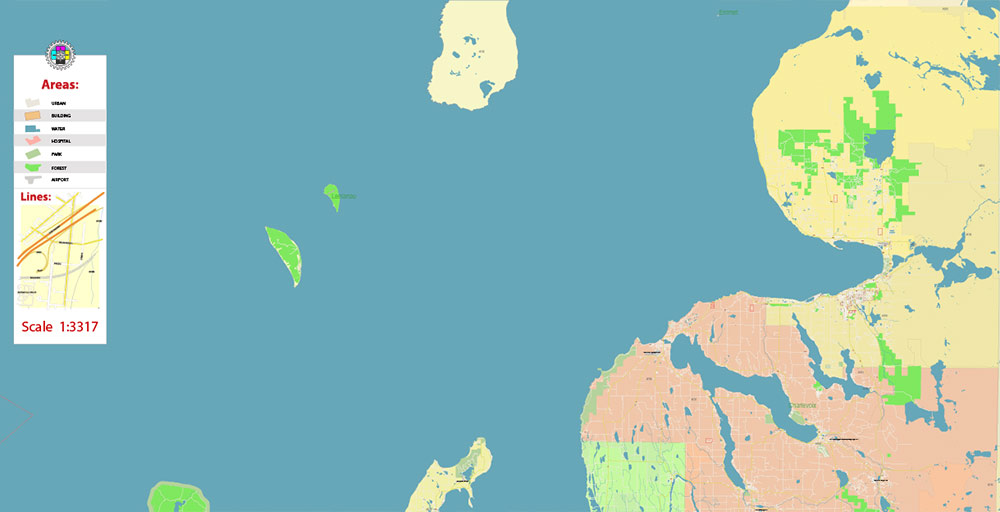
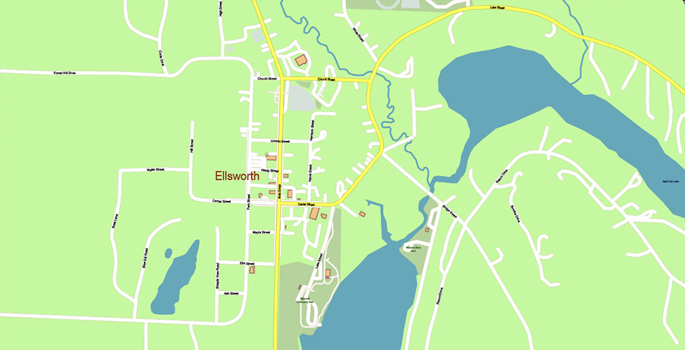
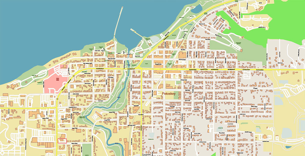
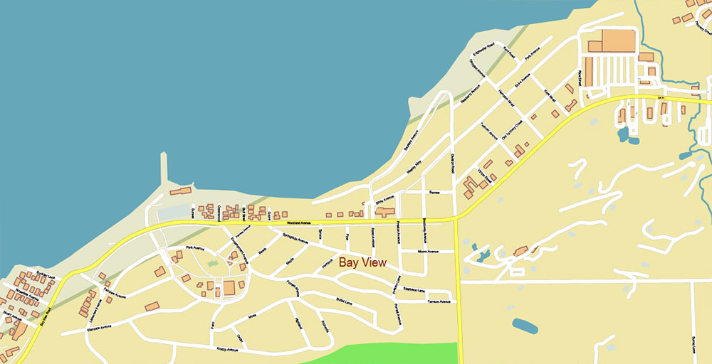
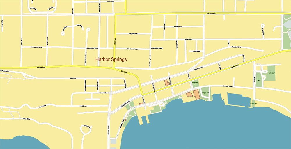
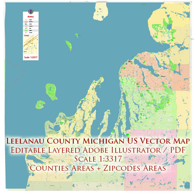
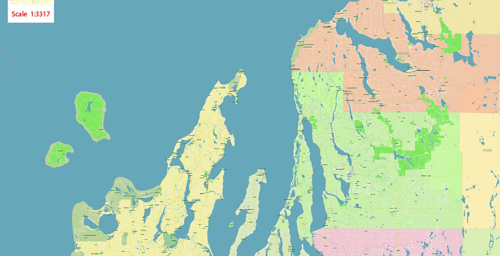
Printable Vector Map of Leelanau County (and nearest counties) Michigan US, High Detailed City Plan scale 1:3317 fully editable Adobe Illustrator Street Map in layers, scalable, text format all names, 21 MB ZIP
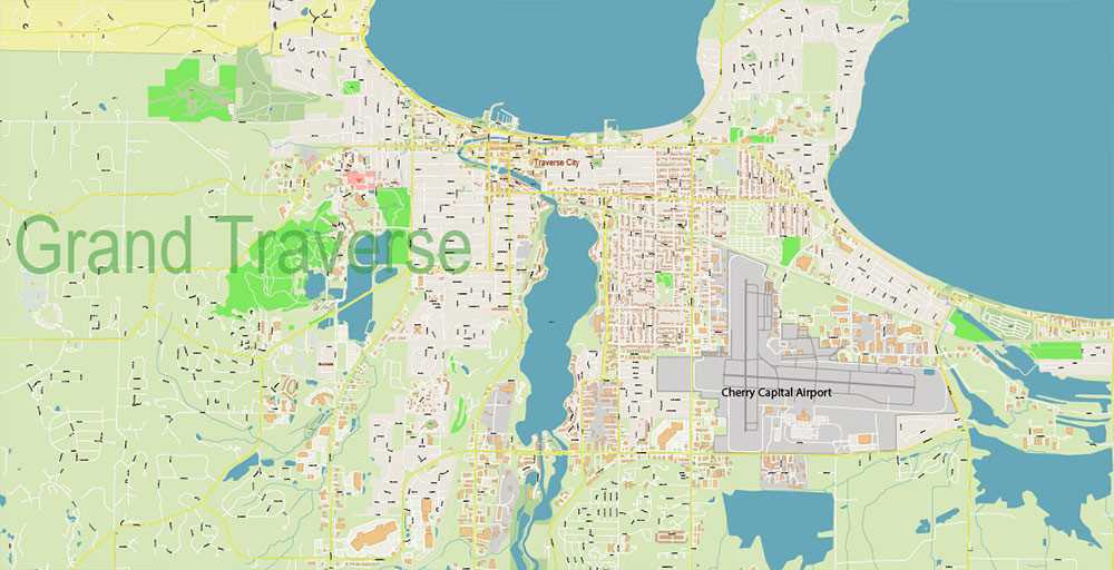
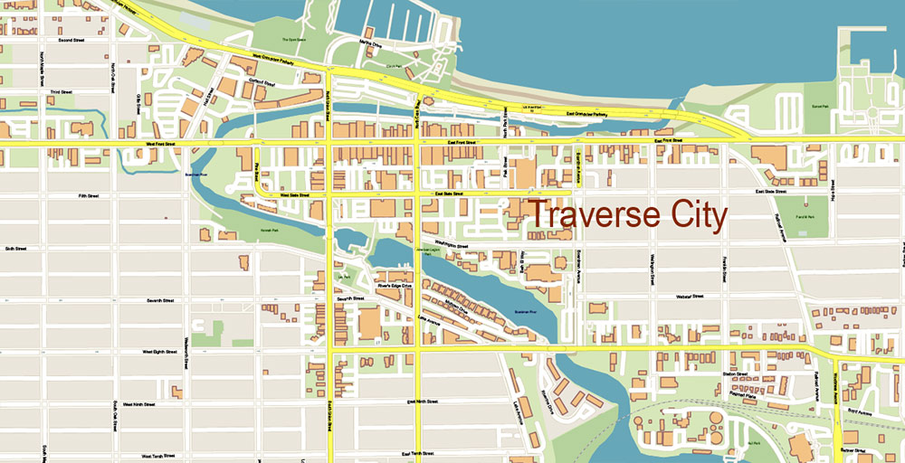
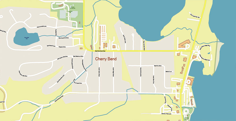
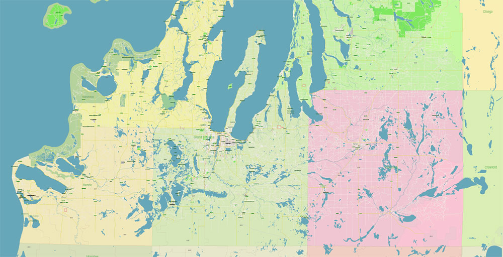
All street names, Main Objects, Buildings, + Counties areas, + ZIP-codes areas. Map for design, printing, arts, projects, presentations, for architects, designers, and builders, business, logistics.
If you need: We can add some objects to this map (add-on layers).
Free for our customers.
Need AutoCAD DWG / DXF or any other format? Please, contact us!
Map covered area:
Layers list:
- Legend
- Grids
- Labels of roads
- Names of places (city, hamlet, etc.)
- Names of objects (hospitals, parks, water)
- Additional Names layer
- Names of main streets
- Names of residential streets
- Arrows of the street direction
- Names of Counties
- Numbers of ZIP-codes
- Boundaries
- Main Streets, roads
- Residential streets
- Additional simple lines layer (all lines, include coastlines)
- Railroads
- Buildings
- Airports and heliports
- Water objects (rivers, lakes, ponds)
- Waterways
- Color fills Mode 2 (parks, hospital areas, land use, etc.)
- Color fills (parks, hospital areas, land use, etc.)
- ZIP-codes areas
- Counties areas
- Islands
- Lake Michigan polygons
- Background
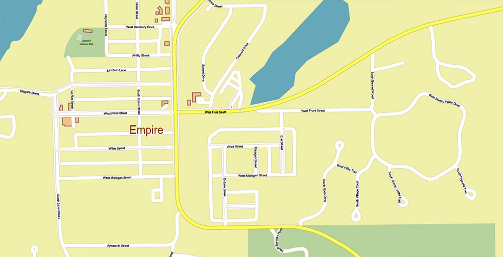
Leelanau County Michigan US Map Vector Exact High Detailed City Plan + counties + zipcodes: editable Adobe Illustrator Street Map in layers
Leelanau County Michigan US Map Vector Exact High Detailed City Plan + counties + zipcodes: editable Adobe Illustrator Street Map in layers
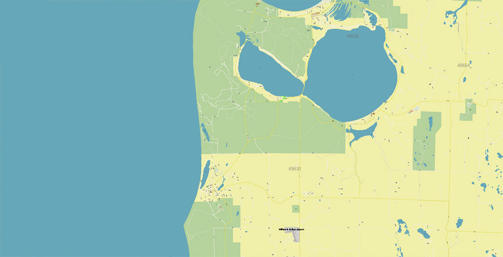
Leelanau County Michigan US Map Vector Exact High Detailed City Plan + counties + zipcodes: editable Adobe Illustrator Street Map in layers
Leelanau County Michigan US Map Vector Exact High Detailed City Plan + counties + zipcodes: editable Adobe Illustrator Street Map in layers
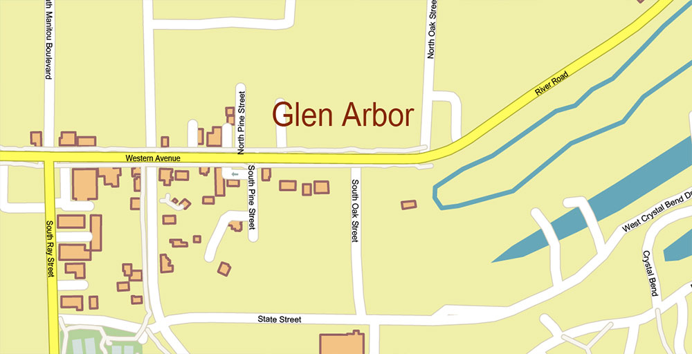
Leelanau County Michigan US Map Vector Exact High Detailed City Plan + counties + zipcodes: editable Adobe Illustrator Street Map in layers
Leelanau County Michigan US Map Vector Exact High Detailed City Plan + counties + zipcodes: editable Adobe Illustrator Street Map in layers
Leelanau County Michigan US Map Vector Exact High Detailed City Plan + counties + zipcodes: editable Adobe Illustrator Street Map in layers
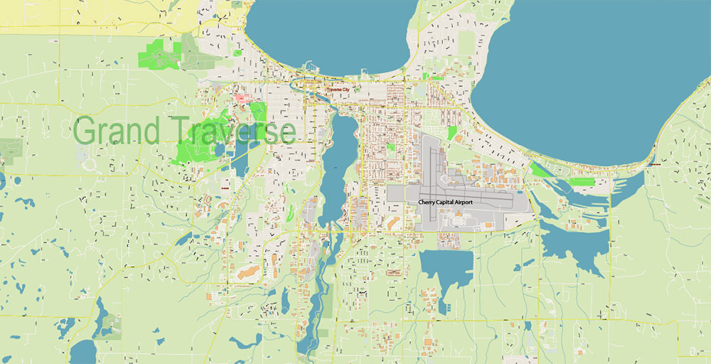
Leelanau County Michigan US Map Vector Exact High Detailed City Plan + counties + zipcodes: editable Adobe Illustrator Street Map in layers

Leelanau County Michigan US Map Vector Exact High Detailed City Plan + counties + zipcodes: editable Adobe Illustrator Street Map in layers
Leelanau County Michigan US Map Vector Exact High Detailed City Plan + counties + zipcodes: editable Adobe Illustrator Street Map in layers
Leelanau County Michigan US Map Vector Exact High Detailed City Plan + counties + zipcodes: editable Adobe Illustrator Street Map in layers
Leelanau County Michigan US Map Vector Exact High Detailed City Plan + counties + zipcodes: editable Adobe Illustrator Street Map in layers
Leelanau County Michigan US Map Vector Exact High Detailed City Plan + counties + zipcodes: editable Adobe Illustrator Street Map in layers
Leelanau County Michigan US Map Vector Exact High Detailed City Plan + counties + zipcodes: editable Adobe Illustrator Street Map in layers

Leelanau County Michigan US Map Vector Exact High Detailed City Plan + counties + zipcodes: editable Adobe Illustrator Street Map in layers
Leelanau County Michigan US Map Vector Exact High Detailed City Plan + counties + zipcodes: editable Adobe Illustrator Street Map in layers
Leelanau County Michigan US Map Vector Exact High Detailed City Plan + counties + zipcodes: editable Adobe Illustrator Street Map in layers

 Author: Kirill Shrayber, Ph.D. FRGS


 City Vector Map Exact High Detailed Urban Plan editable Adobe Illustrator Street Map in layers")