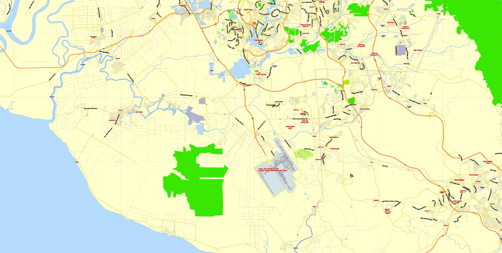
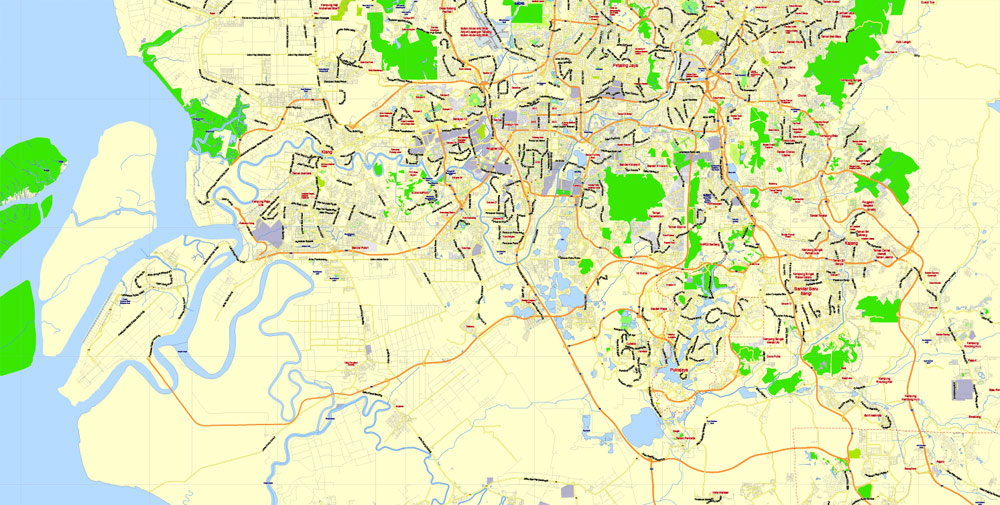
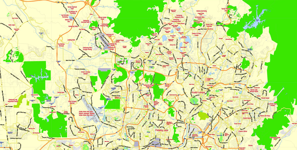
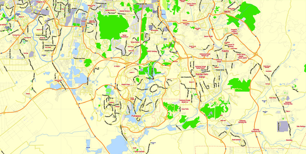
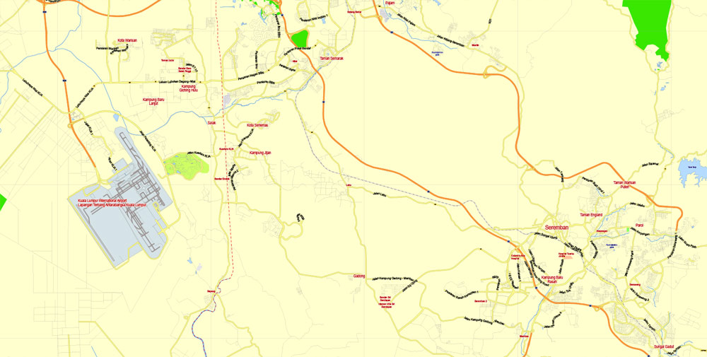
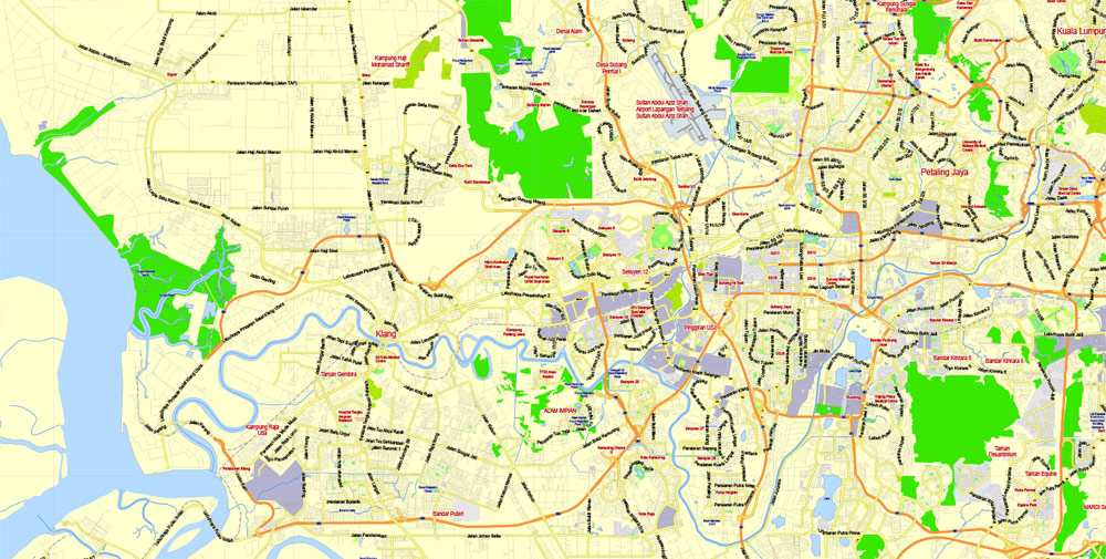
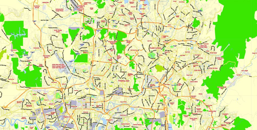
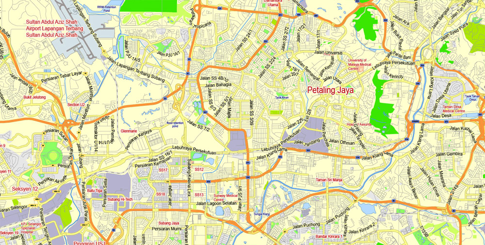
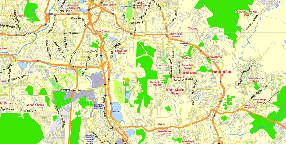
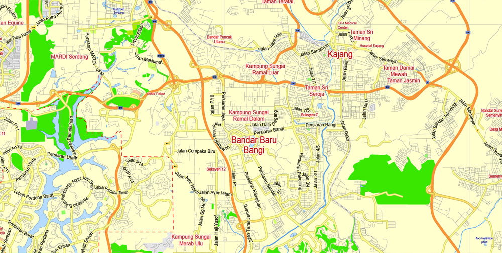
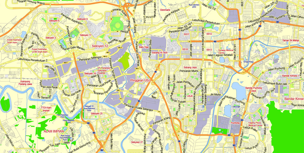
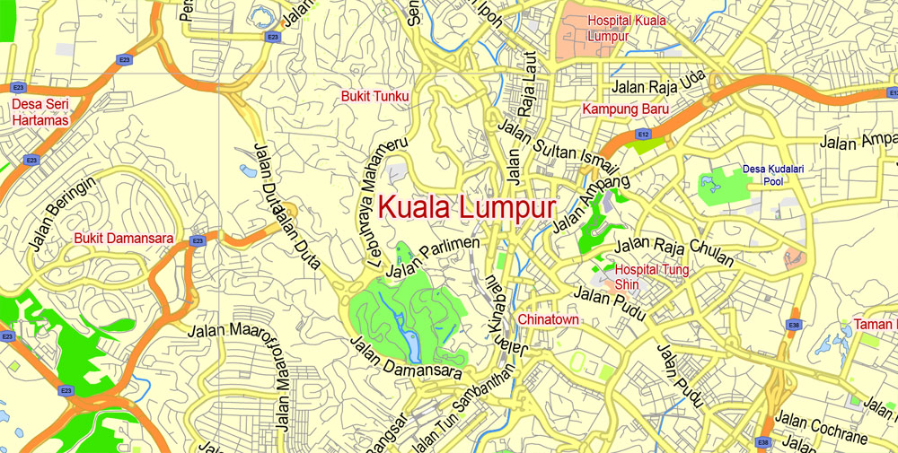
Printable PDF Vector Map of Kuala Lumpur Malaysia ENG low detailed City Plan for small print size scale 1:75047 full editable Adobe PDF Street Map in layers , scalable, editable text format all names, 22 mb ZIP
Main streets names, Main Objects. Map for design, printing, arts, projects, presentations, for architects, designers and builders, business, logistics. English names.
Layers: color_fills, streets_roads, labels_roads, names_objects, names_streets, names_places, water, grids, legend.
The most exact and detailed map of the city in scale.
For Editing and High Quality Printing in small size
DWG, DXF and other formats – on request, same price, please, contact
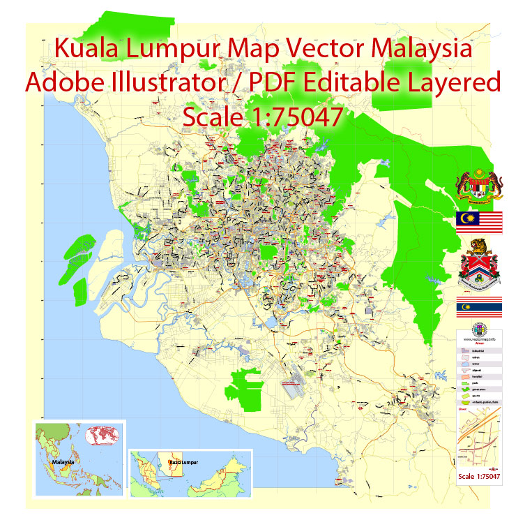
Kuala Lumpur, officially the Federal Territory of Kuala Lumpur (Malay: Wilayah Persekutuan Kuala Lumpur), or commonly known as KL, is the national capital of Malaysia as well as its largest city.
You will probably want to change the color scheme used on our Kuala Lumpur vector city map.
To quickly and effectively play with colors.
Of course, you can do it manually, all objects in our Kuala Lumpur city vector map are divided according to types and layers, and you can easily change the color gamma of vector objects in groups and layers.
But there is more effective way of working with the whole VECTOR MAP of Kuala Lumpur city and all layers:
The overview dialog «Edit colors»/«Repaint Graphic Object» (this dialog box name can change depending on the context):
If you have selected a part or a layer of Kuala Lumpur city vector map and open the dialog box by clicking the icon in the Control panel, on the Samples palette or the Color Catalog, or if you choose Edit > Edit Colors> Repaint Graphic Object, then the «Repaint Graphic Object» dialog box appears, and you get access to «Assign» and «Edit» tabs.
The only global city in Malaysia, it covers an area of 243 km2 (94 sq mi) and has an estimated population of 1.73 million as of 2016. Greater Kuala Lumpur, also known as the Klang Valley, is an urban agglomeration of 7.25 million people as of 2017.
It’s very easy to work with vector maps of Kuala Lumpur city, even for a not very experienced designer who can turn on and off the map layers, add new objects, change the colors of fill and lines according to customer requirements.
It is among the fastest growing metropolitan regions in South-East Asia, in both population and economic development.
This vector map of Kuala Lumpur city is used as a basis for design, editing, and further printing.
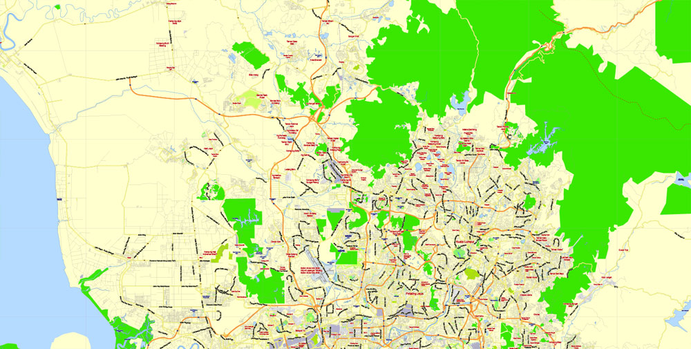
This is the most detailed, exact map of Kuala Lumpur city for high-quality printing and polygraphy. You can always clarify the map development date by contacting us.
For your convenience, all objects on Kuala Lumpur vector city map are divided into layers. And the editing is very easy – colors, lines, etc.
You can easily add any objects needed (e.g. shops, salons, sale points, gas station or attraction) on any layer of Kuala Lumpur vector map.
One of the advantages of Kuala Lumpur city vector maps of our production is the relevance of cartographic data, we constantly update all our products.
This vector map of Kuala Lumpur city is used by:
designers, layout designers, printers, advertisers and architects. Our product – vector maps – is designed for further editing and printing in large formats – from @Wall format (a few meters) to A-0 and A-1, A-2, A-3.
The Kuala Lumpur city map in vector format is used for design, urban planning, presentations and media visualizations.
Kuala Lumpur is the cultural, financial and economic centre of Malaysia and home to the Parliament of Malaysia, and the official residence of the Malaysian King (Yang di-Pertuan Agong), the Istana Negara.
The undoubted advantage of Kuala Lumpur city vector maps in printing is an excellent and detailed visualization, when customer can expand a large paper map and instantly define his location, find a landmark, an object or address on map, unlike using the popular electronic formats of Google and Yandex maps for example.
Printable vector maps of Kuala Lumpur city are much more convenient and efficient than any electronic maps on your smartphone, because ALL DETAILS are displayed in the entire space of Kuala Lumpur city map.
The city once held the headquarters of the executive and judicial branches of the federal government as well, but they were moved to Putrajaya in early 1999. Some sections of the judiciary still remain in Kuala Lumpur.
Kuala Lumpur is one of three Federal Territories of Malaysia, enclaved within the state of Selangor, on the central west coast of Peninsular Malaysia. Since the 1990s, the city has played host to many international sporting, political and cultural events including the 1998 Commonwealth Games. Kuala Lumpur has undergone rapid development in recent decades.
The «Edit colors» button or «Edit or apply colors» on the «Color Catalog» palette
Click this button if you need to edit colors on the «Color Catalog» palette or edit and then apply them to the selected Vector Map of Kuala Lumpur city or its fragment.
The «Edit color group» button or «Edit or apply color group» on the «Samples» palette.
Click this button if you need to edit the colors in the specific color group or edit and apply them to the selected Vector Map of Kuala Lumpur city or a group of its elements, for example, the whole layer “Streets and lines”. You can also double-click the color group in the Samples panel to open the dialog box.
Saving a color group adds this group to the specified list.
Opening the «Edit Colors»/«Repaint Graphic Object» dialog box.
Open the «Edit Colors»/«Repaint Graphic Object» dialog box using one of the following methods:
«Edit»> «Edit Colors»> «Repaint Graphic object» or «Repaint With Style».
Use these commands if you need to edit the colors in the selected vector map of Kuala Lumpur city.
«Repaint Graphic object» button on the «Control» panel.
Use this button if you need to adjust colors of Kuala Lumpur city vector map using the а «Repaint graphic object» dialog box.
The specified button is available if the selected vector map or its fragment contains two or more colors.
Note. This color editing method is convenient for global color adjustment in a vector map, if global colors were not used when creating a City Map of Kuala Lumpur.
It is home to the tallest twin buildings in the world, the Petronas Twin Towers, which have become an iconic symbol of Malaysia’s futuristic development.
Kuala Lumpur has a comprehensive road system that is supported by extensive public transport networks such as the Mass Rapid Transit (MRT), Light Metro (LRT), Bus Rapid Transit (BRT), monorail, commuter rail and airport rail link. Kuala Lumpur is one of the leading cities in the world for tourism and shopping. It is the eighth most visited city in the world. The city is also home to three of the world’s 10 largest malls.
Create and edit color groups of Kuala Lumpur city vector map, and also assign colors using the «Edit Colors»/ а «Repaint Graphic Object» dialog box.
A. Creating and editing of a color group on the «Edit» tab
B. Assigning colors on the «Assign» tab
C. Select a group of colors from the «Color groups» list
The option «Repaint a graphic object» in the lower part of the dialog box allows you to preview the colors on a selected layer of Vector map, or a group of elements, and specify whether its colors will be redefined when the dialog box is closed.
The main areas of the dialog box are:
«Edit»
The «Edit» tab is designed to create a new or edit the existing color groups.
The harmony rules Menu and the Color Wheel are used to conduct experiments with color harmonies. The color wheel shows how colors are related in color harmony, and the color bars allow you to view and manipulate an individual color values. In addition, you can adjust the brightness, add and remove colors, save color groups and view colors on the selected Vector Map of Kuala Lumpur city or a separated layers.
Kuala Lumpur has been ranked by the Economist Intelligence Unit’s Global Liveability Ranking at No. 70 out of 140 global cities, and second in Southeast Asia after Singapore at No. 35. EIU’s Safe Cities Index of 2017 also put Kuala Lumpur 31st out of 60 on its world safest cities list.
For travelers, maps are sold at the airports and gas stations around the world. Often the source is our vector maps.
Kuala Lumpur was named as one of the New7Wonders Cities. UNESCO also have named Kuala Lumpur as World Book Capital 2020.
If the map file is too large and your computer freezes or even can’t open it quickly:
1. Try to reduce the color resolution of the video card (display) to 256 colors while working with a large map.
2. Using Windows Task Manager, select all the application you don’t need, while working with map, just turn them off.
3. Launch Adobe Illustrator. (DO NOT OPEN the vector map file)
4. Start the Windows Task Manager using administrator rights > Find the “Illustrator” process > set the «real time» priority,
5. Open the file. When you see the LEGACY FONT popup window – click “OK” (do not update). You can restore the TEXT later.
6. Can also be useful: When file is opened – Edit > Settings > Basic Settings > disable smoothing. /// It looks scary, but works quickly)))
We recommend saving the file in Adobe Illustrator 10 version. It’s much more stable when working with VERY BIG size files.
Assign
The «Assign» tab is used to view and control on how the original colors are replaced with colors from the color group like your corporate colors in the Vector Map of Kuala Lumpur city.
The assign color ability is provided only if the entire map, layer or fragment is selected in the document. You can specify which of new colors replace the current colors, whether the spot colors should be preserved and how colors are replaced (for example, you can replace colors completely or changing the color tone while maintaining the brightness). The «Assign» tab allows you to redefine colors in the Vector Map of Kuala Lumpur city, or in separate layers and fragments using the current color group or reducing the number of colors in the current Vector Map.
Color groups
Is a list of all saved color groups for current document (the same groups appear in the «Samples» palette). You can edit and delete the existing color groups, as well as creating a new ones using the list of “Color Groups” in the dialog box. All changes appear in the «Samples» palette.
The highlighted color group shows, which color group is currently edited.
Any color group can be selected and edited, or used to redefine the colors in the selected vector map of Kuala Lumpur city, its fragments or elements.
The geography of Kuala Lumpur is characterised by the huge Klang Valley. The valley is bordered by the Titiwangsa Mountains in the east, several minor ranges in the north and the south and the Strait of Malacca in the west. Kuala Lumpur is a Malay term that translates to “muddy confluence” as it is located at the confluence of the Klang and Gombak rivers.
Useful tips on working with vector maps of cities and countries in Adobe Illustrator.
«V» – launches the Selection tool (cursor, black arrow), which makes active any vector line.
«А» – launches the Direct Selection tool (white cursor), allows you to select curve elements and drag them to the desired place.
«R» – activates the Rotate tool, which helps you rotating selected objects around the center point by 360 degrees.
«E» – gives you the opportunity to use the Eraser tool and erase unnecessary parts.
«X» – switches between Fill and Stroke in the Tools section. Try to get used to this hot key and
you will quickly understand that you can’t live and work without it.
Guides are not limited to vertical and horizontal in Adobe Illustrator. You can also create a diagonal guide for example. Moreover, you can turn any contours into guides. Select the outline and go to View > Guides > Make Guides (Create Guides), or simply press Cmd/Ctrl + 5. You can also turn the guides back into an editable object. Go to menu, View > Guides > Unlock Guides (Release Guides), select the guide you want to edit and select View > Guides > Release Guides (Reset Guides), or just press Cmd/Ctrl + Option / Alt + 5).
The advertising and presentation map of Kuala Lumpur city (usually the final designer marks the routes, and puts the client’s objects (shops, saloons, gas stations etc.)
The undoubted advantage is that people will NEVER throw out this advertising product – the map. In fact, as an advertising medium, a city map is the most “long-playing” of the well-known polygraphic advertising media, with the longest lifespan, and the maximum number of interactions with the customer.
Located in the centre of Selangor state, Kuala Lumpur was a territory of Selangor State Government. In 1974, Kuala Lumpur was separated from Selangor to form the first Federal Territory governed directly by the Malaysian Federal Government.
Take a look, who purchases our vector maps of Kuala Lumpur city in “Our Clients and Friends” page – these are large and small companies, from super-brands like Volvo and Starbucks, to small design studios and printing houses.
Its location within the most developed state on the west coast of Peninsular Malaysia, which has wider flat land than the east coast, has contributed to its faster development relative to other cities in Malaysia. The municipality of the city covers an area of 243 km2 (94 sq mi), with an average elevation of 81.95 m (268.9 ft).
If a picture or a map fragment is not selected, and you open the dialog box by clicking the icon in the Control panel, on the Samples palette or in the Color Catalog, the «Edit Colors» dialog box appears and you can only access the «Edit» tab.
Regardless of the name at the top of the dialog box, the right-hand side always displays the color group of the current document, as well as two default color groups: Print Color and Grayscale. These color groups can be selected and used any time.
Kuala Lumpur
Capital of Malaysia
Kuala Lumpur is the capital of Malaysia. Its modern skyline is dominated by the 451m-tall Petronas Twin Towers, a pair of glass-and-steel-clad skyscrapers with Islamic motifs. The towers also offer a public skybridge and observation deck. The city is also home to British colonial-era landmarks such as the Kuala Lumpur Railway Station and the Sultan Abdul Samad Building.
Area
• Federal Territory and City 243 km2 (94 sq mi)
• Metro 2,243.27 km2 (866.13 sq mi)
Elevation 66 m (217 ft)
Population
• Federal Territory and City 1,790,000 (1st)
• Density 6,891/km2 (17,310/sq mi)
• Metro 7,200,000
• Metro density 6,581/km2 (17,040/sq mi)
Free vector map World, Adobe Illustrator, download now maps vector clipart
Map for design, projects, presentation free to use as you like.
See also: TERMS & CONDITIONS: SOFTWARE LICENSE AGREEMENT FOR DIGITAL CARTOGRAPHIC DATA.
Need more USA Vector Maps, printable and editable?

 Author: Kirill Shrayber, Ph.D. FRGS

 map, full editable, Adobe illustrator")