The main industries of the state of Kansas are industry, agriculture, and mining.
Kansas ranks eighth in the list of “oil” states in the United States. Despite the fact that the cost of oil production is constantly increasing due to the need to use more complex technologies, the increase in prices for “black gold” ensures the high profitability of oil production. The state ranks fifth in the United States in terms of natural gas exploration and eighth in terms of natural gas production. In addition, the Kansas gas fields provide a significant portion of the world’s helium production.
The state also produces rock salt, gypsum, sand, gravel, and other minerals used in construction.
Traditionally, Kansas is considered an agricultural state – ” The State of sunflowers and wheat.” In terms of agricultural land area, of all the US states, Kansas is second only to Texas and Montana.
Kansas is part of the grain belt of the United States, the state occupies one of the first places in America for the production of wheat and corn. In addition, oats, barley, sorghum, sunflower, soybeans, and other crops are grown in the fields of Kansas.
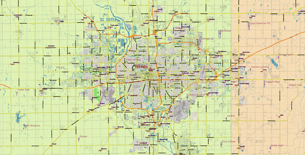
The largest city in Kansas, Wichita, known as the “aviation capital of the world”, is one of the largest centers of the US aerospace industry. Here are the headquarters of such well-known companies that produce aircraft and components for them, such as Cessna, Spirit AeroSystems, Hawker Beechcraft, Learjet; one of the divisions of the Boeing company.
In addition to the aircraft industry, Kansas produces food, makes shoes and clothing, and produces products from the oil and chemical industries.
With the development of industry, there is a significant outflow of the population of Kansas from rural areas to large cities, which is also characteristic of other once exclusively agricultural states (such as Iowa, for example).
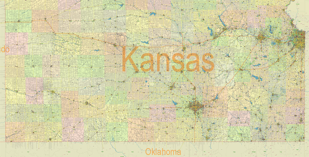
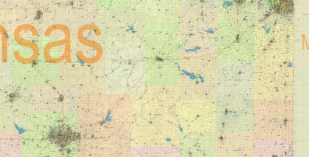
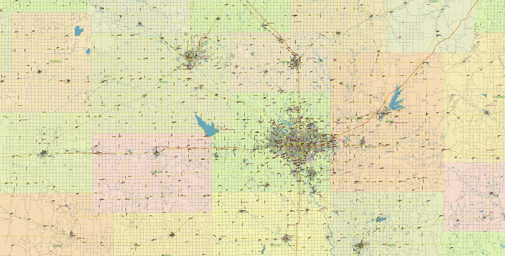
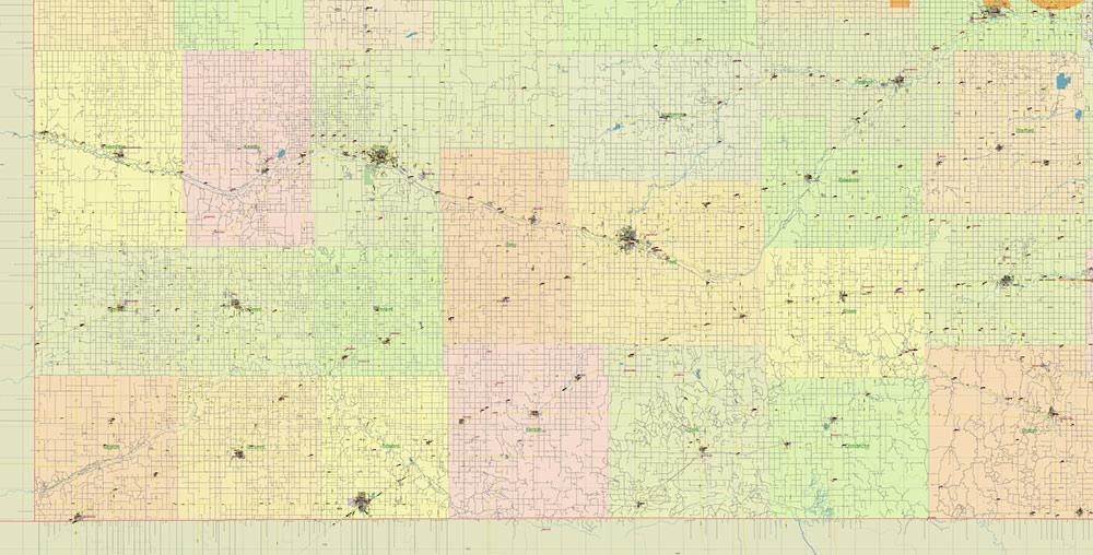
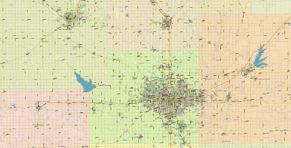
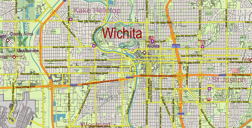
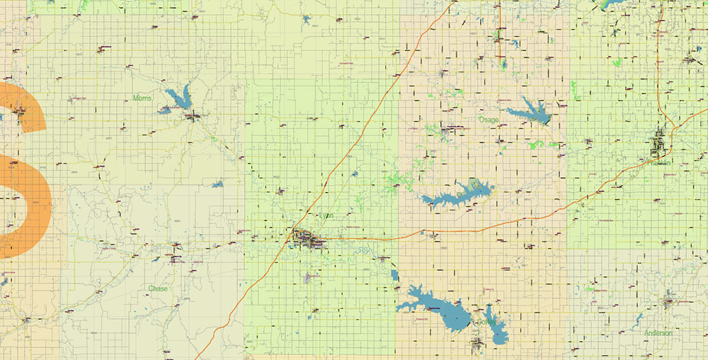
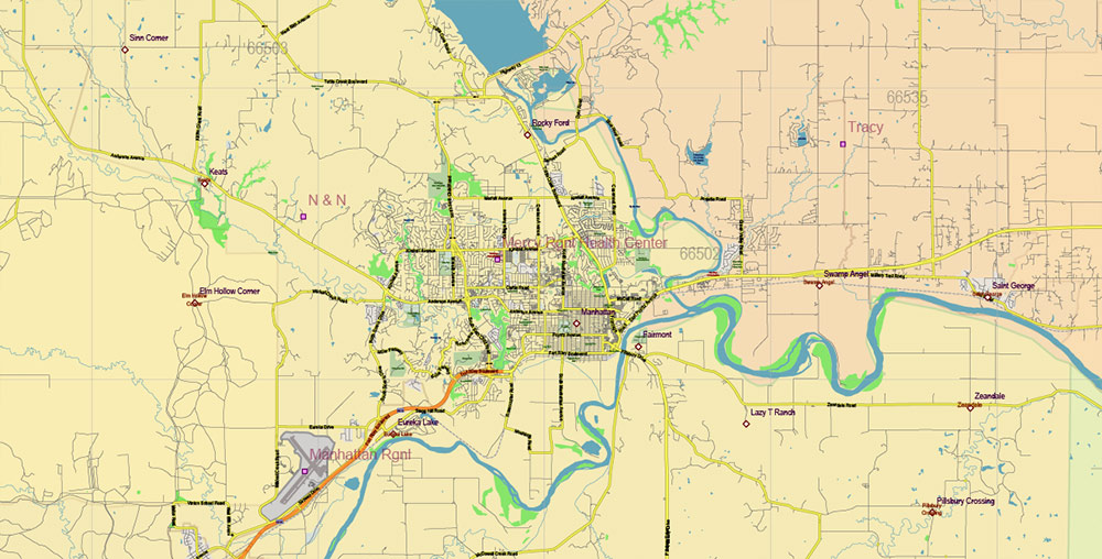
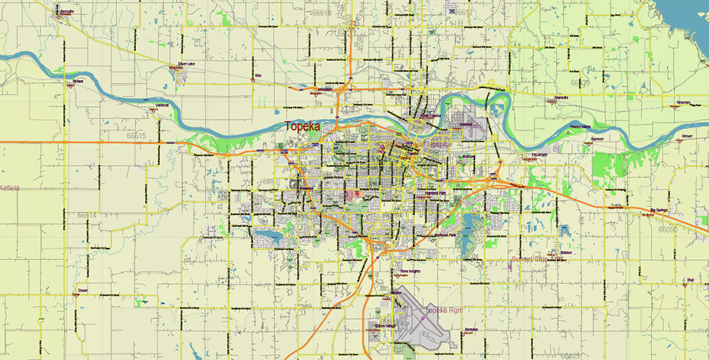
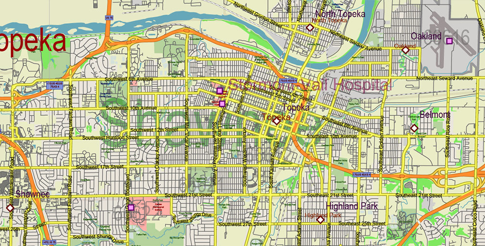
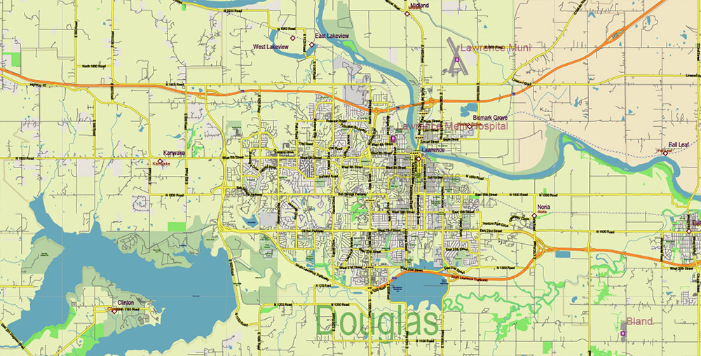
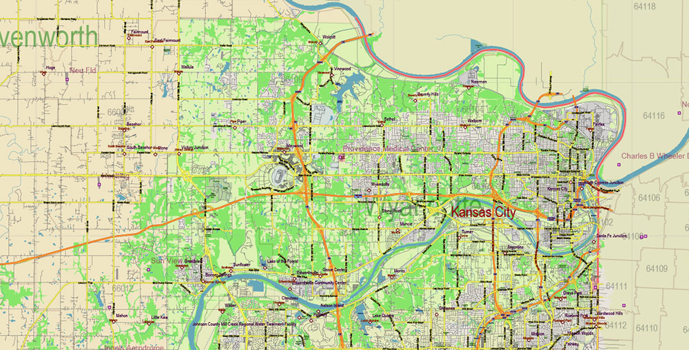
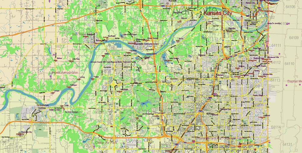
Printable Vector Map of Kansas Full State US: All Streets and Roads + counties areas + zip-codes areas, fully editable Adobe Illustrator Map in layers, scalable, 51 MB ZIP
Scale: 1:58780
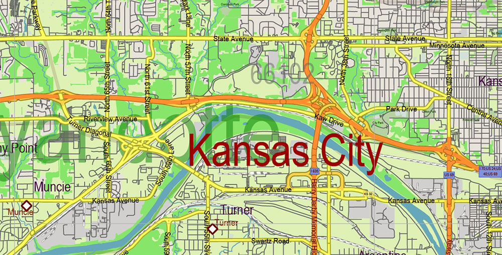
All streets and roads, Names of Principal streets, All Cities and Towns, Counties, All Geonames, airports, and heliports. Map for design, printing, arts, projects, presentations, for architects, designers, and builders, business, logistics.
NOTE! All objects are located on separate layers by type. The preview shows them all together. When you work with this map, just turn off or delete those layers that are not needed for your project.
For Editing and High-Quality Printing, Royalty free
Need AutoCAD DWG / DXF, CDR, or any other format? Please, contact us!
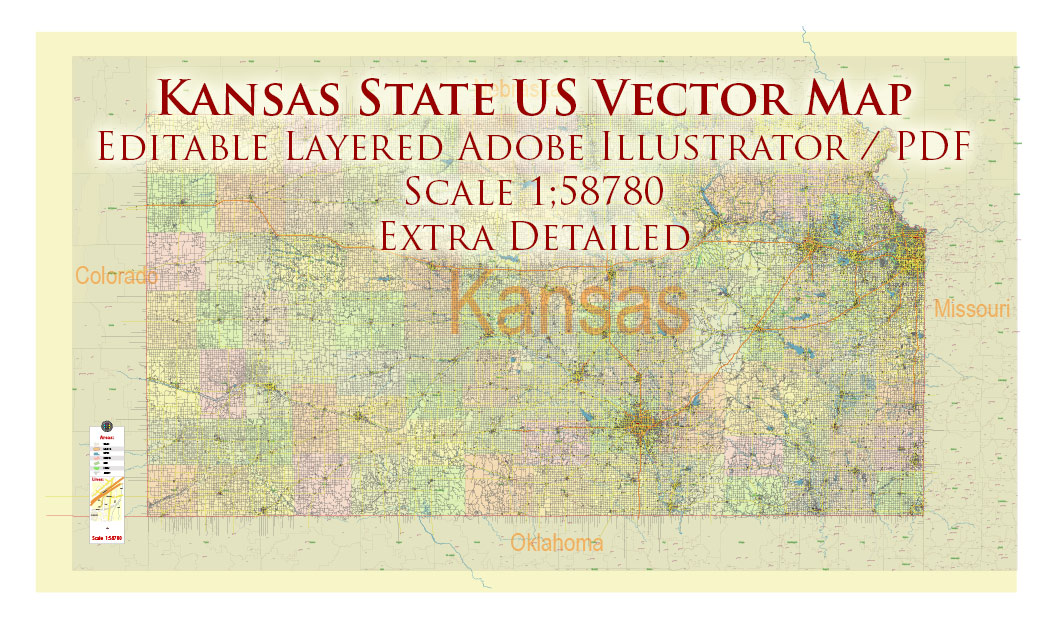
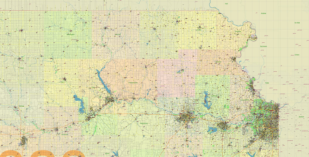
Kansas Full State US Vector Map: Full Extra High Detailed (all roads, zipcodes, airports) + Admin Areas editable Adobe Illustrator in layers
Layers list:
- Legend
- Grids
- Labels of roads (numbers) – highways, interstate
- All Geonames (cities, towns, villages, hamlets, islands)
- Points of the Geonames (cities, towns, villages, hamlets, islands)
- Names places: Names of all Cities, towns, villages and hamlets
- Names of the Airports and Heliports
- Points of the Airports and Heliports
- Numbers of ZIP codes
- Names of objects (water, park, hospital)
- Names of States
- Names of Counties
- Names of the Main Streets
- Major Roads and Streets – Highways
- Minor Roads and residential streets
- Railroads
- State boundaries
- Water objects (rivers, lakes, ponds, swamps, reefs)
- Waterways
- Ground objects (urban areas, parks, hospitals, etc.)
- ZIP-codes areas
- Counties areas (colored)
- States areas
- Background
Kansas Full State US Vector Map: Full Extra High Detailed (all roads, zipcodes, airports) + Admin Areas editable Adobe Illustrator in layers
Kansas Full State US Vector Map: Full Extra High Detailed (all roads, zipcodes, airports) + Admin Areas editable Adobe Illustrator in layers

Kansas Full State US Vector Map: Full Extra High Detailed (all roads, zipcodes, airports) + Admin Areas editable Adobe Illustrator in layers
Kansas Full State US Vector Map: Full Extra High Detailed (all roads, zipcodes, airports) + Admin Areas editable Adobe Illustrator in layers
Kansas Full State US Vector Map: Full Extra High Detailed (all roads, zipcodes, airports) + Admin Areas editable Adobe Illustrator in layers
Kansas Full State US Vector Map: Full Extra High Detailed (all roads, zipcodes, airports) + Admin Areas editable Adobe Illustrator in layers
Kansas Full State US Vector Map: Full Extra High Detailed (all roads, zipcodes, airports) + Admin Areas editable Adobe Illustrator in layers
Kansas Full State US Vector Map: Full Extra High Detailed (all roads, zipcodes, airports) + Admin Areas editable Adobe Illustrator in layers
Kansas Full State US Vector Map: Full Extra High Detailed (all roads, zipcodes, airports) + Admin Areas editable Adobe Illustrator in layers
Kansas Full State US Vector Map: Full Extra High Detailed (all roads, zipcodes, airports) + Admin Areas editable Adobe Illustrator in layers
Kansas Full State US Vector Map: Full Extra High Detailed (all roads, zipcodes, airports) + Admin Areas editable Adobe Illustrator in layers
Kansas Full State US Vector Map: Full Extra High Detailed (all roads, zipcodes, airports) + Admin Areas editable Adobe Illustrator in layers
Kansas Full State US Vector Map: Full Extra High Detailed (all roads, zipcodes, airports) + Admin Areas editable Adobe Illustrator in layers
Kansas Full State US Vector Map: Full Extra High Detailed (all roads, zipcodes, airports) + Admin Areas editable Adobe Illustrator in layers
Kansas Full State US Vector Map: Full Extra High Detailed (all roads, zipcodes, airports) + Admin Areas editable Adobe Illustrator in layers
Kansas Full State US Vector Map: Full Extra High Detailed (all roads, zipcodes, airports) + Admin Areas editable Adobe Illustrator in layers
Kansas Full State US Vector Map: Full Extra High Detailed (all roads, zipcodes, airports) + Admin Areas editable Adobe Illustrator in layers

Kansas Full State US Vector Map: Full Extra High Detailed (all roads, zipcodes, airports) + Admin Areas editable Adobe Illustrator in layers

 Author: Kirill Shrayber, Ph.D. FRGS

 full editable, Adobe Illustrator")
