The area of the state of Kansas – 213,096 km2 (15th place in the United States)
The length of the state of Kansas:
from north to south-340 km
from east to west-645 km
Region of the state of Kansas – the Northwestern Central States of the United States
The highest point in the state of Kansas – 1232 meters above sea level
The lowest point of the state of Kansas -207 meters above sea level
The abbreviation of the State of Kansas is KS
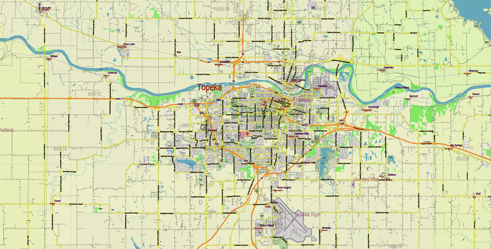
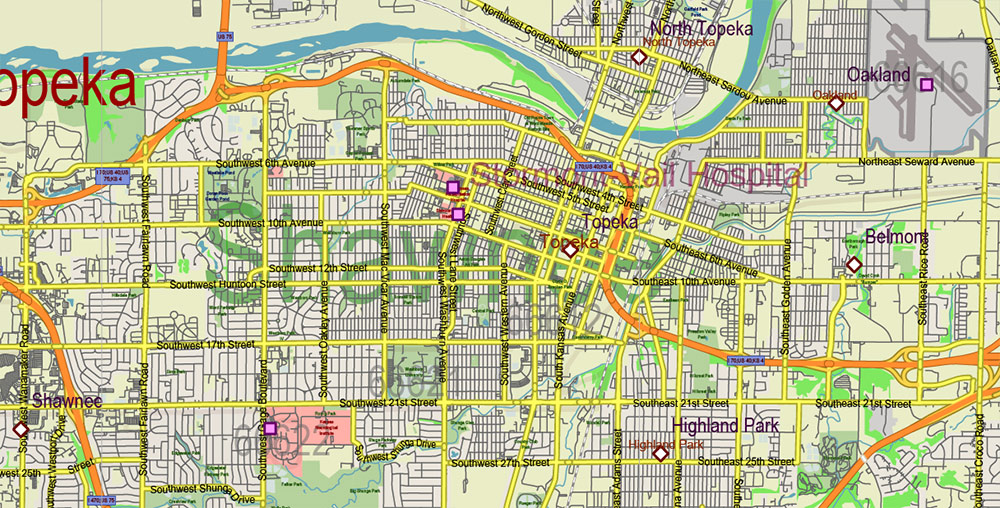
The capital of the state of Kansas is Topeka
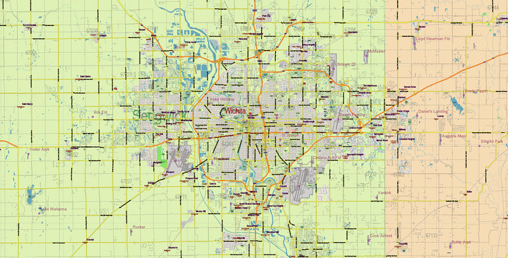
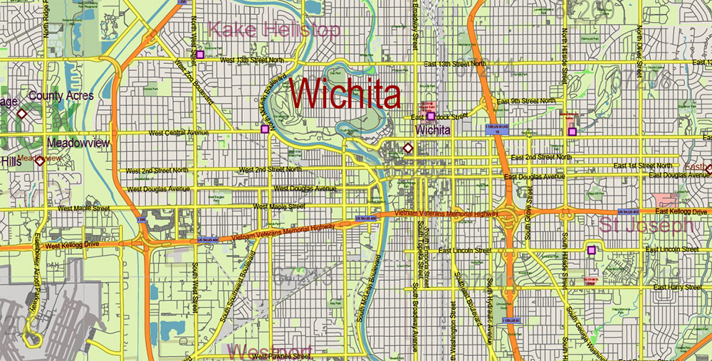
The largest city in the state of Kansas is Wichita
Date of formation of the state of Kansas – January 29, 1861 (34 in the United States)
The population of the state of Kansas is about 2,870,000 people (33rd in the United States)
The population density in the state of Kansas is 13.5 people per km2 (40th place in the United States)
The Kansas State motto is Ad Astra per Aspera (“To the stars through the thorns”)
The nickname of the state of Kansas is “The State of sunflowers”, ” The State of wheat”
The state of Kansas takes its name from the Missouri tributary of the Kansas River, which flows through its territory. In turn, the Kansas River was named after the Kansa (or Kau) Indians who lived on the lands of the present state of Kansas.
The French, the first Europeans to map the land in the area of the Kansas River, called it Cansez, in English the word came as Kansas.
The state of Kansas is home to about 2,870,000 people (the thirty-third most populous state in the United States). The average population density in the “Sunflower State” is about 13.5 people per km2 (the fortieth place in the United States).
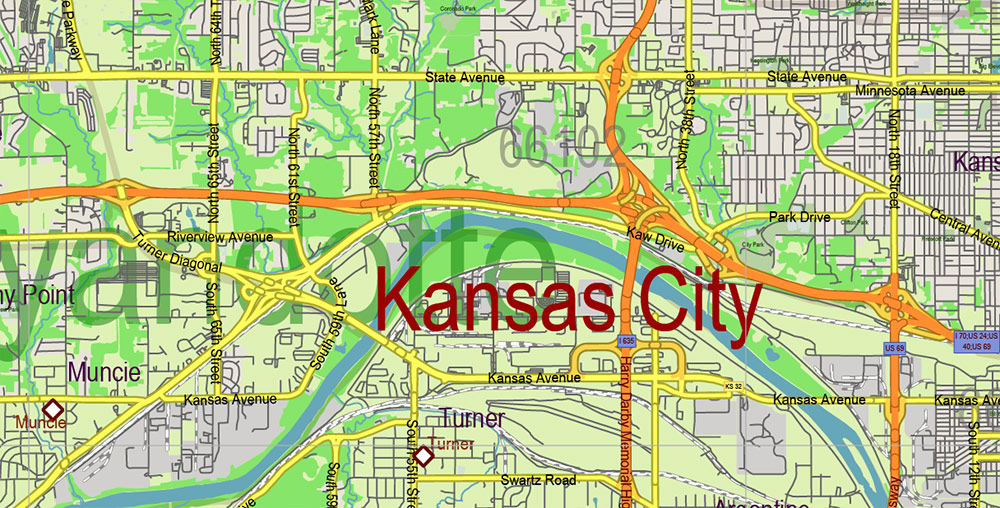
The largest cities in Kansas are Wichita (Wichita, about 385,000 residents), Overland Park (about 175,000 residents), Kansas City (about 150,000 residents), the state capital of Topeka (Topeka, about 130,000 residents), and Olathe (Olathe, about 125,000 residents).
The largest metropolitan area in Kansas was formed around Kansas City (as well as Overland Park and Kansas City in neighboring Missouri), where about 2,050,000 people live (the twenty-ninth place in the list of megacities in the United States). Large urban agglomerations have also grown around Wichita (about 650,000 people), Topeka (about 235,000 people), and the city of Manhattan (about 130,000 people).
The largest ethnic (national) groups among the population of the state of Kansas:
Germans – 34%
Irish – 14.4%
English – 13%
French (and Franco-Canadians) – 4%
Dutch – 2.6%
Swedes – 2.5%
Scots-Irish – 2.2%
Scots – 2%
Italians-1.8%
Poles – 1.5%
Russian – 0.9%
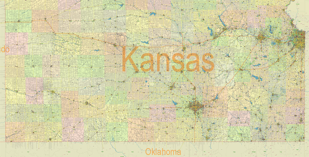
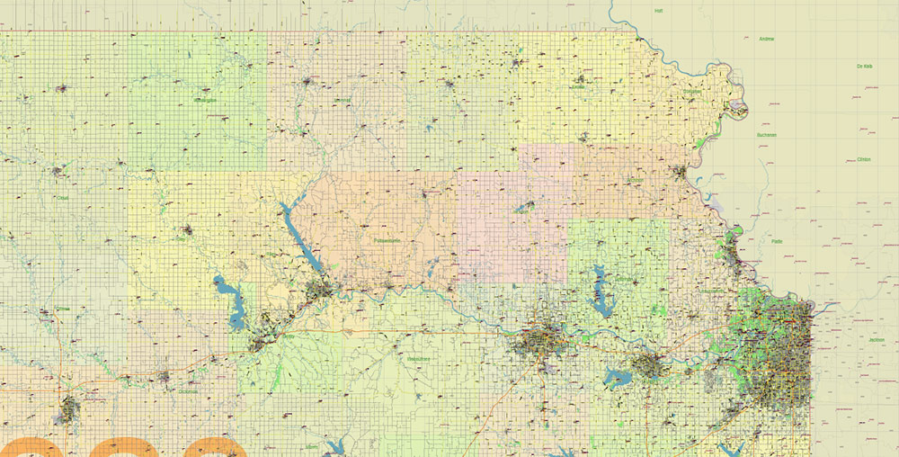
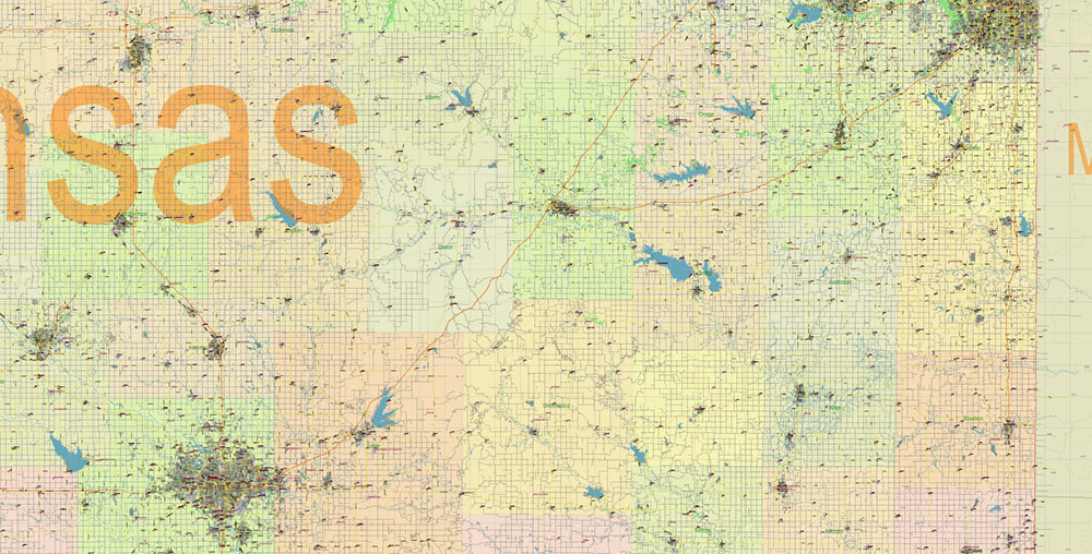
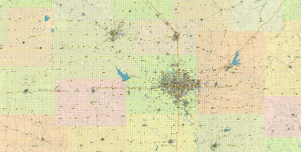
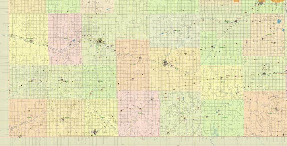
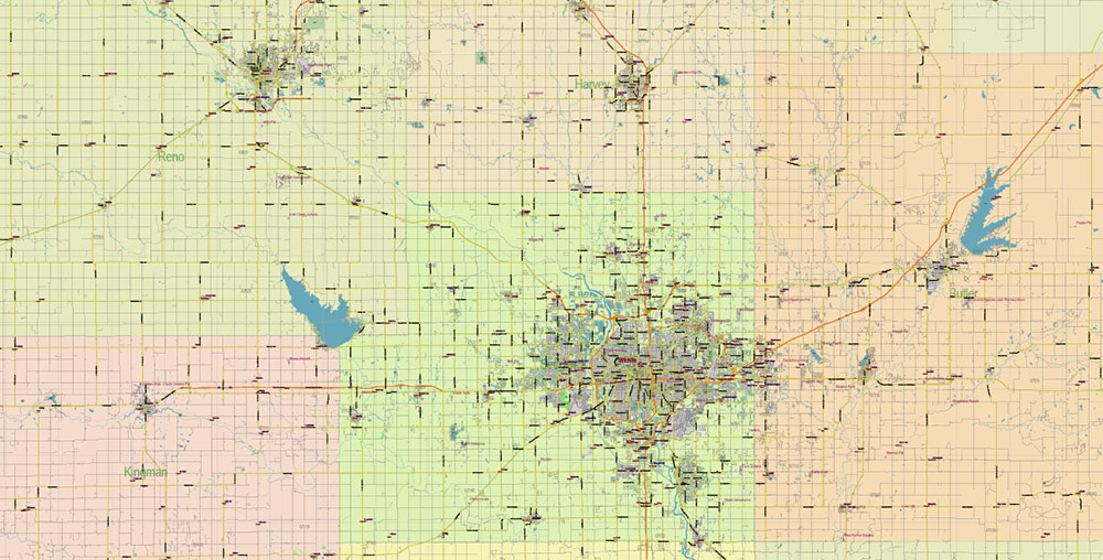
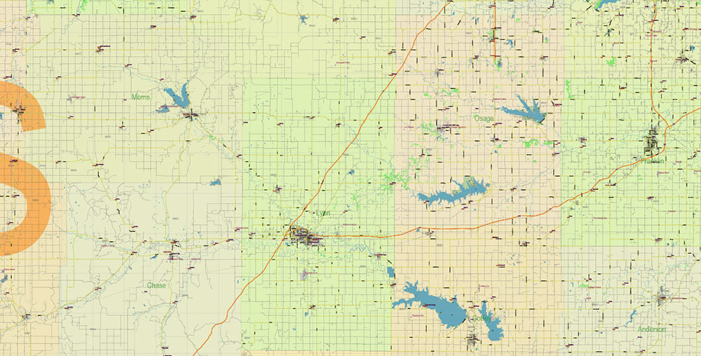
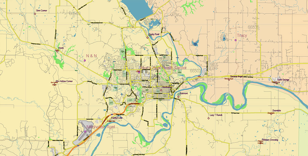
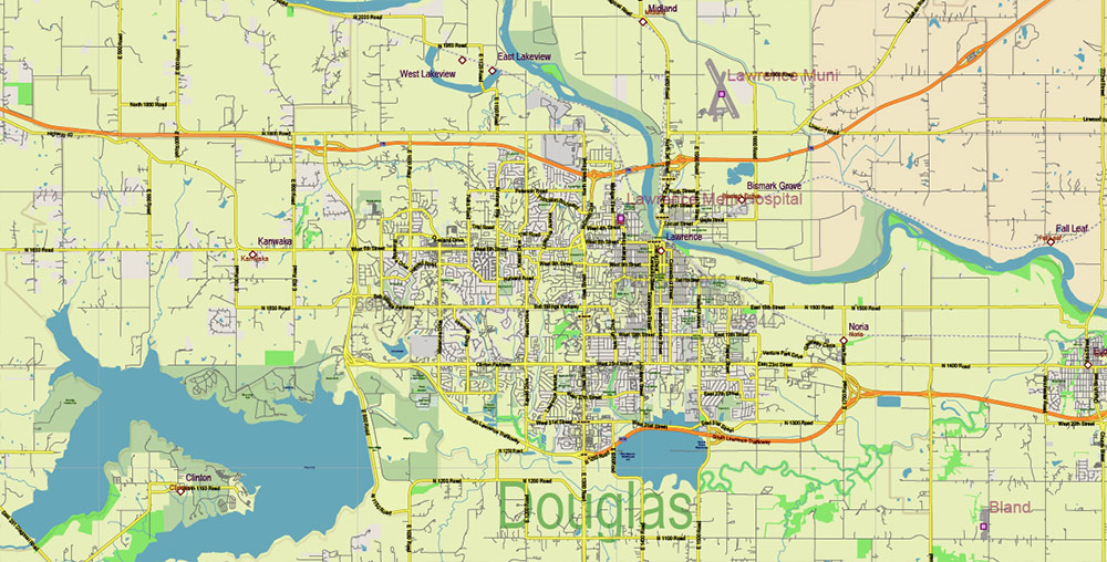
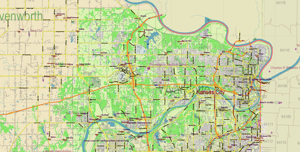
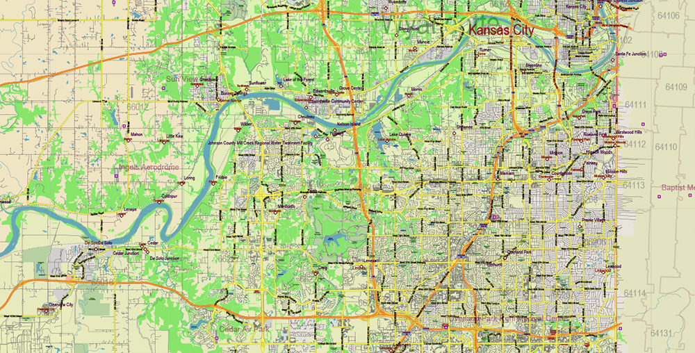
Printable PDF Vector Map of Kansas Full State US: All Streets and Roads + counties areas + zip-codes areas, fully editable Adobe PDF Map in layers, scalable, 121 MB ZIP
Scale: 1:58780
All streets and roads, Names of Principal streets, All Cities and Towns, Counties, All Geonames, airports, and heliports. Map for design, printing, arts, projects, presentations, for architects, designers, and builders, business, logistics.
NOTE! All objects are located on separate layers by type. The preview shows them all together. When you work with this map, just turn off or delete those layers that are not needed for your project.
For Editing and High-Quality Printing, Royalty free
Need AutoCAD DWG / DXF, CDR, or any other format? Please, contact us!
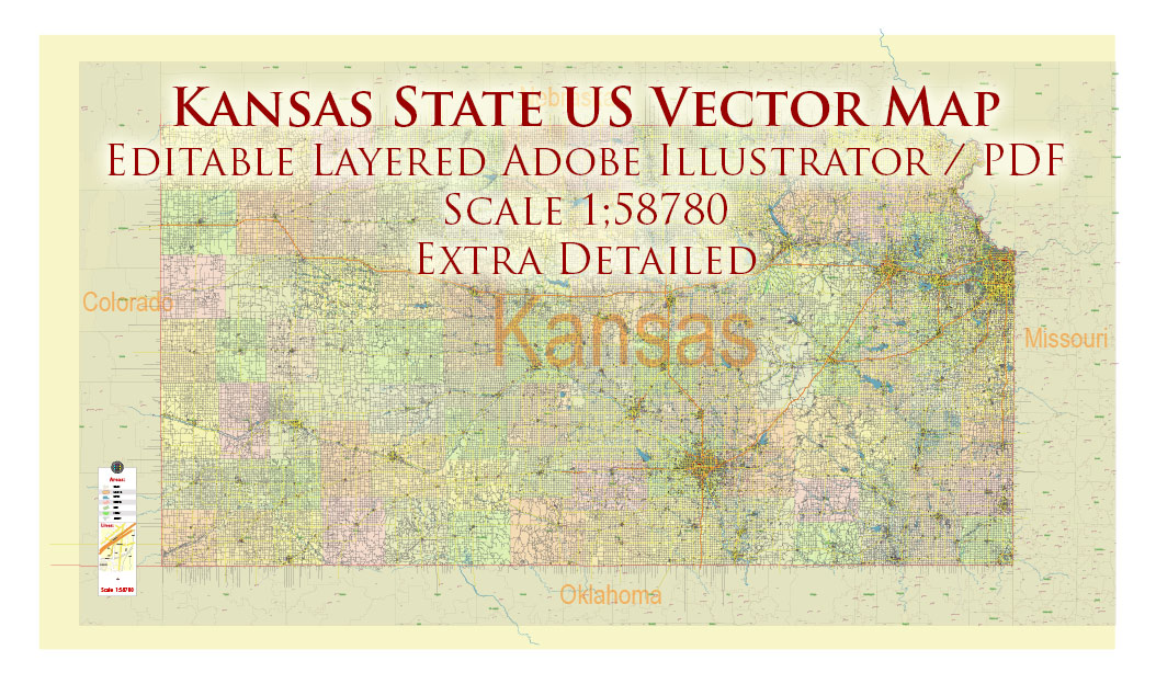
Kansas Full State US PDF Vector Map: Full Extra High Detailed (all roads, zipcodes, airports) + Admin Areas editable Adobe PDF in layers
Layers list:
- Legend
- Grids
- Labels of roads (numbers) – highways, interstate
- All Geonames (cities, towns, villages, hamlets, islands)
- Points of the Geonames (cities, towns, villages, hamlets, islands)
- Names places: Names of all Cities, towns, villages and hamlets
- Names of the Airports and Heliports
- Points of the Airports and Heliports
- Numbers of ZIP codes
- Names of objects (water, park, hospital)
- Names of States
- Names of Counties
- Names of the Main Streets
- Major Roads and Streets – Highways
- Minor Roads and residential streets
- Railroads
- State boundaries
- Water objects (rivers, lakes, ponds, swamps, reefs)
- Waterways
- Ground objects (urban areas, parks, hospitals, etc.)
- ZIP-codes areas
- Counties areas (colored)
- States areas
- Background
Kansas Full State US PDF Vector Map: Full Extra High Detailed (all roads, zipcodes, airports) + Admin Areas editable Adobe PDF in layers
Kansas Full State US PDF Vector Map: Full Extra High Detailed (all roads, zipcodes, airports) + Admin Areas editable Adobe PDF in layers

Kansas Full State US PDF Vector Map: Full Extra High Detailed (all roads, zipcodes, airports) + Admin Areas editable Adobe PDF in layers
Kansas Full State US PDF Vector Map: Full Extra High Detailed (all roads, zipcodes, airports) + Admin Areas editable Adobe PDF in layers
Kansas Full State US PDF Vector Map: Full Extra High Detailed (all roads, zipcodes, airports) + Admin Areas editable Adobe PDF in layers
Kansas Full State US PDF Vector Map: Full Extra High Detailed (all roads, zipcodes, airports) + Admin Areas editable Adobe PDF in layers
Kansas Full State US PDF Vector Map: Full Extra High Detailed (all roads, zipcodes, airports) + Admin Areas editable Adobe PDF in layers
Kansas Full State US PDF Vector Map: Full Extra High Detailed (all roads, zipcodes, airports) + Admin Areas editable Adobe PDF in layers
Kansas Full State US PDF Vector Map: Full Extra High Detailed (all roads, zipcodes, airports) + Admin Areas editable Adobe PDF in layers
Kansas Full State US PDF Vector Map: Full Extra High Detailed (all roads, zipcodes, airports) + Admin Areas editable Adobe PDF in layers
Kansas Full State US PDF Vector Map: Full Extra High Detailed (all roads, zipcodes, airports) + Admin Areas editable Adobe PDF in layers
Kansas Full State US PDF Vector Map: Full Extra High Detailed (all roads, zipcodes, airports) + Admin Areas editable Adobe PDF in layers
Kansas Full State US PDF Vector Map: Full Extra High Detailed (all roads, zipcodes, airports) + Admin Areas editable Adobe PDF in layers
Kansas Full State US PDF Vector Map: Full Extra High Detailed (all roads, zipcodes, airports) + Admin Areas editable Adobe PDF in layers
Kansas Full State US PDF Vector Map: Full Extra High Detailed (all roads, zipcodes, airports) + Admin Areas editable Adobe PDF in layers
Kansas Full State US PDF Vector Map: Full Extra High Detailed (all roads, zipcodes, airports) + Admin Areas editable Adobe PDF in layers
Kansas Full State US PDF Vector Map: Full Extra High Detailed (all roads, zipcodes, airports) + Admin Areas editable Adobe PDF in layers

Kansas Full State US PDF Vector Map: Full Extra High Detailed (all roads, zipcodes, airports) + Admin Areas editable Adobe PDF in layers

 Author: Kirill Shrayber, Ph.D. FRGS

 full editable, Adobe Illustrator")
