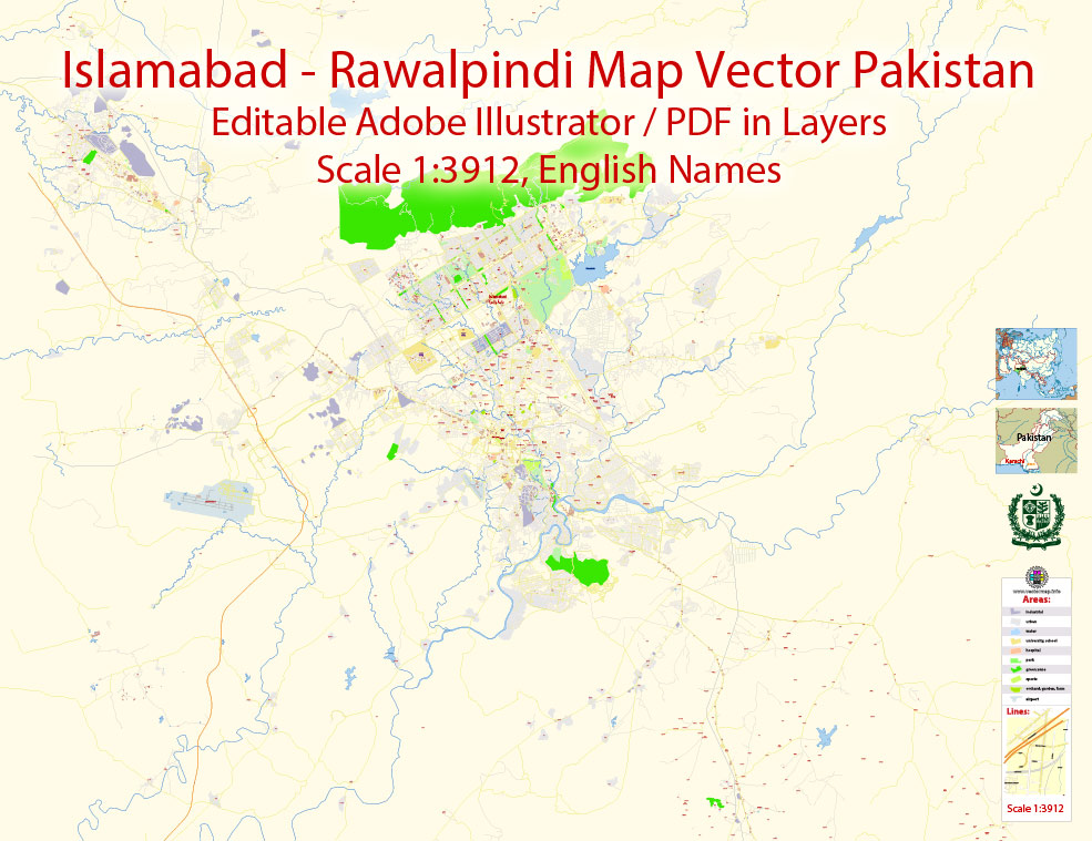
Printable Vector Map of Islamabad + Rawalpindi Pakistan EN detailed City Plan scale 1:3912 editable DWG + DXF + PDF + Adobe Illustrator Street Map in layers , in 1 archive, scalable, editable text format all names, 119 mb ZIP
English streets names, Main Objects, Buildings. Map for design, printing, arts, projects, presentations, for architects, designers and builders, business, logistics.
Layers: color_fills, streets_roads, labels_roads, names_objects, names_streets, names_places, grids, legend.
The most exact and detailed map of the city in scale.
For Editing and High Quality Printing
Islamabad
Capital of Pakistan
Islamabad is the capital city of Pakistan located within the federal Islamabad Capital Territory. With a population of 1,014,825 at the 2017 Census, it is the 9th largest city of Pakistan Islamabad is the capital city of Pakistan located within the federal Islamabad Capital Territory. With a population of 1,014,825 at the 2017 Census, it is the 9th largest city of Pakistan, while the larger Islamabad-Rawalpindi metropolitan area is the third largest in Pakistan with a population exceeding four million. The city is the political seat of Pakistan and is administered by the Islamabad Metropolitan Corporation, supported by the Capital Development Authority (CDA).
For travelers, maps are sold at the airports and gas stations around the world. Often the source is our vector maps.
Take a look, who purchases our vector maps of Islamabad city in “Our Clients and Friends” page – these are large and small companies, from super-brands like Volvo and Starbucks, to small design studios and printing houses.
You can easily add any objects needed (e.g. shops, salons, sale points, gas station or attraction) on any layer of Islamabad vector map.
Regardless of the name at the top of the dialog box, the right-hand side always displays the color group of the current document, as well as two default color groups: Print Color and Grayscale. These color groups can be selected and used any time.
Create and edit color groups of Islamabad city vector map, and also assign colors using the «Edit Colors»/ а «Repaint Graphic Object» dialog box.
Islamabad is located in the Pothohar Plateau in the northeastern part of the country, between Rawalpindi District and the Margalla Hills National Park to the north. The region has historically been a part of the crossroads of Punjab and Khyber Pakhtunkhwa with the Margalla Pass acting as the gateway between the two regions.
The city’s master-plan, designed by Greek architect Constantinos Apostolou Doxiadis, divides the city into eight zones, including administrative, diplomatic enclave, residential areas, educational sectors, industrial sectors, commercial areas, and rural and green areas.
Saving a color group adds this group to the specified list.
Opening the «Edit Colors»/«Repaint Graphic Object» dialog box.
Open the «Edit Colors»/«Repaint Graphic Object» dialog box using one of the following methods:
«Edit»> «Edit Colors»> «Repaint Graphic object» or «Repaint With Style».
Use these commands if you need to edit the colors in the selected vector map of Islamabad city.
«Repaint Graphic object» button on the «Control» panel.
Use this button if you need to adjust colors of Islamabad city vector map using the а «Repaint graphic object» dialog box.
The specified button is available if the selected vector map or its fragment contains two or more colors.
Note. This color editing method is convenient for global color adjustment in a vector map, if global colors were not used when creating a City Map of Islamabad.
The «Edit colors» button or «Edit or apply colors» on the «Color Catalog» palette
Click this button if you need to edit colors on the «Color Catalog» palette or edit and then apply them to the selected Vector Map of Islamabad city or its fragment.
The «Edit color group» button or «Edit or apply color group» on the «Samples» palette.
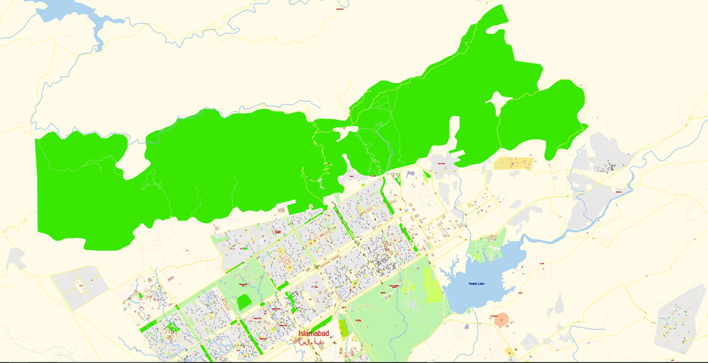
The city is known for the presence of several parks and forests, including the Margalla Hills National Park and Shakarparian Park. The city is home to several landmarks, including the Faisal Mosque, the largest mosque in South Asia and the fourth largest in the world. Other landmarks include the Pakistan’s National Monument and Democracy Square.
Islamabad is a beta-world city; it is categorised as very high on the Human Development Index, with an HDI of 0.875, the 2nd highest in the country after Lahore.
The assign color ability is provided only if the entire map, layer or fragment is selected in the document. You can specify which of new colors replace the current colors, whether the spot colors should be preserved and how colors are replaced (for example, you can replace colors completely or changing the color tone while maintaining the brightness). The «Assign» tab allows you to redefine colors in the Vector Map of Islamabad city, or in separate layers and fragments using the current color group or reducing the number of colors in the current Vector Map.
Color groups
Is a list of all saved color groups for current document (the same groups appear in the «Samples» palette). You can edit and delete the existing color groups, as well as creating a new ones using the list of “Color Groups” in the dialog box. All changes appear in the «Samples» palette.
The highlighted color group shows, which color group is currently edited.
Any color group can be selected and edited, or used to redefine the colors in the selected vector map of Islamabad city, its fragments or elements.
The city has the highest cost of living in Pakistan, and its population is dominated by middle and upper middle class citizens. The city is home to twenty universities, including the Quaid-e-Azam University, PIEAS, COMSATS Institute of Information Technology and NUST. The city is one of the safest in Pakistan, and has an expansive surveillance system with 1,900 CCTV cameras.
The advertising and presentation map of Islamabad city (usually the final designer marks the routes, and puts the client’s objects (shops, saloons, gas stations etc.)
The undoubted advantage is that people will NEVER throw out this advertising product – the map. In fact, as an advertising medium, a city map is the most “long-playing” of the well-known polygraphic advertising media, with the longest lifespan, and the maximum number of interactions with the customer.
Geography and climate
Islamabad is located at 33.43°N 73.04°E at the northern edge of the Pothohar Plateau and at the foot of the Margalla Hills in Islamabad Capital Territory. Its elevation is 540 metres (1,770 ft). The modern capital and the ancient Gakhar city of Rawalpindi form a conurbation, and are commonly referred to as the Twin Cities.
To the northeast of the city lies the colonial era hill station of Murree, and to the north lies the Haripur District of Khyber Pakhtunkhwa.
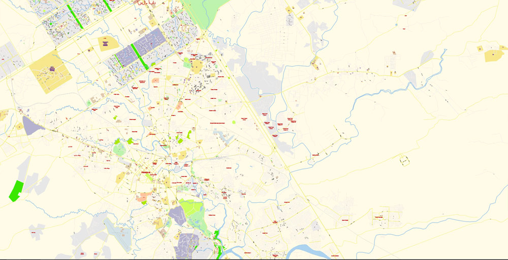
The Islamabad city map in vector format is used for design, urban planning, presentations and media visualizations.
Kahuta lies on the southeast, Taxila, Wah Cantt, and Attock District to the northwest, Gujar Khan, Rawat, and Mandrah on the southeast, and the metropolis of Rawalpindi to the south and southwest. Islamabad is located 120 kilometres (75 mi) SSW of Muzaffarabad, 185 kilometres (115 mi) east of Peshawar, 295 kilometres (183 mi) NNW of Lahore, and 300 kilometres (190 mi) WSW of Srinagar, the capital of the Indian state of Jammu and Kashmir.
If a picture or a map fragment is not selected, and you open the dialog box by clicking the icon in the Control panel, on the Samples palette or in the Color Catalog, the «Edit Colors» dialog box appears and you can only access the «Edit» tab.
The city of Islamabad expanses an area of 906 square kilometres (350 sq mi). A further 2,717 square kilometres (1,049 sq mi) area is known as the Specified Area, with the Margala Hills in the north and northeast. The southern portion of the city is an undulating plain. It is drained by the Kurang River, on which the Rawal Dam is located.
Cityscape
Civic administration
See also: Mayor of Islamabad, Islamabad Metropolitan Corporation, and Capital Development Authority (Islamabad)
For your convenience, all objects on Islamabad vector city map are divided into layers. And the editing is very easy – colors, lines, etc.
The main areas of the dialog box are:
«Edit»
The «Edit» tab is designed to create a new or edit the existing color groups.
The harmony rules Menu and the Color Wheel are used to conduct experiments with color harmonies. The color wheel shows how colors are related in color harmony, and the color bars allow you to view and manipulate an individual color values. In addition, you can adjust the brightness, add and remove colors, save color groups and view colors on the selected Vector Map of Islamabad city or a separated layers.
Assign
The «Assign» tab is used to view and control on how the original colors are replaced with colors from the color group like your corporate colors in the Vector Map of Islamabad city.
This is the most detailed, exact map of Islamabad city for high-quality printing and polygraphy. You can always clarify the map development date by contacting us.
The main administrative authority of the city is the Islamabad Metropolitan Corporation (IMC) with some help from Capital Development Authority (CDA), which oversees the planning, development, construction, and administration of the city.
Islamabad Capital Territory is divided into eight zones: Administrative Zone, Commercial District, Educational Sector, Industrial Sector, Diplomatic Enclave, Residential Areas, Rural Areas and Green Area.
Guides are not limited to vertical and horizontal in Adobe Illustrator. You can also create a diagonal guide for example. Moreover, you can turn any contours into guides. Select the outline and go to View > Guides > Make Guides (Create Guides), or simply press Cmd/Ctrl + 5. You can also turn the guides back into an editable object. Go to menu, View > Guides > Unlock Guides (Release Guides), select the guide you want to edit and select View > Guides > Release Guides (Reset Guides), or just press Cmd/Ctrl + Option / Alt + 5).
You will probably want to change the color scheme used on our Islamabad vector city map.
To quickly and effectively play with colors.
Of course, you can do it manually, all objects in our Islamabad city vector map are divided according to types and layers, and you can easily change the color gamma of vector objects in groups and layers.
But there is more effective way of working with the whole VECTOR MAP of Islamabad city and all layers:
The overview dialog «Edit colors»/«Repaint Graphic Object» (this dialog box name can change depending on the context):
If you have selected a part or a layer of Islamabad city vector map and open the dialog box by clicking the icon in the Control panel, on the Samples palette or the Color Catalog, or if you choose Edit > Edit Colors> Repaint Graphic Object, then the «Repaint Graphic Object» dialog box appears, and you get access to «Assign» and «Edit» tabs.
Islamabad city is divided into five major zones: Zone I, Zone II, Zone III, Zone IV, and Zone V. Out of these, Zone IV is the largest in area. Zone I consists mainly of all the developed residential sectors while Zone II consists of the under-developed residential sectors.
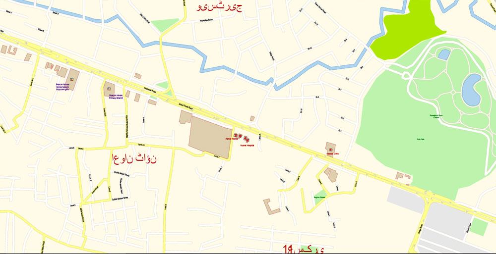
Each residential sector is identified by a letter of the alphabet and a number, and covers an area of approximately 2 km × 2 km (1 1⁄4 mi × 1 1⁄4 mi). The sectors are lettered from A to I, and each sector is divided into four numbered sub-sectors.

This vector map of Islamabad city is used as a basis for design, editing, and further printing.
Sectors
Main article: Sectors of Islamabad
Series A, B, and C are still underdeveloped. The D series has seven sectors (D-11 to D-17), of which only sector D-12 is completely developed. This series is located at the foot of Margalla Hills. The E Sectors are named from E-7 to E-17.
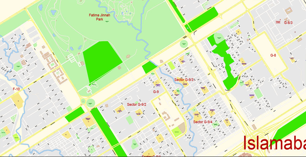
Many foreigners and diplomatic personnel are housed in these sectors. In the revised Master Plan of the city, CDA has decided to develop a park on the pattern of Fatima Jinnah Park in sector E-14. Sectors E-8 and E-9 contain the campuses of Bahria University, Air University, and the National Defence University. The F and G series contains the most developed sectors.
Printable vector maps of Islamabad city are much more convenient and efficient than any electronic maps on your smartphone, because ALL DETAILS are displayed in the entire space of Islamabad city map.
Useful tips on working with vector maps of cities and countries in Adobe Illustrator.
«V» – launches the Selection tool (cursor, black arrow), which makes active any vector line.
«А» – launches the Direct Selection tool (white cursor), allows you to select curve elements and drag them to the desired place.
«R» – activates the Rotate tool, which helps you rotating selected objects around the center point by 360 degrees.
«E» – gives you the opportunity to use the Eraser tool and erase unnecessary parts.
«X» – switches between Fill and Stroke in the Tools section. Try to get used to this hot key and
you will quickly understand that you can’t live and work without it.
F series contains sectors F-5 to F-17; some sectors are still under-developed. F-5 is an important sector for the software industry in Islamabad, as the two software technology parks are located here. The entire F-9 sector is covered with Fatima Jinnah Park. The Centaurus complex is a major landmark of the F-8 sector.
G sectors are numbered G-5 through G-17. Some important places include the Jinnah Convention Centre and Serena Hotel in G-5, the Red Mosque in G-6, the Pakistan Institute of Medical Sciences, the largest medical complex in the capital, located in G-8, and the Karachi Company shopping center in G-9.
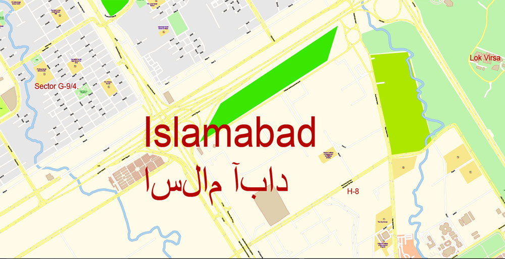
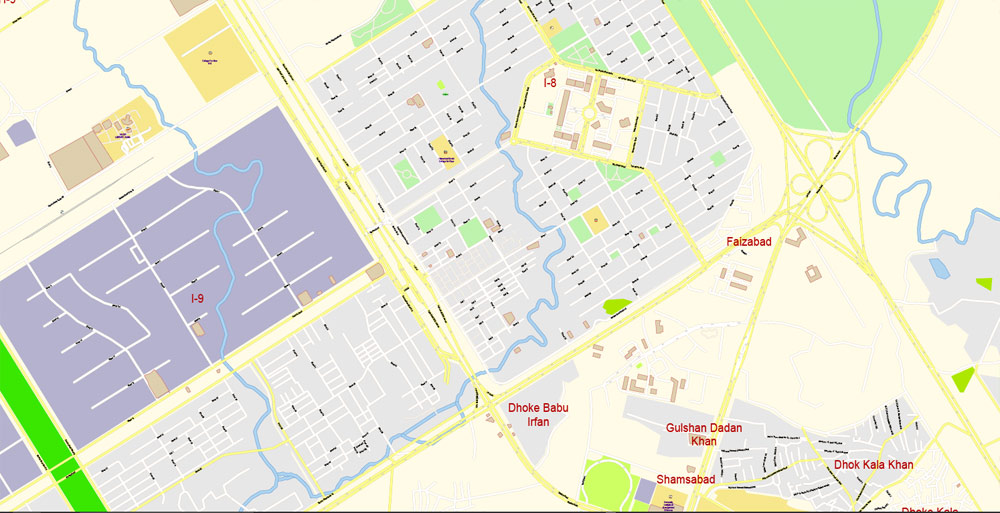
The H sectors are numbered H-8 through H-17. The H sectors are mostly dedicated to educational and health institutions. National University of Sciences and Technology covers a major portion of sector H-12. The I sectors are numbered from I-8 to I-18.
This vector map of Islamabad city is used by:
designers, layout designers, printers, advertisers and architects. Our product – vector maps – is designed for further editing and printing in large formats – from @Wall format (a few meters) to A-0 and A-1, A-2, A-3.
One of the advantages of Islamabad city vector maps of our production is the relevance of cartographic data, we constantly update all our products.
With the exception of I-8, which is a well-developed residential area, these sectors are primarily part of the industrial zone. Currently two sub-sectors of I-9 and one sub-sector of I-10 are used as industrial areas.

CDA is planning to set up Islamabad Railway Station in Sector I-18 and Industrial City in sector I-17. Zone III consists primarily of the Margalla Hills and Margalla Hills National Park. Rawal Lake is in this zone. Zone IV and V consist of Islamabad Park, and rural areas of the city. The Soan River flows into the city through Zone V. It’s very easy to work with vector maps of Islamabad city, even for a not very experienced designer who can turn on and off the map layers, add new objects, change the colors of fill and lines according to customer requirements.
The undoubted advantage of Islamabad city vector maps in printing is an excellent and detailed visualization, when customer can expand a large paper map and instantly define his location, find a landmark, an object or address on map, unlike using the popular electronic formats of Google and Yandex maps for example.
Islamabad/Rawalpindi Metropolitan Area
Main article: Islamabad-Rawalpindi metropolitan area
A. Creating and editing of a color group on the «Edit» tab
B. Assigning colors on the «Assign» tab
C. Select a group of colors from the «Color groups» list
The option «Repaint a graphic object» in the lower part of the dialog box allows you to preview the colors on a selected layer of Vector map, or a group of elements, and specify whether its colors will be redefined when the dialog box is closed.
When the master plan for Islamabad was drawn up in 1960, Islamabad and Rawalpindi, along with the adjoining areas, was to be integrated to form a large metropolitan area called Islamabad/Rawalpindi Metropolitan Area.
The area would consist of the developing Islamabad, the old colonial cantonment city of Rawalpindi, and Margalla Hills National Park, including surrounding rural areas. However, Islamabad city is part of the Islamabad Capital Territory, while Rawalpindi is part of Rawalpindi District, which is part of province of Punjab. Initially, it was proposed that the three areas would be connected by four major highways: Murree Highway, Islamabad Highway, Soan Highway, and Capital Highway. However, to date only two highways have been constructed: Kashmir Highway (the former Murree Highway) and Islamabad Highway. Plans of constructing Margalla Avenue are also underway.
Islamabad is the hub all the governmental activities while Rawalpindi is the centre of all industrial, commercial, and military activities. The two cities are considered sister cities and are highly interdependent.
Click this button if you need to edit the colors in the specific color group or edit and apply them to the selected Vector Map of Islamabad city or a group of its elements, for example, the whole layer “Streets and lines”. You can also double-click the color group in the Samples panel to open the dialog box.
If the map file is too large and your computer freezes or even can’t open it quickly:
1. Try to reduce the color resolution of the video card (display) to 256 colors while working with a large map.
2. Using Windows Task Manager, select all the application you don’t need, while working with map, just turn them off.
3. Launch Adobe Illustrator. (DO NOT OPEN the vector map file)
4. Start the Windows Task Manager using administrator rights > Find the “Illustrator” process > set the «real time» priority,
5. Open the file. When you see the LEGACY FONT popup window – click “OK” (do not update). You can restore the TEXT later.
6. Can also be useful: When file is opened – Edit > Settings > Basic Settings > disable smoothing. /// It looks scary, but works quickly)))
We recommend saving the file in Adobe Illustrator 10 version. It’s much more stable when working with VERY BIG size files.
Area
• Capital city 906.5 km2 (350.0 sq mi)
• Land 897.7 km2 (346.6 sq mi)
• Water 8.8 km2 (3.4 sq mi) 0.97%
• Urban 220.15 km2 (85.00 sq mi)
• Rural 466.20 km2 (180.00 sq mi)
• Parks 220.15 km2 (85.00 sq mi)
Highest elevation 620 m (2,000 ft)
Lowest elevation 490 m (1,610 ft)
Population
• Capital city 1,014,825
• Density 2,089/km2 (5,410/sq mi)
• Urban 1,014,825
• Urban density 4,609/km2 (11,940/sq mi)
• Rural 991,747
• Metro 4 million
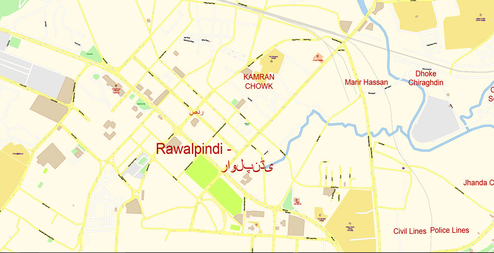
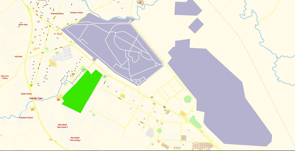
Rawalpindi commonly known as Pindi is a city in the Punjab province of Pakistan. Rawalpindi is adjacent to Pakistan’s capital of Islamabad, and the two are jointly known as the “twin cities” on account strong social and economic links between the cities. Rawalpindi is the fourth-largest city in Pakistan by population, while the larger Islamabad Rawalpindi metropolitan area is the country’s third-largest metropolitan area.
Rawalpindi is located on the Pothohar Plateau, known for its ancient Buddhist heritage, especially in the neighbouring town of Taxila – a UNESCO World Heritage Site. The city was destroyed during the invasion of Mahmud of Ghazni before being taken over by Gakhars in 1493. In 1765, the ruling Gakhars were defeated as the city came under Sikh rule, and eventually became a major city within the Sikh Empire based in Islamabad Rawalpindi. The city fell to the British Raj in 1849, and in 1851 became the largest garrison town for the British Indian Army. Following the partition of British India in 1947, the city became home to the headquarters of Pakistan Army hence retaining its status as a major military city.
Construction of Pakistan’s new purpose-built national capital city of Islamabad in 1961 led to greater investment in the city, as well as a brief stint as the country’s capital immediately before completion of Islamabad.
Modern Rawalpindi is socially and economically intertwined with Islamabad, and the greater metropolitan area. The city is also home to numerous suburban housing developments that serve as bedroom-communities for workers in Islamabad. As home of Benazir Bhutto International Airport, and with connections to the M-1 and M-2 motorways, Rawalpindi is a major logistics and transportation centre for northern Pakistan. The city is also home to historic havelis and temples, and serves as a hub for tourists visiting Rohtas Fort, Azad Kashmir, Taxila and Gilgit-Baltistan.
Area
• Total 259 km2 (100 sq mi)
Elevation 508 m (1,667 ft)
Population
• Total 2,098,231
Free vector map World, Adobe Illustrator, download now maps vector clipart
Map for design, projects, presentation free to use as you like.
See also: TERMS & CONDITIONS: SOFTWARE LICENSE AGREEMENT FOR DIGITAL CARTOGRAPHIC DATA.
Need more USA Vector Maps, printable and editable?

 Author: Kirill Shrayber, Ph.D. FRGS
