Extended Description of the Vector Map
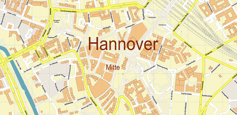
Hannover is the capital of the state of Lower Saxony in Germany. The city hosts many industrial fairs, including the annual CeBIT. The red-brick Gothic Market Church and the Old Town Hall stand among the half-timbered houses in the Old Town, reconstructed after the Second World War. From the dome of the richly decorated New Town Hall, you can see the city. The town hall houses four models of the city, depicting different historical periods. Not far from the center of Hannover are the Herrenhausen Gardens, founded in the 17th century.
Area: 204 km²
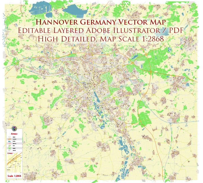
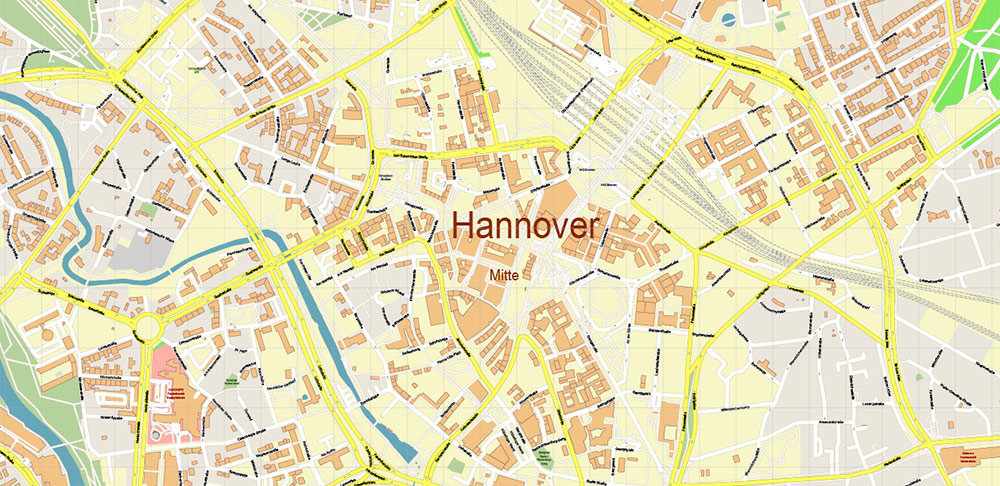
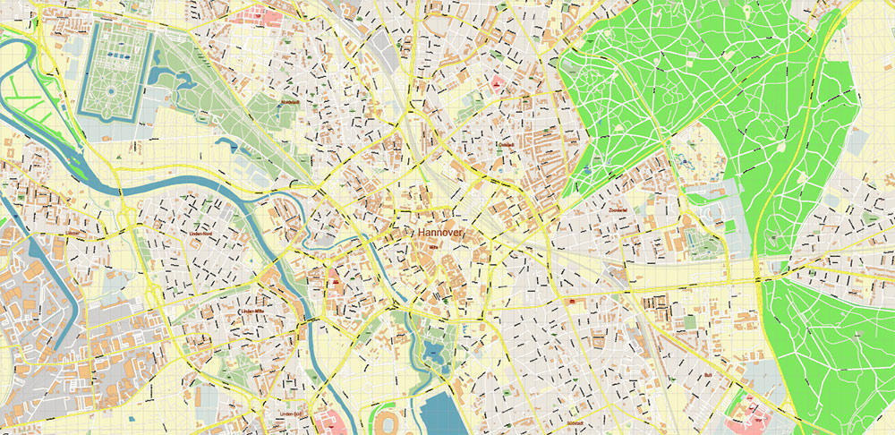
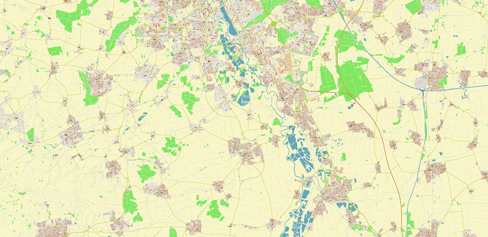
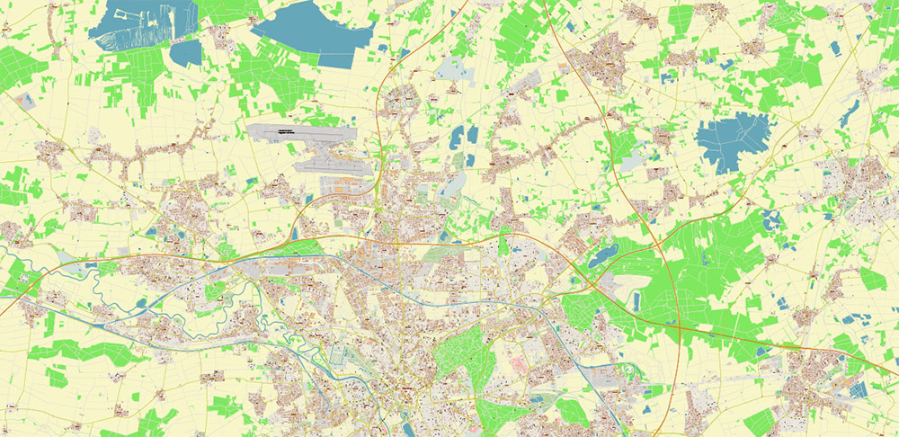
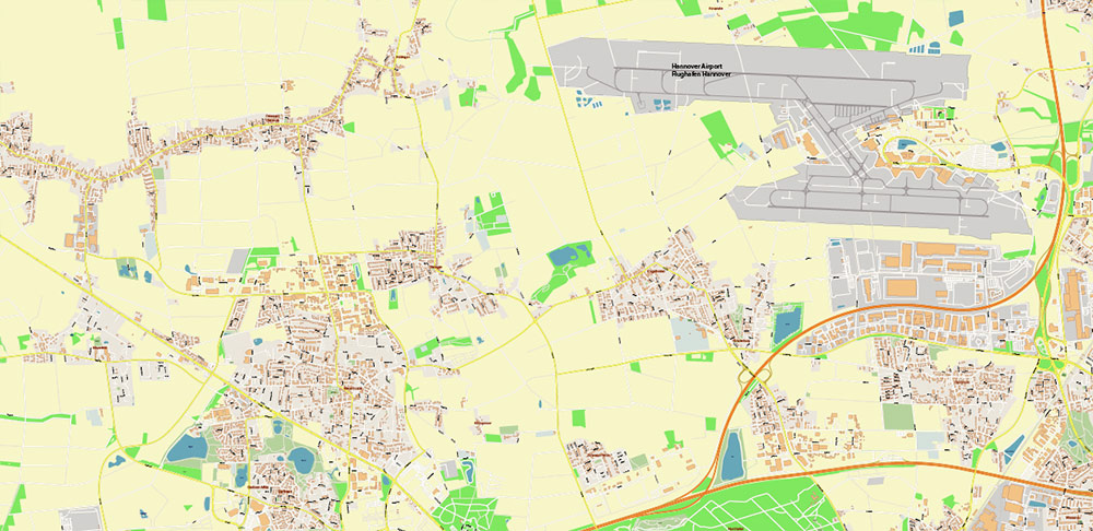
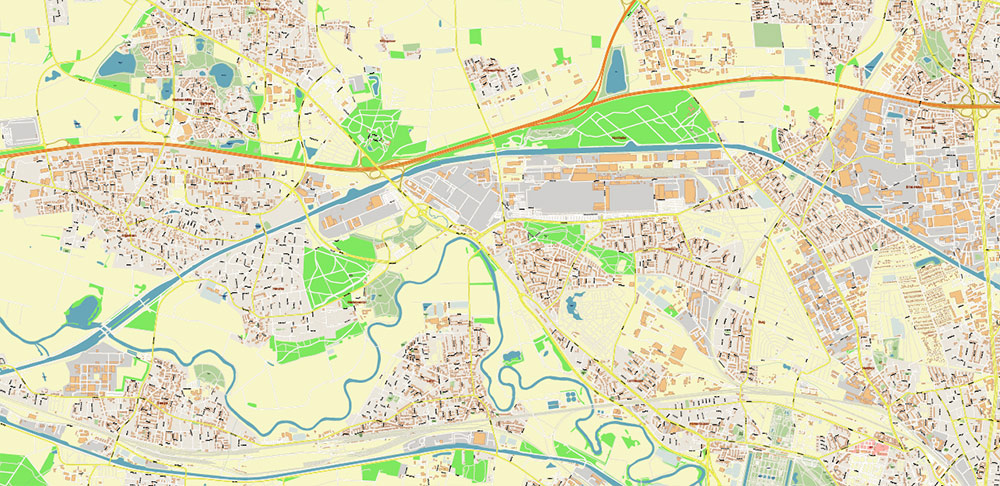
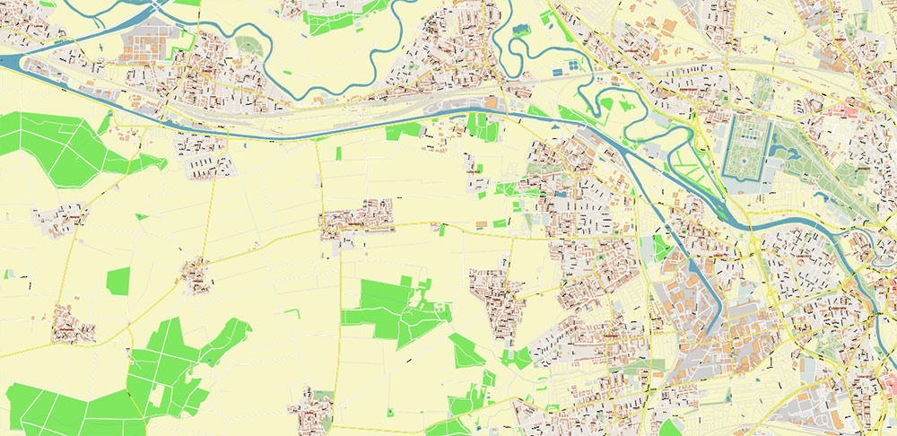
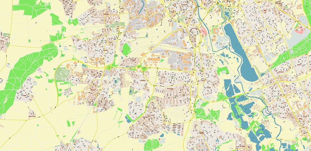
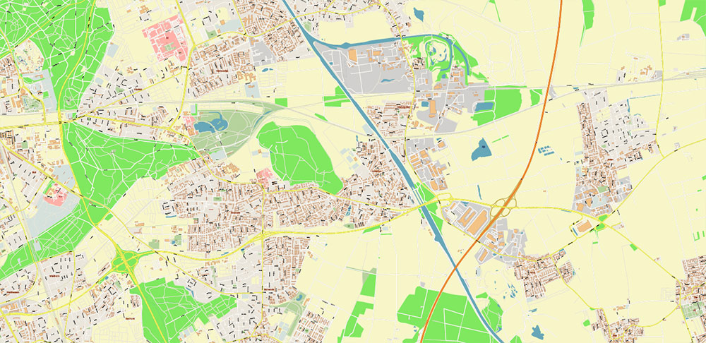
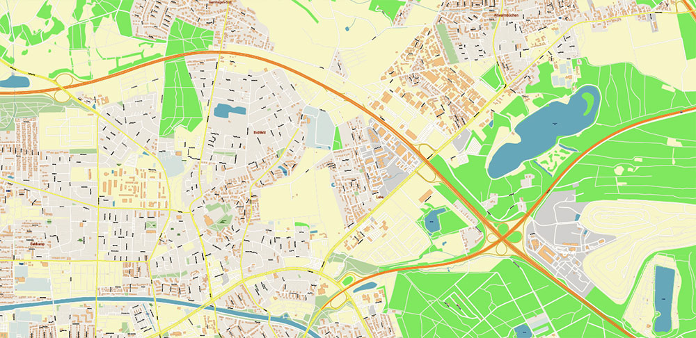
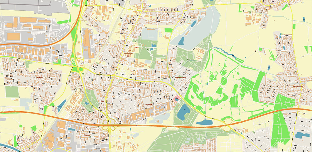
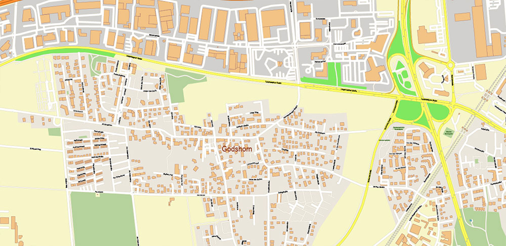
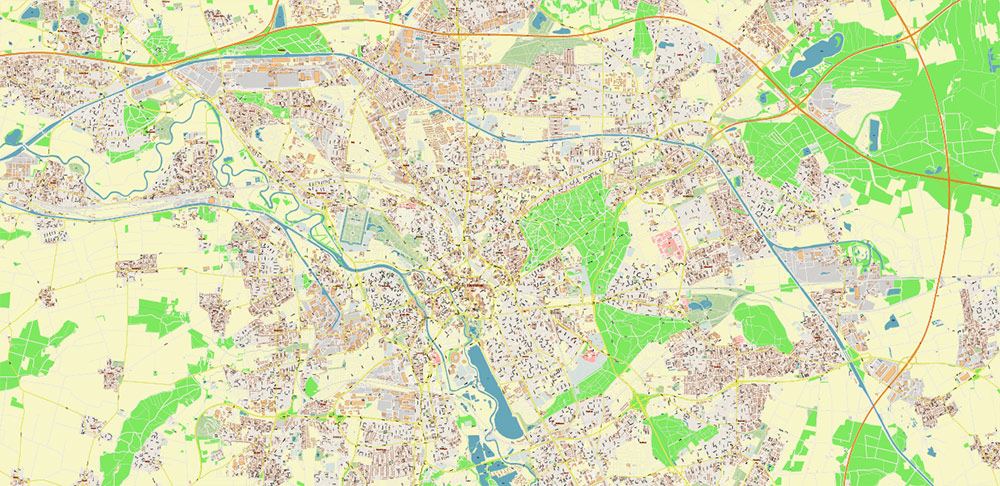
Hannover Germany Map Vector City Plan High Detailed Street Map editable Adobe Illustrator in layers
Printable Vector Map of Hannover Germany High Detailed City Plan scale 1:2868 full editable Adobe Illustrator Street Map in layers, scalable, text/curves format all names, 25 MB ZIP
All street names, Main Objects, Buildings. Map for design, printing, arts, projects, presentations, for architects, designers, and builders, business, logistics.
Also: We can add (additional layer for this map), any other objects for you. It’s free for our customers.
Also: We can add the RELIEF (Topo Isolines or shaded relief)
If you need any OTHER format – DWG, DXF, Corel, or something else – please, email us
Hannover Germany Map Vector City Plan High Detailed Street Map editable Adobe Illustrator in layers
Druckbare Vektorkarte von Hannover Deutschland Hochdetaillierter Stadtplan Maßstab 1:2868 voll editierbarer Adobe Illustrator Straßenkarte in Ebenen, skalierbar, Text-/Kurvenformat alle Namen, 25 MB ZIP
Alle Straßennamen, Hauptobjekte, Gebäude. Karte für Design, Druck, Kunst, Projekte, Präsentationen, für Architekten, Designer und Bauherren, Wirtschaft, Logistik.
Außerdem: Wir können (zusätzliche Ebene für diese Karte) beliebige andere Objekte für Sie hinzufügen. Für unsere Kunden ist es kostenlos.
Außerdem: Wir können das RELIEF hinzufügen (Topo Isolines oder schattiertes Relief)
Hannover Germany Map Vector City Plan High Detailed Street Map editable Adobe Illustrator in layers
Layers list:
- Legend
- Grids
- Labels of roads
- Names of places (city, hamlet, etc.)
- Names of objects (hospitals, parks, water)
- Names of main streets
- Names of residential streets
- Arrows of street directions
- Main Streets, roads
- Residential streets
- Railroads
- Buildings
- Waterways
- Water objects (rivers, lakes, ponds, marshes)
- Airports and Heliports
- Color fills (parks, hospital areas, land use, etc.)
- Background
Hannover Germany Map Vector City Plan High Detailed Street Map editable Adobe Illustrator in layers
Hannover Germany Map Vector City Plan High Detailed Street Map editable Adobe Illustrator in layers
Hannover Germany Map Vector City Plan High Detailed Street Map editable Adobe Illustrator in layers
Hannover Germany Map Vector City Plan High Detailed Street Map editable Adobe Illustrator in layers
Hannover Germany Map Vector City Plan High Detailed Street Map editable Adobe Illustrator in layers
Hannover Germany Map Vector City Plan High Detailed Street Map editable Adobe Illustrator in layers
Hannover Germany Map Vector City Plan High Detailed Street Map editable Adobe Illustrator in layers

Hannover Germany Map Vector City Plan High Detailed Street Map editable Adobe Illustrator in layers
Hannover Germany Map Vector City Plan High Detailed Street Map editable Adobe Illustrator in layers
Hannover Germany Map Vector City Plan High Detailed Street Map editable Adobe Illustrator in layers
Hannover Germany Map Vector City Plan High Detailed Street Map editable Adobe Illustrator in layers
Hannover Germany Map Vector City Plan High Detailed Street Map editable Adobe Illustrator in layers
Hannover Germany Map Vector City Plan High Detailed Street Map editable Adobe Illustrator in layers

 Author: Kirill Shrayber, Ph.D. FRGS
