Extended Description of the Vector Map
Printable PDF Vector Map of Hamburg Germany Extra High Detailed City Plan + Transport Map, scale 1:2789 full editable Adobe PDF Street Map in layers, scalable, text/curves format all names, 191 MB ZIP
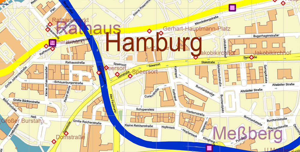
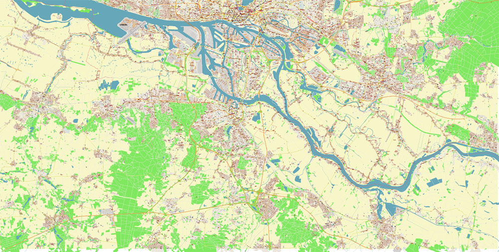
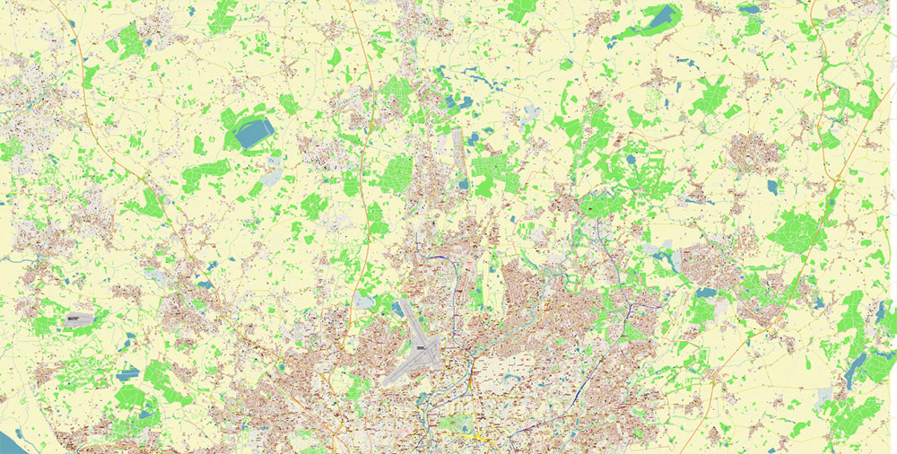
All street names, Main Objects, Buildings, Subway lines and stations, all bus stations. Map for design, printing, arts, projects, presentations, for architects, designers, and builders, business, logistics.
Also: We can add (additional layer for this map), any other objects for you. It’s free for our customers.
If you need any OTHER format – DWG, DXF, Corel, or something else – please, email us
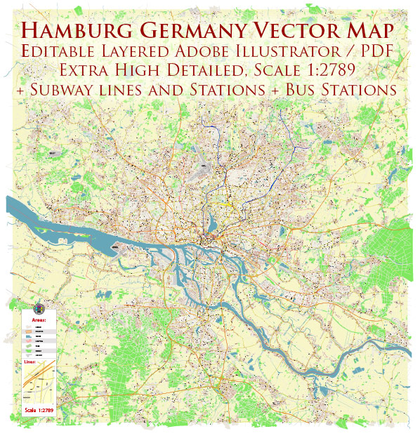
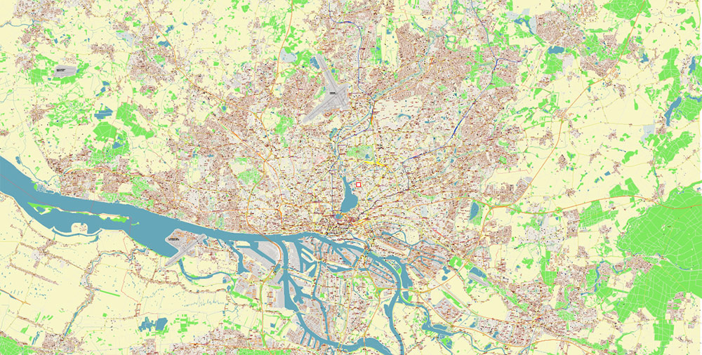
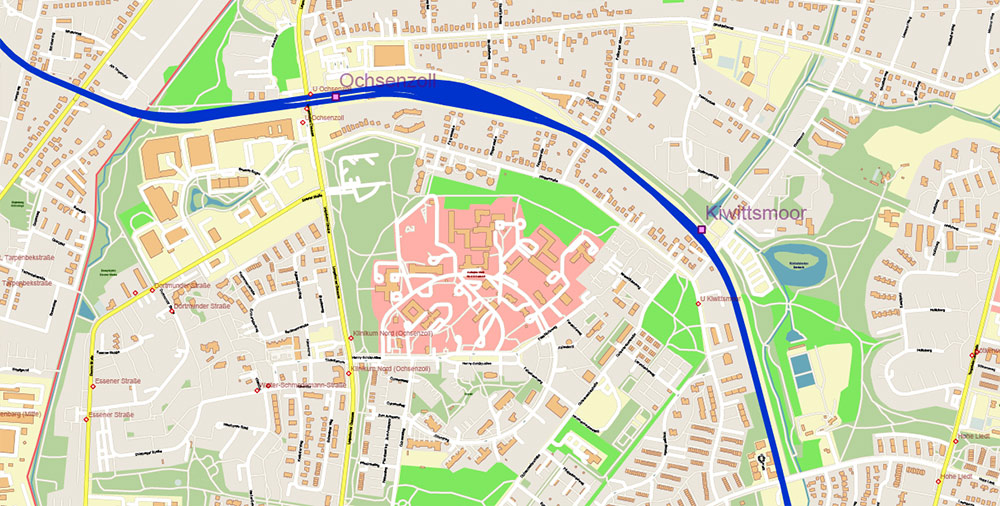
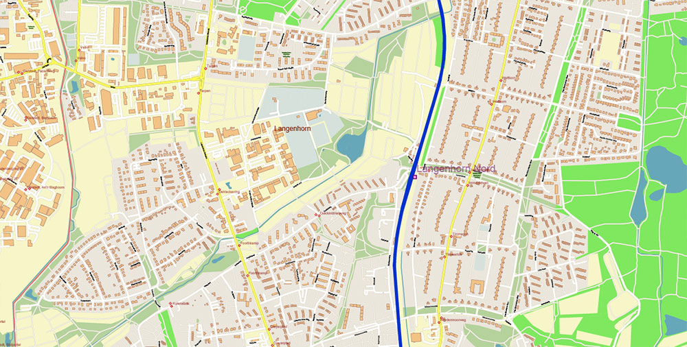
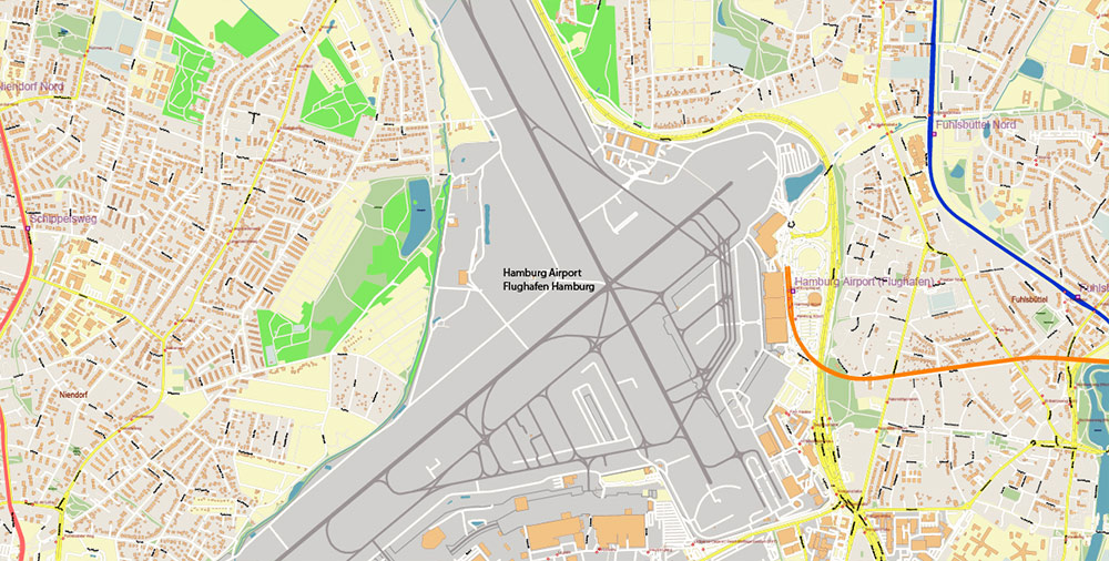
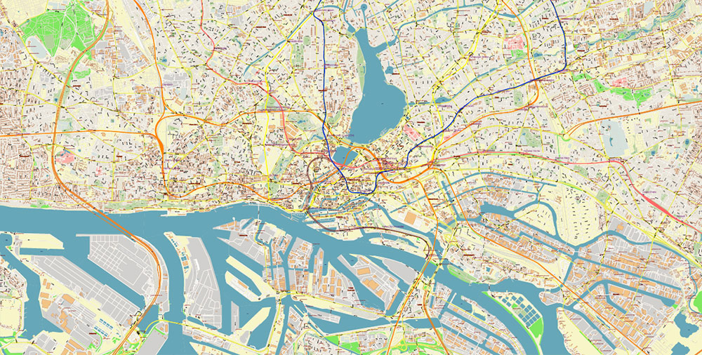
Hamburg Germany PDF Vector Map: Full Extra High Detailed (+ subway lines and stations + all bus stops) editable Adobe PDF in layers
Layers list:
- Legend
- Grids
- Labels of roads
- Names of places (city, hamlet, etc.)
- Names of objects (hospitals, parks, water)
- Names of Bus Stations
- Points of Bus Stations
- Names of Subway Stations
- Points of Subway Stations
- Names of main streets
- Names of residential streets
- Main Streets, roads
- Residential streets
- Subway lines (colored)
- Railroads
- Buildings
- Waterways
- Water objects (rivers, lakes, ponds)
- Airports and Heliports
- Color fills (parks, hospital areas, land use, etc.)
- Background and sea
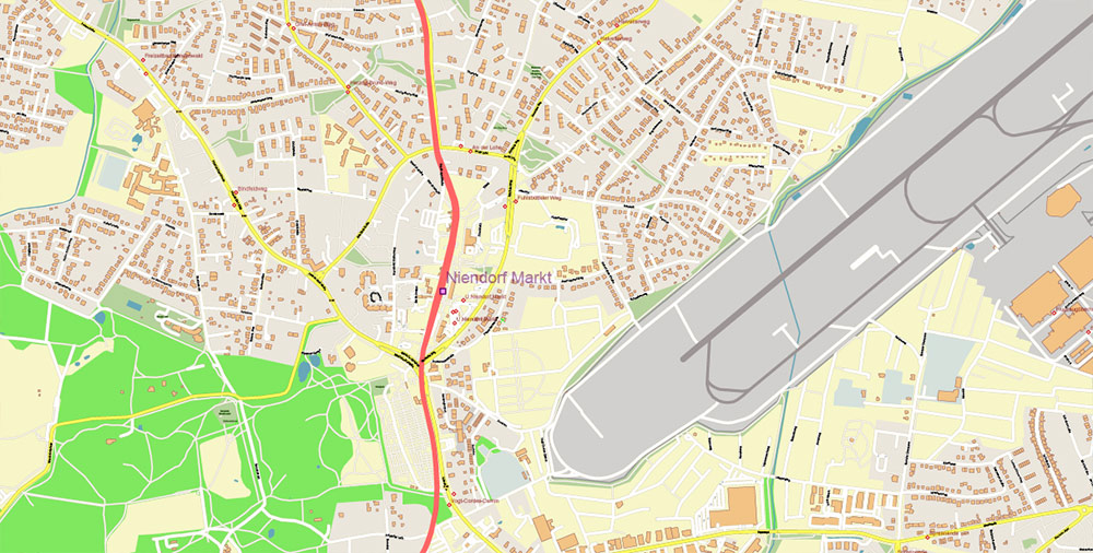
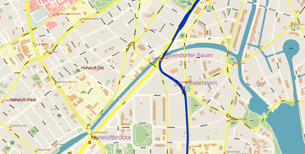
Hamburg Germany PDF Vector Map: Full Extra High Detailed (+ subway lines and stations + all bus stops) editable Adobe PDF in layers
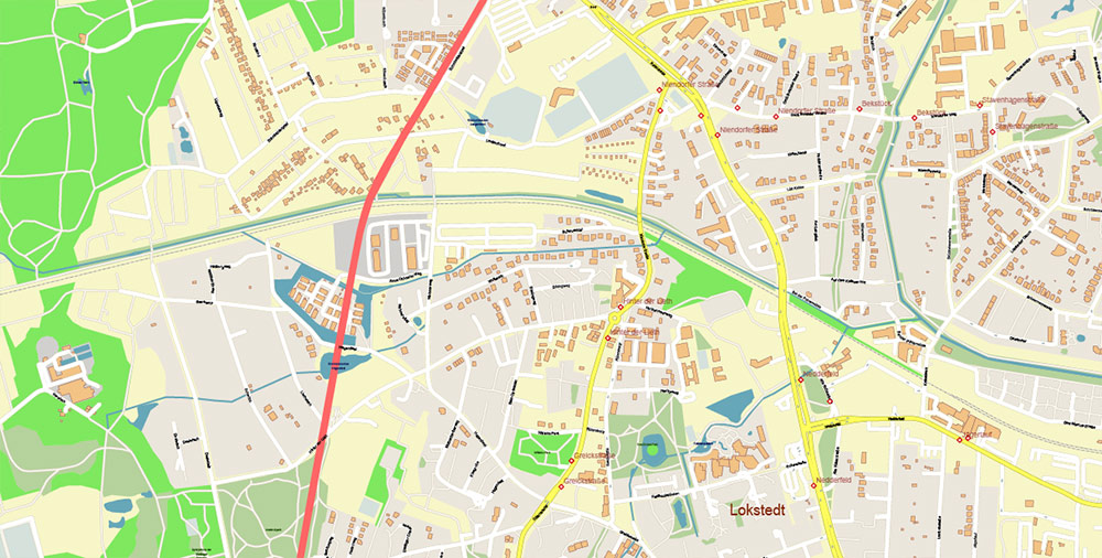
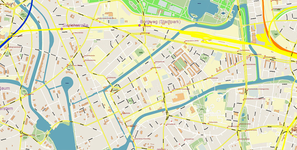
Hamburg Germany PDF Vector Map: Full Extra High Detailed (+ subway lines and stations + all bus stops) editable Adobe PDF in layers
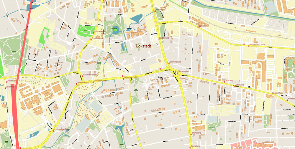
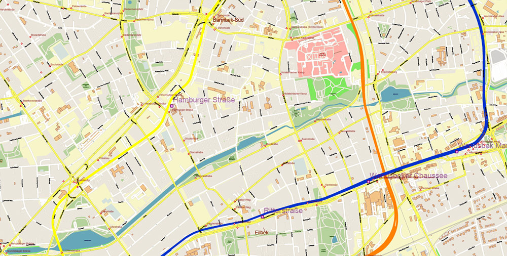
Hamburg Germany PDF Vector Map: Full Extra High Detailed (+ subway lines and stations + all bus stops) editable Adobe PDF in layers
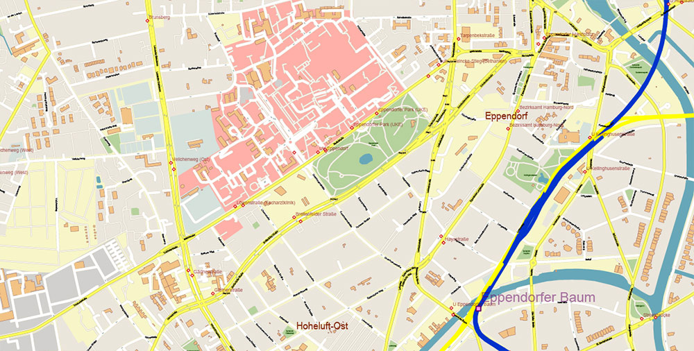
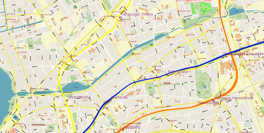
Hamburg Germany PDF Vector Map: Full Extra High Detailed (+ subway lines and stations + all bus stops) editable Adobe PDF in layers

Hamburg Germany PDF Vector Map: Full Extra High Detailed (+ subway lines and stations + all bus stops) editable Adobe PDF in layers
Hamburg Germany PDF Vector Map: Full Extra High Detailed (+ subway lines and stations + all bus stops) editable Adobe PDF in layers
Hamburg Germany PDF Vector Map: Full Extra High Detailed (+ subway lines and stations + all bus stops) editable Adobe PDF in layers
Hamburg Germany PDF Vector Map: Full Extra High Detailed (+ subway lines and stations + all bus stops) editable Adobe PDF in layers
Hamburg Germany PDF Vector Map: Full Extra High Detailed (+ subway lines and stations + all bus stops) editable Adobe PDF in layers
Hamburg Germany PDF Vector Map: Full Extra High Detailed (+ subway lines and stations + all bus stops) editable Adobe PDF in layers
Hamburg Germany PDF Vector Map: Full Extra High Detailed (+ subway lines and stations + all bus stops) editable Adobe PDF in layers
Hamburg Germany PDF Vector Map: Full Extra High Detailed (+ subway lines and stations + all bus stops) editable Adobe PDF in layers
Hamburg Germany PDF Vector Map: Full Extra High Detailed (+ subway lines and stations + all bus stops) editable Adobe PDF in layers
Hamburg Germany PDF Vector Map: Full Extra High Detailed (+ subway lines and stations + all bus stops) editable Adobe PDF in layers

Hamburg Germany PDF Vector Map: Full Extra High Detailed (+ subway lines and stations + all bus stops) editable Adobe PDF in layers
Hamburg Germany PDF Vector Map: Full Extra High Detailed (+ subway lines and stations + all bus stops) editable Adobe PDF in layers
Hamburg Germany PDF Vector Map: Full Extra High Detailed (+ subway lines and stations + all bus stops) editable Adobe PDF in layers
Hamburg Germany PDF Vector Map: Full Extra High Detailed (+ subway lines and stations + all bus stops) editable Adobe PDF in layers

Hamburg Germany PDF Vector Map: Full Extra High Detailed (+ subway lines and stations + all bus stops) editable Adobe PDF in layers

 Author: Kirill Shrayber, Ph.D. FRGS

