Extended Description of the Vector Map
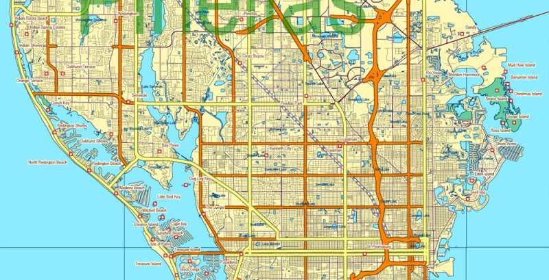
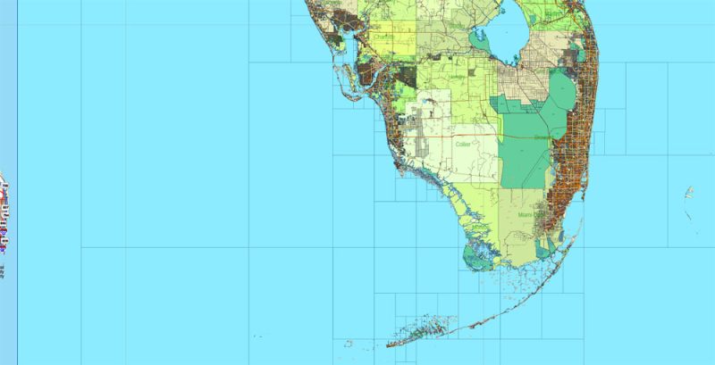
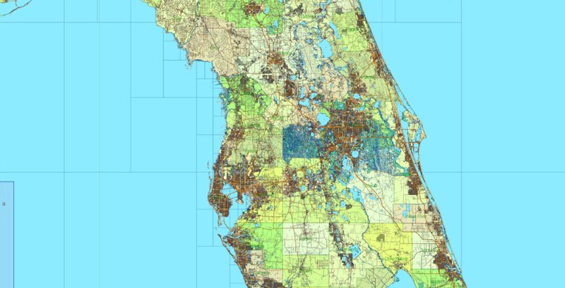
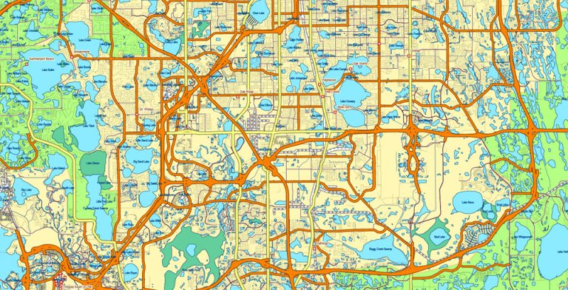
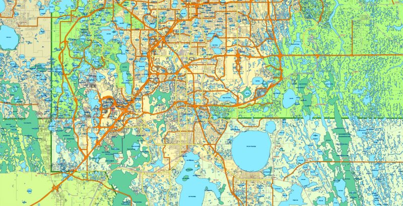
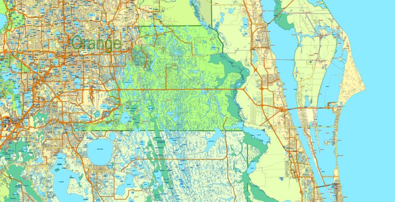
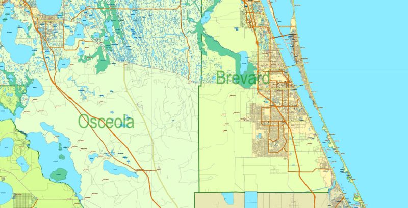
Printable Vector Map Florida State US, exact extra detailed All Roads and Streets, Cities, and Counties map editable Layered Adobe Illustrator scalable, editable text format all names, 89 MB ZIP
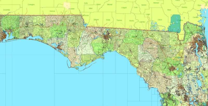
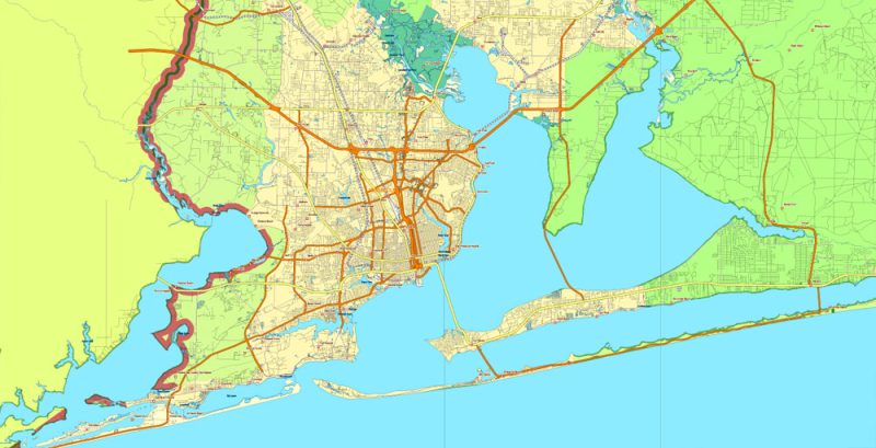
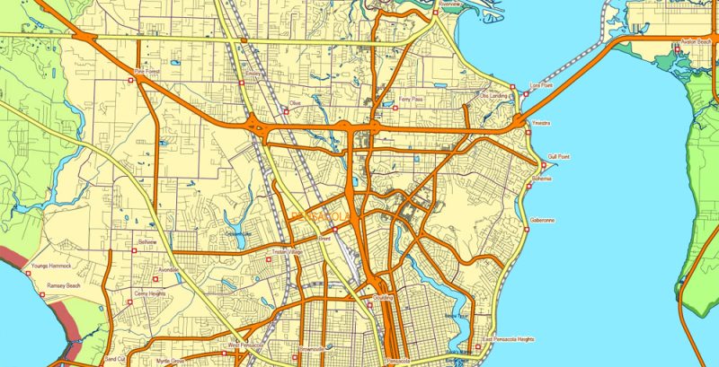
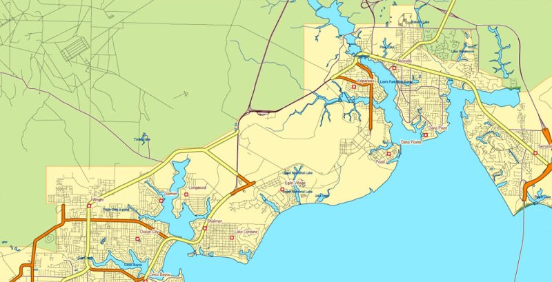
All roads, streets, Cities and towns, Counties, Water objects and Railroads Map for design, printing, arts, projects, presentations, for architects, designers, and builders, business, logistics.
Layers: color fills, main_streets_roads, civil_streets_roads, water_objects, waterways, names_places, counties, names_counties, dots_places grids, etc.
The most exact and detailed map of Florida State.
Map for editing and High-Quality Printing
DWG, DXF and other formats – on request, the same price, please, contact
Florida
US State
Florida is the southeasternmost U.S. state, with the Atlantic on one side and the Gulf of Mexico on the other. It has hundreds of miles of beaches. The city of Miami is known for its Latin-American cultural influences and notable arts scene, as well as its nightlife, especially in upscale South Beach. Orlando is famed for theme parks, including Walt Disney World.
Capital: Tallahassee
Population: 21.3 million
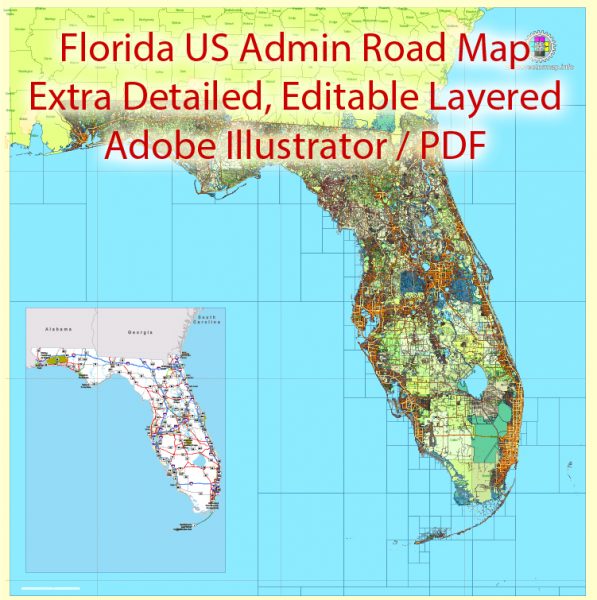
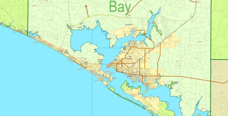
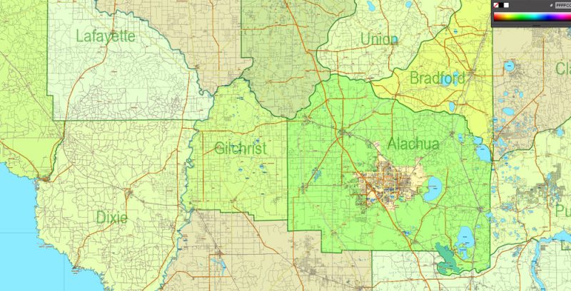
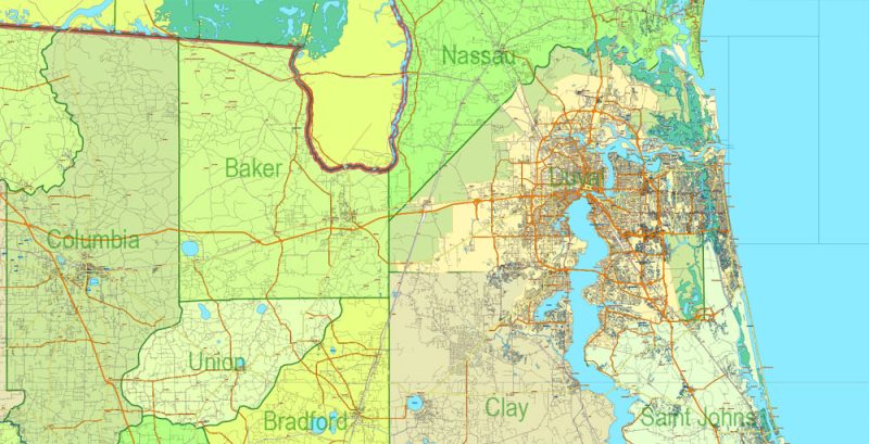
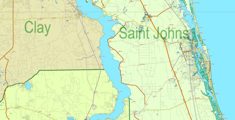
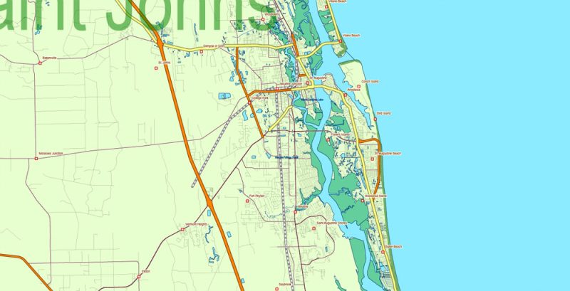
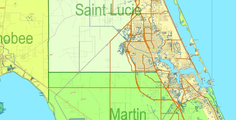
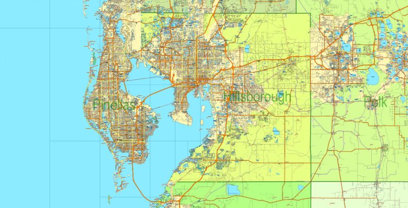
Florida State Vector Map exact extra detailed All Roads, Cities and Counties map editable Layered Adobe Illustrator
Florida State Vector Map exact extra detailed All Roads, Cities and Counties map editable Layered Adobe Illustrator
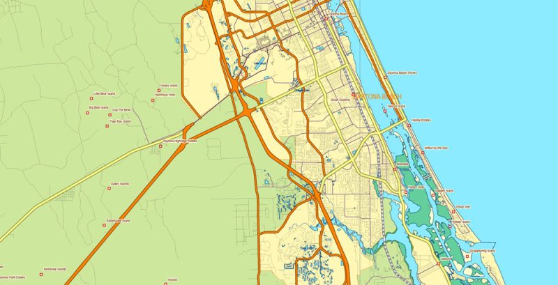
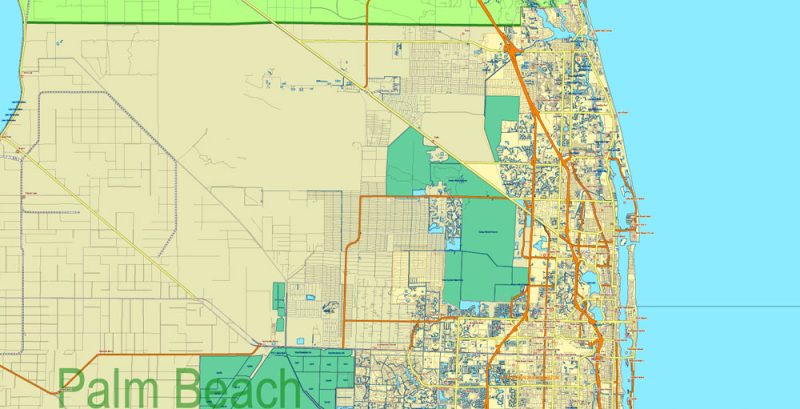
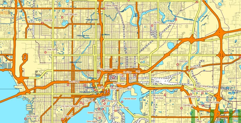
Florida State Vector Map exact extra detailed All Roads, Cities and Counties map editable Layered Adobe Illustrator
Florida State Vector Map exact extra detailed All Roads, Cities and Counties map editable Layered Adobe Illustrator
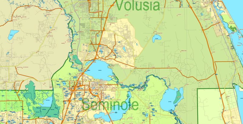
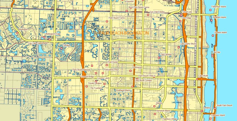
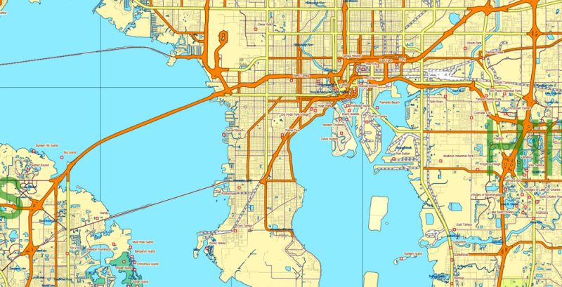
Florida State Vector Map exact extra detailed All Roads, Cities and Counties map editable Layered Adobe Illustrator
Florida State Vector Map exact extra detailed All Roads, Cities and Counties map editable Layered Adobe Illustrator
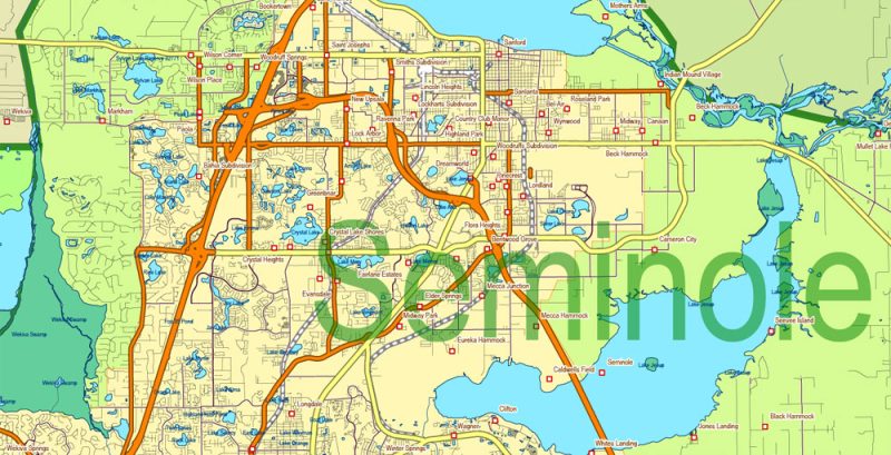
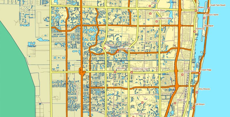
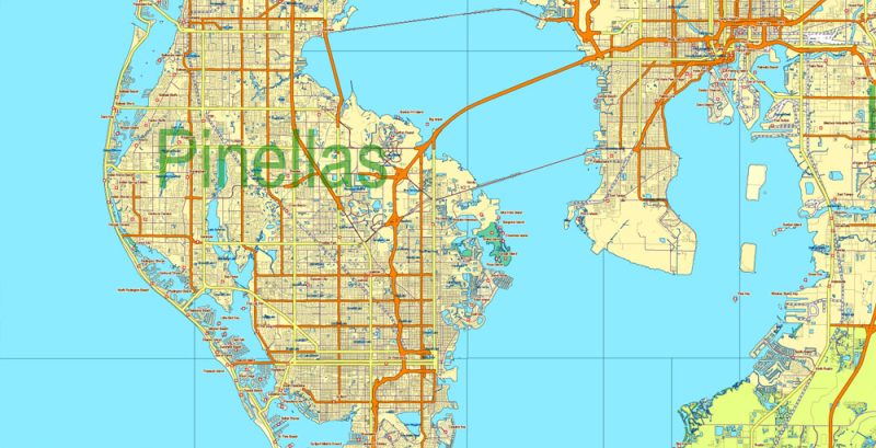
Florida State Vector Map exact extra detailed All Roads, Cities and Counties map editable Layered Adobe Illustrator
Florida State Vector Map exact extra detailed All Roads, Cities and Counties map editable Layered Adobe Illustrator
Florida State Vector Map exact extra detailed All Roads, Cities and Counties map editable Layered Adobe Illustrator
Florida State Vector Map exact extra detailed All Roads, Cities and Counties map editable Layered Adobe Illustrator
Florida State Vector Map exact extra detailed All Roads, Cities and Counties map editable Layered Adobe Illustrator
Florida State Vector Map exact extra detailed All Roads, Cities and Counties map editable Layered Adobe Illustrator
Florida State Vector Map exact extra detailed All Roads, Cities and Counties map editable Layered Adobe Illustrator
Florida State Vector Map exact extra detailed All Roads, Cities and Counties map editable Layered Adobe Illustrator
Florida State Vector Map exact extra detailed All Roads, Cities and Counties map editable Layered Adobe Illustrator
Florida State Vector Map exact extra detailed All Roads, Cities and Counties map editable Layered Adobe Illustrator
Florida State Vector Map exact extra detailed All Roads, Cities and Counties map editable Layered Adobe Illustrator
Florida State Vector Map exact extra detailed All Roads, Cities and Counties map editable Layered Adobe Illustrator
Florida State Vector Map exact extra detailed All Roads, Cities and Counties map editable Layered Adobe Illustrator
Florida State Vector Map exact extra detailed All Roads, Cities and Counties map editable Layered Adobe Illustrator
Florida State Vector Map exact extra detailed All Roads, Cities and Counties map editable Layered Adobe Illustrator
Florida State Vector Map exact extra detailed All Roads, Cities and Counties map editable Layered Adobe Illustrator
Florida State Vector Map exact extra detailed All Roads, Cities and Counties map editable Layered Adobe Illustrator
Florida State Vector Map exact extra detailed All Roads, Cities and Counties map editable Layered Adobe Illustrator
Florida State Vector Map exact extra detailed All Roads, Cities and Counties map editable Layered Adobe Illustrator
Florida State Vector Map exact extra detailed All Roads, Cities and Counties map editable Layered Adobe Illustrator
Florida State Vector Map exact extra detailed All Roads, Cities and Counties map editable Layered Adobe Illustrator
Florida State Vector Map exact extra detailed All Roads, Cities and Counties map editable Layered Adobe Illustrator
Author Rating
Aggregate Rating
no rating based on 0 votes
@vectormapper
Product Name Florida State Vector Map exact extra detailed All Roads, Cities and Counties map editable Layered Adobe Illustrator
Price
USD 79
Product Availability
Available in Stock


 Author: Kirill Shrayber, Ph.D. FRGS


