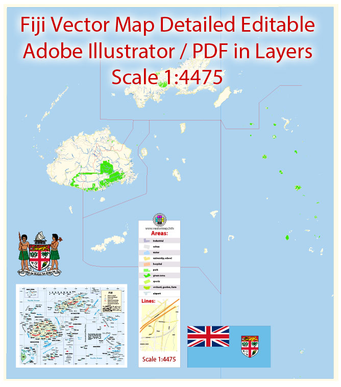
Printable Vector Map of Fiji Full Country Extra detailed Roads Stree Map full editable Adobe Illustrator , scalable, editable text format all names, 16 mb ZIP English Names
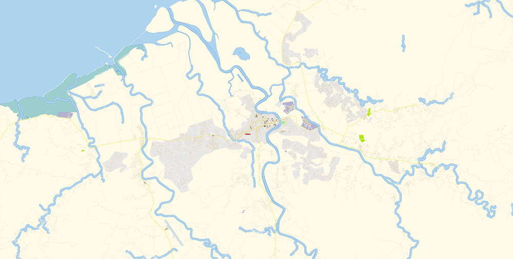
All cities and small towns, all roads, railroads, water objects. Map for design, printing, arts, projects, presentations, for architects, designers and builders, business, logistics.
Layers: streets_roads, color_fills, buildings etc.
The most exact and detailed map of the Pakistan.
For High Quality Printing any size
DWG, DXF and other formats – on request, same price, please, contact
Fiji is an island country in Melanesia, part of Oceania in the South Pacific Ocean about 1,100 nautical miles (2,000 km; 1,300 mi) northeast of New Zealand’s North Island.
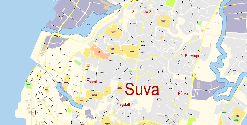
This vector map of Fiji city is used as a basis for design, editing, and further printing.
This is the most detailed, exact map of Fiji city for high-quality printing and polygraphy. You can always clarify the map development date by contacting us.
Its closest neighbours are Vanuatu to the west, New Caledonia to the southwest, New Zealand’s Kermadec Islands to the southeast, Tonga to the east, the Samoas and France’s Wallis and Futuna to the northeast, and Tuvalu to the north.
You can easily add any objects needed (e.g. shops, salons, sale points, gas station or attraction) on any layer of Fiji vector map.
For your convenience, all objects on Fiji vector city map are divided into layers. And the editing is very easy – colors, lines, etc.
It has an archipelago of more than 330 islands—of which 110 are permanently inhabited—and more than 500 islets, amounting to a total land area of about 18,300 square kilometres (7,100 sq mi). The farthest island is Ono-i-Lau. The two major islands, Viti Levu and Vanua Levu, account for 87% of the total population of 898,760.
The advertising and presentation map of Fiji city (usually the final designer marks the routes, and puts the client’s objects (shops, saloons, gas stations etc.)
The undoubted advantage is that people will NEVER throw out this advertising product – the map. In fact, as an advertising medium, a city map is the most “long-playing” of the well-known polygraphic advertising media, with the longest lifespan, and the maximum number of interactions with the customer.
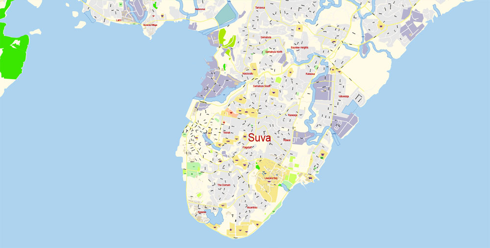
The capital, Suva on Viti Levu, serves as Fiji’s principal cruise port. About three-quarters of Fijians live on Viti Levu’s coasts, either in Suva or in smaller urban centres like Nadi (with tourism being the major industry) or Lautoka (sugar cane industry). Viti Levu’s interior is sparsely inhabited due to its terrain.
The majority of Fiji’s islands were formed through volcanic activity starting around 150 million years ago. Today, some geothermal activity still occurs on the islands of Vanua Levu and Taveuni. The geothermal systems on Viti Levu are of non-volcanic origin with low temperature (35-60 degrees Celsius) surface discharges, Sabeto Hot Springs near Nadi being a good example. Fiji has been inhabited since the second millennium BC, and was settled first by Austronesians and later by Melanesians, with some Polynesian influences.
It’s very easy to work with vector maps of Fiji city, even for a not very experienced designer who can turn on and off the map layers, add new objects, change the colors of fill and lines according to customer requirements.
The undoubted advantage of Fiji city vector maps in printing is an excellent and detailed visualization, when customer can expand a large paper map and instantly define his location, find a landmark, an object or address on map, unlike using the popular electronic formats of Google and Yandex maps for example.
Europeans visited Fiji from the 17th century, and, after a brief period as an independent kingdom, the British established the Colony of Fiji in 1874. Fiji was a Crown colony until 1970, when it gained independence as the Dominion of Fiji. A republic was declared in 1987, following a series of coups d’état. In a coup in 2006, Commodore Frank Bainimarama seized power. When the High Court ruled in 2009 that the military leadership was unlawful, President Ratu Josefa Iloilo, whom the military had retained as the nominal Head of State, formally abrogated the Constitution and reappointed Bainimarama. Later in 2009, Iloilo was replaced as President by Ratu Epeli Nailatikau. After years of delays, a democratic election was held on 17 September 2014. Bainimarama’s FijiFirst party won with 59.2% of the vote, and the election was deemed credible by international observers.
Fiji has one of the most developed economies in the Pacific due to an abundance of forest, mineral, and fish resources. Today, the main sources of foreign exchange are its tourist industry and sugar exports. The country’s currency is the Fijian dollar. Fiji’s local government, in the form of city and town councils, is supervised by the Ministry of Local Government and Urban Development.
Geography
Main article: Geography of Fiji
See also: Flora and fauna of Fiji
Fiji’s location in Oceania.
A map of Fiji
Topography of Fiji
Coconut palms line the beaches of Fiji
Fiji covers a total area of some 194,000 square kilometres (75,000 sq mi) of which around 10% is land.
Fiji is the hub of the South West Pacific, midway between Vanuatu and Tonga. The archipelago is located between 176° 53′ east and 178° 12′ west. The 180° meridian runs through Taveuni but the International Date Line is bent to give uniform time (UTC+12) to all of the Fiji group. With the exception of Rotuma, the Fiji group lies between 15° 42′ and 20° 02′ south.
The «Edit colors» button or «Edit or apply colors» on the «Color Catalog» palette
Click this button if you need to edit colors on the «Color Catalog» palette or edit and then apply them to the selected Vector Map of Fiji city or its fragment.
The «Edit color group» button or «Edit or apply color group» on the «Samples» palette.
Click this button if you need to edit the colors in the specific color group or edit and apply them to the selected Vector Map of Fiji city or a group of its elements, for example, the whole layer “Streets and lines”. You can also double-click the color group in the Samples panel to open the dialog box.
The Fiji city map in vector format is used for design, urban planning, presentations and media visualizations.
Rotuma is located 220 nautical miles (410 km; 250 mi) north of the group, 360 nautical miles (670 km; 410 mi) from Suva, 12° 30′ south of the equator.
Fiji consists of 332 islands (of which 106 are inhabited) and 522 smaller islets. The two most important islands are Viti Levu and Vanua Levu, which account for about three-quarters of the total land area of the country. The islands are mountainous, with peaks up to 1,324 metres (4,341 ft), and covered with thick tropical forests.
One of the advantages of Fiji city vector maps of our production is the relevance of cartographic data, we constantly update all our products.
This vector map of Fiji city is used by:
designers, layout designers, printers, advertisers and architects. Our product – vector maps – is designed for further editing and printing in large formats – from @Wall format (a few meters) to A-0 and A-1, A-2, A-3.
Ceva-i-Ra, an uninhabited reef, is located about 250 nautical miles (460 km; 290 mi) southwest of the main archipelago.
The assign color ability is provided only if the entire map, layer or fragment is selected in the document. You can specify which of new colors replace the current colors, whether the spot colors should be preserved and how colors are replaced (for example, you can replace colors completely or changing the color tone while maintaining the brightness). The «Assign» tab allows you to redefine colors in the Vector Map of Fiji city, or in separate layers and fragments using the current color group or reducing the number of colors in the current Vector Map.
Color groups
Is a list of all saved color groups for current document (the same groups appear in the «Samples» palette). You can edit and delete the existing color groups, as well as creating a new ones using the list of “Color Groups” in the dialog box. All changes appear in the «Samples» palette.
The highlighted color group shows, which color group is currently edited.
For travelers, maps are sold at the airports and gas stations around the world. Often the source is our vector maps.
A. Creating and editing of a color group on the «Edit» tab
B. Assigning colors on the «Assign» tab
C. Select a group of colors from the «Color groups» list
The option «Repaint a graphic object» in the lower part of the dialog box allows you to preview the colors on a selected layer of Vector map, or a group of elements, and specify whether its colors will be redefined when the dialog box is closed.
The main areas of the dialog box are:
«Edit»
The «Edit» tab is designed to create a new or edit the existing color groups.
The harmony rules Menu and the Color Wheel are used to conduct experiments with color harmonies. The color wheel shows how colors are related in color harmony, and the color bars allow you to view and manipulate an individual color values. In addition, you can adjust the brightness, add and remove colors, save color groups and view colors on the selected Vector Map of Fiji city or a separated layers.
Assign
The «Assign» tab is used to view and control on how the original colors are replaced with colors from the color group like your corporate colors in the Vector Map of Fiji city.
Administrative divisions
Main article: Local government of Fiji
A map of Fiji’s administrative divisions.
Fiji is divided into Four Major Divisions which are further divided into 14 provinces. They are:
Central Division has 5 provinces: Naitasiri, Namosi, Rewa, Serua, and Tailevu.
Eastern Division has 3 provinces: Kadavu, Lau, and Lomaiviti.
Northern Division has 3 provinces: Bua, Cakaudrove, and Macuata.
Western Division has 3 provinces: Ba, Nadroga-Navosa, and Ra.
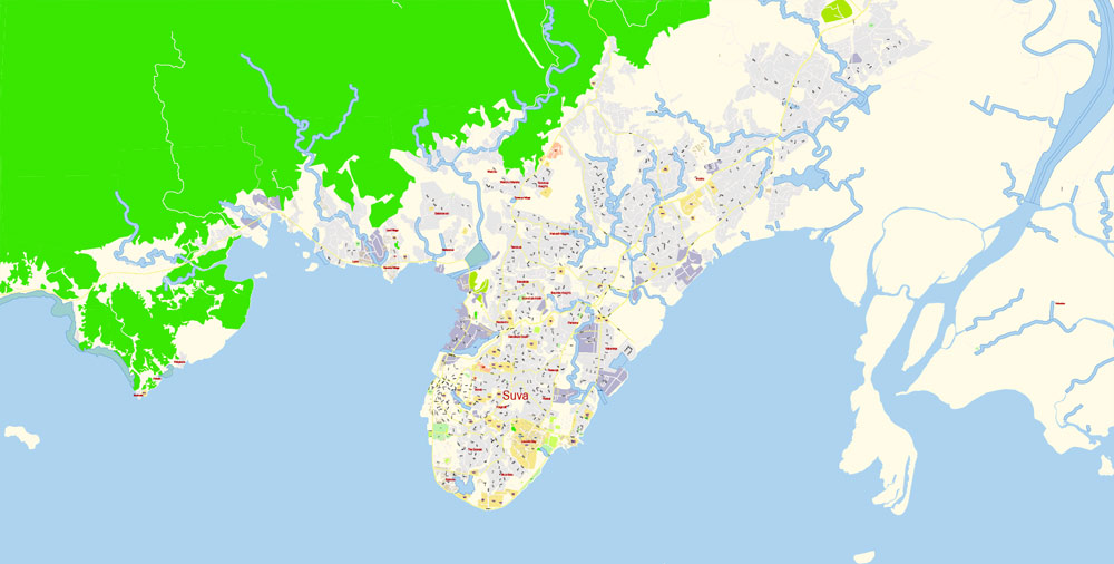
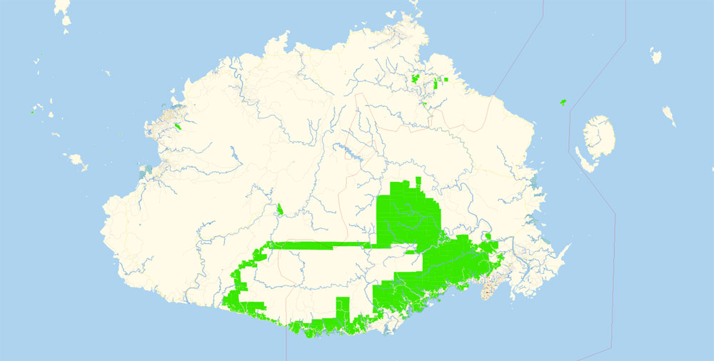
The highest point is Mount Tomanivi on Viti Levu. Viti Levu hosts the capital city of Suva, and is home to nearly three-quarters of the population. Other important towns include Nadi (the location of the international airport), and Lautoka, Fiji’s second city with large sugar cane mills and a seaport.
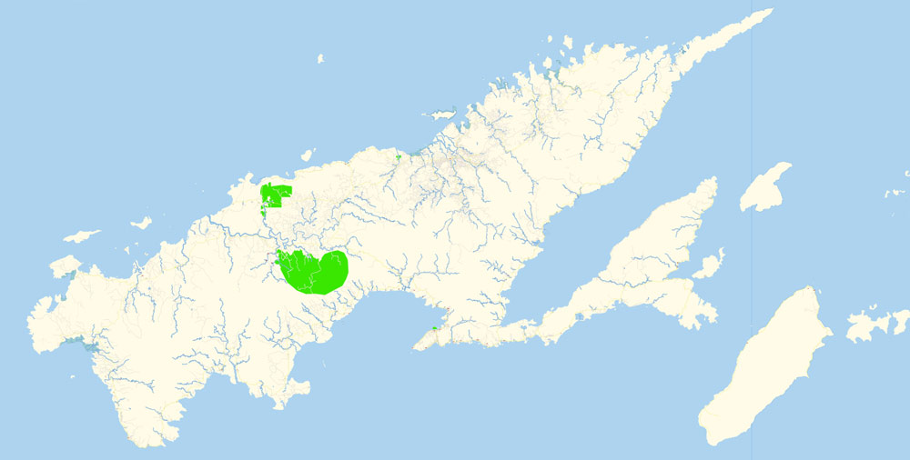
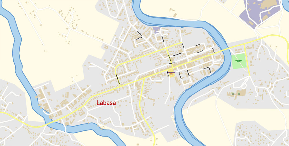
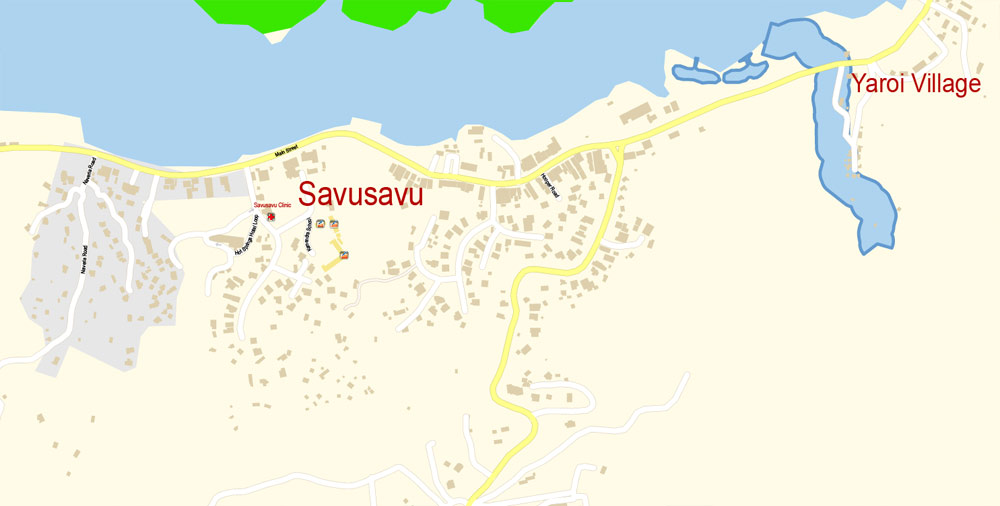
The main towns on Vanua Levu are Labasa and Savusavu. Other islands and island groups include Taveuni and Kadavu (the third and fourth largest islands, respectively), the Mamanuca Group (just off Nadi) and Yasawa Group, which are popular tourist destinations, the Lomaiviti Group, off Suva, and the remote Lau Group.
You will probably want to change the color scheme used on our Fiji vector city map.
To quickly and effectively play with colors.
Of course, you can do it manually, all objects in our Fiji city vector map are divided according to types and layers, and you can easily change the color gamma of vector objects in groups and layers.
But there is more effective way of working with the whole VECTOR MAP of Fiji city and all layers:
The overview dialog «Edit colors»/«Repaint Graphic Object» (this dialog box name can change depending on the context):
If you have selected a part or a layer of Fiji city vector map and open the dialog box by clicking the icon in the Control panel, on the Samples palette or the Color Catalog, or if you choose Edit > Edit Colors> Repaint Graphic Object, then the «Repaint Graphic Object» dialog box appears, and you get access to «Assign» and «Edit» tabs.
Rotuma, some 270 nautical miles (500 km; 310 mi) north of the archipelago, has a special administrative status in Fiji.
Take a look, who purchases our vector maps of Fiji city in “Our Clients and Friends” page – these are large and small companies, from super-brands like Volvo and Starbucks, to small design studios and printing houses.
If a picture or a map fragment is not selected, and you open the dialog box by clicking the icon in the Control panel, on the Samples palette or in the Color Catalog, the «Edit Colors» dialog box appears and you can only access the «Edit» tab.
Regardless of the name at the top of the dialog box, the right-hand side always displays the color group of the current document, as well as two default color groups: Print Color and Grayscale. These color groups can be selected and used any time.
Create and edit color groups of Fiji city vector map, and also assign colors using the «Edit Colors»/ а «Repaint Graphic Object» dialog box.
Fiji was also divided into 3 Confederacies or Governments during the reign of Seru Epenisa Cakobau, though these are not considered political divisions, they are still considered important in the social divisions of the indigenous Fijians
Printable vector maps of Fiji city are much more convenient and efficient than any electronic maps on your smartphone, because ALL DETAILS are displayed in the entire space of Fiji city map.
Useful tips on working with vector maps of cities and countries in Adobe Illustrator.
«V» – launches the Selection tool (cursor, black arrow), which makes active any vector line.
«А» – launches the Direct Selection tool (white cursor), allows you to select curve elements and drag them to the desired place.
«R» – activates the Rotate tool, which helps you rotating selected objects around the center point by 360 degrees.
«E» – gives you the opportunity to use the Eraser tool and erase unnecessary parts.
«X» – switches between Fill and Stroke in the Tools section. Try to get used to this hot key and
you will quickly understand that you can’t live and work without it.
Guides are not limited to vertical and horizontal in Adobe Illustrator. You can also create a diagonal guide for example. Moreover, you can turn any contours into guides. Select the outline and go to View > Guides > Make Guides (Create Guides), or simply press Cmd/Ctrl + 5. You can also turn the guides back into an editable object. Go to menu, View > Guides > Unlock Guides (Release Guides), select the guide you want to edit and select View > Guides > Release Guides (Reset Guides), or just press Cmd/Ctrl + Option / Alt + 5).
Any color group can be selected and edited, or used to redefine the colors in the selected vector map of Fiji city, its fragments or elements.
Saving a color group adds this group to the specified list.
Opening the «Edit Colors»/«Repaint Graphic Object» dialog box.
Open the «Edit Colors»/«Repaint Graphic Object» dialog box using one of the following methods:
«Edit»> «Edit Colors»> «Repaint Graphic object» or «Repaint With Style».
Use these commands if you need to edit the colors in the selected vector map of Fiji city.
«Repaint Graphic object» button on the «Control» panel.
Use this button if you need to adjust colors of Fiji city vector map using the а «Repaint graphic object» dialog box.
The specified button is available if the selected vector map or its fragment contains two or more colors.
Note. This color editing method is convenient for global color adjustment in a vector map, if global colors were not used when creating a City Map of Fiji.
If the map file is too large and your computer freezes or even can’t open it quickly:
1. Try to reduce the color resolution of the video card (display) to 256 colors while working with a large map.
2. Using Windows Task Manager, select all the application you don’t need, while working with map, just turn them off.
3. Launch Adobe Illustrator. (DO NOT OPEN the vector map file)
4. Start the Windows Task Manager using administrator rights > Find the “Illustrator” process > set the «real time» priority,
5. Open the file. When you see the LEGACY FONT popup window – click “OK” (do not update). You can restore the TEXT later.
6. Can also be useful: When file is opened – Edit > Settings > Basic Settings > disable smoothing. /// It looks scary, but works quickly)))
We recommend saving the file in Adobe Illustrator 10 version. It’s much more stable when working with VERY BIG size files.
Fiji
Country in Oceania
Fiji, a country in the South Pacific, is an archipelago of more than 300 islands. It’s famed for rugged landscapes, palm-lined beaches and coral reefs with clear lagoons. Its major islands, Viti Levu and Vanua Levu, contain most of the population. Viti Levu is home to the capital, Suva, a port city with British colonial architecture. The Fiji Museum, in the Victorian-era Thurston Gardens, has ethnographic exhibits.
Capital: Suva
Currency: Fijian dollar
Continent: Oceania
Area
• Total 18,274 km2 (7,056 sq mi) (151st)
• Water (%) negligible
Population
• 2018 912,241 (161st)
• 2017 census 884,887
• Density 46.4/km2 (120.2/sq mi) (148th)
Free vector map World, Adobe Illustrator, download now maps vector clipart
Map for design, projects, presentation free to use as you like.
See also: TERMS & CONDITIONS: SOFTWARE LICENSE AGREEMENT FOR DIGITAL CARTOGRAPHIC DATA.

 Author: Kirill Shrayber, Ph.D. FRGS