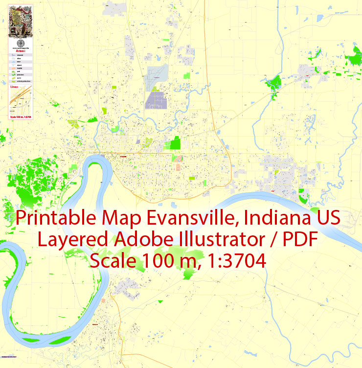
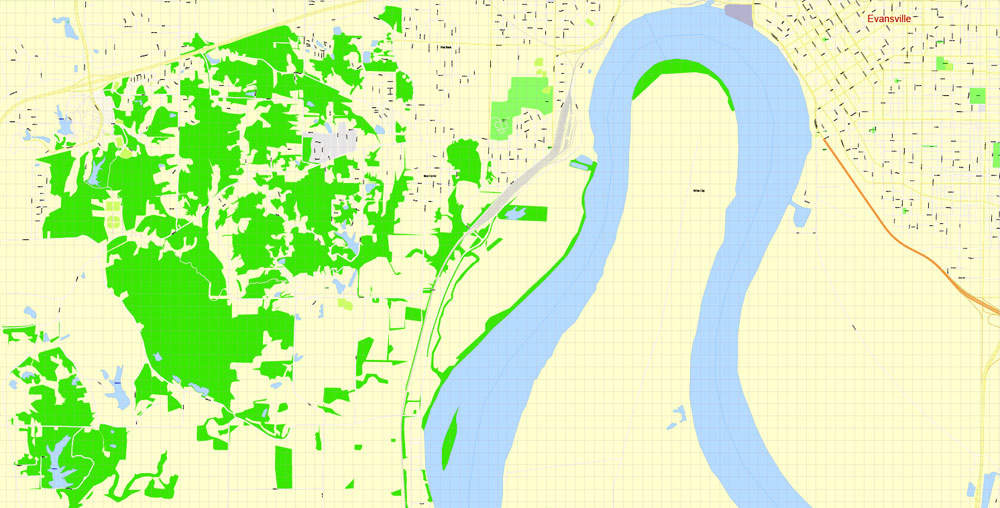
Editable PDF Map Evansville, Indiana US, exact vector City Plan Map street G-View Level 17 (100 meters scale 1:3704) full editable, Adobe PDF, full vector, scalable, editable text format street names, 22 mb ZIP
All streets named, Main Objects, no buildings. Map for design, printing, arts, projects, presentations, for architects, designers and builders, business, logistics.
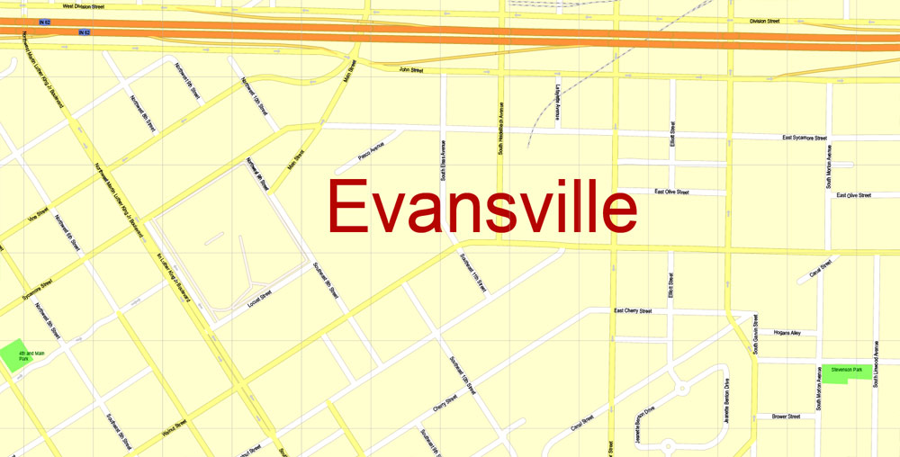
Layers: color fills, streets_roads, arrows_streets, labels_roads, objects, names_objects, names_streets, names_places, grids, legend.
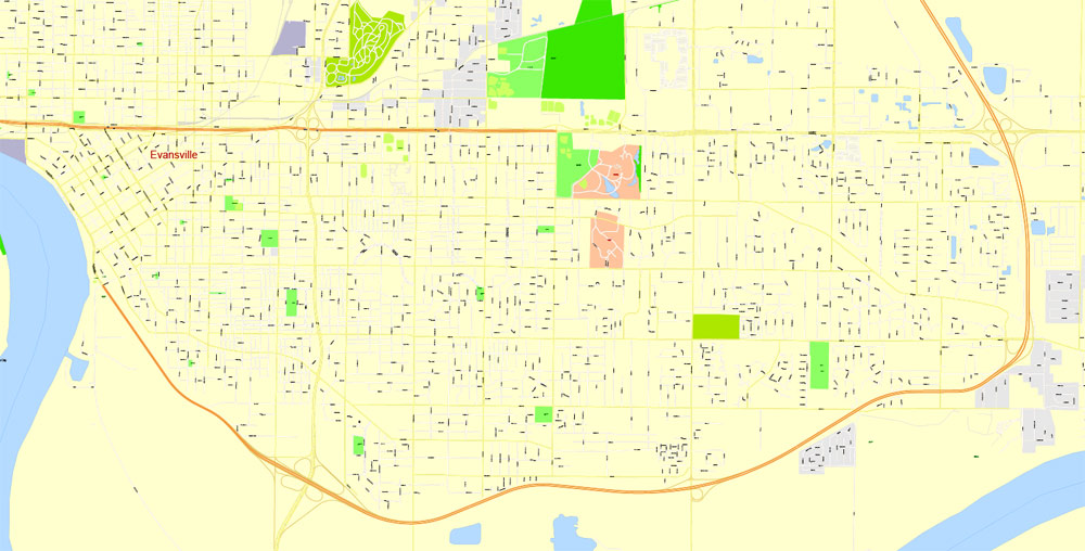
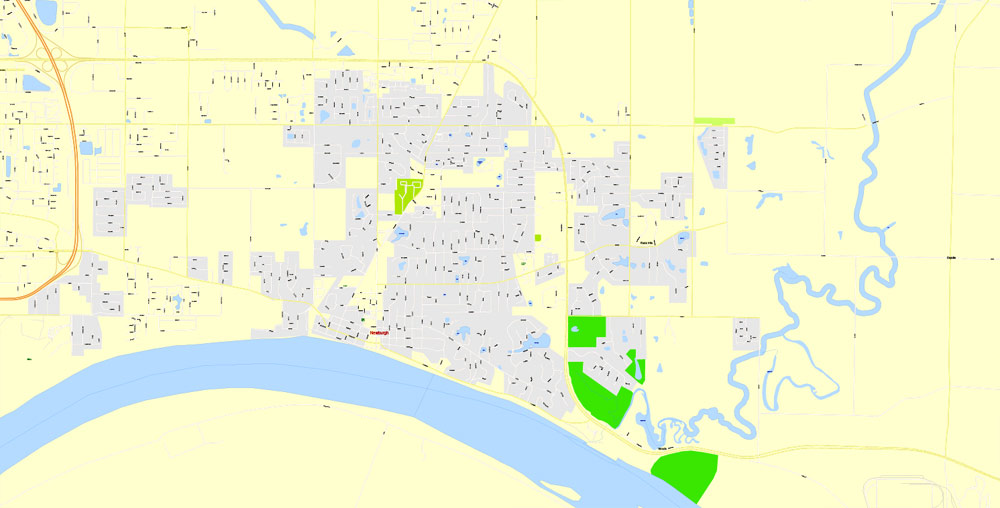
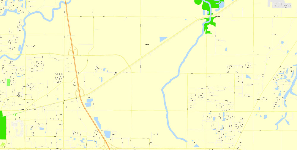
The most exact and detailed map of the city.
You can edit this file by Adobe Illustrator, Adobe Acrobat, Corel Draw.
DWG, DXF and other formats – on request, same price, please, contact
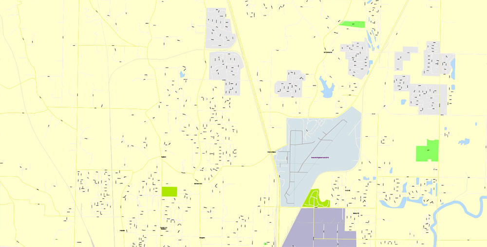
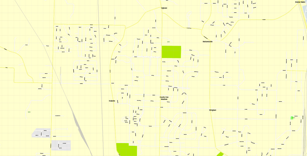
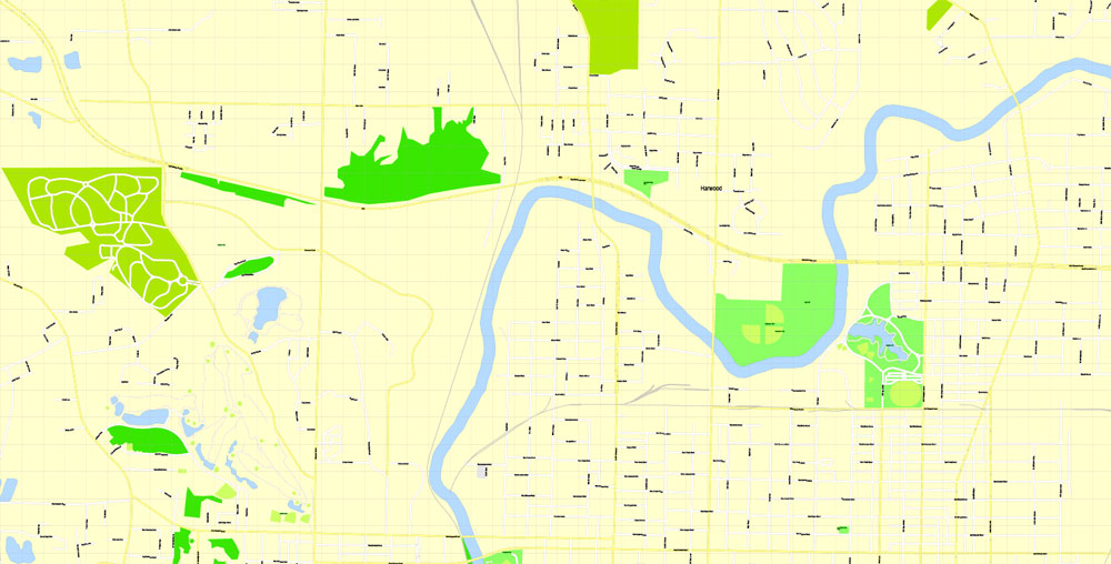
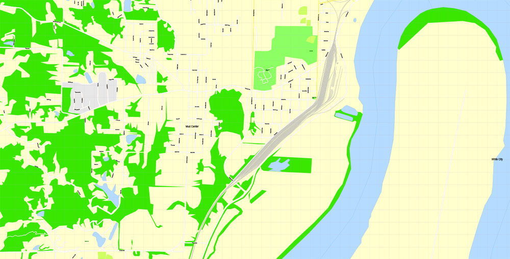
Evansville, Indiana, USA.
This vector map of Evansville city is used as a basis for design, editing, and further printing.
This is the most detailed, exact map of Evansville city for high-quality printing and polygraphy. You can always clarify the map development date by contacting us.
For your convenience, all objects on Evansville vector city map are divided into layers. And the editing is very easy – colors, lines, etc.
You can easily add any objects needed (e.g. shops, salons, sale points, gas station or attraction) on any layer of Evansville vector map.
Evansville is a city and the county seat of Vanderburgh County, Indiana, United States. The population was 117,429 at the 2010 census, making it the state’s third-most populous city after Indianapolis and Fort Wayne, the largest city in Southern Indiana, and the 232nd-most populous city in the United States. It is the commercial, medical, and cultural hub of Southwestern Indiana and the Illinois-Indiana-Kentucky tri-state area, home to over 911,000 people. The 38th parallel crosses the north side of the city and is marked on Interstate 69.
One of the advantages of Evansville city vector maps of our production is the relevance of cartographic data, we constantly update all our products.
This vector map of Evansville city is used by:
designers, layout designers, printers, advertisers and architects. Our product – vector maps – is designed for further editing and printing in large formats – from @Wall format (a few meters) to A-0 and A-1, A-2, A-3.
The Evansville city map in vector format is used for design, urban planning, presentations and media visualizations.
The advertising and presentation map of Evansville city (usually the final designer marks the routes, and puts the client’s objects (shops, saloons, gas stations etc.)
The undoubted advantage is that people will NEVER throw out this advertising product – the map. In fact, as an advertising medium, a city map is the most “long-playing” of the well-known polygraphic advertising media, with the longest lifespan, and the maximum number of interactions with the customer.
For travelers, maps are sold at the airports and gas stations around the world. Often the source is our vector maps.
Take a look, who purchases our vector maps of Evansville city in “Our Clients and Friends” page – these are large and small companies, from super-brands like Volvo and Starbucks, to small design studios and printing houses.
It’s very easy to work with vector maps of Evansville city, even for a not very experienced designer who can turn on and off the map layers, add new objects, change the colors of fill and lines according to customer requirements.
The undoubted advantage of Evansville city vector maps in printing is an excellent and detailed visualization, when customer can expand a large paper map and instantly define his location, find a landmark, an object or address on map, unlike using the popular electronic formats of Google and Yandex maps for example.
Printable vector maps of Evansville city are much more convenient and efficient than any electronic maps on your smartphone, because ALL DETAILS are displayed in the entire space of Evansville city map.
Useful tips on working with vector maps of cities and countries in Adobe Illustrator.
«V» – launches the Selection tool (cursor, black arrow), which makes active any vector line.
«А» – launches the Direct Selection tool (white cursor), allows you to select curve elements and drag them to the desired place.
«R» – activates the Rotate tool, which helps you rotating selected objects around the center point by 360 degrees.
«E» – gives you the opportunity to use the Eraser tool and erase unnecessary parts.
«X» – switches between Fill and Stroke in the Tools section. Try to get used to this hot key and
you will quickly understand that you can’t live and work without it.
Guides are not limited to vertical and horizontal in Adobe Illustrator. You can also create a diagonal guide for example. Moreover, you can turn any contours into guides. Select the outline and go to View > Guides > Make Guides (Create Guides), or simply press Cmd/Ctrl + 5. You can also turn the guides back into an editable object. Go to menu, View > Guides > Unlock Guides (Release Guides), select the guide you want to edit and select View > Guides > Release Guides (Reset Guides), or just press Cmd/Ctrl + Option / Alt + 5).
Situated on an oxbow in the Ohio River, the city is often referred to as the “Crescent Valley” or “River City”. As a testament to the Ohio’s grandeur, early French explorers named it La Belle Rivière (“The Beautiful River”). The area has been inhabited by various indigenous cultures for millennia, dating back at least 10,000 years. Angel Mounds was a permanent settlement of the Mississippian culture from 1000 AD to around 1400 AD. The European-American city was founded in 1812.
You will probably want to change the color scheme used on our Evansville vector city map.
To quickly and effectively play with colors.
Of course, you can do it manually, all objects in our Evansville city vector map are divided according to types and layers, and you can easily change the color gamma of vector objects in groups and layers.
But there is more effective way of working with the whole VECTOR MAP of Evansville city and all layers:
The overview dialog «Edit colors»/«Repaint Graphic Object» (this dialog box name can change depending on the context):
If you have selected a part or a layer of Evansville city vector map and open the dialog box by clicking the icon in the Control panel, on the Samples palette or the Color Catalog, or if you choose Edit > Edit Colors> Repaint Graphic Object, then the «Repaint Graphic Object» dialog box appears, and you get access to «Assign» and «Edit» tabs.
If a picture or a map fragment is not selected, and you open the dialog box by clicking the icon in the Control panel, on the Samples palette or in the Color Catalog, the «Edit Colors» dialog box appears and you can only access the «Edit» tab.
Regardless of the name at the top of the dialog box, the right-hand side always displays the color group of the current document, as well as two default color groups: Print Color and Grayscale. These color groups can be selected and used any time.
Create and edit color groups of Evansville city vector map, and also assign colors using the «Edit Colors»/ а «Repaint Graphic Object» dialog box.
A. Creating and editing of a color group on the «Edit» tab
B. Assigning colors on the «Assign» tab
C. Select a group of colors from the «Color groups» list
The option «Repaint a graphic object» in the lower part of the dialog box allows you to preview the colors on a selected layer of Vector map, or a group of elements, and specify whether its colors will be redefined when the dialog box is closed.
The main areas of the dialog box are:
«Edit»
The «Edit» tab is designed to create a new or edit the existing color groups.
The harmony rules Menu and the Color Wheel are used to conduct experiments with color harmonies. The color wheel shows how colors are related in color harmony, and the color bars allow you to view and manipulate an individual color values. In addition, you can adjust the brightness, add and remove colors, save color groups and view colors on the selected Vector Map of Evansville city or a separated layers.
«Assign»
The «Assign» tab is used to view and control on how the original colors are replaced with colors from the color group like your corporate colors in the Vector Map of Evansville city.
The assign color ability is provided only if the entire map, layer or fragment is selected in the document. You can specify which of new colors replace the current colors, whether the spot colors should be preserved and how colors are replaced (for example, you can replace colors completely or changing the color tone while maintaining the brightness). The «Assign» tab allows you to redefine colors in the Vector Map of Evansville city, or in separate layers and fragments using the current color group or reducing the number of colors in the current Vector Map.
Color groups
Is a list of all saved color groups for current document (the same groups appear in the «Samples» palette). You can edit and delete the existing color groups, as well as creating a new ones using the list of “Color Groups” in the dialog box. All changes appear in the «Samples» palette.
The highlighted color group shows, which color group is currently edited.
Any color group can be selected and edited, or used to redefine the colors in the selected vector map of Evansville city, its fragments or elements.
Saving a color group adds this group to the specified list.
Opening the «Edit Colors»/«Repaint Graphic Object» dialog box.
Open the «Edit Colors»/«Repaint Graphic Object» dialog box using one of the following methods:
«Edit»> «Edit Colors»> «Repaint Graphic object» or «Repaint With Style».
Use these commands if you need to edit the colors in the selected vector map of Evansville city.
«Repaint Graphic object» button on the «Control» panel.
Use this button if you need to adjust colors of Evansville city vector map using the а «Repaint graphic object» dialog box.
The specified button is available if the selected vector map or its fragment contains two or more colors.
Note. This color editing method is convenient for global color adjustment in a vector map, if global colors were not used when creating a City Map of Evansville.
The «Edit colors» button or «Edit or apply colors» on the «Color Catalog» palette
Click this button if you need to edit colors on the «Color Catalog» palette or edit and then apply them to the selected Vector Map of Evansville city or its fragment.
The «Edit color group» button or «Edit or apply color group» on the «Samples» palette.
Click this button if you need to edit the colors in the specific color group or edit and apply them to the selected Vector Map of Evansville city or a group of its elements, for example, the whole layer “Streets and lines”. You can also double-click the color group in the Samples panel to open the dialog box.
If the map file is too large and your computer freezes or even can’t open it quickly:
1. Try to reduce the color resolution of the video card (display) to 256 colors while working with a large map.
2. Using Windows Task Manager, select all the application you don’t need, while working with map, just turn them off.
3. Launch Adobe Illustrator. (DO NOT OPEN the vector map file)
4. Start the Windows Task Manager using administrator rights > Find the “Illustrator” process > set the «real time» priority,
5. Open the file. When you see the LEGACY FONT popup window – click “OK” (do not update). You can restore the TEXT later.
6. Can also be useful: When file is opened – Edit > Settings > Basic Settings > disable smoothing. /// It looks scary, but works quickly)))
We recommend saving the file in Adobe Illustrator 10 version. It’s much more stable when working with VERY BIG size files.
Four NYSE companies (Accuride, Berry Global, OneMain Financial, and Vectren) are headquartered in Evansville, along with the global operations center for NYSE company Mead Johnson. Three other companies traded on the NASDAQ (Escalade, Old National Bank, and Shoe Carnival) are also headquartered in Evansville. The city is home to public and private enterprise in many areas, as Evansville serves as the region’s economic hub.
A tourist destination, Evansville is home to Tropicana Evansville, the state’s first casino; Mesker Park Zoo and Botanic Garden, one of the state’s oldest and largest zoos; and sports tourism industry. The city has several educational institutions. The University of Evansville is a small private school on the city’s east side, while the University of Southern Indiana is a larger public institution just outside the city’s westside limits. Other local educational institutions include the nationally ranked Signature School and the Evansville Vanderburgh Public Library. In 2008, Evansville was voted the best city in the country in which “to live, work, and play” by the readers of Kiplinger, and in 2009 as the 11th best.
Geography
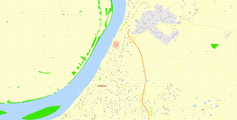
The Evansville Metropolitan Area, the 142nd largest in the United States, includes four Indiana counties (Gibson, Posey, Vanderburgh, and Warrick) and two Kentucky counties (Henderson, and Webster). The metropolitan area does not include Owensboro, Kentucky, which is an adjacent metropolitan area about 30 miles (48 km) southeast of Evansville. This area is sometimes referred to as “Kentuckiana”, although the area is usually referred to as the “Tri-State” by the local media. Evansville is at 37°58’38” north, 87°33’2″ west (37.977166, −87.550566). According to the 2010 census, Evansville has an area of 44.622 square miles (115.57 km2), of which 44.15 square miles (114.35 km2) (or 98.94%) is land and 0.472 square miles (1.22 km2) (or 1.06%) is water.
Topography
The city’s southern boundary lies on an oxbow in the Ohio River. Most of the city lies in a shallow valley surrounded by low rolling hills. The city’s west side is built on these rolling hills and is home to Burdette Park, Mesker Amphitheatre, and Mesker Park Zoo. The eastern portion developed in the valley and is protected by a series of levees that closely follow the path of I164-69. Notable landmarks on the east side are the 240-acre (1.0 km2) Wesselman Woods Nature Preserve and the Angel Mounds State Historic Site, just southeast of Evansville, between Evansville and Newburgh.
Cityscape
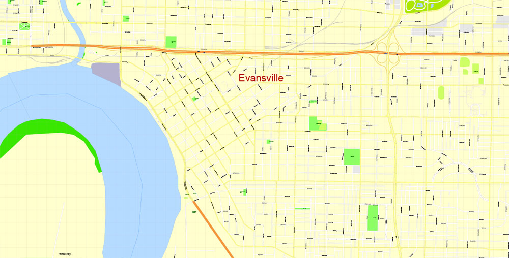
Evansville’s original downtown plat was made on about 200 acres, with streets running parallel to the river from northwest to southeast. Other streets nearby were later laid out on the cardinal points, due north-south, and east-west. Thus, anyone entering or leaving downtown finds the street makes a confusing oblique-angle turn in one direction or another. In the 1970s, the city suffered from problems such as decreased economic activity and suburban flight, but city-sponsored revitalization has improved downtown conditions.
The business district and riverfront feature riverboat gambling, restaurants, bars, and shops that attract tens of thousands of visitors each year. Although much of the outer city’s architecture is typical suburban design, the city’s downtown district retains early twentieth-century architecture. A few blocks east of the main business district is the Riverside district, featuring tree-lined brick streets full of turn of the twentieth-century homes. The Reitz Home Museum is one of the finest examples of French Second Empire architecture in the United States. Other homes nearby feature similar character and design and include Italianate, Colonial Revival, and Renaissance Revival styles.
Evansville
City in Indiana
Evansville is a city on the Ohio River in Indiana. Angel Mounds State Historic Site was home to prehistoric Native Americans, and has 12 earthen mounds, a museum and trails. Mesker Park Zoo and Botanic Garden houses jaguars and tropical plants. Evansville Museum of Arts, History and Science displays thousands of objects and has a planetarium. The Koch Family Children’s Museum has play-based interactive exhibits.
Area
• City 47.84 sq mi (123.90 km2)
• Land 47.35 sq mi (122.63 km2)
• Water 0.49 sq mi (1.27 km2)
• Metro 2,367 sq mi (6,130 km2)
Elevation 387 ft (118 m)
Population
• City 117,429
• Estimate 119,477
• Rank 1st in Vanderburgh County
1st in Southern Indiana
3rd in Indiana
223rd in the United States
• Density 2,523.43/sq mi (974.30/km2)
• Urban 229,351 (US: 159th)
• Metro 314,280 (US: 156th)
Free US vector maps

Free Download Vector Map US County and State Adobe Illustrator
Free_Vector_Map_US_States_County_Map.ai
Free Download Vector Map US County and State Adobe PDF
Free_Vector_Map_US_States_County_Map.pdf

Free Download Vector Map US With States Names, Adobe Illustrator
Free_Map_of_USA_with_state_names_en.ai
Free Download Vector Map US With States Names, Adobe PDF
Free_Map_of_USA_with_state_names_en.pdf
From WIKI
Free vector map World, Adobe Illustrator, download now maps vector clipart
Map for design, projects, presentation free to use as you like.
See also: TERMS & CONDITIONS: SOFTWARE LICENSE AGREEMENT FOR DIGITAL CARTOGRAPHIC DATA.
Need more USA Vector Maps, printable and editable?

 Author: Kirill Shrayber, Ph.D. FRGS
 Indiana US Map Vector City Plan High Detailed Street Map editable Adobe Illustrator in layers")

