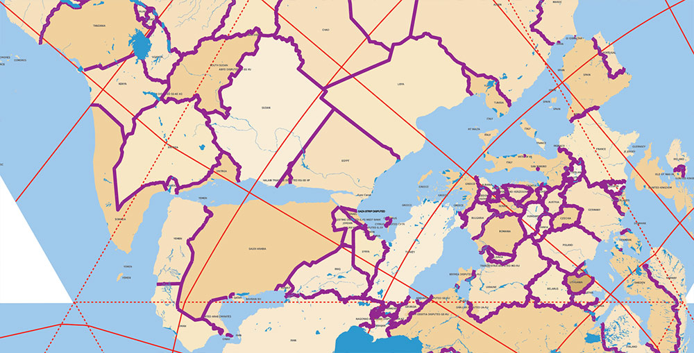
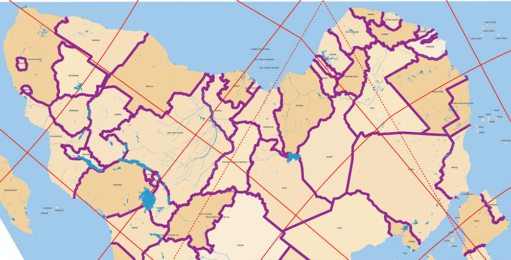
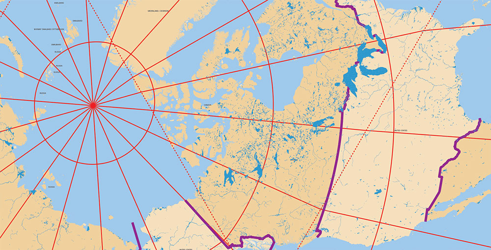
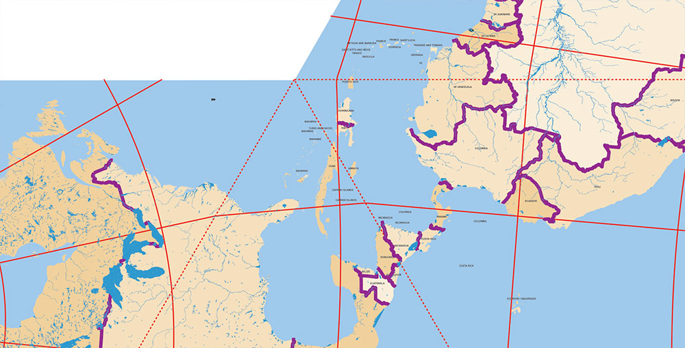
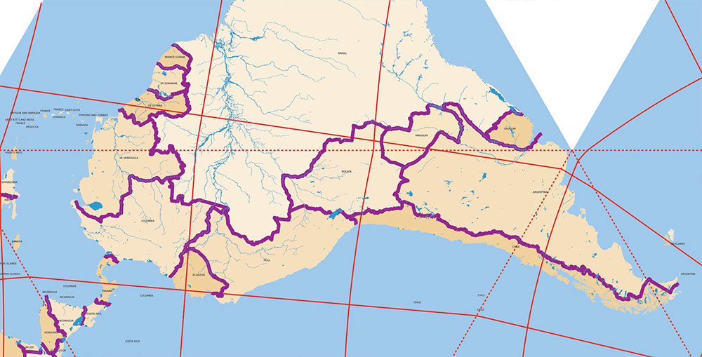
Extended Description of the Vector Map
PDF World Vector Map Precision Dymaxion Projection detailed Divided by layers by countries areasnames: Adobe PDF 40 MB in the ZIP archive.
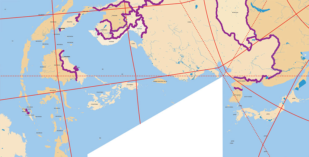
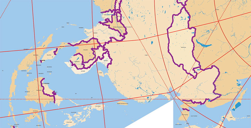
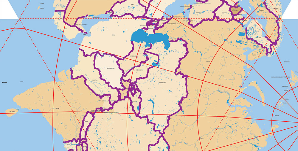
All disputed territories as of 2026 are marked.
Fully editable, layered.
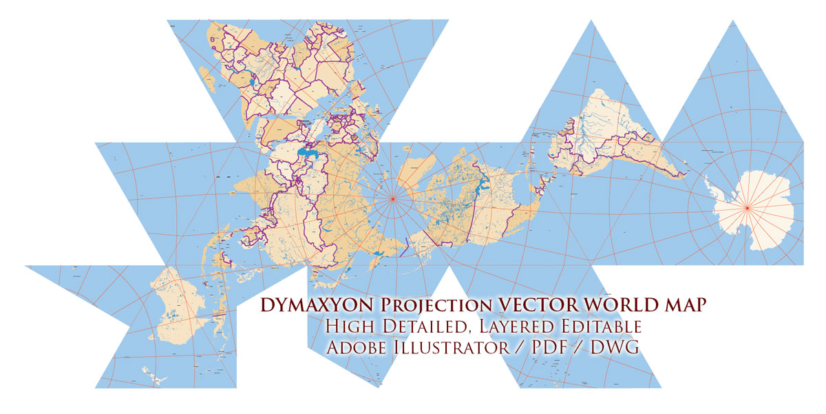
Dymaxion World PDF Vector Map Fuller Projection Adobe PDF Precision Areas
Content of Map:
- Grids Dymaxion Projection lines layer
- Countries names layer
- The water inland objects (rivers, lakes)
- Country Boundaries *inland
- Country areas colored areas, layers with Mask layer
- The water inside objects (rivers, lakes)
- Sea / Ocean layer
Dymaxion Map Projection — Brief Overview
The Dymaxion map projection is an unconventional world map projection developed by Buckminster Fuller in the 1940s. Unlike traditional projections, it unfolds the surface of the Earth onto a polyhedron (most commonly an icosahedron), which is then flattened into a two-dimensional net.
Purpose and Concept
The primary goal of the Dymaxion projection is to minimize distortion of relative sizes and shapes of landmasses. It avoids privileging any continent or ocean and has no inherent “up” or “down” orientation, emphasizing the idea of Earth as a single, interconnected system.
Fuller described it as a way to show the planet as “one island in one ocean.”
Key Characteristics
-
Based on an icosahedral geometry
-
Low overall distortion compared to Mercator or cylindrical projections
-
No fixed orientation (north is not necessarily “up”)
-
Oceans can be split to preserve continental continuity
-
Preserves global spatial relationships better than most flat maps
Use in Military and Strategic Contexts
Although not widely adopted for operational navigation, the Dymaxion projection has been used for strategic analysis and planning, particularly during the mid-20th century.
In military contexts, its value lies in:
-
Visualizing global theaters of operation without polar exaggeration
-
Understanding true intercontinental proximities
-
Planning long-range air routes and logistics
-
Emphasizing that many regions traditionally seen as distant are, in fact, closely connected
During World War II and the early Cold War period, similar polyhedral and great-circle–focused representations were explored for global strategy and airpower planning.
Application in Aeronautics and Navigation
For aeronautical and long-range navigation, the Dymaxion map is useful as a conceptual and planning tool, not as a direct navigational chart.
Its strengths include:
-
Clear representation of great-circle routes
-
Reduced polar distortion compared to Mercator
-
Better intuition for global air corridors
However:
Thus, it complements, rather than replaces, conventional aeronautical charts.
Contemporary Relevance
Today, the Dymaxion projection is primarily used in:
It remains influential as a reminder that map projections shape perception, and that alternative geometries can reveal hidden global relationships.
Dymaxion World PDF Vector Map Fuller Projection Adobe PDF Precision Areas
Dymaxion World PDF Vector Map Fuller Projection Adobe PDF Precision Areas
Dymaxion World PDF Vector Map Fuller Projection Adobe PDF Precision Areas
Dymaxion World PDF Vector Map Fuller Projection Adobe PDF Precision Areas
Dymaxion World PDF Vector Map Fuller Projection Adobe PDF Precision Areas
Dymaxion World PDF Vector Map Fuller Projection Adobe PDF Precision Areas
Dymaxion World PDF Vector Map Fuller Projection Adobe PDF Precision Areas
Dymaxion World PDF Vector Map Fuller Projection Adobe PDF Precision Areas

 Author: Kirill Shrayber, Ph.D. FRGS

