Extended Description of the Vector Map
Duisburg is a city of district subordination in the west of Germany, in North Rhine-Westphalia, near Düsseldorf. By the end of 2021, the population of Duisburg was 497.5 thousand inhabitants.
Area: 232.8 km²
Date of foundation: 883 AD
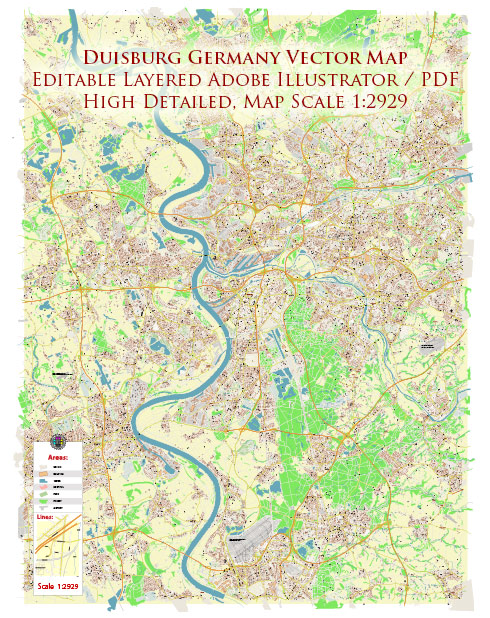
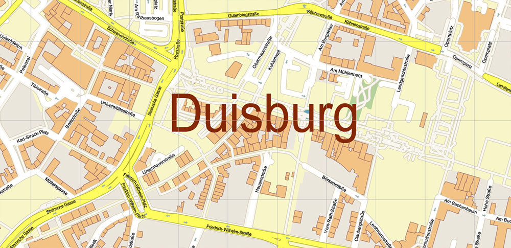
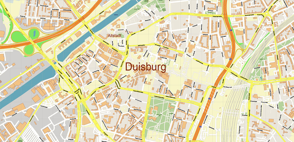
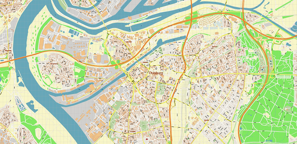
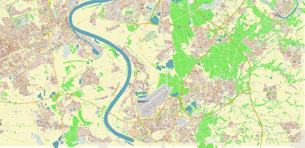
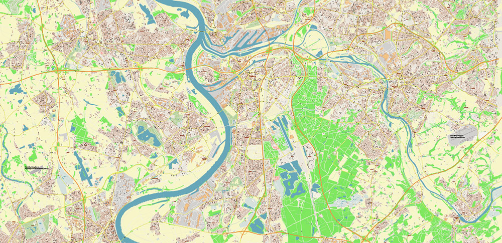
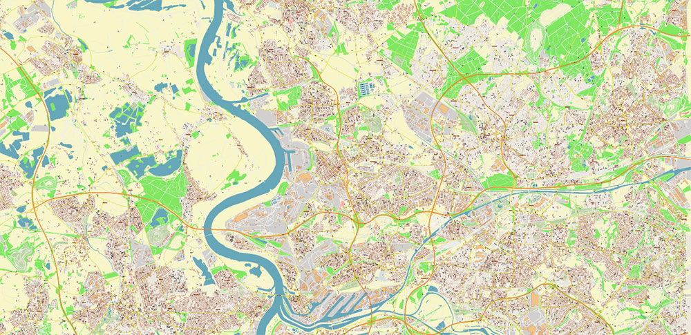
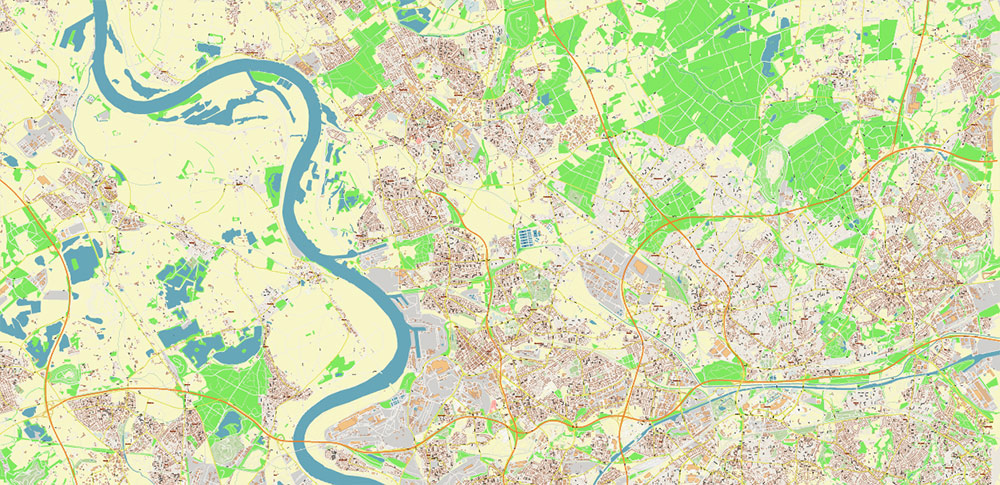
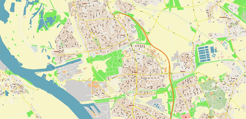
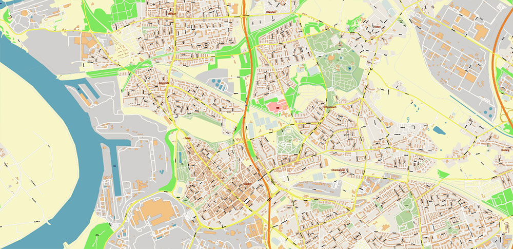
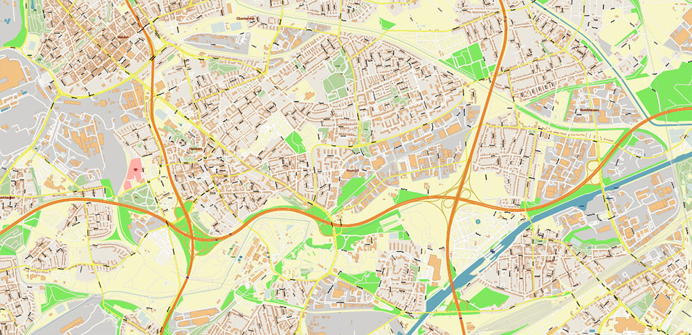
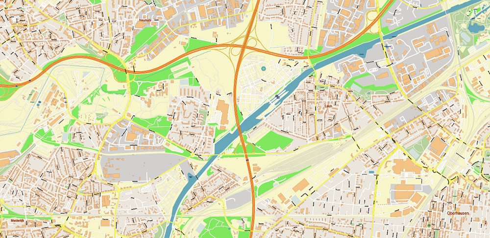
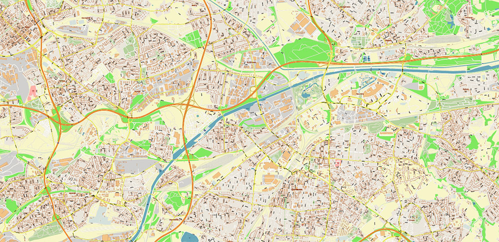
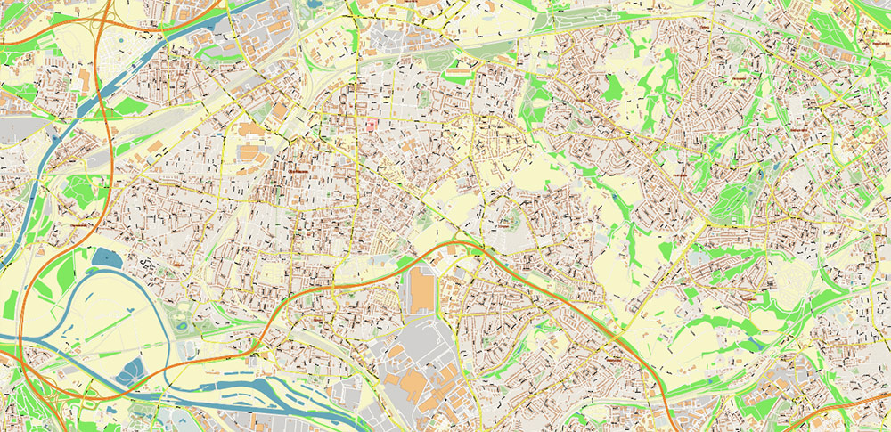
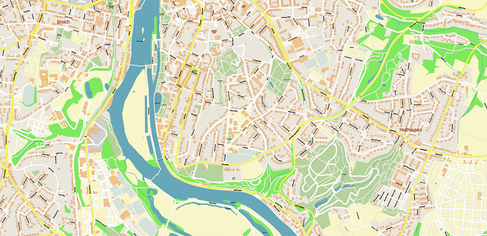
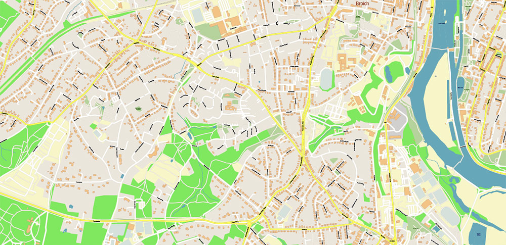
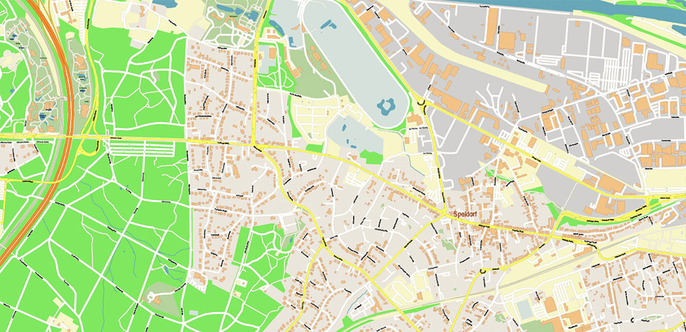
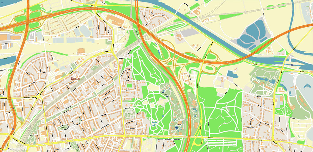
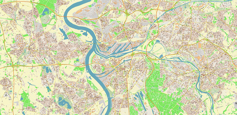
Duisburg Germany Map Vector City Plan High Detailed Street Map editable Adobe Illustrator in layers
Printable Vector Map of Duisburg Germany High Detailed City Plan scale 1:2929 full editable Adobe Illustrator Street Map in layers, scalable, text/curves format all names, 56 MB ZIP
All street names, Main Objects, Buildings. Map for design, printing, arts, projects, presentations, for architects, designers, and builders, business, logistics.
Also: We can add (additional layer for this map), any other objects for you. It’s free for our customers.
Also: We can add the RELIEF (Topo Isolines or shaded relief)
If you need any OTHER format – DWG, DXF, Corel, or something else – please, email us
Duisburg Germany Map Vector City Plan High Detailed Street Map editable Adobe Illustrator in layers
Druckbare Vektorkarte von Duisburg, Deutschland, hochdetaillierter Stadtplan, Maßstab 1:2929, vollständig bearbeitbare Adobe Illustrator-Straßenkarte in Ebenen, skalierbar, Text-/Kurvenformat, alle Namen, 56 MB ZIP
Alle Straßennamen, Hauptobjekte, Gebäude. Karte für Design, Druck, Kunst, Projekte, Präsentationen, für Architekten, Designer und Bauherren, Wirtschaft, Logistik.
Außerdem: Wir können (zusätzliche Ebene für diese Karte) beliebige andere Objekte für Sie hinzufügen. Für unsere Kunden ist es kostenlos.
Außerdem: Wir können das RELIEF hinzufügen (Topo Isolines oder schattiertes Relief)
Duisburg Germany Map Vector City Plan High Detailed Street Map editable Adobe Illustrator in layers
Layers list:
- Legend
- Grids
- Labels of roads
- Names of places (city, hamlet, etc.)
- Names of objects (hospitals, parks, water)
- Names of main streets
- Names of residential streets
- Arrows of street directions
- Main Streets, roads
- Residential streets
- Railroads
- Buildings
- Waterways
- Water objects (rivers, lakes, ponds, marshes)
- Airports and Heliports
- Color fills (parks, hospital areas, land use, etc.)
- Background
Duisburg Germany Map Vector City Plan High Detailed Street Map editable Adobe Illustrator in layers
Duisburg Germany Map Vector City Plan High Detailed Street Map editable Adobe Illustrator in layers
Duisburg Germany Map Vector City Plan High Detailed Street Map editable Adobe Illustrator in layers
Duisburg Germany Map Vector City Plan High Detailed Street Map editable Adobe Illustrator in layers
Duisburg Germany Map Vector City Plan High Detailed Street Map editable Adobe Illustrator in layers
Duisburg Germany Map Vector City Plan High Detailed Street Map editable Adobe Illustrator in layers
Duisburg Germany Map Vector City Plan High Detailed Street Map editable Adobe Illustrator in layers
Duisburg Germany Map Vector City Plan High Detailed Street Map editable Adobe Illustrator in layers
Duisburg Germany Map Vector City Plan High Detailed Street Map editable Adobe Illustrator in layers
Duisburg Germany Map Vector City Plan High Detailed Street Map editable Adobe Illustrator in layers
Duisburg Germany Map Vector City Plan High Detailed Street Map editable Adobe Illustrator in layers

Duisburg Germany Map Vector City Plan High Detailed Street Map editable Adobe Illustrator in layers
Duisburg Germany Map Vector City Plan High Detailed Street Map editable Adobe Illustrator in layers
Duisburg Germany Map Vector City Plan High Detailed Street Map editable Adobe Illustrator in layers
Duisburg Germany Map Vector City Plan High Detailed Street Map editable Adobe Illustrator in layers
Duisburg Germany Map Vector City Plan High Detailed Street Map editable Adobe Illustrator in layers
Duisburg Germany Map Vector City Plan High Detailed Street Map editable Adobe Illustrator in layers

 Author: Kirill Shrayber, Ph.D. FRGS