Dresden vector map Atlas 100 parts. Germany, Europe
Archive size: 33 Mb, zipped .AI
DPI: 300
License: Royalty Free
Dresden (Germany) vector maps in Adobe Illustrator format (.AI) features (check the preview images):
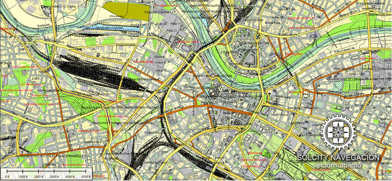
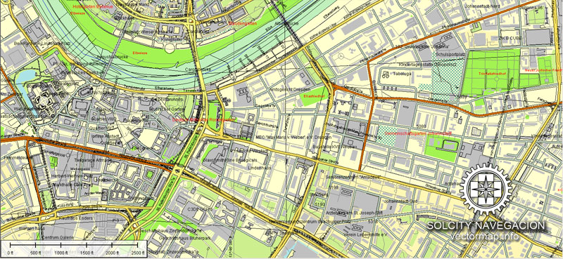
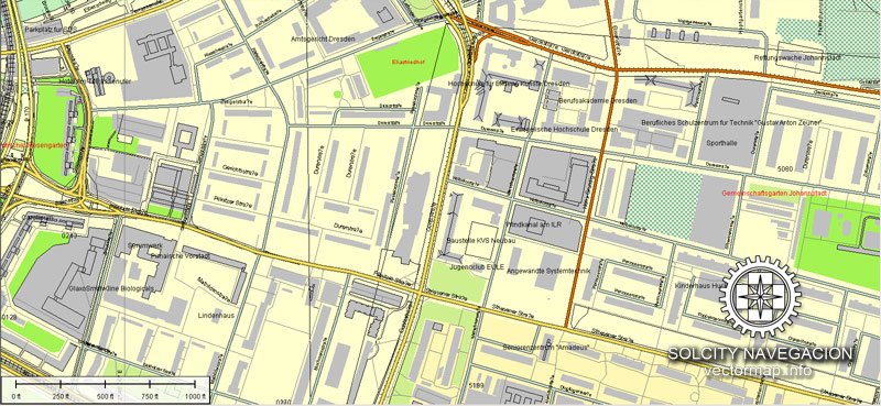
Highways with names,
Major streets with names,
Major Roads,
Dam,
National Park Borders,
Minor Roads,
Big and small Rivers, small streams also,
Lake, ponds and other water bodies,
Landmark fill,
Houses,
Railway
Recreation zones,
Parks.
We provide detailed maps of Dresden (Deutschland) in AI. Being vector maps, they are completely editable, and scalable. No matter what big is the print size you need (office wall mural o bigboard). This vector maps of Dresden are fully customisable, you can turn on or off the layer you need, also complete map with objects needed, like your company logo for example.
Please also check other vector maps of Germany.
Dresden, Germany.
This vector map of Dresden is used as a basis for design, editing, and further printing.
This is the most detailed, exact map of Dresden for high-quality printing and polygraphy. You can always clarify the map development date by contacting us.
For your convenience, all objects on Dresden vector map are divided into layers. And the editing is very easy – colors, lines, etc.
You can easily add any objects needed (e.g. shops, salons, sale points, gas station or attraction) on any layer of Dresden vector map.
Dresden is the capital city and, after Leipzig, the second-largest city of the Free State of Saxony in Germany. It is situated in a valley on the River Elbe, near the border with the Czech Republic.
One of the advantages of Dresden vector maps of our production is the relevance of cartographic data, we constantly update all our products.
This vector map of Dresden is used by:
designers, layout designers, printers, advertisers and architects. Our product – vector maps – is designed for further editing and printing in large formats – from @Wall format (a few meters) to A-0 and A-1, A-2, A-3.
Dresden map in vector format is used for design, urban planning, presentations and media visualizations.
Advertising and presentation map of Dresden (usually the final designer marks the routes, and puts the client’s objects (shops, saloons, gas stations etc.)
The undoubted advantage is that people will NEVER throw out this advertising product – the map. In fact, as an advertising medium, a map is the most “long-playing” of the well-known polygraphic advertising media, with the longest lifespan, and the maximum number of interactions with the customer.
For travelers, maps are sold at the airports and gas stations around the world. Often the source is our vector maps.
Take a look, who purchases our vector maps of Dresden in “Our Clients and Friends” page – these are large and small companies, from super-brands like Volvo and Starbucks, to small design studios and printing houses.
It’s very easy to work with vector maps of Dresden, even for a not very experienced designer who can turn on and off the map layers, add new objects, change the colors of fill and lines according to customer requirements.
The undoubted advantage of Dresden vector maps in printing is an excellent and detailed visualization, when customer can expand a large paper map and instantly define his location, find a landmark, an object or address on map, unlike using the popular electronic formats of Google and Yandex maps for example.

Printable vector maps of Dresden are much more convenient and efficient than any electronic maps on your smartphone, because ALL DETAILS are displayed in the entire space of Dresden map.
Useful tips on working with vector maps of cities and countries in Adobe Illustrator.
«V» – launches the Selection tool (cursor, black arrow), which makes active any vector line.
«А» – launches the Direct Selection tool (white cursor), allows you to select curve elements and drag them to the desired place.
«R» – activates the Rotate tool, which helps you rotating selected objects around the center point by 360 degrees.
«E» – gives you the opportunity to use the Eraser tool and erase unnecessary parts.
«X» – switches between Fill and Stroke in the Tools section. Try to get used to this hot key and
you will quickly understand that you can’t live and work without it.
Guides are not limited to vertical and horizontal in Adobe Illustrator. You can also create a diagonal guide for example. Moreover, you can turn any contours into guides. Select the outline and go to View > Guides > Make Guides (Create Guides), or simply press Cmd/Ctrl + 5. You can also turn the guides back into an editable object. Go to menu, View > Guides > Unlock Guides (Release Guides), select the guide you want to edit and select View > Guides > Release Guides (Reset Guides), or just press Cmd/Ctrl + Option / Alt + 5).
You will probably want to change the color scheme used on our Dresden vector map.
To quickly and effectively play with colors.
Of course, you can do it manually, all objects in our Dresden vector map are divided according to types and layers, and you can easily change the color gamma of vector objects in groups and layers.
But there is more effective way of working with the whole VECTOR MAP of Dresden and all layers:
The overview dialog «Edit colors»/«Repaint Graphic Object» (this dialog box name can change depending on the context):
If you have selected a part or a layer of Dresden vector map and open the dialog box by clicking the icon in the Control panel, on the Samples palette or the Color Catalog, or if you choose Edit > Edit Colors> Repaint Graphic Object, then the «Repaint Graphic Object» dialog box appears, and you get access to «Assign» and «Edit» tabs.
If a picture or a map fragment is not selected, and you open the dialog box by clicking the icon in the Control panel, on the Samples palette or in the Color Catalog, the «Edit Colors» dialog box appears and you can only access the «Edit» tab.
Regardless of the name at the top of the dialog box, the right-hand side always displays the color group of the current document, as well as two default color groups: Print Color and Grayscale. These color groups can be selected and used any time.
Dresden has a long history as the capital and royal residence for the Electors and Kings of Saxony, who for centuries furnished the city with cultural and artistic splendor, and was once by personal union the family seat of Polish monarchs. The city was known as the Jewel Box, because of its baroque and rococo city centre. The controversial American and British bombing of Dresden in World War II towards the end of the war killed approximately 25,000 people, many of whom were civilians, and destroyed the entire city centre. After the war restoration work has helped to reconstruct parts of the historic inner city, including the Katholische Hofkirche, the Zwinger and the famous Semper Oper.
Create and edit color groups of Dresden vector map, and also assign colors using the «Edit Colors»/ а «Repaint Graphic Object» dialog box.
A. Creating and editing of a color group on the «Edit» tab
B. Assigning colors on the «Assign» tab
C. Select a group of colors from the «Color groups» list
The option «Repaint a graphic object» in the lower part of the dialog box allows you to preview the colors on a selected layer of Vector map, or a group of elements, and specify whether its colors will be redefined when the dialog box is closed.
The main areas of the dialog box are:
«Edit»
The «Edit» tab is designed to create a new or edit the existing color groups.
The harmony rules Menu and the Color Wheel are used to conduct experiments with color harmonies. The color wheel shows how colors are related in color harmony, and the color bars allow you to view and manipulate an individual color values. In addition, you can adjust the brightness, add and remove colors, save color groups and view colors on the selected Vector Map of Dresden or a separated layers.
«Assign»
The «Assign» tab is used to view and control on how the original colors are replaced with colors from the color group like your corporate colors in the Vector Map of Dresden.
The assign color ability is provided only if the entire map, layer or fragment is selected in the document. You can specify which of new colors replace the current colors, whether the spot colors should be preserved and how colors are replaced (for example, you can replace colors completely or changing the color tone while maintaining the brightness). The «Assign» tab allows you to redefine colors in the Vector Map of Dresden, or in separate layers and fragments using the current color group or reducing the number of colors in the current Vector Map.
Color groups
Is a list of all saved color groups for current document (the same groups appear in the «Samples» palette). You can edit and delete the existing color groups, as well as creating a new ones using the list of “Color Groups” in the dialog box. All changes appear in the «Samples» palette.
The highlighted color group shows, which color group is currently edited.
Any color group can be selected and edited, or used to redefine the colors in the selected vector map of Dresden, its fragments or elements.
Saving a color group adds this group to the specified list.
Opening the «Edit Colors»/«Repaint Graphic Object» dialog box.
Open the «Edit Colors»/«Repaint Graphic Object» dialog box using one of the following methods:
«Edit»> «Edit Colors»> «Repaint Graphic object» or «Repaint With Style».
Use these commands if you need to edit the colors in the selected vector map of Dresden.
«Repaint Graphic object» button on the «Control» panel.
Use this button if you need to adjust colors of Dresden vector map using the а «Repaint graphic object» dialog box.
The specified button is available if the selected vector map or its fragment contains two or more colors.

Note. This color editing method is convenient for global color adjustment in a vector map, if global colors were not used when creating a Map of Dresden.
The «Edit colors» button or «Edit or apply colors» on the «Color Catalog» palette
Click this button if you need to edit colors on the «Color Catalog» palette or edit and then apply them to the selected Vector Map of Dresden or its fragment.
The «Edit color group» button or «Edit or apply color group» on the «Samples» palette.
Click this button if you need to edit the colors in the specific color group or edit and apply them to the selected Vector Map of Dresden or a group of its elements, for example, the whole layer “Streets and lines”. You can also double-click the color group in the Samples panel to open the dialog box.
If the map file is too large and your computer freezes or even can’t open it quickly:
1. Try to reduce the color resolution of the video card (display) to 256 colors while working with a large map.
2. Using Windows Task Manager, select all the application you don’t need, while working with map, just turn them off.
3. Launch Adobe Illustrator. (DO NOT OPEN the vector map file)
4. Start the Windows Task Manager using administrator rights > Find the “Illustrator” process > set the «real time» priority,
5. Open the file. When you see the LEGACY FONT popup window – click “OK” (do not update). You can restore the TEXT later.
6. Can also be useful: When file is opened – Edit > Settings > Basic Settings > disable smoothing. /// It looks scary, but works quickly)))
We recommend saving the file in Adobe Illustrator 10 version. It’s much more stable when working with VERY BIG size files.
Since German reunification in 1990 Dresden is again a cultural, educational and political centre of Germany and Europe. The Dresden University of Technology is one of the 10 largest universities in Germany and part of the German Universities Excellence Initiative. The economy of Dresden and its agglomeration is one of the most dynamic in Germany and ranks first in Saxony. It is dominated by high-tech branches, often called “Silicon Saxony”. The city is also one of the most visited in Germany with 4.3 million overnight stays per year. The royal buildings are among the most impressive buildings in Europe. Main sights are also the nearby National Park of Saxon Switzerland, the Ore Mountains and the countryside around Elbe Valley and Moritzburg Castle. The most prominent building in the city of Dresden is the Frauenkirche. Built in the 18th century, the church was destroyed during World War II. The remaining ruins were left for 50 years as a war memorial, before being rebuilt between 1994 and 2005.
According to the Hamburgische Weltwirtschaftsinstitut (HWWI) and Berenberg Bank in 2017, Dresden has the fourth best prospects for the future of all cities in Germany.
Location
Dresden lies on both banks of the Elbe River, mostly in the Dresden Basin, with the further reaches of the eastern Ore Mountains to the south, the steep slope of the Lusatian granitic crust to the north, and the Elbe Sandstone Mountains to the east at an altitude of about 113 metres (371 feet). Triebenberg is the highest point in Dresden at 384 metres (1,260 feet).
With a pleasant location and a mild climate on the Elbe, as well as Baroque-style architecture and numerous world-renowned museums and art collections, Dresden has been called “Elbflorenz” (Florence of the Elbe). The incorporation of neighbouring rural communities over the past 60 years has made Dresden the twelfth largest urban district by area in Germany after Berlin, Hamburg and Cologne.
The nearest German cities are Chemnitz 62 kilometres (39 miles) to the southwest, Leipzig 100 kilometres (62 miles) to the northwest and Berlin 165 kilometres (103 miles) to the north. Prague, Czech Republic is about 150 kilometres (93 miles) to the south and to the east 200 kilometres (120 miles) is the Polish city of Wrocław.
Nature
Dresden is one of the greenest cities in all of Europe, with 63% of the city being green areas and forests. The Dresden Heath (Dresdner Heide) to the north is a forest 50 km2 in size. There are four nature reserves. The additional Special Conservation Areas cover 18 km2. The protected gardens, parkways, parks and old graveyards host 110 natural monuments in the city. The Dresden Elbe Valley is a former world heritage site which is focused on the conservation of the cultural landscape in Dresden. One important part of that landscape is the Elbe meadows, which cross the city in a 20 kilometre swath. Saxon Switzerland is an important nearby location.
You can edit all map data using different vector graphics editors like Adobe Illustrator, Freehand or CorelDraw, cropping, changing colors, fonts or borders, also adding your company logo or necessary objects. And also is a fully scalable map, no matter what size you need.
This vector map of Dresden is available in different vector formats (the same price): .AI, .CDR .DWG, .DXF, .EPS, .PDF.
Royalty Free license. You don`t pay extra: per volume sold; for each use; for period of use.
Dresden map with big “zoom” without quality degradation. The difference between raster and vector is that vector can be adjusted to any size you need with NO quality loss. Perfect for large-size printing (walls & billboards).
Probably, you need more objects to be added? Just tell us, we don`t charge for this work.
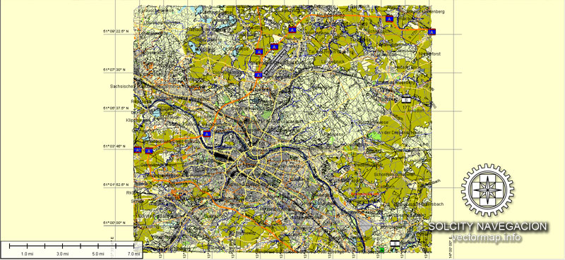
Dresden map (Germany, Europe) in vector. Cities and counties near
Our vector map of Dresden includes maps of the nearest areas (see the preview):
Friedrichstadt, Pieschen, Neustadt, Blasewitz, Loschwitz, Alberstadt, Reick, Leuben, Pillnitz, Prohlis, Dresdner Heide, Strehlen, Zschertnitz, Seevorstadt West, Rossthal, Leutewitz, Merbitz, Mobschatz, Kemnitz, Ubigau, Kaditz, Stetzsch, Gohlis, Niedergohlis, Oberwartha, Brabschutz, Weistropp, Constappel and others.
Dresden vector map for Adobe Illustrator. Purchasing and downloading.
We accept PayPal and Credit Card payment. After the payment you will be redirected to the download page.
The biggest base of Vector Maps. Maps containing streets with names, buildings, railways, airports or other objects needed.
[DE] Dresden Vektorkarte. Deutschland, Europa
Archivgröße: 33 Mb, Reißverschluss .AI
DPI: 300
Diese Vektorkarten von Dresden ist erstellt mit 2015 Daten.
Lizenz: Royalty Free
Dresden (Deutschland) Vektorkarten in Adobe Illustrator-Format (.AI) verfügt (überprüfen Sie die Vorschaubilder):
Autobahnen mit Namen,
Hauptstraßen mit Namen,
Hauptverkehrsstraßen,
Damm,
Nationalpark Borders,
Nebenstraßen,
Große und kleine Flüsse, kleine Bäche auch,
See, Teichen und anderen Gewässern,
Landmark-Füllung,
Häuser,
Eisenbahn
Erholungszonen,
Parks.
Wir bieten Ihnen detaillierte Karten von Dresden (Deutschland) in AI. Als Vektorkarten, sind sie vollständig bearbeitbare und skalierbare. Egal, welche groß ist der Druck-Größe Sie benötigen (Bürowandbild o bigboard). Diese Vektorkarten von Dresden sind völlig kundengerecht, können Sie aktivieren oder deaktivieren Sie die Ebene, die Sie benötigen, auch komplette Karte mit Objekten benötigt wird, wie Sie Ihr Firmenlogo zum Beispiel.
Bitte auch andere Vektorkarten von Deutschland.
Sie können alle Kartendaten unter Verwendung verschiedener Vektor-Grafik-Editoren wie Adobe Illustrator, Freehand oder CorelDRAW, Beschneiden, wechselnden Farben, Schriftarten und Rahmen, auch das Hinzufügen Ihr Firmenlogo oder notwendigen Objekte zu bearbeiten. Und ist auch eine voll skalierbare Karte, egal, welche Größe Sie benötigen.
Diese Vektor-Karte von Dresden ist in verschiedenen Vektor-Formate (zum gleichen Preis): .AI, .CDR DWG, DXF, EPS, PDF.
Lizenzfreie Lizenz. Sie don `t extra bezahlen: pro Volumen verkauft werden; für jede Anwendung; für die Zeit der Nutzung.
Karte Dresden mit großen “zoom” ohne Qualitätsverlust. Der Unterschied zwischen Raster- und Vektor ist, dass Vektor kann auf jede Größe Sie ohne Qualitätsverlust müssen eingestellt werden. Perfekt für großformatige Druck (Wände & Plakatwände).
Wahrscheinlich müssen Sie mehrere Objekte hinzugefügt werden? Sagen Sie uns einfach, wir `t Gebühr für diese Arbeit.
Dresden Karte (Deutschland, Europa) im Vektor. Städte und Landkreise in der Nähe
Unsere Vektor-Karte von Dresden enthält Karten ihrer Umgebung (siehe Vorschau):
Friedrichstadt, Pieschen, Neustadt, Blasewitz, Loschwitz, Alberstadt, Reick, Leuben, Pillnitz, Prohlis, Dresdner Heide, Strehlen, Zschertnitz, Seevorstadt West, Roßthal, Leutewitz, Merbitz, Mobschatz, Kemnitz, Übigau, Kaditz, Stetzsch, Gohlis, Niedergohlis, Oberwartha, Brabschutz, Weistropp, Constappel und andere.
Dresden Vektorkarte für Adobe Illustrator. Kaufen und Herunterladen.
Wir akzeptieren PayPal und Kreditkarten-Zahlung. Nach der Bezahlung werden Sie zur Download-Seite umgeleitet werden.
Der größte Basis von Vektorkarten. Karten enthalten Straßen mit Namen, Gebäude, Eisenbahnen, Flughäfen oder andere Gegenstände benötigt.
Small guide: How to work with the vector map?
You can: Mass select objects by type and color – for example, the objects type “building” (they are usually dark gray) – and remove them from the map, if you do not need them in your print or design project. You can also easily change the thickness of lines (streets), just bulk selection the road by the line color.
The streets are separated by type, for example, type “residential road” are usually white with a gray stroke. Highway usually orange with a brown or dark gray stroke.
All objects are divided by types: different types of roads and streets, polygons of buildings, landfills, urban areas, parks and more other.
It is easy to change the font of inscriptions, all or each individually. Also, just can be make and any other manipulation of objects on the vector map in Adobe illustrator format.
Important: All the proportions on the map are true, that is, the relative sizes of the objects are true, because Map is based on an accurate GPS projection, and It transated into the (usual for all) the Mercator projection.
You can easily change the color, stroke and fill of any object on the map, zoom without loss of quality Image Verification.


 Author: Kirill Shrayber, Ph.D. FRGS
 Street Map editable Adobe Illustrator in layers")
