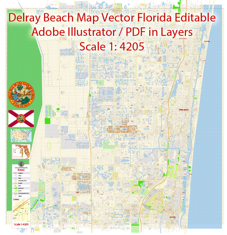
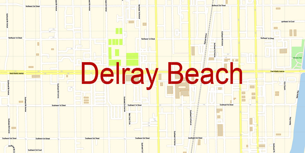
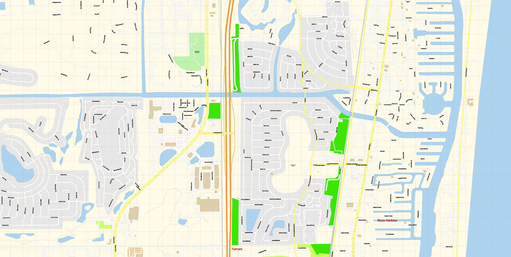
Printable Vector Map of Delray Beach Florida US detailed City Plan scale 1:4205 full editable Adobe Illustrator Street Map in layers , scalable, editable text format all names, 10 mb ZIP
All streets names, Main Objects, Principal Buildings. Map for design, printing, arts, projects, presentations, for architects, designers and builders, business, logistics.
Layers: color_fills, streets_roads, labels_roads, names_objects, names_streets, names_places, water, buildings, grids, legend.
The most exact and detailed map of the city in scale.
For Editing and High Quality Printing
DWG, DXF and other formats – on request, same price, please, contact
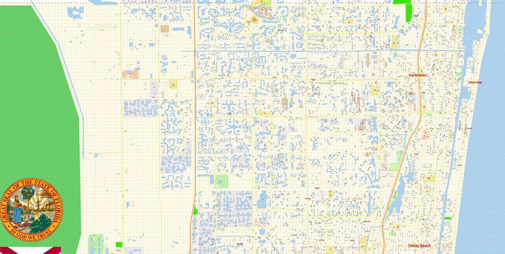
Delray Beach is a coastal city in Palm Beach County, Florida, United States. The population of Delray Beach was estimated at 67,371 in 2016.
The Delray Beach city map in vector format is used for design, urban planning, presentations and media visualizations.
That is up from 60,522 according to the 2010 United States Census. Delray Beach is a principal city of the Miami metropolitan area, which was home to an estimated 6,012,331 people in 2015.
Geography
Delray Municipal Beach, 2015.
This vector map of Delray Beach city is used by:
designers, layout designers, printers, advertisers and architects. Our product – vector maps – is designed for further editing and printing in large formats – from @Wall format (a few meters) to A-0 and A-1, A-2, A-3.
The specified button is available if the selected vector map or its fragment contains two or more colors.
Note. This color editing method is convenient for global color adjustment in a vector map, if global colors were not used when creating a City Map of Delray Beach.
The city’s eastern boundary includes 3 miles (4.8 km) of beachfront along the Atlantic Ocean.
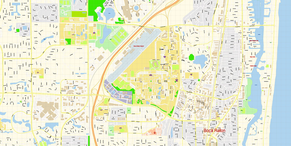
Directly to the south, the city is bordered by Boca Raton.
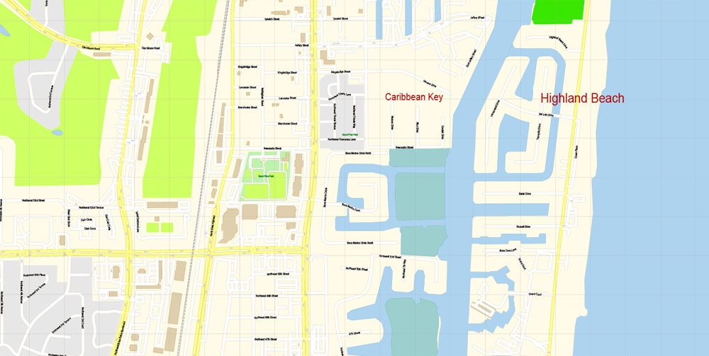
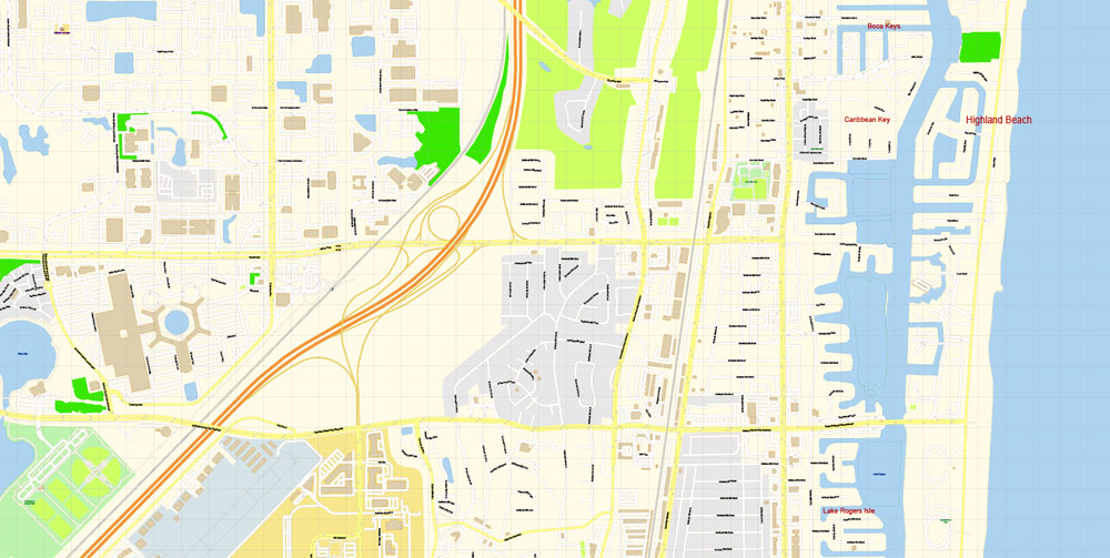
To the south and southeast, the city is bordered by Highland Beach on the same barrier island east of the Intracoastal Waterway.
You can easily add any objects needed (e.g. shops, salons, sale points, gas station or attraction) on any layer of Delray Beach vector map.
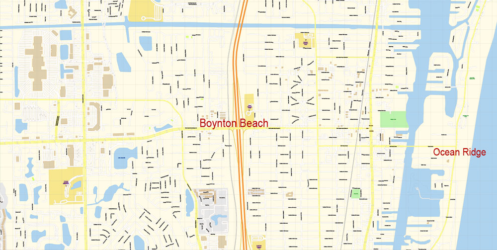
Directly to the north, the city is bordered by Boynton Beach.
To the north and northeast, the city is bordered by Gulf Stream on the barrier island and along a section of mainland east of U.S. Route 1.
The main areas of the dialog box are:
«Edit»
The «Edit» tab is designed to create a new or edit the existing color groups.
The harmony rules Menu and the Color Wheel are used to conduct experiments with color harmonies. The color wheel shows how colors are related in color harmony, and the color bars allow you to view and manipulate an individual color values. In addition, you can adjust the brightness, add and remove colors, save color groups and view colors on the selected Vector Map of Delray Beach city or a separated layers.
Printable vector maps of Delray Beach city are much more convenient and efficient than any electronic maps on your smartphone, because ALL DETAILS are displayed in the entire space of Delray Beach city map.
If a picture or a map fragment is not selected, and you open the dialog box by clicking the icon in the Control panel, on the Samples palette or in the Color Catalog, the «Edit Colors» dialog box appears and you can only access the «Edit» tab.
Regardless of the name at the top of the dialog box, the right-hand side always displays the color group of the current document, as well as two default color groups: Print Color and Grayscale. These color groups can be selected and used any time.
Useful tips on working with vector maps of cities and countries in Adobe Illustrator.
«V» – launches the Selection tool (cursor, black arrow), which makes active any vector line.
«А» – launches the Direct Selection tool (white cursor), allows you to select curve elements and drag them to the desired place.
«R» – activates the Rotate tool, which helps you rotating selected objects around the center point by 360 degrees.
«E» – gives you the opportunity to use the Eraser tool and erase unnecessary parts.
«X» – switches between Fill and Stroke in the Tools section. Try to get used to this hot key and
you will quickly understand that you can’t live and work without it.
For nine decades the Greater Delray Beach Chamber of Commerce has served as the hub of business where stakeholders intersect with government, technology, health care, education, economic development, tourism, arts, culture and non-profit interests.
For travelers, maps are sold at the airports and gas stations around the world. Often the source is our vector maps.
The «Edit colors» button or «Edit or apply colors» on the «Color Catalog» palette
Click this button if you need to edit colors on the «Color Catalog» palette or edit and then apply them to the selected Vector Map of Delray Beach city or its fragment.
The «Edit color group» button or «Edit or apply color group» on the «Samples» palette.
Click this button if you need to edit the colors in the specific color group or edit and apply them to the selected Vector Map of Delray Beach city or a group of its elements, for example, the whole layer “Streets and lines”. You can also double-click the color group in the Samples panel to open the dialog box.
If you are a business owner — whether large or small — the Chamber is the place where you can connect with every aspect that makes up the community.
Take a look, who purchases our vector maps of Delray Beach city in “Our Clients and Friends” page – these are large and small companies, from super-brands like Volvo and Starbucks, to small design studios and printing houses.
You’ll be amazed when you hear about the types of businesses that have relocated to Delray Beach in the last two years.
Guides are not limited to vertical and horizontal in Adobe Illustrator. You can also create a diagonal guide for example. Moreover, you can turn any contours into guides. Select the outline and go to View > Guides > Make Guides (Create Guides), or simply press Cmd/Ctrl + 5. You can also turn the guides back into an editable object. Go to menu, View > Guides > Unlock Guides (Release Guides), select the guide you want to edit and select View > Guides > Release Guides (Reset Guides), or just press Cmd/Ctrl + Option / Alt + 5).
Our long-time business owners coupled with our new up and coming entrepreneurs create a vibrant business landscape like no other.
The Greater Delray Beach Chamber of Commerce is one of only 300 chambers in the country which is accredited by the U.S. Chamber of Commerce, placing us in the top 3 percent of all chambers in the United States.
You will probably want to change the color scheme used on our Delray Beach vector city map.
To quickly and effectively play with colors.
Of course, you can do it manually, all objects in our Delray Beach city vector map are divided according to types and layers, and you can easily change the color gamma of vector objects in groups and layers.
But there is more effective way of working with the whole VECTOR MAP of Delray Beach city and all layers:
The overview dialog «Edit colors»/«Repaint Graphic Object» (this dialog box name can change depending on the context):
If you have selected a part or a layer of Delray Beach city vector map and open the dialog box by clicking the icon in the Control panel, on the Samples palette or the Color Catalog, or if you choose Edit > Edit Colors> Repaint Graphic Object, then the «Repaint Graphic Object» dialog box appears, and you get access to «Assign» and «Edit» tabs.
The undoubted advantage of Delray Beach city vector maps in printing is an excellent and detailed visualization, when customer can expand a large paper map and instantly define his location, find a landmark, an object or address on map, unlike using the popular electronic formats of Google and Yandex maps for example.
Assign
The «Assign» tab is used to view and control on how the original colors are replaced with colors from the color group like your corporate colors in the Vector Map of Delray Beach city.
The assign color ability is provided only if the entire map, layer or fragment is selected in the document. You can specify which of new colors replace the current colors, whether the spot colors should be preserved and how colors are replaced (for example, you can replace colors completely or changing the color tone while maintaining the brightness). The «Assign» tab allows you to redefine colors in the Vector Map of Delray Beach city, or in separate layers and fragments using the current color group or reducing the number of colors in the current Vector Map.
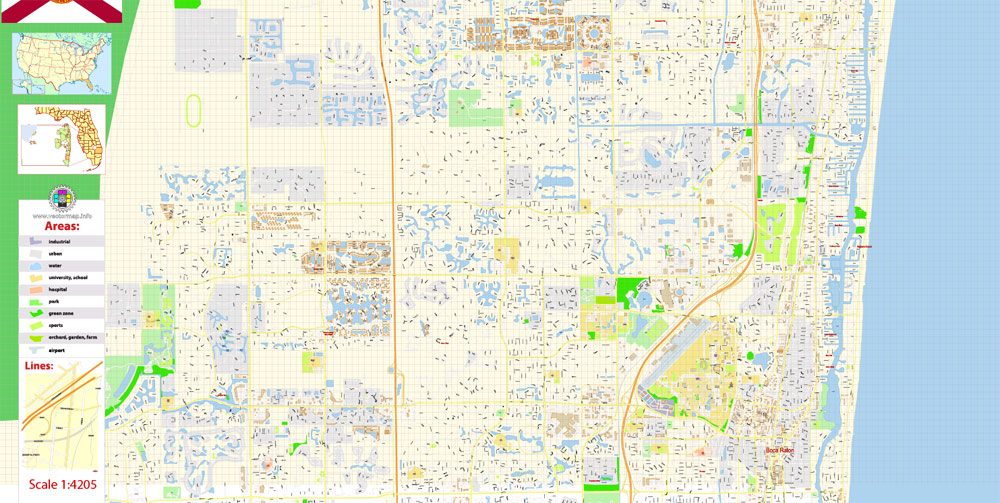
To the west, an urbanized area that includes High Point, Kings Point, Villages of Oriole, and multiple gated communities extends from the city’s western boundary to the Loxahatchee National Wildlife Refuge portion of the Everglades.
For your convenience, all objects on Delray Beach vector city map are divided into layers. And the editing is very easy – colors, lines, etc.
Many residences and businesses within this suburban corridor of unincorporated Palm Beach County possess a Delray Beach postal address despite technically lying outside the city limits. This area is sometimes referred to collectively and informally as “West Delray.”
Delray Beach’s location in Southeastern Palm Beach County is in the middle of Florida’s Gold Coast region.
According to the United States Census Bureau, the city of Delray Beach has a total land area of 15.81 miles (25.44 km).
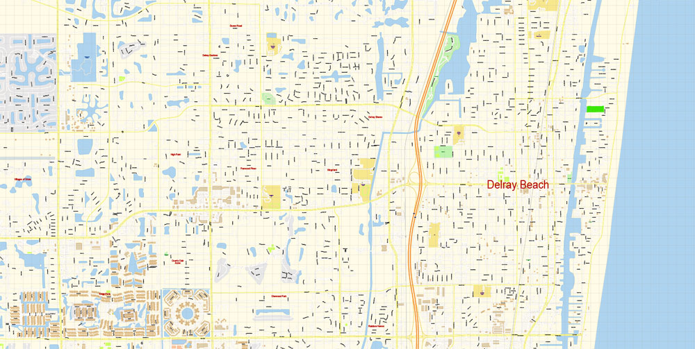
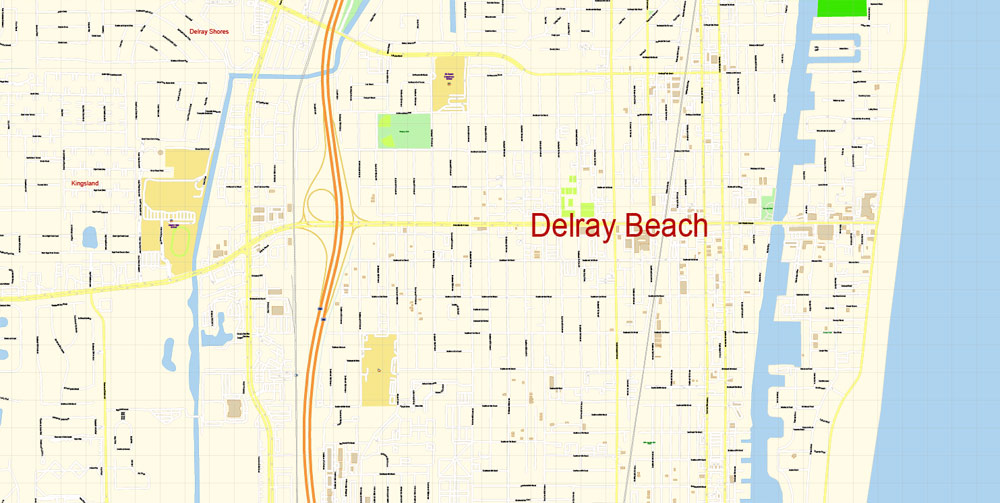
Downtown location
In earlier years downtown Delray was centered along Atlantic Avenue as far west as Swinton Avenue and as far east as the intracoastal waterway. Downtown has since expanded. By 2010, downtown extended west to I-95 and east as the Atlantic Ocean; The north-south boundaries extend roughly two blocks north and south of Atlantic Avenue.
One of the advantages of Delray Beach city vector maps of our production is the relevance of cartographic data, we constantly update all our products.
Create and edit color groups of Delray Beach city vector map, and also assign colors using the «Edit Colors»/ а «Repaint Graphic Object» dialog box.
A. Creating and editing of a color group on the «Edit» tab
B. Assigning colors on the «Assign» tab
C. Select a group of colors from the «Color groups» list
The option «Repaint a graphic object» in the lower part of the dialog box allows you to preview the colors on a selected layer of Vector map, or a group of elements, and specify whether its colors will be redefined when the dialog box is closed.
Saving a color group adds this group to the specified list.
Opening the «Edit Colors»/«Repaint Graphic Object» dialog box.
Open the «Edit Colors»/«Repaint Graphic Object» dialog box using one of the following methods:
«Edit»> «Edit Colors»> «Repaint Graphic object» or «Repaint With Style».
Use these commands if you need to edit the colors in the selected vector map of Delray Beach city.
«Repaint Graphic object» button on the «Control» panel.
Use this button if you need to adjust colors of Delray Beach city vector map using the а «Repaint graphic object» dialog box.
The advertising and presentation map of Delray Beach city (usually the final designer marks the routes, and puts the client’s objects (shops, saloons, gas stations etc.)
The undoubted advantage is that people will NEVER throw out this advertising product – the map. In fact, as an advertising medium, a city map is the most “long-playing” of the well-known polygraphic advertising media, with the longest lifespan, and the maximum number of interactions with the customer.
Color groups
Is a list of all saved color groups for current document (the same groups appear in the «Samples» palette). You can edit and delete the existing color groups, as well as creating a new ones using the list of “Color Groups” in the dialog box. All changes appear in the «Samples» palette.
The highlighted color group shows, which color group is currently edited.

Any color group can be selected and edited, or used to redefine the colors in the selected vector map of Delray Beach city, its fragments or elements.
If the map file is too large and your computer freezes or even can’t open it quickly:
1. Try to reduce the color resolution of the video card (display) to 256 colors while working with a large map.
2. Using Windows Task Manager, select all the application you don’t need, while working with map, just turn them off.
3. Launch Adobe Illustrator. (DO NOT OPEN the vector map file)
4. Start the Windows Task Manager using administrator rights > Find the “Illustrator” process > set the «real time» priority,
5. Open the file. When you see the LEGACY FONT popup window – click “OK” (do not update). You can restore the TEXT later.
6. Can also be useful: When file is opened – Edit > Settings > Basic Settings > disable smoothing. /// It looks scary, but works quickly)))
We recommend saving the file in Adobe Illustrator 10 version. It’s much more stable when working with VERY BIG size files.
It’s a whole new day at the Greater Delray Beach Chamber of Commerce. This year the community came together to create a new and improved Chamber – one the entire city can be proud of. After years of dreaming of new updated office space, our dream is finally a reality.
It’s very easy to work with vector maps of Delray Beach city, even for a not very experienced designer who can turn on and off the map layers, add new objects, change the colors of fill and lines according to customer requirements.
We invite you to visit our new home, meander around the visitor’s center (bursting with helpful information) and be sure to check out the state-of-the art meeting facilities.
This vector map of Delray Beach city is used as a basis for design, editing, and further printing.
You’ll find our staff is extremely welcoming and equipped to help you and your business grow to the next level. If you’re visiting Delray, we’d love to talk with you about all that our treasured Delray Beach has to offer. We’ll assist you in creating the most memorable vacation ever.
This is the most detailed, exact map of Delray Beach city for high-quality printing and polygraphy. You can always clarify the map development date by contacting us.
Delray Beach
City in Florida
Delray Beach is a small city on Florida’s southeast coast. The Pineapple Grove Arts District is dotted with public art and galleries. Nearby, Cornell Art Museum displays contemporary works. The lakeside Morikami Museum and Japanese Gardens offers tea ceremonies, calligraphy workshops and serene outdoor spaces. Wakodahatchee Wetlands is a park featuring a raised boardwalk with views of birds, turtles and alligators.
Area
• Total 16.33 sq mi (42.30 km2)
• Land 15.93 sq mi (41.25 km2)
• Water 0.41 sq mi (1.05 km2)
Elevation 9 ft (2.7 m)
Population
• Total 60,522
• Estimate (2016 67,371
• Density 4,229.72/sq mi (1,633.11/km2)
Free US vector maps

Free Download Vector Map US County and State Adobe Illustrator
Free_Vector_Map_US_States_County_Map.ai
Free Download Vector Map US County and State Adobe PDF
Free_Vector_Map_US_States_County_Map.pdf

Free Download Vector Map US With States Names, Adobe Illustrator
Free_Map_of_USA_with_state_names_en.ai
Free Download Vector Map US With States Names, Adobe PDF
Free_Map_of_USA_with_state_names_en.pdf
From WIKI
Free vector map World, Adobe Illustrator, download now maps vector clipart
Map for design, projects, presentation free to use as you like.
See also: TERMS & CONDITIONS: SOFTWARE LICENSE AGREEMENT FOR DIGITAL CARTOGRAPHIC DATA.
Need more USA Vector Maps, printable and editable?

 Author: Kirill Shrayber, Ph.D. FRGS


