Extended Description of the Vector Map
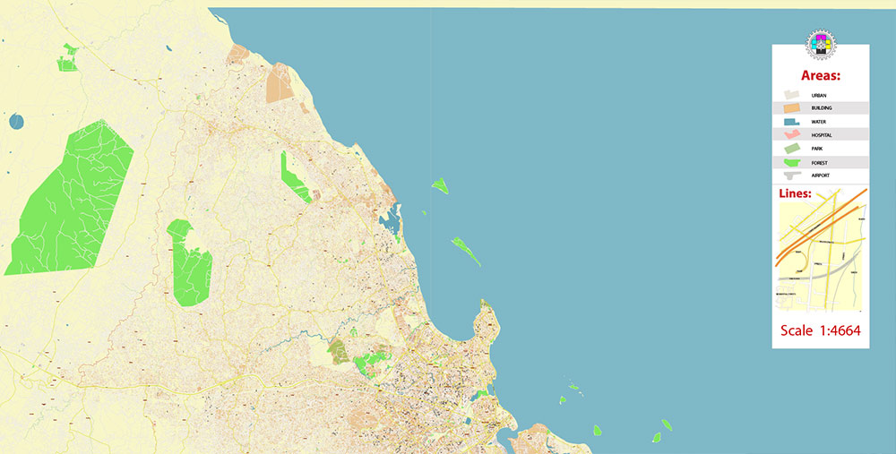
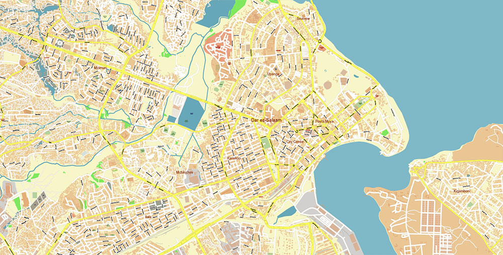
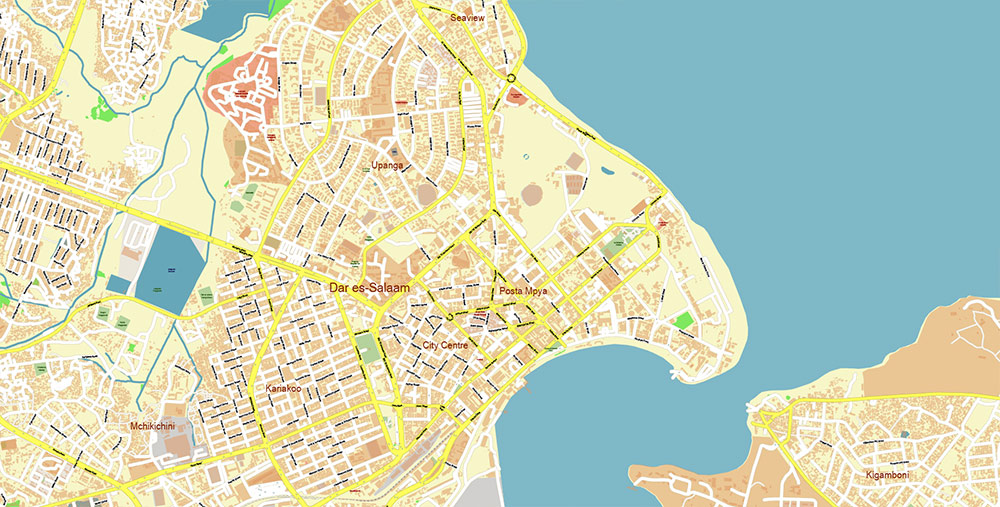
Printable PDF Vector Map of Dar Es Salaam Tanzania detailed street map scale 1:4664 fully editable Adobe PDF scalable, text/curves all names, 77 MB ZIP
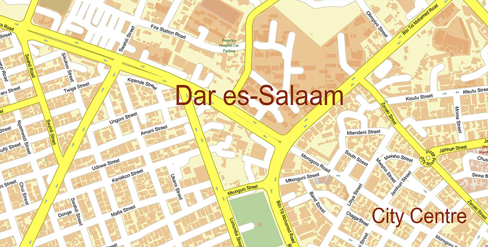
All street names, Main Objects. Map for design, printing, arts, projects, presentations, for architects, designers, and builders, business, logistics.
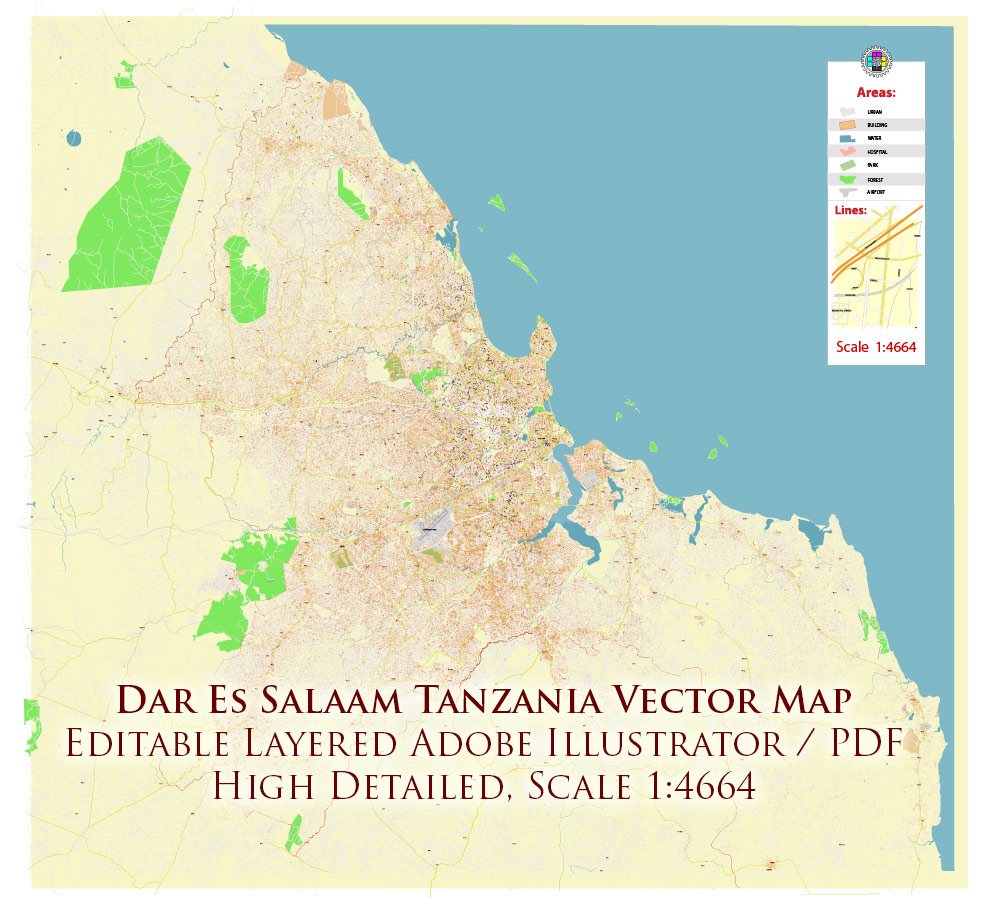
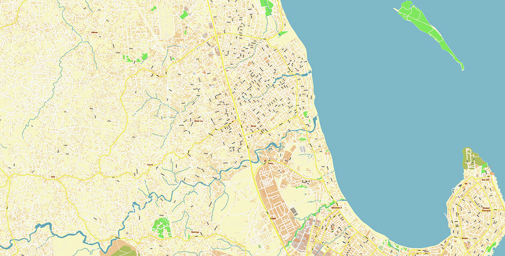
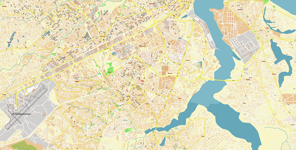
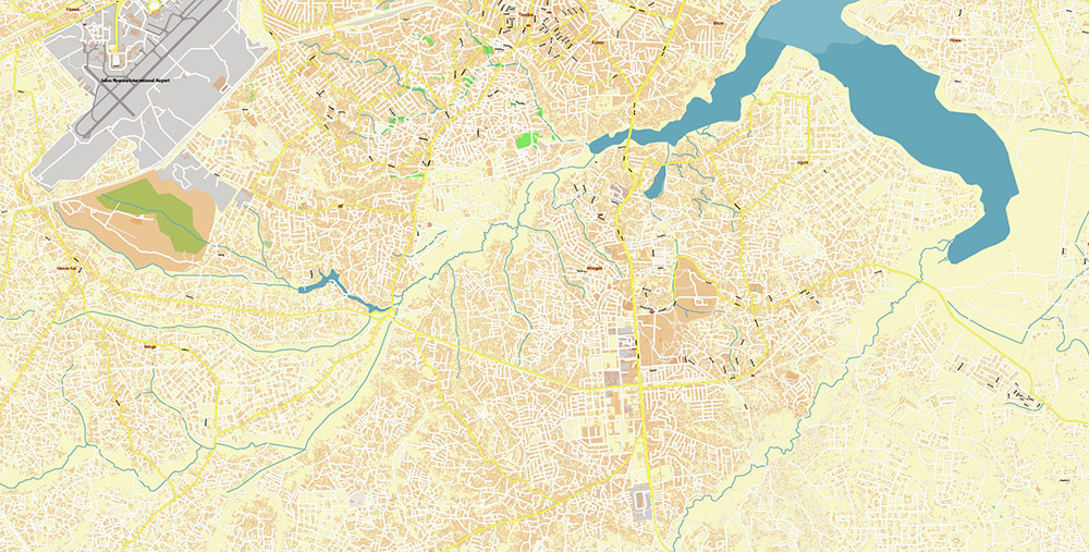
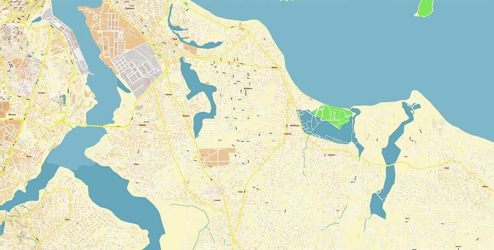
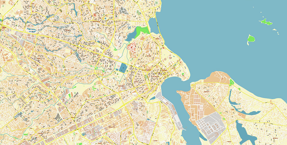
Dar Es Salaam Tanzania Map Vector Exact City Plan High Detailed Street Map editable Adobe Illustrator in layers
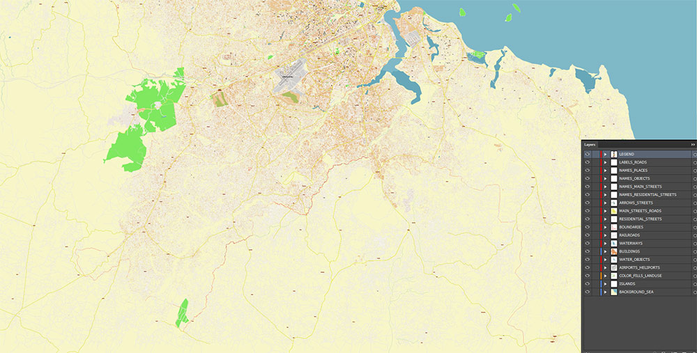
Layers list:
- Legend
- Labels of roads
- Names of places (city, hamlet, etc.)
- Names of objects (parks, water, hospitals)
- Names of main streets
- Names of residential streets
- Arrows of streets
- Main Streets, roads
- Residential streets
- Railroads
- Airports and Heliports
- Water objects (rivers, lakes, ponds, wetlands)
- Waterways
- Color fills (parks, hospital areas, land use, etc.)
- Islands
- Background and sea
The most exact and detailed map of the city in scale.
For Editing and High-Quality Printing
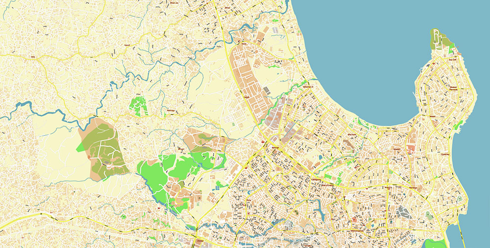
Dar Es Salaam Tanzania Map Vector Exact City Plan High Detailed Street Map editable Adobe Illustrator in layers
Dar Es Salaam Tanzania Map Vector Exact City Plan High Detailed Street Map editable Adobe Illustrator in layers
AO BRIEF — Dar es Salaam (Cartographic Edition)
AO Geometry
- Coastal urban mass on west bank of the Indian Ocean
- Natural harbor indentation forming primary port basin
- Elevation: near sea level; flat coastal plain (<50 m)
- Urban footprint elongated N–S along coastline, with W-bound inland expansion
Primary Axes (Lines of Communication)
- W Corridor (Core Inland Axis): Morogoro Rd → national interior (Dodoma corridor)
- SW Corridor: Nyerere Rd → airport + inland logistics
- N Coastal Axis: Bagamoyo Rd → peri-urban expansion / coastal settlements
- S Industrial Axis: Kilwa Rd → port-industrial belt (Kurasini / Temeke)
- Inner Freight Ring: Mandela Rd → lateral industrial connectivity
👉 Pattern: radial corridors with incomplete ring linkage → bottleneck concentration near core
Transport Nodes
- Seaport Node: Kurasini / Port Basin — high-capacity maritime interface
- Air Node: Julius Nyerere Intl (SW sector) — primary air gateway
- Rail Nodes:
- Central Line terminal (westbound inland)
- TAZARA terminal (SW → Zambia corridor)
- BRT Spine: Morogoro Rd axis (primary structured transit corridor)
Urban Morphology
- Core CBD: Kivukoni coastal strip (administrative + commercial density)
- Industrial belt: SW sector (Kurasini–Temeke) aligned with port access
- High-density informal zones: distributed along all radial corridors
- Peri-urban expansion: strongest along Bagamoyo (N) and Morogoro (W) axes
Hydro / Terrain Constraints
- Coastal lagoons and tidal inlets fragment shoreline
- Low-gradient drainage → flood-prone basins during rainy seasons
- Limited natural barriers → unrestricted horizontal sprawl
Mobility Structure
- Dominant flow: radial inbound/outbound commuting toward coastal core
- Peak congestion nodes:
- Morogoro × Mandela junctions
- Port access corridors (Kilwa / Mandela)
- CBD coastal entry points
- Mode hierarchy:
- daladala (primary distributed network)
- BRT (fixed high-capacity spine)
- bodaboda (last-mile / adaptive flow)
Demographic Distribution
- Dense population clustering along transport corridors
- Informal settlements form continuous belts around formal core
- Gradient: highest density near CBD and along Morogoro axis → decreasing outward
Operational Constraints
- Radial network without full ring → systemic choke points
- Port + city traffic overlap → freight/passenger conflict
- Flooding disrupts low-lying transport segments
- Rapid edge growth outpaces infrastructure grid
Command Takeaways
- AO defined by port-centric coastal node + radial inland corridors
- Morogoro axis = primary structural spine
- Lack of full ring infrastructure → predictable congestion geometry
- Urban expansion strictly follows transport vectors
- Control of port + Morogoro/Nyerere corridors = control of entire AO
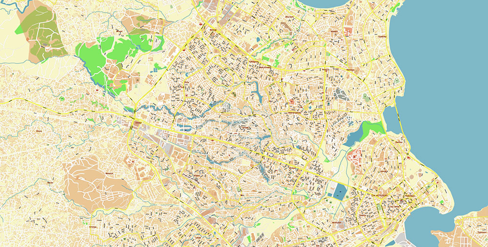
Dar Es Salaam Tanzania Map Vector Exact City Plan High Detailed Street Map editable Adobe Illustrator in layers
Dar Es Salaam Tanzania Map Vector Exact City Plan High Detailed Street Map editable Adobe Illustrator in layers
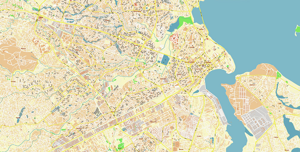
Dar Es Salaam Tanzania Map Vector Exact City Plan High Detailed Street Map editable Adobe Illustrator in layers
Dar Es Salaam Tanzania Map Vector Exact City Plan High Detailed Street Map editable Adobe Illustrator in layers
Dar Es Salaam Tanzania Map Vector Exact City Plan High Detailed Street Map editable Adobe Illustrator in layers
Dar Es Salaam Tanzania Map Vector Exact City Plan High Detailed Street Map editable Adobe Illustrator in layers
Dar Es Salaam Tanzania Map Vector Exact City Plan High Detailed Street Map editable Adobe Illustrator in layers
Dar Es Salaam Tanzania Map Vector Exact City Plan High Detailed Street Map editable Adobe Illustrator in layers
Dar Es Salaam Tanzania Map Vector Exact City Plan High Detailed Street Map editable Adobe Illustrator in layers
Dar Es Salaam Tanzania Map Vector Exact City Plan High Detailed Street Map editable Adobe Illustrator in layers
Dar Es Salaam Tanzania Map Vector Exact City Plan High Detailed Street Map editable Adobe Illustrator in layers

 Author: Kirill Shrayber, Ph.D. FRGS