Extended Description of the Vector Map
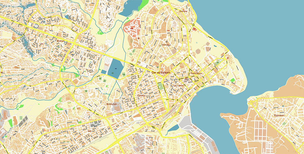
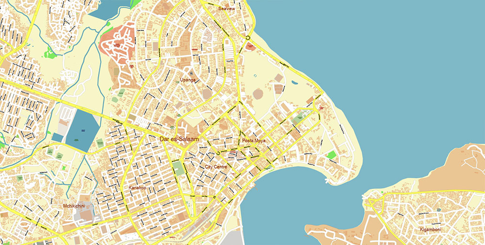
Printable Vector Map of Dar Es Salaam Tanzania detailed street map scale 1:4664 fully editable Adobe Illustrator scalable, text/curves all names, 82 MB ZIP
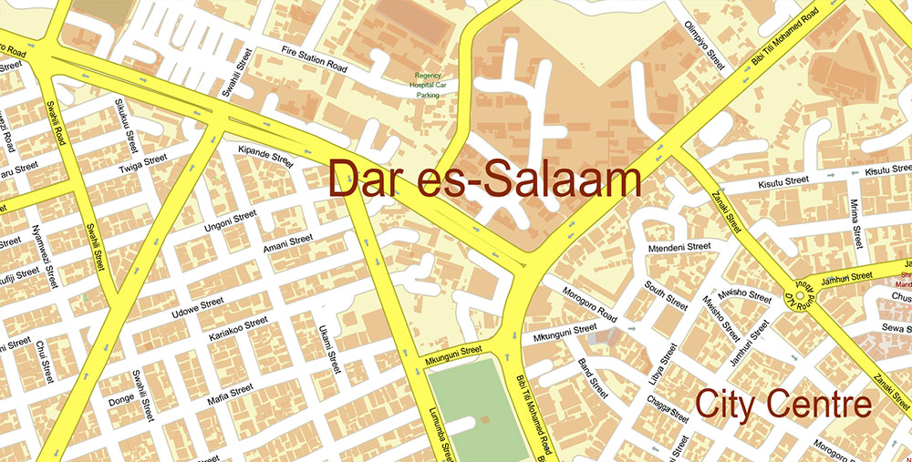
All street names, Main Objects, Buildings. Map for design, printing, arts, projects, presentations, for architects, designers, and builders, business, logistics.
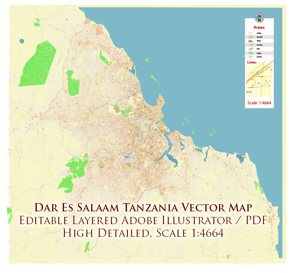
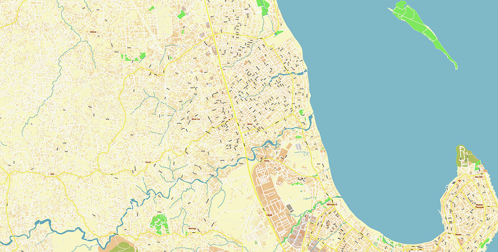
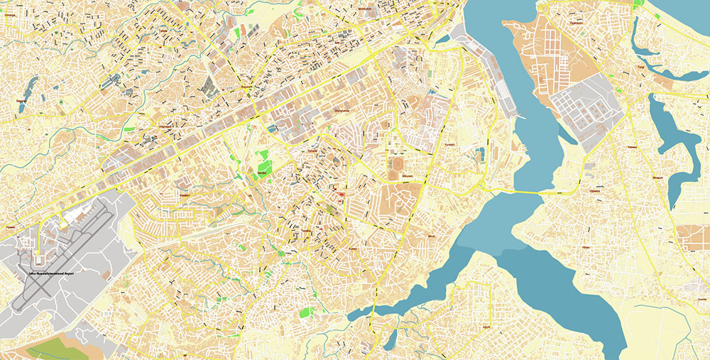
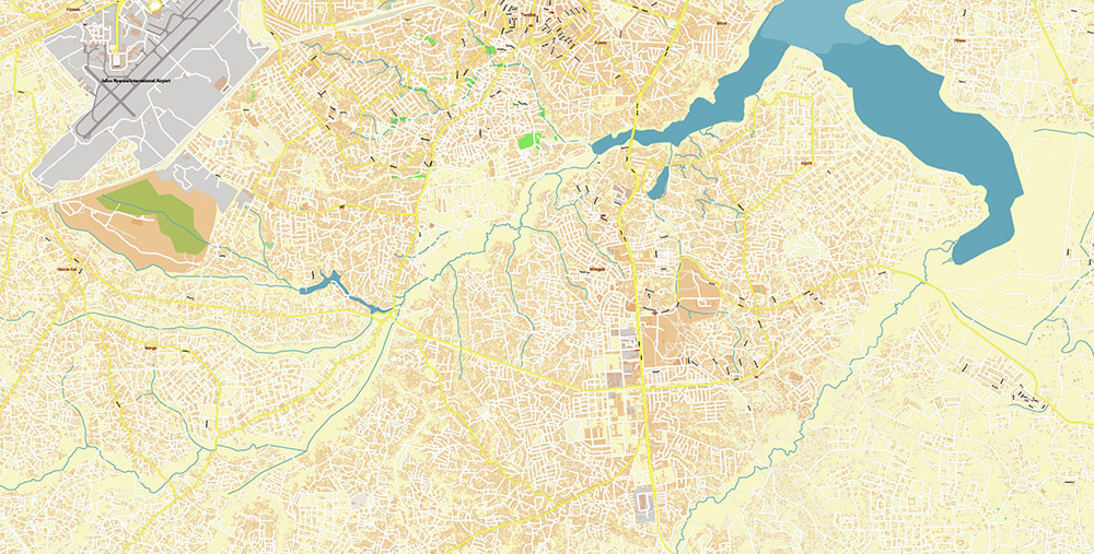
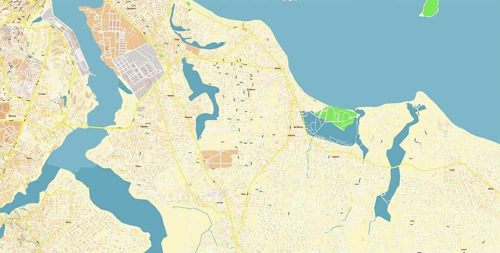
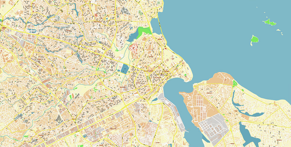
Dar Es Salaam Tanzania Map Vector Exact City Plan High Detailed Street Map editable Adobe Illustrator in layers
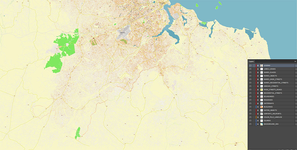
Layers list:
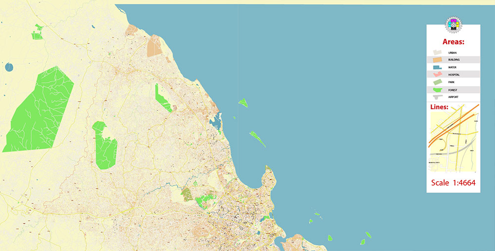
- Legend
- Labels of roads
- Names of places (city, hamlet, etc.)
- Names of objects (parks, water, hospitals)
- Names of main streets
- Names of residential streets
- Arrows of streets
- Main Streets, roads
- Residential streets
- Railroads
- Buildings
- Airports and Heliports
- Water objects (rivers, lakes, ponds, wetlands)
- Waterways
- Color fills (parks, hospital areas, land use, etc.)
- Islands
- Background and sea
The most exact and detailed map of the city in scale.
For Editing and High-Quality Printing
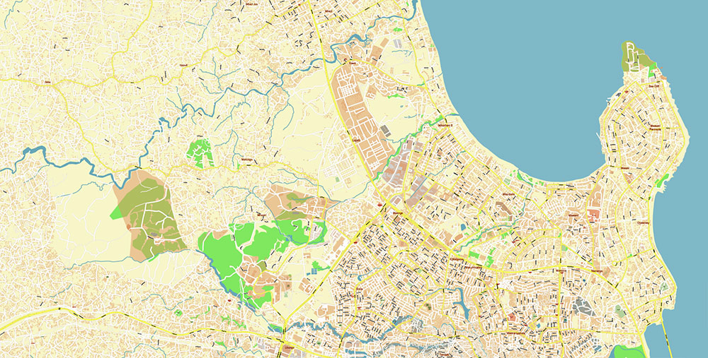
Dar Es Salaam Tanzania Map Vector Exact City Plan High Detailed Street Map editable Adobe Illustrator in layers
Dar Es Salaam Tanzania Map Vector Exact City Plan High Detailed Street Map editable Adobe Illustrator in layers
AO BRIEF — Dar es Salaam
Overview
- largest city in Tanzania; primary economic and logistics hub
- located on the Indian Ocean (Swahili Coast)
- main maritime gateway for inland East African states (Zambia, Rwanda, Burundi)
- rapid urban growth driven by migration and economic concentration
Geography / Terrain
- low-lying coastal plain with natural harbor
- tropical humid climate; high temperatures and humidity year-round
- flat terrain → radial urban expansion along road corridors
- seasonal flooding risk due to weak drainage and heavy rains
- coastal lagoons and estuaries shape urban footprint
Key Roads / Lines of Communication
- radial structure: ~5 primary outbound corridors + partial ring connections
- main axes:
- Morogoro Road — principal westbound corridor inland
- Nyerere Road — airport access and southwest axis
- Bagamoyo Road — northern coastal corridor
- Kilwa Road — southern industrial and port access
- Mandela Road — industrial bypass / freight circulation
- systemic congestion: vehicle growth exceeds road capacity
Transport / Mobility
- Port of Dar es Salaam — dominant national trade gateway
- Julius Nyerere International Airport — main aviation hub
- rail:
- Central Line → western Tanzania
- TAZARA Railway → Zambia (strategic international corridor)
- urban transport:
- daladala minibuses — primary mass transit
- BRT (Dar Rapid Transit) — structured high-capacity corridors
- bodaboda motorcycle taxis — flexible but high-risk
- significant share of trips on foot
Demography / Human Terrain
- population: ~4–5+ million; rapidly expanding metropolitan area
- high-density informal settlements (≈65–70% of residents)
- predominantly African population with Arab and South Asian minorities
- religious composition:
- Christianity ~60%
- Islam ~35%
- informal economy dominates urban activity
Urban Pattern
- polycentric, weakly planned expansion
- peripheral sprawl along transport corridors
- industrial zones concentrated in Temeke / Kurasini (port, logistics)
- CBD located along central coastal strip (Kivukoni area)
Logistics / Constraints
- chronic road congestion and bottlenecks
- limited drainage and sanitation infrastructure
- informal development reduces planning control
- elevated transport risk (accidents, traffic instability)
Command Takeaways
- critical port city controlling access from inland Africa to the Indian Ocean
- infrastructure lag vs population growth → persistent overload
- transport network is the primary operational constraint
- high informal density complicates governance and planning
- strategic logistics node with regional significance
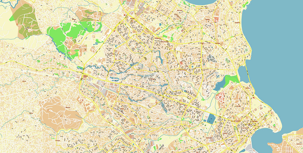
Dar Es Salaam Tanzania Map Vector Exact City Plan High Detailed Street Map editable Adobe Illustrator in layers
Dar Es Salaam Tanzania Map Vector Exact City Plan High Detailed Street Map editable Adobe Illustrator in layers
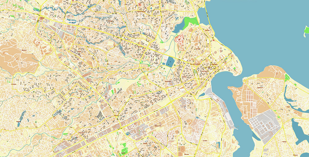
Dar Es Salaam Tanzania Map Vector Exact City Plan High Detailed Street Map editable Adobe Illustrator in layers
Dar Es Salaam Tanzania Map Vector Exact City Plan High Detailed Street Map editable Adobe Illustrator in layers
Dar Es Salaam Tanzania Map Vector Exact City Plan High Detailed Street Map editable Adobe Illustrator in layers
Dar Es Salaam Tanzania Map Vector Exact City Plan High Detailed Street Map editable Adobe Illustrator in layers
Dar Es Salaam Tanzania Map Vector Exact City Plan High Detailed Street Map editable Adobe Illustrator in layers
Dar Es Salaam Tanzania Map Vector Exact City Plan High Detailed Street Map editable Adobe Illustrator in layers
Dar Es Salaam Tanzania Map Vector Exact City Plan High Detailed Street Map editable Adobe Illustrator in layers
Dar Es Salaam Tanzania Map Vector Exact City Plan High Detailed Street Map editable Adobe Illustrator in layers
Dar Es Salaam Tanzania Map Vector Exact City Plan High Detailed Street Map editable Adobe Illustrator in layers

 Author: Kirill Shrayber, Ph.D. FRGS