Extended Description of the Vector Map
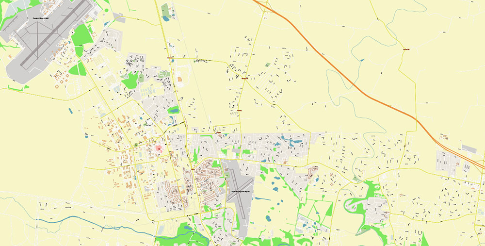
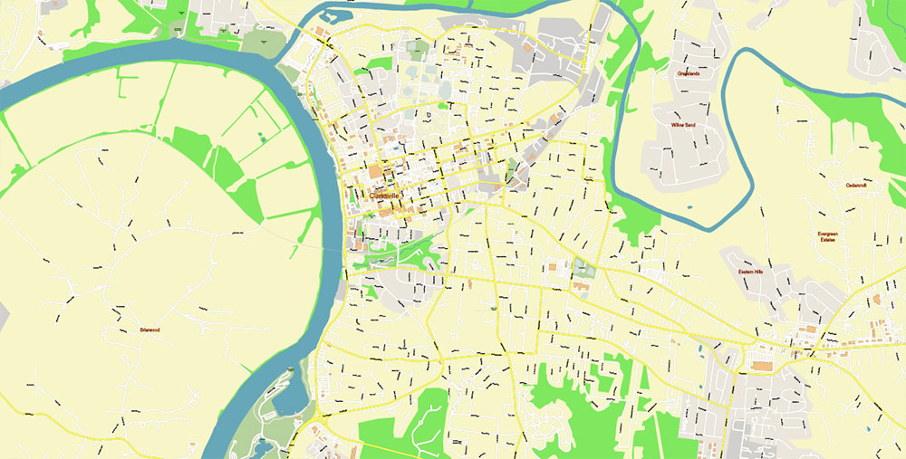
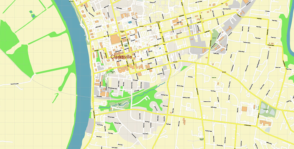
Printable PDF Vector Map of Clarksville Tennessee USA High Detailed scale 1:3773 fully editable Adobe PDF Layered Street Map in layers, scalable, text/curves format all names, 20 MB ZIP
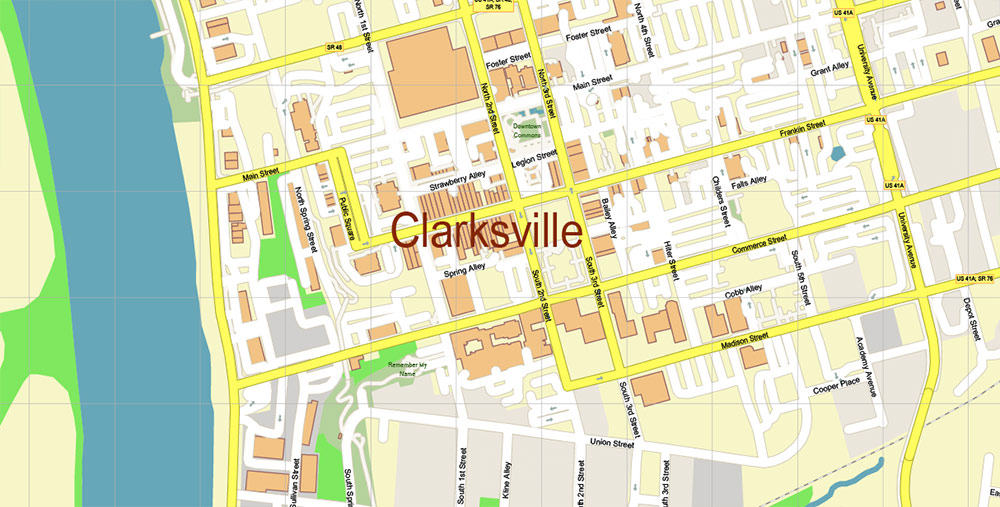
All street names, Main Objects, Buildings. Map for design, printing, arts, projects, presentations, for architects, designers, and builders, business, logistics.
Also: We can add (additional layer for this map), any other objects for you. It’s free for our customers.
If you need any OTHER format – or something else – please, email us
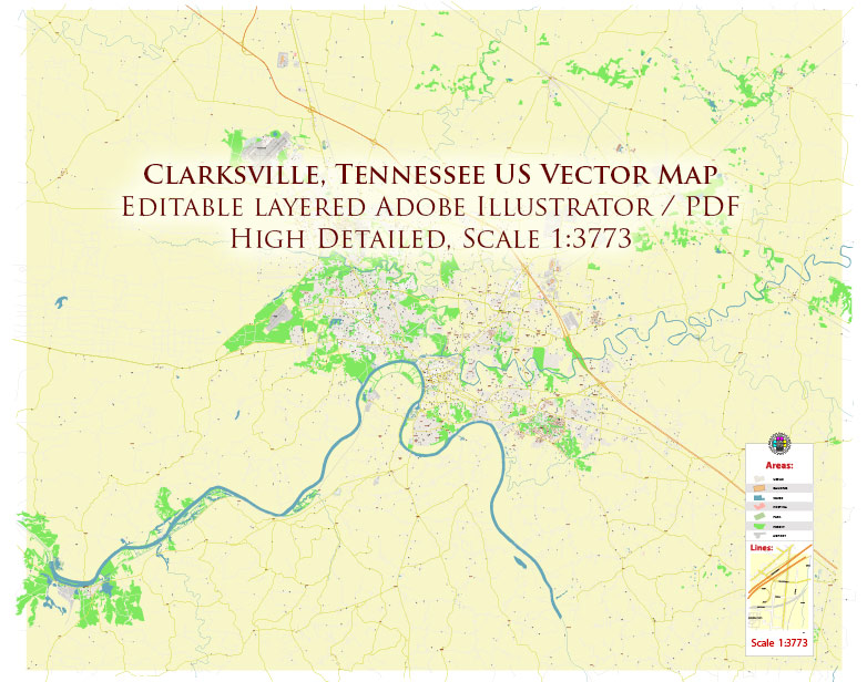
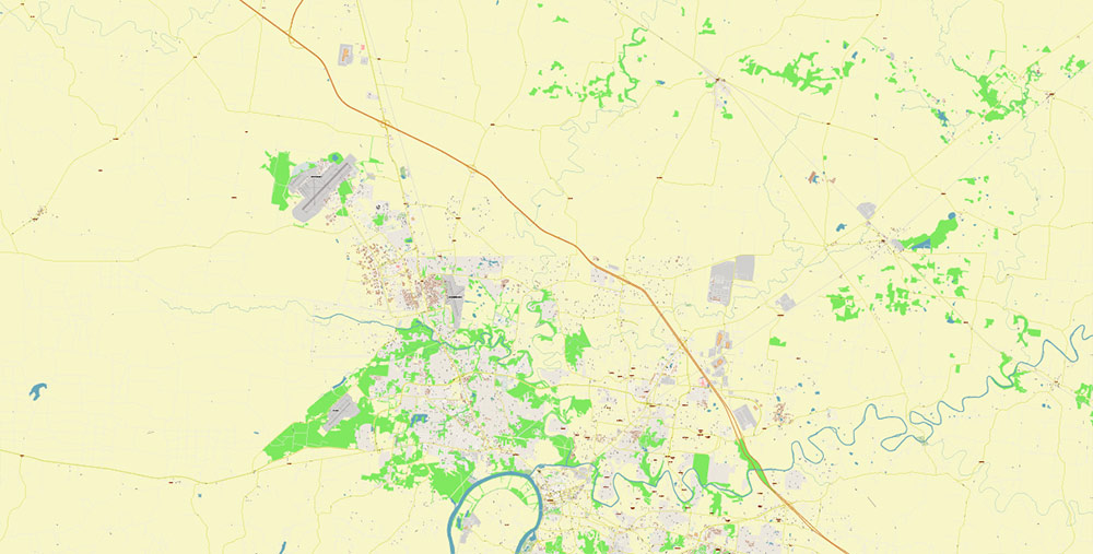
Clarksville Tennessee USA PDF Map Vector High Detailed Street Map editable Adobe Illustrator PDF
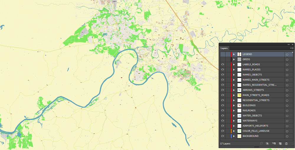
Layers list:
- Legend
- Grids
- Labels of roads
- Names of places / objects
- Names of objects (hospitals, parks, water)
- Names of main streets
- Names residential streets
- Arrows of street directions
- Main streets
- Residential streets
- Railroads
- Buildings
- Water areas
- Airports and heliports areas
- Landuse areas
- Background
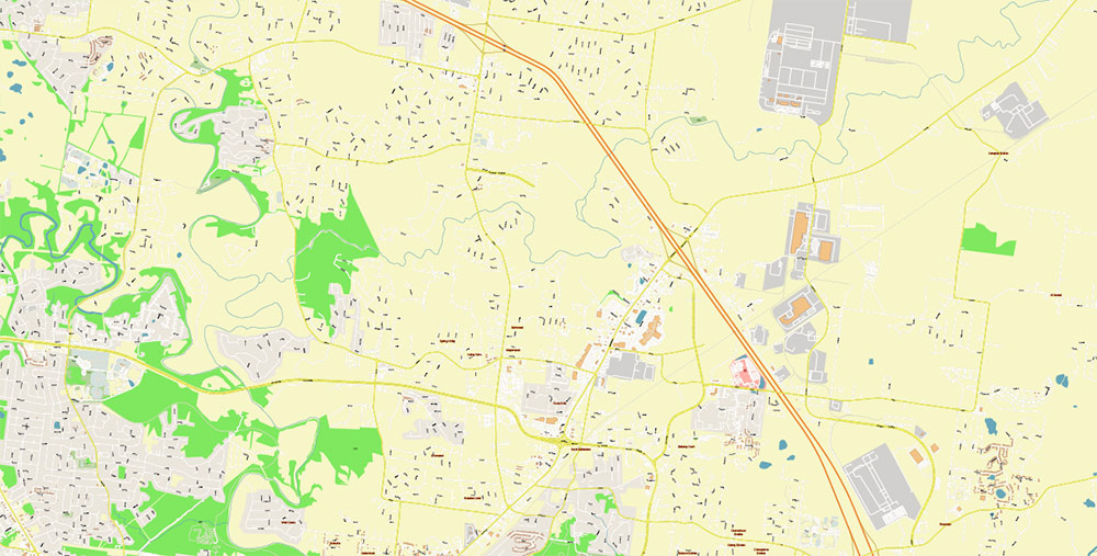
Clarksville Tennessee USA PDF Map Vector High Detailed Street Map editable Adobe Illustrator PDF
AO BRIEF — Clarksville, Tennessee (USA)
Overview
-
Role: Mid-size river city and logistics node on the Nashville–Kentucky corridor; heavily shaped by the nearby Fort Campbell military complex.
-
Setting: North-central Tennessee, on the Cumberland River, roughly 45–50 miles (70–80 km) northwest of Nashville.
Key Roads and Lines of Communication
-
Primary corridor: I-24 — main high-capacity route linking Clarksville to Nashville (SE) and to Paducah / southern Illinois via Kentucky connections (NW).
-
Major arterials / connectors (typical):
-
US-79 — regional connector through Clarksville; important for east–west movement and access to industrial/commercial zones.
-
US-41A — major north–south spine; strong link toward Fort Campbell area and Kentucky line.
-
TN-48 / TN-13 — regional route set supporting local distribution and access to surrounding towns/rural areas.
-
Urban movement: Expect commuter congestion on I-24 approaches, river crossings, and retail/strip corridors during peak hours; freight movement is common due to warehousing/manufacturing.
Ground Transport
-
Transit: Local bus network (city transit) serves core corridors; practical coverage is strongest in built-up areas, weaker in outer suburbs and rural periphery.
-
Trucking: Clarksville is truck-friendly due to I-24 adjacency; industrial parks and fulfillment/warehouse activity make last-mile and regional freight a major pattern.
Rail
Air
-
Local general aviation: Outlaw Field (Clarksville–Montgomery County) — small airport supporting GA, training, business aviation, medevac/utility flights.
-
Military aviation: Fort Campbell provides significant rotary-wing/Army aviation capability (operational airfield/heli facilities) influencing airspace use and noise patterns.
-
Commercial air access: Primary scheduled passenger service is typically via Nashville International (regional hub) within ~1 hour by road under normal traffic.
Waterways
-
Cumberland River: Core geographic feature; supports barge-capable regional navigation in the broader system and influences siting of industry, utilities, and floodplain development.
-
Operational implications: Bridges and river-adjacent corridors are key choke points; the river valley can channel fog and weather effects and constrains east–west routing at crossings.
Terrain and Geography
-
Physiography: Rolling uplands typical of the Highland Rim region; mixed forest and developed land; local relief is modest but terrain is not flat.
-
Elevation: Generally low-to-moderate (hundreds of feet / ~100–200 m above sea level), with bluffs and slopes near the river.
-
Soils/rock: Limestone/karst tendencies in the wider region can affect drainage, sinkhole risk (localized), and construction/road maintenance.
Climate and Seasonality
-
Type: Humid subtropical.
-
Effects: Hot, humid summers; cool winters with occasional ice/snow; severe thunderstorms possible in warm seasons.
-
Mobility impacts: Heavy rain events can cause localized flooding/road closures near low-lying river zones; winter icing can disrupt bridges and elevated segments.
Demography and Human Terrain
-
Population: City-scale ~170k–180k range (order-of-magnitude); the metro/county catchment is larger and growing.
-
Composition drivers: Strong military influence (active-duty, veterans, contractors), plus logistics/warehouse labor force and Nashville commuter spillover.
-
Urban pattern: River-centered core with expanding suburban rings; newer growth commonly tracks I-24 interchanges and major arterials.
Hazards and Constraints
-
Flood risk: River floodplain exposure along the Cumberland; watch low crossings, riverside industrial areas, and parks.
-
Severe weather: Thunderstorms/tornado risk regionally; power and communications disruptions possible during storm outbreaks.
-
Traffic choke points: I-24 interchanges, bridge crossings, and access routes toward Fort Campbell during shift changes/events.
Logistics and Sustainment Takeaways
-
Strengths: Interstate access + strong trucking ecosystem; nearby major airport hub (Nashville); robust support services driven by military + growth.
-
Constraints: River crossings and I-24 bottlenecks are the main operational friction; weather can degrade mobility episodically.
Command Takeaways
-
Control/monitor I-24 approaches, US-79 / US-41A spines, and Cumberland River crossings to shape movement.
-
Assume military-driven airspace activity and periodic surges in road demand tied to Fort Campbell cycles.
-
Plan for floodplain sensitivity and storm-driven disruptions; keep alternate routes that avoid river-adjacent low ground.
Clarksville Tennessee USA PDF Map Vector High Detailed Street Map editable Adobe Illustrator PDF
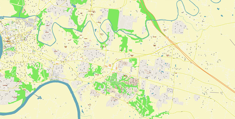
Clarksville Tennessee USA PDF Map Vector High Detailed Street Map editable Adobe Illustrator PDF
Clarksville Tennessee USA PDF Map Vector High Detailed Street Map editable Adobe Illustrator PDF
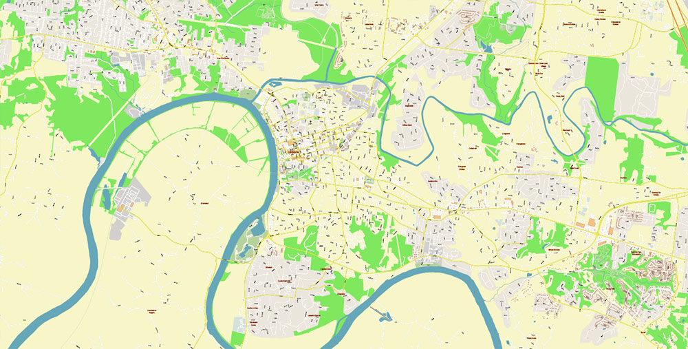
Clarksville Tennessee USA PDF Map Vector High Detailed Street Map editable Adobe Illustrator PDF
Clarksville Tennessee USA PDF Map Vector High Detailed Street Map editable Adobe Illustrator PDF
Clarksville Tennessee USA PDF Map Vector High Detailed Street Map editable Adobe Illustrator PDF
Clarksville Tennessee USA PDF Map Vector High Detailed Street Map editable Adobe Illustrator PDF
Clarksville Tennessee USA PDF Map Vector High Detailed Street Map editable Adobe Illustrator PDF

 Author: Kirill Shrayber, Ph.D. FRGS


